|
|

|
Mr Hamhead’s TMA Blog |
|
Two Different Days on Dartmoor
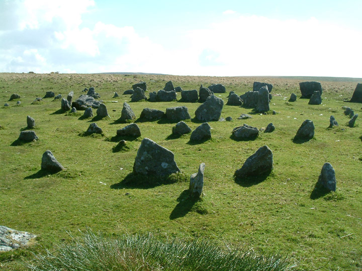
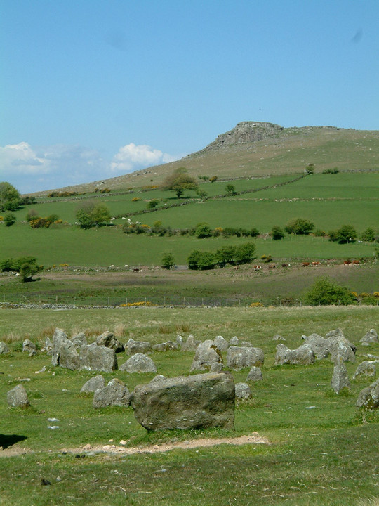
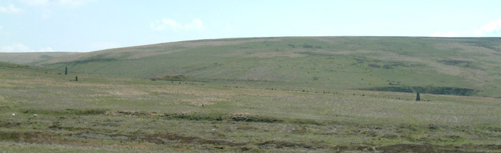
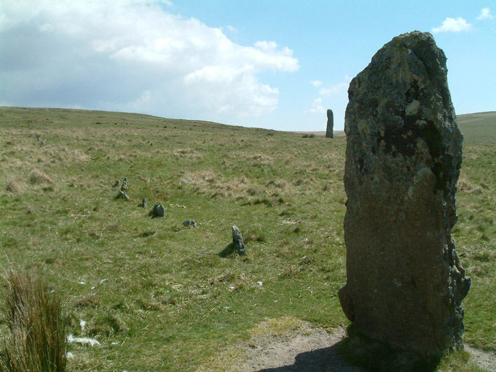
| Having spent much of the last three years slogging my way across Bodmin Moor, I decided it was time to bite the bullet and go over the border..... Dartmoor is a BIG place...where should I start? I decided to start somewhere that was at least familiar and headed for Sheepstor on the South West side of the moor. As a young fit 20 something i had spent some great times climbing the rock face on the eastern end of the tor and knew how to get there and where to park. DIRECTIONS: From Burrator Reservoir drive through Sheepstor village until you come to a road that turns up on the left. Take this and after winding up beside farm buildings the road comes out on open moor. After a short distance there are a couple of places on the left where a car or two can park of the road. The only plans I had were to get to Yellowmead circle and then see what happened after that. I decided i would leave the climb up to Sheepstor until later and headed off across the moor to the east. Keeping close to the field boundary I reached the end of the wall and turned right. From here it is an easy contour cross the open moorland to the circle. Yellowmead Multiple Stone Circle — Images13.05.05ce
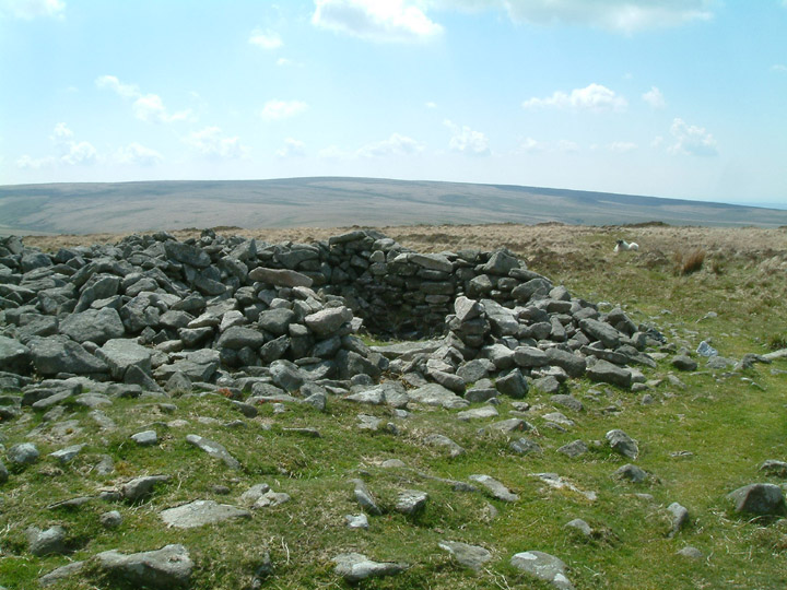
Yellowmead Multiple Stone Circle — Fieldnotes13.05.05ceMy first site on a walk that would take me to many other historic remains this sunny May day. The circle is small...and too perfect for my liking! Something in my head tells me that this originated as a simple cairn but when the restorers got here they decided to create a stone circle (or 4). I missed the stone row but as i was to see later that would tie in with the cairn thoughts. It is a nice spot (although the aroma from the recently spread field nearby was a bit off putting) with Sheeps Tor towering over it from the west. To think I sat up there on countless occasions back in the late 80s and never even noticed this site.... On leaving the circle I headed up hill to view the cairns before carefully treading my way across the boggy valley between Yellowmead and the Scout Hut. There is no need to go to the Scout Hut and I passed behind it and decided to follow the left bank of the watercourse for Yellowmead Farm heading for Whittenknowles Rocks. I expected a natural rock formation here but I think the name just refers to the remains of the settlement. Whittenknowles Rocks Settlement — Images13.05.05ce
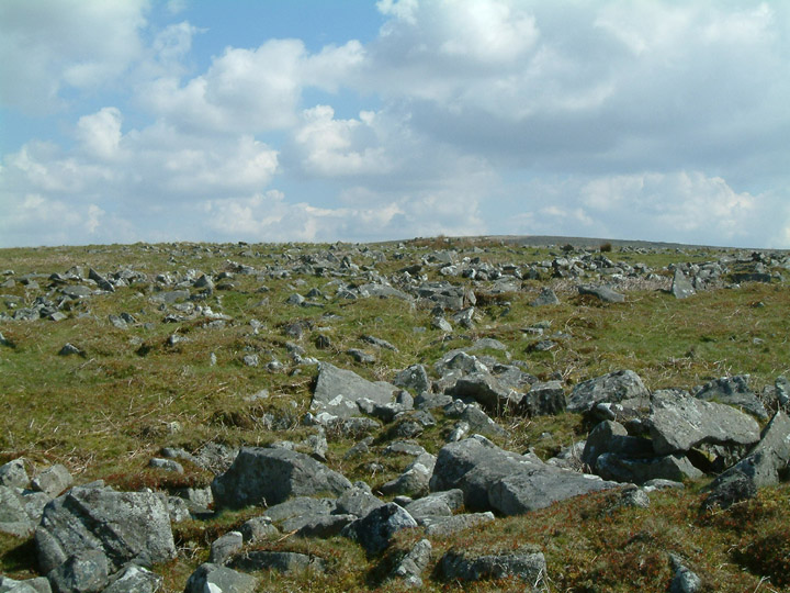
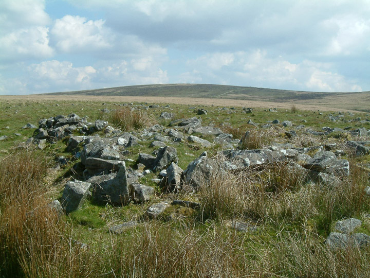
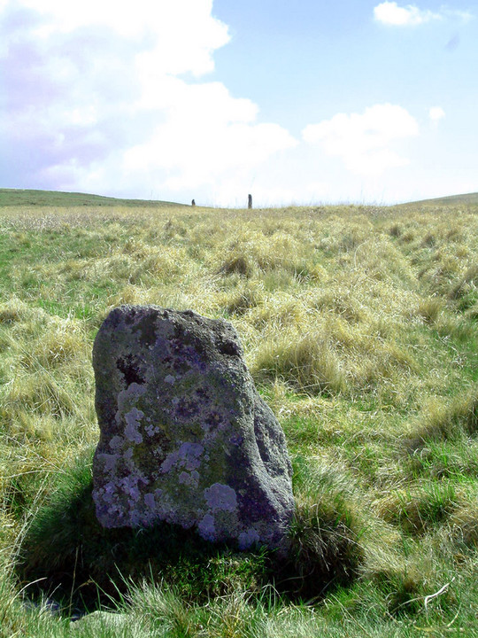
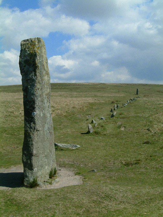
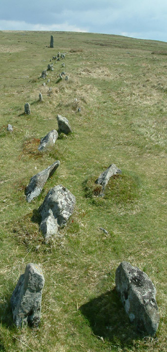
Whittenknowles Rocks Settlement — Fieldnotes13.05.05ceThis is just one great area of rocks...at one time placed by man but now scattered at random. To my untrained eye there is very little that can be made out but i am sure the experts know every hut circle, burial cairn etc on this hillside. It is while walking uphill amongst the rocks that you first gain sight of the Drizzel Combe complex....i wonder if the two sites are connected? At the top end of the settlement there is a rectanguler "table" of rocks a good 20 ft long and about 2 to 3 feet high. What it is I know not, but at least it is still there... Whilst clambering amongst the former round houses and enclosures I caught sight of the stone rows at Drizzelcoombe, my next target. I had read that this was one of the finest places to explore Dartmoor's prehistoric landscape but had not read much further…I like things to be a surprise! From my view point I could see the rows standing clear against the backdrop of Hentor, a long line of low stones with a couple of bigger ones at the end and half way along. There also seemed to be some other standing stones between me and the rows. I set off down hill to investigate. The first stone I came to looked "modern" and I guessed it to be a boundary stone, although my map tells me that there is no boundary running through that point. The next one was a low stone sitting on the side of the shallow valley. It is not marked on the map but on my return home it is mentioned in Byng's "Dartmoor's Mysterious Megaliths" book as lining up with the western end menhir of the stone row and Hen Tor..something I did not notice at the time. I carried on to the western stone, and slowly its size became apparent. After taking a good nunber of photos, I started walking up the row. At one point it becomes a double row and carries on this way until the cairn at the top end. This siteing of a small cairn at one end of a row, I will come to understand as usual on Dartmoor. Having only seen the rows on Bodmin Moor before today, it is not something I have come across before. Drizzlecombe Megalithic Complex — Images20.05.05ce
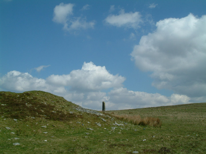
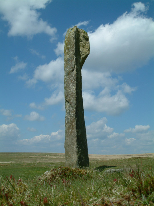
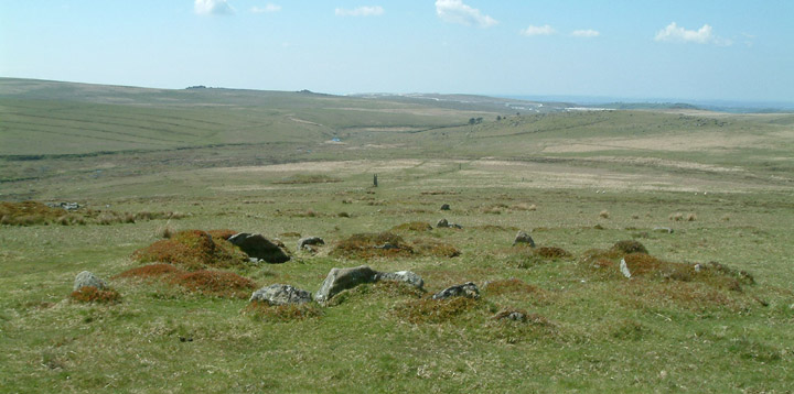
A gap now appears before the next row starts, although I believe the two rows are as one. To the north another standing stone attracts me to a third row running more or less parallel with the one I am about to follow. It is not as tall as the two other menhirs but its row is possibly the longest of the three. Before making my way to the upper row I wander to the right to view the Giants Basin. This is a BIG cairn! Climbing up it I find the centre has been hollowed out, (should I have expected otherwise?) and the discarded stones cover the west side of the mound. The menhir at the end of the upper row still does not give away its height as I approach it. From the west it is a large fat stone and it is not until I get right up close that I realise I am standing beside a huge monolith. The stone row that leads from the menhir carries on up the hillside to a barrow. The barrow is one of three that sit here in a row, this being the right hand side one. The middle one is the termination point for the other stone row whilst the left hand side one seems to be the odd one out with no stones leaving it in any direction. I carry on climbing, a gentle slope that goes through the remains of cairns and pounds. The view down slope is fantastic; the three rows stand proud, their size once again lost in the sheer scale of their surroundings. The city of Plymouth can be seen in the distance and beyond that, through the haze, I can just make out the sea. I wonder if, on a clear day, Dodman Point or even the Lizard can be seen from up here? Eventually I reach Higher Hartor Tor, a collection of low granite rocks that netherthe less offer shelter from the chilly east wind. A new view of Dartmoor now opens up; that to the east. It is a barren wasteland, an area unknown to me, so I head north to Eylesbarrow. Passing through the Victorian mining remains of Eylesbarrow Mine (where an old shaft is still open for all to see, but fenced off) I turn right and follow the old miners track through the workings for a short distance before branching of to the left and climbing the hill to the summit. More mining remains are passed through, open cuttings where tin was extracted using water, before the summit cairn is reached. Eylesbarrow — Fieldnotes13.05.05ceThe hill takes its name from the two large cairns that sit atop the summit. Both have been much altered by travellers seeking shelter over the years...and I for one was welcome of the little circular shelter on what was a sunny but cold day. The views up here are superb, looking down to the Cornish coast (and home) to the south west whilst to the east the barrenness of Dartmoor is there for all to see. Eylesbarrow — Miscellaneous13.05.05ceIn 1240 a perambulation of the Bounds of the forest of Dartmoor was undertaken by 12 knights summoned by the Sheriff of Devon, under the orders of Henry III. Included in that perambulation was Elysburgh. Eylesbarrow — Images20.05.05ce
Lunch is spent in the company of a mother sheep and lamb, sheltering from the same wind as me. At 454 meters this is the highest point of the walk and the views are superb, sadly it is also starting to rain, so I pack my remaining chocolate hob-nobs away and head off towards my next stone row. But something is not right….I have not seen a sole all day..but down in the valley, gathered around the stone row there are people! Lots of people! How dare they! I deviate away from my route and head for the tin workings to the east of the stone row. If I give them a bit of time they might move on and I can have the stones to myself. I explore the tin workings, usual stuff, scattered stones, areas of bog, startled sheep…. And climb out on the north side and head towards a cairn marked on the map. Beside the cairn is a enclosure and with the group making no attempt to move I decide to look at this. I fail to notice that one man and his dog have broken away from the pack and I soon hear a cheery voice telling me they are French. The voice introduces himself as a local and explains that he is doing the same walk as me but the other way round. He tells me all about standing stones and stone rows and how they all tie in with the sunrise on midsummer day. We exchange pleasantries for a while before he heads off after his impatient dog. Down Tor — Images22.05.05ce
Everytime I look back they are still there…one of them is standing in the centre of the circle pretending to be the central stone, arms tight to his side, gortex jacket glowing in the sunshine. I give up! Down Tor — Images22.05.05ce
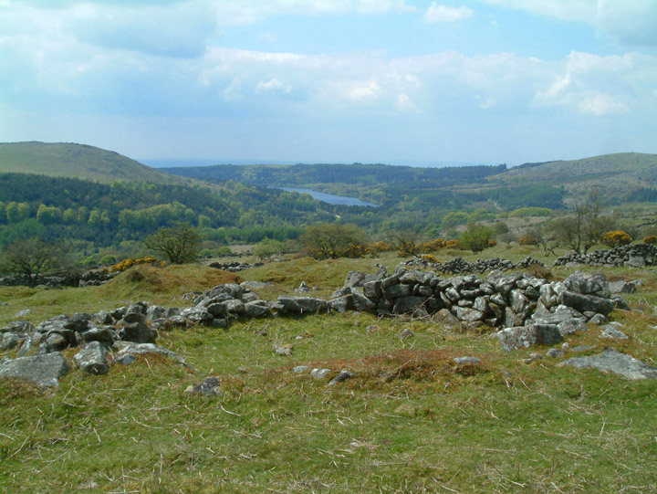
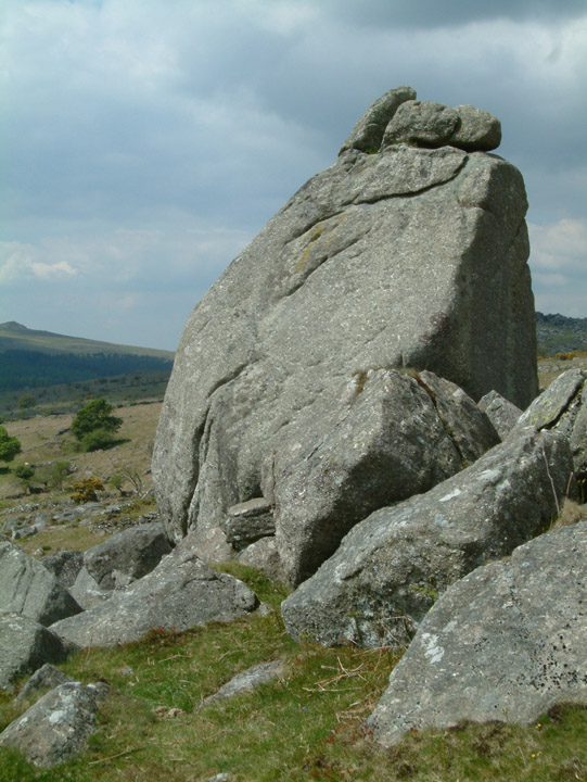
Down Tor — Fieldnotes22.05.05ceA local tells me that the sun rises in line with this row at Midsummer...It is not facing due NE but taking in to account the dip in the hills to the east he may be right. The row dips in the centre as it crosses the hillside rising to the cairn (Stone Circle) at the western end. I did not get to look at the cairn as it was full of French people standing bolt upright pretending to be stones... I head across the hillside to the Cuckoo Rock, passing through a settlement of well preserved hut circles on the way. Cuckoo Rock — Images22.05.05ce
Cuckoo Rock — Images22.05.05ce
Cuckoo Rock — Fieldnotes22.05.05ceThis huge rock sits on the southern slope of Combshead Tor and is a popular place for walkers to the area. It is I would guess 15 ft high on the shortest side. Just to the north of it is a wonderful walled settlement featuring about a dozen hut circles in reasonable condition and beyond them it is a short walk to Down Tor stone row. The rock is easily reached up the Deancombe from Burrator Reservoir. My next quest is to find the Potato House, mentioned in Crossings 1909 guide to Dartmoor. He mentions it as being in the valley to the east of here and is an underground shelter used to store potatoes and illicit alcohol. There is nothing ancient about it, it was built by the farmers who lived up here in the early 1800's, but I want to see if I can find it. It takes a while, the directions in the book are not good. It certainly would have been a good place to hide things. The entrance is only about 3 ft high with a mound of earth infront making only about 1 ft visable. Once through the entrance, the "cave" open out into a rounded chamber about 7ft high. There is room for about 4 people to sit in it comfortably and a little shelf has been cut out on one side to allow a candle to be placed (the remains of a tea light bear witness to this). After all that excitement it is time to head for home. From here in the bottom of Deancombe it is a long slow climb up to Sheepstor. Pace fastens when I realise the French hordes are in persuit! Sacre blu! Is their no escape? I reach the top of the tor and scramble up onto the summit. 20 years on from my climbing days it is a tired, overweight 40 something, that sits on top and gazes out over the moor. Gone are the days of hanging off the rock face searching for a handhold, it is the easy grass covered bank that now leads me to the top. Down at Yellowmead, the French have arrived. The circle has disappeared beneath a melee of gortexed garlic gnosshers. Up here it is just me and the skylarks…I leave them the crusts of my last sandwich and head off back to the car. A week or so later, bitten by the Dartmoor bug, I find myself once again on the moor. This time I am not alone. My friend Karen, over from Canada, is with me. She has never been on Dartmoor before and I have decided to show her the Erme valley. It is not an area I know, but having studied the map, I have planned an eight mile walk taking in some great scenery and a multitude of stone rows and cairns. Trouble is, it is very misty and there is rain forecast. To Be Continued…. |
20th May 2005ce Edited 22nd May 2005ce
Mr Hamhead's TMA Blog
Latest TMA Blog Posts
|


Comments (0) |
|
| You must be logged in to add a comment | |