|
|

|
thesweetcheat’s TMA Blog |
|
A Crack In The Clouds (3) – Carfury to Gurnard's Head 23 June 2011
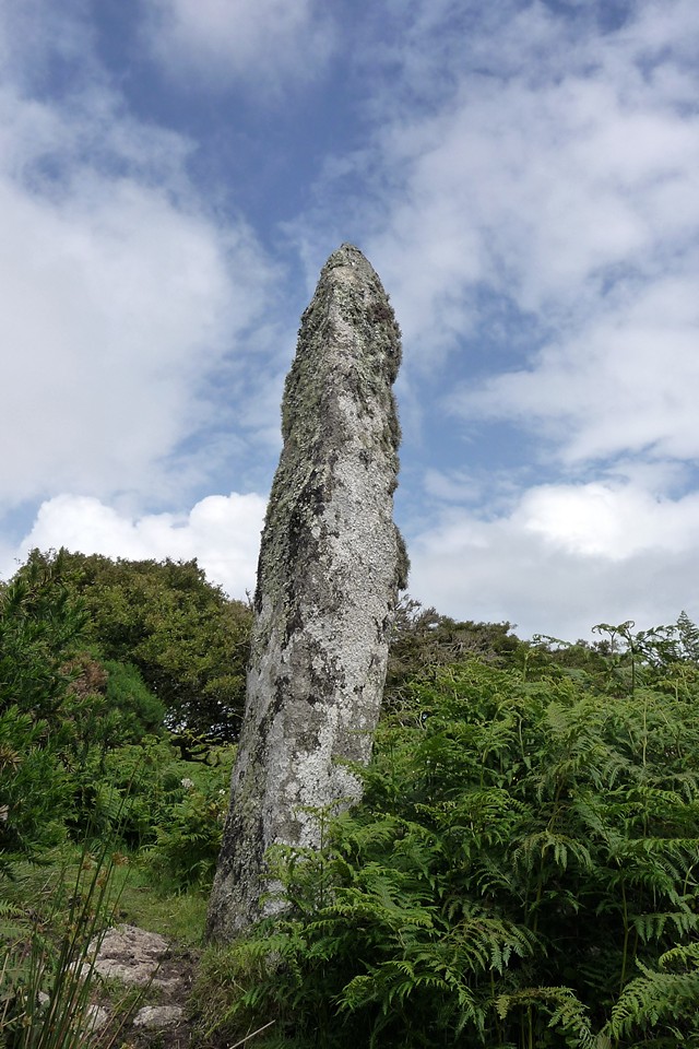
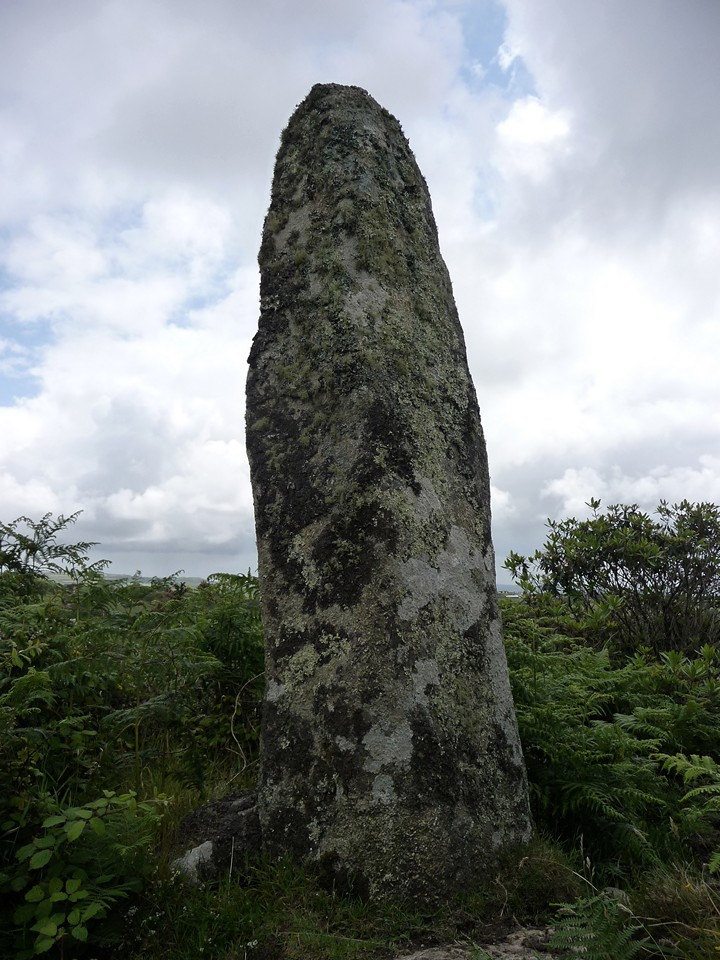
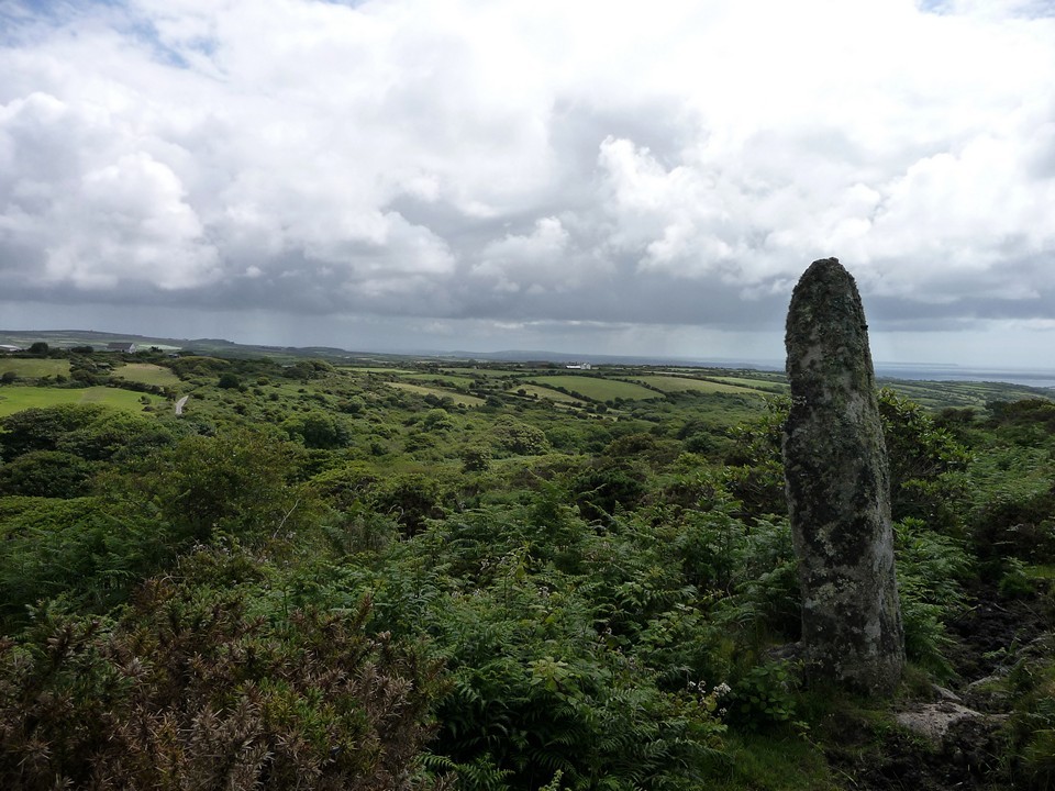
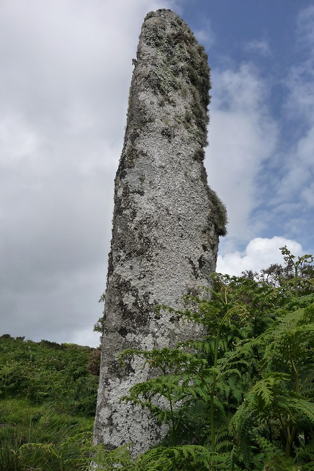
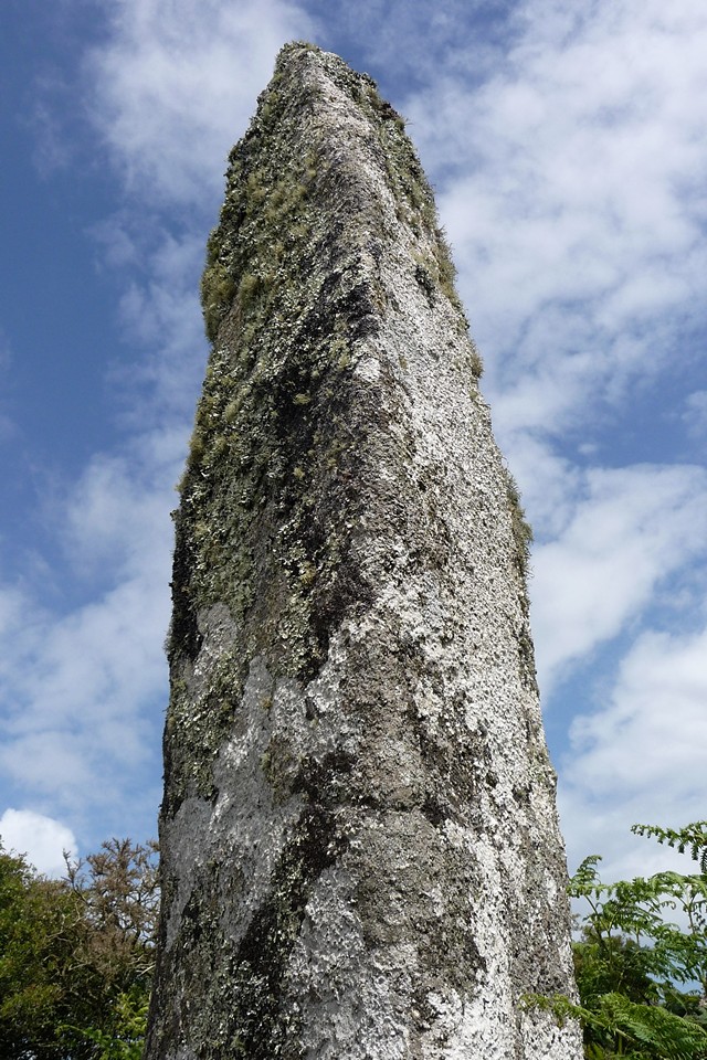
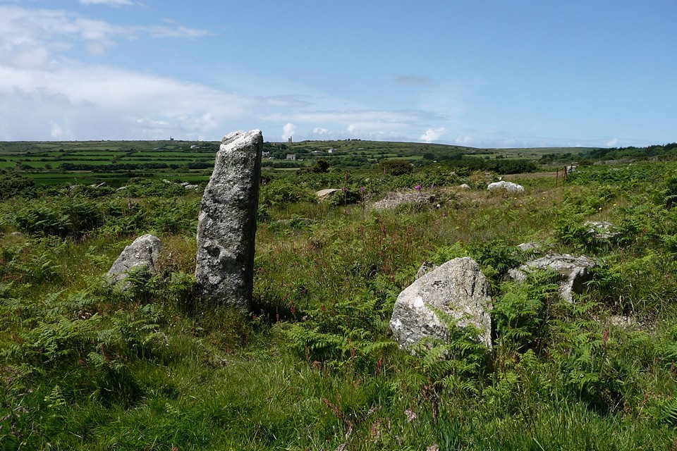
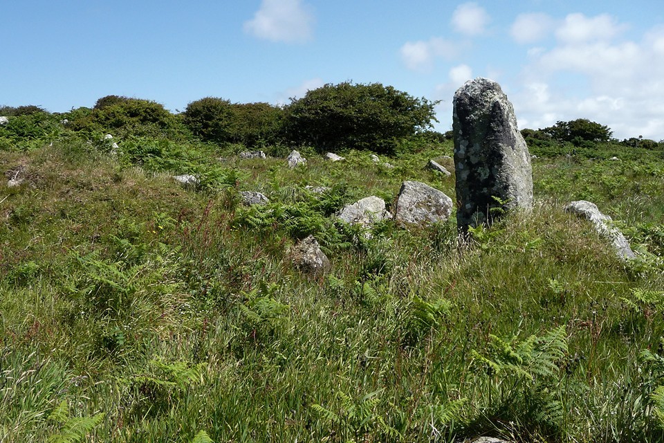
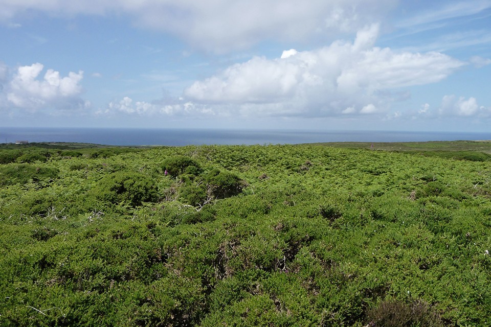
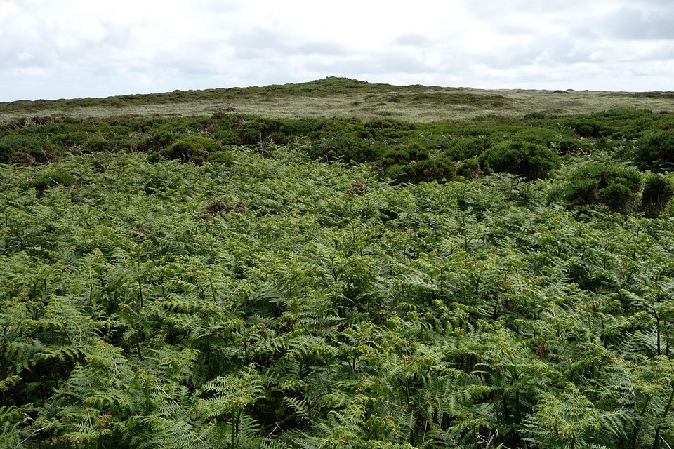
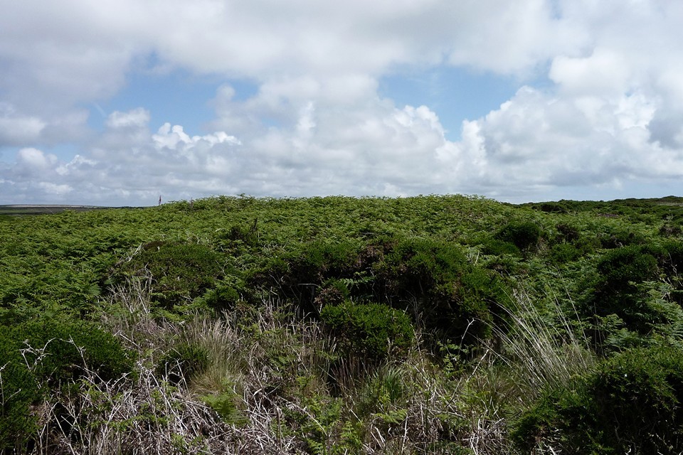
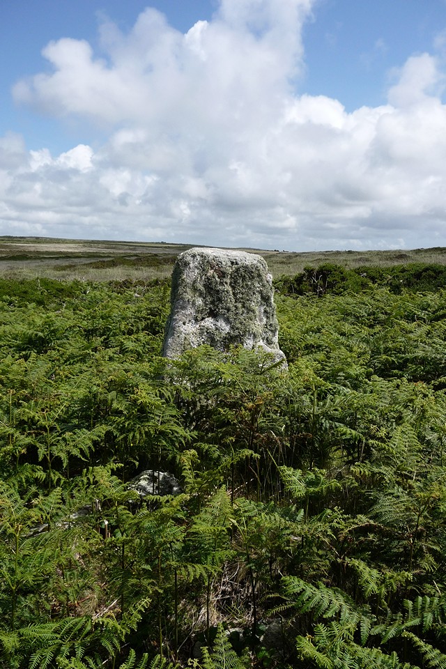
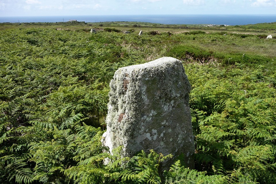
The holiday is drawing towards an end and G/F decides to have a day away from anything stony, leaving me to seek out a standing stone I haven't visited before, as well as some nearby sites to make a day of it. I take the bus to New Mill, then walk along winding lanes past Trythall and Carfury.Carfury — Fieldnotes17.07.11ceCarfury menhir is one I've intended to visit for years, but somehow never quite made it. It's not on any footpaths and its location is a bit obscure. I have seen it, across the valley from the southeast, where it stood out grey and stately against the brown autumn bracken. But my only attempt to actually visit it before was from the west, after a trip to Nine Maidens some years ago. That was a summer walk and progress down a vegetation-choked track ground to a halt after not much distance. I am more confident of the approach from the valley, particularly as, once again, I spy the stone surrounded by vegetation from across the valley. How hard can this be? At this point I don't really know where the stone is in relation to the features on the OS Explorer map, so I'm looking for clues from this initial vantage point. As seen across the valley, a line through the vegetation runs up the hillside behind the stone, which I remember stands in a low wall. I take this feature to be the narrow track shown on the map as running NE-SW, assuming then that the wall in the description is the southern boundary of the track itself. Boy, would that turn out to be wrong… I follow the minor road past Carfury itself, where it drops down gently into the valley, cutting off any further views of the stone. The road bends round to the east at a wide gateway and at the point, almost hidden, the narrow track I'm looking for heads off southwest. I follow it, almost immediately entering a green, leafy world with the sun creating dappled patterns on the soft surface beneath the trees. After a while, the path reaches a blockage of vegetation and wire, where a gate on the left leads out onto the hillside. Because I'm thinking the stone is to the left (or south) of the track, I happily take this, thinking the stone will be close by alongside the track. I emerge into an area of narrow stock tracks surrounded by thick bracken and other vegetation. I head uphill, following parallel with the track. No stone. I head into an area of very dense vegetation, trees and bushes snagging my backpack and sleeves. I come back out near to Mount Whistle, by now thoroughly confused and starting to get a bit irritated with myself. This thing's nine feet tall for goodness sake! I've already seen it! But none of that helps very much. A heavy shower comes winging in, forcing me to take cover once more in the dense vegetation and I realise I must be back "inside" the track again. I wander around the area in ever-decreasing circles for a while, but still no stone. Eventually I start to despair and decide to head back down the hill. At this point, just before giving up, it occurs to me that perhaps the stone is on the other side of the track… So I head back to the track, looking for an opening to the north. Lo and behold, a muddy cattle run leads off the lane, into the bracken-covered hillside on that side. It leads upwards for a while and suddenly, looming out of the bracken ahead of me, there it is! I've never been so happy to find a stone in all my wanderings. I've wasted the best part of an hour in completely the wrong place, but this was worth it. Tall and slender, the stone stands with its base in the remains of a low granite wall – which of course I now realise was the linear feature I saw, not the track at all. Doh! Castle-an-Dinas with its hillfort can be seen across the valley to the east, as can more distant Castle Pencaire on the way to the Lizard. I spend a while here, dodging a further rain shower under nearby hawthorn bushes. Although I'm now running late for the other sites I hope to visit, I'm not going to rush off after all the efforts of finding this bloody stone. Eventually I head off, back the way I came down to the track. It'll be easier next time… Carfury — Images12.07.11ce
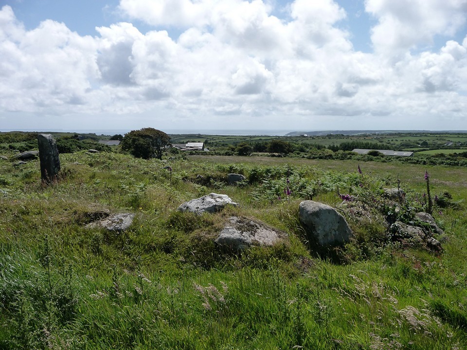
I retrace my steps along the narrow lanes to Lower Ninnes. Mulfra courtyard houses — Fieldnotes17.07.11ceAt Bay of Biscay, a minor road heads northwards to the hamlet of Mulfra. From here a footpath wends along between high walls, leading slowly uphill. It reaches a rusting iron gate, and beyond this can be seen the remains of houses in the Mulfra courtyard settlement. The site is cleared by the Cornish Ancient Sites Preservation Network (CASPN), an excellent organisation who have taken on responsibility for care and monitoring of a number of the sites in West Penwith. The best house of the group is fairly well-preserved, with its thick outer wall surviving to several courses high. A single, megalithic gatepost marks the entrance. At least one other house stood in this field, but the remaining stones are a jumble and the form is not easy to see. But an excellent spot to sit for a while, looking out over the farmland of the area. I suspect that Carfury menhir may be visible from here. You probably won't be disturbed on a visit. Other houses of the settlement lie in much thicker vegetation on the east side of the footpath, but I don't see anything and feel that I've had enough of bracken for one day (although that will come back to haunt me later)! Mulfra courtyard houses — Images12.07.11ce
Mulfra Quoit — Fieldnotes17.07.11ceThe footpath heads on up to the top of Mulfra Hill. You can't really miss the quoit, because it's right in front of you! The slipped capstone faces me on this approach. By now the sun is at its midday and indeed midsummer peak. Obligatory photos taken, I set my back against the capstone and eat the biggest vegetable pasty I've ever had. Yum! What a spot it is, with excellent views over Mount's Bay to the south, taking in St Michael's Mount. Castle-an-Dinas is prominent to the east. Over to the west the Nine Maidens ridge and Ding Dong engine house are clearly visible. Perfect. Mulfra Quoit — Images12.07.11ce
At length, I head away northwards, passing but not stopping at a couple of very overgrown round barrows. As the path drops down to Bosporthennis Common, I see the first people since leaving the road near Carfury. This isn't the most often-visited part of the peninsula. Mulfra Hill round barrows — Images12.07.11ce
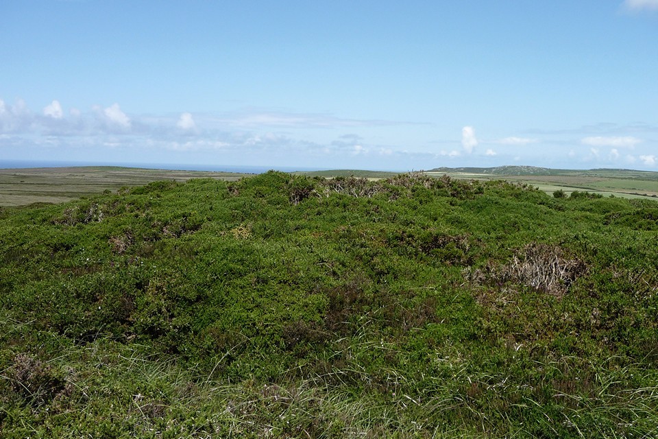
The Beacon (Zennor) — Fieldnotes17.07.11ceCrossing the route of the Tinners Way, the path becomes increasingly faint in amongst the thickening heather, which in turn gives way to ankle-taxing gorse. I have decided to visit the two barrows on The Beacon, even though this turns out to be a rather foolish idea. Progress becomes very slow, and the scratches on my ankles are now bleeding underneath my thin trouser legs. The things we do. Eventually I reach the southern barrow, only to find it hidden under deep gorse. No thanks. I press on, painfully, trying to find patches of grass to cut through rather than more gorse. This takes a huge amount of faff, but eventually I reach the northern barrow, a low and very wide mound, covered in bracken. Which would be fine, except that there is a ring of deep gorse encircling the whole thing. I push through this, into the centre and onto the mound. This is definitely "it", but it's not possible to see anything much through the bracken. Humph. I then have to push back through the gorse to get back out. These sites do not repay summer visits at all. The Beacon (Zennor) — Images13.07.11ce
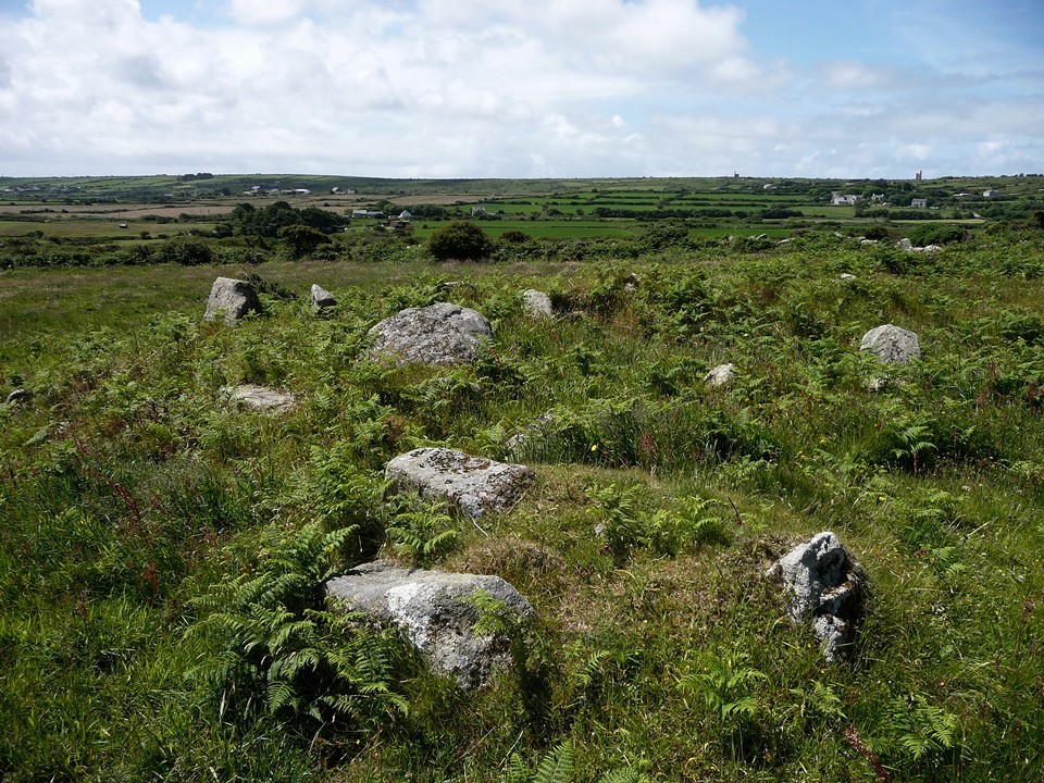
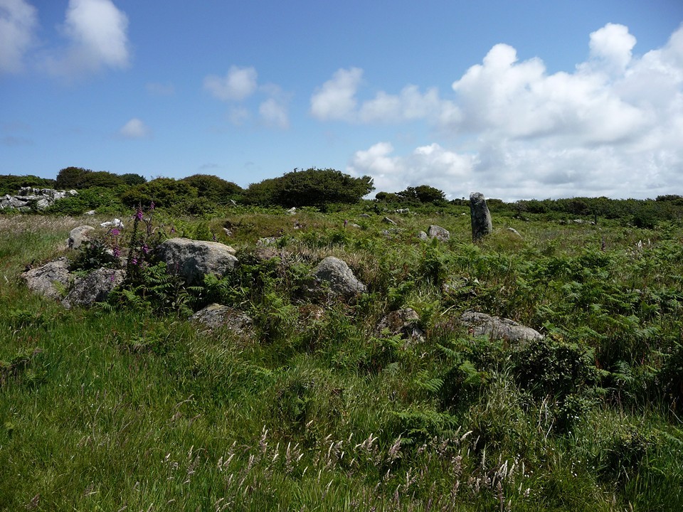
I head off down the slopes of Treen Common, progress still a painful crawl through the never-ending heather and bracken. At least I didn't drag G/F here! Mercifully, I finally reach a wide area of burning, where the heather and gorse has been stripped away to leave blackened charcoal stumps. I immediately make much better progress and before long the stones of the Treen Common "circle" are visible. Porthmeor (Treen Common) — Fieldnotes17.07.11ceI have been here a couple of times before, but I was aware that CASPN had been due to carry out one of their volunteer-assisted clear ups, so I was hopeful that it would be easier to make out some of the stones. And so it proved to be. I am still unconvinced by this as a stone circle. It bears no real similarity to the four marvellous stone circles that can still be seen in West Penwith. It's much bigger in diameter and the stones do not seem to have been carefully selected for their aesthetic quality. On the other hand, the stones all stand alone, none of them are placed contiguously with the others. The solitary stone on the south side wouldn't be out of place in a "proper" stone circle. To my mind, this seems more likely to have been an Iron Age enclosure or pound, now largely robbed away to leave a ring of individual stones. Porthmeor (Treen Common) — Images13.07.11ce
Treen Entrance Graves — Fieldnotes17.07.11ceI leave the enclosure and onto the road. My original plan had been to go down to the cliff castle on Gurnard's Head, but time is against me now and I don't want to rush a visit. So I content myself with a stop-off at the southern of the two Treen entrance graves. More overgrown than I remember from my previous visit, this is a great site, full of character and interest. The chamber is almost hidden behind a curtain of bracken fronds, but once inside it's a cool and damp space. Treen Entrance Graves — Images13.07.11ce
From here it's a short stroll down to the Gurnard's Head hotel, where a lovely beer garden and a cool pint of lemonade await, with plenty of time before the bus back to St Ives. A perfect end to the day. It's been hard work at times, as my poor shins attest, but always worth it in the end. After all, this is what we do, right? |
 Posted by thesweetcheat
17th July 2011ce Edited 11th June 2023ce
thesweetcheat's TMA Blog
Latest TMA Blog Posts
|


Comments (0) |
|
| You must be logged in to add a comment | |