|
|

|
Exmoor (Devon): Latest Posts |
Muxworthy Ridge (Round Barrow(s)) — Miscellaneous |
|
Details of barrows on Pastscape A: SS 72533760; B: SS 72553757 )C: SS 72583754;D: SS 72743756 ) Tumuli (NR) (1) A: "High Bray No 10", bowl barrow seen by Grinsell in April 1949. R Rainbird-Clarke, in 1938, records a ditch with causeway 3 paces wide on E, where traces of outer bank. Diameter 24 paces,height 3'. B: "High Bray No 11", bowl barrow seen by Grinsell in April 1949. Diameter 13 paces, height 4'. C: "High Bray No 12", bowl barrow seen by Grinsell in April 1949. Diameter 18 paces, height 2'. D: "High Bray No 13", bowl barrow seen by Grinsell in April 1949. Diameter 23 paces, height 2 1/2'.(2) Surrounded by shallow trench 5' wide lying within the margin of barrow. (Possibly not original (2).) Outer edge marked by circle of stones 67' in diameter, largest being 36" x 11 " x 9" high; 12 stones still extant. (3) "A". A flat topped bowl barrow, 23.0 metres in diameter and 0.7 metres high with an 0.3 metre deep trench cut into the top of the slopes on the north side (see "D"). "B" SS 72543756. A bowl barrow up to 16.0 metres across and 1.0 metre high. "C" SS 72563755. A spread bowl barrow up to 20.0 metres across and with an average height of 0.7 metres. "D" SS72733755. A mutilated bowl barrow 28.0 metres in diameter and up to 0.7 metres high. An 0.3 metre deep trench has been dug into the top of the slope similar to "A" and SS 73 NW 5,'8'. Were these trenches dug to remove the retaining stones for road mending and hedging? Only a few of the stones noted by authority 3 are visible and these are at trench level. Published survey 1:2500 revised. (4) Four barrows described above are clearly visible on aerial photographs as earthworks on moorland north of North Twitchen, Brayford. The Devonshire HER has identified a fifth barrow, while aerial survey undertaken in 2008 for Exmoor National Park National Mapping Programme has identified a possible sixth. Possible ditches can be seen on aerial photographs as cropmarks surrounding barrows A and D, but these may be the trenches described above. NB The Devon HER has numbered the barrows differently. The HER numbers for each barrow are as follows. A; 725, B;724, C;723 and D; 722. (5). |
 Posted by Chance
9th March 2015ce |
Ilkerton Ridge Stone (Standing Stone / Menhir) — Miscellaneous |
|
Details of stone on Pastscape Standing stone at SS 72064471 on Ilkerton Ridge south west of Hill Cottage, 3ft 3in high, 14in wide and 7in thick (1) was 2ft high in 1961 (2). (1-2) SS 72074474. A standing stone 0.9m high, probably of prehistoric origin and classified under Bronze Age by Grinsell. (3) A standing stone of local slate situated on the SE side of a broad saddle, is aligned WNW to ESE, following the ridge. It is of rectangular section, 0.4m wide and 0.15m thick and has an angled or `chisel' top. A slight lean to the NNW has reduced its vertical height of 1m to 0.9m. Firmly embedded the stone is within a sheep worn hollow 1.8m across and 0.2m deep with a few loose stones which may have been former trigs. Its situation and proximity to barrows, suggests a prehistoric origin (4). |
Posted by Chance 27th December 2014ce |
Badgworthy Lees Stone (Standing Stone / Menhir) — Miscellaneous |
|
Details of stone on Pastscape SS 78784467 Stone (NAT) (1) At Badgworthy Lees, South of Withycombe Ridge Water, two stones are shown on the OS map. (2) SS 788446 One standing stone. (3) The eastern of the two probably prehistoric standing stones has apparently been removed. (4) Formerly recorded as SS 74 SE 23, the easternmost of two standing stones (W stone is now SS 74 SE 97) This stone, still visible, contra authority (4), is an irregular slab with a jagged point, 0.7m high, 0.6m wide and 0.3m thick at the base. It now stands in an erosion hole, 1.5m across and 0.2m deep. It is regarded as probably prehistoric and is scheduled as such, but its origin remains uncertain. (5) |
Posted by Chance 27th December 2014ce |
The Longstone (Exmoor) (Standing Stone / Menhir) — Miscellaneous |
|
Details of Longstone on Pastscape (SS 70514307) Long Stone (NR) A standing stone known as the Longstone 9ft high, 2ft2in wide and 7in thick. No change; classified as Bronze Age by Grinsell. Published survey 1:2500 correct. (3) SS 70514307 Longstone, A Standing Stone situated on a flat topped ridge of rough grassland and heather at about 465m OD. It is a tall slatey slab 3m high, 1.2m wide and 0.25m thick at its base. It is orientated NE/SW and an OS bench mark has been cut on its SE side. There is a `trigger' stone 0.7m high, 0.5m high and 0.15m thick, set against its SE side. It stands in an erosion hollow 3m in diameter and 0.3m maximum depth (4). SS 7051443072. `Long Stone' a prehistoric standing stone as described by authority 4. It is shown on Donn's Map (a) of 1765 but incorrectly positioned on the Somerset side of the County Boundary. The monument is Scheduled: Devon 204, entitled Chapman Longstone (b). Published Surveyed 1:2500 correct. (Note: Part of the SMR (c) entry for this site is incorrect. Long Stone is not "set in a quadrilateral formed of smaller stones"; the reference to "Plate 3" does not apply to Long Stone; and the barrow referred to is not `Long Stone Barrow'. There appears to have been some confusion in the recording with NMR site SS 64 SE 2). (5) |
Posted by Chance 27th December 2014ce |
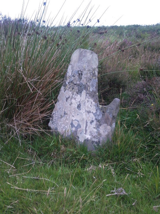
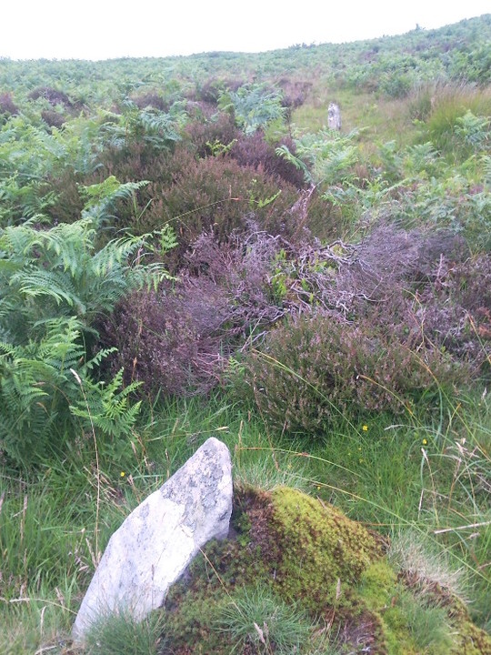
Hoccombe Hill East (Standing Stones) — Miscellaneous |
|
Details of stone on Pastscape Standing stone on Hoccombe Hill, SS 77044389. These ground photograph supplied to the NAR. SS 77044389: A slab, possibly prehistoric in origin, is situated on the summit of the ridge from Clannon Ball to Hoccombe Hill about 418m OD in an area of rough grassland. It is up to 0.45 m high, 1.1 m wide and 0.2m thick. At its N end there is a hollow, 0.7 m across and 0.3 m deep. (2) |
Posted by Chance 27th December 2014ce |
Berrynarbor (Barrow / Cairn Cemetery) — Miscellaneous |
|
Barrow cemetery of about nine barrows, located on the northern edge of Exmoor. One the barrows excavated in 1883 by George Doe yielded a ribbon-handled urn of Cornish Trevisker type, inverted over a cremation burial. Now in Exeter Museum. [info from "Southern England - An Archaeological Guide" James Dyer (1973, Faber).] Pastscape details here. |
 Posted by thesweetcheat
15th January 2013ce |
Hoccombe Hill East (Standing Stones) — Images (click to view fullsize) |
|
 Posted by juamei
8th June 2012ce |
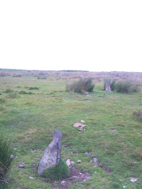
Hoccombe Hill West (Standing Stones) — Images |
|
Posted by juamei 8th June 2012ce |