|
|

|
|
|
Return to the Land of the RSC - Day Three. |
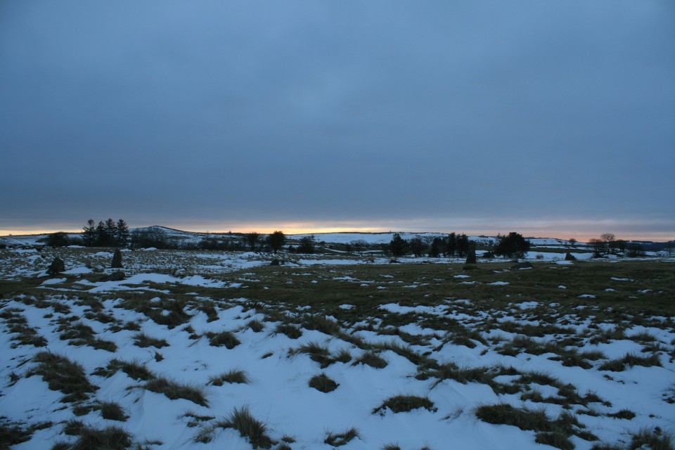
My third day in Aberdeenshire began with its coldest morning so far. -5 still didn’t feel so bad though, as the wind was kind, and the landscape just had a glorious monochromatic vibe.Springhill — Images19.12.18ce
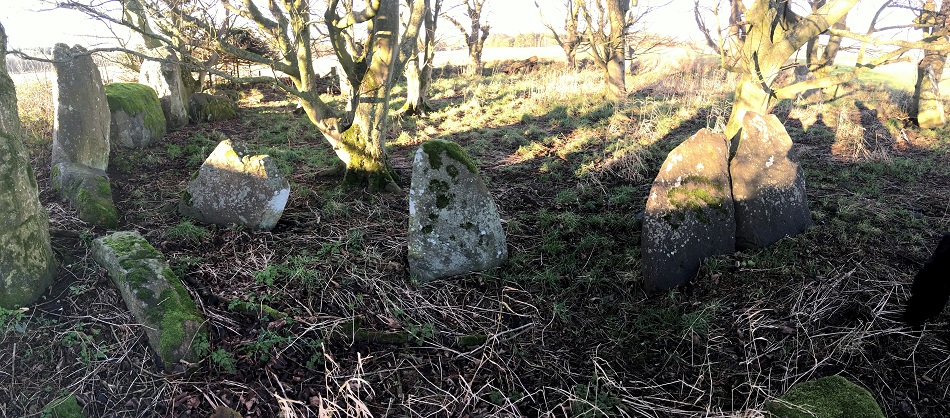
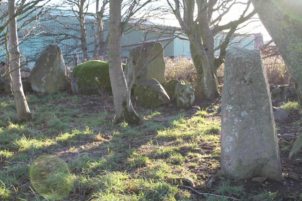
Nether Corskie — Images19.12.18ce
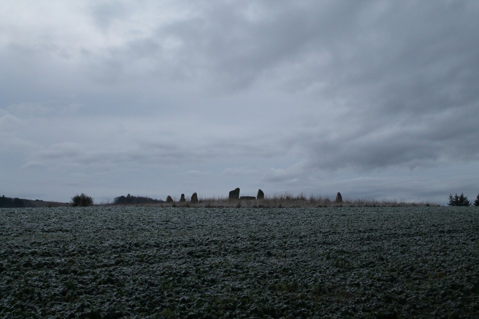
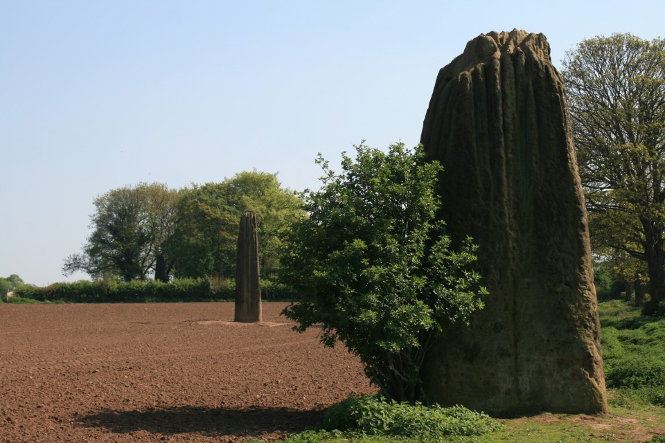
Today’s target area was the A944 corridor running up from Dunecht to Alford, taking in the Dunnideer area of sites. More than enough to keep me busy! I aimed for Balgorkar being first on my list, and as I travelled out that way I passed by the standing stones of SPRINGHILL, and had actually forgotten all about NETHER CORSKIE. I didn’t head down from the road, over the field to the remaining recumbent and flankers, instead I was satisfied with just a longview via the camera. Balgorkar — Images19.12.18ce
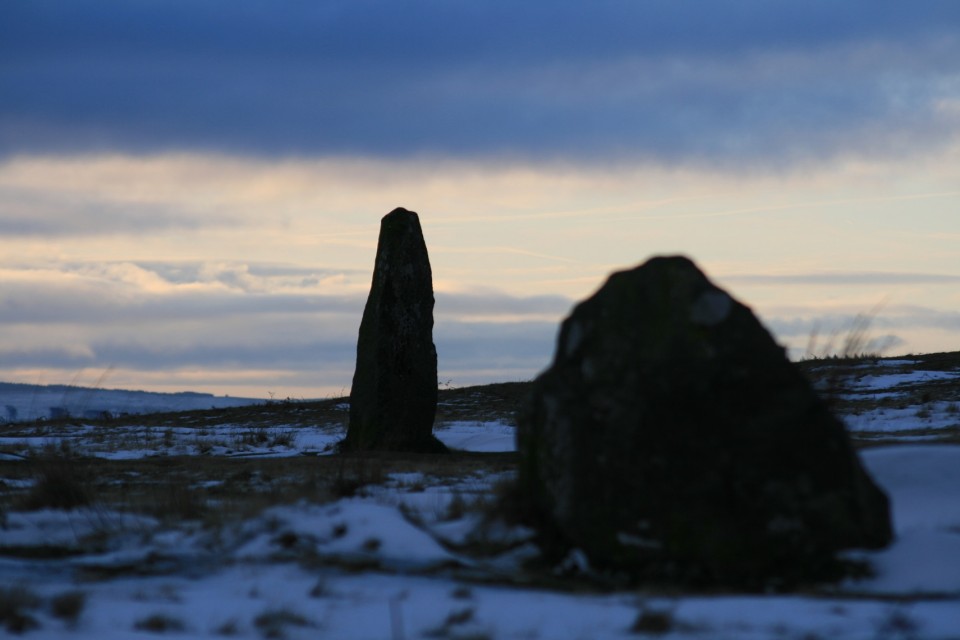
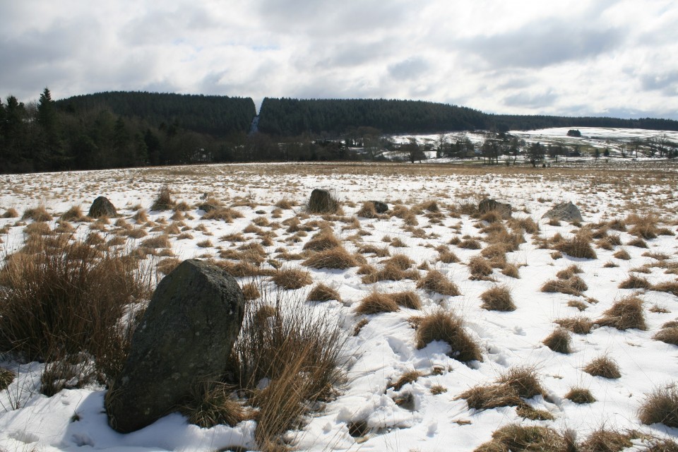
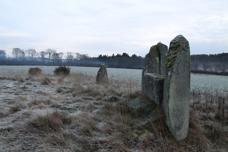
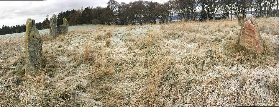
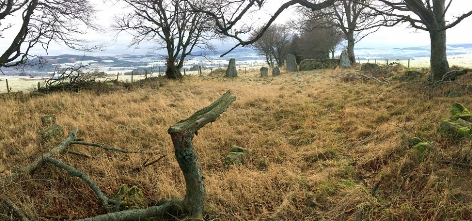
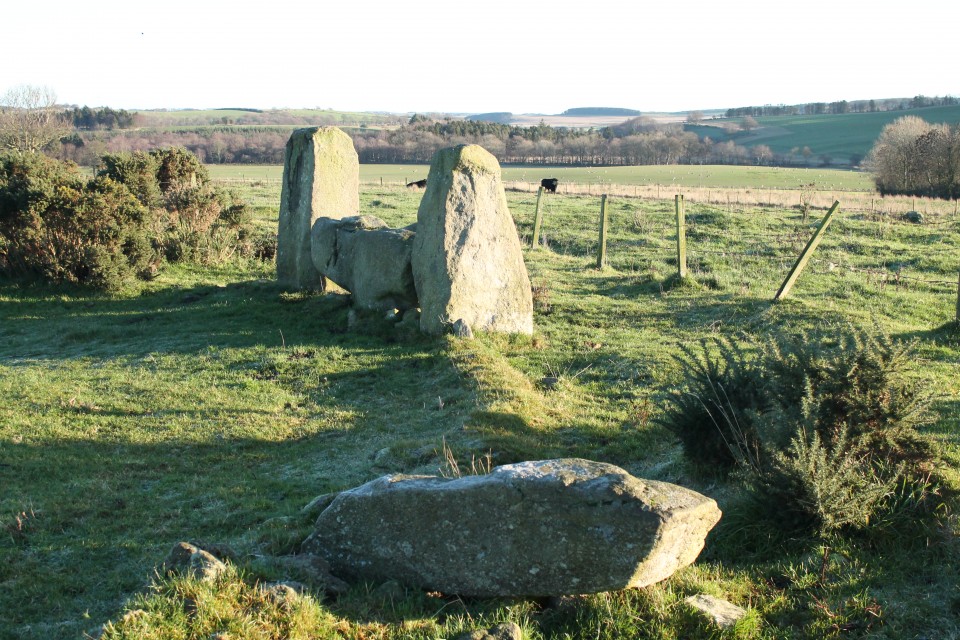
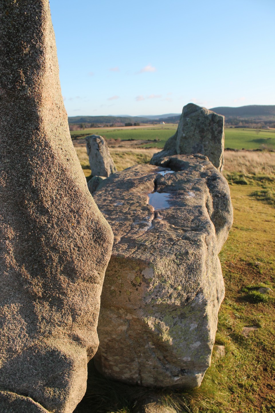
BALGORKAR itself is one I’ve wanted to see for a long while, since having visited Castle Fraser many years ago (pre-megalithic obsession years). At this halfway point in my week, I was aware of how lucky I was to have this chance to explore so many sites in one go, but also about wanting to actually take in each moment properly. It is not about ‘collecting’ numbers of sites, but more about having a number of experiences, and I reminded myself to soak up my time among these stones. In another life (my job), I get to teach mindfulness, and I was aware that this approach is something that easily marries up with each visit. Enjoy it, don’t rush it. At this point, a call from my daughter at University, made me spend a longer time here, and although equally focussing on her, I also had time to study the circle more. The mist hung low over the field with the two outliers nearby, and apart from some horses nearby nothing stirred in this frozen valley this morning. Balgorkar felt stark and ancient, and commanded my attention. Deer Park — Images20.12.18ce
By the time I got to DEER PARK the sun was coming out, and this collection of three stones felt somehow warmer in every way, compared with Balgorkar. I parked in the cul-de-sac, just down from the big red gate on the corner. I walked down to the corner of the astro-turfed pitch, where a big chunk of fencing is lifted, leading onto a path down to the stream, which in turn leads down to the river. From here, you turn left along the bank, until in a few seconds you are about to leave the cover of trees, and then must turn left and head back up the hill towards the road. A pretty little spot. Whitehills — Images20.12.18ce
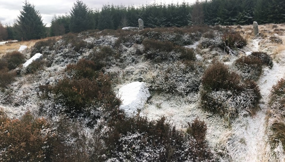
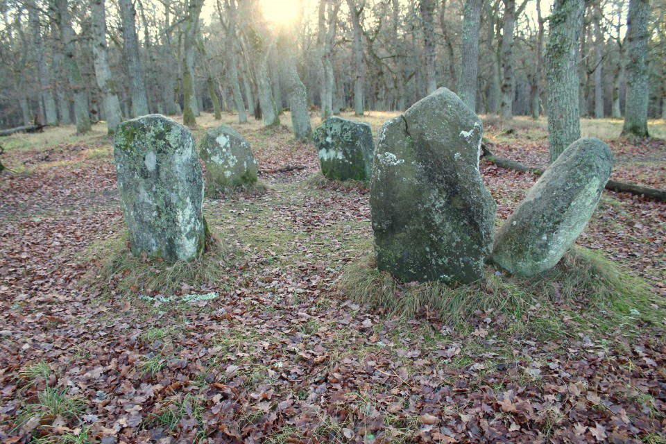
Next up was a bit of a trek (20 mins each way) up the lightly snow-dusted forestry track that led to TILLYFOURIE. ‘Whitehills’ indeed. The snow covering the fallen stones really helped define the circle amongst the grass and heather. Although I felt away from everything, there were lots of footprints in the snow around and through the circle already this morning. Easy to find, and easy on the eye. Cothiemuir Wood — Images20.12.18ce
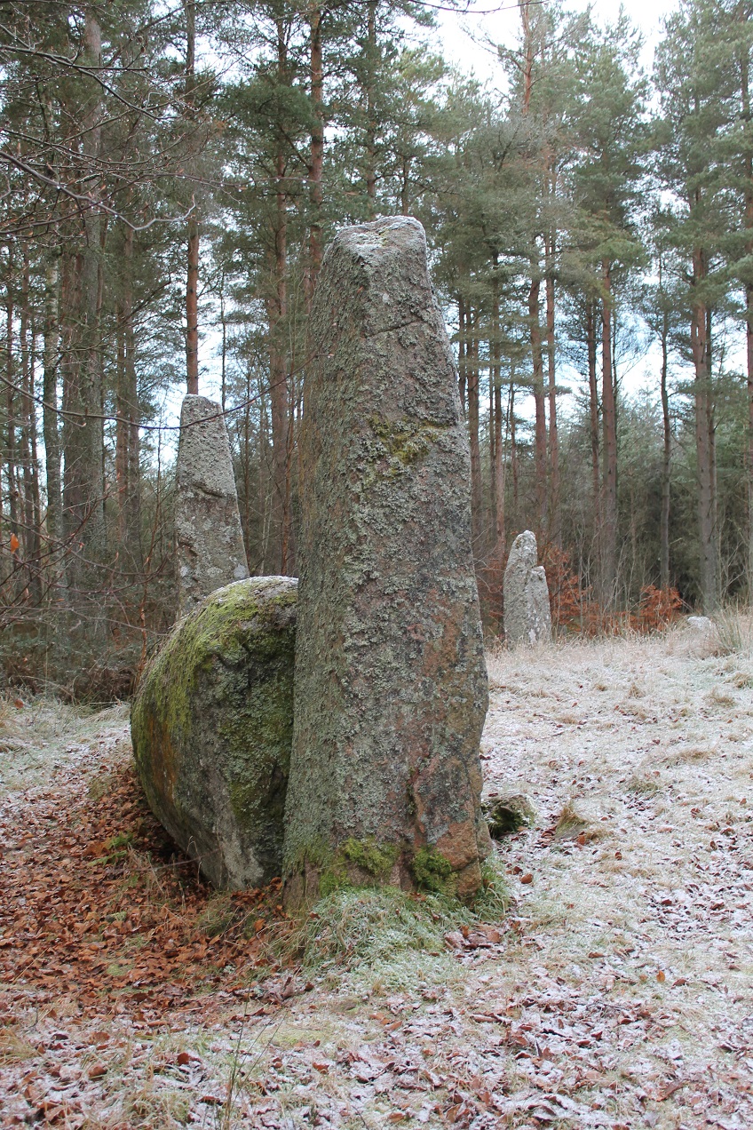
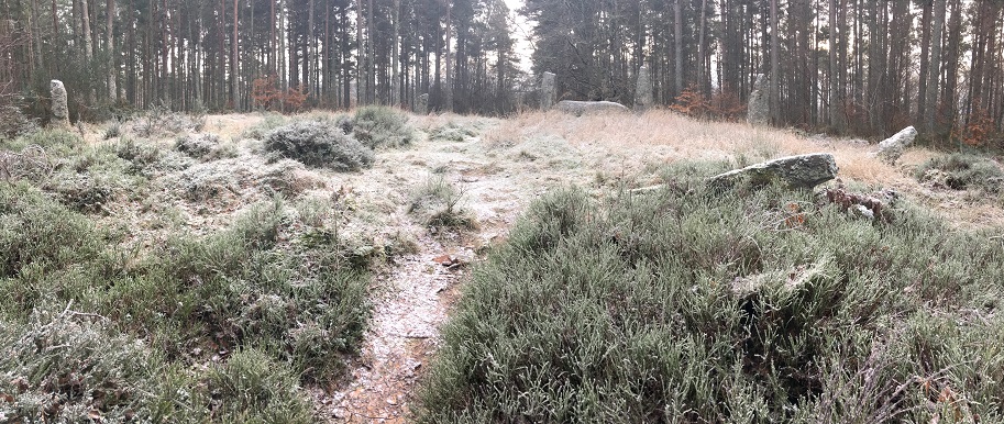
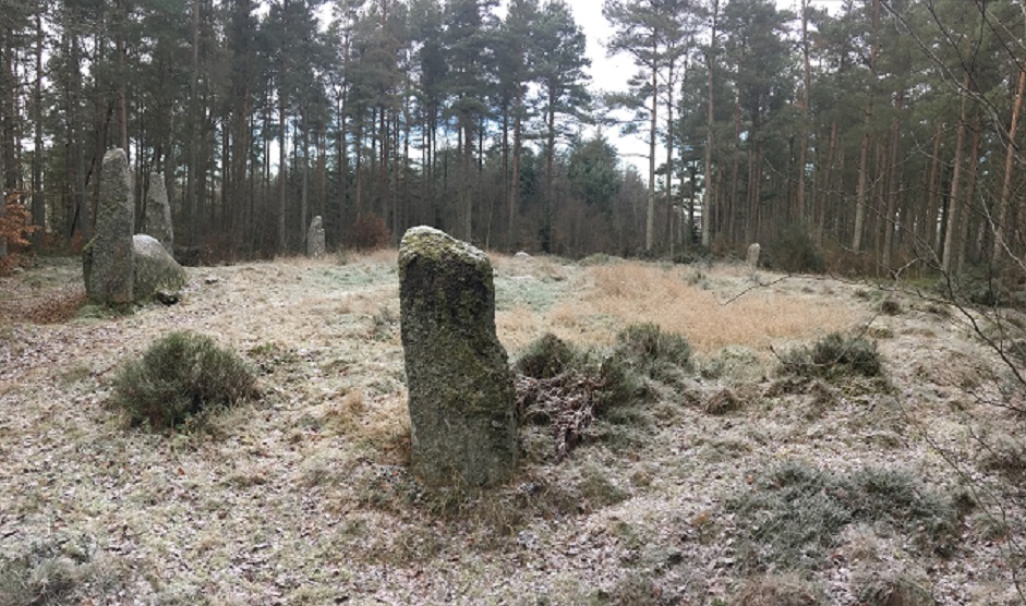
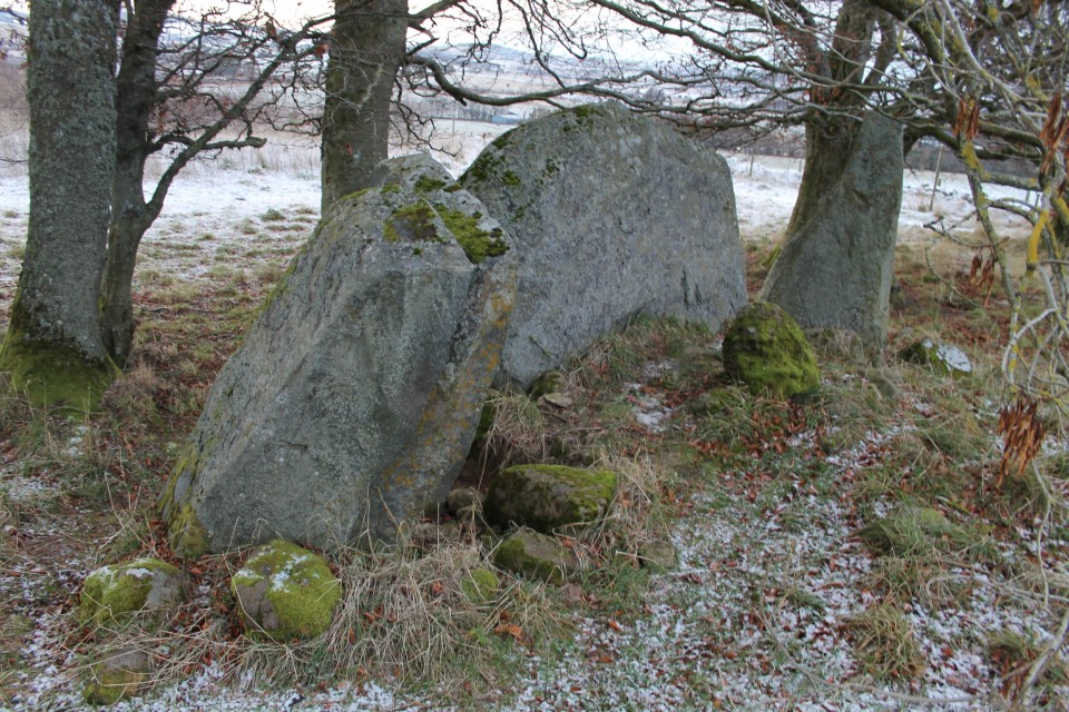
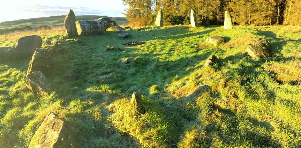
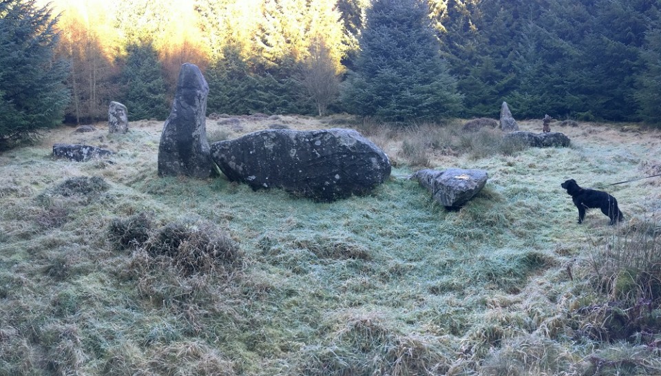
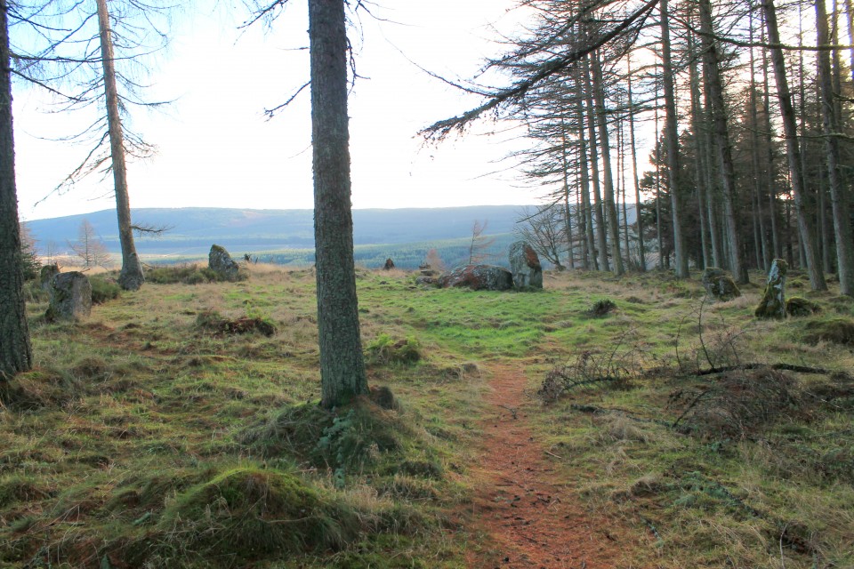
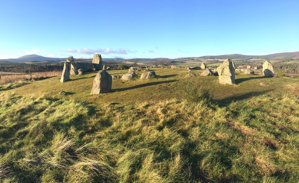
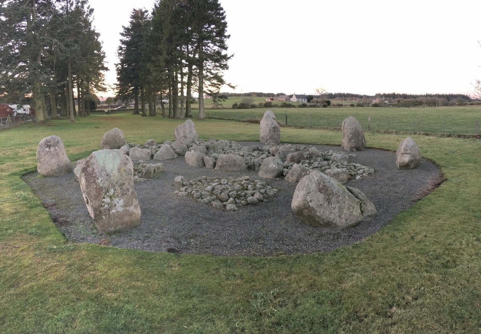
After leaving here, I managed to completely miss the road up to North Strone RSC, and after a long time spent at Tillyfourie, I decided that trying to get back on track (and a long-ish trek up to North Strone) would take too much time. So I pushed on, stupidly missing Druidsfield & Druidstones, and ended up in Keig. First I went east to COTHIEMUIR WOOD, following signs to the empty car park for the burial ground there. After a short walk into the trees, a path snakes off to the left, and you are soon into a clearing. Well…I suspected this one would be good, but Cothiemuir Wood RSC is just stunning. With just the clearing being frozen – the trees beyond sheltering the orange/green floor beneath – the site appeared like some holy relic. Like a cathedral of the forest. Beautifully graceful uprights, with sharp, balanced flankers gripping a massive slab of a recumbent. Winter suits this grey circle. Probably the high point of my week, and shooting up my list of favourites. I really wanted to stay there for as long as possible, and found it hard to leave. Old Keig — Images20.12.18ce
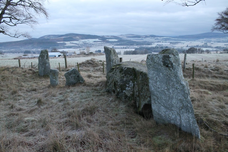
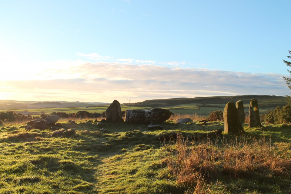
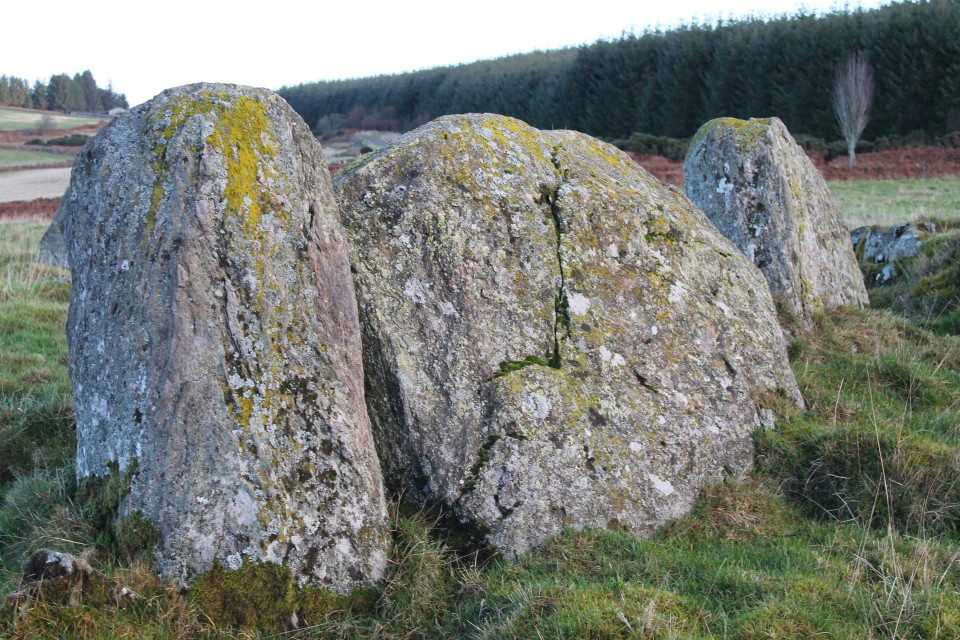
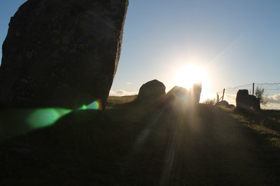
Still on a bit of a high, I made the short drive up to OLD KEIG, which provided a bit of a double whammy after Cothiemuir. Another fantastic RSC, albeit more trashed in part. The walk through the line of trees is all about the drama of expectation; leading you down the hill until big Old Keig greets you, like an old king in his branch-strewn throneroom. Although kept in its pen, and protected by trees, Old Keig sort of expands out into the landscape, down the valley and up to the distant rolling hills. This huge recumbent and accompanying stones have a truly timeless quality. Again, I could have stayed happily transfixed by here and nearby Cothiemuir Wood for as long as necessary. But, the afternoon was moving on… Ardlair — Images20.12.18ce
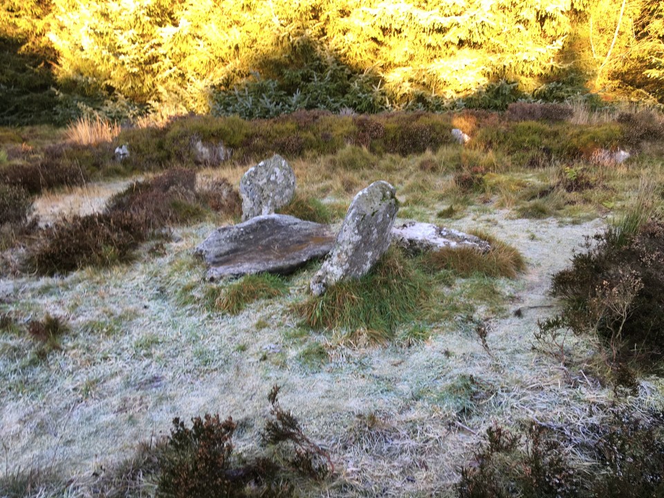
On reaching ARDLAIR I had a change of heart – possibly feeling not encouraged by the lack of any “to stone circle” sign, which I expected to find. Stonehead — Images20.12.18ce
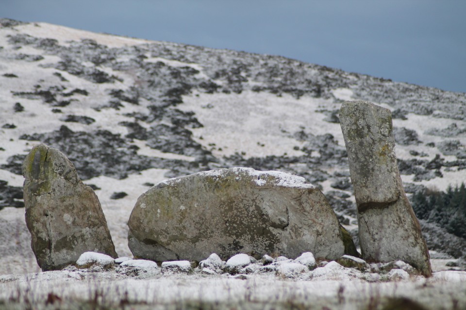
I pressed on, wanting to get closer to Dunnideer. Took a quick stop at STONEHEAD, which is a beautifully placed monster. Feels an iconic RSC kinda feel here, looking perfect in the snow. Dunnydeer Farm — Images20.12.18ce
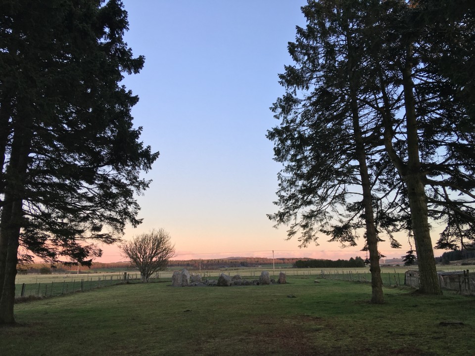
Wish I would’ve stayed longer here, but moved along to DUNNYDEER FARM, where I barely had space to park up, before following the many dog walkers up the hill, through the trees (bit like the reverse of Old Keig). As the path swept ‘round I first saw the top of Dunnideer, with its ruined arch, before reaching the small group of trees which hang messily about the last remaining stones. It’s a great spot, though not the greatest looking recumbent and flankers. Probably looks stunning in the summer, but feels wrecked in December. Wantonwells — Images20.12.18ce
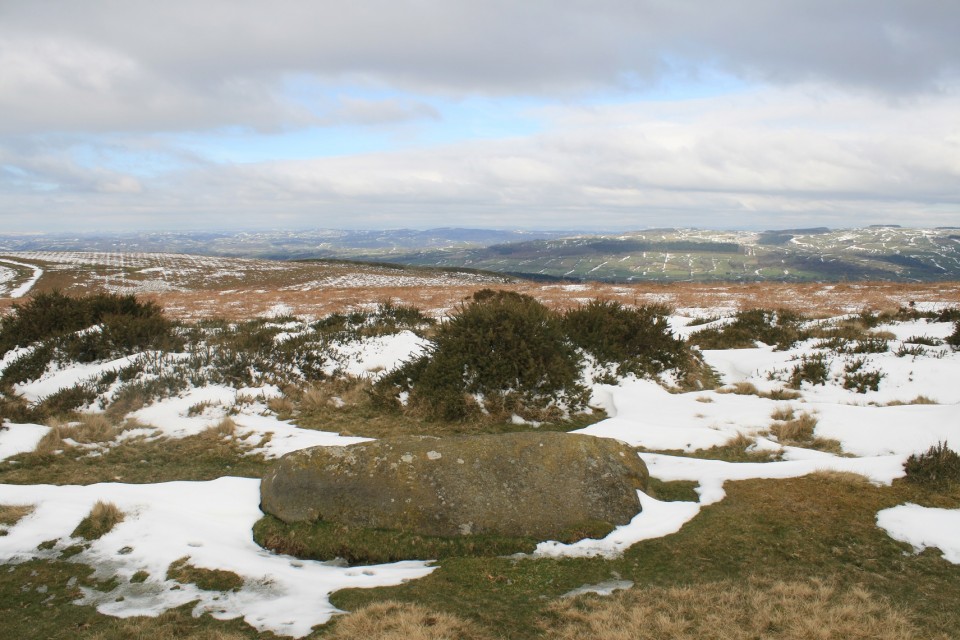
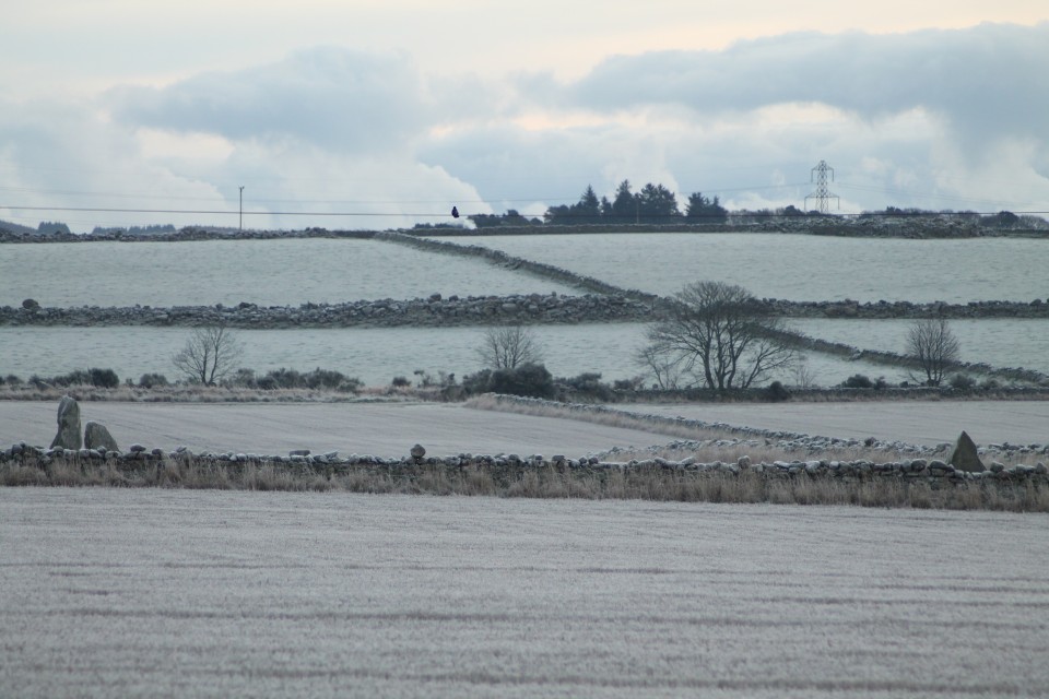
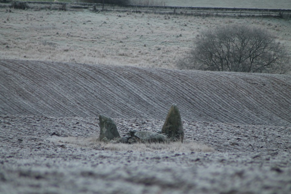
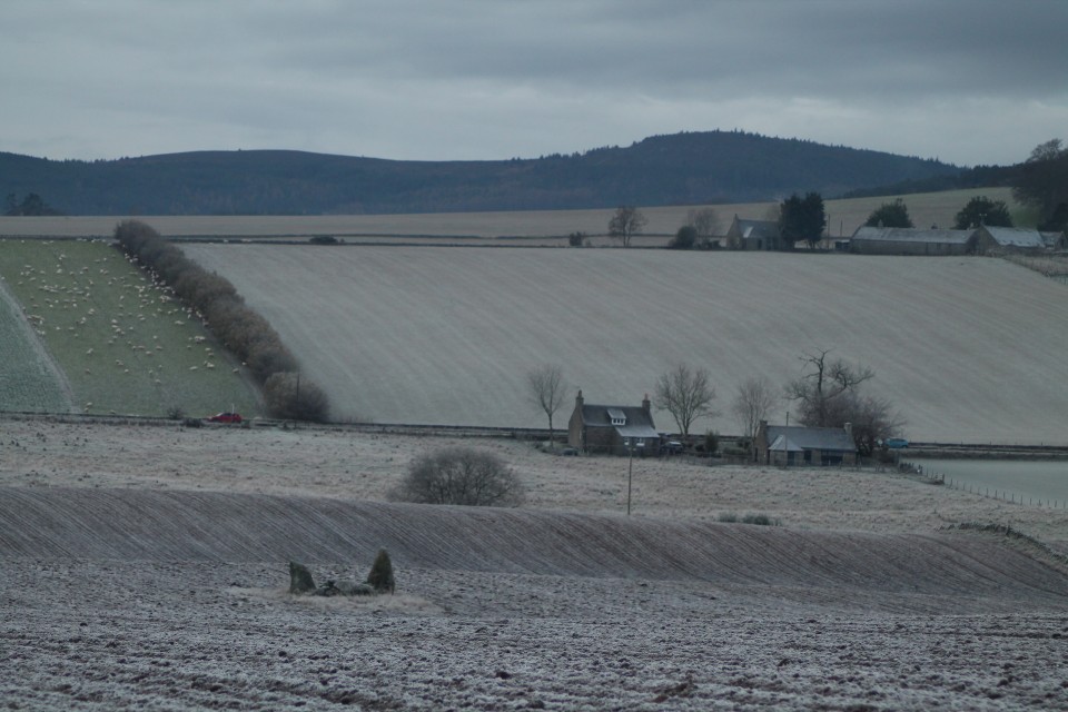
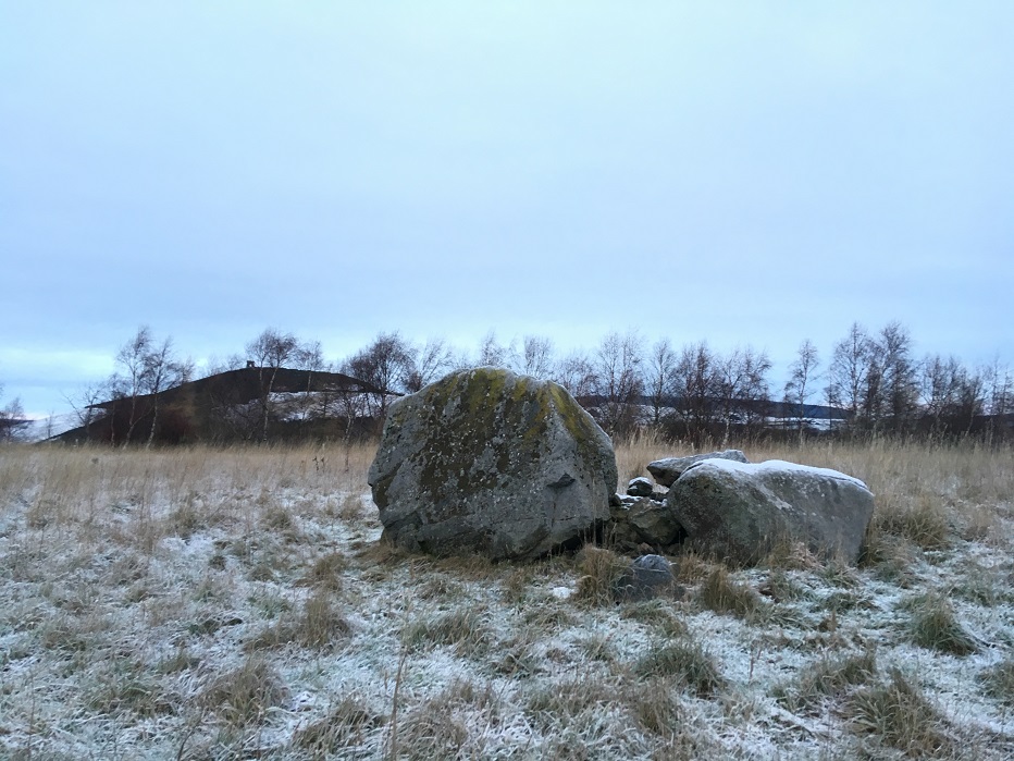
Time to go home, as the light was disappearing quickly, I thought. However, I realised I was coming down right near WANTONWELLS, so made a quick detour up the road to the deserted little field, with its snowy bundle of rocks. Great view back across to Dunnideer once more. Now the light really was gone. |
Posted by ruskus 19th December 2018ce |


Return to the Land of the RSC - Day Two. |
|
Today’s targeted area was the north east of Aberdeenshire; my guide – drewbhoy. We made sure we got an early start, and along with Bess the dog for a companion, we headed out eastwards. Although it was an icy morning, there was no bitter northerly wind to chill the bones, and a nice dry, sunny day of looking at stones awaited. Auchmaliddie — Images14.12.18ce
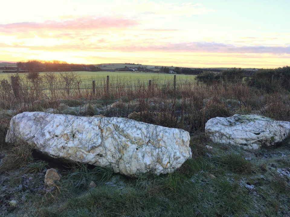
First stop was the remains of AUCHMALIDDIE – just a quick walk up the field-side track from the road. These two remaining stones glow so bright in the frosty morning sunrise. With the surrounding white ground, they resembled two melting snowmen, pushed over and at that stage when the snow looks dirty as it shrinks. The white quartz seems so different from anything else in the area, and reminded me of the circle way down in Duloe. Aikey Brae — Images14.12.18ce
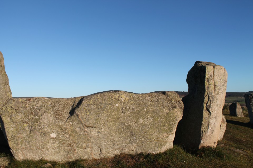
AIKEY BRAE is one of those big, ‘famous’ circles which I had been desperate to include in this trip, and visiting it confirmed why. As others have mentioned, the walk through the trees to the circle, following the pebble-edged path, adds much to the moment. The great reveal reminding me also of my visit to Clune Wood 24 hrs ago. Another big recumbent, vaguely resembling a boat (or something altogether more phallic), laying between two relatively small-looking flankers (one fallen). The evenly-spaced west side uprights remain, unlike the east side casualties. Loudon Wood — Images14.12.18ce
For the next site I thanked the Lord that I had Drew to shed some light on the mystery of LOUDON WOOD. Whilst preparing for this trip, I had been dreading the search for the circle, and had another plan for getting quite close to the wood, which thankfully I didn’t have to put into action. Drew’s invaluable knowledge led us right up to the near vicinity of the path through the wood to the circle. Initially we slightly skewed off to the side, and went into the trees too far, backtracking a couple of times before taking a direct route off the path in a presumed general direction. This led us out into a frost-white clearing, where the circle sat, looking forgotten by the world. It was difficult underfoot to notice any bank or wall-ring typical of the Buchan rings, but honestly I was just glad to finally be here. It is a magical spot. Netherton — Images14.12.18ce
NETHERTON was very different from Loudon Wood; access was quicker(!), being easily reached at the back of the farm. As Drew asked permission, we crunched through the cracking mud puddles up the track to find the complete (?) RSC that is Netherton. I really liked this one. The trees within the circle block any decent camera view, but within the messy ‘forest’ the circle is clearer than initially thought. The recumbent and flanker stones are quite undramatic, being fairly shapeless boulders, with an abundance of other stones shoved up next to them, but it feels a sturdy little group which isn’t going anywhere. Berrybrae — Images14.12.18ce
BERRYBRAE, also has a recumbent/flanker set up similar in look and feel to Netherton, and being away from any farm buildings/machinery should appeal more than the previous site we had been to, but somehow Berrybrae underwhelmed me a little in comparison. Its setting is a little scrappy and overgrown, but its ring-bank is clearer. Still, it’s easy to get to, and let’s face it – it is still pretty wonderful to be here and appreciate what is here. Drew tells me enough horror stories, during our travels, of cairn and circles destroyed nearby. Memsie Burial Cairn — Images14.12.18ce
Strichen — Images14.12.18ce
After a short detour to the astounding MEMSIE, we get lunch sorted, and talk music, politics and of course, all things megalithic, sitting at the parking spot near Strichen. Refreshed, we let Bess lead the way up to STRICHEN. By now the sky is bright, and shows this reconstruction off to its best. Although one orthostat lays flattened (by cattle apparently), this ring stands proud, looking uniformed and balanced on the hillside. Great views all around also help to make this a must visit site. White Cow Wood — Images14.12.18ce
And finally, Drew took us back to WHITE COW WOOD, for more walking along empty forestry tracks. Bess was loving it, and my weak, old legs were pretending to as well. I hadn’t necessarily planned to visit here before linking up with Drew, but glad I did, as it’s a decent cairn. With its fallen mini-dolmen-like cist in the centre, it is a fair sized ring. With the light fading, we left this corner of Aberdeenshire, and as I thanked Drew for his amazing help today and said my goodbyes to Bess the dog, I drove back to the City, already starting to work through tomorrow’s itinerary, but still trying to process all of today’s marvels. Superb. |
Posted by ruskus 14th December 2018ce Edited 21st December 2018ce |


Return to the Land of the RSC - Day One. |
|
I had not been to Aberdeenshire for many years now, having been twice in the distant past. Those trips had been whistlestop visits, where I had perhaps only had a chance to see a few of the obvious sites around the outskirts of Aberdeen. A few months ago my wife said that she had an opportunity for a 5 day work trip to Aberdeen in December, and we agreed I would tag along. 5 days!….That’s a lot of potential for hunting down sites right there. So I have been planning this trip for a while now; trying to work out how I could possible do justice to so many Recumbent Stone Circles, which over the years had become a bit of an obsession from afar. I don’t know why I have this strong attachment to the region – I live in Suffolk! Other than my best friend from childhood living in Aberdeen, and my wife’s irregular work jaunts there, I do have a link also in that my maternal grandfather’s family were from Peterhead. But it feels something beyond that; like I have been here before somehow. Anyway; that’s the background, let’s get going with these stones… Day One: I had roughly sectioned off Aberdeenshire into 5 areas for the 5 days ahead; SouthWest Aberdeen (inc. Aboyne area), South of Dunnideer, North of Dunnideer, between Huntly and Turriff, & the north east (Fraserborough/Peterhead way). I had a target to cover as many RSCs as possible – maybe around the 50+ mark even! I realise now that was pretty ambitious. Clune Hill — Images12.12.18ce
I thought I would start close to Aberdeen, with a few huddled together sites, to quickly get some successes under my belt. So I headed off in my hire car with the dry, frosty weather on my side, looking for CLUNE HILL (Clune Wood). After a few wrong turns around Durris forest. I found the car park and headed off up the path, remembering just how unfit I really am these days. After a short 15 walk uphill, I veered off left through the trees, before coming out into the circle’s peaceful clearing overlooking the valley. The rust-coloured bracken attempted to hide the fallen stones of the circle, but with enough still standing, the rough circle can be easily seen. The warm glow from the low early morning sun really made the colours come alive here, and indeed at one point the glare played tricks as I turned to look back at the circle believing a figure was standing there, quickly to my relief realising it was one of the lifeless orthostats. But it would be wrong to call this RSC lifeless, it is full of character and feeling, and a perfect benchmark was set for the rest of the day. Nine Stanes — Images12.12.18ce
Onwards to the NINE STANES, which are reached within seconds from the road. Quite a low, similar-sized set of stones, including a big boulder of a recumbent and its flankers (one fallen). Orange/brown pine needles covered any flat surface of stone, noticeably giving the recumbent and fallen flanker an eye-catching look. An open aspect, and vista looking across the circle to the south gives this wooded glade a wide, spacious, relaxed feel. Esslie the Greater — Images12.12.18ce
Just around the corner from the Nine Stanes, are the Eslies. First up is ESSLIE THE GREATER. Sitting there, exposed to the elements, in the middle of its field, it looks a big ‘ol jumble of rubbly rocks and tufts of grass, raised on a platform. Approaching from the road, passing through the busted gate, over to the rough trapezoid-shaped platform, and up into the low-stoned circle. Esslie the Lesser — Images12.12.18ce
ESSLIE THE LESSER had to make due with just a flying visit, as I headed off to Glassel next. En route I was called by Drewbhoy. We had made contact just before my trip to Aberdeen, and Drew had kindly offered to be my guide on one of my days here, so we finalised plans for tomorrow, and I parked up near Glassel house, and headed into the woods. GLASSEL always looked as if it was going to be difficult, and it delivered on that front. The ‘track’ soon faded, but I reached a wall, which I knew would act as a guide onwards. Without any GPS,etc I was never likely to find it though. I reached the brook, and headed left and right, but could not find any clues (even without a print out of advice from the TMA’s previous entries). Everywhere I just saw tree stumps or the dark stone-like silhouettes of up-ended root balls of fallen trees, leading me further into nowhere. I even texted Drew in my frustration for any hints, but I made the decision to leave my search as I had wasted too much time. Of course, I’m sure I was yards from it at one point. Image Wood — Images12.12.18ce
Next to Aboyne, and the easier woodland wander to reach IMAGE WOOD. Possibly Image Wood would make more of an impact on a different day, in a different season, but it left me a little underwhelmed. 5 little stumps huddling together in their cold, winter woodland setting, as the numerous dog walkers passed by. Tomnaverie — Images13.12.18ce
Leaving Aboyne, I headed out towards Tarland and TOMNAVERIE. Whilst driving up from Coull towards Tarland, I was suddenly taken aback by the sight of Tomnaverie perched high on a hilltop, looking like a golden crown in the sunlight. I hadn’t expected that to be my first view, and regret now that I didn’t stop for a picture from there. There’s ample parking up the short track from the road, and only a few minutes’ walk up the hill to the stones. What an incredible site this is – lovely views of course, but just a delightful circle to keep the attention back onto itself. I was reminded of the far away Torhouskie for some reason. The restoration here feels just right, and definitely must have changed quite a bit from the previously almost wrecked location next to the quarry (what quarry?!). Whilst looking across the recumbent I was amazed to find the line of hills matched the surface of the stone facing both ways! Soon after this my phone died whilst standing centre circle taking pictures (but on return to the car, it displayed as having plenty of power). Midmar Kirk — Images13.12.18ce
As the light began to go, and the chill factor set in, I decided to return towards Aberdeen, taking in the double whammy of Midmar Kirk and Sunhoney. I had visited both of these over a decade ago, but felt is silly to ignore such beauties, by taking them for granted. MIDMAR KIRK always seems a cold, but quiet and obviously respectful place. I feel the ancient stones seem quite ‘natural’ being here in a way. They feel protected, and bring an even more peaceful stillness to the graveyard. They seem to renew the links from the past ancestors, to our more recent ones. Sunhoney — Images13.12.18ce
The walk up to Sunhoney was very muddy (Mudhoney?), but I soon reached the well-kept pathway that leads up to the grove of trees and stones. SUNHONEY always feels such a special, contained space; shut off from our world. Despite the cold, it gave me a warmer feeling than on a previous long ago visit. The grass was lower this time, and the large circle was more visible. I’d forgotten just how long that recumbent is. From standing outside the circle, looking back across the recumbent and flankers, the nearby hill (Barmekin?) was glowing bright orange in the last of the afternoon sun, whilst everywhere else was shade. Sun honey indeed. Cullerie — Images13.12.18ce
On the return journey back to Aberdeen, I passed so close to CULLERIE that I thought I’d just nip there, expecting that I would confirm my feelings about it relating to a previous visit here. But, I have to say that it wasn’t nearly as bad as I’d thought. The gorgeously clear afternoon gave the avenue of trees a grand feel, as if they were rich stage curtains pulled back to reveal the encore act for my day of stone hunting. The framing effect built as I walked towards this pretty little circle, which didn’t give me the artificial, centre-of-a-roundabout vibes I had expected. If it had a recumbent it wouldn’t seem all that different from Loanhead of Daviot really, in terms of reconstructed presentation. Bit of an undervalued site methinks. |
Posted by ruskus 13th December 2018ce |


Thornborough.......A henge for everyone. |
After a lovely time at the Druid's Altar four poster stone circle near Grassington we got stuck, not in mud or anything like that but in a bicycle race, the pestilence, the niche absurdity that is the Tour De Yorkshire. Druid's Altar — Images07.05.18ce
The Arrows, are always very entertaining, tall and perfect, and very brilliant. The Devil's Arrows — Images07.05.18ce
I thought what I'd do was start at the north then go middle and then of course south. A good idea, I thought. There was already two cars parked by the woods, but experience tells me that just because there's a car by an ancient site doesn't always mean that's where they'll be, apparently some people walk for fun, don't laugh, it's true, I promise Thornborough Henge North — Images07.05.18ce
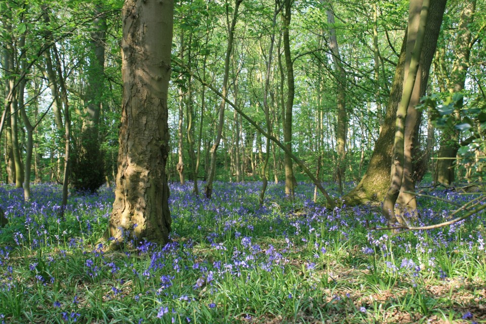
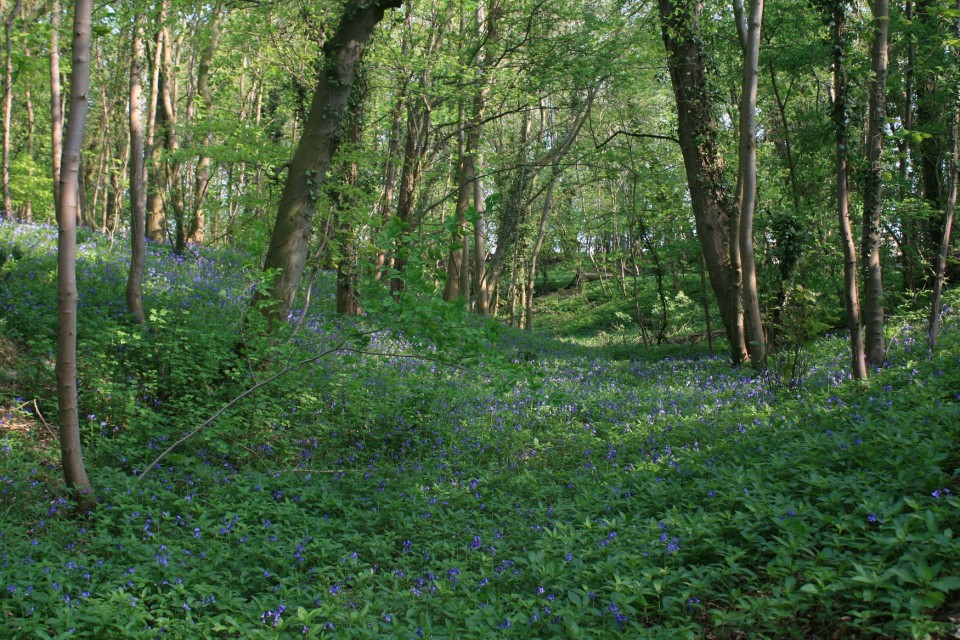
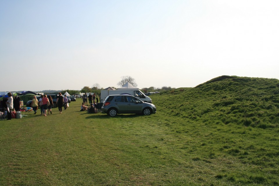
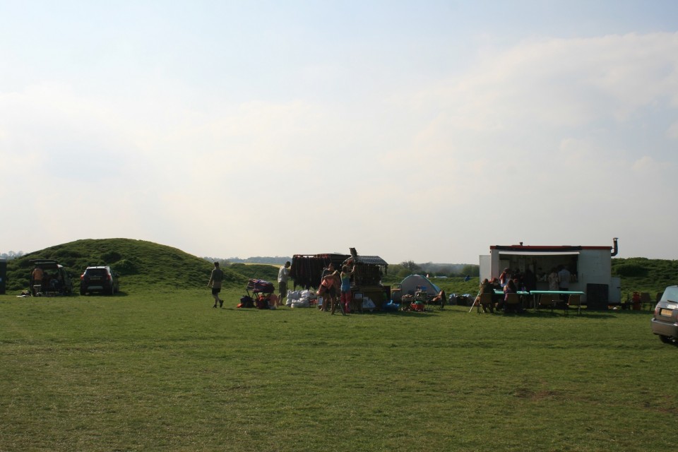
I left daughter in the car and entered the woods, immediately transporting me to another world, a world where the dominant life form on the planet is Bluebells. There were roughly 9.4 people dotted about the henge, bluebells outnumbered us like a million to one, because of the trees, banks and ditches, even if there are other people here, you can still get a very personal visit with this henge. It's all very much intact as well, some of the banks are higher than in other places, but very well preserved, a sleeping giant beneath the trees. But a shadow loomed, even here, in this quaint and quiet part of the Shire, whilst looking through the southern entrance I saw a worrying thing, a thing that does not go well with ancient sites, it wasn't a bicycle race, but it was lots of people. Back in the car we go round the block looking all the time towards where were going and inwardly groaning, there appeared to be something going on at the central henge. I parked on the roadside and gingerly approached the henge. This wasn't good at all, there's hundreds of people here, camping around almost the entire perimeter of the henge, stalls selling crap and trash, portaloos, burger vans, and dread locked wastrels eyeing up young girls, not good at all. Thornborough Henge Central — Images07.05.18ce
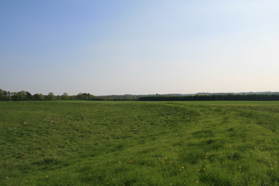
Immediately I climbed the bank west of the entrance, to photograph the disturbing scene, and was shouted at by greasy fat lady with her husband Krustie "get off the henge" they shouted, I looked around, "good lord, they mean me" they shouted again, "get off the henge" . Natural curiosity got the better of me so I asked "why?" "Because I said so" was the reply, who was I to argue with such clarity of thought, a well planned out argument. I demurred to there outlandish ways and descended the bank, stopped when out of view of most of the hoard, sat down and skinned up. I've never been, but this is what I imagine a summer solstice at Stonehenge would be like, unbearable. I strolled across the interior of the henge to where it is at it's lowest, and crossed over into the refugee camp cum Beltane celebration. A nearby oaf sitting in his plastic chair noticed me and burbled something at me in some southern drawl, "what?". He said again, "good job no one saw you do that, they don't like it at all". I went over. "Whats going on here,? I've never been to a henge and not walked all the way round." " Celtic festival of Beltane innit mate, my misses makes us come every year, I've been here since Friday." He gave me quite a sad look. I inquired further "There's hundreds of henges all over the country, why have you all come to this one?" He shrugged. Long drawn out sigh. I decided it was time for a different henge, leaving, I photographed the ugly monster that is a Beltane celebration. Honestly, I like marking the solstices and equinoxes as much as the next guy, maybe more, but it's a bit much to do the half way points between them too, unless of course all's your after is beer, burgers, bangles and under dressed teenage girls. Returning to the car, I relayed my misadventure to my under dressed teenage daughter. Then told her I'm going to the other henge in that field right there, pointing, Ok she said. She's a good girl. Now, having a look at these henges on here the day before, I noted Carl couldn't find this henge, I couldn't remember it much either, only that its the most worn out of the three henges, so I picked the bridleway pointing in the direction of where the last henge should be, and entered the field, almost immediately I could see a rise in the land that must surely be it, I got closer, it was, it was the last henge. Thornborough Henge South — Images07.05.18ce
I sat for a while, I found a quiet henge at last, one all to myself, listening to the fine lovely birdsong and the audio equivalent of poo or torturing. It's been a mixed kind of day. Then it was time to go home, so we went home. |
 Posted by postman
7th May 2018ce Edited 8th May 2018ce |
Signs. Spring Equinox at Mitchell's Fold. |
|
I don't like winter, that's not strictly true, what I really don't like is being cold, it hurts. So I am pretty eager for signs that we're moving back to the good times of warmth and light, signs like snowdrops and crocuses, the day being light when i'm going work, signs like the spring equinox. Which is today, so i'm going out to see some stones and take a look at what the sky is up to. Though I can probably guess. So, where to go, it needs to be quite close, so Callanish is out, i'm old and knackered so it shouldn't be hard to get to, so Bryn Cader Faner is out. How about the Bull stones on the edge of the Peak district, too small. Mitchell's Fold? It's been eleven years since last time. Done. It's closer than you think, to my house, I got there with time to spare, which is quite unusual. But I was going to need that extra time, because it had been snowing a day or two ago, heavily, in places I had to wade through two foot deep snow drifts. Seeing other places in winter makes me see just how strangely weather free home is, it snows, for sure, but it's only just a mild inconvenience, it doesn't close roads. After much heaving and sighing I arrive at the circle, first thing to do is remove the wads of snow from inside my not good new boots, second, breath heavily on my stinging cold fingers til there warm enough to handle the camera. Third, do photography. The equinox sun looked to be rising from behind the Stiperstones, a rocky cairn topped ridge of ankle breaking renown, about six kilometers distant. Mitchell's Fold — Images21.03.18ce
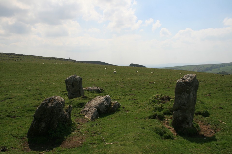
I say looked to be, cloud, which had been absent my whole drive here had come out of no where to obscure the magic moment of sun rise. There was just a thin sliver of sky protruding through the grime close to the ground, enough to see where the sun would be if all was perfect. It's not even close. If it's been eleven years since I've been here, the same must be true of the Hoarstones stone circle as well. So I march off in the direction of Stapeley hill, it was easier last time as I had a mountain bike, this was likely to take longer. I passed the Dead cow stone not seeing it, as I was talking to the sheep, they chose to ignore me. Reaching the top of Stapeley hill wasn't easy, long deep snow drifts had to be navigated like some cruel Labyrinth, or waded through, flipping snow, is it really necessary ? Stapeley hill has two rocky peaks, with superior views, hanging between the two on a shallow ridge was something I wasn't expecting, kind of. I'd seen pictures of it, but hadn't appreciated where it was, a nice little ring cairn, it was here ! cooooool, if this ring cairn was on twitter, I'd have like it. What ever that means. Stapeley Hill — Images21.03.18ce
New boots are beginning to hurt, just above the ankle, it must be time to walk further away from the car, course it is. Like I said, it's been a while since I was last here, so I decide to come down off the hill too early and start searching for a stone circle that isn't there, deep snow, hidden holes, hidden streams, all impeded progress, I was just about to give up when a van came close by, I went over, he stopped, we talked. It's not here, it's on the other side of the forest commission bit, over there, he pointed, up and over. He gave me directions, but my man mind can only hold half of all directions, I set off again. Somewhere in the forest I got distracted following animal footprints in the snow, and went wrong. Nothing was making sense, I stupidly left the map in the car, but am fairly sure I've just gone off the top of it, so it's useless anyway. I'm now poking about around a house called Hillcrest near castle ring hill fort, another man helps with directions, it's over there, holds out both arms and indicates it's between them, over there somewhere. It's looking a bit grim now, I've warmed up, but lost a stone circle, it was much easier last time. Next is a long walk along the road rounding the Hemford corner and heading back to the A 488. I have by now given up, even the sight of four Roe deer doe's doesn't fill me with positivity, I do photography and walk on, painfully, some walking boots aren't really made for walking. Back on the main road I spot a footpath that goes in the direction of back up Stapeley hill, I take it. Immediately I recognise this place, I believe I am now close to the circle, at one point I peer across the snowy moor, but see nothing and give up once more, I shouldn't have, it was there, I looked right at it but didn't see it. Grumped out, I stomp back up and around Stapeley hill, blundering haplessly upon the Dead Cow stone, at least I managed to find that, by accident. The Cow Stone — Images21.03.18ce
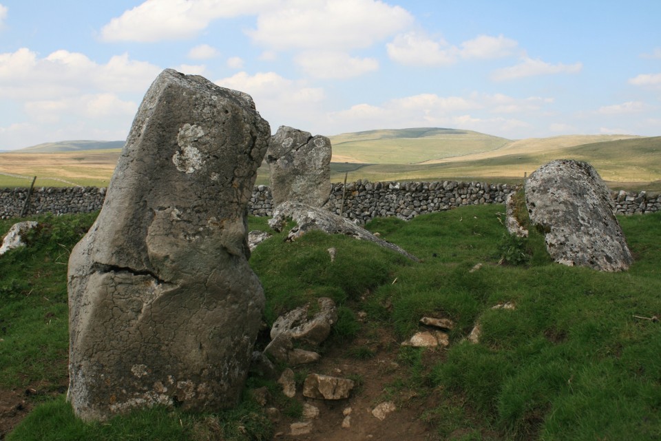
But I couldn't let it go for long, after wading back through the snow I get in the car and look at the map, oh, there it is, kind of exactly where both my local helpers said it was, I drive back to that same footpath off the A488, ditch the car angrily by the side of the road, don my wellies and wade through ankle deep freezing mud and shite across two fields and there it is. Then I went snow blind. The sun had decided to show itself, the snow seemed to glow thumpingly, hitting my eyes with some considerable vigour. The Hoarstones — Images21.03.18ce
I had to shield my eyes from the worst of the glare whilst I took some photos, then I sat on the edge of the circle upon a flat topped stone and closed my eyes, with some relief. After the sun had gone back in I inspected the stones more closely, well, I say closely, I mean I didn't fall over them. Two holes have been drilled into one of the remaining stones, some say they could be ancient but the loss of over half the ring suggests a more explosive reason. A central stone, there's one of them at the Bull stones on the edge of the Peak district, I wonder if the sun put in an appearance there, I imagine it would have been life changing. Time to go, I agree with the devil on my shoulder and trespass wildly in order to take a more direct mud and shite free route back to the car. Done. |
Posted by postman 21st March 2018ce |