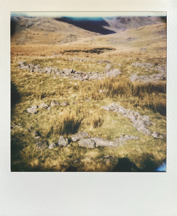
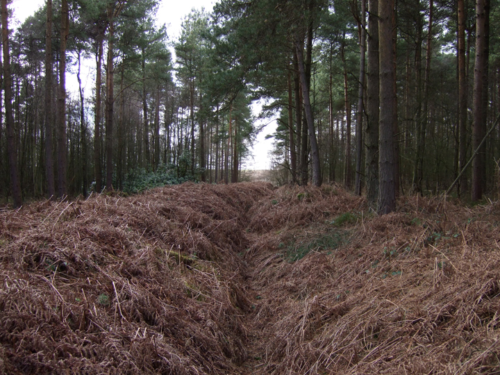
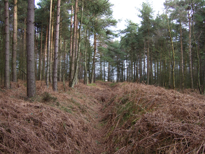
Details of the cairn excavation in 2007
|
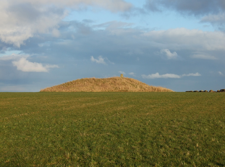
Though the OS maps show very little, the Duddon Valley has a very rich history of human settlement and this is detailed in the community led publication "Ring Cairns to Reservoirs". Following various discoveries, the community in the valley managed to raise then secure additional funding in order to carry out a survey of the area which uncovered around 3000 previously unrecorded historic sites. Not all of these fall within the age interest of TMA, but a fair few do, and Long Pike was one of the sites to be excavated.
The excavation revealed a couple of pieces of pottery, and some charcoal backfill beneath some of the stones which allowed for dating of around 1500 BCE. This absence of detritus is taken as a sign that the site was kept very clean due to the great significance it may have had to those who build and used it, pointing to it's likely use as a ritual site.
|

|
Details of Scheduled Monument at risk
|
I set out on an exploratory trek taking me through Monk's Wood, the largest area of Ancient Woodland, in Cambridgeshire, the least wooded county in the country. I came out on the other side, looking for something significant as the barrow is marked on OS maps, and also the map of the woodland, but could see nothing.
On the other side I set across a pathway between the fields, seeing very little. I saw a hare and took that as a sign - so followed it. The hare waited and then I saw I was following two, shortly before disturbing a large deer. The three creatures ran into the opposite woodland as a buzzard cried overhead.
They weren't obvious signs, and I could see nothing. As I walked back taking numerous pictures and checking maps and my gps location I made a final turn and there it was.
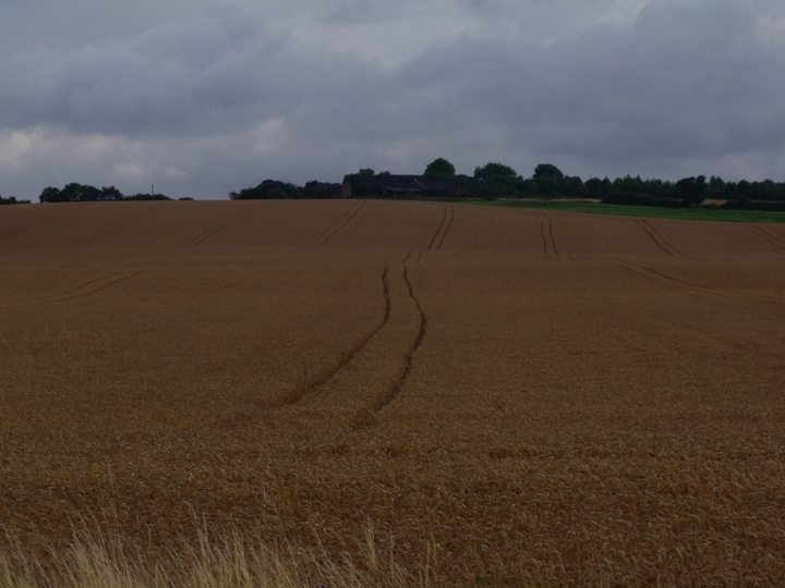
The Heritage gateway describes the site as being a Bronze Age bowl barrow (2500BC - 701BC) though after ploughing, the impression is certainly more of a Pond Barrow, as illustrated by Nicholas Thomas (Guide to Prehistoric England, 1960).
Faint marks can be seen from aerial photography, though on the ground it is more difficult as the terrain has numerous dips, and hills. Once found though, it is very obviously uniform and hopefully the photograph provided shows this as the crop rises slightly, dips into a bowl then rises again on the other side.
I didn't go into the crop to investigate further, there seemed little to be gained from the damage that would be caused. Other than the Heritage Gateway details, there seems to be very little information about this site.
Photos taken, i turned back into the berry, fungus and hazel rich woodlands and began to make my way home.
|

|
details of Cambridgeshire Heritage site 00819
|
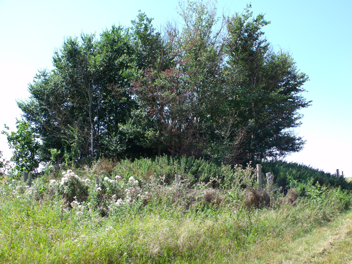
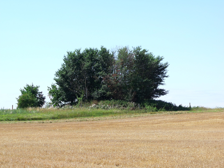
Now stuck in an area I initially left 15 years ago, and in desperate need of trying to straighten my head and connect somehow with the ancestors, I located Round Hill and went to get pictoral documentation.
Since I left the area, the A421 has been built and lies close by. The best way of getting to the site is to turn off the Black Cat roundabout just after St.Neots to the turning for Roxton (between the A! exit and the A421 to Bedford) then turn right over the A421 flyover (Roxton Road). Just on the other side is a large area where you can park safely then walk. A disused road takes you round the edge of the sandy coloured wheat fields and then along the other side of the A421 embankment.
The Hill is quite large, and riddled with Rabbit holes. On its top are a cluster of planted Alder trees, some still with their rabbit guards in place. I have found little in the way of documentation about the site, only being able to go on what Rhiannon has added, that it remains unexcavated.
Looking out, the landscape rolls very gently and you can see the mound is situated on a slightly higher plane than everything else. In a North Easterly direction I saw hillside rising with a wooded area in the distance, which within the setting of the landscape I think could hold some historic interest. Despite the fact that arial photography shows one of these patches (Alington Hill) to be circular, I have yet to find any documentation supporting a history.
I sat on the burial mound looking out, and my ancestors gave me the realisation I had been missing. With a sense of sorrow, but a lighter heart, I was able to leave, thankful for the help.
|
 
|
".....a group of distinctive earthworks in the north-east of the North York Moors that prior to investigation by the RCHME, had been categorised as double pit-alignments. The earthworks consist of two or three pairs of pits, with the spoil from the pits spread into parallel enclosing banks. The orientation of the segments is rarely consistent along an axis north-west to south-east ; in each case there seems to be a tengential alignment on burial mound, putatively Bronze Age in date, which may give a clue as to their age and function."
LOFTHOUSE C. A
Proceedings of the Prehistoric Society
1993, vol. 59, pp. 383-392
|
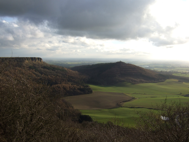
Information about Roulston Scar, plus old OS map of the area.
|

|
 
|
  
|
Setting out for the day I had written down points of interest and had an idea where i was going, and to make things a little easier, foolishly forgot to pick up all my grid reference details from the kitchen table!
I hadn't on this occasion read around the subject as fully as i could have done, and only when I returned home did i realise the whole area is Roulston Scar (I have always known it as Sutton Bank). We parked at the top, near the gliding club and headed roughly NEE to the fortification as marked on the OS map. Crossing a small valley we scrabbled up the sides and headed into the woods. I all honesty, an easier way would have been to park at the top of High Town Bank Road and walk down.
In any case the length and size of the fortification was quite impressive, and surrounded by woodland. Its termination point seems a little odd and I wonder if it maybe ran at some point to the top of Hell Hole SE523816. It certainly seems like this now wooded stretch is all that remains of the fortification. Walking along it's ditch West to East with it's Southerly side being easily 5 feet high in places, it wasn't difficult to imagine what it once looked like, and when you look out over the flat land that Roulston Scar rises from, it isn't difficult to imagine why fortifications where built there.
The thing that is a little tricky though, is that information about the Hillfort suggests that it's perimeter terminates before the small valley we crossed. Maybe this was an additional fortification. The OS map shows a tumulus in the fields near by, although all signs of this are now gone.
|
 
|
   
|
Polly and I trecked along here today.
The signs saying it was private looked old and out of use, and there was a much newer sign indicating the right to roam. We scared of several grouse and it seems to be managed land with numerous grouse butts. The only restriction we could see was that there were to be no dogs at all.
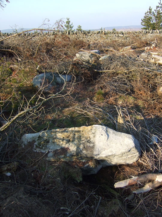
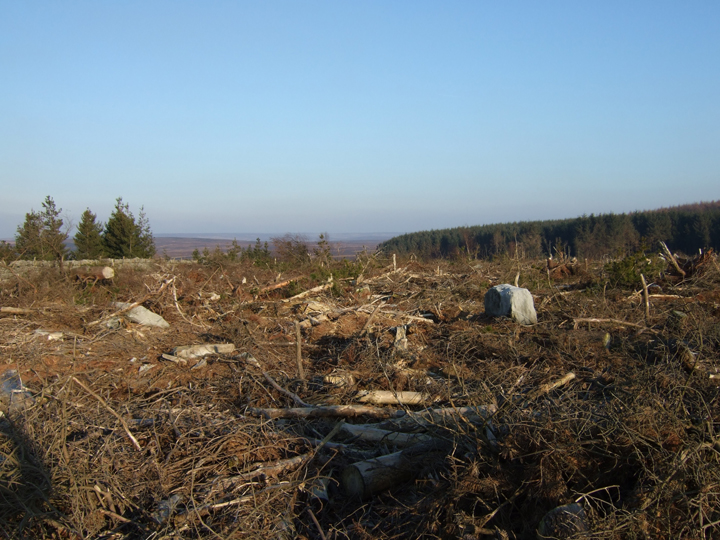
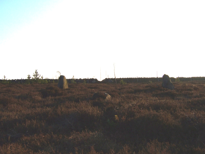
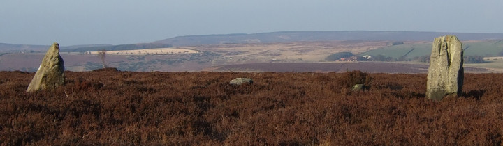
We made our way along the track and veered of to the left and along the edge of the stone wall that borders the plantation. Much of the plantation is now cut down and has exposed numerous large stones, some looking as if they had once stood upright and some in a distinct circle.
The main and obvious ones were on the North side of the wall.
Don't get lured into boggy ground full of ponds by stones that you think might be the ones you're looking for. Carry on past a few trees on the North side of the wall and it will become obvious.
The first two set relatively close together, with the next pair being a bit further appart. The Northernmost pair have a fallen stone between them. This also lines up with the middle of the Southerly gap by the wall, and another fallen stone between the two.
It didn't strike me as a stone circle and finding all stones required stretching my imagination. However, they were definately positioned, though it seemed to me to be as some kind of a gateway.
The stones in the plantation were more difficult to work out, though as ive mentioned, there are some that appear to have fallen and seem to form part of a definate circle. Plantation harvesting looks to be the cause of some damage, but not all. On one hand its a shame, but on the other hand, the lack of plantation allows a better view of the stones.
|
Aiming for SE667399 we immediately crossed off the dirt road, under some power lines and hopped over a ditch to it's right and into some pine woods. It is open access land so CROW applies. I had an idea we were getting near and saw a slightly raised mound. We headed towards it and it was riddled with burrows. At this point, Em suggested we bear right. This took us into a different section of woodland which was fenced off for paint-balling. We carried on exploring there then arched round to the left again.
We saw a mound at about the same time as our chests tightened and I felt loads of pressure against the sides of my neck. Where we turned off to the right previously had been the front of what seemed to be a long barrow, right on the edge of the pine plantation. Taking some bearings and comparing them with a map charting local ley-lines, we found the direction we'd gone off in was along one of the lines.
We looked around the woods some more in case we'd missed something but kept getting drawn back to the barrow. It was definitely the place, looking more regular that the surrounding terrain, but overgrown and with a definite foreboding feel. We decided we probably needed the advice of someone local.
Heading back towards the car, we stumbled across a small circular mound that we must have missed when entering the woods. It felt very calming but confused us as we were unsure how many there were meant to be. The current OS map record tumuli, whereas and older one shows a barrow as well, and positions on both are different.
We crossed back towards the dirt road and bumped into a gentleman who seemed to know some of the history of the area. He mentioned that Danes Hills was the name given as the Norsemen had camped in the vicinity. It was part of their route overland to Ricall, but had been in existence since the Iron Age. He also mentioned a few more on Skipworth Common nearby (these are shown on the older OS maps, but not the newer ones, although there are others that are nearby, which are shown on new maps but not older ones!). Coincidently our local gentleman didn't think we were lunatics when Em mentioned ley lines and dowsing as it seemed that he too was a dowser.
We headed for SE644377 and though we found slight raised ground, they didn't fit in with the map, and not all felt entirely man made.
A GPS would have been useful for accurately pinpointing the various mounds.
|
"From the east window of the bar [Blakey Inn / The Lion] can be seen the grave at Loose Howe where a Bronze Age chieftain was interred in a boatlike oak coffin, armed, clothed and equipped for his "voyage," with a smaller dugout placed alongside."
Mystery Inn with Hundreds of Years History - J.H.Ruston
|
robokid hasn't added a profile
|
|