|
|
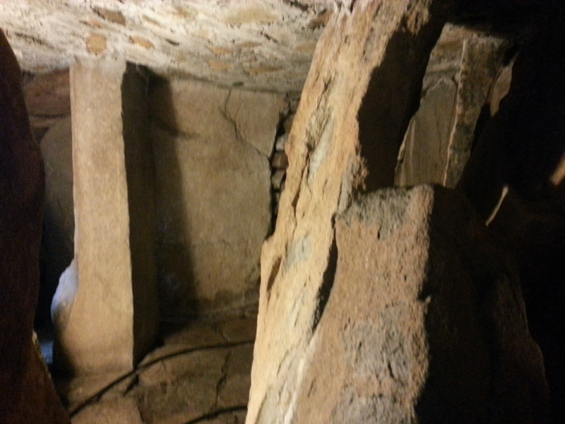
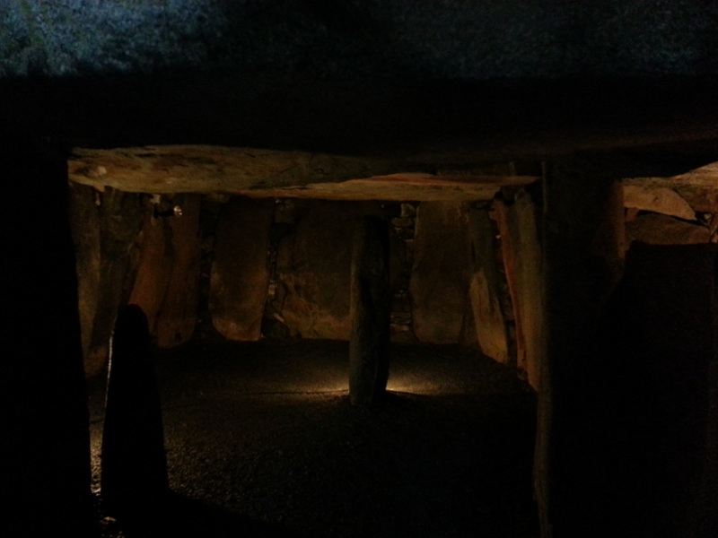
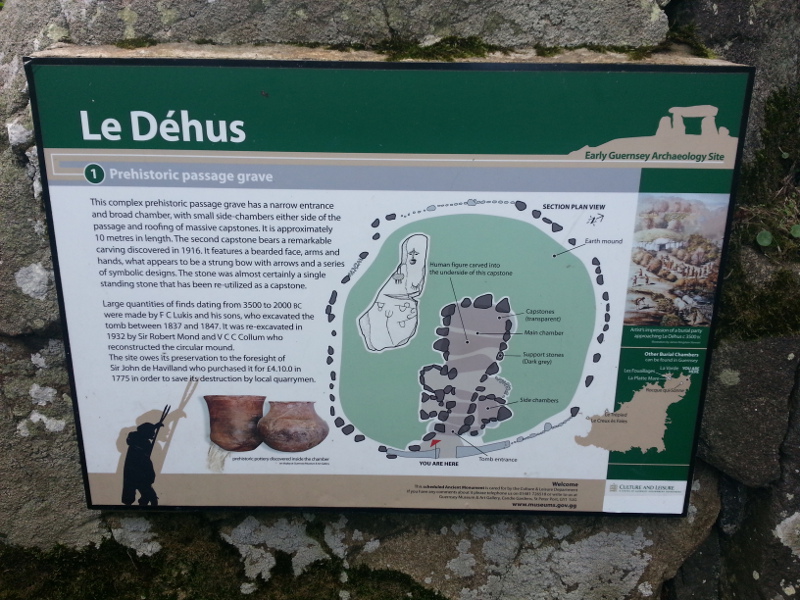
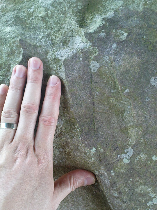
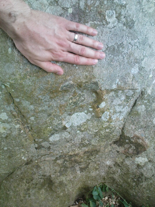
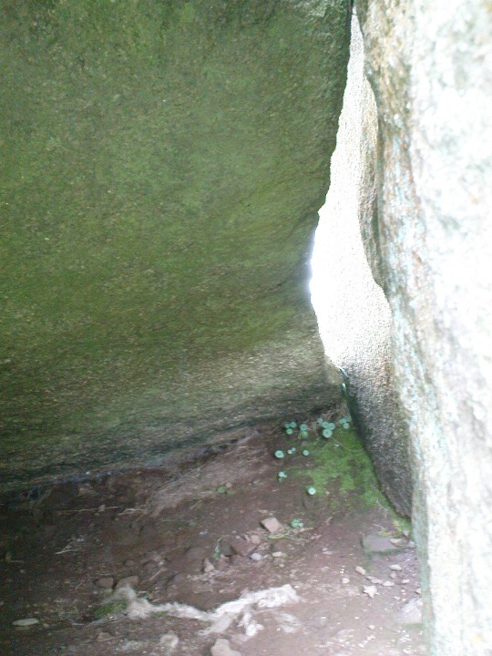
I make no exaggeration in saying that Dehus is possibly the most amazing long barrow type monument I have ever encountered. I suppose it is trumped by La Hougue Bie on Jersey, but Dehus has one very special feature: a man's face carved into a capstone, looking down at you. There are side chambers and an enigmatic central standing stone that does not reach the ceiling.
|
  
|
|
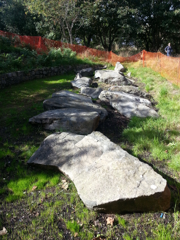
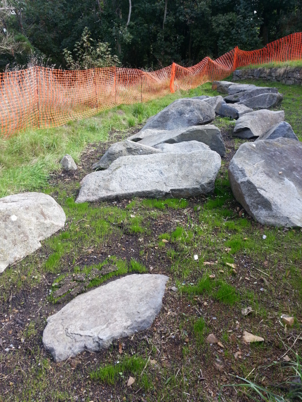
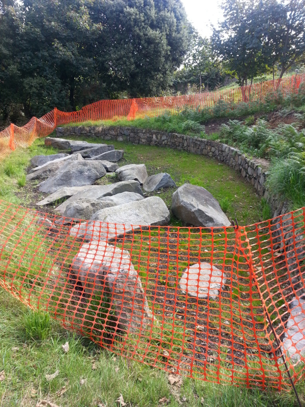
Visited on holiday on October 2013. The location of the tomb is not marked or signposted anywhere in the park, but it is in the trees near the car park. Clearly some work was still going on then, or recently, as it was fenced off by some rather unattractive orange plastic. Medium sized stones of up to 5 feet length, arranged now in two elongated rows. The whole is in a hollow where it was (I presume) excavated and has a retaining wall on the higher side.
|
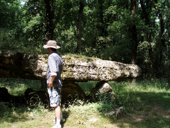
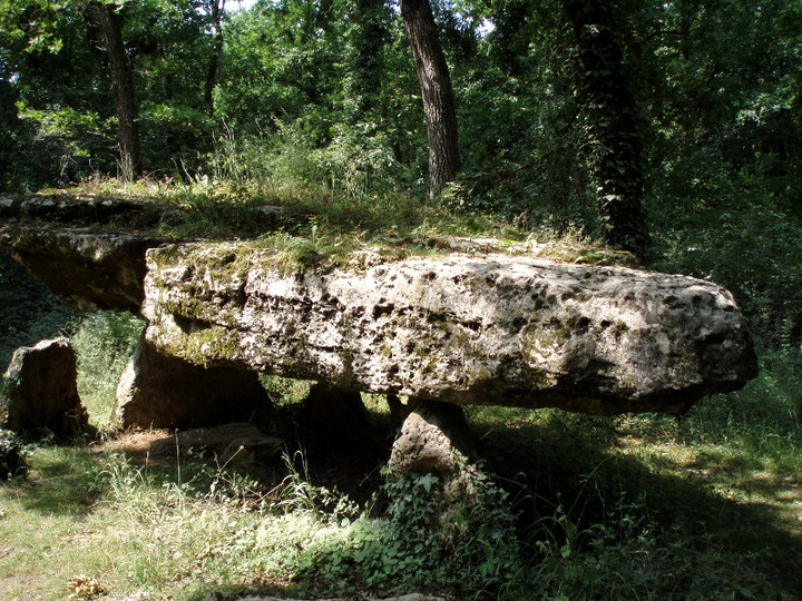
An elegant dolmen with a whopper of a capstone, a short walk through the steaming woodland on a summer's day. There is enough of a space to park one car at the brown roadsign. You have to be quick to spot it just to the east of the new TGV line under construction (not on Google Maps yet).
The nearby villages seem to be full of holidaying Brits, what what? If you get a chance, read the heritage information board in Hanc which describes village ceremonies conducted until recently that are straight out of the Golden Bough.
|
 
|
Very clever Google Maps-integrated website with direction of sunrise/ sunset for anywhere, anytime. You need never speculate about a solstice alignment again!
|
|
Visited this on a cycling holiday in Brittany this summer. Just before the bend in the D7 going out of Saint-Suliac, walk up the farm track to the right, and you will see a home-made sign to "Menhir". That leads you into an orchard (there was nobody around when we were there) surrounding this massive stone. It is a very rugged and irregular shape. Whether really a menhir or just a prominent erratic I know not, though the maps show it as prehistoric. There was a huge pumpkin nearby with the name Gargantua carved into it. Menhir a true word spoken in jest, as Obelix might have said (in English translation).
|

|
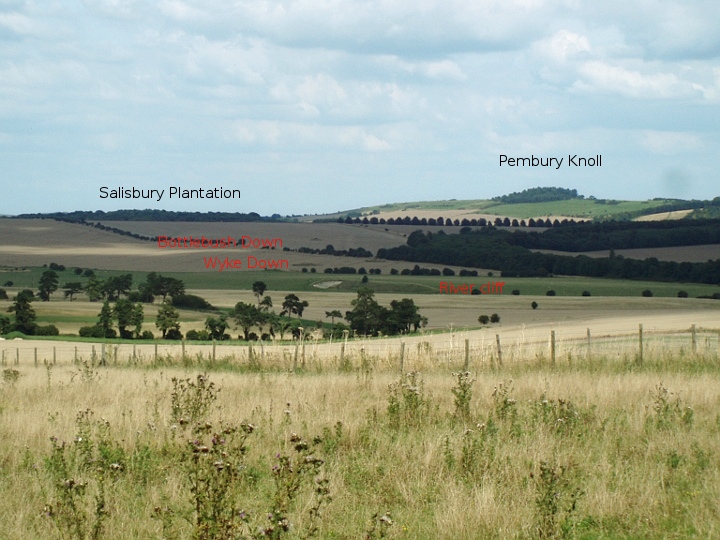
I promise this is my last one. Isn't tecknologie marvellous? You are looking at the Bottlebush Down terminus - yes, the one-foot-high bump running across the screen. On the skyline is the Gussage Down long barrow where the midwinter sun sets. You can zoom out and turn round to see where Mr Cope took his photo all those years ago. And you can drive north to see Berendes Beorh and south to see the round barrow unceremoniously called "Wimborne St Giles 35" right on the verge of the road. And some roadkill. Eeek.
|

Pleased to see much of England's lovely lanes now available online. Especially as I'm trapped in the city studying for exams and I can top up by looking at some country side even if I can't go there yet. Sniff.
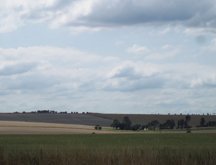
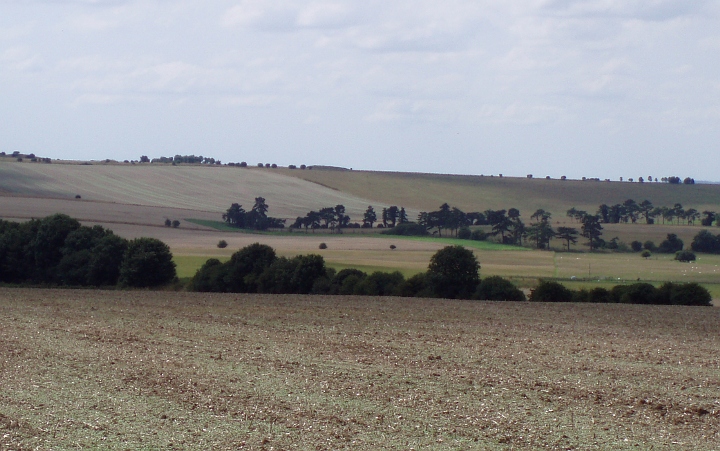
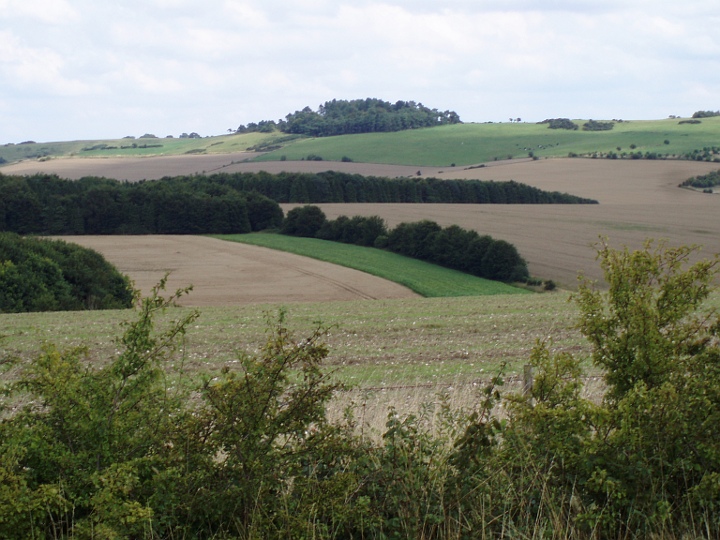
ANYWAY... this is Mr Green's famous "Pleistocene river cliff". There was a boggy spring at the base of this and a stream rose here before heading down to Knowlton. The cursus surrounds the car at this point. And I'd like to think the driver knew that.
|
 
|
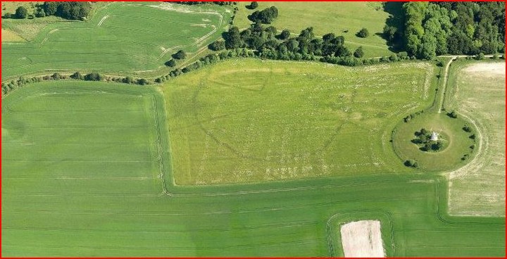
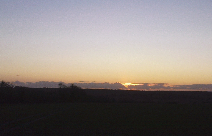
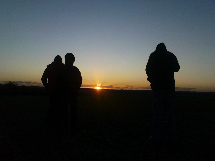
Yesterday, the day before midwinter, I came over to the Cursus with three friends to see the sunset. Does it actually go into Gussage Down long barrow from the original east end of the cursus? (see this summer's blog at http://www.themodernantiquarian.com/post/77897/weblog/ ) I have seen only one photograph of this alignment, in Martin Green's book "A Landscape Revealed", so I was curious to see if it really happened as accurately as they say. I wasn't sure if my chums would think it was worthwhile, lacking in visible earthworks. We had just been to Knowlton in the dying rays of the sun. Nice midwinter alignment there too through the causeway in from the road.
It was about -1 degrees C as we left the warmth of the car and walked down the side of the field. Now in the low sun, the one foot high ridge that seems likely to have been the original eastern end and might have the platform for viewing the sunset was quite easy to see, until you are near it. We stood along the "ridge" and watched the orange sun slide through a thin strip of cloud, more horizontally than sinking. You could get the impression it is gliding down to rest on Gussage Down. A hare ran out in front of us, stopped and had a good long look. I realised that the appearance of that animal inside the cursus bank at the same time 5200 years ago would have been seen as pretty significant, the hare spirit coming to hang out with the high downland folk.
And yes, the alignment does happen. The sun hits the skyline at the long barrow's SE end and glides along to the NW end where there is just a glimmer left. It disappears into the ground right next to the NW end. These precise alignments are moved slightly by where you stand along the ridge, but not much, maybe half a sun-diameter (15 minutes of arc). When the bank of the cursus was a full 2 meters it would have interfered as well and I think the sun would not have appeared again outside the cursus. We took a few photographs but it was so cold I had to get my hand back in the glove pretty quick.
The sun was down and the old year dead (approximately). We stood there for a bit watching the snowstorm clouds billowing up on the horizon. I went to investigate what looked like some dead creature that had succombed to the cold in the field ahead. It was a battered motorbike tyre, and it had landed around the skull of a rabbit. The symbols abound when you start looking. Jeez it was cold. The flask of tea in the car went down a treat.
Happy new year everybody!
|
Marine Mapping Helps Uncover the Past in the New Forest
Hampshire, UK, 08 September 2009 -
The New Forest National Park Authority is using detailed marine mapping from SeaZone to undertake an archaeological assessment of its coastline in response to changing sea levels. Part of a nationwide programme of Rapid Coastal Zone Assessment Surveys supported by English Heritage, the study will help with the development of long term coastal management plans by identifying archaeological and historic sites, and protecting them where possible or making provision for their recording where this may not be possible. There is a need to protect archaeological sites and artifacts from rising sea level and flooding as well as increasing pressures from industrial, residential and leisure developments.
Using SeaZone HydroSpatial together with additional historic records such as aerial photographs many dating back over 90 years, the study aims to identify and record previously undiscovered archaeological sites and artifacts along the 86 kilometres of New Forest and National Park coastline. Supplied as a multi layered theme the digital data is easily used in the Authority's Geographical Information System (GIS).
'The SeaZone data is invaluable in identifying changes to the landscape over the past 8,000 years,' commented Mark James, Maritime Archaeology Project Officer. 'For example the bathymetric layer gives us a greater understanding of the sea bed and helps us identify previous water courses and ancient river and stream channels that are now submerged in the Solent. In addition the Wrecks and Obstruction data has the potential for discovering archaeological sites helping us identify locations for further investigation.'
[from agi.org.uk on 14 Sept 09 - not much in the way of news, more a product placement, but hopefully more will emerge in due course]
|
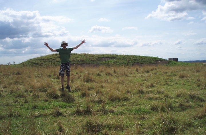
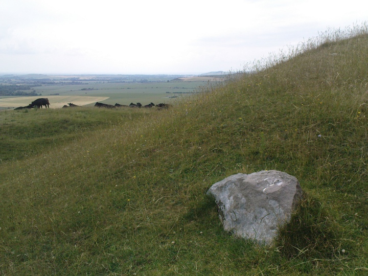
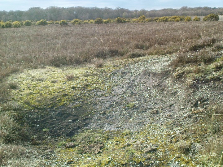
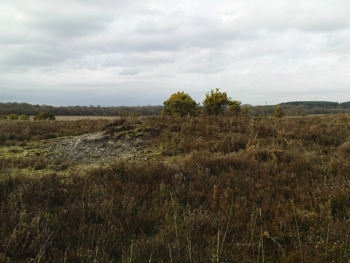
Well and truly ploughed down, and fenced off from the plebs, this was once one of the long mounds flanking the eastern terminus of the Dorset Cursus. Alas, it is not doing well any more.
Grinsell claimed to have found it in 1938, when its ditches were "well-marked", and then noted that in 1954 when he came to write up "Dorset Barrows", it was ploughed to the edge of the mound. Sadly the tractors and harvesters and muckspreaders now go straight over the top of this integral part of our national heritage. He notes it as 95 feet long, 70 feet wide [which makes it oval more than long] and 3.5 feet high.
In "A Landscape Revealed", Martin Green says:
During Colt Hoare's brief examination of this mound he described it as 'surrounded by sarsen stones'. Indeed, even now [book published 2000] I have noticed large lumps of sarsen ploughed to the surface around the edges of this mound.
|

|
 
|

|
 
|

|

|

|
|
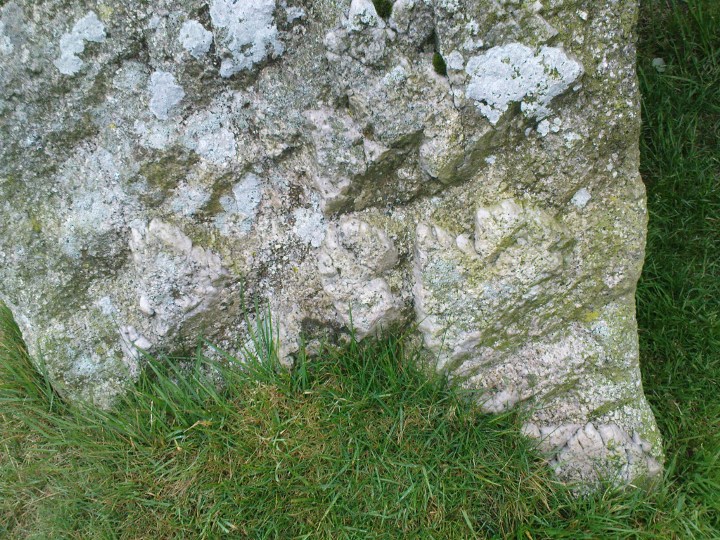
Visited in July 2009 and found the site easy to access, though the base of the dolmen is quite overgrown. The surface of the field within about 8m radius of the dolmen is scattered with small stones and fragments of strange shapes and substances. Quite a few bits thin tubes of flint, some porous stone - or is it bone??? - and what looks like slag from very high temperatures. 'Tis devilry!
|
 
|

|
Funding shortfall threatens visitor centre?
The Grauniad have a front page story today about a "black hole" in funding at the Department for Culture, Media and Sport which threatens funding promised to a number of major arts and culture projects - including building the new Stonehenge visitors' centre.
The proportion of the £25m Stonehenge budget which is actually going to come from the DCMS is not clear, but it appears to be the cheapest of the various projects listed in the article. That, and the fact that some wiseguy in Whitehall linked it to the holy of holies, the 2012 Olympics(TM) probably makes it safer than most. Fingers crossed (or not, if you are an indomitable local older lady with photocopied road plans to hand out).
|
I have been reading David Field's wonderful book "Earthen long Barrows" recently, which has much to say about Old Ditch. This is one of a group of long mounds around the source of the river Till. Excavated by William Cunnington on one of his early digs in 1802, apparently by putting an unsympathetic trench longitudinally along the mound, ending 26m from the east end (I suppose the significance of the eastern end had not been discovered yet). A layer of decayed turf extended out from a central mound of it, leading him to make possibly the earliest suggestion of a pre-existing circular mound later replaced by the long 'un. Three skeletons laid out in an H shape on a pavement of flints at the west (?) end confused him as he had assumed a big barrow meant lots of dead folk, probably from a battle. But there was a large number of bird bones placed in there too
More intriguing to me is the classic shallow pit covered by the mound, 90cm x 50cm and 75cm deep, "cut with such exactness in the solid marl as though it had been done by a chisel" according to Cunnington. Characteristically, there was nothing in there...
Later, John Thurnam came by and thought it might be worth having a peek in the east end and found a cairn of flints covering another pavement of them, on which remains of one individual had evidently been cremated then covered up. How long between this cairn and the long mound is a mystery.
There were later two Bronze Age cremations placed near the surface of the mound in a shallow cist. One was examined by Cunnington but the first had been scattered by the excavators before he could get to it. No respect.
And apparently this is the only rectangular long barrow on Salisbury Plain. Years of maths classes have knocked any excitement that might hold out of me...
|
|
A very pleasant bit of wildish woods in the middle of suburbia. If you need to escape the city and pretend it's actually 2009BCE then you'd do worse than Croham Hurst. The hill is made of layers of unusual geology and drops away very steeply to the south. Also you can get here in about a fifteen minute walk from South Croydon station. There is little to see of the barrow(s) but the place feels really old and self-sufficient. Nice.
|

|
   
|
|
This Brutus chap who turns up in London folklore is not the one from Shakespeare's Julius Caesar, but a supposed survivor from the sacked city of Troy. Have a look at "Brutus of Troy" on good old wikipedia for an excellent summary. The notion that a handful of Trojans would leg it all the way across Europe to settle down anew in misbegotten and backward Britain is probably a little far-fetched. There probably was a Troy (there is a corresponding archaeological site at Hisarlik in Turkey) and it may well have been sacked by a load of dudes from Mycenae about 1200BC, but there is no Brutus or similar name in the Iliad, which was written down from oral history about 800BC. So all in all a load of old cobblers? Not entirely as there have been waves of invasions from the continent, notably the Roman colonisers, and one feature of colonised literature is that old native stories are given a flavour of the occupying culture as a way of making them seem more respectable, a little like building a church in the middle of Knowlton Rings. Old stories about legendary king Bran/Bendigeidfran sounded much better in the early middle ages once they had been given that Latinate gloss. I find it easy to believe there was a native hunting ritual that took place here, which was assimilated and survived in some form until the 1500s, given a respectable "Diana" label. Corresponding Christian saints would be Hubert or Eustace (both symbolised by a stag's head with a cross between the antlers, which will sound familiar to those of you who have read Riddley Walker), but I'm not aware of any old City churches dedicated to them geezers. Anyone up for a re-enactment?
|
|