|
Illuminating discovery at megalithic tomb in Kerry
https://www.rte.ie/news/munster/2017/0925/907390-megalithic/
A hillwalker in west Kerry has made a stunning discovery which connects a 4,000-year-old tomb with the equinox. The megalithic tomb, known as the Giant’s Grave, is situated in the valley of Loch an Dúin on the eastern side of the Conor Pass.
Ancient rock art can be found within the tomb, including a cup and circle near the head of the tomb.
For the past 14 years Daithí Ó Conaill, a retired school principal, has visited the site during the winter and summer solstice hoping to make a connection between the tomb and the sun.
He has now discovered that the wedge tomb is actually aligned to the setting sun of the equinox, which last occurred on Friday 22 September.
As the sun sets directly into a 'V' shaped valley in the distant Brandon mountain range, a shaft of light enters the wedge tomb, illuminating the chamber and the rock art at the head of the tomb. The event can be witnessed at sunset for a number of days either side of the equinox.
Archaeologist Míchéal Ó Coiléain who has carried out extensive surveys in Loch an Dúin said it was a stunning discovery, providing a fine example of the engineering brilliance demonstrated by the people who constructed it.
"Daithí's discovery is wonderful and it goes to show that people living 4000 years ago are aware of movements of the sun. They are agricultural communities, so to know when the longest days of the year, the shortest, and when the equinoxes fall is so important. To construct such a perfectly positioned monument required remarkable expertise and knowledge."
The Equinox occurs twice a year when the plane of the Earth’s equator passes directly through the centre of the Sun’s disc. During an equinox, night and day are approximately the same duration.
|

|
   
|
|
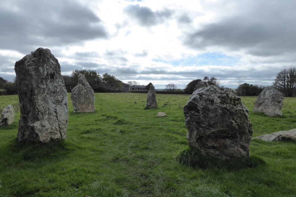
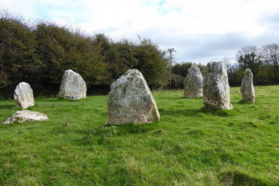
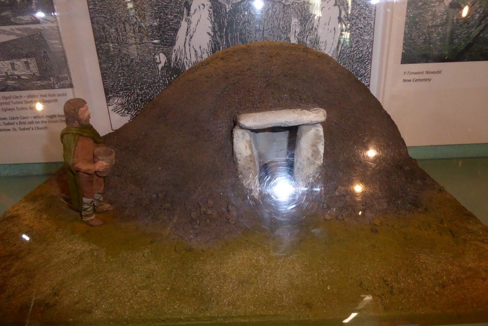
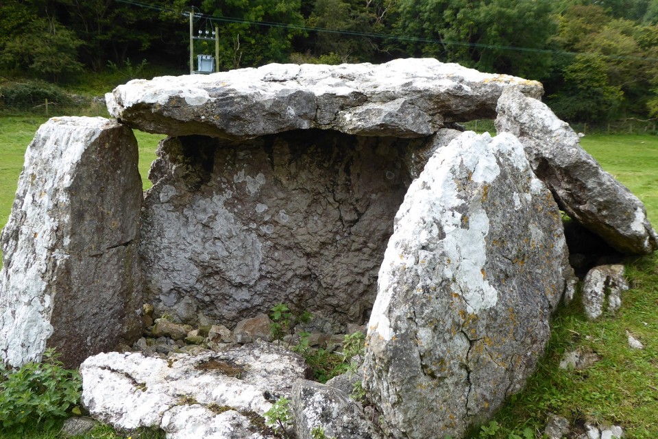
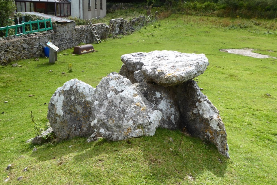
Visited 13th Sept 2017: my second visit to the Great Orme. The first two and half years ago was specifically to visit the Copper Mines. This time we went went up to the top of the Great Orme by the tramway from Llandudno - which is a recommended and enjoyable experience. As before, however, there was a fierce wind blowing along with daunting rain showers sweeping in over the Great Orme headland. Wonderfully dramatic but not really walking weather. Had a look around the Visitor's Centre and learnt about Cromlech ar y Gogarth or Cromlech on the Great Orme (Llet y'r Filiast). The helpful volunteer told me it could be found about 150 metres below the Great Orme Mines so we used our tramway return tickets to take us back down to the Halfway Station. From here we found our way down to some houses on the higher edges of Llandudno - and asked a local resident. The cromlech was actually in a field at the end of Cromlech Road with a good stile into the field. In the great scheme of magnificent restored portal tombs this one was quite small but none the less very satisfying to find on that wind swept chilly North Wales day. The cherry on the cake of a memorable day.
|
"Carved into the chalk of a hillside in southern England, the Uffington White Horse is utterly unique. Stretching 360 feet from head to tail, it is the only prehistoric geoglyph—a large-scale design created using elements of the natural landscape—known in Europe. “There’s just nothing like it,” says University of Southampton archaeologist Joshua Pollard, who points to the Nazca lines in Peru as the closest parallel. Pollard says that because the site is so anomalous, researchers have resisted grappling with its distinct nature. As a consequence, few new interpretations of the site have been advanced since the early twentieth century. “Archaeologists are tripped up by things that are unique,” says Pollard, “and the White Horse has thrown us.” But now, after making a close study of the site and its relationship to the landscape around it, Pollard has developed a theory that connects the Uffington Horse with an ancient mythological tradition ..."
|
Elba, the 9,300-year old Spanish cowherd who was lactose intolerant
https://elpais.com/elpais/2017/05/12/inenglish/1494584904_820305.html
"Death caught up with Elba on a Spanish hillside 9,300 years ago. She is thought to have been following her herd of aurochs, an extinct breed of large cattle, along an ancestral trail that is now a paved road. In fact, it is the same road that Google suggests as the best route between the localities of O Courel and Pedrafita do Cebreiro, in Galicia’s Lugo province, in northwestern Spain.
Her herd was made up of three aurochs: an enormous male with massive horns and two younger specimens. It might have been early spring or early winter, and the ground was covered by a blanket of snow thin enough to make for easy walking, yet thick enough to conceal some of the geographical features lying beneath.
As a result, she did not see the hole that had opened up in the earth. All four of them fell into the gap created by the collapse of the roof of a cave known today as Cova do Uro, or Aurochs’ Cave in the regional Galician language .... "
|
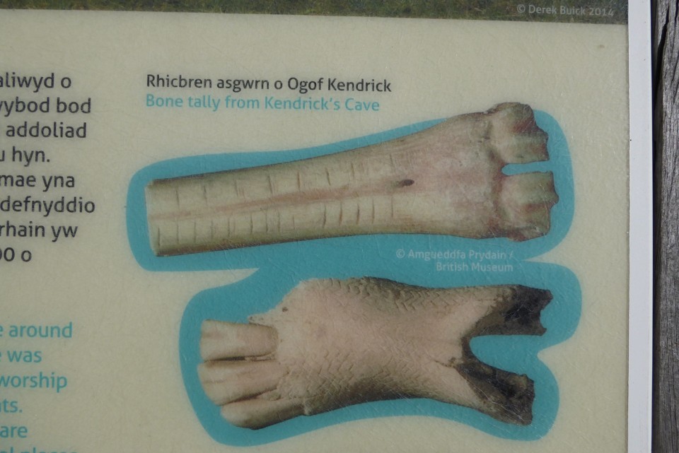
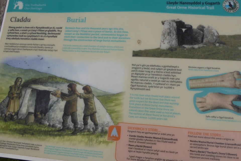
"The earliest antiquarians who visited, documented, sketched and spoke about Newgrange sometimes get a hard time from the modern academic establishment. The writings of Lhwyd and Molyneux and Pownall and Vallancey are all criticised for one reason or another (poor Charles Vallancey is largely ridiculed, perhaps because he referred to Newgrange as a Mithraic temple). All of the early antiquarian accounts of the monument are valuable for one reason or another. Some of them have captured aspects of the monument that have disappeared since they wrote. Without the tools and techniques of modern archaeology, all of them were poking around in the dark, so to speak. They couldn't have known the true age of Newgrange, nor could they have appreciated the skills of the artists and builders who created it, those whom they all too often referred to as barbarous. .... "
|
Archaeologists unearth ancient origins of New Forest Town
http://www.heritagedaily.com/2017/07/archaeologists-unearth-ancient-origins-new-forest-town/115980
A high-tech survey at Buckland Rings Iron Age hillfort in Lymington has revealed evidence of 2,000 year old roundhouses within the fort’s ramparts.
The geophysical survey was led by the New Forest National Park Authority with local volunteers and students from Bournemouth University.
Up to seven prehistoric dwellings were identified, which would have once housed a community of hunters and farmers that would grow into the modern Lymington. Trading throughout Britain and across the sea, these ancient ancestors would have lived in round wooden buildings caked in a soil-based mixture.
Continued ....
|
    
|
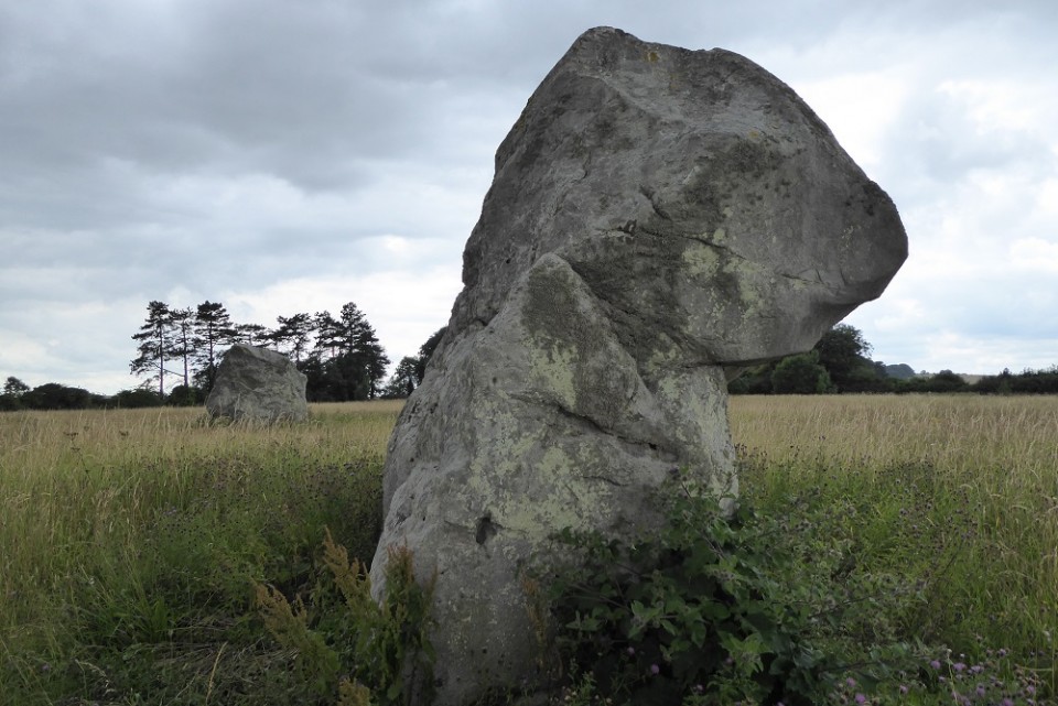
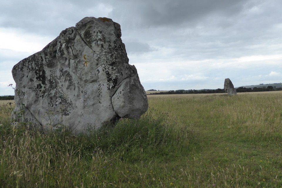
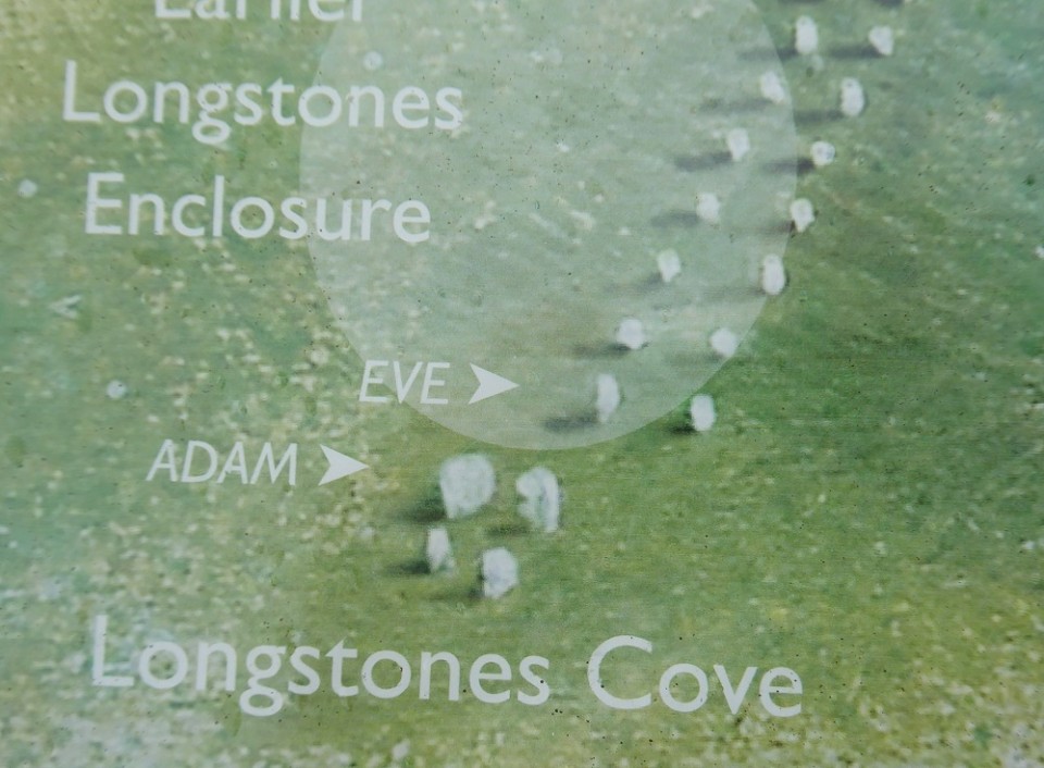
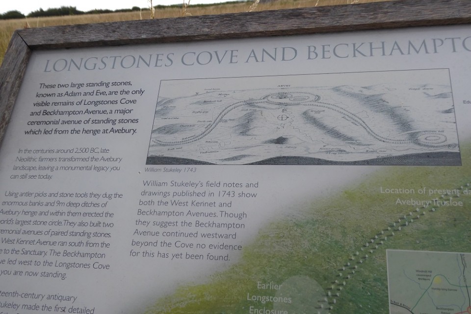
NT have bought the URC Chapel
Predictably perhaps, the National Trust has purchased the historic URC Chapel which stands within the Avebury Stone Circle. They are inviting people to come along in the afternoon and early evening (up to 7.00pm) on 5th July to share their views about its future use.
|
Visited Friday 26/5/17:
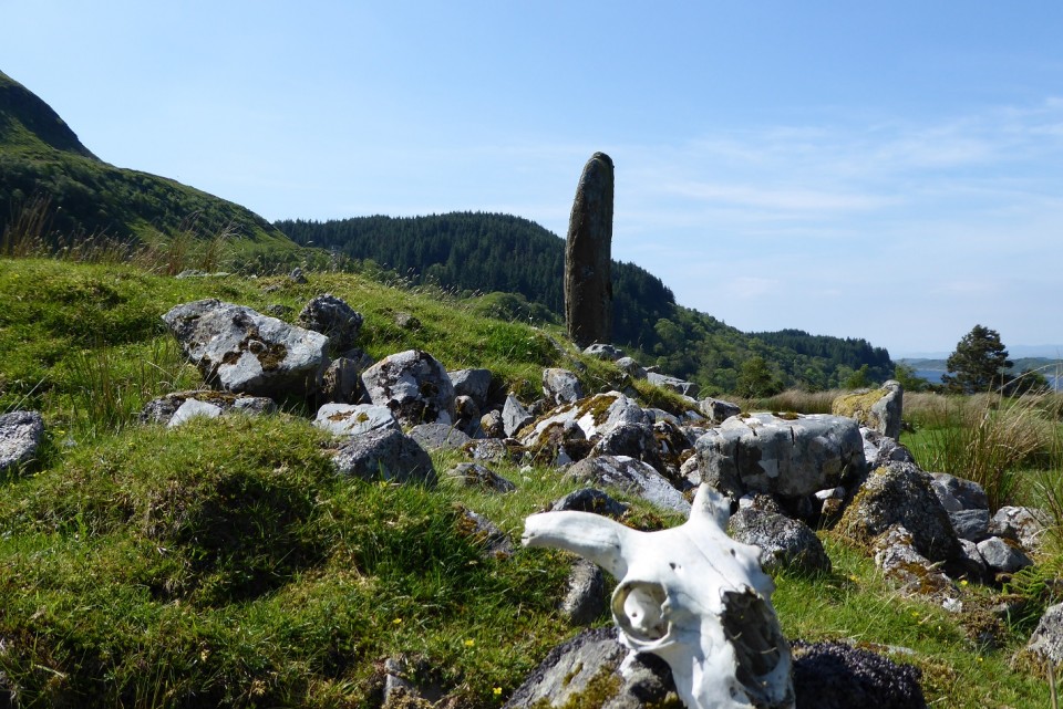
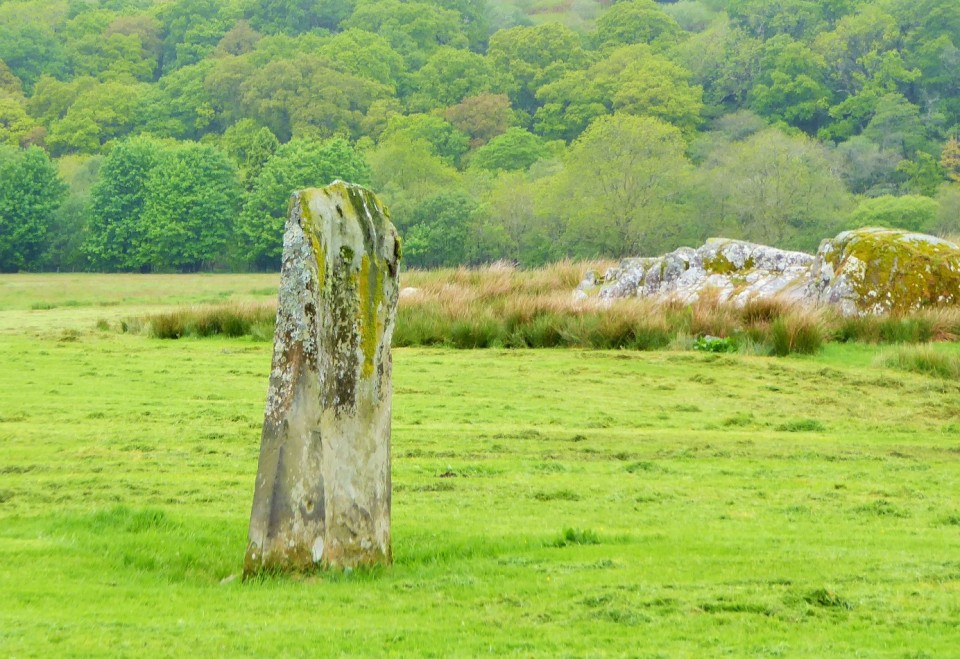
The most perfect day and, unfortunately, our last full day in Argyll. Kintraw standing stone and cairn can be seen clearly at a sharp bend as you drive towards the village of Ardfern and Loch Craignish and there is a small pull-in parking area opposite the site. This particular day the sun shone, the sky blue and it was warm - the best of sort of summer day. Kintraw is probably the tallest standing stone I've ever stood next to. It is also in the most fabulous location overlooking Loch Craignish and the loch-side village of Ardfern. I did wonder what its purpose was as it was unlike any of the other standing stones we had seen in the Kilmartin area - being almost cylindrical in shape. Although Loch Craignish was visible from the site I don't think the standing stone or cairn could been seen from the loch.
Made a bit of a mistake here though as my companion-in-charge-of-map-reading told me that Kintraw and the Clach an t-Sagairt Cairn were in the same place so we made the assumption it was the cairn next to the standing stone. Have since found out it wasn't and we've missed it.
Anyway after a leisurely lunch in the Crafty Cafe Tea Room in Ardfern we spent a peaceful afternoon visiting the ruined chapel of Kilmarie (Kilvaree) -
which is dedicated to the 7th century Irish monk St Maelrubha of Applecross - and then exploring the remote coastal area nearby.
|
  
|

|
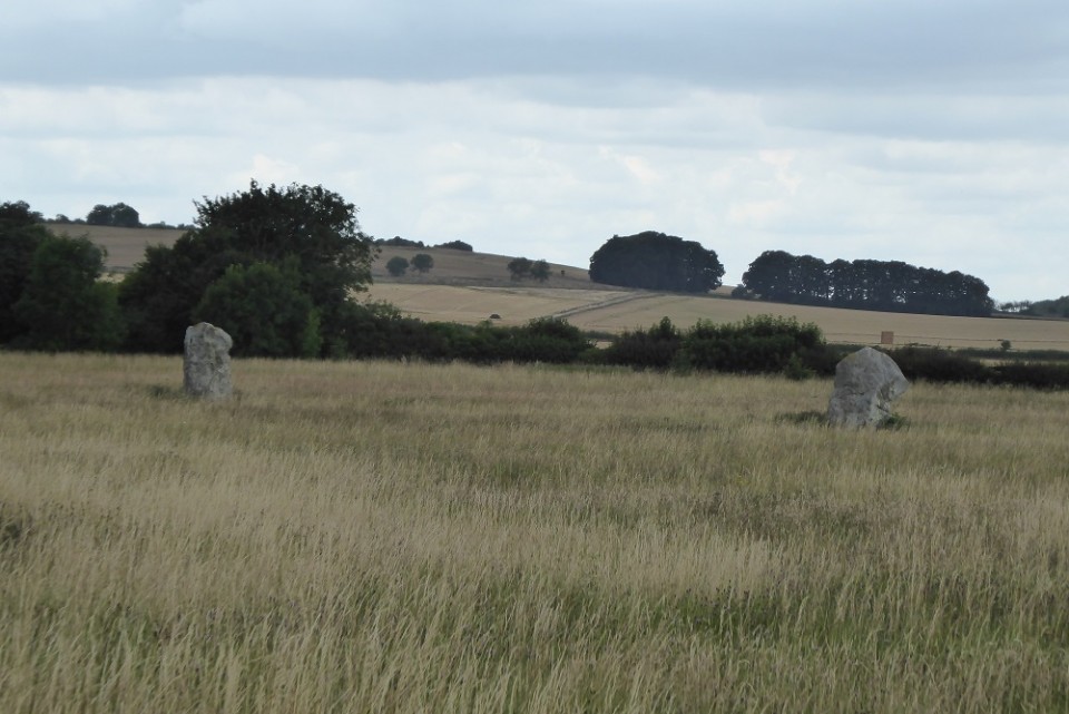
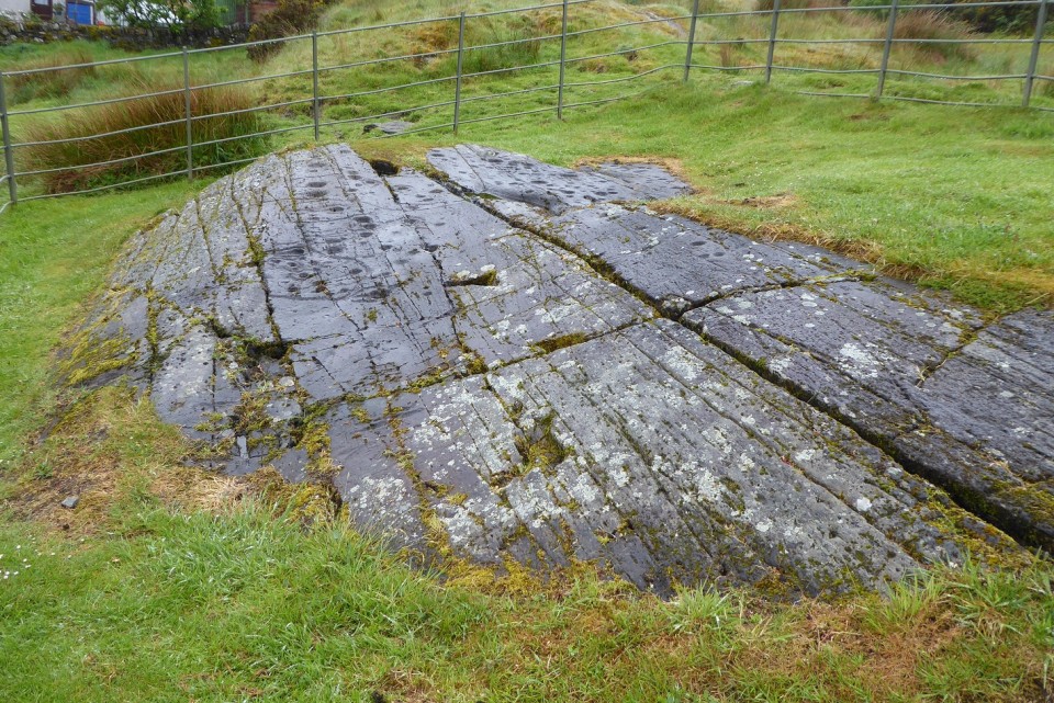
Visited 25/5/17 as part of our visit to Kilmichael Glen
Following the road from Kilmichael Glassary northeast out of the village to the bridge over the River Add (where Dunadd gets its name) we continued walking along the quiet single track road which runs along the valley bottom. A little bit further along on in a field on your left there is a single standing stone which has cup marks similar to those at Ballymeanoch and Nether Largie. One more stone is known to have stood in the field (and there may have been others). In the same field there two earthfast rock outcrops which are covered with cup and ring marks. On the day we walked by there was a tractor cutting the grass in the field and the gate was firmly secured - we decided not to climb over on this occasion.
|
 
|
Visited Wednesday 24/5/17
More wonderful rock carvings on easily accessible panels just behind the local primary school. It is ok to park in the small car park by the school though visitors are asked to avoid school pick-up times.
To quote "In The Footsteps Of Kings" by Sharon Webb (Walk 11):
“Within the fenced enclosure you will see two groups of cup and ring markings carved into earthfast rock slabs. There are many single cups as well as cups with rings and gutters. Look out for the cups with rings shaped like a keyhole which occur on both slabs. Some of the outcrops around the fenced enclosure also have markings, but please don’t be tempted to pull back the vegetation as the carvings are liable to be damaged by stock.”
After examining the panels walked back down to the village - with some free range chickens and an anxious cockerel keeping us in their sights. Next over the Glassary Churchyard to look at some medieval grave stones – apparently the ‘Kil’ element in the place name Kilmichael Glassary indicates an early Christian settlement in the Glen.
|
     
|
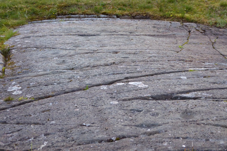
Visited the evening of 21/5/17:
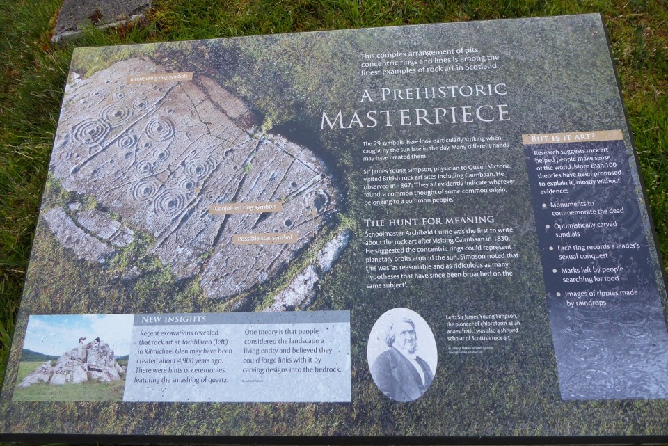
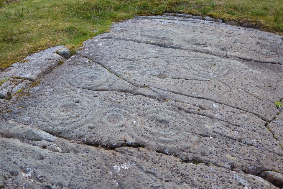
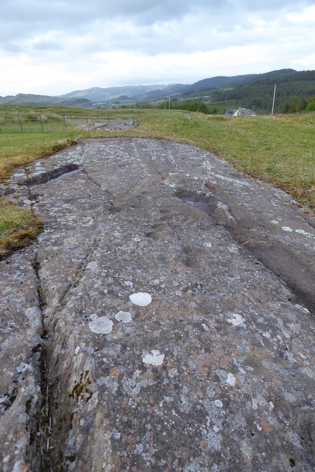
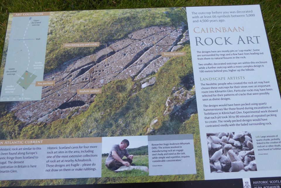
Found this walk by chance on our first evening. Having been out for most of the day on the way back to our accommodation we noticed a simple sign pointing to ‘cup & ring marks’ just on the corner by the between the Cairnbaan Hotel and adjacent houses. So at around 8.30pm on our first evening (the rain had stopped, the light was lovely) after a pleasant towpath walk to the hotel we found the narrow path up to the Cairnbaan rock art panels. A steep uphill walk through pinewood and bluebells. Small signposts point the way to a clearing where the rock are panels are protected by railings. There were metal steps provided, however, to let visitors have a closer look. There are actually two sites with other outcrops a bit further uphill (look for the sign post). This second site is described as being one of the best examples of cup & rings around.
The lower panels contain mostly pits or cup marks, some of which are surrounded by rings and a few have lines leading out from them to natural fissures in the rock. According to the information board the Neolithic people who created the rock art may have chosen these outcrops for their views over an important route into Kilmartin Glen. The designs would have been pecked out using quartz hammerstones like those found during excavations at Torbhlaren in Kilmichael Glen. Experimental work showed that each pit took 30 to 90 minutes of repeated pecking and much concentration to create.
The upper panels contain a complex arrangement of pits, concentric rings and lines, 29 symbols in all. Again, referring to the second information board we learnt that schoolmaster Archibald Currie was the first person to write about rock art after visiting Cairnbaan in 1830. He suggested the concentric rings could represent planetary orbits around the sun. Sir James Young Simpson (pioneer of chloroform as an anaesthetic) also became a shrewd scholar of Scottish rock art observing in 1867 “They evidently indicate wherever found, a common thought of some common origin, belonging to a common people”
This walk appears as Walk 14 in "In The Footsteps Of Kings" by Sharon Webb.
Fabulous views over the Crinan Canal towards Lochgilphead to the south and hills to the north.
|
  
|
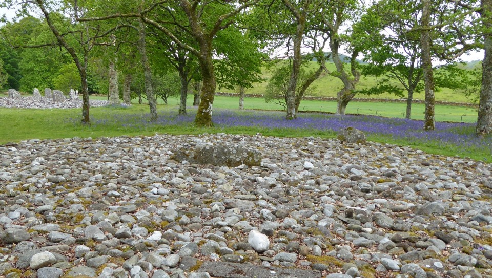
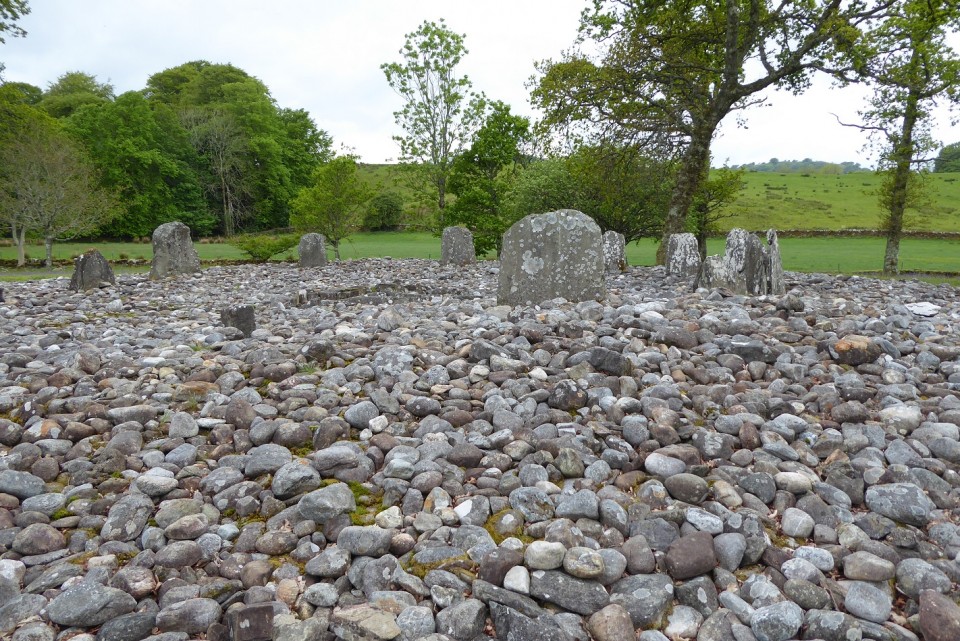
Visited Sunday 21st April 2017.
This was a surprising site, not at all what I was expecting - we walked from the Nether Largie Standing Stones in the rain. Access very easy as everywhere is signposted. The bluebells were still out under the trees which, together with the relatively small size of the stones, gave the site an enchanted atmosphere. I don't think I have done this site justice as at first sight it is unspectacular compared to other stone circles. Strictly speaking this was definitely an ancient burial site which is something we are not able to say about other larger stone circles.
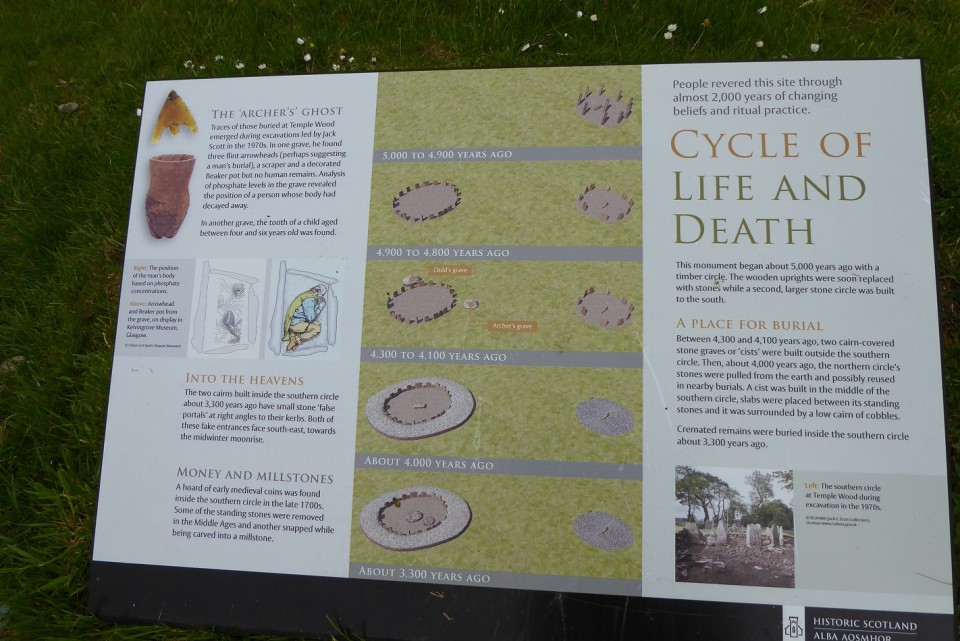
As with all the other sites around Kilmartin there was an excellent interpretation/information board which really helped in the understanding of the site. I have reproduced the information below:
Templewood started as a timber circle about 5,000 years ago. The wooden uprights were soon replaced with stones while a second larger stone circle was built to the south. Between 4,300 and 4,100 years ago, two cairn covered stone graves or ‘cists’ were built outside the southern circle.
Then about 4,000 years ago the northern circle’s stones were pulled from the earth and possibly re-used in nearby burials. A cist was built in the middle of the southern circle, slabs were placed between its standing stones and it was surrounded by a low cairn of cobbles. Cremated remains were buried inside the southern circle about 3,300 years ago.
Into the heavens: The two cairns built inside the southern circle about 3,300 years ago have small stone ‘false portals’ at right angles to their kerbs. Both these fake entrances face south-east towards the midwinter moonrise.
The ‘Archer’s Ghost’: Traces of those buried at Templewood emerged during excavations led by Jack Scott in the 1970s. In one grave he found three flint arrowheads, a scraper and a decorated Beaker pot but no human remains. Analysis of phosphate levels in the grave revealed the position of a person whose body had decayed away. In another grave the tooth of a child aged between four and six was found.
|
     
|
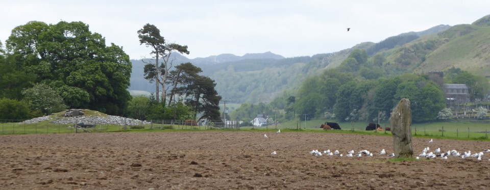
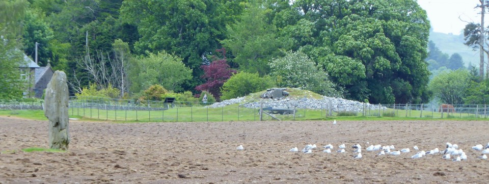
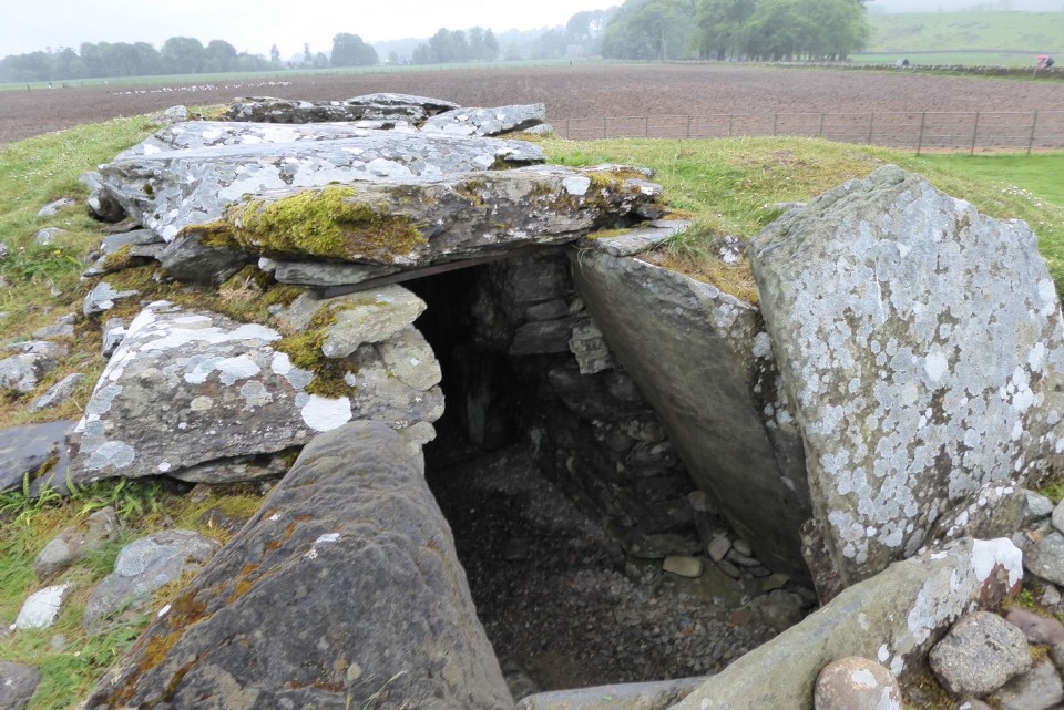
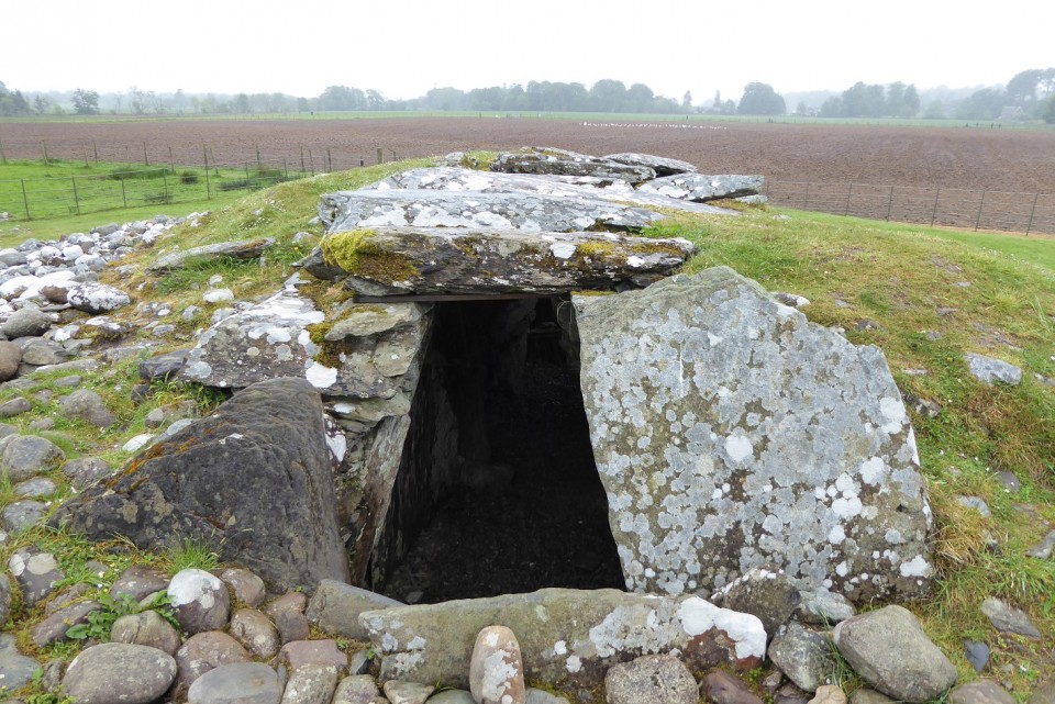
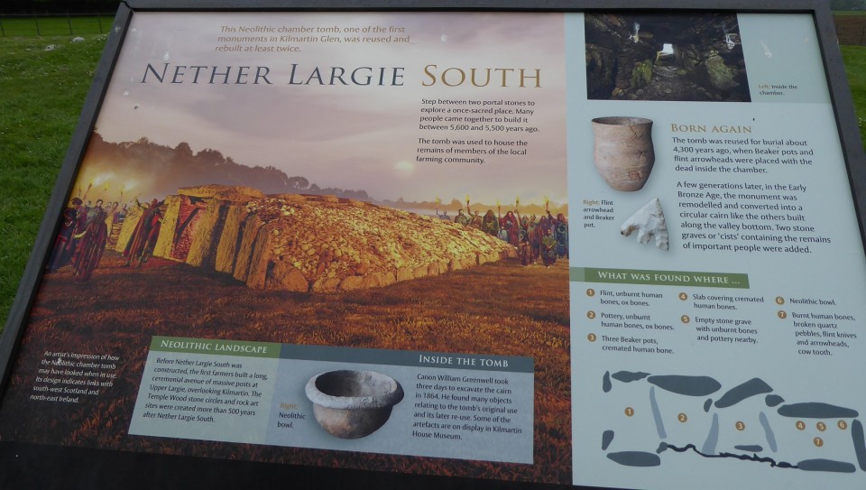
Visited on 21/5/17 and again on 24/5/17
This is one of the first and oldest monuments in Kilmartin Glen and reminded me a bit of West Kennet Long Barrow back home in Wiltshire. It had been re-used and rebuilt at least twice.
Information taken from the Interpretation Board.
The tomb was used for burial about 4,300 years ago when Beaker pots and flint arrowheads were placed with the dead inside the chamber. A few generations later, in the Early Bronze Age, the monument was remodelled and converted into a circular cairn like the others along the valley bottom. Two stone graves or 'cists' containing the remains of important people were added.
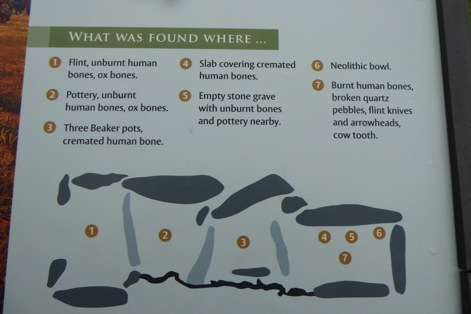
See plan of the tomb - this is what was found:
1. Flint, unburnt human bones, ox bones.
2. Pottery, unburnt human bones, ox bones.
3. Three beaker pots, cremated human bones.
4. Slab covering cremated human bones.
5. Empty stone grave with unburnt bones and pottery nearby.
6. Neolithic bowl.
7. Burnt human bones, broken quartz pebbles, flint knives and arrowheads, a cow tooth.
|
 
|
Passionate about:
Nature; stone circles and all ancient sites that involve walking through unspoilt countryside/being near the sea; islands around the the British Isles, especially those with ancient monuments.
|
|