Showing 1-50 of 87 posts. Most recent first | Next 50      
|
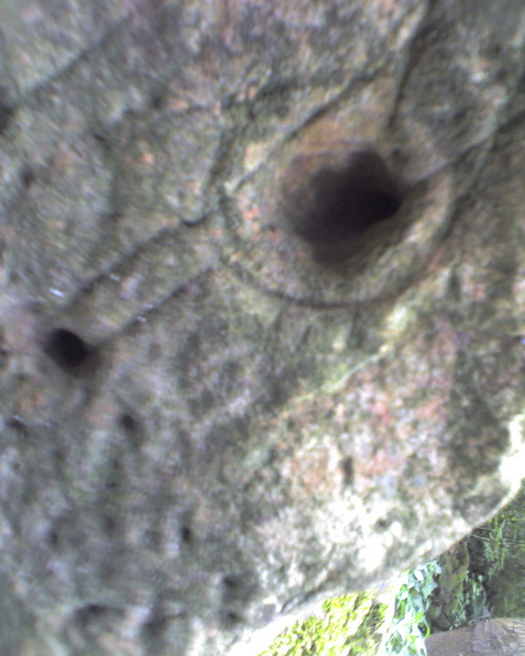
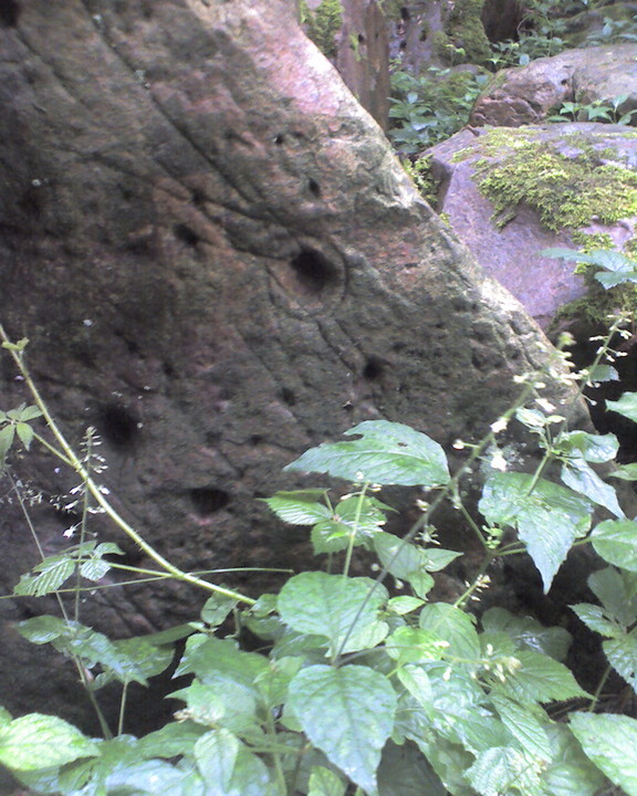
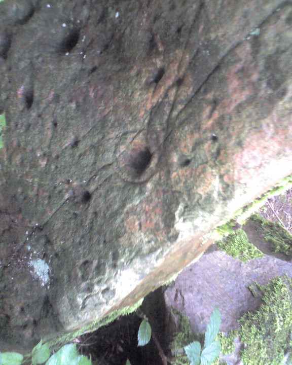
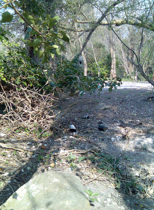
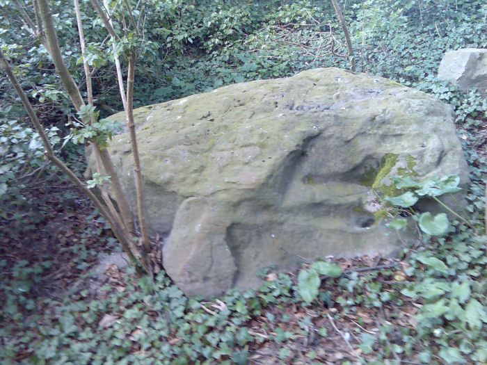
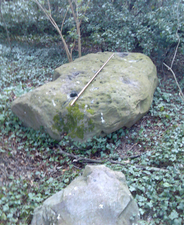
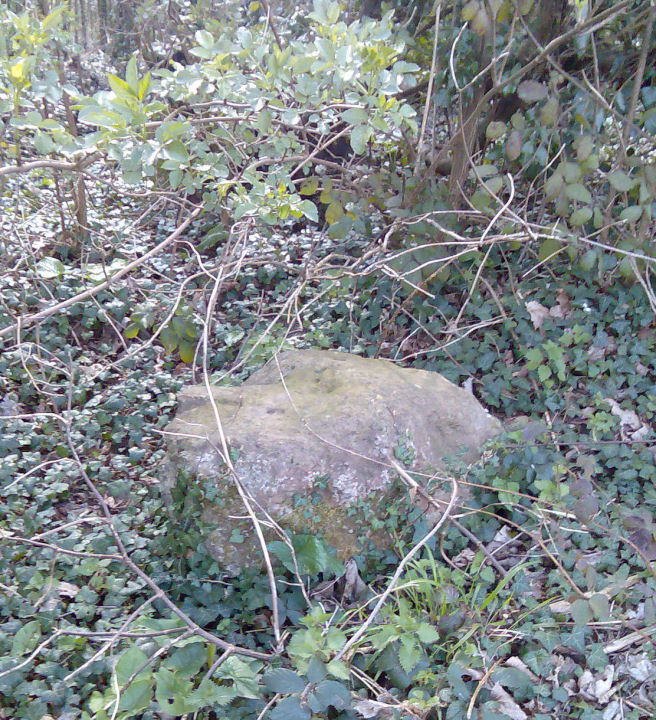
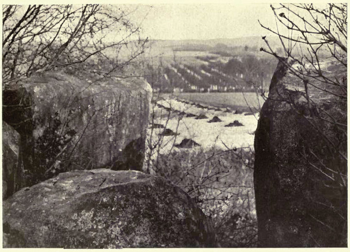
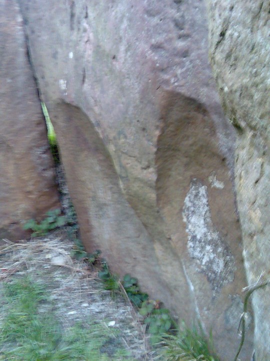
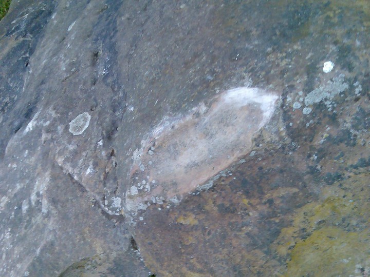
For many years I have dreamed of discovering some cup-and-ring marks in Kent, and this morning I struck sarsen!
Discussing the sarsens littered around Walderslade, on the hills above Kits Coty etc, I was suprised when a friend told me he'd seen cup-and-ring marks on some of them. So off I went in the rain today, and lo and behold, as far as I know, the only cupmarks in Kent!
Not the best pictures you'll ever see, but it was dark, wet, raining and the stones were buried in the trees. No doubt described by some as a stone circle, but that is purely fanciful and overimaginative. Doubtful even as a chambered tomb, buried in a small narrow valley, even though there are two triangular stones standing at one 'end' of the group of 10 or so stones. I'd love to say it is a possible tomb, but even my desire to discover a new one can't overcome my commonsense!
|

|
 
|
Lottery Grant to raise Medway's profile
I have spent the last few months battering away at the local Heritage departments in an attempt to improve the knowledge and awareness of the locals and to do something about the pretty sad state of the monuments around the Medway.
Today I was told they have received a Lottery grant and are starting on it next year! This will probably mean an excavation at Kit's Coty, and the removal of those railings once and for all, follow-ups to other local finds [and probably more tombs] and a kind of marketing campaign to help protect them.
I suggested some other, more specific targets, which they seemed unaware of, and it could mean the start of an ongoing project to unearth and record so much that has been lost to farming.
With the tallest megalithic chambers and the two oldest causewayed enclosures in the country at Sheppey and Cliffsend, plus another on the Medway at Burham that is so far undated, it looks like Prehistoric Kent might finally be put back on the map.
|

|
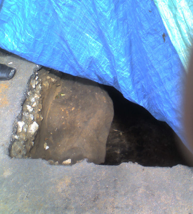
Following my discovery of the roadworks on the barrow and a phonecall to Kent Heritage, I went visiting today. A team of three, including a young lady who I have been emailing regarding the Medway Megaliths for six months, were busy mapping the site, and then I got a nice surprise. Thinking they were getting ready to explore the pothole repair, I was stunned to be shown a large, squarish hole with a buried kerbstone, beneath the tarmac and metalling of the road. I was told I was only the 4th person to see that stone in over 500 years, which is a bit of a buzz!
The road is now closed for "as long as it takes" and I have been invited back at the weekend to see the next stage. They are planning a fullscale survey and possible excavation in the next 12 months, and will keep me informed so I can visit every day and blog it.
And about bloody time too...
PS In return for showing me underground, the team asked that I ask that no visitors descend on them this weekend please! Next year, when the real work begins, no problem.
|

|

|
With no plans to stop on my 4-hour trek home, it was with a screech of brakes and a floorwell full of front-seat junk that I decided with 25 yards to go to stop and have a look, as I've passed it too many times without paying my respects.
Strangely the tree-planting noted by Stubob only covers the road-side of the barrow, and there seems to have been no additions since his photos from last December, though the unplanted side does seem to have spouting trees of some sort, maybe from coppicing.
Hemmed in by drystone walling, but protected by it, so a double-edged sword, unfortunately not repaired after digging so bearing the scar on the south-east side, which always gets my back up. But this is compensated by the lovely views of the Dales, a far softer and less forbidding landscape than further north. A definite stop-for-a-ciggie place for the future on my A515 slog.
|

|
|
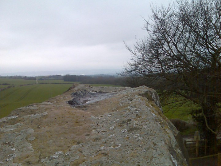
Made it up the hill to this fort on Friday evening, so not enough time to make the climb to the top as it was getting dark, but with some fantastic views from halfway and from the quarry side, it was well worth it.
|
   
|
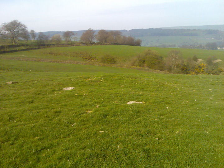
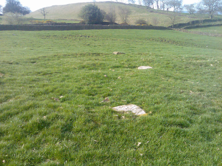
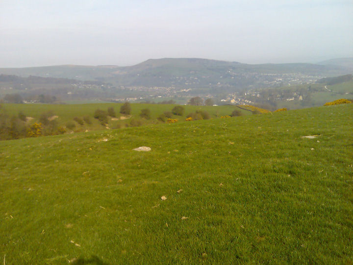
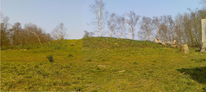
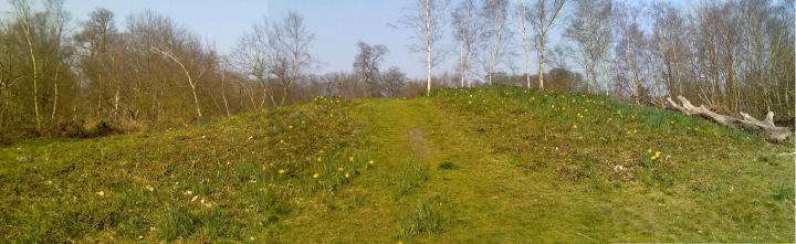
Third attempt, and with stronger legs, I finally found this site, and what a superb place to put whatever it is. Stunning views of Eccles Pike, Whaley Bridge and further on to hilltops and lows unknown [at least by me] especially at 9am on a wonderful clear spring morning.
It measures 36 by 34 feet across, so rather small, with a pronounced bank on the western downhill side. Several larger stones, with many smaller and buried stones found by probing, all around the perimeter, with a single central stone. Highly unlikely to be the result of field clearance, as there are several other stones in the field and a deep narrow gully only 50 yards away downhill. Easily visible from a long distance [so how did I miss it before? Too bloody lazy to walk another 50 yards...steep path though], but alone in the landscape.
I was under the impression it was a hengiform thing, but there's no evidence of a ditch, it's far too small, but it would be pretty perfect as a stone and earth barrow that has been robbed out. Suggestions of it being a stone circle are probably based on the stones visible around the edge and the central stone, like a small version of Arbor Low, complete with flat stones. As well as the stones around the field, there is a very large one under the tree in the field over the path to the south. The field has never been ploughed [or the farmer had an unlimited supply of blades to break] so the ridge around the edge survives well enough to give an impression of how wide it originally was.
A skull currently at Tunstall Farm was alledgedly from this site.
Worth the climb.
|
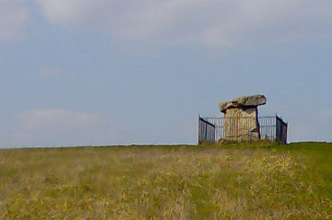
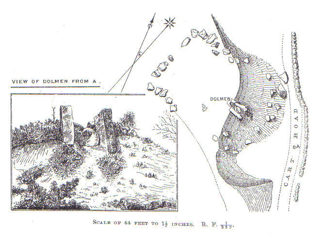
For anyone trying to 'reconstruct' this monument, a recent visit with Stukeley and Ashbee's words in my head cleared it up.
Stand to the east, looking back over the stones and along the access path. The closest stones [the mouth of the chamber] were all pushed over to the north, ie, to the right. The capstones lay tangled between the uprights on either side. The rear of what Stukely described as a semi-circular chamber was pushed in and to the right, and with his plan in my hand it made sense at last. Just don't expect to see two lines of parallel stones!
Unfortunately, although still graffiti-free, some digging had been done to the north, around a 2' hole, mostly, from what I could see, the remains of the roots from the tree that stood in that spot, wedged between three stones. Thankfully there was enough spoil left so filling it in wasn't too difficult, though it did look hand-dug....two fresh smaller sarsen chunks down there tho, was tempted, just for a second, to have a poke around, but managed to reign in my curiosity, and reported it to Maidstone Museum instead.
|
 
|
First time back at the Upper WHS for a good few years, there's some new-fangled train thing running past it now, quite a contrast between the old and the new.
Now it's a mess. A distressed, neglected, over-visited mess. The smell of rotting flesh [two recently-deposited chunks of unidentifiable raw meat, complete with plastic bag, covered in flies], the remains of several fires, cans and general shit everywhere. Stones moved here and there, some even having had fresh holes dug for them and stuck in, wobbly and half-done...
No matter how I look at it, it still doesn't look like part of a chamber. There is no mound as such, just what is left that hasn't been cut away to make pathways on either side. The downhill slope could feasibly have washed away over the years as happened at Warren Farm 200m to the north, but it is steeper than I have seen at any other LB, especially with alternative flat land accessible all around. But it didn't stand up on its own...
|

|
   
|
 
|
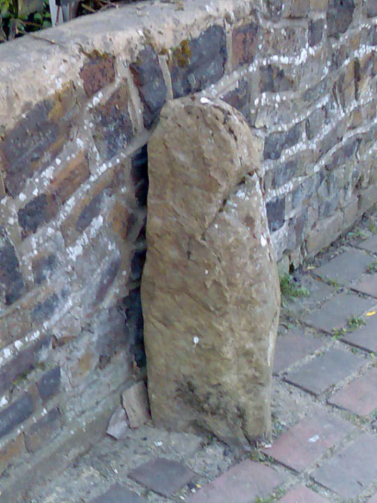
"A Standing Stone At Eynsford
This 1978 report says that a sarsen stone was recently recognised in a direct line between the ancient ford and the church. It is 29" high and set in concrete outside Bridge House, It's shape suggests a possible fertility significance. The writer says 'Ponder its enigmatic presence'"
Arch Cantiana Vol 9 p260-262
"A sarsen stone at Eynsford was "re-erected" in the 1970s. Located between the ford and the church, the stone had been lying "embedded in the ground" but was re-erected to "what was probably its original position". However, there appears to be little evidence that it ever stood upright in the first place."
http://ads.ahds.ac.uk/catalogue/search/fr.cfm?rcn=NMR_NATINV-410176
The claim of a stone being on a line between a ford which is up to 30' wide, and a church, less than 200m away, is utterly ridiculous. However, I spoke to an old chap years ago who reckons it used to stand until they built the wall, which disturbed it, and it ended up half-buried in the path until someone decided to put it back up again years later.
|
"Our previous excavations have produced a wealth of information, which we are now starting to piece together. In prehistoric times, the site at Ringlemere must have been one of considerable importance. The story really begins around 2600 BC when a large circular ditched enclosure was constructed on the site, for reasons which still remain unclear to us. This enclosure was probably used for ceremonial purposes. We understand little of the detail but there had been a small rectangular timber building at the centre of the monument at one time, perhaps a shrine. This timber structure was surrounded by pits, holes for wooden posts and several hearths, all of which implies that there had once been considerable activity within the enclosed area.
Years later, perhaps around 2000 BC, a mound of turf and soil was heaped up in the middle of the old enclosure, burying all the earlier features. The mound seems to have created a platform to support a new timber structure, close to the site of the earlier shrine. A large pit dug into the top of the mound nearby may have originally contained the gold cup. By the time the gold cup came to be buried, however, the monument had perhaps already been in use (possibly intermittently) for well over 500 years. Yet, not long after, the site seems to have been abandoned, leaving the mound with its encircling ditch as a monument to the Ancestors, largely ignored by later inhabitants of the region. The Romans came and went without leaving much of a mark on the site. But to generations of local rabbits, foxes and badgers this ancient mound provided an ideal place to dig their burrows - we have excavated numerous examples of them.
Then, in about AD 450 new Anglo-Saxon settlers arrived in the region. To them, the ancient mound showed that this was a place of great importance, which would be very suitable for the burial of their dead. They established a cemetery here which contained over 50 individuals, some cremated. The cemetery went out of use around AD 550 and the area eventually became the farmland that it continues to be today."
http://www.canterburytrust.co.uk/ringlem3.html
From an excellent up-to-date resource on the ongoing excavations at Ringlemere. Recent aerial photographs have turned up more than 20 barrows marked in the immediate vicinity.
|
"A local vicar carried out excavations here in about 1845 and human bones were said to have been found. The eastern chamber still had its capstone in place then, but due to the attention of this over enthusiastic cleric the chamber collapsed as a result of his excavation. He also threw away all the pottery, bones and artefacts he found, as he felt "That they were rude and common stuff" !!!"
(This article originally appeared in the January 1999 issue of the BAG newsletter)
|
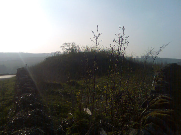
This round barrow stands in a clearing, at the highest point in Ashenbank Wood. It stands around 2m tall, with the ditch buried under the spread of the mound, and is around 22m across. It was partially excavated back in 1895 but work was restricted by a growing tree. As usual they failed to fill the hole completely leaving a hollow in the top on the mound.
Thankfully this barrow is protected and kept clear, with the trees downhill to the south almost thin enough to see through. To the north there is a covered reservoir, and all around the woods are the remains of a WW2 camp used to house those stationed at Gravesend airfield, so it's probably lucky to have survived.
Apart from the fact that this is not on chalk, being a much more gravelly mix, this reminded me a lot of the barrow in Shoulder of Mutton Wood, both in shape, size and positioning in the landscape. When on grassland the view to the south would have been awesome, with probable views of the Thames to the north.
Access best from the carpark in Halfpence Lane, then a gentle 10-minute uphill stroll through mature oak woodland dotted with brick walls and other camp remains.
|
 
|
 
|

|
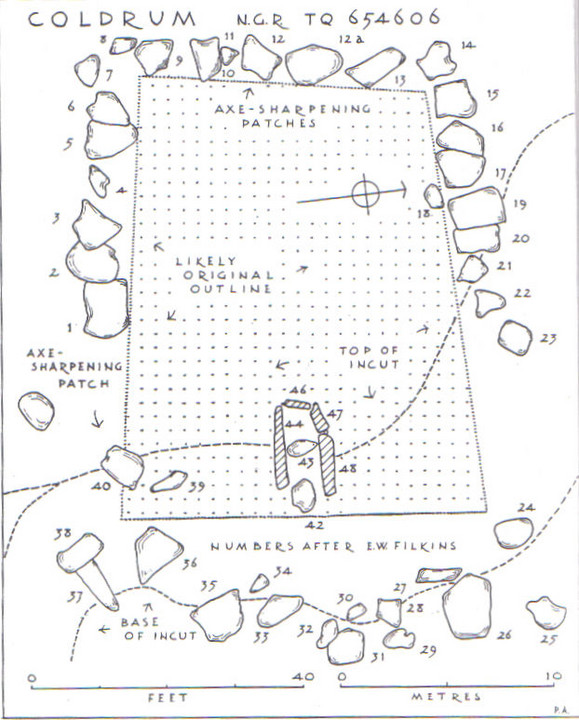
Paul Ashbee has expressed doubts over the length of the monument as it stands - the kerbstones could have been pulled together to free up more field space to the West. With that in mind, I walked the field today, and must say the distribution of stone chips and flint is more pronounced in a line between the kerbstones outside the fence. Following suggestions and after studying plans of the site I was able to look more closely at the slighting caused by removal of the end of the chamber and the capstone[s], and to recreate the site as was in my mind. The chamber ends are uneven, which with square slabs, is an anomaly - they are over 6" out of line, suggesting there were more stones and a longer chamber. The stones are there, identifiable as squarish slabs, at the foot of the slope. [But as Mr Ashbee says, they could have been brought from elsewhere!]
This makes the chamber at least another 7' long - evidenced by the amount of deposits found in the spoil on the eastern slope - and, with a facade [there were two standing stones on the lower ground level in the right alignment to complete the edging on the north east corner, one still stands, the other is beneath the hedge] and, therefore, two levels of building - the facade being at least 12' lower than the side kerbs.
Extending the chamber creates its own problem. The chamber would still be considerably higher than the ground level, and wet chalk to climb up does not makes sense with a monument aligned ESE [ie, winter solstice sunrise]. Therefore, at some stage, there would need to be steps to get to the high chamber. Of course, the chamber itself could have been on two levels, the 'front' chamber stones being 15' tall to match the height of the rear stones when planted and buried in the soil.
Unfortunately the whole monument has been attacked at least twice over the years, with religious fervour responsible in the 13th C, and the demand for chalk [of all things] making the eastern and northern banks into a small quarry 300 years later. This has led to stones being buried or removed [though not so many as elsewhere] and unearthed, to be arbitrarily placed along the kerb. Some of the kerbstones look like they could have been a capstone, dragged back across the chamber rather than risking injury by tipping it off the edge. Thankfully, its isolated position in the landscape and its inaccessibility due to it being surrounded by springs and therefore mud, has protected it from being noticed for many years. Once overthrown and overgrown, nobody would know what was there.
|
  
|
|
Made a spring attempt on this today, but the site is so seriously overgrown, and the flint/mortar walls are so spread, I doubt anyone could find a sarsen in there without professional help. The surrounding field is absolutely smothered with flint, as flinty a field as you're ever linkely to find. The chapel itself is tiny, maybe 20' x 15', and a lot of the fallen wallstone is inside the building, though the siting of the whole thing is a little strange, on a false level floor halfway up the southern incline of Knatts Valley [itself a strange place - fields and no hedgerows]. Not really dug into the hillside, rather a built level surface proud of the soil level. Found a beautiful piece of jet-black flint, most Kent flint being grey/blue in colour, so quite unusual.
|
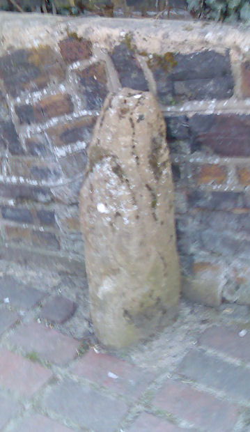
In response to Rhiannon's Battle Street conundrum, I drove past there today and made a short detour. Just before the end of the lane, on the right, is a modernish housing development...called Sarsen Close, would you believe...in the drive of one house were 3 stones, and more in the gardens of the other houses in the close. One must have been 12' x 6' x 1' thick, laying flat and used as a planter of all things, a real shame because it was a stunning piece of stone...I didn't go into the field or down the path. not knowing really what to look for.
Also 1/4 mile away I found another stone, an absolute beauty, either heavily carved or bless with the most natural art ever.
Now I have some photos, but if I start posting pictures of sarsens everywhere it will mean chaos!
|
Showing 1-50 of 87 posts. Most recent first | Next 50
Dazed, confused and peering through a fog for a glimpse of truth...and other similar flowery poetic sentiments. At heart I'm a sceptic when it comes to a man in a suit, a crap anarchist, a collector of live music, pebbles and stones, a friend of the Peaks, an enemy of the State, who suffers with perpetual cold feet. My hair is too long, my legs are too short and my knees are fucked up. I'd be an archaeologist if I could put my mind to studying, didn't have a bad back, and could handle cold weather. I want to buy a stone circle with a house in the grounds and have Phil Harding round for tea...
|
|