|
 
|
|
A short, but steep and off-path, walk down to the west of the mast that sits atop Ben Dorrery.
|
|
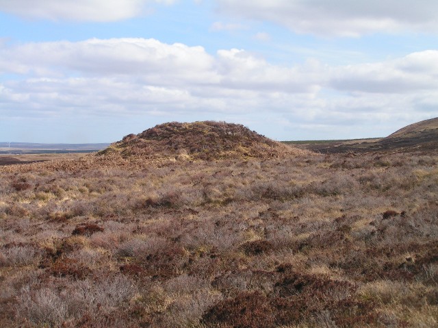
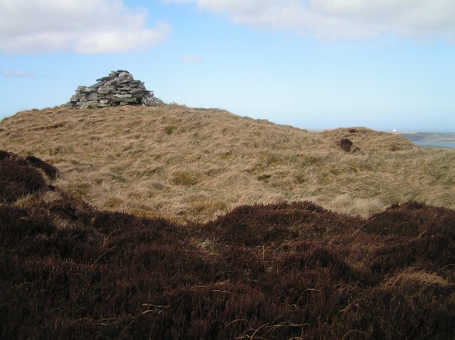
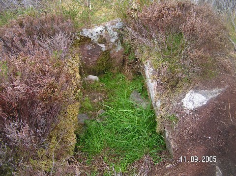
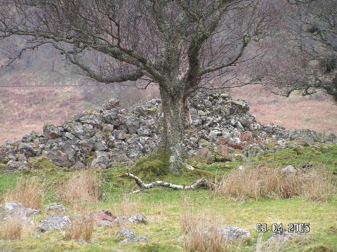
Round cairn, with a cist on the top.
|

|
 
|
|
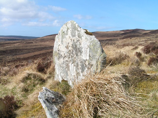
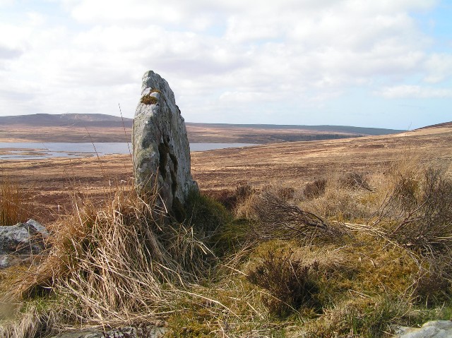
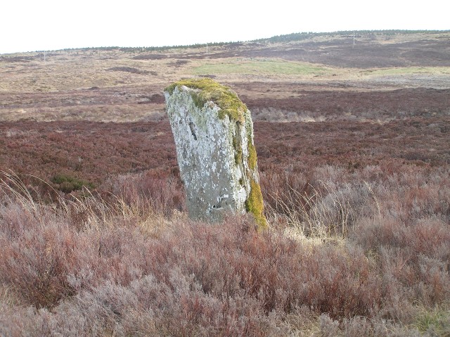
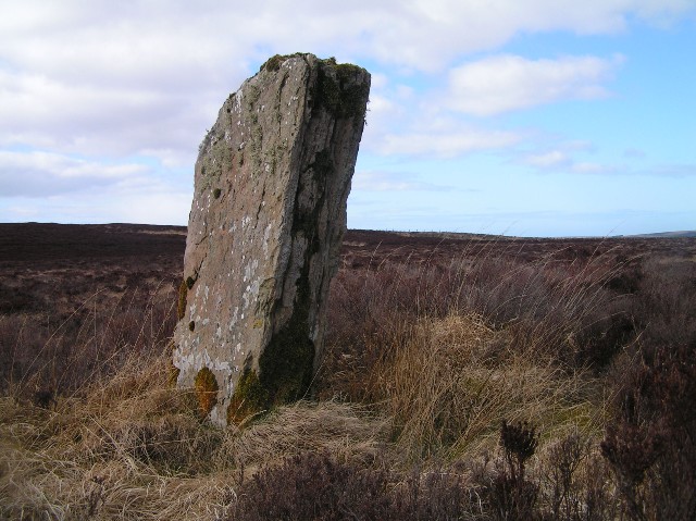
Solitary standing stone, approximately 5ft in height. It is in wet, boggy ground and there are no paths to it.
|

|
|
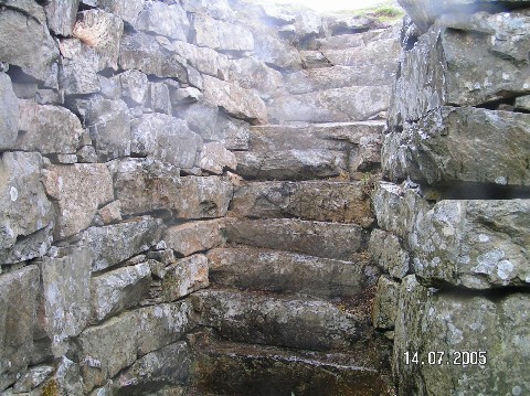
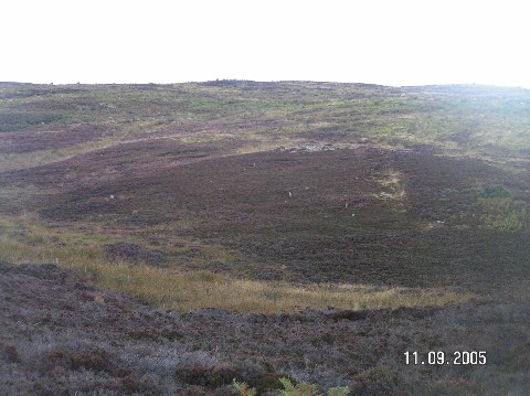
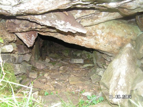
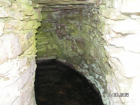
This chambered cairn, which has a modern cairn on top of it, sits just within the northern part of Bualie Oscar hillfort.
|
|
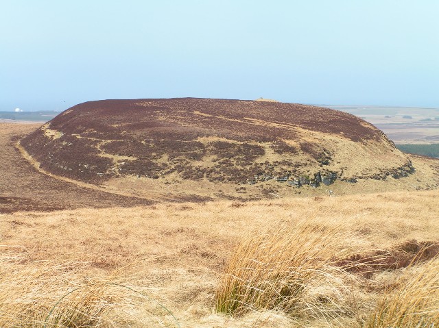
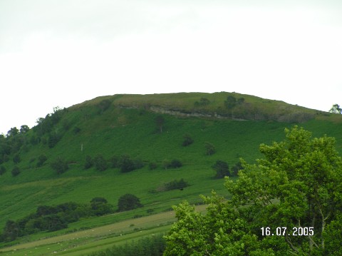
A short walk from the mast atop Ben Dorrery, although it's across heather - so avoid during tic season. This fort, also known as Buaile Oscar, covers a fairly large area and makes good use of natural rock defenses.
|
 
|
|
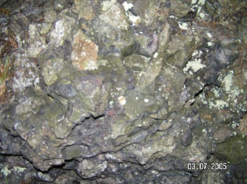
In 1915, Wedderspoon described it as "a beehive shaped structure". RCAHMS say that according to local fishermen it is a natural rock formation - and is "similar to others in the area". This is also what they say about the 'circle' in the Pool of Borodil - except in that case they say it's similar to "several others".
|
Took some finding, despite guidance from CanMap printouts - but once you spot the large standing stone it becomes considerably easier. Excellent site - the remains of the cairn seem to be surrounded by a broad stone circle. The large standing stone (cross carved into the western face), with the remains of other some stones in a roughly circular arrangement (either snapped or fallen). There are many rows here, and some of them seem to have interesting alignments to geographical land marks - most notably two converging lines that seem to form a triangle with a distant conical peak. The remains of a stone circle of smaller stones appears to lie just beyond the cairn too. Will definately go back and take more time - taking care to search for the cup-marked stones which are down through the village, towards the trees, which we didn't have time to look for.
Nice walk to the site, through the remains of the village of Learable which was cleared in 1815, with nice views all around. Don't visit during tick season, though - you're off path and on heather most of the time.
|
One of the most archaeologically significant brochs in existance, due in no small part to the lower section of it being preserved under water.
Canmore has a lenghty entry: NMRS Number is NB13NW 3
Very close to the wheelhouse at Cnip, and the Dun Bharabhat broch. Between them, these three represent what is currently one of the top sites in the country for archaeological research.
|

|
|
This distinct hut circle is now signposted from the path around the Dunnet Woods.
|

|
As described by Hob.
There's also a fort to the north west, but I was in torrential rain - and with my young family - so will visit that some other time.
|
 
|
Accurately described in Canmore as:
"a featureless low mound of boulders, grass-covered except round the waters edge."
If you're going to the lighthouse at the end of Point, you'll drive right past this and can't miss it.
|

|
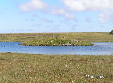
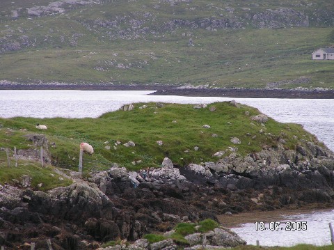
One of the many sites around Steinacleit. You can't help but notice this, sitting on the loch.
Besides the obvious causeway, other remains include several traces of walls, and possible evidence of the existance of earlier crannogs in the loch.
|

|
|
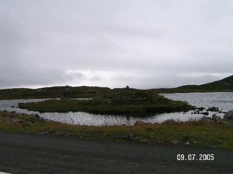
If you're heading to Dun Carloway from Callanish, look for this dun in the loch just before the Dun Carloway broch turn off. It's right next to the road, and has a clear causeway linking it to the shore. That's about the only structure that remains, as the rest is a tumble of stones and heather.
|

|
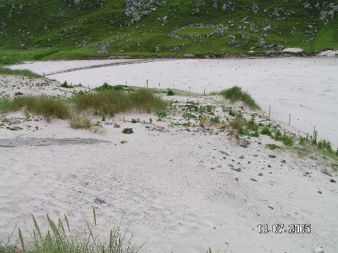
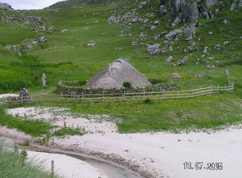
A recreated "jelly baby" Pictish house sits behind the dunes here. Not ancient, but I've included a photograph of it. It's well worth visiting.
The actual original settlement has been partially excavated, but some of it hasn't been touched. It's all reburied in the sand, and it isn't very easy to make out. The beach here is outstanding, and the views are amazing.
|
 
|
|
Not much remains of this broch. If you like brochs, it's worth a brief glance if you're seeing the Bernera bridge standing stones anyway.
|

|

|
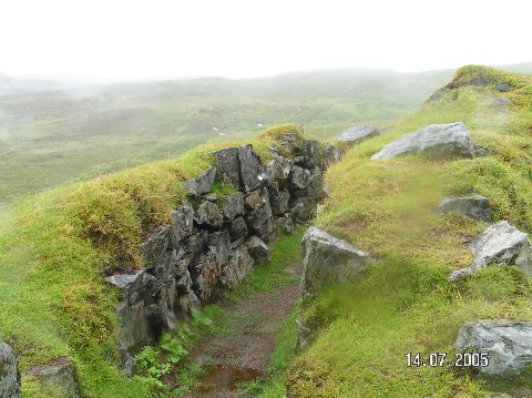
Excellent views of the church at Rodel from this Dun, which is at the top of the small hill immediately to it's north.
Very little remains of it, although there are traces of the walls (including hints of mural cells) and an external wall creating an enclosure around the Dun and the summit of the hill it sits on.
|
 
|
This vitrified fort is between Strathpeffer and Dingwall.
It's one of the four hillforts with direct line of sight to Craig Phadraig hillfort above Inverness. It also has direct line of sight to Ord Hill hillfort, North Kessock.
|

|
|
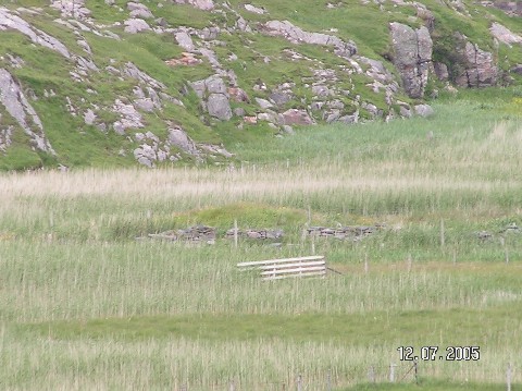
This cist is inches from the path to the Cairn o' Get, about 20 yards short of it.
|

|

|

|
|
There is now a dedicated car park 50 yards along the road from the gate. On the way to this site, there is a large broch on the top of a hill off to the right, some hut circles, lime kilns and the path passes inches from a cist. There are also two arrangements of stone rows, almost like "Hills O' Few Stanes".
|
|
This "cairn" is, in fact, the Carn Barn broch.
|
|
Across the river from the A897, but can be accessed on foot from the road through Glen Loth. Nothing much remains, except a 6 feet high pile of stones.
|

|
|
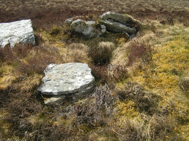
Pretty much across the road from one of the easiest approaches to Kilphedir broch. Not much more than a pile of rubble, as it has long since been robbed out, but it's likely to be a chambered cairn - possibly one with the Caithness "horns".
|
Amateur archaeologist.
|
|