Previous 50 Previous 50 | Showing 51-80 of 80 posts. Most recent first
13th May - GARLAND DAY AT ABBOTSBURY.
Do we offer floral tributes to Neptune in England to-day? Yes, at Abbotsbury on the 13th May every year the children go round the village with large garlands, asking for gifts from the inhabitants. When the round has been completed, a start is made for the beach, the flowers are placed in boats, and put out to sea--not for Neptune to do as he likes with--for they are brought back again, taken to the church, where a service is gone through. Here then is an excellent instance of a Christianised pagan superstition, for the floral tributes, if Neptune is to be worshipped, should be committed to the waves. The idea was to propitiate the god and bring luck in fishing. In all probability the custom will linger for some years to come, but it is already robbed of its original significance, and shows some signs of decay in consequence. Maybe some modern pagan, interested in old customs, will induce the inhabitants to return to the old rite of trusting the floral gifts to Father Neptune.
(from http://www.sacred-texts.com)
|
  
|
I present here an extract of correspondence between myself and Miles Russell, Senior Lecturer in Archaeology, School of Conservation Sciences, Bournemouth University. He excavated some of Wolstonbury in 1995, and discovered the nearby Mile Oak Henge.
> The report on the web seems to conclude that it is a Bronze Age
> enclosure, while the interim report states that 'of all the
> Wolstonbury C interpretations, that of Late Neolithic/ Early Bronze
> Age henge monument, is by far the most plausible.' Is this still your take on it?
[Miles Russell] the most plausible interpretation, from the C14 dates supplied (approximating around 1000 BC) is that the section of ditch sampled in 1995 dates from the later Bronze Age, but this doesn't explain the exterior bank - There may well be an earlier (henge) phase at Wolstonbury (and only further examination would prove or disprove this) reworked and modified in the Later Bronze Age - it's certainly an anomalous (not to say mysterious) site and I'd love it to be a henge dominating the concentration of Late Neolithic material in the Brighton area of the South Downs, but more work really needs to be done here.
>The things that turned me off the henge
> idea were location and size (although, as you rightly point out, there are henges on hilltops and of comparable size and larger), plus the lack of similar monuments in Sussex.
[Miles Russell] certainly the location is unlike most other henges, but the size and basic form are spot on
> I also thought that if you were going to build a henge, you would go
> to the trouble of clearing away the old field lynchets (if that's what
> they are) that are in the center! If the site is ceremonial/ non-utiliarian, do you think the use of the 3 earthworks may be related, with the monument being expanded over time to accommodate a growing population?
[Miles Russell] problem is the field banks are themselves undated (and very poorly preserved). The lynchets could conceivably be later, their shape reflecting that of the enclosure banks already in existence
>And what about Mile Oak? I have to admit to not having heard of this site before and it rather blows my 'no Sussex henges' theory out of the water! Do you still feel this is definitely a henge? I would be keen to see any reports you may have on that site. Is it visitable, or buried under the A27?
[Miles Russell] Mile Oak is definitely a henge. Sadly it was destroyed by the A27 (its position is close to the eastbound lay-by as you emerge from the Southwick tunnel heading into Brighton). The site report, written in 1991, was finally published by English Heritage as part of the A27 archaeological report entitled "Downland settlement and land-use" edited by David Rudling in 2002. I don't possess an electronic copy of the report (sadly) and as I recall the finished tome is expensive- £30 I think (though it may now be discounted) - last saw it advertised on the Oxbow Books website
http://www.oxbowbooks.com/bookinfo.cfm/ID/33377
but I imagine that most reference libraries in Sussex have a copy. There must be other similar sites on the chalk, they just have yet to be found!
Many Thanks to Miles Russell for taking the time to answer these questions.
|
Another article from a Sussex 'earth mysteries' zine, Quiksilver Messenger.
All a bit ley-line, but some interesting points.
|
Wolstonbury: a Henge?
(Many thanks to Miles Russell of Bournemouth University for providing the interim report of his 1995 excavations at Wolstonbury, from which some of this information is taken)
The widely held belief that most, if not all, Sussex downland univallate enclosures are Iron Age or later has been shown to be inaccurate by the discovery of at least four continuously ditched sites of Neolithic construction: Bury Hill, Court Hill 1 and 2 and Halnaker Hill. All sites were thought to be Iron Age, prior to excavation.
The Sussex Downs are often thought to be completely lacking in Late Neolithic/ Early Bronze Age ritual/ communal monuments such as Henges. This was challenged in 1989 with the discovery of an Early Bronze Age, class II (double entrance) henge monument at Mile Oak farm, 6km to the south west of Wolstonbury, during rescue excavations in advance of the A27 Brighton bypass (Rudling and Russell 1990; Russell 1996.)
There is also a cluster of found 'exotic' grave goods, metalwork and stone tools of this date in central southern Sussex that would 'appear to emphasise the ritual/ ceremonial importance of the Wolstonbury/ Brighton Zone in the Later Neolithic and Early Bronze Age.'
Two of the things that put me off the Wolstonbury Henge theory are location and size. However, there are Henges on hilltops (Figsbury Rings for example). And although it is big for a henge, it is not as big as 'henge enclosures' like Durrington Walls, Mount Pleasant and Marden.
Wolstonbury has been heavily damaged by 18th-19th Century flint quarrying, with lots of small pits being dug here and there. This has led to much speculation regarding the original entrances, as the north and south sections of the bank have been so affected by quarrying that the entrance could have faced in either of the two directions. Two potential entrances aligned on a North – South East orientation is akin to recorded examples of Class II Henge.
Unfortunately, funding fell through for planned further investigations at Wolstonbury. I believe this monument warrants further research, if it does indeed constitute a 'non-utilitarian' monument on the Sussex Downs.
|
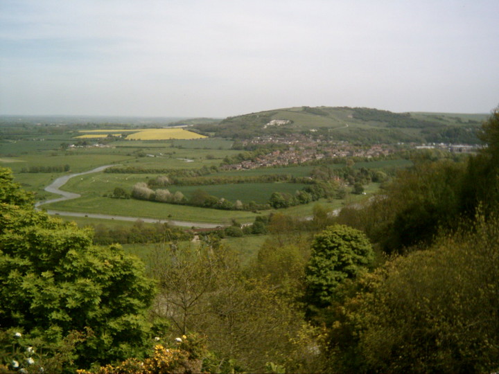
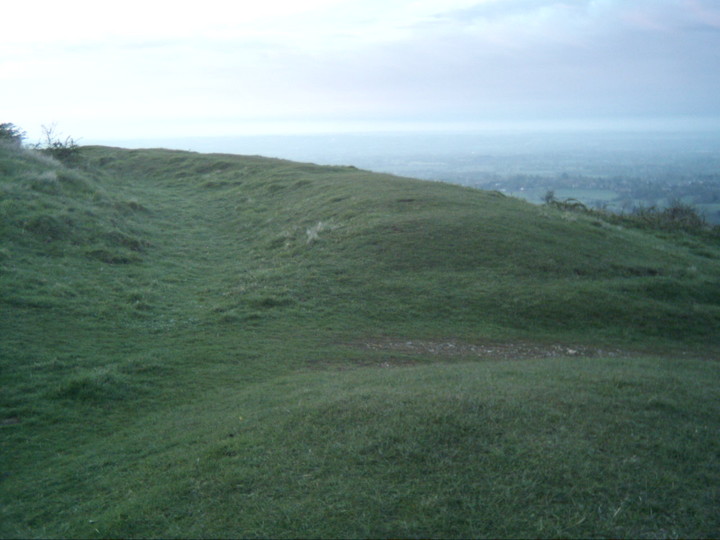
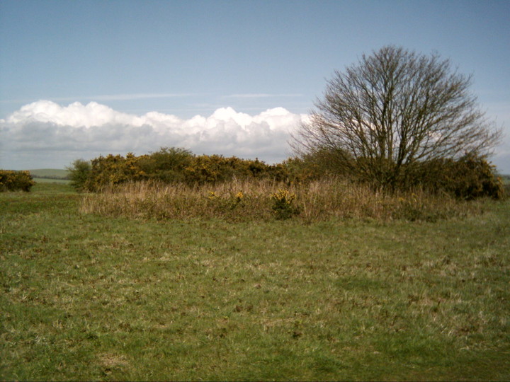
Just what the earthwork atop Wolstonbury Hill is remains a matter of intrigue.
Following some the links posted here will give further information on the various archaeological interpretations.
Since I moved to this area I have found the shape and presence of this hill more thought provoking than any of the other prominences on the South Downs.
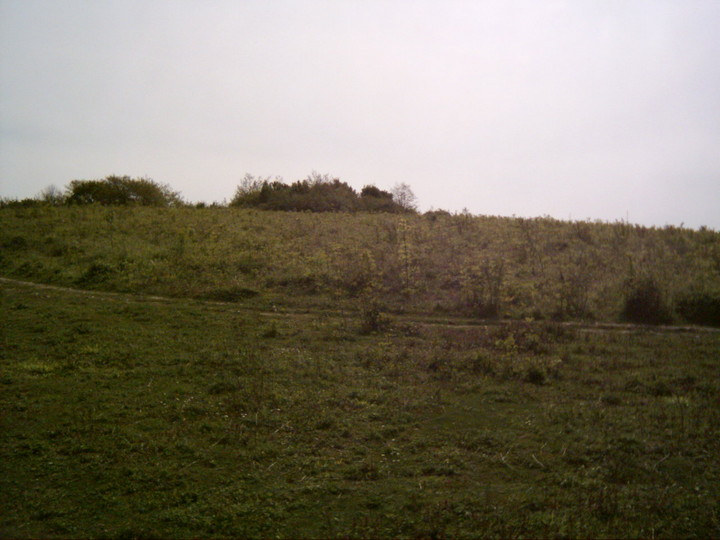
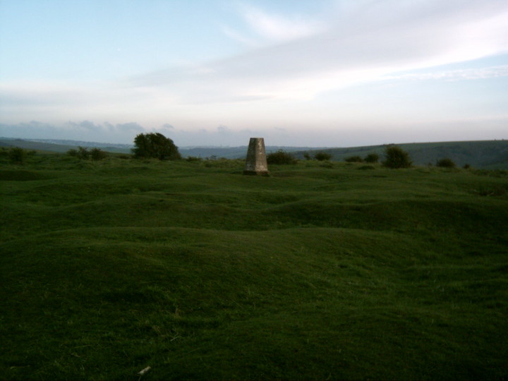
What is up here for sure is a large oval earthwork covering some 2.2 hectares with an inner ditch. There is also a faint oval earthwork within the area of the main 'rampart', a 1994 survey revealed the presence of a third enclosure sandwiched between the two!
A cross ridge dyke and the remains of two round mounds lie just to the South East of the main enclosure.
The interior of the enclosure has been pock-marked by 18th - 19th century flint quarrying, with lots of pits evident. There is also a large quarry on the North East slope of the hill.
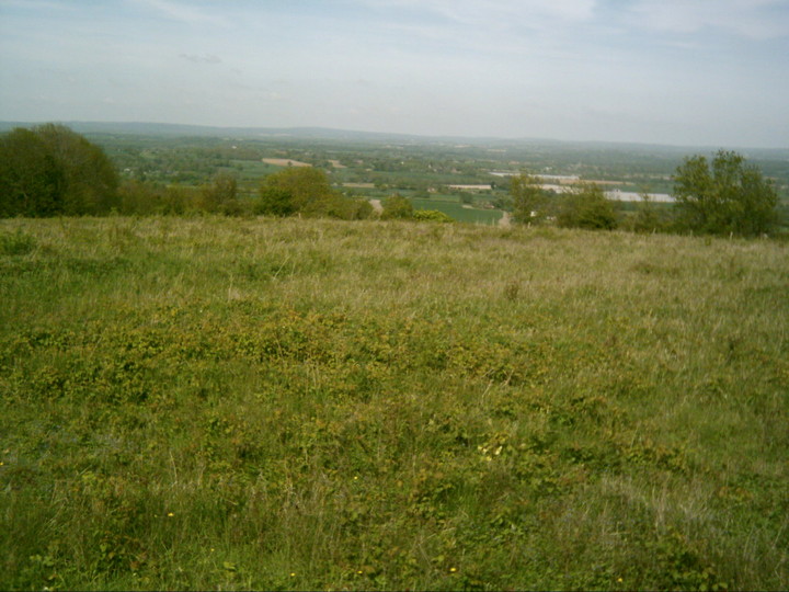
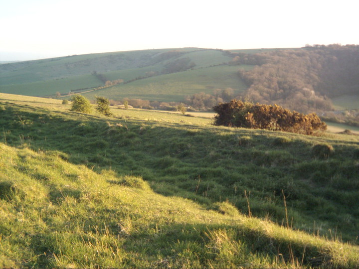
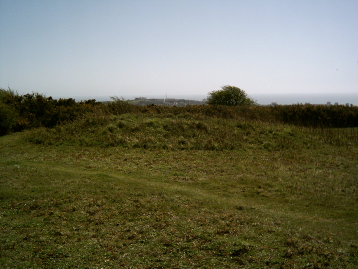
Views across the Weald to the North are panoramic, to the East are the Clayton Windmills and Ditchling Beacon beyond. Hollingbury is prominent to the South East.
Look West and you see Newtimber Hill, West Hill with Devils Dyke just beyond. Beyond that, Chanctonbury Ring is sticking it's tree lined head up.
The National Trust currently grazes a herd of some ancient breed of cow on the hill. Long spiky horns, but they are friendly and look more fitting than a bunch of modern aggro dairy cows!
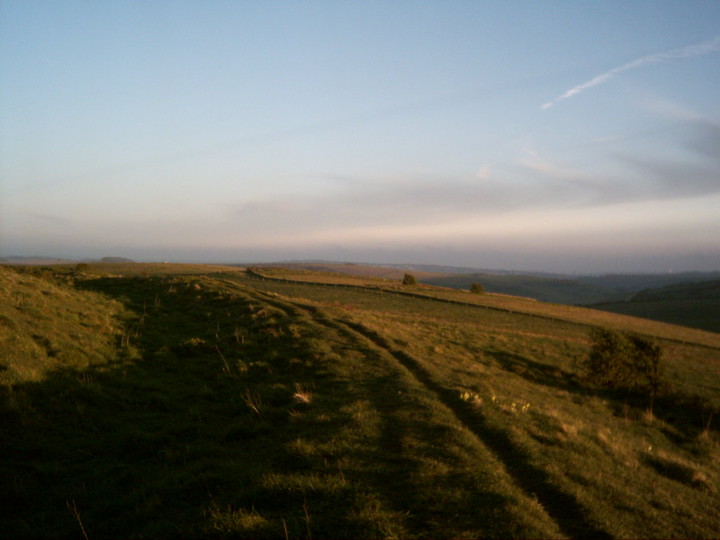
This is surely one of the South Downs most enigmatic monuments and its remoteness means that solitude is easier to come by than at places like Devils Dyke and Ditchling Beacon. A splendid place for sunset contemplation.
Access: It is a good half hours walk from your car to the top of the hill.
Easiest approach is to park at The Plough pub in Pyecombe and approach from the South. This will take you past the two barrows and cross ridge dyke.
If approaching from the North you can park in the lanes at the foot of the hill (turning at Jack and Jill pub on A273) and there are several paths up. If you are feeling energetic, take what I call the 'pilgrims' steps up the North face. Steps have been cut into this path at some point, but it is still quite steep. Guaranteed to invoke an 'altered state of consciousness' by the time you reach the summit!! (ie: knackered!)
|
   
|
A great site (put together by a local) packed with interesting info on Hollingbury.
|
    
|
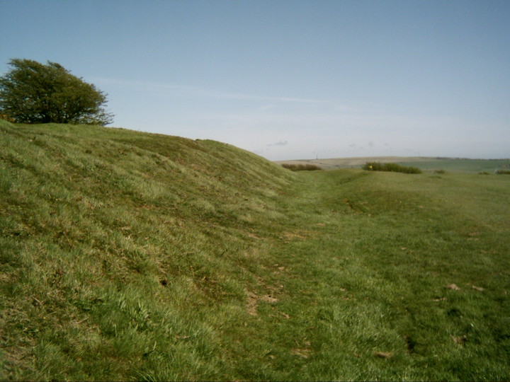
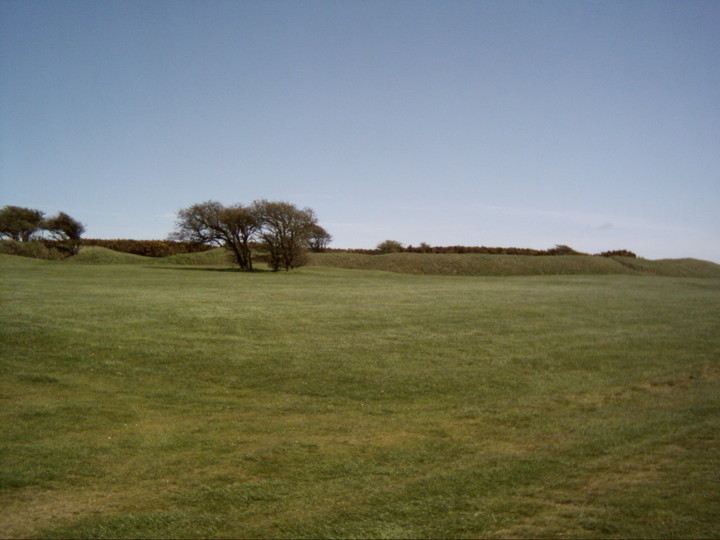
This roughly square hillfort encloses about 3.6 hectares and is defended by a single rampart and ditch with a counterscarp bank on its southern side.
This fort gave it's name to a particular type of construction, whereby the rampart was built of 2 rows of posts 2 metres apart,
tied together with cross beams to form a continuous box, and then filled with chalk rubble.
On my visit today a large section of the interior has been freshly strimmed (much is still covered in thick gorse) and so gives a chance to have a better look at the disk barrows near the center.
I have visited the larger one many times before, but two other smaller barrows are evident to the North of this one.
There is an even smaller barrow to the West, but I didn't spot it. These (bronze age) barrows predate this sites defensive use.
Someone had placed a small bunch of fresh flowers at the meeting of the paths that disect the interior of the fort.
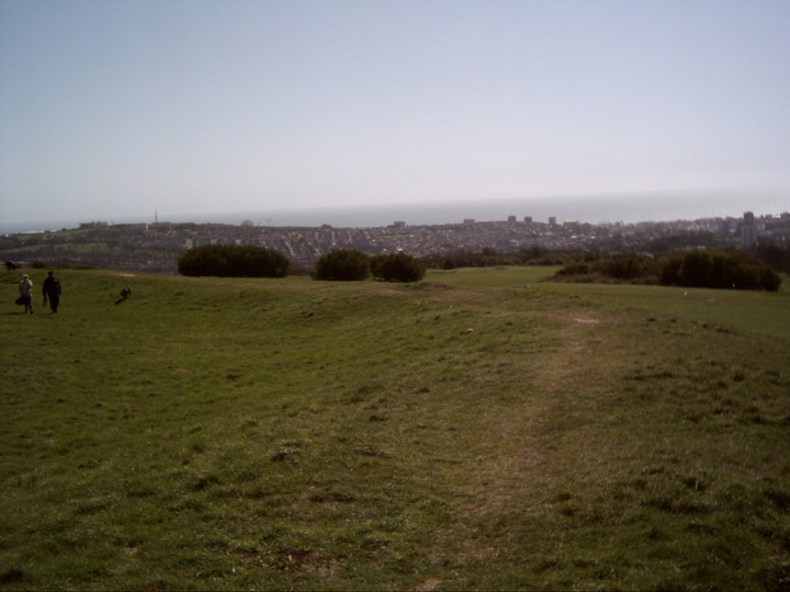
Those seeking a glimpse of the eternal and an escape from the modern bustle of Brighton can do no better than to climb the Ditchling Road to the stunning viewpoint of Hollingbury.
Access: It's in the middle of a public golf course, several paths leading in from all directions. Bring your wits, or a cycling helmet!
|
Summary of the excavation of one of the aforementioned cists on Cataclews Point near Constantine Bay.
|

Summary of excavation and finds at Harlyn Bay Prehistoric Burial Ground (near Constantine Bay)
|
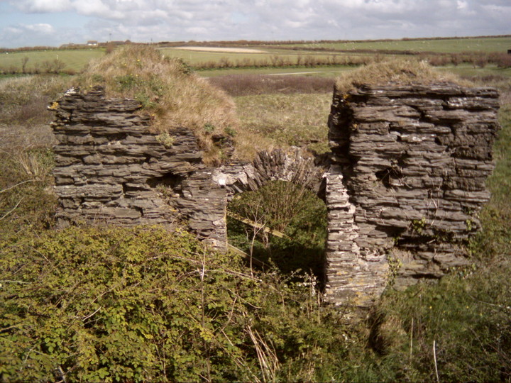
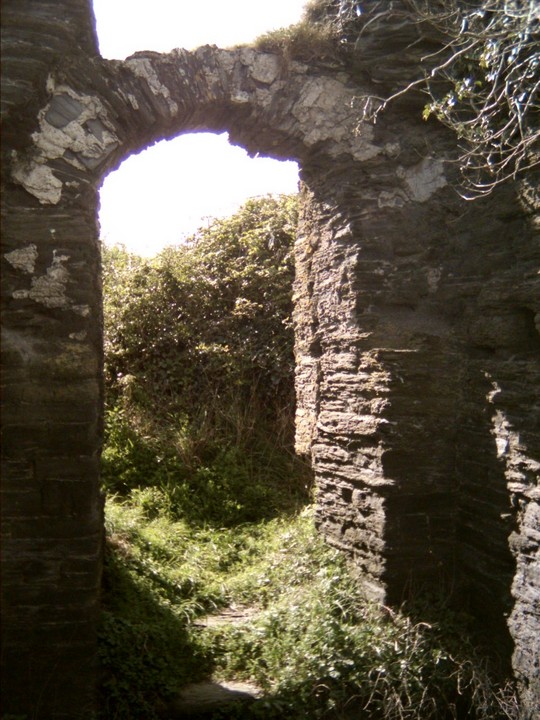
I visited this site on a weekend at Constantine Bay. It is very overgrown and one of the side walls has been propped up to stop it collapsing. It wasn't obvious where the reputed 'sacred stone' (see Misc section) was due to the foliage on the site. The biggest lump under the tower just looked like a large, flat step, but looking at the illustration this is where it would be. This stone is just visible in the first photo. It does seem a wierd place to go to the trouble of building a church, and one can imagine this secluded hollow in the sand could have been a sacred place for a long time beforehand. It was obviously a good place to gather and feast on shellfish, as the kitchen midden would suggest.
There is also a Well near the ruin, but I was too scared to venture out across the golf course!
Access: It is in the middle of Trevose golf course, and unless you like the feeling of being under fire then it is best to go to the Golf (and Country Club!!) Reception in Constantine Bay and ask a nice man to point the way through the flying golf balls.
Once at the church you are tucked in the middle of a mound and it is quite peaceful!
There are other sites of interest in the area which are worth a look; Cataclews Point with it's 3 burial cist barrows (see Ficklefingers post below), and, further around the coast path in Harlyn Bay, is a burial ground which has yielded many interesting finds and was thought to be in use from pre-history up until just before the Roman invasions. (See links section)
|
 
|
Summary of finds at Offham Hill excavation - password required
|
One of the Sussex Neolithic Causewayed Enclosures, (others being The Trundle , Combe Hill and Whitehawk Camp)
Offham is much damaged by quarrying.
Ooops! Just updating these notes as last time I visited and posted I was looking at an 18th Century chalk pit, not a Neolithic Causewayed Enclosure!
The remains of the enclosure are actually up on top of the hill, just to the North of 3 bowl barrows (and, more prominently, a covered reservoir). The chalkpit has completely eaten the whole side of the hill, and taken the eastern half of the enclosure with it. Only a visit can make you appreciate just how much damage was done to the hill by chalk quarrying. One side of the site is a sheer quarry cliff.
What is left is a large C shape of 'causewayed' banks and ditches, the top half of which disappears into the woods on the northern slope.
However, this is all barely perceptible now, especially as the site appears to be returning to woodland quite rapidly. I scurried around like an idiot looking for something bank or ditch - like to photograph, but to no avail! You can just perceive some of the earthworks in the scrub, but it is nigh on impossible to trace any distinct circular pattern. Maybe better in the winter. Times like these you wish you could fly and get a bird's eye view. (Although the multimap aerial photo doesn't reveal much either)
Frustrated at the lack of obvious monument, I turn my attention to the setting: this is such a beautiful spot, and it's location at the very edge of the Downs may have made it a special, boundary zone for early settlers. I know I will return again later in the season, and sit and feast on some of these wild strawberries that carpet much of this site.
Access: Park in Offham Village near the Church, cross the busy A275, over a stile and take the steep footpath up the side of the hill until you come out at the chalk pits. Look up to the escarpment on your right and you will appreciate how much of the hill has been taken out. Carry straight on into the woods on the other (south) side of the chalk pit and climb the path that curves round to the top of the hill. You pass another dizzyingly deep chalk pit on your left. Don't get too close to the edge! Bear round to the right and you will see the fenced in reservoir atop the hill. The 3 bronze age bowl barrows are at the NE corner of the reservoir, and the enclosure is just to the NE of the barrows.
|

|
Compelling little leaflet about the history of the Caburn.
The story is told as a series of six "windows in time",
falling on midsummer days throughout the history of the site
and its people, from 3,000 BC to the present day.
|
5th March 05
What a beautifully preserved, peaceful and interesting site. A standing stone in a field on the right just before the car park welcomes you as you arrive. Two passage graves, a central ring cairn and a kerb cairn, with another dilapidated cairn and enigmatic ruined chapel (?) 10 mins walk to the west at Milton of Clava. My favourite stone has to be the split 'crocodile' stone in the circle around the SW cairn (see images). I had the place to myself for a while this morning and it was pretty special. Now a variety of folk have passed through, all obviously impressed with the power and artistry of this place. (See the
link to the leaflet below for practical info, then just get here and soak up the atmosphere of this perfect resting place).
|
Excellent 6 page leaflet with lots of background on this site. It has all the info detailed on the site sign boards - and more!
|
Previous 50 | Showing 51-80 of 80 posts. Most recent first
Originally from Weymouth in Dorset, I now live in Hurst, West Sussex.
Would be pleased to meet up with folk in the area to visit and discuss local sites.
I have a particular interest in the mysterious collections of Sussex sarsens at various sites and the enigma of Wolstonbury Hill.
|
|