The Modern Antiquarian. Stone Circles, Ancient Sites, Neolithic Monuments, Ancient Monuments, Prehistoric Sites, Megalithic MysteriesThe Modern Antiquarian

Get the TMA Images feed
rockandy's Latest Posts

Latest Posts
Previous 50 | Showing 201-250 of 527 posts. Most recent first | Next 50

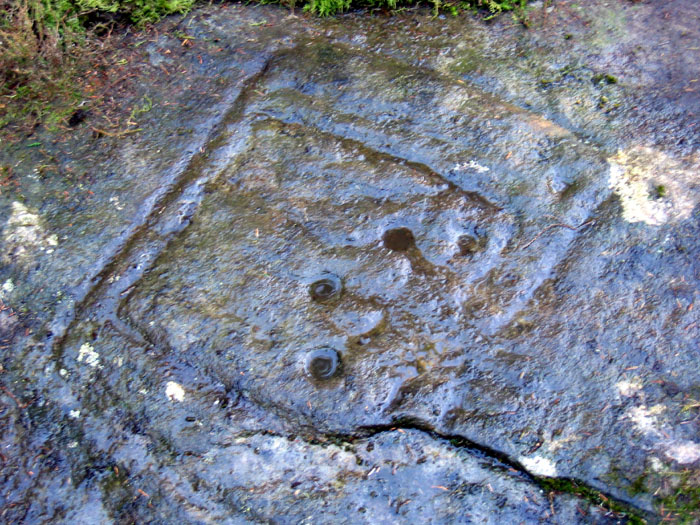
Midstead (Cup and Ring Marks / Rock Art) — Images (click to view fullsize)

<b>Midstead</b>Posted by rockandy<b>Midstead</b>Posted by rockandy<b>Midstead</b>Posted by rockandy

Rough Castles / Roughley Wood (Cup and Ring Marks / Rock Art) — Fieldnotes

This area lies between Thrunton Wood and the main A697 roads which bounds it on the E side. Its location is north west of the Millstone Burn rock art site and west of Corby Crags and Caller Crags which are hidden by intervening high ground. It is effectively a poorly drained large sheep field with a few marshy streams feeding north into the Coe Burn which, further north joins the River Aln. Two Iron Age Enclosures are known on the ridge of Rimside Moor just west of the minor road, and adjacent to the main road, just north of the rock art, are another Enclosure and Settlement of undetermined age. There is no outcropping bed-rock but a large number of sandstone boulders of all sizes, several showing signs of quarrying.
The Beckensall Archive shows 5 marked boulders in this area, although even rock art enthusiasts would only get excited by two of them, Rough Castles 1 and 4. The former must have been a much larger boulder which has been cut by quarrying on two sides. The south side slice appeared to have broken when extracted and the central part removed. A series of wedge cuts have also been made from the top through the westerly face and carve straight through the main cup and ring motif. It is possible that a second ring is also present, although highly eroded. Clearly a large amount of carving has been lost both from this rock and possibly from others in the vicinity.

Rough Castles / Roughley Wood (Cup and Ring Marks / Rock Art) — Links

Rough Castles in the Beckensall Archive


Rough Castles / Roughley Wood (Cup and Ring Marks / Rock Art) — Images

<b>Rough Castles / Roughley Wood</b>Posted by rockandy<b>Rough Castles / Roughley Wood</b>Posted by rockandy<b>Rough Castles / Roughley Wood</b>Posted by rockandy<b>Rough Castles / Roughley Wood</b>Posted by rockandy<b>Rough Castles / Roughley Wood</b>Posted by rockandy<b>Rough Castles / Roughley Wood</b>Posted by rockandy<b>Rough Castles / Roughley Wood</b>Posted by rockandy

Morwick (Cup and Ring Marks / Rock Art) — Images

<b>Morwick</b>Posted by rockandy

Camas an Staca (Standing Stone / Menhir) — Links

The Gaelic Landscape of Jura: Place Names and Landscape Photography


(The) bay of (the) projecting rocks; in this case, standing stones.

An Carn (Cup Marked Stone) — Links

The Gaelic Landscape of Jura: Place Names and Landscape Photography


Abhainn na Sroine (Cairn(s)) — Links

The Gaelic Landscape of Jura: Place Names and Landscape Photography


Abhainn na Sròine is the name of the river that runs into the bay, Poll a' Cheo. The chambered cairn, Cladh Chlainn Ian, lies alongside it just above an old cliff line.

Caller Crag (Cup Marked Stone) — Images

<b>Caller Crag</b>Posted by rockandy<b>Caller Crag</b>Posted by rockandy

Gled Law (Cup and Ring Marks / Rock Art) — Images

<b>Gled Law</b>Posted by rockandy

Hare Law Crags (Cup and Ring Marks / Rock Art) — Images

<b>Hare Law Crags</b>Posted by rockandy<b>Hare Law Crags</b>Posted by rockandy

Buaile Riabhach (Standing Stone / Menhir) — Images

<b>Buaile Riabhach</b>Posted by rockandy

Uamh na Bantighearna, Kiloran Bay (Cave / Rock Shelter) — Images

<b>Uamh na Bantighearna, Kiloran Bay</b>Posted by rockandy

Cladh Chlainn Iain (Chambered Cairn) — Fieldnotes

This is the only chambered cairn known on Jura. It is situated on a cliff top on the west side of a stream that runs into the bay Poll a'Cheo - the Bay of the Mists. It can be approached either from Strone via the standing stone (although the last part is quite rough) or along the cliff path from Ardfin (Jura Gardens).

Cladh Chlainn Iain (Chambered Cairn) — Images

<b>Cladh Chlainn Iain</b>Posted by rockandy<b>Cladh Chlainn Iain</b>Posted by rockandy

Strone (Standing Stones) — Fieldnotes

The stones are in a field called Achadh na Lice - the field of the slabs. The easiset approach is from the road near Strone house or through the alder wood from the chambered cairn above Poll a'Cheo - Bay of the Mists, an extension of the cliff-top walk from Jura Gardens.

Strone (Standing Stones) — Images

<b>Strone</b>Posted by rockandy<b>Strone</b>Posted by rockandy

Ardfernal (Standing Stone / Menhir) — Images

<b>Ardfernal</b>Posted by rockandy<b>Ardfernal</b>Posted by rockandy

Morwick (Cup and Ring Marks / Rock Art) — Fieldnotes

A new rock art panel at Morwick Crag has been found by Team 2 of the Northumberland & Durham Rock Art Project (Special Boat Unit). The vertical rock face lies directly between Stan's 1 and 2 series on a vertical part of the cliff that overhangs the river, facing due north. On the east side of this panel round the corner (left hand side on the photos), panel 1f is about 3m high above the path that ducks under this overhang and carries a nice array of horned and linked spirals.
The new panel probably continues this theme although the motifs are hard to see as they are completely covered in a uniform yellowish lichen similar to congealed custard. There are hints that multiple similar motifs lie on this new panel. Better light and some ladders will be required for a closer look.
Our early analysis is that all the motifs on Morwick Cliff may have been made from a path running along the crag line and would not have required any climbing or ladders by their original carvers. This path has now been severely eroded by the river leaving a few of the panels more than 3m above ground level. Futher river erosion and rock falls are a continued cause of concern at this site.

Morwick (Cup and Ring Marks / Rock Art) — Images

<b>Morwick</b>Posted by rockandy<b>Morwick</b>Posted by rockandy<b>Morwick</b>Posted by rockandy

Morwick (Cup and Ring Marks / Rock Art) — Miscellaneous

Morwick Mill

from: Anniversary Address by Dr. Charles Douglas. History of the Berwickshire Naturalists Club Vol 8: 212-214 (1881)

A move was now made onwards to Morwick Mill, where the party joined some of the members, who had gone there by a more direct route to inspect the incised figures on rocks overhanging the Coquet, a short way below the mill, which had recently been discovered by Mr Middleton Dand. These are different from any of those so well and elaborately described by our late Secretary, Mr Tate, and others, as occurring on rocks at Old Bewick, Doddington, Routing Linn. and other places in Northumberland. Those already recorded occur generally on the surface of sandstone rocks, cropping up on hills or other high ground; these are on the face of a sandstone cliff rising perpendicularly from the bed of the Coquet, a very short way above the level of the sea. The most typical of the former are composed of concentric circles with a radial groove passing from the centre to the circumference, or beyond it. In these now under observation, about six in number, there is no radial groove, but the figure in the most distinct is of a spiral form somewhat resembling those figured by Mr Tate in his paper, published in our Transactions for 1864, from sketches by Capt. Carr, R.E, as occurring on rock temples at Malta; with this remarkable difference, however, that the latter were in relief, those on the Coquet, like all others in Northumberland, incised. The first inscription seen by Mr Dand from a boat on the river is of a different character from any of the others, the outer circle being composed of a number of dots or pits, at perhaps two inches distance from each other, in this, somewhat resembling an inscription discovered by Mr Tate, at Jedburgh, but not in situ, and shown in Plate XI., Fig, 6 of the illustrations to his paper, above alluded to. The entire diameter appeared from the boat, from which the inspection was made by small detachments of our party at a time, to be about a foot, and was apparently the largest observed; it faced the river; others were on a different aspect of the rock, facing nearly at right angles to the one first observed. One of our members noticed that two of the spiral figures, close to each other, were in fact continuous, the line being carried from one to the other. The inscriptions are from about ten to fifteen feet above the present level of the river, but at the remote period at which they were doubtless executed the channel of the river would be at a much higher elevation. It is to be hoped that a minute and accurate account of these inscriptions with engravings, may be supplied for our Proceedings, by some member having the means of closer observation than we had. Some of the more adventurous of our party got a nearer view than those in the boat, by scrambling along the face of the rock, not without danger to all concerned; one energetic member displaced with his feet a block of sandstone rock, which fell with a mighty splash into the river, the boat at the time fortunately being some yards off. These rocks were covered with impressions of Lepidodendrons.

The company now proceeded up the river, crossing in boats, kindly provided by Mr Dand and Mr Tate, and had a delightful walk up the banks, which were beautifully wooded and rich with blossoms, among the gayest of which were the Lychnis dioica and Geranium sylvaticum in great profusion.

from: On the Incised Rocks at Morwick By James Hardy.
With Notices and Illustrations by Miss Sarah Dand.
Plates III,., IV., V., V*.
History of the Berwickshire Naturalists Club Vol 10: 343-347 (1883)


This paper on the remarkable group of incised inscriptions on the face of a precipitous sandstone rock overhanging the Coquet behind the village of Morwick, and at a short distance from Morwick Hall, is drawn up from the observations of the Club made during their visit in 1877; from the notes of Miss Sarah Dand accompanying the faithful sketches, with which, with great painstaking, she has favoured the Club; and from the recollections of a very brief visit which I paid to the spot, July 4th, 1883, in company with Mr Middleton Dand, Mr John Dand, Mr Wm. T. Hindmarsh, and Capt. McCabe.
The record of the visit of the Club on the 27th June, 1877, in the address of the President, Dr. Charles Douglas, is so accurate and ample, that it is superfluous to relate afresh the circumstances of the discovery of the figures, or their special attributes. I shall therefore incorporate the greater part of it. It is owing to the Club's resolution on that occasion, that an "account of these inscriptions with engravings," should be supplied for the Proceedings, that with Miss Dand's assistance the subject is now resumed.

[Here follows a large part of the previous publication followed by:]

The distance of the incised rock from the village of Warkworth including the windings of the river is 23/4; miles; and there is little more than a mile farther to the present mouth of the river. At first I imagined that a party of wanderers sheltering here at no great distance from the open sea, might have formed these tracings during their involuntary detention; but having subsequently learned that there are remnants of a British camp on the space behind the perpendicular cliff, it is rather I think to the agency of its resident occupants that these improved exercises in stone-cutting may be attributed.

"There is very little trace," Miss Dand writes, "of any camp left. A formed path three yards wide from and to the camp slopes from west to east to the level of the river, leaving a steep bank to the south, and a deeper bank from the height of the path to the river. To the north this is the only feature of manual formation, and is immediately to the east of the incised rock. An extensive view," she continues, "can be had to the north and west, but owing to the rising ground, only a short way can be seen to the south and east. Two small ravines on the west and east favour the idea that it might have been made a strong position. It has been suggested that here was the site of Hugh de Morwick's castle (the Norman possessor of the land), but this is a mere conjecture, for I do not know of any tradition bearing this out. Were this the fact it might account for the disappearance of the outlines of the Camp. There are several mounds running from north to south on the north side of the river on Warkworth Moor. They may be merely owing to tracks worn at different ages to 'Pomfret's ford,' – now corrupted into 'Paupers' ford – a few yards to the east; but they are not unlike barrows." This suggestion must be left for future inquiry.
Miss Dand next proceeds to describe the figures in Plates III., IV. and V. The plates are exact reproductions of her pen and ink drawings.

http://www.themodernantiquarian.com/post/44191

"The figures are scattered over the face of a perpendicular grey sandstone rock on the south bank of the Coquet. Excepting in figures 1, 2, and 3 there seems no attempt at combination. Figure 1 is the highest. Calling the rock about 30 feet high, the spirals will be about 20 feet from the ordinary level of the river. Figure 2 is on part of the rock facing east and is about 7 feet from the ground. The spirals here like those in figure 1 are of a uniform size and depth, about 3 inches in diameter and cut into the rock about the 8th of an inch. In figure 4 the spiral is larger being quite 5 inches in diameter, and curls the opposite way to its smaller representatives. I find figure 5 has long been known in the village as 'The Lion.' It is much the largest; is about 1 foot from the ground in a part of the rock that is very coarse and gritty, and appears much affected by the weather. The cups round the horse-shoe in figure 6 are very much deeper than the lines, being cut into the rock about an inch. This figure is about 12 feet above the river. Figure 3 is much overgrown with lichens, and is very indistinct."

I visited the scene under the disadvantage of a heavy thunder plump; and the troubled and discoloured river was in flood, sweeping down rafts of wood and branches. This necessitated a cautious guidance of the boat, which had to be steadied and held secure by a chain from the shore. The rock is a single cliff below the high bank, supposed to have been once crowned with a British Camp. It was ornamented with ferns from its numerous water runnels. It was surmised that the figures might at one time have been more numerous. The rock is crumbly, and detached masses of it have fallen; and the inscriptions now remaining are preserved on the more indurated projections. The northern bank of the river is grassy and without trees. The wooded scene above this free space, where the mill-race and the main stream of the Coquet meet at the apex of an islet clad with tall umbrageous trees, is exceedingly fine.

To discuss the particular object and meaning of these rock-writings is beyond the scope of this paper. Among them are examples of the first spirals as yet observed among the Northumbrian rocks. next to the Berwickshire Club, the Antiquarian Society of Scotland have in their "Proceedings" figured examples of cups, circles, and other rock markings; but among them I have failed to find spirals exactly according with those represented in the accompanying plates. On the stone, however, engraved in Plate V., the similarity of the incised figures to those at Morwick, is too obvious to be disregarded. It is derived from a plate at p.106 of Mr. Robert Bruce Armstrong's elaborate and careful "History of Liddesdale, Eskdale, Ewesdale, Wauchopedale and the Debateable Land," Part 1, Edinburgh, David Douglas, 1883, 4to; which the liberality of the publisher has placed at the disposal of the Club. The stone, evidently only a fragment of a larger block once containing more figures, forms the door-sill of the vault of the Hollows Tower on the river Esk, the residence of "Johnie Armstrong," (Gilnockie), of tragic fame, and supposed to have been erected by that Border reiver in the early part of the sixteenth century. Whence it was at first procured is not stated, but there might still be tangible evidence remaining in the neighbourhood if earnestly sought out.

http://rockartuk.fotopic.net/c865746.html

A representation of the double spiral, like that on the stone of Hollows, resembling the volutes on an Ionic column, is of ready access in the catalogue of the Museum of the S.A.S. p.115, from a sculptured stone found in a "Pict's House" in Eday, Orkney.

http://rockartuk.fotopic.net/c911426.html

A very remarkable association of the double pagan volute with a Christian cross may be seen in a figure in the Scottish Society of Antiquaries' volume for 1880-81, page 121, in a contribution by Mr William Stevenson on the Antiquities of the Islands of Colonsay and Oransay. A barbarous figure with a human head and a fish's tail, has the arms converted into involute spirals on the transverse beam of the cross.

The survival of the original central cup and concentric circles of the older Northumbrian sculptures, is sufficiently pronounced in the Morwick group; but art had advanced since a more primitive age, and was forming new combinations apparently more ornamental than significant, both in what was added and what was retrenched. This modification is also exemplified in some figures on the sculpted rock at Cuddy's Cove, near Doddington, which have other more modern accompaniments. On one of them the pagan circles and cup are displayed in the centre of a small cross; shewing a pagan and Christian emblem combined, it may have been contemporaneously. We find there also the horse-shoe arch.

http://rockartuk.fotopic.net/c894075.html

Morwick (Cup and Ring Marks / Rock Art) — Images

<b>Morwick</b>Posted by rockandy<b>Morwick</b>Posted by rockandy

Millstone Burn (Cup and Ring Marks / Rock Art) — Images

<b>Millstone Burn</b>Posted by rockandy<b>Millstone Burn</b>Posted by rockandy<b>Millstone Burn</b>Posted by rockandy

Millstone Hill (Cup Marked Stone) — Links

Millstone Hill Portable in Beckensall Archive


Millstone Hill in Beckensall Archive


Ros Castle (Cup Marked Stone) — Images

<b>Ros Castle</b>Posted by rockandy<b>Ros Castle</b>Posted by rockandy<b>Ros Castle</b>Posted by rockandy<b>Ros Castle</b>Posted by rockandy<b>Ros Castle</b>Posted by rockandy<b>Ros Castle</b>Posted by rockandy

Ox Eye (Long Cairn) — Fieldnotes

Northumberland & Durham SMR Ref No: N13330 says of the Ox Eye long cairn, near Chillingham (Chatton):

"The Ox Eye long cairn has only fairly recently been recognised as such. It was first noted in the early 1990s and was surveyed about ten years later by members of the Border Archaeological Society. The prehistoric cairn is trapezoidal in shape and measures 55m long by 22m wide and stands just over 2m high. The edges of the cairn are quite difficult to see as they have tumbled and are covered in bracken. This is one of only a handful of long cairns in the county."

The cairn lies in the centre of a large clearing in the dense forest plantation of Ros Hill Wood. The quite prominent raised shape is surrounded by a larger ring of bracken contrasting with the surrounding deep heather.

The Ox Eye natural boundary stone lies to the SW and has eroded in one part into several tubes, which pierce, in an unlikely manner in at least one case, straight through the rock. Perhaps these are the origin of the Ox Eye name.

The Beckensall Archive describes two cup-marked outcrops between the cairn and boundary marker but these I couldn't find. They weren't revisited for the Archive project and Stan says that they are usually buried in deep heather. The Ox-Eye 1 slab is described as having scattered cup marks, most of them in a cluster at one end. Ox-Eye 2 has a scatter of 28 cups, some of which may be paired like those at Ros Castle.

Comparison with old OS maps of the area shows that before afforestation the area was called Lousy Law and the cairn was given as Shepherd's Cairn. Two more Shepherd's Cairns are shown on the ridge at Millstone Hill so perhaps this name is more to do with (apparent) origin. Recent maps apply Shepherd's Cairn to only one point of the ridge midway between Ros Castle and Millstone Hill. The large Ox Eye stone, however, appears to have been one of the several boundary markers along the parish boundary.
Previous 50 | Showing 201-250 of 527 posts. Most recent first | Next 50
rockandy hasn't added a profile


My TMA Content: