|
  
|
|
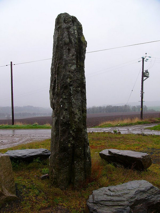
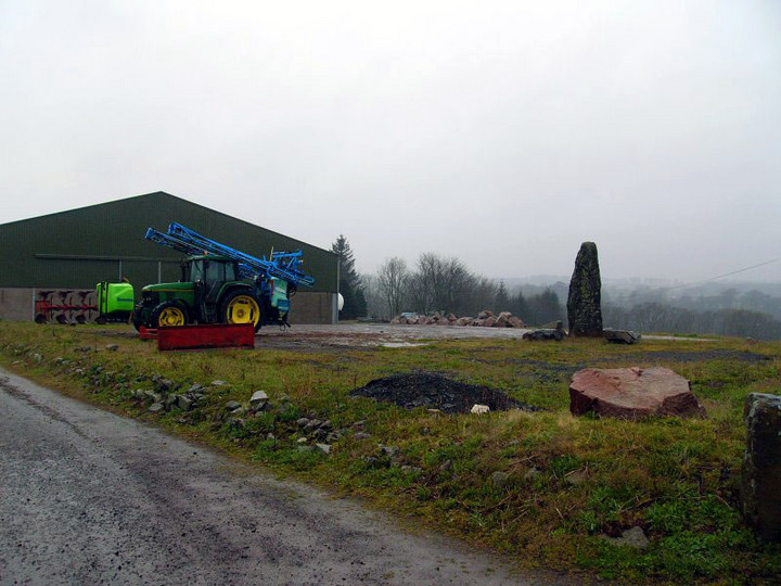
The Stone of Morphie stands atop a small rise in SE Aberdeenshire, north of Montrose and west of the village of St Cyrus. An impressive 10ft stone with interesting whorls, shapes, colours and markings, it struggles to achieve its full grandeur against the utilitarian backdrop of a modern farm.
|

|
|
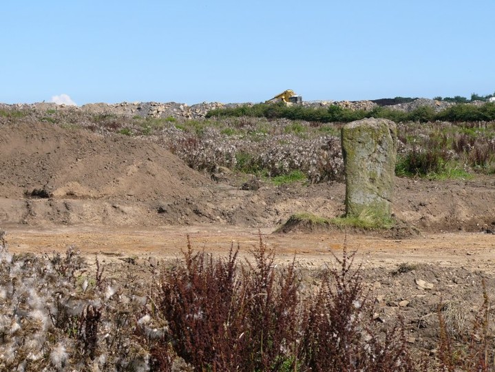
Bogleys in August 2004 must be one of the saddest stones in Scotland. As luck would have it, the stone appears to have found itself in the middle of an open cast coal mine and its situation is much changed since just a year ago when the first pictures of it were submitted to the Modern Antiquarian. Now the stone may be seen presiding over mounds of earth, with construction diggers in the background. When the opencast mining stops, this 140 acre site is further earmarked for development as Fife's Kingdom Park - for "high quality retail, leisure and industrial use".
|

|
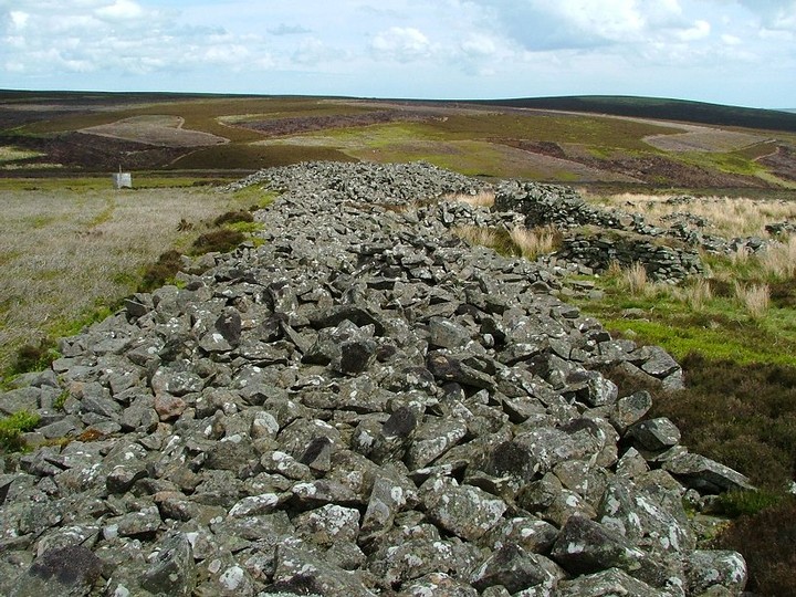
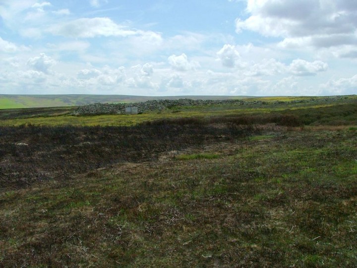
The Mutiny Stones date from the third millennium BC and are identified as a long cairn, aligned NE-SW. They are situated about 4 miles NW of Longformacus in a very remote spot. Believed to be a burial mound, but, in fact, evidence of burials has never been found, so perhaps they have a wider, different significance. To get there, take the B6355 from Gifford, then branch off onto a narrow windy road which heads in the direction of Duns. From the narrow road, avoiding the numerous sheep along the way (the road is unfenced), you are looking for an unmetalled track that goes south to a place called Killpallet. It is a little confusing because there is an official footpath marked to the left of the track you want. Ignore that, head on the right hand track to Killpallet, park your bike at the furthest point, then stride out south across the moor. It is not suitable to ride your bike across the moor. The heather and vegetation is quite thick, but also there are grouse and other ground-nesting birds. The Mutiny Stones are at the place indicated in the OS map ref . There are a couple of small cairns that you pass on the way.
The Mutiny Stones are 85m long and between 7 and a half and 23m wide. This long cairn used to be bigger but some of the stones have been pilfered for various uses, including constructing the sheep pens that you can also see in my pictures.
|
 
|
nobut hasn't added a profile
|
| |