Amerside Law Panel 1
This panel is located in a small clearing within a densely packed conifer plantation. When Andy and Hob rediscovered this panel it was covered in a thick, dense mat of woodland crud which they spent a considerable amount of time clearing.
The panel is located on a rock outcrop; views from the panel are currently non-existent. If the plantation was removed, the main viewshed would be across the Till Valley to the distant Cheviot and surrounding hills.
The carvings themselves are much worn and were described by Stan Beckensall in the 1970's. It was not possible to locate all of the features included in Stan Beckensall's drawing of the panel. It appears that during the intervening years, a section of the carvings have disappeared completely, possibly due to damaged by forestry vehicles during the planting of the conifers.
Initially the carvings were quite difficult to make out, tracing their outlines with water helped bring the panel to life revealing a complex set of motifs. For me, one of the striking features of this and other panels is the asymmetrical nature of a number of the motifs. By this I mean that you have a large channel or double channel enclosing a number of cups, however, the cups are not evenly distributed but occur in one sector of the enclosed area or may even lay across the enclosing channel. This has always interested me, it is obviously a deliberate act and my personal opinion is that this strengthens the case for attaching a specific meaning to the motifs as opposed to purely an abstract design.This post appears as part of the blog post " Amerside Law" |
I visited Long Meg for the winter solstice sunset on the 22.12.07 and noticed that someone had attacked Long Meg with a sharp object causing a series of peck marks and in the process chipping of a small amount of stone.
A great way to spoil a lovely day.
|
This is an easy site to visit. Travelling south from Shap on the A6 take the first left onto the M6 link road and then take your first right onto the minor road to Orton.
As you turn onto this road you will see a row of boulders bordering an area of rough moorland. The site is just beyond the boulders.
Tom Clare reports this site as a group of stones that 'appear to form a circle'. I was unable to fully trace Mr Clare's full circle but there is a definite arc of stones at the southern end.
The 'circle' is situated on the side of a gentle rise with the views restricted to the south by the rising ground. I was fortunate enough to visit on a cloudless, frosty Midwinter day and the views to the east west and north were beautiful, looking over the great limestone plain to the Pennines and the moon rising over Cross Fell and then looking northwards over Shap with the Skiddaw massif just visible in the far distance, the vista to the west takes in the fells around Haweswater and High Street.
Whether this is a genuine prehistoric ring or not, it's well worth a short visit, if only to take in the views.
|
The tombs at Xemxija are significant for a number of reasons. They were excavated by Evans in the 1950's and yielded a whole host of material. The majority of the finds dated to the Ggantija phase but there were also some sherds of Tarxien pottery and some later Bronze Age burials were also found along with some axe amulets. Many animal bones many were also found here giving us a good idea of what animals existed on the islands during the Neolithic. Bones found included sheep, goats, pigs, cattle, horse, dog, cat, deer, rabbit and hedgehog.
The tombs themselves are not too difficult to find and you can drive to within a dozen yards of them. To reach the tombs you need to turn off the main road (route 1) at the roundabout at the top of the hill at Xemxija, there is also a church on this roundabout. Turn into Xemxija and drive past the derelict hotel complex to the top of the village. The tombs are beside Triq bil-Preistorja which is the last road at the top of the hill. Park on this road. The tombs are at the top of the small rise about half way along the road. When we visited we drove to the end of the road and then went mooching around the fields on the hillside until a very nice lady pointed us in the right direction.
A word of warning, You need to keep your wits about you in this area . It seems to be very popular with hunters. I used to drive past this hillside on a daily basis and there were always at least a couple of four by four vehicles parked on the hillside.
The tombs themselves are basically just holes in the ground. I stuck my head into most of them and was greeted by the hum of wasps or bees in three of them which kind of put me off going any further into the tombs. What I did find remarkable was that the tomb builders had picked a horizontal surface to tunnel into. The limestone here is very hard so excavating the tombs vertically in to the bedrock must have taken a considerable effort. It would have been far easier to cut horizontally into the strata a little lower down in the Mistra valley where there are cliffs and natural caves. Which leads to the question why all the effort? What was the significance of this particular hill?
The hill is not the highest in the area but it does have good view over St Paul's Bay and the coast beyond or at least it would have if the village were not in the way. It is possible to pick out the location of the Buggibba temple in the distant sprawling resort.
All in all the Xemxija tombs don't offer much in the way of spectacular remains but if you are wanting to build up a picture of Maltese Prehistory and maybe understand why certain locations were chosen then it's worth coming here, sitting yourself down and having a good look around you. One feature of the tombs is that some of them are lobed which indicates that there may be a link between the lobed nature of the caves and the similar layout of the temples.
I would never describe Malta as a pretty place then again I would never describe the Maltese landscape as boring. I'll take interesting over pretty any time. My lad would say that it's worth visiting the site because there are lots of huge ant's nests and you can spend time feeding dead insects to the ants.
|
If you are visiting Clapham Junction the caves are quite easy to find. Just walk a few couple of dozen yards uphill to the top of the limestone area and you're there.
Back in geological time the caves were all underground but then as tends to happen with limestone, the roof of the largest cave or a series of caves collapsed leaving a large cavity in the ground with a number of caves many of which are interlinked, around the margins. It's well worth scrambling down into the caves, they are lovely and cool and provide a bit of welcome shade from the Maltese sun.
The caves were occupied up until the nineteenth century and when you climb down into them you can see evidence of walls and entrances. Solid evidence of prehistoric occupation has yet to be found in the caves but considering that a set of cart ruts start on the margins of the caves I'm sure this site would not have gone unnoticed by the prehistoric Maltese.
|
I guess if you want to see prehistoric cart ruts then Misrah Ghar il-Kbir aka Clapham Junction is pretty much the place to go. However cart ruts are not just a Maltese phenomena, they can also be found in Sicily, Spain Sardinia Greece and France but I guess the reason why the Clapham Junction cart ruts have become so famous is that there are so many of them in such a small area.
The site can be a little tricky to find especially if you are coming at it from the Dingli cliffs. Your safest bet is to get on the Rabat to Busket gardens road and look for an area between two large modern quarries.
The cart ruts themselves are pretty remarkable when you consider their age. I should mention something here about the age of the ruts. There is a lot of debate on this subject. There are a number of rock-cut Punic tombs in this area and at least one of the tombs cuts through a set of cart ruts. The tombs have been reliably dated a have been dated to the later centuries BC. This means that at least some of the ruts are older than this date. Most of the experts seem to agree that most of the ruts are pre-Punic but opinions differ from this point onwards. Some argue that the ruts are from the temple period whilst others, including Trump favour a Bronze Age date.
The debate around the use of the ruts isn't much clearer than the dating debate, however many experts seem to favour the idea that the ruts were made by some kind of vehicle but after this there seems to be all sorts of opinions. Trump states that 'Wheeled vehicles do seem to attract the least serious objections'.*
As a visitor I guess you could probably spend the best part of an hour following the ruts around this limestone plain, they are fascinating but I'm going to contradict myself here and tell you that I found them to be are pretty unremarkable and felt quite under whelmed. However, what I really did enjoy about Clapham Junction was the Ghar il-Kbir caves and the rock cut Punic graves.
*Malta Prehistory and Temples
David H. Trump
Midsea Books
Pub 2002
Also see
Malta's Ancient Temples and Ruts
R. Parker & M. Rubenstein
Institute for Cultural Research Monograph Series No. 26
1988
|
When it comes to 'looking at rocks' my family and I have an unspoken agreement, they are happy to tolerate my obsession as long as it doesn't involve me dragging them around a bunch of sites or trying to convince them how wonderful these places are. So I had a choice to make, I knew I could get away with taking them to one prehistoric site on Gozo. The island has many prehistoric sites from standing stones to temples to Dolmens, so where would it be? Without a doubt it had to be Ggantija.
Ggantija is signposted and quite easy to find. Once you get to Xaghra just look for the large car park and you know you're there.
When walking towards the temple it is worth looking at the surrounding walls. Not far inside of the main gate there are some large orthostats that have been interpreted as possibly another structure associated with the main temple.
Another feature worth looking out for is The North Cave, which is a cave just at the top of the site. The cave has been interpreted as possibly starting out as a rock cut tomb which then became a rubbish pit for the temples.
As for Ggantija itself, the scale of the walls is overwhelming. Mr Cope is spot-on when he refers to the walls as Cyclopean. I just had to stop and take it all in. This structure is five and a half thousand years old and was build by people who had no knowledge of metal. These stones were cut, erected and had fallen long out of use long before any Egyptian had even considered building a pyramid.
Of course the Maltese temples were not the first structures in Europe, we on the margins of western Europe had been erecting our megaliths and building tombs even before the Maltese culture had risen and flourished, but what is important about these these Maltese and Gozitan temples where designed and built as public buildings, they had torba floors, the walls were plastered, they contained ornately carved decorative stonework as well as carved features such as holes for door posts, animal tethers, libation bowls etc.
I could bore you here with a long explanation of the lay-out of the temples but I'll spare you that. In a nutshell you have two temples enclosed by a huge wall, the older, western temple has five apses and the eastern temple has four plus what the guidebooks call a 'niche'. The Ggantija temples should not be seen in isolation, this part of the island has many prehistoric monuments. The Brochtorff Circle which is now known as the Xaghra circle is just on the other side of town, the Santa Verna temples lie 700 metres west of town and there are various other bits and bobs including Ta Ghejzu, a cave that yielded pottery from the Ggantija phase and has the possible remains of a temple on it's margins.
Ggantija is an extremely important site and is treated as such by the Goitans, it has had the full heritage treatment but is not over the top, this is no 'Stonehenge-site-in-cage' it is a site you can still interact with and come away feeling that you've had a personal experience. As temples go Ggantija is definitely a world class site and my second favourite temple of the islands.
|
In His book 'The Stone Circles of Cumbria' John Waterhouse describes three circles at Gretigate that were not identified until the late 1950's "by which time they were in a very ruinous condition.
I parked up in Gosforth, crossed the A595T and walked down the track to Seascale Hall. Waterhouse's sketch map locates the circle on a trackway that runs off the main track at a cottage called Sides. I called in at the cottage and was met by an old fella who was working on his immaculate gardens, obviously a labour of love for him.
"Howdo, do you mind if I have a walk down your lane to have a look at the stones circles?
"Don't mind at all, if you can find it" he replied and then promptly disappeared into his shed.
Waterhouse's sketch map places circle A about 100 metres from the cottage and circles B & C another 50 or so metres beyond that.
The only remains of circle A was supposed to be a 'chord of the circle, about 30m long, which has been incorporated into a stone wall along the edge of the field. Unfortunately this wall is now covered on both sides by a dense overgrowth of every thorn bearing bush known to grow in the British Islands. I managed to hack away at some of this and found a number of large boulders at the base of the wall. Unfortunately boulder based walls are quite common around these parts so in all honesty it was difficult to say if these were the remains of the circle. Examination from the field side was equally impossible, hindered even more by a barbed wire fence.
One possible candidate for a stone was a large plum-shaped boulder that had been dumped amongst a bunch of bramble strewn rubble of the opposite side of the trackway.
As for circles B & C. The lane petered out at a large farm dump that contained decades of accumulated rubbish. Behind this was a narrow wood of low trees that had once been used as a pheasant rearing area. The wood was badly overgrown and the terrier and I spent a good three quarters of an hour hacking our way around it being ripped to shreds by brambles and thorns in the process. After that we turned our attention to the bordering fields. The result of all this activity was that we found absolutely nothing. I can only assume that all visible traces of the three circles are now either beneath the dense woodland mat, ploughed out of the adjacent fields or dumped in the nearby stone dump.
All in all our visit to Gretigate failed to yield any concrete evidence of the stones, we found a couple of possible stones but that was it. Definitely one for the enthusiast.
If you do find yourself in this area, I would recommend a visit to the Gosforth Bakery, a small house just opposite the car park; it's a pie lover's paradise. There's also the beautiful carved Saxon Cross in the parish churchyard.
|
I'd never visited Greycroft before yesterday, its unsalubrious neighbour and other peoples bad experiences had always given me an excuse to be somewhere else. However I decided to put all this aside and get myself there.
The circle can be seen from the road and access was a doddle and hassle free. I parked up on the main road just beside the bridge and took the signed footpath along the stream past the ruined mill house. The lovely farmer has erected a stile on the field beside the circle with a noticeboard highlighting the permissive pathway to the ring.
The stones themselves are a bit knocked about but lovely all the same. Nine of the ten stones are agglomerate which has weathered with a pinkish patina. A number of the stones have been damaged and you can see the original colour of the stone is a dark grey. The most southerly stone is sandstone and continues the Cumbrian ring builders liking for including an 'exotic' in amongst the natives.
The great thing about this circle is the views and the way it balances the sea on one side and the distant fells on the other. It was also nice to see that the woods that line the bank between the ring and the power station have now matured and block out most of the view of its dark satanic neighbour.
All in all, a lovely circle with nice views, well worth a visit. Access may be a problem if you are unable to climb a couple of stiles or negotiate a narrow, irregular path.
|
Easter Monday 2006
The last time I drove to Hagar Qim was three years ago and I found myself driving through a labyrinth of narrow, dusty, potholed lanes that ran between a series of small firework factories, this time I was determined stay focused and not get lost. Guess what? I managed to get myself to Qrendi, the nearest town to the temples, and then ended up in the self same maze of farm tracks and firework factories. What the hell, I knew I was only a couple of miles from the temples and traveling in the right direction.
The Temples open at nine o'clock, I arrived at the Heritage parks car park at about ten to nine which was just enough time to grab my kit and give the ancient tatty capped car park custodian a 'voluntary contribution' to look after my car. My plan was simple and selfish. I wanted to be the first person of the morning at either Hagar Qim or Mnajdra or both. I was having a Verruca Salt moment 'I want a temple to myself and I want it now!' As it turned out I ended up having both sites to myself, the first guided tour did not turn up at Hagar Qim until I was out of the gates.
You approach the temple from roughly the south east and the façade is stunning, its asymmetry is puzzling but very appealing. The beautifully quarried orthostats that surround the entrance seem to degenerate into large irregular rotting monoliths looking for all the world like a gobful of rotten teeth. It makes you wonder what was going through the architects mind here. These large blocks draw the eye away from the temple entrance and towards the sea where your gaze finally settles on the beautiful rocky isle of Filfla in the distance. The huge irregular orthostats appear almost like temple guardians looking out to sea and protecting the faithful from what? The primitive folk who lived beyond the horizon? As the temple is located on the top of a hill it would be interesting to see it from the sea. Would these megaliths appear like giants looking out over the sea? Their wild weathered nature also contrasts with the regular smooth blocks of the entrance. Perhaps the architects and stone masons knew that the blocks that faced seaward would eventually become gnarly and weathered and erected them as a gesture to whatever deity controlled the elements. All the winds still have names in Malta.
There are a corresponding set of huge irregular monoliths on the opposite corner of the temple and it is the largest of these that you can see looming over the temple as you approach it, another guardian perhaps. One of the unusual things about Hagar Qim is its' hilltop location, the large orthostats are visible from all around the monument including the nearby Mnajdra temples. I have read so much about these temples that walking into Hagar Qim is a very comfortable feeling for me. I feel warm and happy and I have the place to myself.
The temples can be quite confusing in their layout, there is some debate as to whether this temple is a four or five apsed structure, it's nice to know that there are some things that we still cannot define or label. I'm not here to study the floor plans, I've done plenty of that at home, I'm here to be happy and spend some time amongst these big old stones and I'm getting that in spades.
A few of the carved stones are replicas but don't let this spoil your appreciation of their beauty. I have seen the originals in the Museum in Valletta are there is no difference.
A few yards north of the temple is a second five apsed temple which if anywhere else would get a great deal of attention, unfortunately here it is totally eclipsed by it's beautiful exotic neighbour. I wandered over to this substantial but forgotten neighbour and sat a while within its walls and tried to soak up a little of it's flavour. It almost felt like an act of condolence. Between this temple and the large temple is another structure which again is quite substantial but formless. No one is quite sure as to what the purpose of this building was. It is sometimes called 'the priests quarters'. A prehistoric parochial house, that notion really appeals to me.
It was now time to move on. I walked the few yards to the perimeter fence and the path that leads down the hillside and look out upon one of my favourite views in the world, the Mnajdra temples nestled in a hollow in the cliff below.
|
In their wonderful book, Malta Prehistory and Temples, David Trump describes Wied Filep Dolmens as being "the most accessible" and as having "one of the biggest capstones" accessible and biggest, yeh, my kind of words.
Trump doesn't lie when he states that Weid Filep is accessible, it's right beside the road, trouble is you have to find the road. I spent a good part of half an hour driving in and around Mosta before I found the Dolmens. My tip is this, find the wadi on the outskirts of Mosta and head east along the road that parallels the steep valley. Take a look over your left shoulder and you should see a fort on the opposite hillside. Now wind your window down and listen. You should be able to hear the sound of dogs barking. So if you can see the sea, the fort and the wadi and hear the dogs then you are 'in the zone'. The noise of the dogs barking is coming from the fort which is the Maltese police dog pound.
The dolmen are situated on the edge of Mosta and can be found on a raised limestone platform beside the road. The monuments have been walled-in presumably to protect them.
There are two dolmen , they are both sat on the same limestone exposure and it is possible to see how the stone has been quarried from behind the dolmen to create the large capstones. Trump states that the largest of the pair is 3.8m from end to end.
As impressive as the dolmen were it's the setting that grabbed me. The dolmen are sat on a hillside overlooking a wadi with the beautiful Mediterranean Sea in the distance. A modern addition to this view is a huge limestone quarry, I guess some people could see this as an abomination but for me it's just another sign of continuity of the use of the beautiful Maltese limestone. Only the scale has changed.
|
Buggibba/Quara is a typical Mediterranean tourist town. It has developed in a strip along the sea shore overlooking St Pauls Bay. The temple is in the grounds of a hotel called the New Dolmen. I drove up and down the seafront looking for this hotel but was unable to find it. I eventually parked the car and walked along the sea front. The hotel faces the sea but doesn't open out onto the shore side road, its quite easy to find, just look for the biggest, ugliest hotel on the strip, and then march on in through the glass, marble and gold foyer, through the bar and out onto a patio area where you'll find all of the usual suspects laying around the pool on their sun beds oblivious to the Megalithic wonder in their midst.
The temple has been incorporated into the hotel grounds and on the day I visited it was being used as a sanctuary/hangout for teenagers escaping from their over-oiled, overweight, g-string be-decked parents. The uprights and lintel of the temple entrance are present and give the temple an air of authenticity, but apart from that there are a number of low walls and a few large stones but it is difficult to visualise what the original structure must have looked like from these meagre remains.
It's worth thinking about the closeness of the sea and the role it may have played in the choice of site for the temple builders. The sea is only a couple of dozen yards away from the temple. This part of the bay forms a natural harbour within a harbour. The view to the North West is interesting as it looks over to Saint Paul's island and the coast beyond. This may be significant to the location of the temple when you consider that the wonderful temples of Hagar Qim and Mnajdra also overlook an island. However the temple entrance is orientated to face inland (south-south-west). This view is completely obscured by the hotel and town. Another indicator that the sea may be linked to this temple is the lintel stone with carved fish along it. The stone was discovered during the excavation of the temple and is now on display in the museum in Valletta.
|
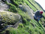
L'Elefante is exactly what it says it is, an elephant or at least an elephant shaped rock. If you approach it from the north it is an upright elephant and from the south it is an elephant sitting down either way it is unmistakably an elephant. I had passed this rock a few days before and dismissed it as a tourist curiosity, one of hundreds of bizarrely-shaped rocks that litter the island.
Two things changed my mind about this, one was the road sign which said Domus de Janus and the second was a brief reference in Margaret Guido's excellent 'Sardinia' book.
L'Elephante couldn't be easier to visit as it is on the kerbside next to a major road; there is also a handy lay-by opposite the rock. The rock is perched on the margins of the road on a hillside overlooking the coastal plain from Castelsardo to the north, the views are beautiful and include a nice view of the Nuraghe su Tesoru.
To tell you the truth I wasn't expecting too much from this site but what a shock I got. The rock itself reminded me of a large red cinder, there's that colour again!, but it wasn't until I got up close to it that I realised that there were a number of chambers carved into it, I was even more surprised when I climbed through one of the carved portals into the chambers and was confronted by two great crescents carved into the walls of the chambers.
One thing I should warn you about is that you have to run the gauntlet of a group of old men selling tourist trinkets at the side of the road, there is even a man with a donkey, donkey rides on a main road?..hmmm No grazie. Two things struck me about the hawkers, one, they seemed to be mainly selling knives, two, none of them would have looked out of place in the Godfather part 2, wrong island I know but that's how they looked, all that was missing were the shotguns.
If you are travelling around the north of the island I would definitely recommend that you call in on L'Elefante. The nearby medieval seaside town of Castelsardo is very picturesque and a good place to stop and have a drink and something to eat.
|
The name means 'Red Angel'. This 'red' thing is starting to nag at me.
The site was discovered in 1903 by a workers quarrying the local sandstone. 37 tombs have so far been discovered' almost all of the literature uses the words 'so far'. The site is well signposted and situated next to main road. There is a car park and an entry fee is required.
All there is to see when you enter the site is a low grassy hill surrounded by rich farmland and close to a large river, the Riu Filberta. This area is known as Fertilia. The remains of the quarry are visible along with a few loose rocks and one small standing stone. The locations of the tomb entrances are given away by little information boards above each tomb. The board tells you the tomb number, gives a plan of the tomb and provides you with a little information about the tomb. The tombs have been dated by the finds discovered within them to the Oziere culture of approximately 3300-2800BC. The tombs were later reused by different cultures including the Beaker culture.
I'm not sure if you are allowed to climb down into the tombs. I couldn't see a sign prohibiting it so I crawled through a number of them. Crawling through the chambers was a little scary, some of the chambers had props supporting the ceilings so I tended to avoid these, I also tried not to think about the dead snake my son had found the previous day. I was unable to stand up in any of the chambers; which to me would indicate that they were not used for ritual activity on a regular basis. The chambers did not seem to follow a uniform layout.
"In plan the tombs naturally vary, but not infrequently a large burial chamber with smaller chambers radiating from it is reached by a long passage sloping down from the entrance steps: the passage too may have chambers leading off it. Others are much simpler. The chamber themselves may be oval or rectangular in plan, and have round or flat ceilings". Sardinia. M.Guido
One common feature of the tombs and chambers was the rectangular door with the carved recess; which was also a feature of L'Elefante and reminded me at the time of carved entrances I'd seen in Maltese temples. Many of the doors also had a carved lintel. In one of the tombs there were carved stone pillars which I presume were there as architectural feature rather than structural supports. In another tomb, whose roof had collapsed, was a carved bed. The lintels, pillars and carved bed lead you to think that design of the tombs may have reflected features found in the houses of the Ozerei people who created the tombs.
There are two sets of carvings that make this site really special. One is a set of carvings depicting 5 Bulls heads ,or protomi turine, situated above the entrance to a tomb with a 6th on an adjacent wall. The second set of carvings is within tomb XXVII. This carving consists of a pair of crescents over a set of concentric circles enclosed within a rectangular box; there are two of these carvings facing each other on opposing walls. There is much speculation as to the meaning of these carvings, the depiction of bulls heads outside of one of the tombs strengthens the arguments that these carvings are stylised versions of the bulls head and are linked to a bull cult others suggest that they may represent high–prowed ships. Unfortunately my camera packed up as I was photographing this carving so the images I have are a little rough.
When the tombs were excavated they yielded many grave goods including metal axes, beads, marble idols and many other objects, the most interesting of which to me, was a flat axe and an awl that were found to have come from the British Isles, probably Ireland.
Anghelu Ruju is a beautiful site and well worth a visit.
|
This site was on the top of my list of Sardinian sites to visit. Who could resist a site that has been described as 'one of the most puzzling and interesting monuments in Sardinia', 'the only Ziggurat in the Mediterranean' and 'an important monument to megalithic architecture unique to the western world'? A Ziggurat is defined as a "temple tower, either stepped in tiers or spiral, symbolizing the mountain peak where the gods dwelt and where the skies met with the earth." Ziggurats are thought to represent a cosmic axis, a bridge between heaven and earth.
To reach the site I once again had to drive across the top of the island. I managed to get through Porto Torres without losing my wing mirrors or enraging the locals and found myself heading towards Sassari. You know how it is when you're driving along the road and all of a sudden you pass the place you need to be? Well this is what happened to me. The site entrance is situated on the busy 131 dual carriageway, I had managed to find the site but I then spent 20 frustrating minutes trying to back-track on myself. I don't know how many Sardinian traffic laws I broke but after a period of frenzied driving, which took me into the outskirts of Sassari, I managed to get to finally get to the site.
There is a car park and a site reception/ticket office. Once you've purchased your ticket you walk along a long path to the site. I had driven for two and a half hours to reach Monte Accoddi; my level of anticipation was so high that I almost ran down the path to the site, definitely a case of 'mad dogs and Englishmen'. After passing through a set of gates you enter the site from the south and walk along the eastern side of the monument. The man in the ticket office told me to report to the guide, so I headed down to the porta cabins at the bottom of the site.
When I arrived at the cabins the guide was showing an Italian couple around a small exhibition so I waited patiently and used the time to look at the surrounding landscape to see if I could spot any distinctive landmarks. The day I visited was extremely hot and the heat haze had reduced visibility. All I can really say about the surrounding landscape is that the monument is situated on a flat fertile plain with mountains in the far distance. The guide finished with her Italian couple so I asked her if I could look around the site. Her English was quite poor but 100% better than my Italian. She managed to explain to me that I was welcome to walk around the site as I pleased but I couldn't walk up to the platform of the monument as there was work taking place. Nay problems!
The monument itself is stunning, although the site itself could do with a good tidying-up. Basically you have a rectangular platform of 36 x 30m aligned north-south and faced with a dry stone wall construction using large, un-worked, limestone rocks, this is then surmounted by a smaller, three stepped, platform faced with smaller, more closely packed stones also in a dry stone construction. There is a 30m long, trapeze-shaped, ramp that leads from the south to the first stage and then a set of 14 steps leads you to the top platform. The top platform is 9-10m higher than the surrounding land. The site faces north and I am told that on a good day you can see the coast and the Golfo Dell Ainara from the top.
My first impression of the monument when looking up from the base of the ramp was "bloody 'ell, it looks like a ziggurat", not that I'd ever seen one in the flesh. My second impression was of the asymmetry of the structure, with the ramp leading up the right hand side. On closer examination I realised that the right hand side of the top platform had been destroyed.
When I first saw a picture of Monte Accoddi, I was stunned by the sight of a large, cup marked boulder. Having stood at the foot of the monument and taken in it's size I made a beeline for the boulder. There are two boulders, one large, one small and both cup marked. The larger boulder is cracked, two ideas immediately came to mind, an omphalos and the cosmic egg. I sort of discarded the omphalos idea due to the stones position in relation to the monument and the fact that there were two stones, I guess you can't really have two omphalos (what's the pleural of omphalos?) in the same place. The egg idea lingered. There are a number of creation myths around the world that feature the cosmic egg, the seed from which the world was born. Another idea that came to mind was that there were two stones here, one substantially larger than the other. The larger stone is a reddish colour the smaller one whitish grey. Could they represent the sun and the moon? I love days like this.
I eventually managed to tear myself away from the boulders to have a mooch around the rest of the site. A little further along the eastern side of the monument is an amazing large flat stone known as the sacrificial table. The stone has a number of perforations around it's margins which could only have been man- made. It is these perforations that have led people to suppose that they were used to tether the living sacrifices to the stone. I don't know whether any evidence of sacrifice has been found but the stone could certainly accommodate a fairly hefty victim, man or beast.
From the stone I carried on around the margins of the monument where there is ample evidence of other buildings in the form of low walls.
The rear of the monument is a good place to have a look at how the monument was constructed with most of the stonework still intact, there is also a small ramp. However this is also the area that lets the site down badly. It is being used as a dump for construction materials and debris.
Whilst I was looking at the small exhibition in the site cabins I noticed a picture and illustration of a carved stone that had been interpreted to be a crude carving of a female figure, possibly a goddess. I had presumed that this stone had been carted off to Sassari Museum for safe keeping. I was deeply shocked and saddened to find this stone lurking amongst a pile of large drainage pipes and site rubbish. The stone was cracked and chipped in two places and the cracks looked recent. I later mentioned this to the site guide but she just shrugged.
The western side also has evidence of structures surrounding the main monument and to balance the sacrificial stone, on the eastern side of the ramp, is a large standing stone. Whilst looking at the stone I was struck by the strange asymmetry of the monument and wondered if the standing stone, sacrificial table and 'egg' had some form of alignment or were just placed there with little or no thought of their symmetrical relationship to the ramp and the main monument. Perhaps this trio of stones predated the monument. The standing stone itself is beautiful, it is made of limestone and has a number of large holes caused by weathering, these holes have been occupied by snails who have secreted a sort of natural concrete which partially fills many of the smaller holes.
I conclude my circumnavigation of the site back at the base of the ramp. Unfortunately I wasn't allowed to walk up the ramp to the platform but to be honest with you I didn't mind. I didn't need to climb to the top of the platform to understand that this site was extremely special and unique. There are elements of the site that suggest that the early Sardinians may have been influenced by the cultures of the near and Middle East.
If you are lucky enough to visit Sardinia I would recommend that place this site on the top of your list. The discovery sort of the broken carved stone put a bit of a damper on my visit to Monte Accoddi.
Monte Accoddi is a world class archaeological site, and from what I saw, it deserves to be treated with a lot more respect that it is currently receiving. Happily this is not the case with the other Sardinian sites I had visited. They had all been well cared for and many were manned by enthusiastic and helpful guides.
|
Li Muri is about a ten minute drive from Li Longhi. Drive past the site and park in the car park on the hill. Walk back up the hill and buy a ticket at the small hut. Once again I was able to use the guide who also spoke excellent English and had a deep love of this site.
This Neolithic necropolis should have a ring of familiarity about it to anyone who has read about or visited British prehistoric burial sites. The site is not large but it is full to the brim with archaeology. The site is neatly 'tucked in' amongst numerous rocky outcrops with views over the surrounding valleys.
Basically what you have here are five cist burials, four of the burials date to about 4500BP, the fifth cist dates to a later pre-Nuraghic culture. There are also a number of standing stones or Betyls, and small cist-like boxes that 'were used for offerings'.
The four Neolithic cists are surrounded by a number of small concentric circles and were originally covered by an earth mound or cairn with only the outer kerb showing. The cists were orientated north–south and when excavated yielded a rich crop of distinctive grave goods including obsidian arrowheads, polished axes, mace heads, flint knives, pottery, soapstone necklaces and a steatite bowl which may be of Cretan origin.
The fifth, and later, cist is aligned roughly east-west and was also covered by a cairn.
My guide was extremely enthusiastic about the site and went to great lengths to explain many aspects of Sardinian prehistory including the trade in Obsidian throughout the Mediterranean. Sardinian obsidian was the best in Europe and Galluran obsidian was the best in Sardinia. She was also very keen on Irish archaeology having just spent seven months living in Galway.
One thing that struck me about the site was a large outcrop of weathered granite on the margins of the site. For me the rock almost seemed part of the site and on closer inspection I noticed a number of weathered depressions and natural bowls within its structure. I tried to discuss this with the guide and how the people who built the monument could have easily chosen a rock-free site in the adjacent field. But she only smiled and said that we can only discuss the facts of the site. I did however detect a knowing look in her smile or maybe I was kidding myself, perhaps she just pitied me for my wide eyed ramblings. She did inform me that the local rocks, some of which are weathered into the most bizarre shapes, contained rock shelters. Some of these shelters had been excavated and yielded early pottery.
The necropolis of Li Muri reminded me of home. There are definite parallels with sites on the North York Moors such as Obtrusch and round barrows and cairns in many other parts of our islands.This post appears as part of the blog post " Scratching the Surface in Sardinia Pt1." |
Once again this is a sign posted site with a car park and a small booth from where you can buy tickets for the monument. On my visit, I had the good fortune to find a guide here who spoke very good English and had recently spent 3 months in Newbury.
If the service is available, pay the extra Euro for the guide, they are usually very knowledgeable and generally keen to speak English, they also carry folders containing illustrations, details of finds and general information about the sites.
Li Longhi is a fascinating site situated on a prominent hill. Like Pasceradda, the tumulus remains intact and the monument has undergone some restoration. The path to the monument is only short and you approach it from the front. The first thing you notice is the stelae, it's huge and it's broken. The repair job on the stelae reminds me of my own attempts to repair things at home. They've just taken the huge lump that fell off and clagged it back on, it's pretty unsympathetic but it works and restores the stelae to it's original height. The stone to the right of the stelae is also a replacement.
The passage is a little confusing until you realise that this monument developed in 3 stages. The first stage of the monument was the construction of a dolmen, the remains of which form the rear of the passage. The dolmen was constructed, during the period of the Bonannaro Culture using rough stone slabs placed on the original ground surface. The second stage of the monument was the construction of an allee couverte or passage; this was dug into the bedrock. The walls of the passage were constructed using a mixture of large slabs and dry stone walling, a mound/tumulus/cairn of stones was also constructed at this point. The final phase of the monument was the addition of the horned façade.
Within the passage, the dolmen was separated from the rest of the monument by a
blocking slab and a bench, as at Pascaredda.
There is only one capstone in situ on the passage, my guide informed me that the archaeologists have speculated as to whether the passage was actually capped with removable wooden planking to allow access. What intrigued me was what happened to the capstone of the dolmen. I wonder if it was reused in the construction of the passage or perhaps in the horned façade of the monument.
My guide also informed me that Roman and Greek writers had witnessed and recorded how the Tombi were still being used when they had visited Sardinia. There are written accounts describing people sitting on a bench-like structure attached to the horned façade of the monument whilst rituals took place within the area defined by the facade.
Li Longhi is well worth a visit, when combined with a visit to Cuddu Vecchiu and the Necropili di li Muri. It provides insight into the development of the wonderful Tombi dei Giganti in this part of the island.
|
Coddu Vecchiu is signposted on the Tempio to Arzachena road. As with Pascaredda, if you approach this site from the west you will be travelling through a beautiful and bizarre landscape passing peaks with boulder strewn ridges and valleys with huge monoliths that appear to have been thrust upwards through the earth by the hand of some unseen orogenic deity. I wrote in my note book "these rocks must have names". Even the modern quarries chop away the hillsides to create the appearance of stepped pyramids.
Coddu Vecchiu is served by a car park. There is a small visitor's centre in the car park where you can purchase a ticket for the monument, buy an ice cream, a cold drink or use the toilet.
Tip No.1– Sardinians are obsessed with change, in the monetry sense, so keep plenty in your pocket. That said, I managed to score a free ice cream at Coddu Vecchiu because the very nice lady behind the counter did not want to lose her change, despite having lots in her till.
The site is just a short walk from the car park and approaches the site looking towards the forecourt. If you can manage to take your eyes off this beautiful site you should check out the lovely large, squat, weather-worn rock outcrops to the left of the path to the monument.
The Monument is stunning and sits in a low valley on an elevated hillside surrounded on one side by scrub land and the other by strictly regimented lines of grape vines running like contour corduroy across the hillside. It would be nice to think that this arrangement stretched back to the origins of the monument. As we know, many megalithic monuments were deliberately sited within liminal areas on the edge of farmland, one foot in the wild and one in the cultivated fields perhaps symbolising the continuity between past and the present. In his book 'The Bronze Age in Barbarian Europe' Jacques Briard describes the Sardinian central stelae as; "the sacred stone in front of the kingdom of the dead was visible from afar and reminded the living, at work in the nearby fields, of the frailty of human life".
It is the central stone or stelae which draws the eye here. This design of stelae is known as a bilithon, a two piece stone. Once again there is a pink tinge to the rock which is enhanced by a vein of pink crystal running downwards at approximately 45 degrees from the top left hand corner of the bottom stone. Later I was to visit the Neolithic cemetery of Il Muri where large amounts of ochre were found in the cists. This set me to wondering if this use of reddish/pink stone and the use of ochre were linked over the millennia between the erection of the monuments. Perhaps red was a colour associated with death. Marija Gimbutas has this to say about the use of ocre "Red was the colour of life, of blood, which was neccessary to secure regeneration".
My first impression of the monument was that this Tombi definitely had a different architect to Pascaredda. It's well worth having a detailed look at the stones of the façade. The central stelae have been beautifully carved. The carving borders the lower stone and extends around the outside edge of the upper stone. Care has also been taken to carve around the small portal at the base of the stone. The carving had also been applied to the back of the stelae, presumably after the two stones were united and erected.
The stone to the right of the stelae has a natural channel carved into it that runs from ground level to the side of the stelae, the final stone of the left hand horn of the façade has a natural cup in its face. I'm sure these features would have not gone unnoticed by such accomplished masons as the Tombi builders and once again we see the use of weather worn stone in the construction of a monument.
The monument we see today is a stripped-down version of the original. Many years ago when the monument was excavated the archaeologists didn't believe that the stone cairn that covered it was actually part of the structure so they removed it.
The passage of the monument is aligned east-west and unlike Pascaredda is constructed of large stone slabs on the interior (visible) passage and thick, dry stone walling on the exterior (unseen) walls. The passage also differs from Pascaredda in its layout. There is no 'bench on the back wall and the side slabs butt straight onto the central stelae. There is also a large slab on the floor of the chamber marking a small step down in the passage just before the stelae, creating a small anti chamber behind the small portal at the base of the stelae. Perhaps this was the place for offerings.
In summary, Coddu Vecchiu is a beautiful Tombi dei Giganti sitting in a lovely landscape. It is well signposted and judging from the day we went, and its close proximity to a main road, can be quite busy.
|
This was my first Sardinian site. It's location on the Tempio to Calganius road is pretty much where Julian Cope describes it in the Megalithic European, unfortunately, due to Ryanairs meagre baggage allowance, I didn't have the book with me and the site wasn't on my map so I came across it by accident. Fortunately for me the Sardinians are pretty good at signposting their ancient monuments.
To reach the site you have to walk down a country lane and along a path on the edge of a field, you then cross over a fairly dodgy looking wooden bridge and the site is just in front of you in a cork wood. That sounds fairly straight forward, as it is, but the walk is absolutely beautiful and a great introduction to the sounds and smells of the Sardinian countryside, it also grounds you in a landscape ringed by sharp, craggy mountains with the Monte Limbara peaks rising to over 1300 metres.
Pascaredda is beautiful, you approach the site from the rear so the first thing I noticed was how neatly the stone capped mound fitted into the surrounding valley. As I moved around the mound the horned façade and forecourt came into view. The rocks of the façade had a definite pink tinge to them which would be something I would also encounter at Li Longhi. The carved portal stone is large but not huge, the proportions and symmetry of the monument are perfect and the carving is beautifully executed. After sitting and taking in the fact that I was actually here, I began to mooch around the mound and passageway. The mound appears to be constructed of small cobbles and earth. One of the cap stones had been removed from the passage, so I was able to slip down into the passage with relative ease. The passage was orientated east-west and was constructed in a dry stone style. It was interesting to note that the passage was independent of the façade, by this I mean that the large carved portal stone had been placed over an existing portal and the passage may have originally been a self-contained unit. This could imply that the façade was added at a later date. The rear (west) end of the chamber had a bench-like structure constructed by placing a large slab horizontally across the back of the chamber. Another feature, which was to become a occurring theme in the monuments I visited in Sardinia, was the use of water/wind eroded stones in the monuments.
Pascaredda was my first Tomba dei Giganti and I think it will always remain my favourite. It just all fits in so well, the walk to the site, the intact mound, the tomb, the lovely façade, the nearby stream, the mountains, Perfect!This post appears as part of the blog post " Scratching the Surface in Sardinia Pt1." |
I took a wander down to the stones after checking out the yew and the cupmarked stone in the churchyard.
In looks as though the field is being left for hay and all three rings are currently pretty overgrown.
It's a crackin' spot on the valley floor, I guess these rings would have made quite an impression on prehistoric visitors to this beautiful Glen.
|
|
https://teessidepsychogeography.wordpress.com/
|