Showing 1-5 of 14 posts. Most recent first | Next 5 
a day tour of Perthshire's ancient sites with Moth & Jane
4th July 2006
Quite a while back I'd promised Moth & Jane a tour around Perthshire on their way to Lewis, so today I headed east to meet them at Fowlis Wester.
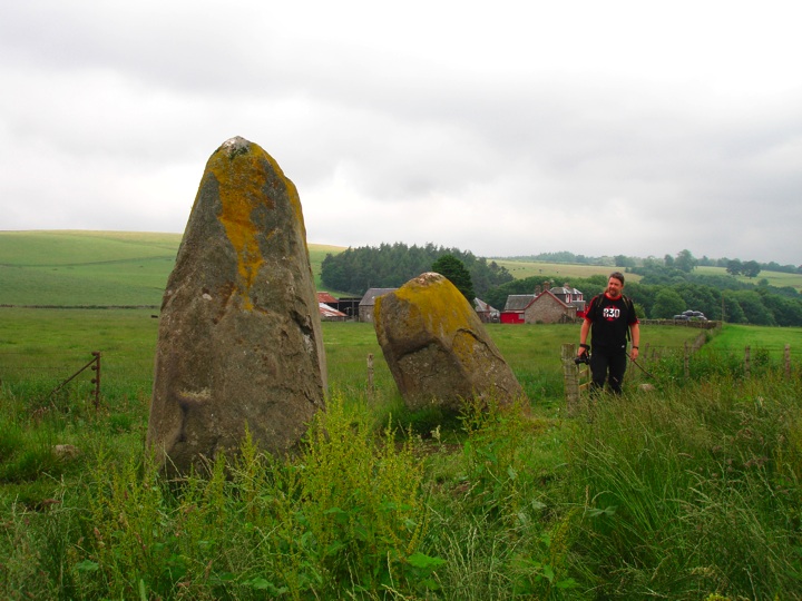
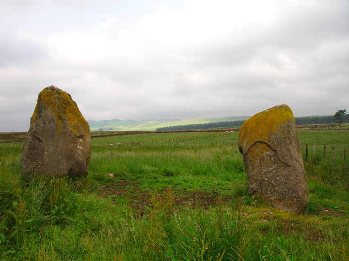
First on our itinerary for the day was within walking distance, the cup-marked rocks at Thorn farm, and the nearby Crofthead Farm standing stones.
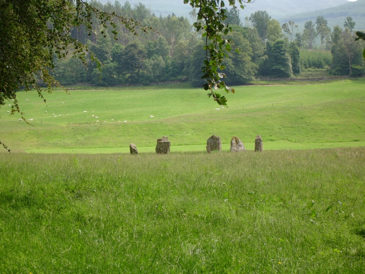
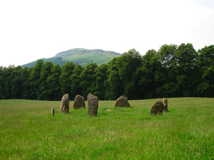
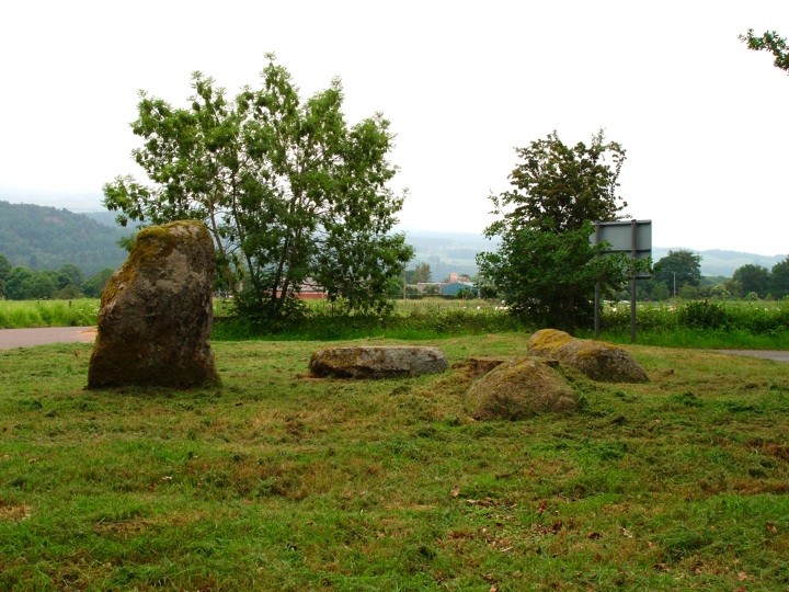
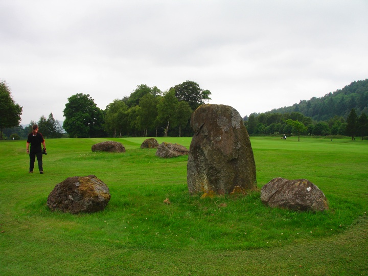
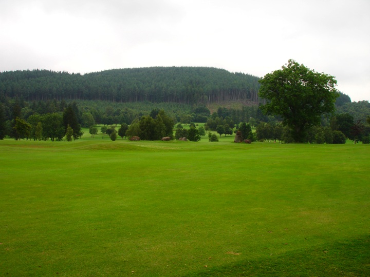
After walking back to the car at Fowlis Wester, we all piled into mine and drove the short distance to Crieff where we stopped at the golf course and asked permission to see the Ferntower stone circle.
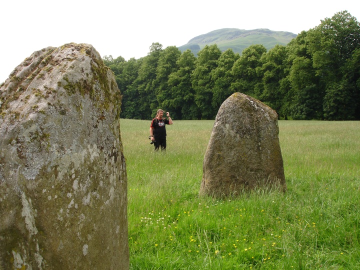
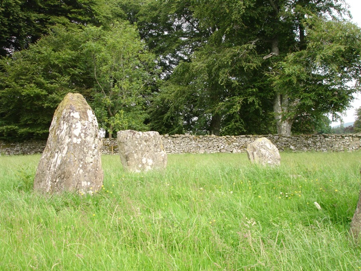
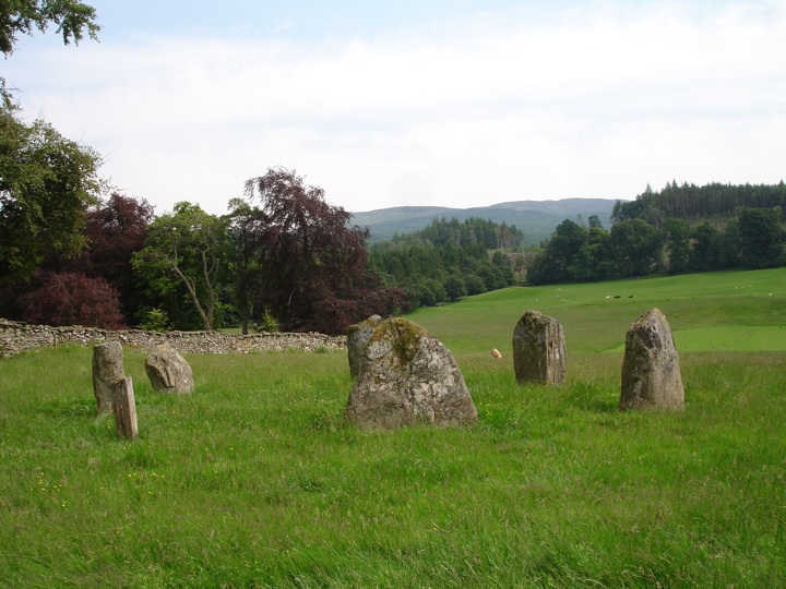
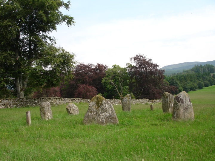
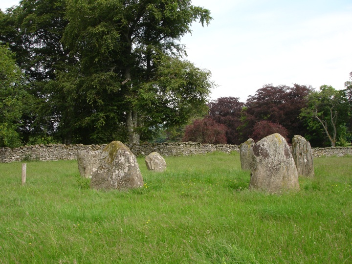
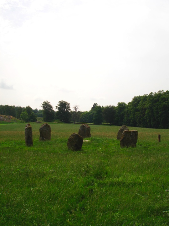
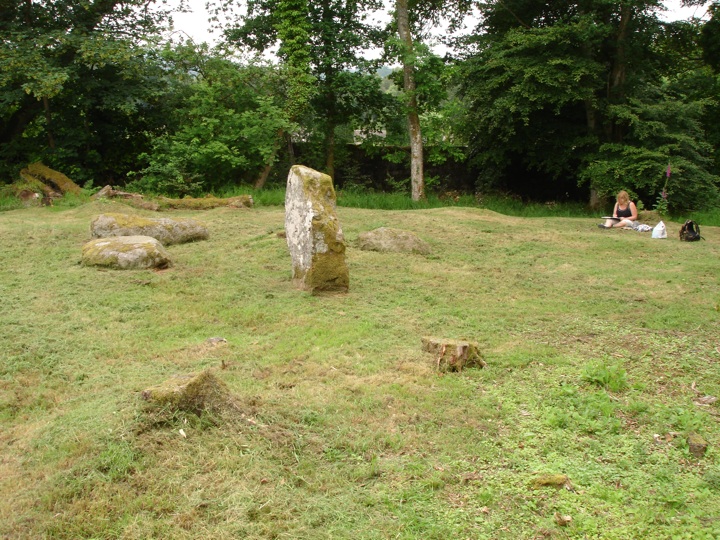
While in Crieff we called in at McNee's delicatessen to pick up some of their fantastic ciabatta sandwiches, then headed west for Comrie and Dalginross stone circle where we had a picnic lunch and Jane did some painting.
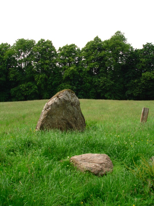
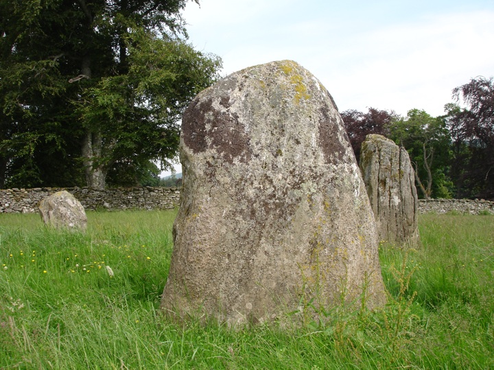
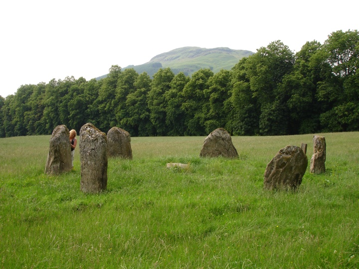
We continued west through St Fillans, along the north shore of Loch Earn to Lochearnhead, and headed north to Killin. We parked next to the Falls of Dochart but before going to see them properly we walked up the drive to Kinnell House to ask permission to visit Kinnell stone circle.
We walked back along the driveway to the Falls of Dochart where we sat for an hour or so, paddling in the water while Jane did some more painting.


We continued around Loch Tay, stopping at Fortingall where unfortunately the stone circles were well hidden by long grass, then turned up into the picturesque Glen Lyon. We followed the River Lyon all the way along the glen, stopping just beyond Cashlie for cakes bought at McNee's earlier.


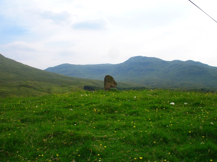
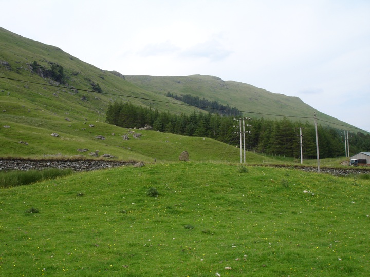
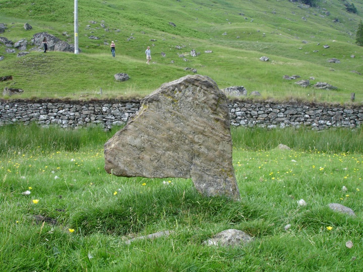
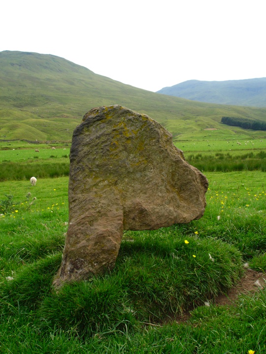
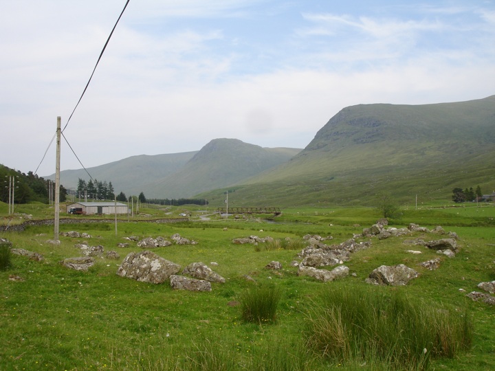
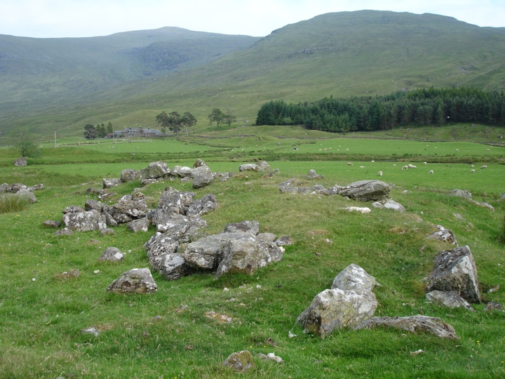
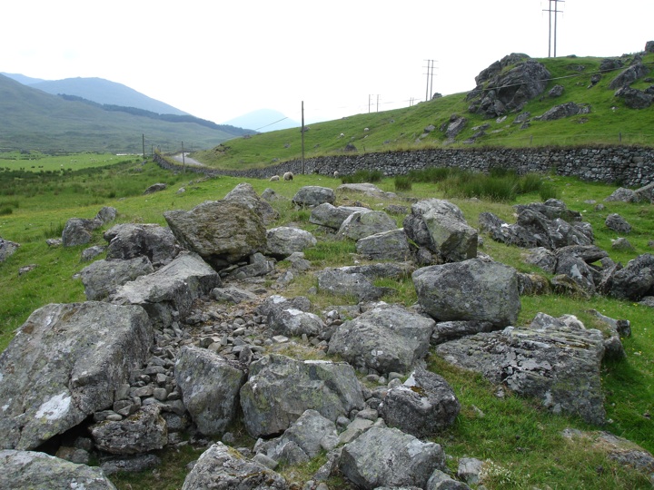
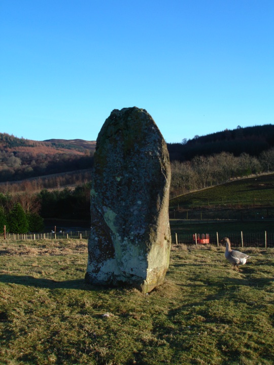
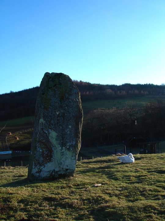
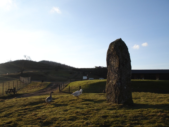
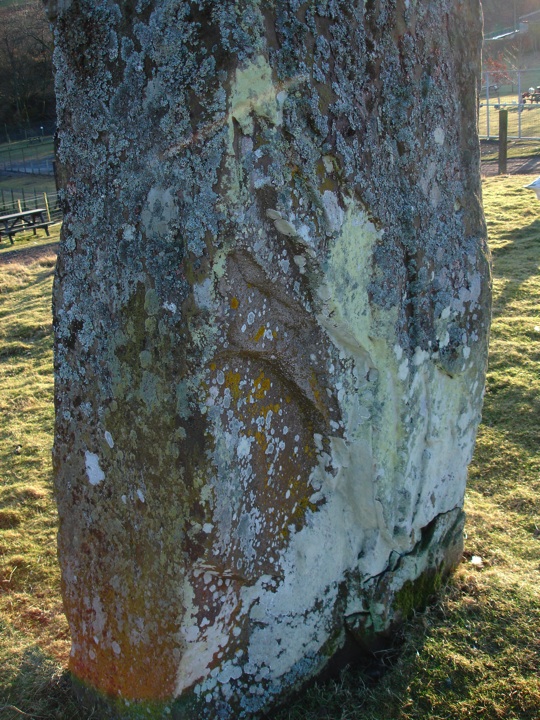
Close by our picnic spot is the enigmatic Cona Bhacain, a curiously-shaped standing stone with various legends associated with it. Near to this stone is another interesting site, the Caisteal Cona Bhacain, a kind of fort unique to the Glen Lyon area.
And that was our day done. But as we passed Cashlie on our way back to Moth and Jane's car at Fowlis Wester, we spotted a herd of deer grazing.

adapted from the original blog here
|
The stones on Hill of Drimmie
I didn't get into the hills last weekend - a combination of bad weather and a busy week of work made it a struggle to summon up the energy - breaking a New Year's resolution, so this weekend I was determined to get out. Waking up this morning to the sound of rain splashing off the windowsill, I nevertheless got up, got ready, and left the flat heading north for Blairgowrie.
I parked in the water-logged car park of an old mill on the north edge of the town, put on my boots and started off up the Hill of Drimmie. I was just walking on the road, which was very quiet. The rain had stopped but it was still overcast and there was a nip in the air as I got higher up. I paused to take a photo of the view down to Blairgowrie.

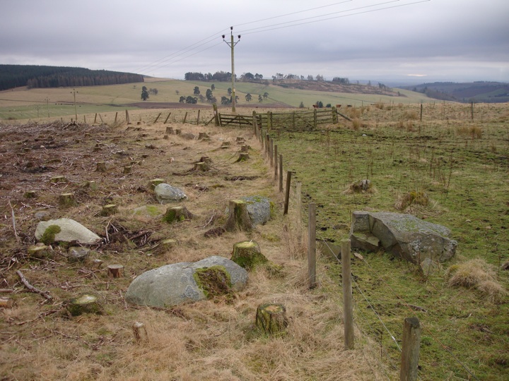
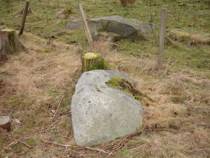
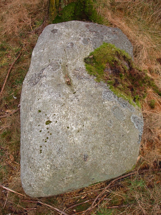
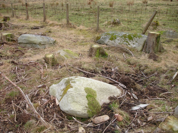
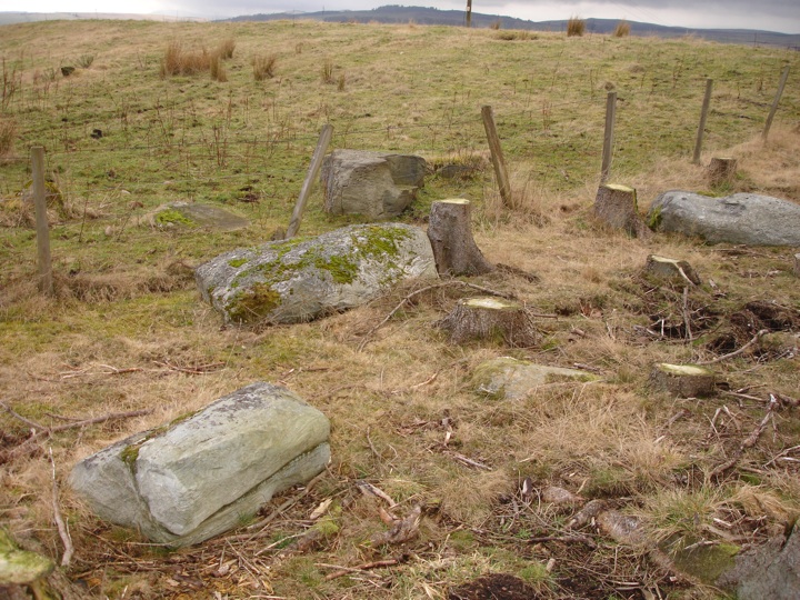
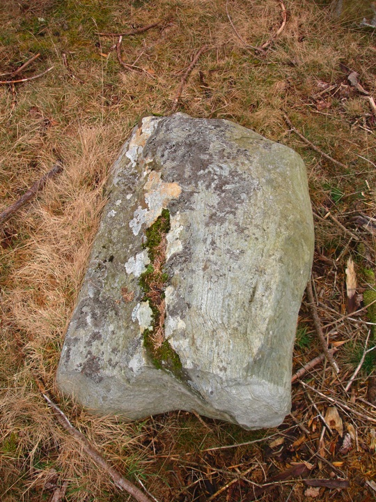
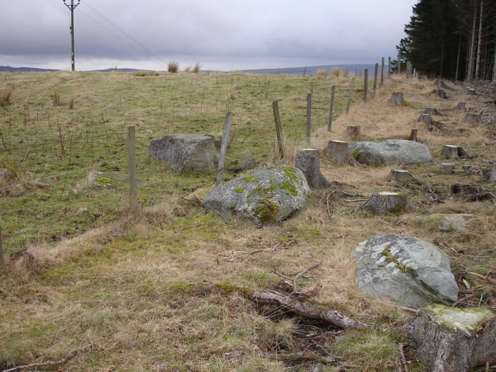
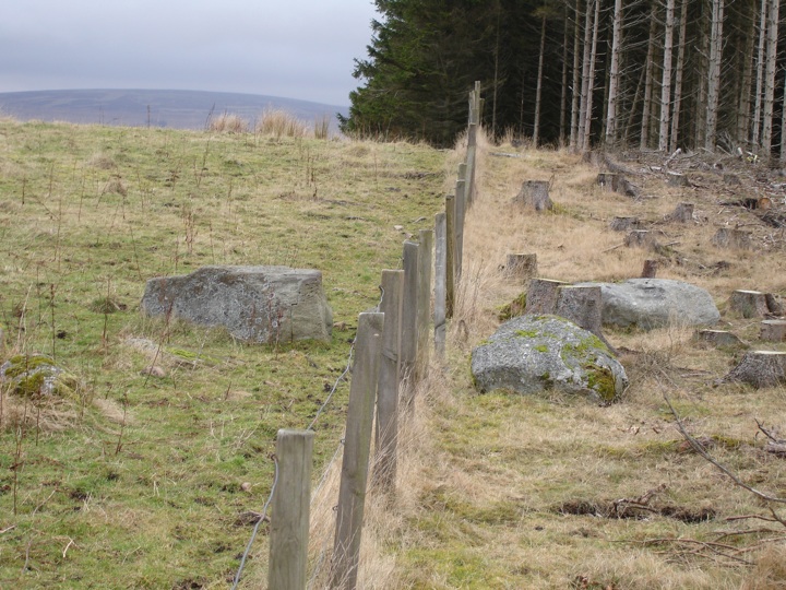
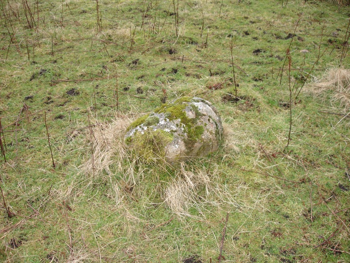
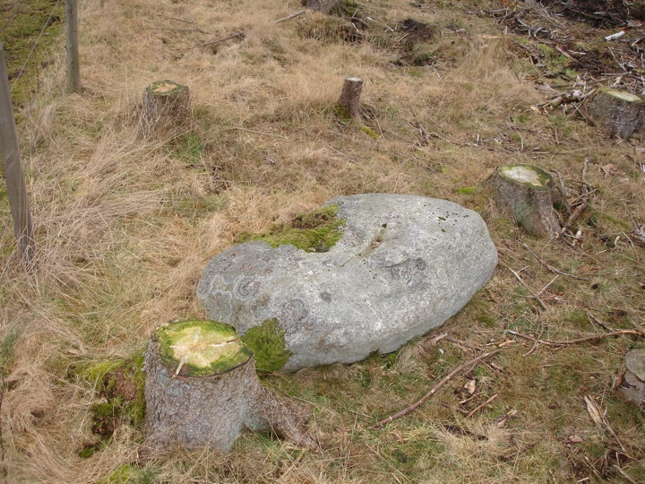
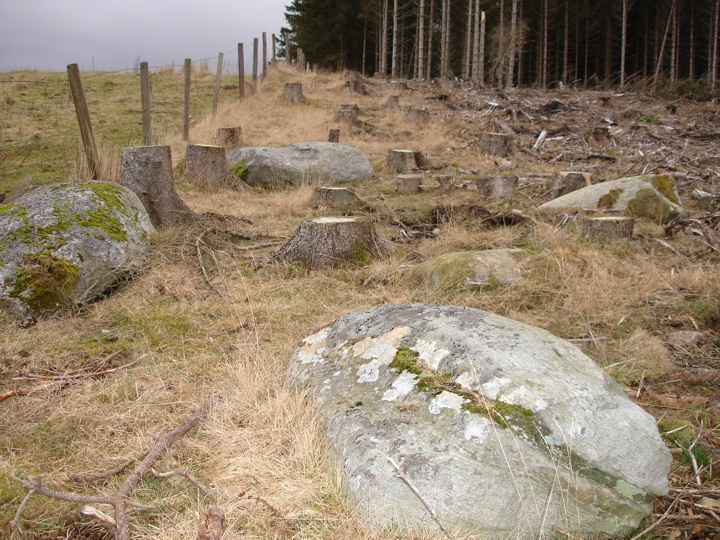
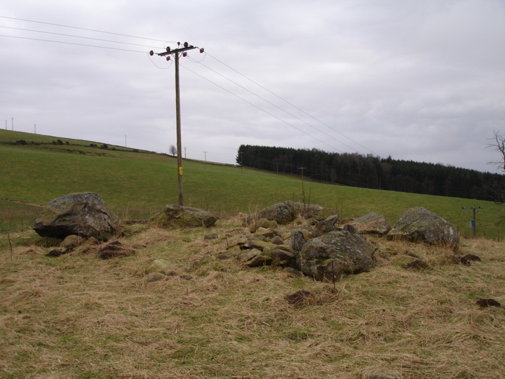
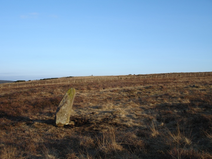
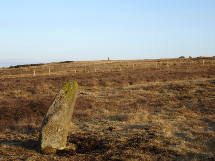
I soon reached the Craighall standing stone and Craighall stone circle but decided to carry on up the hill to the Woodside stone circle since it would be a better place to stop for lunch. Woodside is a perfect description, since the circle is situated on the very edge of Drimmie Woods, bisected by a fence between a cattle field and the forest. The trees around one half of the circle have recently been cut down.
I had my lunch here sitting on a tree stump between the stones, being watched all the time by some inquisitive bullocks.

I then retraced my steps, through a cow field and back down onto the road. As I was walking down the road a car stopped beside me - a lost family looking for directions to a hotel. After about half an hour's walking I was back at the Craighall standing stone, and this time I went into the field for a closer look.
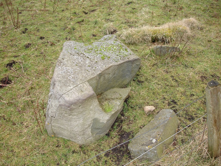
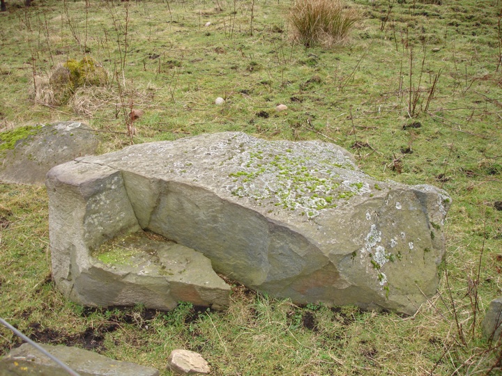
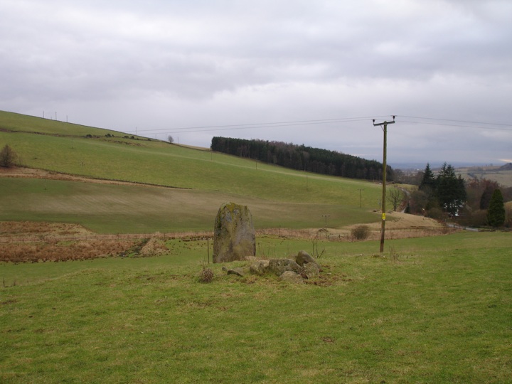
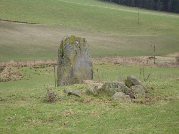
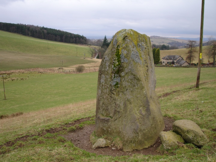
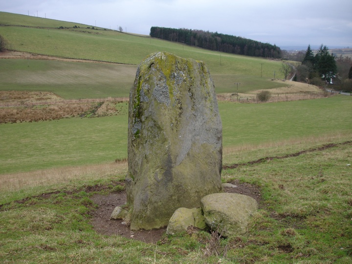
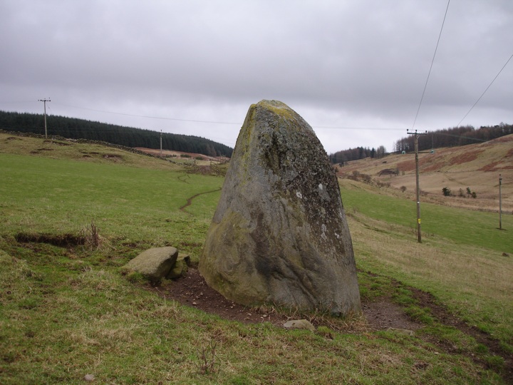
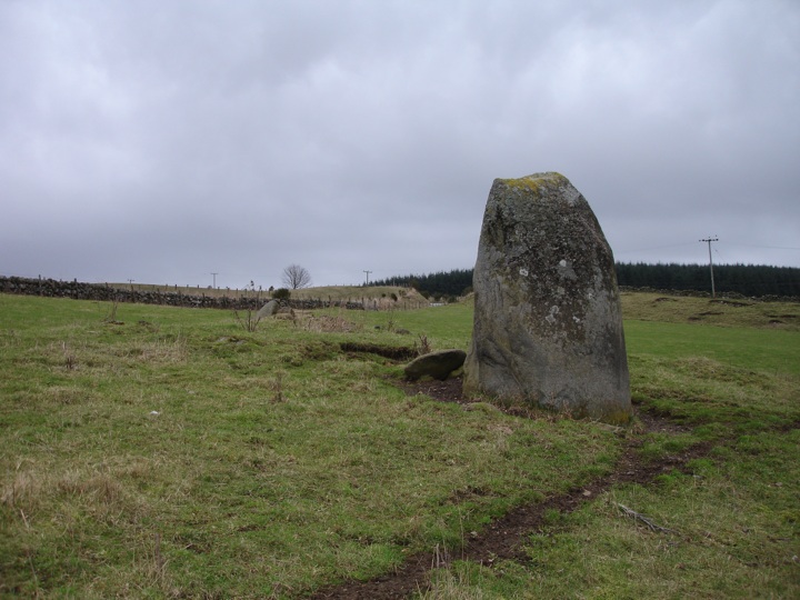
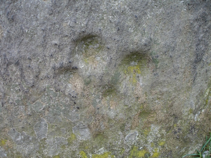
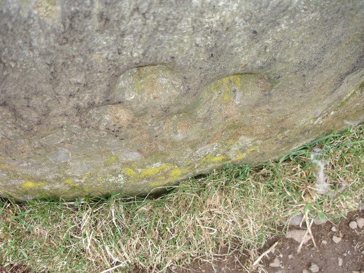
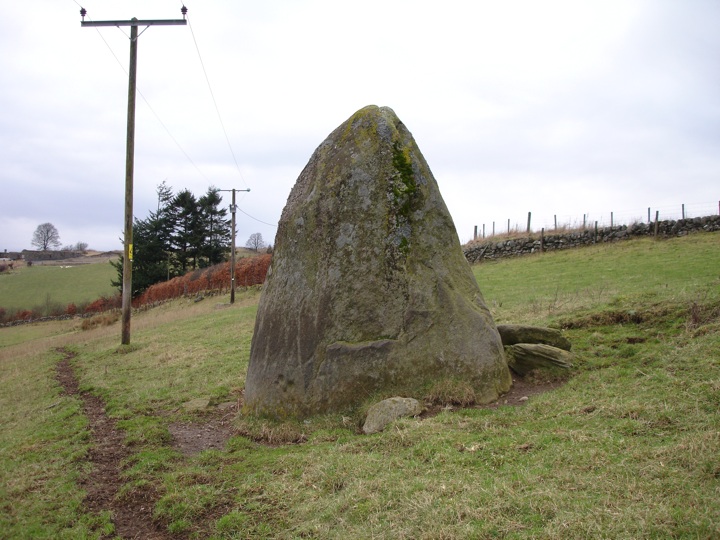
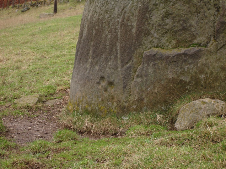
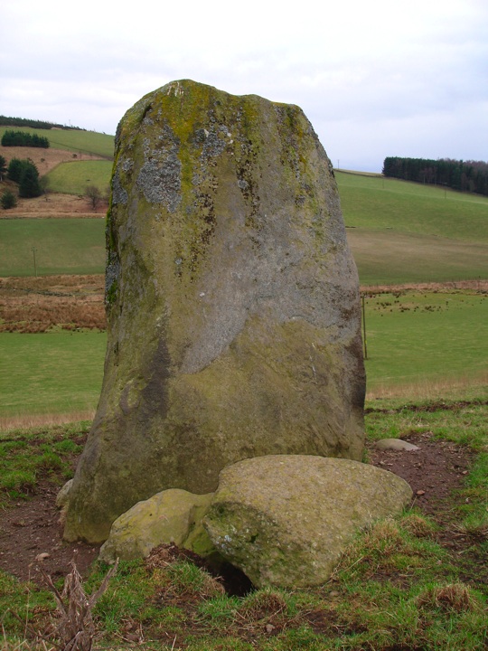
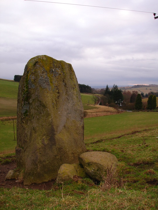
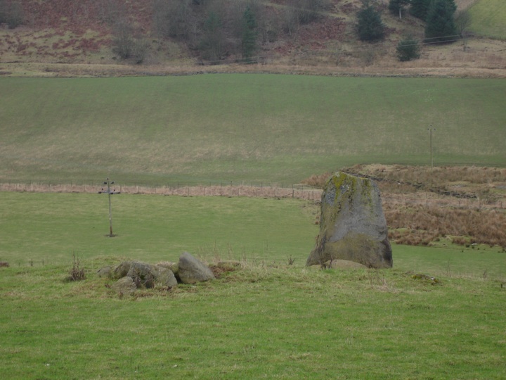
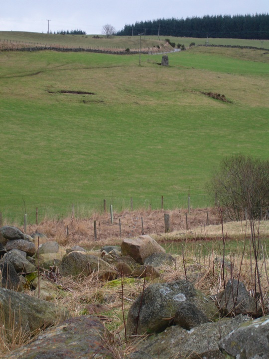
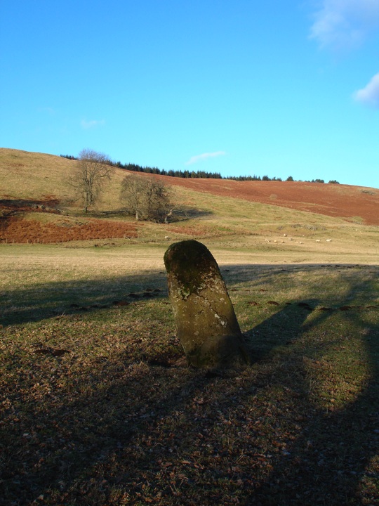
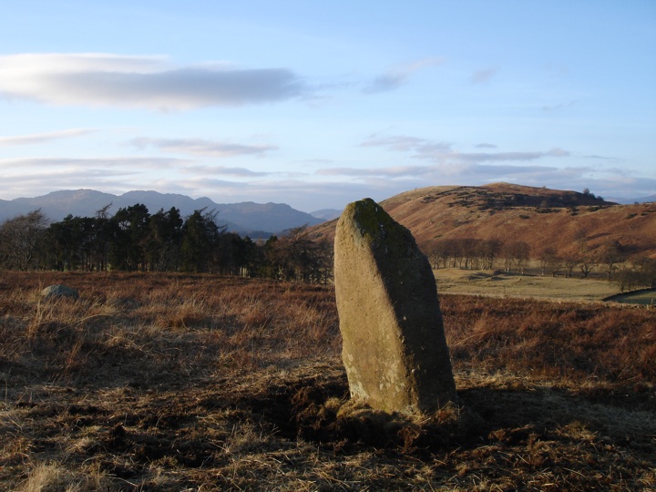
This massive stone stands some 2.5m tall, rising from a wide base to a point, with good views from its position on the edge of a valley to the lower ground below. At the base of the stone are four clear cupmarks.
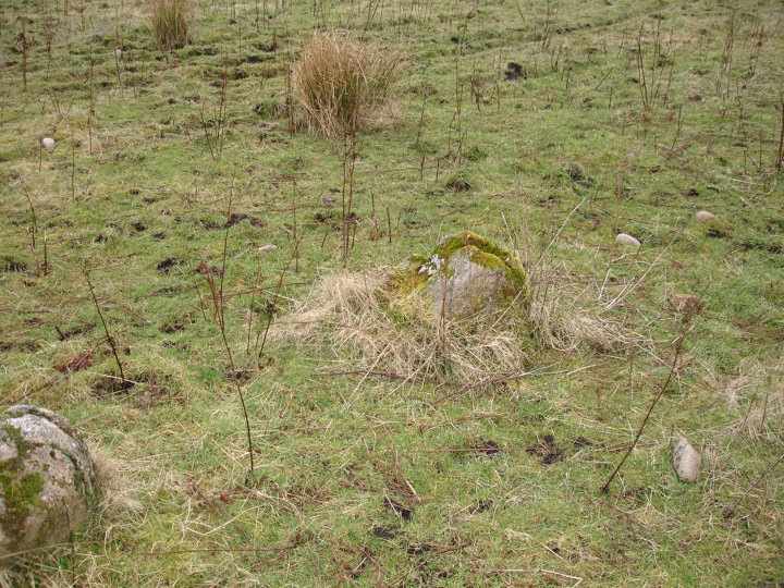
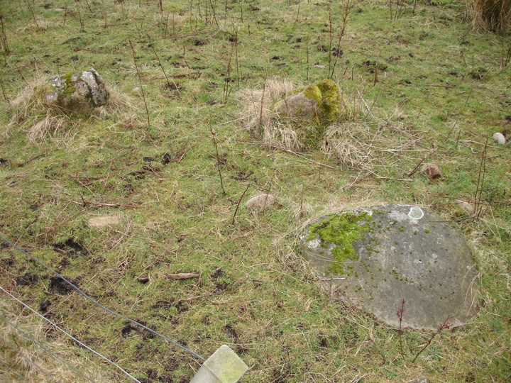
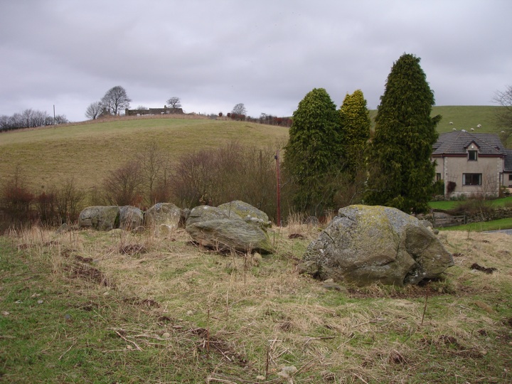
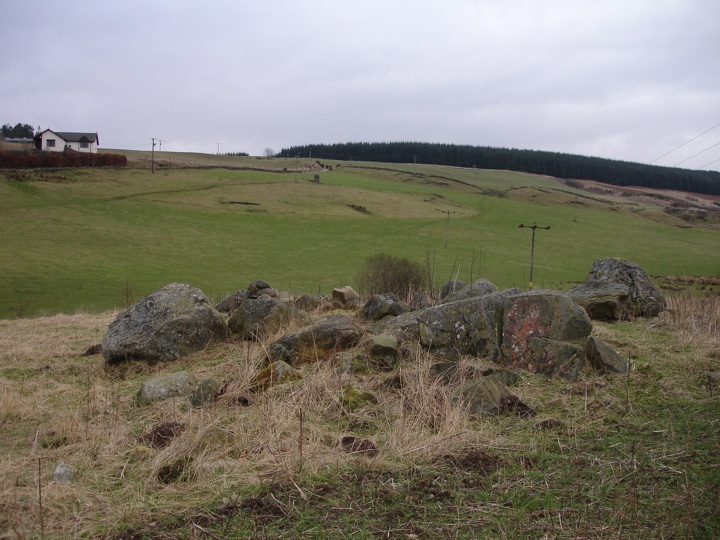
Just a short distance further down the hill are the remains of the Craighall four-poster stone circle, the stones lying on a raised mound at the edge of the field.
As I set off down the final part of the hill light rain started to fall, and with perfect timing as I took my boots off and got into the car, the heavens opened.
The full version of this weblog can be found here
|
ancient sites in glorious sunshine
The sun was burning bright in a brilliant blue sky as a I left Dundee this morning, heading west towards Loch Earn. The further west I went, the more glorious the weather got, the sun picking out the individual hills on the horizon. I parked the car in a layby beside the loch, just beyond the village of St Fillans, and walked back through the village to the footbridge over the River Earn.

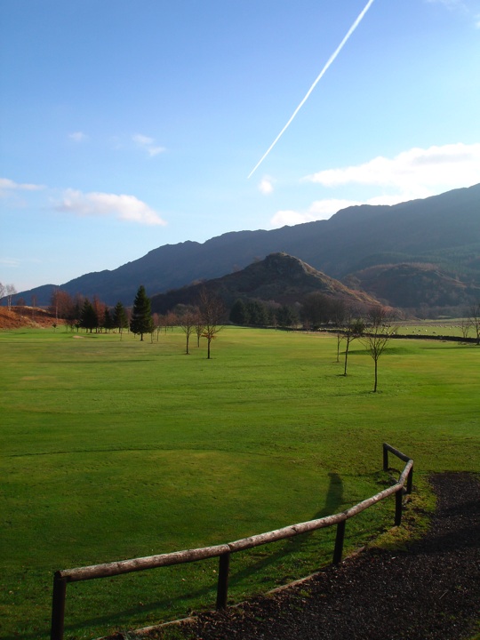
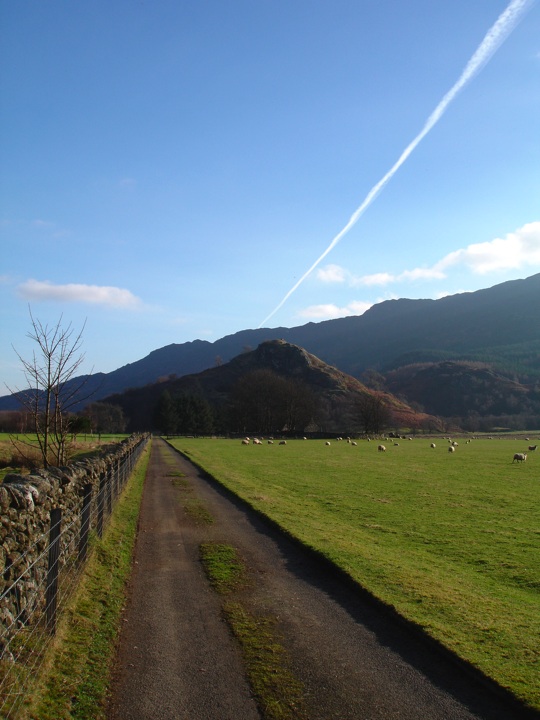
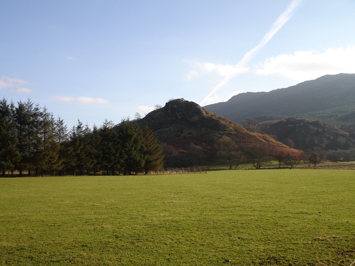
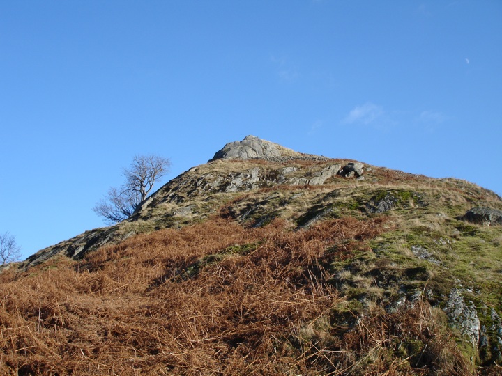
Over the footbridge I turned left and followed the path then the minor road along the edge of the river before turning onto the track that cuts across St Fillans golf course to Wester Dundurn. It was another Dundurn I was on my way to though, the fort on St Fillan's Hill, rising majestically above the golf course.
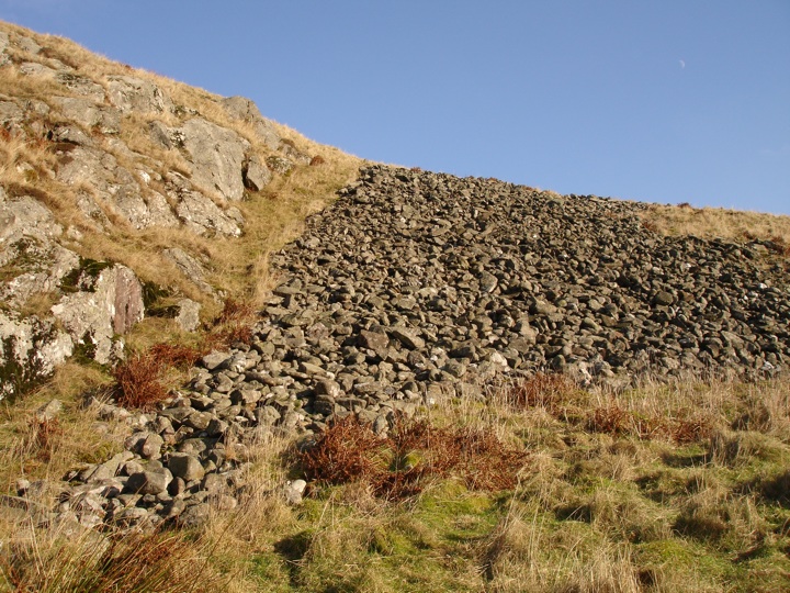
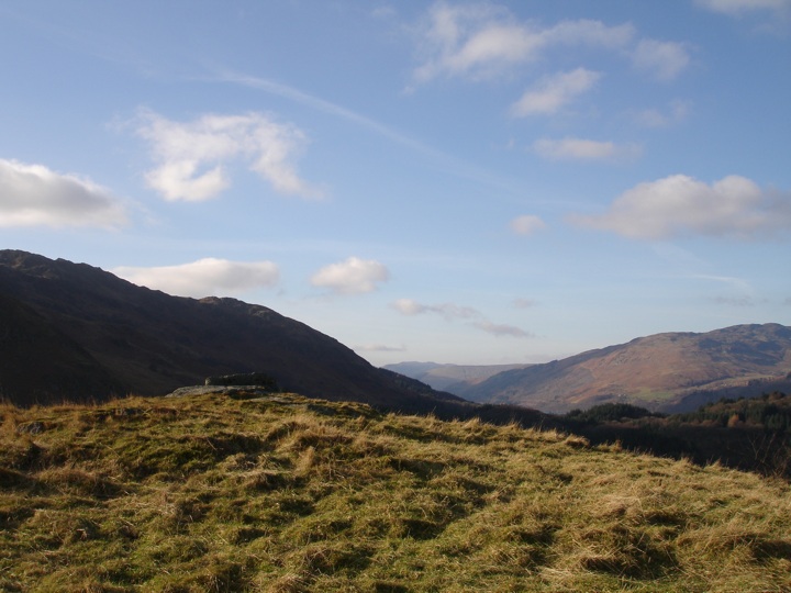
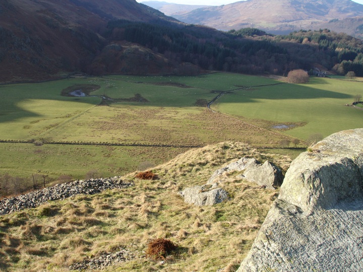
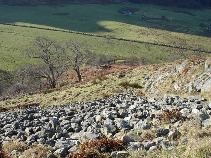
The fort is approached by way of a road to a sewage works, passing the ruins of St Fillan's Church. The road stops at the sewage works - thankfully there wasn't much of a smell - so then it was across a muddy field before fording a wide, shallow burn on the way to the base of the hill. A gate gives access through a fence around the hill, after which the climb starts. You can see why Dundurn was chosen as the site of a fort, as it rises steeply from the flat ground around it making it easy to defend. The slopes are littered with stones that are from the fort's walls, which have now tumbled from their original position on the flat summit.
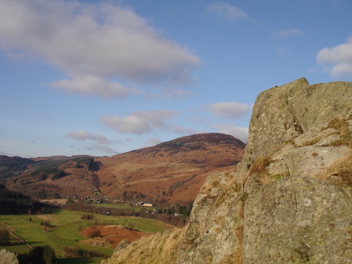
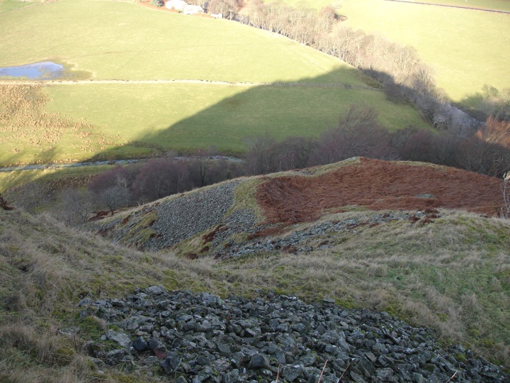
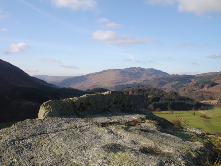
After scrambling up between these stones and the volcanic rock that formed this naturally-defendable position I reached the wide flat summit, which struck me as being much larger than I imagined after viewing Dundurn from the road. The views from the top are absolutely breathtaking, and provide great views over three major mountain passes, showing how strategically-important the fort was.

I stopped up here for my lunch, sitting on the rocky outcrop at the west end, legs dangling, enjoying the view towards Loch Earn, the only noise being babbling of the River Earn far below. The only noise that is until some goats appeared on the lower terrace. After spending half an hour at the top of Dundurn I began the scramble back down the slopes, and retraced my steps back to the car.
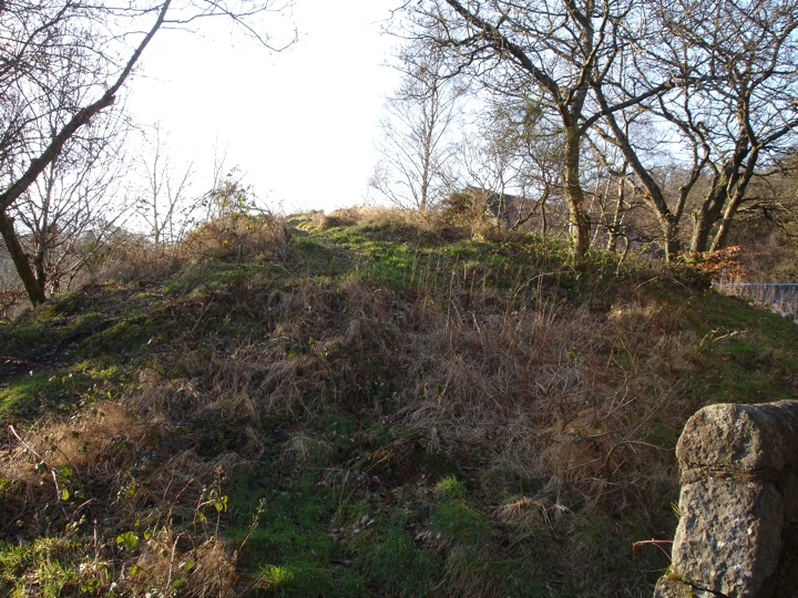
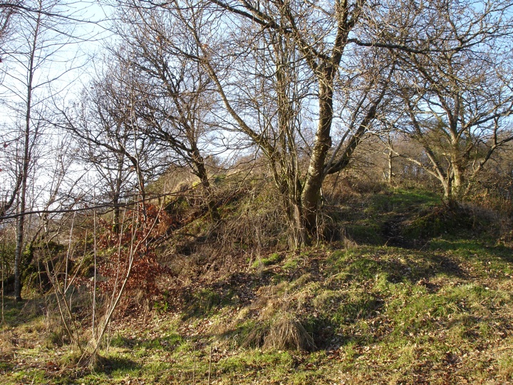
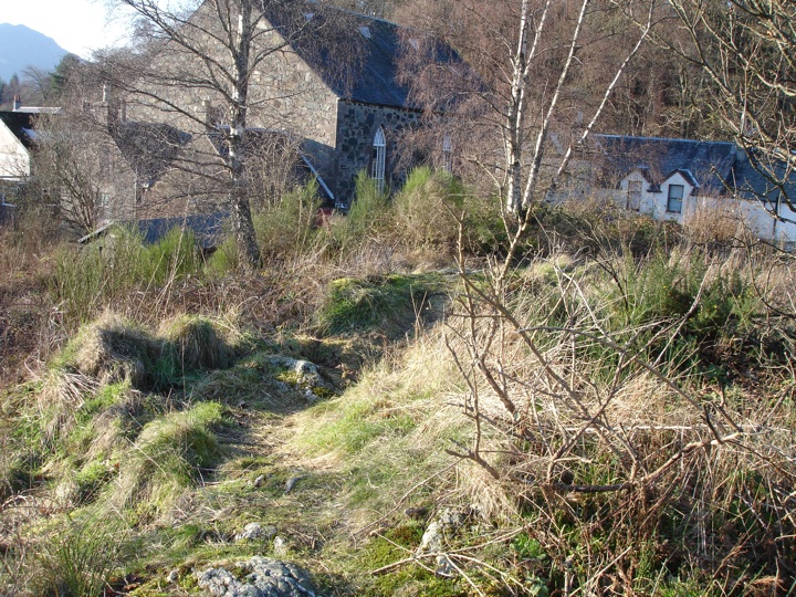
I drove the short distance to Comrie and parked by the school, then walked round the corner to the United Free Church. Behind the church is a mound called Tom na Chessaig (the hill of Kessog) which is supposed to have been the site of a stone circle. It's not much to look at now, overgrown and hemmed in by the church and houses, but originally it would have been in a stunning location, close to the banks of the River Earn with views up and down Strathearn.
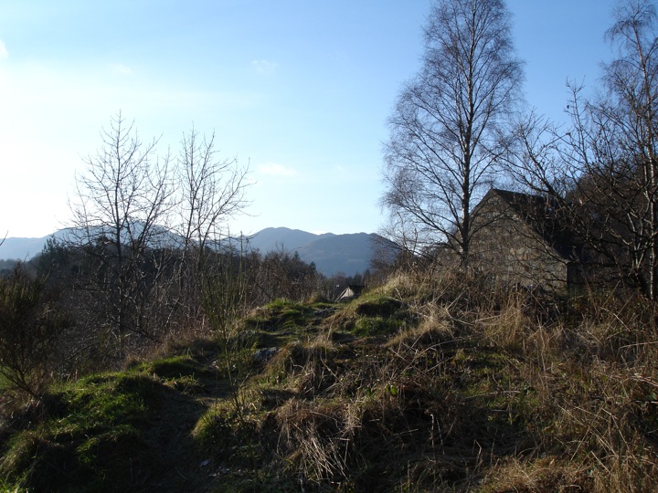
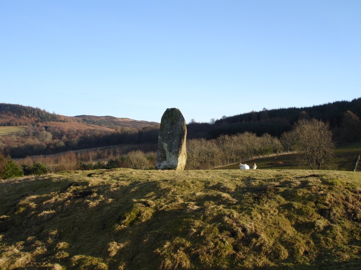
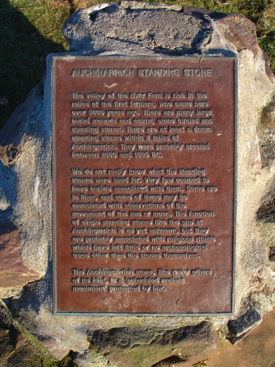
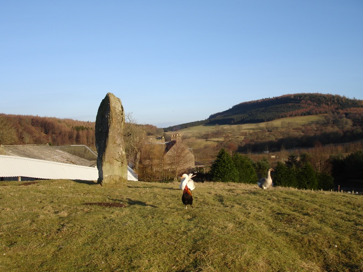
Then it was back to the car again, this time heading south over the River Earn and past the West Cowden Farm standing stone to the Auchingarrich Wildlife Centre. The rough track up was frozen and unforgiving, but it's well worth the effort, because at the top - as well as all kinds of animals - is the large Auchingarrich standing stone.

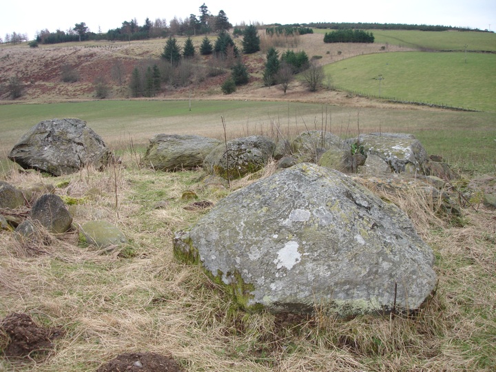
Back in the car I continued on the short distance to Craigneich Farm where there is a complex of fantastic ancient monuments. I parked carefully at the entrance to a field, making sure I didn't block it, but as it happened the farmer's wife came past on a quad bike driven by her grandson and said to park in the farm drive to be safe since they were about to take some hay bales in to the cows in that field. So I moved the car 100m and walked back to the first in this series of stones.
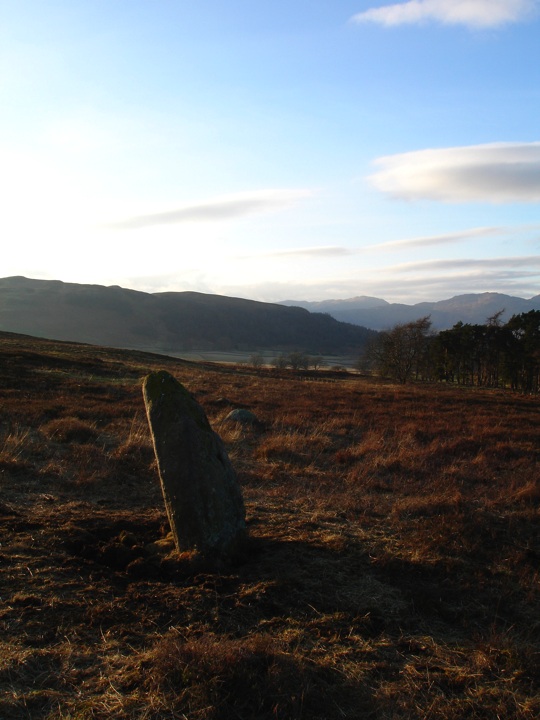
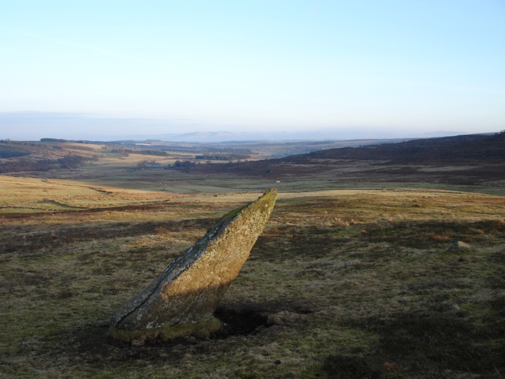
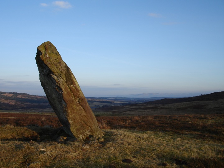
I set off up the track and through a large thicket of gorse, and emerged on the edge of a moor with a one standing stone visible in front of me, and another off to my left. I decided to keep heading up as I knew there were several others further on, and would come back to the outlier on the way back down. After a few hundred more metres traipsing through the heather, I came to another stone, Dunruchan C, a massive stone leaning at a sharp angle.
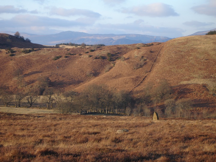
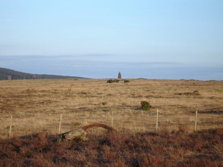
I could see the next stone, Dunruchan D, over the crest of another ridge. It turned out to be another large stone, again leaning at an angle. It's near neighbour, Dunruchan E, was smaller and more rounded. I made my way back down to Dunruchan C and cut across into the next field to go and see the outlier, Dunruchan A. It can be quite difficult to judge the height of stones from a distance with nothing much to compare them to, and this was proved to be spectacularly true the closer I got. This stone is absolutely huge, measuring 3.45m in height.
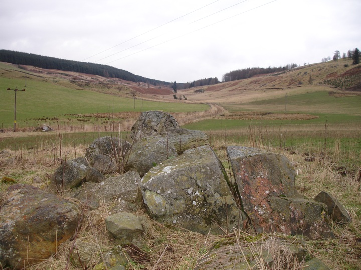
The views from up on the moor were fantastic, and as the sun started to go down behind the hills around Glen Artney it bathed the whole area in a soft light.

With the light fading, I made my way back down off the moor, past the cows that were busy eating, to the car, and drove home with a fiery sky in my mirrors.
|
Mr & Mrs Goff's anniversary tour - day 2
29th September 2005
As with yesterday I arrived at the Moulin Hotel at 10am to pick up Goff and Hazel, but today we had an altogether more physically-challenging itinerary! I'll talk about Schiehallion to anyone who'll listen, so Goff and Hazel had heard plenty about this magical mountain and decided they wanted to have a go at climbing it. But not before seeing a few ground-level sights first.
We drove down into Pitlochry then north on the route of General Wade's military road to Killiecrankie where there's a standing stone known as Claverhouse's Stone. This prehistoric stone is where Claverhouse is said to have died, having retired here shot from the nearby Battle of Killiecrankie.

Continuing on, we drove under the A9 and through the picturesque village of Blair Atholl, passing the magnificent Blair Castle on our way to House of Bruar. House of Bruar is a collection of upmarket shops sitting at the edge of a wood just off the A9, and while the clothes sold their might not be to everyone's taste, there's no denying that the food on offer is a fantastic advert for Scotland's produce. As if to emphasise the quality of the food, when Goff spotted a familiar face we realised it was Camilla Parker-Bowles, who we overhead saying she "must buy some sprats for her husband"!
Continuing on the theme from yesterday, Goff umm'd and ahh'd over what culinary delights to purchase. After the difficult decisions had been made, we bought some sandwiches and took all the shopping back to the car before heading up behind the House of Bruar on foot. The Falls of Bruar are a series of spectacular waterfalls, best seen after heavy rain. We were lucky with the weather today, it was nice and dry, but yesterday's rain only served to make the falls even more impressive than usual.


High up above the House of Bruar a bridge crosses the burn, where Goff obligingly posed for the camera.


The return path comes back down the other side of the burn, and looking back up the hill gives a great view of the bridge spanning the falls.

Further down is another smaller bridge.

The walk had served well as a warm-up for Schiehallion, so back at the car we set off in that direction, stopping off briefly just outside House of Bruar to see the big lump of rock that is Clach na h-Iobairt standing stone.

Then it was back under the A9, through Calvine and down Glen Errochty to Trinafour, turning south-east for the long, straight descent to Tummel Bridge (again on the route of General Wade's military road) to cross the River Tummel before climbing back up the other side of Strathtummel to the car park for Schiehallion at Braes of Foss.
On the approach path to Schiehallion is the Braes of Foss cup-marked boulder, which today had it's numerous cups picked out beautifully by the sun.

Soon after this rock the path starts to get steeper and the breathing starts to get heavier as you climb up the eastern slope of the mountain. The summit was disappearing and appearing as the clouds moved in the wind, so I wasn't sure whether or not we'd get a view from the top, but a view is only the cherry on the top of climbing a mountain anyway. After getting on for a couple of hours' walking and several stops to catch the breath and drink in the views across Perthshire, we reached the summit, enshrouded in cloud. As we looked for some comfy rocks to have our sandwiches on, the cloud lifted and revealed to us a magnificent view back towards Loch Tummel.

Taking advantage of the break in the clouds, Goff and Hazel posed for a photo.

It wasn't long before the cloud came in again, so we moved off the summit to a slightly more sheltered spot to have our sandwiches from House of Bruar before starting the long descent back to the car, which of course was much easier than the climb up the way. By the time we reached the car the sun had started to go down, so we made a mad dash along to Kinloch Rannoch in an attempt to get a photo of the sun setting over the loch, but the clouds were obscuring it so we drove around the loch to the Macdonald Loch Rannoch resort to take a photo of Schiehallion from looking towards its iconic western end.

It was getting late by now and I had to be up early-ish for a work trip to Norway tomorrow, so we headed along Strathtummel in the dark on our way back to the Moulin Hotel, where we said our goodbyes - same again next year Goff?
|
Mr & Mrs Goff's anniversary tour - day 1
28th September 2005
Last year Goff and Hazel stopped in Perthshire on the way back from Orkney and I gave them a tour. I must have done something right, because this year they wanted a 2 day tour!
As with last year I met them at the Moulin Hotel where they were staying at 10am, but this year I was doing the driving so that Goff and Hazel could see as much as possible. Goff had said that Hazel was keen to go back to see the Fowlis Wester cross slab, since last year by the time we got to the church it was locked and we had to make do with the replica, so our journey began with us shooting down the A9.
To make this first leg a little more interesting, I turned off at the Ballinluig junction and headed out west to Aberfeldy then south through Glen Cochill and the Sma' Glen. They'd seen these incredibly picturesque glens last year but were happy to see them again. After climbing out of the Sma' Glen we dropped down onto the main Perth to Crieff road, and turned left then left again at the New Fowlis cairn. I pointed out the standing stone on it, but we didn't stop - we had bigger stones to see!
We drove past the replica cross and parked behind the church, then walked along the track towards Thorn farm, hopping over the fence into the last field before the farm. Above us, at the top of the hill, we could see the Crofthead Farm standing stones.

But before we got to them there was the small matter of the massive Thorn cup-marked boulder.

We spent a bit of time here finding the cup-marks, looking at the view across to the Ochils and generally marvelling at how enormous this stone must once have been, before a short walk up the hill to the Crofthead Farm stones.

Then it was back down to the village and into the church so that Hazel (and Goff) could see the original cross-slab.

There's also a second cross-slab in the church, which was found built into the wall when the church was being renovated.

Our next stop was less megalithic and more retail, although in a speciality kind of way. Back in the car we headed for Crieff. I knew Goff had a sweet tooth and liked his food, so I took them to J L Gill's traditional Scottish grocers where he spent a long time selecting lots and lots of ales, then umm'd and ahh'd on the wisdom of buying cheese with no fridge. Bags clinking, we moved along the High Street to Gordon & Durward's traditional Scottish sweet shop, where Goff was like, well, a kid in a sweet shop!
Just as we got back to the car it started to rain, and by the time we got to the Famous Grouse Experience it was tipping it down. I had planned on lunch here, but the rain had seemingly only increased the number of pensioners in the distillery's restaurant so we decided to press on for St Fillans.
On the way towards Comrie we passed the Lawers standing stone but the rain was so heavy by now that we didn't stop. When we got to Comrie the rain was easing off so we headed to the edge of the village to see Dalginross stone circle.

I had thought of taking Goff and Hazel to the Roman Stone and Auchingarrich standing stone but the rain had started falling heavily again, so instead we drove to the Roman Stone, turned around then continued on for St Fillans. We had one more stop to make on the way though, again more retail than megalithic so the rain wasn't an issue.
Dalchonzie fruit farm sells delicious fresh fruit in the summer, but beyond the end of the season we were here for what they make with that fruit. They stock an amazing range of jams, sauces and pickles, all made with fresh produce from the farm, and the aroma as you walk into the shop is fantastic, smells wafting through from the kitchen behind. Once again Goff's face lit up, and it was a real struggle for him not to buy one of everything in the shop.
Just before St Fillans is the ancient Pictish stronghold of Dundurn. Again my plan was scuppered by the rain. I'd planned on taking them on the short walk to the summit, but the rain was really lashing down now, so the consensus was to just go for lunch in St Fillans.
We stopped at the Drummond Hotel for toasted sandwiches and chips, and sat looking out towards Loch Earn as the rain came past horizontally. Eventually we mustered the energy to head back out into the wind and rain, and continued driving along the edge of the loch to Lochearnhead, turning north en route for Killin where the next thing on the list would only be enhanced by the rain.
The Falls of Dochart in summer is a very picturesque place, perfect for picnics on the rocks beside the river. But in autumn, winter and spring, particularly after rain or snow, the water rages down spectacularly over these rocks and under the narrow bridge.

After spending a bit of time marvelling at the power of the water and noise it was creating, we went back to the car and drove over the bridge and up to Loch Tay. Driving along the north shore, I slowed down so they could see Machuim stone circle, but once again the rain robbed us of any inclination to stop and get out of the car. We followed the loch as far as Fearnan where we turned north towards Fortingall, passing the Bridge of Lyon standing stones and >General's Grave - again, not stopping because of the rain. I was also conscious of the time and wanted them to see Glen Lyon in the best light possible.
A few miles into the glen I stopped the car and took them down to the river. For the second time today the rain had improved a view, this times towards the Roman Bridge (which isn't actually Roman at all).

We continued on along the glen, the rain coming and going. A few miles after Invervar we rounded a corner and saw St Adamnan's Cross, a standing stone that was carved with a Christian cross on either side, supposedly by Adamnan himself.

I had wondered about maybe stopping at Bridge of Balgie post office where you can have something to drink and a slice of cake sitting out looking over the River Lyon, but in today's weather I don't think it would have been a popular decision, so we carried on driving down the glen. Glen Lyon is the longest glen in Scotland, and is also one of the most spectacular. Because it's a dead end, not many tourists go all the way to the end, so even in summer it's quiet. The narrow road twists it's way through a steep-sided valley, the landscape changing every mile to make a visual treat.
Towards the end of the glen is the Stronuich Resevoir and Loch Lyon, their waters artificially high due to hydro-electric dams. There's a footbridge across the river at the Stronuich Resevoir, which is a great place to take a photo of the river winding it's way east.

The bridge is quite rickety, so we gave Hazel a fright by jumping up and down on it!

The road ends suddenly at Loch Lyon with no space for turning. The grass on either side of the road had been turned into a quagmire by the heavy rain so the chance of getting stuck looked quite high, until Hazel very sensibly suggested opening the gate and turning in the dam's car park!
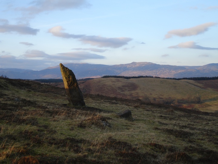
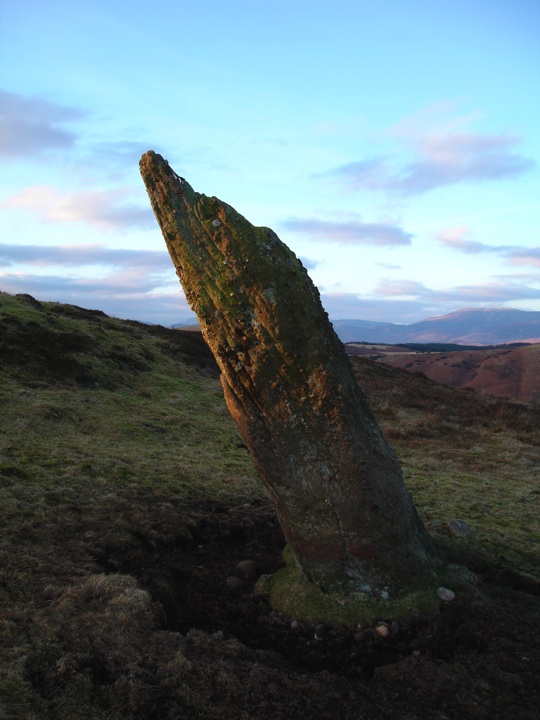
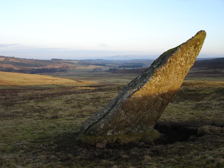
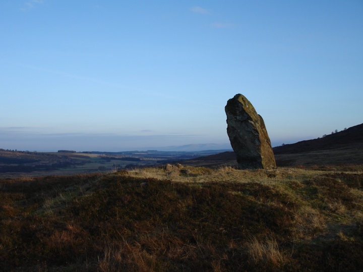
Having escaped a muddy embarrassment, we started heading back along the glen, but this time stopped just before the farm of Cashlie. Cashlie has obviously been inhabited for thousands of years - as well as the present farm there is the Cona Bhacain standing stone and a homestead. The Cona Bhacain is a strange-shaped stone looking quite like a dog's head and neck sticking out of the ground.

There are two legends attached to this stone. One is that this was the stone used by Fingal to tether his hound Bran. There are several large homesteads or circular forts in Glen Lyon which have been attributed to (in legend) Fingalian warriors living in the glen. The other is that local girls used to crawl under the protruding part of the stone as a form of contraception.
After a short dry spell, the rain swept in again so we jumped in the car and continued back along the glen. We crossed the river at Bridge of Balgie and started to climb steeply, the Allt Bail a' Mhuillin churning it's way down beside the road. When we reached Lochan na Lairige (the loch of the pass) there was no view to be had due to the heavy rain, so we carried on as the road twisted its way down to the north shore of Loch Tay. This was the second time we'd been here today, but instead of turning off at Fearnan we followed the road all the way to Kenmore at the head of the loch, where we stopped to take a photo as the sun started to set.

Just outside Kenmore is Taymouth Castle, once the seat of the Campbells but now undergoing redevelopment as a hotel.

Beside the gatehouse of Taymouth Castle are the Newhall Bridge standing stones, but with the light fading fast we settled for a look with no photos. Then it was back in the car for the drive back through Aberfeldy to the A9 and up to the Moulin Hotel where I'd leave Goff and Hazel before returning tomorrow.
|
Showing 1-5 of 14 posts. Most recent first | Next 5 |
Hi!
I'm a freelance eyewear designer in Edinburgh, exiled from my beloved Perthshire. I also run a website which includes a section on Scotland's many standing stones, stone circles and other old things:
Stravaiging around Scotland
Some things I like:
cake
ale
music
Perthshire
Moscow
You can read more of my ramblings here: http://www.stravaiging.com
|