Previous 5 Previous 5 | Showing 6-9 of 9 posts. Most recent first
Three stones and an Abbey
By way of a compromise we agreed to spend an afternoon visiting the ruins of Strata Florida Abbey near Pontrhydfendigaid, as well as a few nearby standing stones. We started with Penmaen-Gwyn, visited the Abbey, then drove south to Nant-y-Ffrwd and Nant-y-Maen.
Penmaen-Gwyn was good, if only because we got some peace and quiet there. I was a bit sceptical about the Abbey part of the excursion, but it turned out to be rather pleasant. There are a load of early Christian grave stones there, which kept me interested. Of the two standing stones we visited after that I was really taken with Nant-y-Maen. Then we grabbed something to eat in Tregaron at the Talbot Hotel, and headed home.
Kammer x
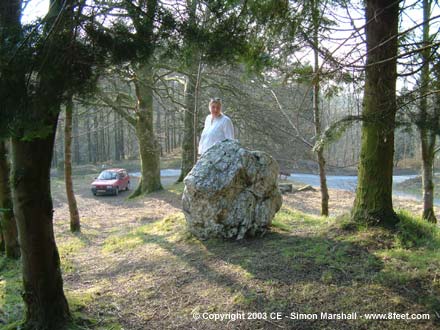
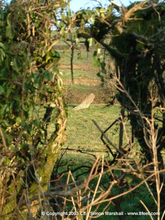
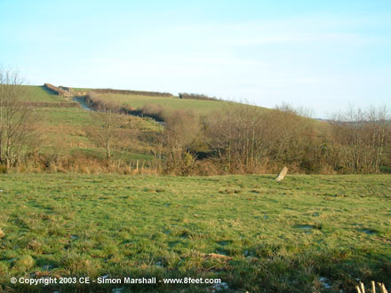
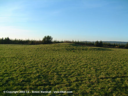
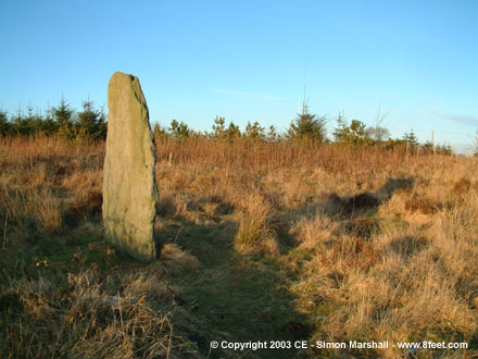
Visited 23rd March 2003: We visited Penmaen-Gwyn after spending an hour or so at Strata Florida Abbey just down the road. The stone stands on a small hill just north of the road (south of the forestry track, contrary to the impression given by Multimap).
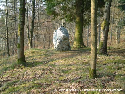
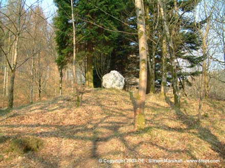
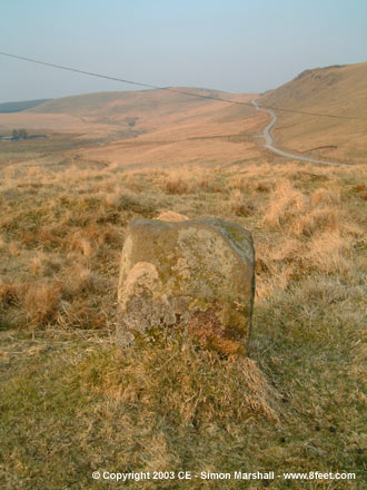
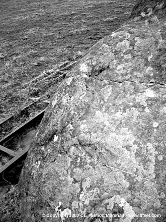
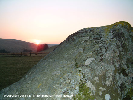
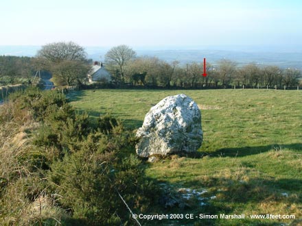
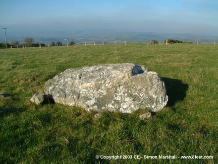
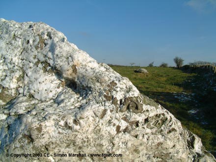
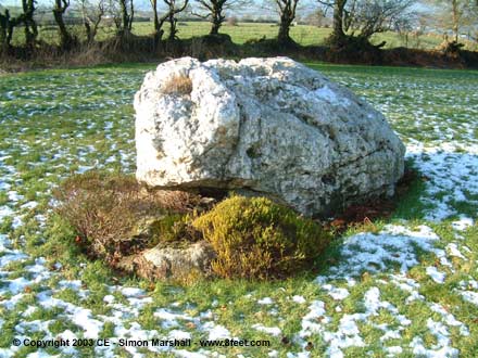
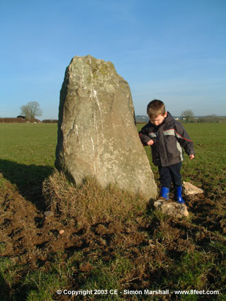
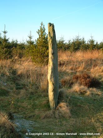
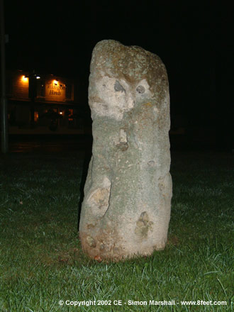
There's a picnic place nearby, but also ample parking at the bottom of the forestry track. The boys were asleep when we arrived, but the stone is so close to the road that there was no problem leaving them in the car. The sunlight through the trees was beautiful, and we took the opportunity enjoy the place in a strange child-free quiet. Very pleasant. Visited 23rd March 2003: This stone stands to the south of the mountain road between Tregaron and Beulah, and may not be prehistoric. The only reference I've yet found for it ( Cambria Archaeology) suggests it may be a post-Medieval milestone or standing stone. They list it without a name, so I've named it after the stream that runs nearby.
Having visited the stone, I'm not sure whether it's prehistoric or not. It looks to me like it's too far off from the road to be a milestone, but it could be a boundary marker (a small one at that though). Could it be a kerb stone from a cairn? Not the most awe inspiring site in itself, but enigmatic, and beautifully positioned.   |
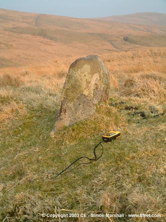
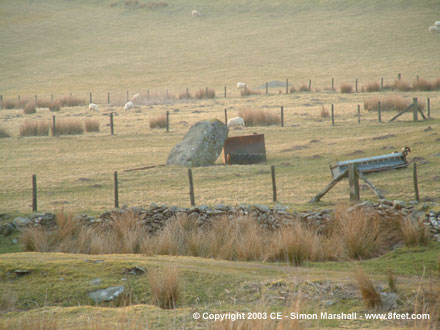
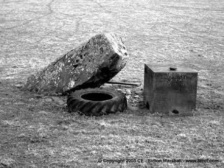
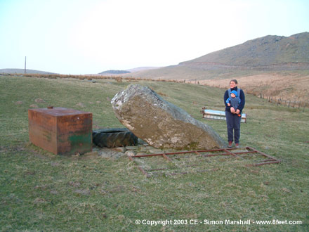
Visited 23rd March 2003: We drove up to the farm and asked permission to go and see the standing stone. The farmer was fine with this, and asked us to park in the yard. Here we were met by a big friendly horse who thought he was about to get his dinner (William loved that).
The stone is very near the farm, but approaching from the farm it's difficult to spot until you're almost next to it. I found this site rather charming because the stone itself leans at an extreme angle, and is surounded by farmyard tat (a tractor tyre, an old gate and a water tank). The objects around the stone probably protect it from livestock.
We spent a while at the stone, and came away with a a good feeling about it. Well worth a visit if you're in the area, but only if you don't mind standing stones that are barely standing.
|
Carmarthenshire Standing Stones
In January we spent a day (or the best part of it) visiting a small number of standing stones north of Carmarthen. I also detoured to see two round barrows, but I thought that would make the title of this web log a bit too long. It was beautiful and sunny, and I came away wanting more!
When it got dark we ended up in Carmarthen looking for somewhere to have a cup of tea, then some food. We wound up at theTescos Coffee Shop (not very swish) and the magnificant Morgans Fish Restaurant (home of fine fried produce).
Visited 11th January 2003: At Meini Gwyn are three quartz standing stones, two relatively close to each and one further off in the garden of a nearby cottage. Of the three stones, two are fallen, the third (in the middle) is probably in it's original position.
The two stones to the east are easy to see from the road (the fence is so poor that you could slip underneath it without any trouble...if you wanted to that is). To the east of the furthest stone are the (probable) remains of a cairn and a small tumulus, but you have to squint really hard to make them out.
The stone in the garden is only just visible from the road. I asked at the cottage to take a closer look, and the man who lives there was happy for me to go in and take a photo. He was keen that I shouldn't be in the garden at the same time as his dog, but I never saw the beast, so I can only guess at how big it was (6ft tall with fangs etc). The stone has been planted around, and made into rather a fetching garden feature.
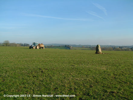
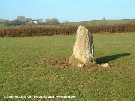
Thanks to Rhiannon for drawing this site to my attention in the first place. Visited 11th January 2003: There's no public footpath to Pentre Ynys, but you can see the stone from the road.
When we visited, the gate to the field it sits in was wide open and there were no crops or livestock to avoid, so we decided to take closer look. I parked in the gateway opposite, and we were just at the stone when the farmer turned up at the gateway in an enormous tractor. Our car was stopping him from turning into the field, so feeling embarrassed (for parking badly and for going into the field without permission) I pegged it back to move the car. As it turned out the farmer was fine about us looking at the stone, and was just keen to get on with his muck spreading.
The stone itself looks a bit lost in the middle of the field. The surrounding ground has been quite badly eroded by cattle, and the stone has bird shit all over it (excuse my French), so it lacks glamour.
There's another stone relatively nearby, but less accessible, called the Rhyd y Fwyalchen Stone ( SN42942412). This stands to the south, on the other side of Nant Felys (like Pentre Ynys it's marked on the Landranger). I'd imagine that the two stones are directly connected to each other and/or the river that runs between them. Visited 11th January 2003: Parc Garreg Lwyd is still standing, but only just. It leans alarmingly to the south. The stone is on private land with no public access across it, but you can get a good view of the stone from the road.
There's enough space to park a car adjacent to the stone, but there's a surprising amount of traffic running along here, so we didn't stop for long. Parc Garreg Lwyd is marked on the Landranger, so it's easy to find. Visited 11th January 2003: We were on our way to see Gareg Hir when we passed these two round barrows. As Alfie was demanding milk we stopped, and I decided to take a closer look. The barrows turned out to be bigger, and better defined than I'd expected. They're both ploughed down, and I'm no expert on these things, so I'm not sure what type they originally were.
Crugiau Fâch are the two most accessible barrows in a reasonably large group (large by Carmarthenshire standards that is). Most of the others are in the surrounding forestry.   |
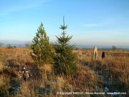
Visited 11th January: This was the last site we visited, and it was certainly the most beautiful. Access to Gareg Hir is very good, and you can see it from the road. The stone stands on the edge of a forestry plantation, and there's a public footpath running very close to it. We parked in front of the metal gate that bars access to the forestry track, but this wouldn't be ideal for a long visit.
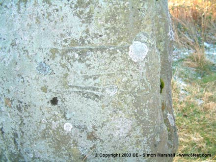
The stone has a lot of modern carving on it (modern as in not prehistoric). There are also some interesting artificial looking horizontal groves on the north facing side of the stone. These may also be modern.
This is a fine stone by any standards, and well worth a visit. |
Day out - Llynau Cregennen
This was a sort of birthday concession on Louise's part (it was my birthday the day before) so despite the fact that she had a lousy cold, we went up north for the day. Having two small kids makes the whole exercise of getting out the house a bit tricky, so by the time we got to our first site it was nearly lunch time.
What with it being a short winter day, we didn't get to see everything in the area, so I plan to go back and do a mopping up exercise some time next year. I reckon on a Summer day you could easily take in Bedd y Brenin and some of the other standing stones (not yet posted on the MA) around the lakes.
The following fieldnotes were posted up over a long period of time, so they're a bit of a jumble. Make of it what you will.
Kammer x
PS. We ended our day looking for refreshment, which we found not too far away at Llwyngwril Gallery.
Visited 24th November 2002: This is a really enigmatic site, in a beautiful location. There are ten stones remaining, and an identifiable hole where an eleventh once stood. Even though this site is now thought to be the remains of a ring cairn, it doesn't neatly fit the bill. Six of the stones form a semi circle (this is the bit that looks like a ring cairn), and three more stand in a row (like a tail to the ring) to the east. Slightly to the north of this tail is a big quartz boulder. All in all it ends up looking like a question mark in plan, which is very appropriate!
Apparently the farmer who owns the field has reported two or more fallen stones coming to light nearby in ploughing. Also worth looking out for (difficult to miss really) are the remains of a large cairn about 20 meters to the west of the Arthog stones.
I don't get the impression that many people visit the Arthog Standing Stones, which is a shame because they're rather splendid. I'd certainly recommend a detour if you're in the area.
Directions
The walk to the Arthog Standing Stones is pleasant, but a bit convoluted. From the road ( SH648138) head west through the white metal gate and along the track. Keep going to the point where a pretty little stone footbridge crosses the river. Cross here, and once over on the other side of the river keep heading east (diverging from the well trodden path to Pant-Phylip). Continue along the north bank of the river following a muddy rutted track. Where the track crosses back across the river at a ford, the footpath heads north through a gate (held shut with bailing twine). Go through this gate and follow the perimeter of the field north (this is pretty steep). The field perimeter curves around to the east (great views to the west), and if you keep going you'll arrive at the stones which are in the far corner of the field. Visited 24th November 2002: Waen Bant is easy to find, but if you want to park nearby you'll have to risk putting at least two wheels on the grass (something I thought twice about because I didn't fancy getting stuck).
There's no public footpath to Waen Bant, but it's not far from the road, and there are no fences between the road and the stone. We approached from the bottom of the field, and got a good view of the stone sitting on it's little lump of land in front of us as we walked.
The stone isn't as big as it looks in photos (I'm warning you now so that you don't expect something enormous). At a guess (based on William's height) I'd say it's about 1.75 metres high. There's a distinctive undercut on it's eastern side which is about half the stone's height in length. I'm not sure that this is artificial, but I'm certain it was significant to whoever erected the stone.
The views out towards Cadair Idris are spectacular, as are the views north towards the mountains on the other side of the Mawddach Estuary. The stone seems to be orientated towards Cadair Idris (specifically the peak called Craig-las). Apparently there's another standing stone to the south east of Waun Bant called the Afon Arthog Stone, but this isn't marked on the OS map, so in the failing light we decided not to try and find it. Visited 24th November 2002: We drove to Carreg y Big from Waen Bant, and spotted it from the gate (one of many that cross the roads around here). The stone is very close to the road, positioned at the bottom of a small elongated lump of hill on the south west shore of the southerly of the two lakes. The only nearby parking space has a sign next to it saying "Parking for Fishermen Only". We ignored this and parked.
Carreg y Big is just over two metres high (I'm basing this on the photo of Lou standing next to it), so definitely larger than Waen Bant. We both liked it more than Waun Bant, but not just because it's larger. The surrounding countryside is spectacular, and while we were there the sun made a last attempt at shining, so the whole scene was something special.
Next to Carreg y Big is a much smaller stone which I have yet to find any reference to. It reminded me of a little stone called Castell Coch near the Buwch a'r Llo standing stones in Ceredigion. I was tempted to name this little stone Carreg y Small, but that would be a horrible thing to do with the Welsh language. I'll have to come up with something better. Visited 24th November 2002: Bryn Seward was the penultimate site on our trip around the Llynau Cregennen area. We approached from the east, and I've never been on a more gated road in my life. With Alfie's baby seat in the front, I had no choice but to open and close all the gates myself (there were loads of them!). I managed to cut my hand on one of them, so beware sharp edges on the gates if you visit Bryn Seward.
The light was fading, so we passed through the forestry, leaving Bedd y Brenin for another day. As the forestry opens up, there's the first stone on the right hand side of the road (see photos 1 & 2). The views beyond towards the Mawddach Estuary and Abermaw (Barmouth) are amazing, with the Llyn Peninsular stretching off to the west. You can see why these stones and this sacred route run along this hillside.
The second stone is just before the gate after the forestry (you really can't miss it). This was my favourite, because it's really quite thin in cross section, but it's face is very triangular. Standing next to the stock fence it looks really darned good. There's a possible third 'fallen' stone just west of this on the other side of the fence, but I was so unimpressed by it that I didn't photograph it (I'm not convinced it's really part of the row).
Just beyond the thin triangular stone is the ambiguous half buried boulder. Since our visit I've read a Cadw description of the row, and apparently the stones used to be incorporated into a low dry stone wall. This wall has now collapsed and spread, which accounts for the debris along the side of the road, and the ambiguity of some of the stones.
After Bryn Seward it we headed off along more gated road, towards Waun Oer. Visited November 24th 2002: After Bryn Seward we headed off to find Waun Oer. The stones are easy to miss as you approach them because of a tall dry stone wall running between them and the road. Luckily we spotted one of the stones through a gateway. Even better there was no gate in the gateway, so apart from the mud there was nothing stopping me from strolling in to the field to take a closer look.
This row is much more complete than Bryn Seward, with five stones remaining, two of which are fallen. I must admit that I'm a bit confused looking back over my photos, because I can only see four stones in them. Perhaps one of them had wondered off!
The most distinctive stone is a big fallen one, with unusual elongated markings on it. There's a nearby boulder with similar markings, and this was cited in the Cadw records as evidence that both sets of markings are probably naturally formed. In the case of the stone in the row, the patterns may have been artificially enhanced. The fallen stone also has a cup mark on it near it's pointed end, a little over an inch in diameter. Unfortunately I only discovered this after my visit.
Interestingly, the Cadw surveyor drew comparisons between Waun Oer and the West Kennett Avenue (in his notes he put 'don't laugh' in brackets). In the same way that the Kennet stones are often identified as either male or female in shape, this chap reckoned that the Waun Oer stones also fall into two distinct types. I'll have to go back and check this out, as well as searching out the cup mark. |
Mad dash around Gloucestershire
Back on 4th August 2002 we decided to finish off our summer holiday in the south east of England by visiting some sites in Gloucestershire on the way home. We planned to get an early start, but it being a holiday, we didn't get up all that early. Then we hit a serious traffic jam on the M25 and ended up not leaving the M4 until lunch time.
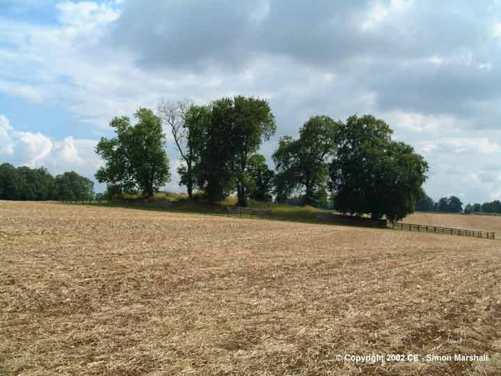
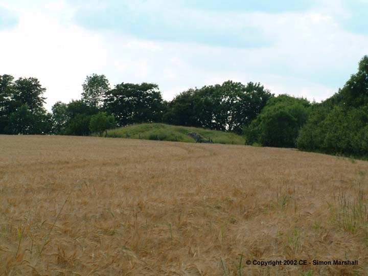
William was very hungry by the time we reached our first site, a long barrow called Windmill Tump near the village of Rodmarton. We had our picnic on top of the barrow just above the really obvious porthole entrance where the nice people from Gloucestershire County Council had cut the grass.
The second site we visited was the Longstone of Minchinhampton. This took us off the edge of the OS map, and onto a horrible road atlas. Louise did a fantastic job navigating, and we eventually found it. There was some sort of equine event going on opposite the stone, so we visited it under the gaze of a policeman who was directing traffic.
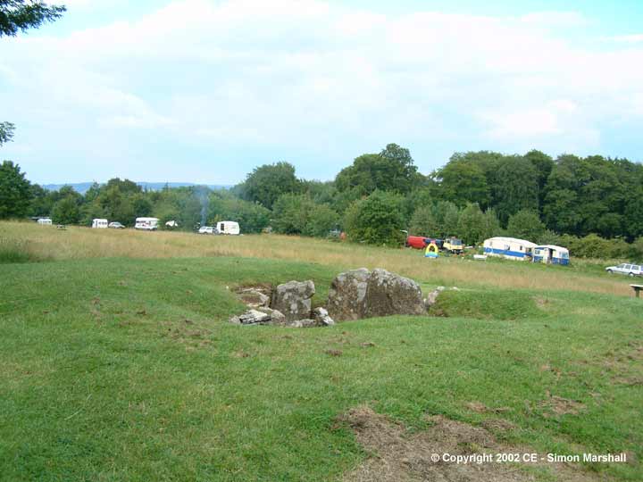
Site number three was Nympsfield Long Barrow which was a bit disappointing. We didn't stop there for long because there was practically no ambience at the site. There were lots of visitors and an ice-cream van in the car park, and a traveller's camp close to the barrow. It felt a bit crowded really.
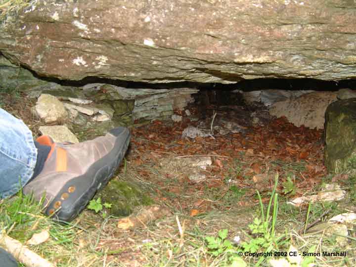
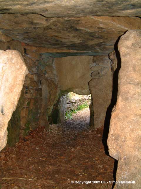
We knew we were about to see something better than the Nympsfield barrow, so we pelted down the B4066 to Hetty Pegler's Tump. I was a bit over excited by the time we'd parked up and walked to the barrow. It's got all the ambience that Nympsfield lacks, and best of all you can go inside! Luckily we'd got William's torch (from his Fireman's kit) with us, so we took this into the chamber. We ended up loaning it to a couple who arrived after us, and they were really grateful (even though it's a pretty poor excuse for a torch).
After that we decided we would have to use the motorway if we were going to make it up north before it got dark. We hopped onto the M5 and drove to Cheltenham where I reluctantly conceded we had to get some food. I'm afraid we resorted to eating at Burger King, and it wasn't a very pleasant experience. It served it's purpose though (just about) and we headed east towards Belas Knap with bellies full of (something resembling) food.
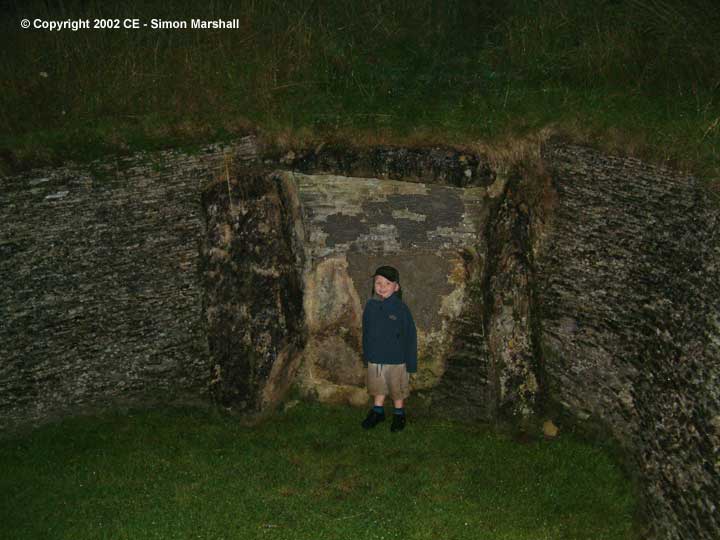
Belas Knap was a bit of a drive from Cheltenham, then a bit of a walk from the car (Lou was pregnant at the time). It poured with rain and the light was fading fast. We really enjoyed Belas Knap despite this, and I think we'd all like to go again when it's less wet and less dark!
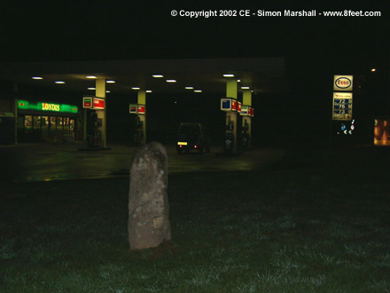
Our last site was on the way home from Belas Knap. The little Tibblestone sits just off a roundabout where the A46 meets the A435. It really was dark by this stage, and much later than we'd planned to be rounding off the tour. After that I had a three hour drive back to our house in Wales!
Kammer x
Here are the images for each of the sites I've described above. If you want to see the individual Fieldnotes that I posted for these sites, use the links in the text above and search them out:
|
Previous 5 | Showing 6-9 of 9 posts. Most recent first |
I live in a small Welsh seaside town on the west coast. As well as being well placed for visiting the local sites, it's relatively easy to get to sites in south Wales, north Wales and the borders.
If you'd like to use one of the photos I've posted on this site please contact the TMA Eds who'll pass the message on ([email protected]).
Some of my favourite prehistoric sites:
Avebury (England)
Calanais (Scotland)
Castlerigg (England)
Dolgamfa (Wales)
Gavrinis (France)
Kernic (France)
Pentre Ifan (Wales)
La Roche-aux-Fées (France)
Stones of Stennes (Scotland)
Wayland's Smithy (England)
Kammer x
|