If it wasn't for the entry in Aubrey Burl's "Megalithic Brittany", I'd probably have passed this by believing it to be a folly!
According to Burl, "It is a thin, grey pillar, striated by the weather. It stands at 2.3 metres high and has been incorporated into a memorial to the dead of the First World War".
Now - I've seen a few standing stones in churchyards, and a few christianised ones, but never, until now, one that's been turned into a war memorial!
It's a fine sight, though. Sort of jumps out at you as you round the corner. The later additions are quite odd. Really makes it look like the whole thing is a modern construct.
The war memorial, as far as I can tell, was built by René Quillivic. According to Wikipedia:
"After World War I he had the opportunity to pursue his art in the form of war memorials, in which he typically emphasised pacifist ideals. Most of these were located in Finistère (Carhaix, Coray, Fouesnant, Loudéac, Plouhinec, Plouyé, Plozévet, Pont-Croix, Pont-l'Abbé, and Saint-Pol-de-Leon)."
http://en.wikipedia.org/wiki/Ren%C3%A9_Quillivic
Slightly separate from the main memorial is another (modern) menhir, with the head of a woman and an inscription bearing names of the deceased.
At the other end of the churchyard is the "fontaine de Saint Théleau à Plozevet" - a delightful little holy well which I sadly didn't take any photos of!
Access:
About 21km on the D784 from Quimper towards Audierne, on the right hand side of the road, in the churchyard. there is a car park next to the church.
|
Tea-time over for Avebury clock
The clock at the Alexander Keiller Museum at Avebury, Wiltshire, will be removed for repair on 8 April, the National Trust has confirmed.
The 18th Century turret clock on the Stables Gallery has been stuck at four o'clock for more than a year.
The National Trust's Meg Sims said: "It's always time for tea at Avebury."
The clock will be restored in Somerset at a cost of £5,700. It is hoped the feature will be ready and reinstalled by Easter 2010.
The museum is named after the archaeologist and businessman, Alexander Keiller.
http://news.bbc.co.uk/1/hi/england/wiltshire/7976929.stm
|
Coate could be the new Avebury
A CONTROVERSIAL area of land in Swindon that is earmarked for a housing development could instead become Swindon's own "mini-Avebury", according to campaigners.
The claim comes after ancient stones, which could be part of Swindon's Neolithic history, were unearthed at Coate.
The two sarsen stones were uncovered by the Highways Agency last week opposite Day House Farm, near the protected Coate Stone Circle.
The find has excited speculation that more historic stones may still lie undiscovered in the area.
Campaigners against a planning application by the Swindon Gateway Partnership to build 1,800 homes and a university campus on land near Coate Water say the development could rob the town of huge potential historic and tourist value.
Jean Saunders, from the Jefferies Land Conservation Trust, said: "There is a real chance here to create almost a mini-Avebury.
"This particular area is steeped in pre-history. We know of a Bronze Age settlement just south of Coate Water, two round barrows opposite Richard Jefferies' old house at Coate, two stone circles on Day House Farm and lines of stones linking these together with others.
"It would be criminal to surround these ancient relics of the past with modern buildings. Who knows how many more of these old stones lie undiscovered? Can Swindon afford to lose more of its history?
"This raises a lot of unanswered questions. We are very aware of the importance of this whole area and it is not just Bronze Age, but medieval and Roman.
"This is something I wanted to bring up at the inquiry but because the developers didn't actually put forward an archaeologist there wasn't the chance. The problem was that English Heritage and the county archaeologist dropped their objections at the eleventh hour, so it no longer became an issue for the planning inspector."
Felicity Cobb, from the Save Coate campaign, said: "It would be nice if the planning inspector took this into account but I'm not holding my breath."
Wiltshire county archaeologist Melanie Pomeroy-Kellinger said: "I haven't been able to go and see the stones yet but they do occur naturally in the area. There is a stone circle nearby which is a scheduled monument."
The inquiry into SGP's planning appeal officially closes on March 27, after which the planning inspector will make his recommendations to secretary of state Hazel Blears.
http://www.swindonadvertiser.co.uk/news/4218302.Coate_could_be_the_new_Avebury/
|
Fire lays bare prehistoric secrets of the moors in Yorkshire
A catastrophic fire which "skinned" a precious moorland to its rocky bones has unexpectedly revealed some of the most important prehistoric archaeology found in Britain.
The uncontrolled six-day blaze on Fylingdales Moor in North Yorkshire has exposed a lost landscape dating back 3,000 years which is now to be made accessible to the public by English Heritage.
Unique rock art and unprecedentedly clear bronze age field boundaries have emerged from the soot and cinders which were all that was left of two-and-a-half square miles of the North York Moors national park when fire crews and heavy rain finally swamped the area in September 2003.
The intense heat destroyed the entire blanket of peat which had accumulated over the area, close to the North Sea coast, since farmers abandoned it for unknown reasons in around 1000BC.
"We have always known that this part of the world is very rich in prehistoric remains," said Graham Lee, senior archaeological conservation officer for the national park. "But the sheer number of new finds exposed by the fire is the most exciting development in archaeology in my experience." The rock art list for the site, part of a vast moor also used by the RAF's Fylingdales satellite tracking and early warning station, has grown to almost three times its previous size, with more than 100 sets of mysterious lines, cups and circles discovered since the fire.
"One of the very rare features exposed by the removal of the entire plant and soil covering is a set of defined borders to the areas cultivated in the bronze age," said Lee.
The North York Moors form one of Britain's most important prehistoric sites, with the wild, rolling uplands the equivalent of Leeds or Manchester in their day. In contrast to most of the rest of the country, their population had its heyday in the second century BC, and has since dwindled to today's scattering of neat villages which largely depend on tourism.
"The fire was environmentally disastrous," said Lee, whose colleagues joined landowners after the fire in reseeding the heather. "But it gave us access to a landscape which we could never have reached otherwise, on such a scale. No archaeologist has the means to dig out an area like this. What we have found as a result has altered perceptions of the period. It also raises questions about the scale of what else lies hidden over the rest of the North York Moors."
Finds include stone age flint tools and drainage runnels and trackways from the 18th century alum industry, which used shiploads of urine from London to break down shale and produce the chemical for dyes and other ground-breaking uses in the Industrial Revolution.
"We've brought things almost up to date by making detailed surveys of slit trenches and foxholes used for training on Fylingdales in the second world war and since forgotten," said Lee. "And the most recent finds are shell craters left over from artillery practice, which carried on into the 1950s."
The wealth of the Fylingdales finds will now be collated with a £26,000 publication grant from English Heritage, following a local exhibition of the principal discoveries. "Everyone had to work very rapidly, because the protective cover had vanished," said Lee. English Heritage's project officer for Fylingdales, David Went, said the fire had "opened up a whole new chapter in our understanding of the moor".
http://www.guardian.co.uk/science/2008/aug/21/archaeology
|
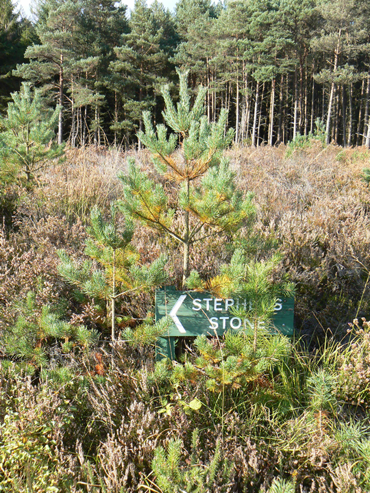
Visited 20/10/2007
Fieldnotes to come when I can find them!
Directions from memory: We parked at the end of St Stephen's Lane, and followed the well-defined footpath as it wound it's way through the forest. After a shortish distance we reached the reservoir. Just after the reservoir is the signpost - on your left - pointing left toward the stone. Further down this path is another sign, pointing right up a smaller path. The stone is just at the end.
|
    
|
Ah! So this is what it's called!
Marked on the OS map only as "Stone Circle".
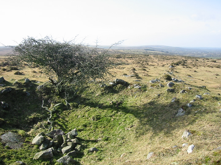
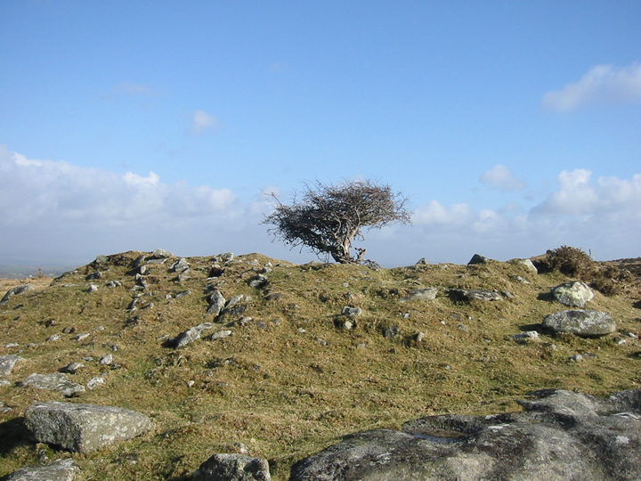
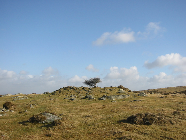
Visited one bright, sunny but VERY cold day last weekend, this was a very pleasant surprise! After a very short walk on a high ridge with panoramic views, the circle appears in front of you, behind a wooden fence urging people to not walk on the monument. The fence is in no way intrusive, and does not block access to the circle, but obviously it's better to stay on the outside of it for preservation reasons.
My first reaction is that it's a lot bigger than I expected! The stones that are still standing are broader and higher, and the diameter greater than I imagined.
It's very exposed up there, so is very cold when that wind blows! The gorse was being burned when we were there, and the sound of a chainsaw permeated the air, but despite that, it felt like a very peaceful location.
A prominent cairn sits just in front of the circle, by the path, which is diverted around the outside of the circle. The other visitors, while we were there, also obeyed the polite notice to stay off it. Nice to see the effect a simple, gentle request has on people!
Access: Parking at approximately SX770872, follow the well-defined path for about 10 minutes up hill, and voila!
Weather permitting, I'd say this was pushchair and (just about) wheelchair friendly.
|
Roman clues found at ancient hill
Archaeologists have found traces of a Roman settlement at a 5,000-year-old landmark man-made hill in Wiltshire.
English Heritage believes there was a Roman community at Silbury Hill about 2,000 years ago.
The 130ft Neolithic mound near Avebury - one of Europe's largest prehistoric monuments - is thought to have been created some 3,000 years earlier.
Experts carrying out a project to stabilise the hill say the site may have been a sacred place of pilgrimage.
Human activity
English Heritage geophysicist Dr Neil Linford said: "We are really excited by this discovery because we had no idea that a Roman village of such a size lay this close to Silbury Hill."
The evidence suggests the Roman community was based on an area the size of 24 football pitches at the base of the hill.
The find was made using caesium magnetometers which can detect changes in the ground's magnetic field caused by human activity.
The settlement was on the road from London to Bath, which is the modern-day A4, where it crossed the Winterbourne river.
Stopover?
English Heritage regional director Dr Bob Bewley says it will be "exciting" to try to find out more about the Roman presence.
"Without further investigation it is difficult to say, but it could be that what we have here is something like a roadside village, where Roman travellers would have changed horses and stayed overnight on the way to Bath, but also a place of pilgrimage focused on the hill," he said.
Mystery surrounds why the hill, where stabilisation work will take place from May to September, was built in the first place.
Heavy rains in May 2000 caused substantial damage to the hill, with the collapse of an 18th century shaft.
From the BBC website >>
|
Ancient lovers are unearthed in Italy
ROME - It could be humanity's oldest story of doomed love. Archaeologists have unearthed two skeletons from the Neolithic period locked in a tender embrace and buried outside Mantua, just 25 miles south of Verona, the romantic city where Shakespeare set the star-crossed tale of "Romeo and Juliet."
Buried between 5,000 and 6,000 years ago, the prehistoric pair are believed to have been a man and a woman and are thought to have died young, as their teeth were found intact, said Elena Menotti, the archaeologist who led the dig.
"As far as we know, it's unique," Menotti told The Associated Press by telephone from Milan. "Double burials from the Neolithic are unheard of, and these are even hugging."
The burial site was located Monday during construction work for a factory building in the outskirts of Mantua. Alongside the couple, archaeologists found flint tools, including arrowheads and a knife, Menotti said.
Experts will now study the artifacts and the skeletons to determine the burial site's age and how old the two were when they died, she said.
Luca Bondioli, an anthropologist at Rome's National Prehistoric and Ethnographic Museum, said double prehistoric burials are rare — especially in such a pose — but some have been found holding hands or having other contact.
The find has "more of an emotional than a scientific value." But it does highlight how the relationship people have with each other and with death has not changed much from the period in which humanity first settled in villages and learning to farm and tame animals, he said.
"The Neolithic is a very formative period for our society," he said. "It was when the roots of our religious sentiment were formed."
The two bodies, which cuddle closely while facing each other on their sides, were probably buried at the same time, possibly an indication of sudden and tragic death, Bondioli said.
"It's rare for two young people to die at the same time, and that makes us want to know why and who they were, but it will be very difficult to find out."
He said DNA testing could determine whether the two were related, "but that still leaves other hypotheses; the 'Romeo and Juliet' possibility is just one of many."
Full story: http://news.yahoo.com/s/ap/20070207/ap_on_sc/italy_prehistoric_love_7;_ylt=AtzuwCQvG_OH.iwT.ih6MTIiANEA
and more at: http://news.yahoo.com/s/ap/20070208/ap_on_sc/italy_prehistoric_love;_ylt=Agb1NwCd0bnoMrKkLO67grRxieAA
(both include slideshow and video links!)
|
Stonehenge builders' houses found
Archaeologists say they have found a huge ancient settlement used by the people who built Stonehenge.
Excavations at Durrington Walls, near the legendary Salisbury Plain monument, uncovered remains of ancient houses.
People seem to have occupied the sites seasonally, using them for ritual feasting and funeral ceremonies.
In ancient times, this settlement would have housed hundreds of people, making it the largest Neolithic village ever found in Britain.
The dwellings date back to 2,600-2,500 BC, the same period that Stonehenge was built.
"In what were houses, we have excavated the outlines on the floors of box beds and wooden dressers or cupboards," said archaeologist Mike Parker Pearson of Sheffield University.
He said he based this on the fact that houses have exactly the same layout as Neolithic houses at Skara Brae in Orkney, which have survived intact because - unlike these dwellings - they were made of stone.
The researchers have excavated eight dwellings in total that belonged to the Durrington settlement. But they have identified many other probable dwellings using geophysical surveying equipment.
The archaeologists think there could have been at least one hundred houses.
Each one would have measured about 5m (16ft) square: "fairly pokey", according to Professor Parker Pearson.
Full story >
|
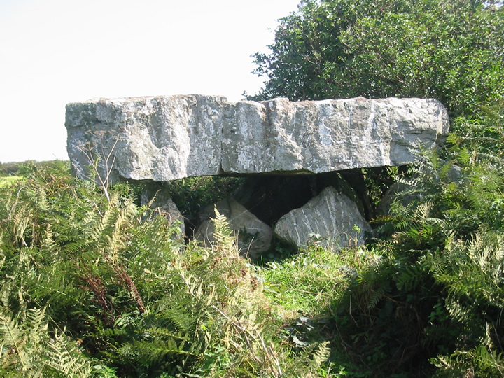
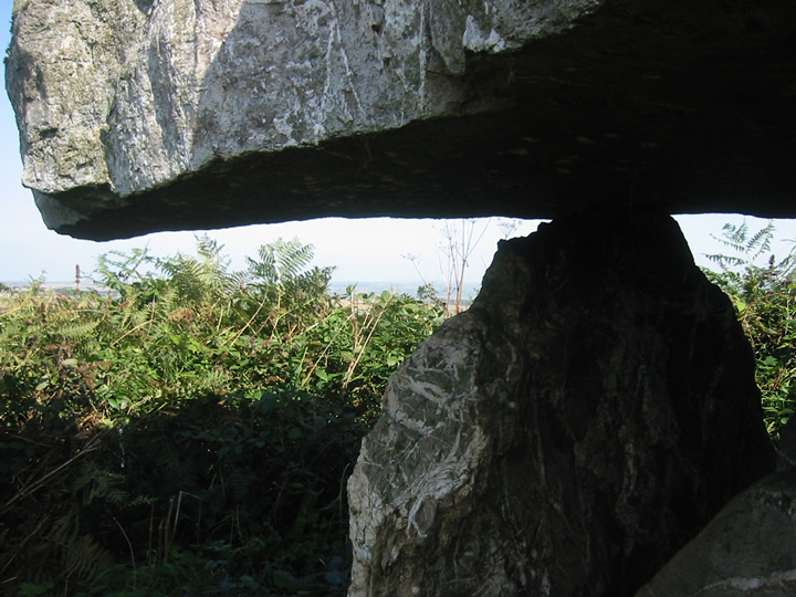
Mrs Goffik and I were extremely lucky to have seein this on the last day of our trip in September.
It's a cracking example of a quoit - the arrow-shaped capstone (which needs no introduction as it's well documented) is HUGE!!! I know our ancestors were nifty with the old stone erection, but still... HOW???!?!
This place feels quite isolated, in a nice way. It's difficult to see from below as it was covered in ferns and brambles when we visited (no crops, luckily for us!) but it commands some nice views.
And has anyone else noticed how it appears to point towards a gap in the distant hills that reveals the sea? Or is it just me? See http://www.themodernantiquarian.com/post/54132
After looking at the map, I'm now curious to explore what is marked, between the quoit and Men Gurta, as "Pawton Springs". :o)
Access: From Wadebridge, follow the A39 South past the Cornwall showground, and take the left turn at Whitecross - signposted, as I recall, to Pawton and Nanscow(e). Follow the road for just under a mile and bear left at the junction. Take the next right (this heads toward the wind farm). The quoit is in, I think, the 3rd field on the right at the top end. There are several gates in the hedge along the road which are traversable. Parking is difficult, but once in the field, the going is quite easy.
|
  
|
 
|

|
 
|
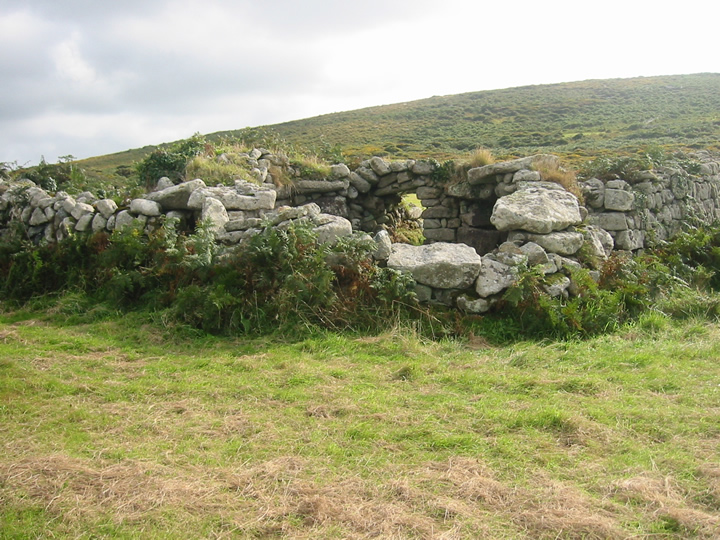
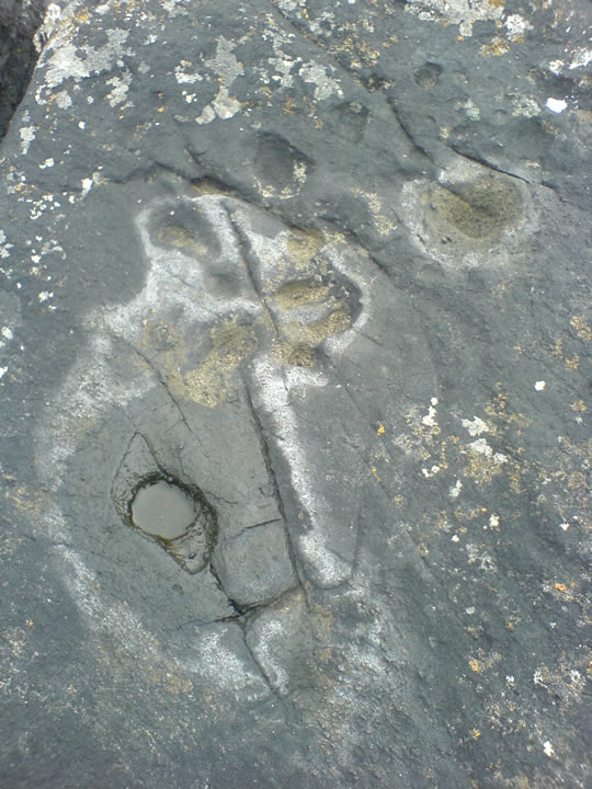
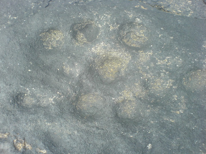
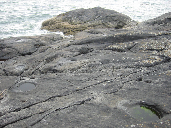
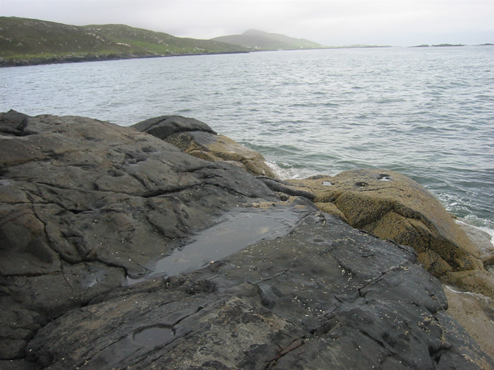
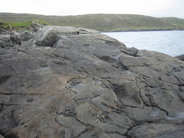
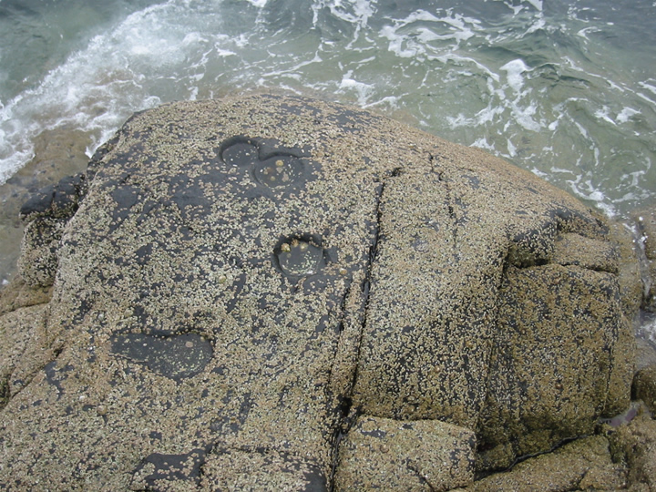
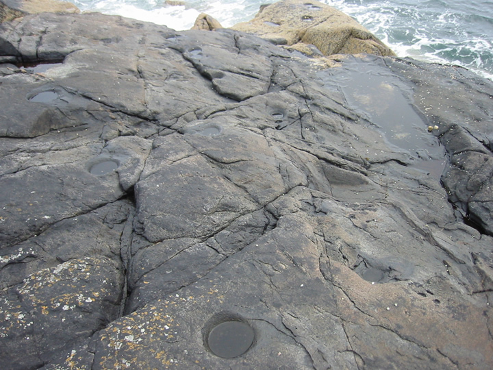
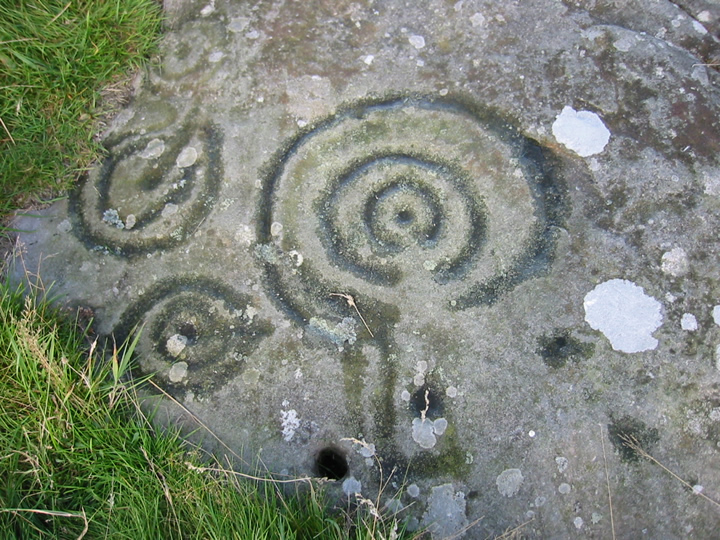
I came across this site in the book "Lewis and Harris - History and Pre-History" by Francis Thompson.
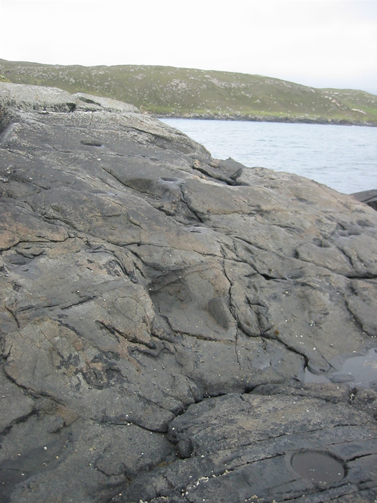
Mrs Goffik and I followed the all-too-vague directions down to the coastline, along a narrow track from the A859, towards Glen Kyles and Rubha Charnain (which isn't signposted, if I remember rightly).
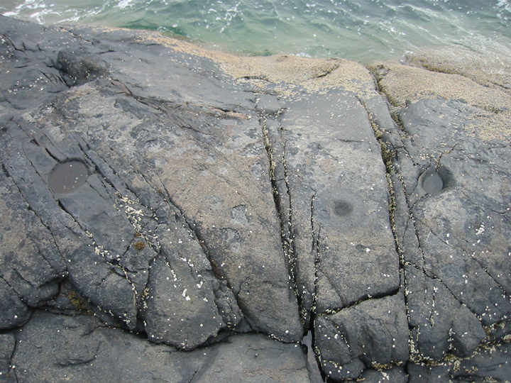
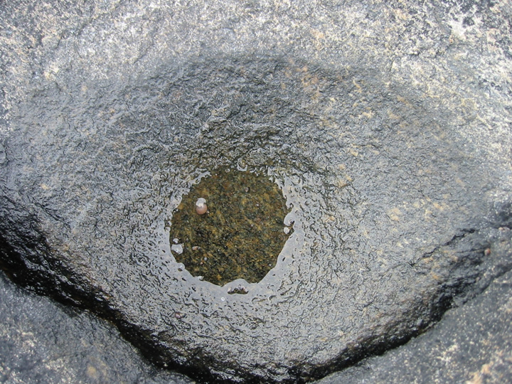
After investigating just about every rock along the small headland, we turned our focus beyond the house at the end of the small road. Navigating along the water's edge, we hopped up onto the grass beyond the fence surrounding the house, and continued straight on (I presume the unfenced area isn't private, anyway!). There is what appears to be an old wall pointing out toward the sea, and just to the left of that is a slope down to the black rocks. The unmistakeable cup-marks are pretty much all around you as you head to the farthest point!
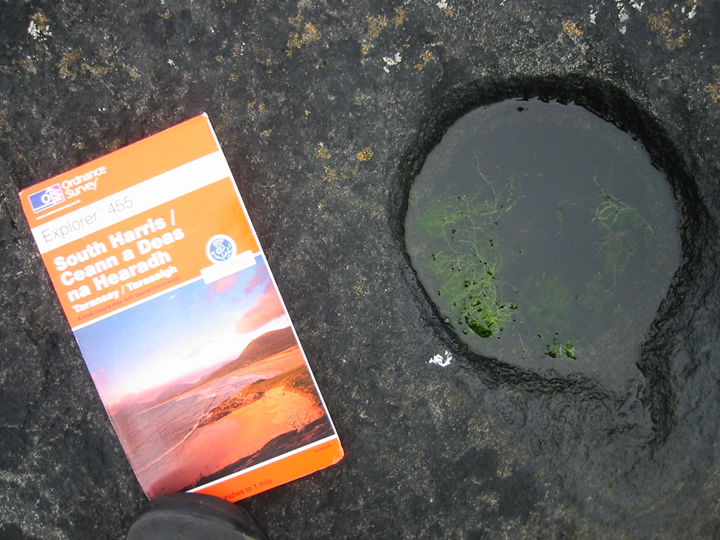
And there's dozens of them! Ranging from coin-sized all the way up to dinner-plate-sized!
Apparently the larger ones may be more modern, although how this is known, I have no idea. They were used by fishermen for holding bait within living memory, but as far as I'm aware, it's nigh on impossible to date rock art... So maybe they were created thousands of years ago and used for that purpose because they were convenient!
The views are spectacular, across the Sound of Harris to the rocky islands of Saghaigh Mor and Saghaigh Beag with Easaigh beyond... Watching the Calmac Ferry come in from Berneray to Leverburgh...
Rock art is apparently very rare in the Outer Hebrides, which makes this place all the more unusual and worth the visit.
Access: Head North on the A859 from Leverburgh, and just after the village, turn left onto a single-track road. The road meanders gently past a couple of houses until a tight(ish) bend (you can probably park here quite safely - we did!) by a small, pebbly beach. The road continues past the bend and terminates at a private house. Follow the coastline to beyond the house and walk along the grass until you reach the slope down to the rocks. Head toward the farthest point and you will see cup-marks all around you!
|
        
|
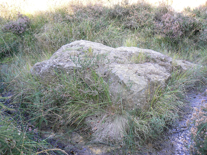
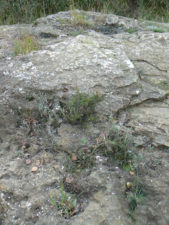
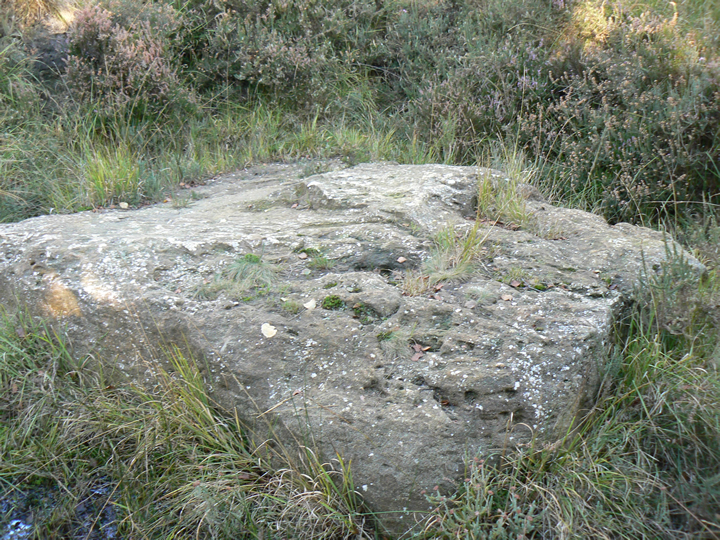
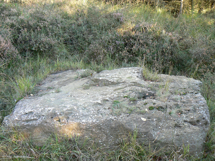
I've been here a few times recently, and it appears the bracken has been cut back!
I picked my way to the top of this low mound, and saw what I presumed to be just the tip of the rocky outcrop that I assumed the Puckstone to be. Maybe that was the alleged standing stone?
I was walking along near the Agglestone last weekend, and could see the Puckstone silhouetted against the sky - it looked a LOT more prominent than my previous visit... I'll see if any of my pics show this in any detail.
|
Iron Age shoe unearthed at quarry
A shoe believed to be 2,000 years old has been dug up at a Somerset quarry.
The Iron Age relic was found in a hollowed tree trunk set into the ground at Whiteball Quarry, near Wellington.
Archaeologists say the shoe is the equivalent of a size 10 and is so well-preserved that stitches and lace holes are still visible in the leather.
The shoe has been taken to a specialist conservation centre in Wiltshire, and is expected to go on display at the Royal Albert Memorial Museum, Exeter.
A team from Exeter Archaeology, led by Stephen Reed, unearthed the shoe when they were excavating at Town Farm, Burlescombe.
"What we have now found is a Bronze Age 'industrial' site consisting of two mounds of burnt stone - dated to 1460 to 1290 BC - and two water-filled troughs," he said.
"Close by were two timber-built wells, preserved by waterlogging and probably dating from the early part of the Iron Age."
One of the wells was constructed over a spring using a hollowed tree trunk set into the ground. The tree trunk was removed from the site so that its contents could be examined under laboratory conditions.
'Oldest shoe'
The "truly remarkable" discovery of the shoe was made when this was being undertaken by the Wiltshire Conservation Centre.
"As far as we know, this is the oldest shoe ever found in the UK," Mr Reed said.
"The shoe measures approximately 30cm, equivalent to a modern size nine or 10, perhaps suggesting its owner was male.
"The reason for its presence in the well or spring is a mystery."
It is hoped examination of the shoe will shed light on the method of its construction and identify the animal from which the leather was derived.
Quarry owners Hanson are working with archaeologists from Exeter Archaeology, Devon County Council and English Heritage, as well as other specialists, to ensure that all the finds from the site are properly recorded and treated.
It is hoped, following conservation, that the timbers and shoe will form the central feature of the proposed expansion of the archaeology galleries at the Royal Albert Memorial Museum in Exeter.
http://news.bbc.co.uk/1/hi/england/somerset/4530905.stm
|
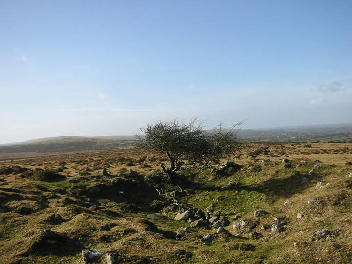
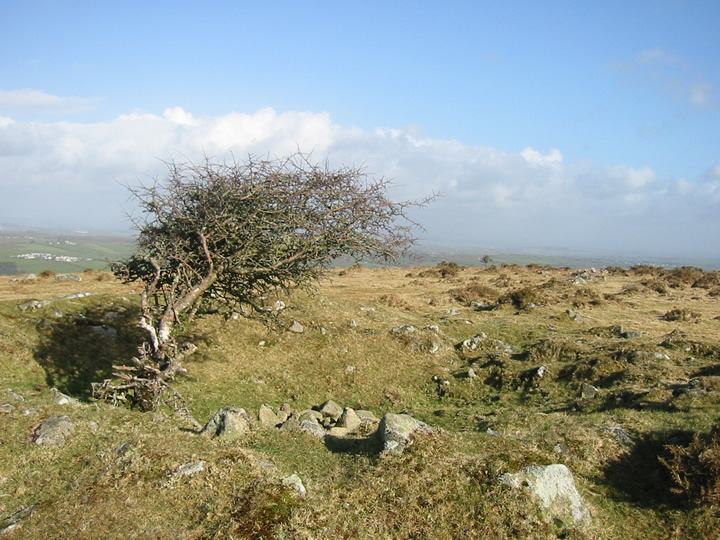
We popped by this lovely cairn on our way to and from the Nine Stones of Altarnun a couple of days ago...
We had to take a different route from the recommended start point of Tolcarne Farm, cos there was a dead sheep with it's insides spilling out blocking the gate. Moving the gate would have been a bit gruesome, so we shied away and drove round to what is possibly Treburland...
Bit of a longer walk, but very pleasant... Walked to the end of the track to what was once a gate (destroyed by a careless farmer, apparently!), left down the path that doubled as a delightful stream, then up, up and more up... It's all signposted as footpath until you reach the woods. Then up, up and up again alongside the woods. Keep going and you will pretty much fall into the cairn, as far as I can remember!
Ver' nice it is too. Lovely windblown tree as a marker, some smaller stones (and an empty cider can which I removed) inside it - it makes a great wind-break! There is a wall that runs up to and beyond the cairn that made me think of a stone row... Wonder if it ever was? I know there are boundary stones aplenty in the area, but they were elsewhere...
You can see the Nine Stones of Alternun from here, too, which is handy if you're lost!
Very windy and boggy, but pleasantly remote...
|
    
|
Hope nobody minds me adding this bit of miscellany - NOT as old as we like here, (so delete at will!) but possibly of interest to someone else besides me!
http://www.chittick.com/history/places_geography/chideock.html
"To the east end of the village on the North side of the main road is Ruins Lane, a short track which leads you up to ruins field, where you will see the site of Chideock castle. All that remains now is the moat and a large cross, erected in memory of the Chideock Martyrs. The castle was built in 1380 by John de Chideocke."
|
We visited this area yesterday for the first time, and what a beautiful, crisp, sunny day it was too!
Didn't check this page first, so trusted the directions in the big papery version and got a bit lost! Headed, as suggested, along the A35 between Bridport and Lyme Regis, but as Rhiannon says - no signpost was forthcoming... Eventually, I gave in and checked my seriously-lacking-in-detail road map, and, lo! Golden Cap was marked on it! Just next to Chideock...
So we drove back till we got to Chideock, and took a chance turning toward Seatown, where we then saw a sign for the Golden Cap Holiday Park - hurrah! At the end of said road is a car park just opposite the pub with voluntary £1 all day parking. Footpaths are marked from there (although currently diverted due to erosion).
We took the opposite path, heading toward Bridport, taking in the highest cliff on the South coast from Thorncombe Beacon - a fantastic vantage point! And a large tumulus right next to it as a bonus for the steep, hilly walk. Some lovely hills/hillforts to be seen from there.
The cliff garden at the Anchor Inn is a fantastic place to watch the sun go down with a rewarding pint of ale...
Getting back out onto the A35 was a bastard tho!
Access: This one's for the *relatively* fit (or the determined!) Sometimes steep, frequently slippery. Cows.
|
  
|
We stayed at the marvellous Clansman Hotel on the banks of Loch Ness. Continuing up the road toward Inverness, we noticed a settlement marked on the map, so took a diversion.
On the A82 from Fort William toward Inverness, just under 2 miles after the Clansman Hotel is a left turn to Abriachan. (You need to go right first, onto a funny little turning bit, cos the corner is so tight!). Continue up the steep, wniding road for about 2 miles, and you will find the small parking area with noticeboard. To your right is the remains of the prehistoric village.
It's in a beautiful location, but to be honest, at the time of year we were there (early September) there wasn't a lot to see! A few stones, presumably from the huts, were poking out from the heather here and there, and you could *just* make out a few circular outlines... A very peaceful place. Boggy. Unspoilt. Worth a look if you're in the area, but not really worth going out of your way for! Might be better at other times in the year when the heather's lower..!
The best bit was the view, continuing along the road to get back on the A82! Didn't realise how high we were!
Access: Parking by the information board, the site is across the very quiet road, through a gate. Paths had been cut into the grass, which were surrounded by low lying heather.
|

|
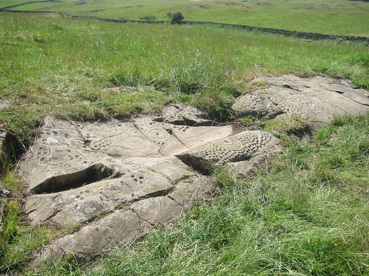
We liked it here, the missus and me...
Hob brought us up here one sunny(ish) afternoon. Last Friday in fact! Seems like ages ago!
A short walk through the golfcourse in Wooler stand several of these magnificent stones, carved with magical motifs. This particular one being within the ramparts of the hillfort.
Dripping water into the shapes and letting it run naturally into the grooves (giving it a gentle rub to spread it to the edges) really highlights the shapes.
The sun came out at just the right moment to take a few pics of the "ring of fire"... the water looked like molten metal for a couple fo minutes - fab!
We were happy here... I forgot for a while that I was on a golf course - wonder how many of these golfers know what they're walking among? Better than whacking a ball with a stick, I reckon!
|
Likes: Massive stones.
Dislikes: Noisome trolls.
|
|