There are two or three long barrows recorded for this area. I was looking for the one mentioned in "Hampshire Treasures" at location SU479362 but there is no record of it on Magic or the OS maps.
It would have been at a place called "Bayley's Clump" about 1km to the East. When I looked into this small copse the nettles and undergrowth was chest high so a winter visit is on the cards.
|
|
A search on Google suggests this may be Romano/British in date.
|
Bronze Age barrow cemetery of seven barrows in Priddy parish (PRNs 23952 23953 23954 23955 23956 23957 23958) and two further ones in Chewton Mendip parish (PRNs 23243 23244 ). Comprise Tratman's T328-T336 and Grinsell's Priddy 28-34 and Chewton Mendip 13-14. See individual PRNs for individual descriptions. There is another possible barrow to the SW (PRN 24008). {1}
Wick's concluded that this chain of barrows had been wrongly named and the name should apply to the group to the N on Ashen Hill (PRNs 23813 23814 23815 23816 23817 23818 23819 23820). {2}
This was challenged by Grinsell who examined the available documentary evidence and revealed that this S group had been consistently known as Nine Barrows since 1296 and was often mentioned in several medieval and later surveys because the Chewton Mendip-Priddy parish boundary passes through them. {3}
Group of seven barrows in approx NW-SE alignment with two detached. All under pasture and standing 1.2-1.5m high. Prominent position and in good condition. Scheduling revised 1992. {6}
References:
1 Personal communication - Dennison, E SCPD 29.08.85
2 Mention - Proceedings of the Somerset Archaeological. Nat. History. Soc. Wicks, A.T 1952 "Priddy Barrows: an error..." vol 97, 185-6
3 Mention - Proceedings of the Somerset Archaeological. Nat. History. Soc. Grinsell, L.V 1982 "Priddy Nine Barrows...correction... vol 126, 103-4
4 Detailed records - Ordnance Survey Archaeology Division 1982 ST55SW75 SCPD
5 Detailed records - HBMC Field Monument Wardens report SCPD
6 Correspondence - HBMC to SCC 22 Jan 1992
Record created by:
Ed Dennison in August 1985
© Copyright Somerset County Council 2003
With thanks to the Somerset Museums Service for the link to this information.
|
A small rock shelter near the head of Ebbor Gorge known as "Bridged Pot Hole" consists of a funnel-shaped dissolution hole some 8-10ft in diameter, partially roofed and open on the downhill W side. It was discovered and partially excavated by Balch in 1926 who found in the first 2ft a few fragments of hand-made black pottery, and a decorated fragment possibly of a beaker. At 3ft a polished stone axe 7" long was found - probably of Neolithic or Early Bronze age date, also a flint knife 4.25" by 1.25", a short scraper and a number of flakes. In a niche in the rock a hoard of eleven leaf-shaped bifacial spearheads, and a group of levelling flakes were found. Late pleistocene bones occurred from 4ft to 8ft. This site provides evidence of human occupation of apparently Upper Palaeolithic character associated with a late glacial found. Finds in Wells museum. {1}
References:
1 Detailed records - Ordnance Survey Archaeology Division 1966 ST54NW30 SCPD
2 Mention - Proceedings of the Prehistoric Society 1959 vol 25, 262-4
3 Excavation report - Antiquaries Journal 1928 vol 8, 197-204
4 Finds stored - WELLSM
Record created by:
Ed Dennison in September 1985
© Copyright Somerset County Council 2003
With thanks to the Somerset Museums Service for the link to this information.
|

On the W side of Ebbor Gorge is a little creep leading to a shelter known as Outlook Cave. A leaf-shaped flint arrow or spear head was found at a depth of 1ft in the entrance way and is now in Wells museum. Human bones lay just on the surface of the inner cave floor - obviously dug up by animals - but with no associated finds. Further digging revealed remains of the bear and reindeer, a fragment of fingernail decorated light brown ware (the edge of a cup or bowl) and two fragments of undecorated black ware. In conclusion this would seem to be an occupied rock shelter of Neolithic and possibly earlier date. {1}
Scheduled 27.9.91. {5}
Some confusion over location as scheduling document gives different NGR from OSAD. English Heritage NGR given above, as OSAD reference is called Lion Cave on OS map. {6}
High on the right bank of the gorge, 58m above the present valley floor and 50m below the plateau. An artificially widened entrance 1m by 1.5m high leads to a small chamber extending c.12m, with a passage to the east. {8}
References:
1 Detailed records - Ordnance Survey Archaeology Division 1966 ST54NW29 SCPD
2 Mention - Balch, E 1914 "Wookey Hole: its caves and cave dwellers", 146-7
3 Mention - Balch, E. 1947 "The Great Cave of Wookey Hole", 96-7
4 Finds stored - WELLSM
5 Correspondence - EH to SCC 30.9.91 scheduling doc.
6 Personal communication - Webster, CJ SCED
7 Description - Barrington, N, and Stanton, W 1977 "Mendip - The Complete Caves.."
8 Detailed records - MPP evaluation 1986 in HER files file
9 Sketch plan - Caves of Ebbor Gorge sepS6 see ref {8}
Record created by:
Ed Dennison in September 1985
© Copyright Somerset County Council 2003
With thanks to the Somerset Museums Service for the link to this information.
|
Southernmost of the four Priddy circles. Excavations in 1956-9 in the NW quadrant revealed that the bank had a stone core with a ring of post-holes on each side. The posts had been of 8" diameter and about 10ft high with stakes between them, apparently erected prior to the ditch, whose upcast was added to the bank probably leaving the posts projecting at least 4-6ft above the earth top. A causewayed entrance was proved for the circle in the NNE sector. Central area was devoid of any structure and no finds were made. {1}
Belongs to the secondary Neolithic and fall into the Henge group of monuments, class 2. Banks average 1m high and the ditch is 0.4m deep. {4}
Bank at best 7m wide and nearly 2m high, interior area flat and about 1m above the surrounding fields. Divided ownership marked by stone wall running NNW-SSE. Part on the W has never been ploughed but is somewhat cut about by old mine workings. On the S the bank is not well preserved. On the E the interior of the circle has been ploughed at some time but the bank is untouched. Some evidence of the stone construction of the bank is visible at some points. Few thorn and gorse bushes on the E side. {5}
Ploughing of centre and surrounding area but not bank in 1984-5. {6}
The interior of the E part of the circle has been ploughed again this spring. One quite large stone has been disinterred and added to the bank. {7}
Many of the surface depressions in and around the Priddy Circles are natural sinkholes, not mine workings as had been assumed. Unsatisfactory ground conditions (the ground remained liable to subsidence) may have been one of the factors that led to the abandonment of the whole ceremonial site before the circles were completed. {10}
Scheduling revised with new national number on 31.1.1997 (was Somerset 119). {11}
See PRN 90072 for inconclusive geophysical survey and discussion. {12}
The monument is basically stable under pasture but there are areas of scrub, nettle, bracken etc growth on the banks. {13}
See PRNs 24043, 24045, 24046 for the other three Priddy circles. {14}
References:
1 Excavation report - PUBSS Taylor, C and Tratman, E.K 1956 "The Priddy Circles..." vol 8(1), 7-17
2 Mention - PUBSS 1960 vol 9(2), 64
3 Excavation report - PUBSS Tratman, E.K 1966 "The Priddy...Henge Monument" vol 11(2), 97-125
4 Detailed records - Ordnance Survey Archaeology Division 1966 ST55SW4 SCPD
5 Detailed records - HBMC Field Monument Wardens report SCPD
6 Personal communication - Dennison, E SCPD 12.09.85
7 Detailed records - HBMC Field Monument Wardens report SCPD
8 Aerial photographs - Slide SCPD 2.040.0004
9 Map - HBMC Field Monument Wardens report SCPD
10 Detailed records - Stanton, WI "Natural sinkholes...Priddy Circles..." PUBSS 17(3) (1986), 355-8
11 Correspondence - EH to SCC (7.2.1997) in HER files
12 Personal communication - Webster, CJ SMRO (14/12/1998)
13 Site visit report - Graham, A. EH field Monument Warden (25/7/2000) report in HER files
14 Personal communication - Matthew Nicholas, SCC (7/7/2003)
Record created by:
Ed Dennison in September 1985
© Copyright Somerset County Council 2003
With thanks to the Somerset Museums Service for the link to this information.
|
A standing stone, "perhaps of no great antiquity", about 4ft high. {1}
An upright block of conglomerate 1.3m high and 0.5m by 0.6m in section. Possibly a comparatively modern rubbing stone. The field has been drained by a series of late or post medieval broad furrows dividing the area into plots The stone stands in one of the plots and it seems unlikely that such an obstruction would have survived any arable farming. {2}
Folklore suggests that this is one of two stones thrown by the Devil from Shute Shelve in a contest. {3}
References:
1 Mention - Knight, F.A 1915 "Heart of Mendip", 332-3
2 Detailed records - Ordnance Survey Archaeology Division 1966 ST45SW1 SCPD
3 Mention - Grinsell, L.V 1976 "Folklore of Prehistoric sites in Britain", 99
Record created by:
David Fraser in February 1983
© Copyright Somerset County Council 2003
With thanks to the Somerset Museums Service for providing the link to this site.
|
Two large standing stones, known as the Deer Leap Stones, were formerly situated in an old hedge bank, but this was grubbed out in 1967, the old stones being left standing. A further similar stone was built into the corner of a wall 200m north at the summit of a hill (ST 51714893). Presumably it was emplaced before the wall, perhaps as a boundary stone. At ST 51804910, 300m north of the Deer Leap stones is the stump of a roadside outcrop of quartzite blasted away in road widening, which has been confused with the Deer Leap stones. {1}
A legend of a phenomenal leap by a deer, commemorated by these stones, is well known to old Mendippers. The stones are 16m apart. Until 1964 each stood c.2m east of a dry-stone wall, but in that year the wall was dismantled and workmen broke up the southern stone and damaged the other. The lost stone was subsequently replaced by a similar from a nearby quarry, and the northern raised upright. Stones consist of quartzite, probably local. {3}
According to other local sources the stone was broken up by Italian prisoners of war and subsequently replaced with another block. {4}
References:
1 Detailed records - Ordnance Survey Archaeology Division 1970 ST54NW37 SCPD
2 Mention - PUBSS Tratman, E.K 1968 vol 11(3), 243-4
3 Detailed records - Stanton, W.I. Proc University of Bristol Spelaeological Society 16:1 (1981), 63-4
4 Mention - Brown, D Somerset v. Hitler (1999), 206
Record created by:
Ed Dennison in October 1985
© Copyright Somerset County Council 2003
With thanks to the Somerset Museums Service for providing the link to this information.
The previous antiquity of these stones in their former location/s still seems undecided.
|
An Iron Age Fort on a prominent hill in this area of the Plain. Bronze Age earthworks fan out from the site and thickly cover the surrounding area with implications that this whole place was important at least 2,500 BCE.
"Henge" noted to the NNE, anything known?
|
The National Trust are a bit coy about this site, so far no details are forthcoming. Perhaps others may have more luck. It looks impressive on the map and is most likely of Iron Age date. It is variously called "DumpTon" which is confusing.
Julian Cope mentions it on P183 of TMA.
|
|
This obvious cave, just up the road from "The Rock Of Ages" was found in 1797 by two men following a rabbit. A small excavation found several human skeletons inside placed on the cave floor. In 1919-27 the University of Bristol Speleological Society more or less cleared the cave and found that the deposits dated from the Late Paleolithic (Cresswellian).
|
The cave was discovered in 1824/5 when miners digging a tunnel in the nearby Stalactite Cave, broke into the Bone Chamber to find that it was completly choked with cave earth and countless Late Pleistcene animal bones. It's thought that the cave roof was open for thousands of years and the animals just fell in.
William Beard excavated here until about 1840 but no new explorations were done until the Axbridge Caving Group started again in the 1950s and extended the cave to its present length.
|
There is a cluster of hill forts in this part of Hampshire of which Danebury is the largest. Baulkesbury, more or less destroyed, Bury Hill and to the E. of the Test Valley, Tidsbury, Norsebury and Woolbury .
Danebury is interesting for the fact that it started as a sacred site, developed into a fortified hill then became a thriving hill town until the Romans came.
A circle of large posts was erected in Bronze Age times then in the 6C BCE the hill seems to have been lightly fortified with a single ditch and bank, a timber revetment and outer earthworks used as cattle enclosures while the people lived in a scatter of round huts.
In the 4C BCE the pattern of occupation changed, the fortifications were strenghtened by elaborate diversions at the E. entrance, a second line of ramparts was erected, watch towers were built and large stocks of sling stones were kept. The town itself was more planned with maintained tracks and the houses were often rectangular. Trade thrived, probably in cattle and twenty or so iron currency bars have been found.
The death customs were curious for the time as bodies just seem to have been thrown out with the rubbish or chucked unceremoniously into pits.
From the number and size of the grain storage pits excavated it is suggested that the town comfortably supported a population of at least a thousand people.
After 100 BCE the town was deserted and Danebury reverted to being a refuge in dangerous times.
|
|
"...a more or less square Iron Age Hill Fort overlooking the Weald. It measures 8 acres and has a double bank and ditch on the N and W sides. To the S and E, where the defences are no longer clear, the slope of the hill would have acted as a natural defence. Excavations in 1930 were limited to the defences. Pottery recovered suggests but does not confirm a connexion with the SE Wealden Culture, and a date just prior to the Roman conquest." "The Buildings of England" Surrey, Nairn Pevsner Cherry ISBN 1407110213.
|
" 1 mile NE of Leith Hill. An Iron Age fort, Oval in plan, enclosing 11 1/2 acres. To the NE and NW the defences are triple banks with double ditches and there are signs of a third ditch to the NE. An entrance at the NNE is probably original. A date of construction between C2 and the C1 Bc may be guessed- the site awaits proper excavation. Holmbury Camp is near by....."
From "The Buildings of England" Surrey. Nairn Pevsner Cherry ISBN 140710213
|
".... In the 1950's the late Dr. Crawford of the OS thought its appearance warranted its marking as an ancient burial mound on OS maps. At the same time, Professor Sheppard Frere inspected it and gave his opinion that it was a native British pagan burial mound probably erected shortly after the Roman Conquest of Britain when native Iron Age customs still persisted. He noted in particular its large size and steep sides, characteristic of burial mounds of that period. Opinions of such eminence must be accepted, but proof could only be obtained by excavation, which would not be appropriate.
However, other evidence may support the theory that the Mound already existed before the formation of the estate in the late 18C. Early 18C maps do not show this feature, but local field names may provide some clues to its earlier existence. From Tudor times onwards, one of the large fields here was called ' Gallowsfield' and there are a number of instances in Surrey of such a name being associated with burial mounds. Again an 'Extent' or valuation of Westminster Abbey's manor of Morden, taken in 1312, includes land called 'Dedemanforlonges' in a list of the demesne lands, which were mostly in the area either side of London Road between Morden Park and Morden Hall. The name may possibly refer to a burial mound, though it may merely refer to memorable death in the area. ....."
Extract from "Morden Park" Merton Library Service on behalf of The Merton Hist. Soc. Sept.2002 ISBN 0905174402
This seems as far as one can go with this enigmatic mound until new excavations can confirm its true antiquity.
|
|
Talking to some Wellsonians (?) before and after my visit here they seemed to think that the stones were one of those strange monuments to the chase (Deerleap ?) beloved by the 18 & 19C. There's one near Winchester dedicated to a horse called "Beware Chalk Pit"! One chap said that his grandfather restored/moved them in the early 20C but the interesting thing is that there seemed to be a bit of a folk memory of them coming from a much older construction. Whatever their true origins this is still a stunning location.
|
As an avid caver in this region I was aware of the use by Paleo/Neolithic peoples of the more open rock shelters as dwelling places, perhaps on a temporary basis. The seemingly deliberate placement of various artifacts in the "non-livible-in" swallets appears to be another example of how our ancestors propitiated the "Gods" of the unknown.
Swallet holes can certainly appear over night especially after heavy rain and can be very deep. Manor Farm swallet , near Charterhouse, opened up during the floods of 1968 into a shaft over 11M deep and would have been accessible with primitive ropes had it happened in the past. Unfortunately it is now used as a farm dump. What a legacy to leave our descendants!
|
|
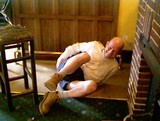
The pic should be interpreted correctly!!! It's a game played in our local to show how experienced cavers, myself included, can crawl through tight spaces. As the pub has a distinct lack of thick limestone in it, bar stools have to do. Honest.....
TMA re-kindled my interest in ancient history when I got my first PC and went on line early in 2002.
Other interests; architecture, natural history ( I'm a Landscape Gardener), parachuting (I used to be an instructor), and chatting in pubs.
|