|
Stanton Drew, located at 51.366997, -2.578645
For us this was not an easy place to find and we would recommend using a Sat Nav. The latitude and longitude given above will take you directly to the car park allocated for the circle. The narrow country lanes access make this a tricky place to drive to. Some of the roads marked as main A roads on the map were little more than country lanes and quite inadequate for the volume, speed, and size of today's traffic.
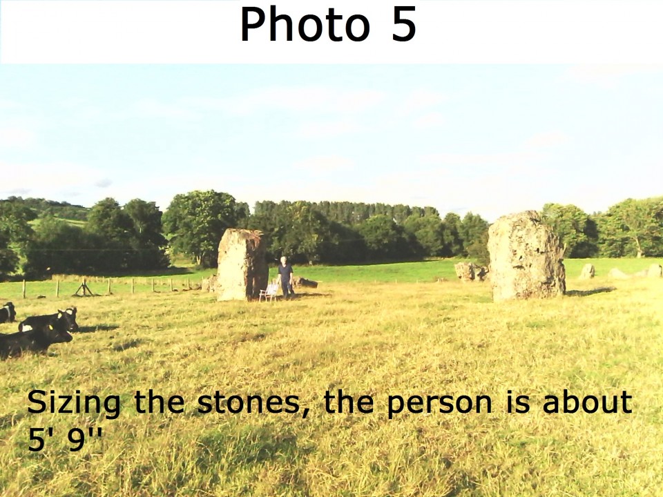
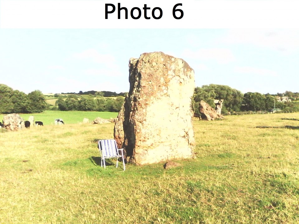
The stone structure is of large rough stones irregularly positioned and standing in flattish farm land. It is a very peaceful spot though, and an inner city dweller (Bristol?) may find it very relaxing and effecting. The size of the rings and the stones are impressive (photo 5 and 6) and the rustic local village and pub, which contains the Cove, is well worth a stroll round.
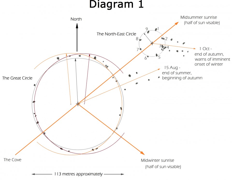
From a more technical point of view there are interesting alignments to the sunrises via the causeways, and the numbers of stones in the two main circles which provide some indication for a sunrise weather/season forecaster.
Causeways -
The circles have Eastern causeways which, from their irregular positioning of their stones, appear to have been disrupted. The stones of the causeways seem to have been in pairs.
They point towards the sunrises of 15 August - the end of summer, and the 1 Oct - the end of Autumn - as can be seen in Diagram 1. These would be important dates for a rural community.
Circles -
The circles appear to have been disrupted with displacements having taken place along the circumference rather than the radius. However it can be seen that the Great Circle does not fit a circle too well; it fits two arcs, one East, one West, far better - as can be seen in Diagram 1 which shows a Plan diagram of the Great Circle and North East Circle and their sunrise orientation. This arrangement can be seen in other structures such as Blakeley Raise, England, and Loupin' Stanes, Scotland. The centres of the circles and The Cove align with the midsummer sunrise, as can be seen in Diagram 1.
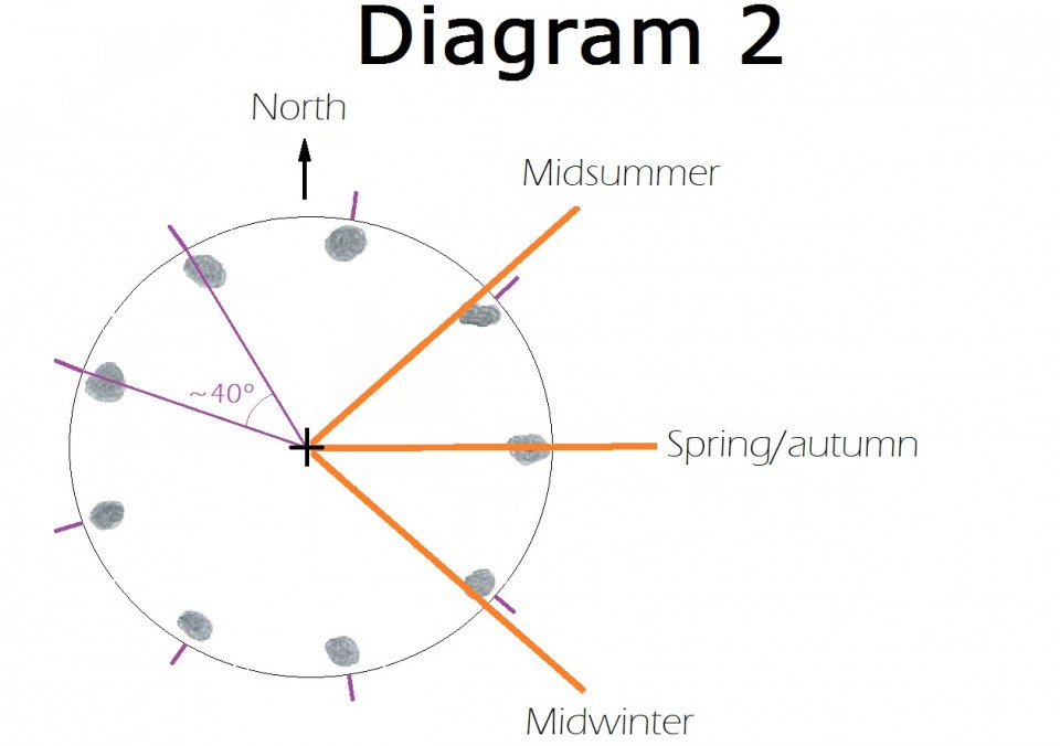
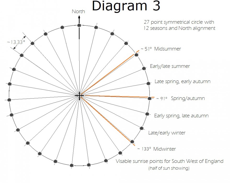
It is interesting to note that the smaller North-East circle appears to have 9 stones - which could give alignments for midsummer, spring/autumn, and midwinter if the stones were suitably placed, as for Nine Ladies in Stanton Moor, Derbyshire, England, and others circles - as can be seen in Diagram 2.
Apparently there are 27 stones present in the Great Circle (source Wikipedia). The stones seem intact although very weathered, and do not seem to have been broken up and left in pieces - although they differ in height - so the original number may have been 27. This, if the stones were placed equidistant from one another in circular shape and one aligned from a central observation point towards the midsummer sunrise, would provide alignments, like Stonehenge, for a 12 season annual cycle - as can be seen in Diagram 3. The Great Circle is so large that the centre would have to be marked in some way. The differing heights would be useful to indicate required alignments, such as midsummer.
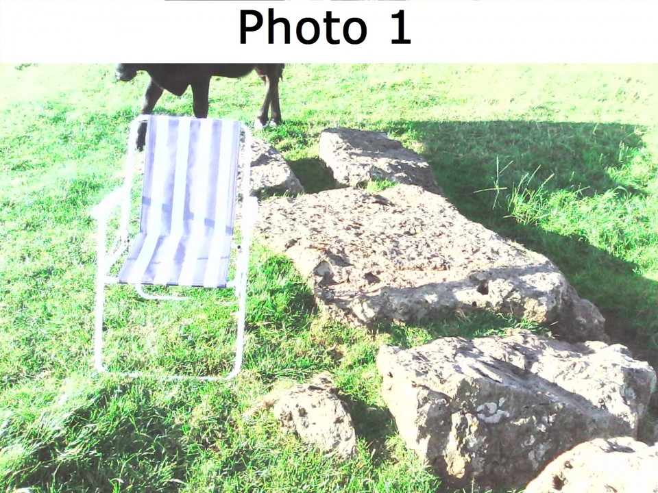
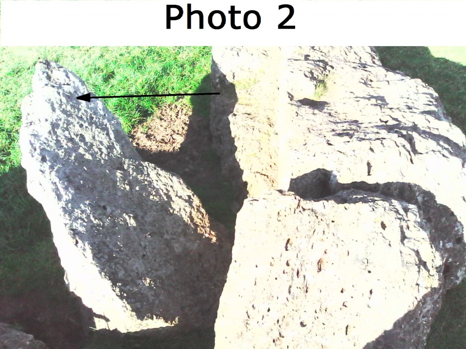
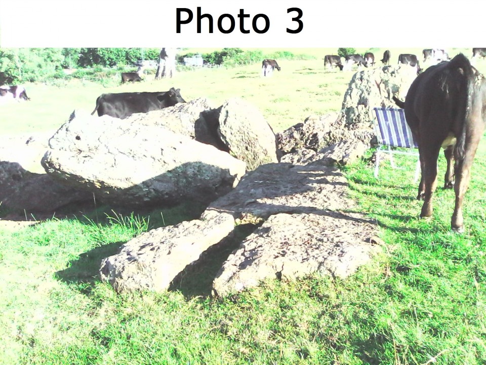
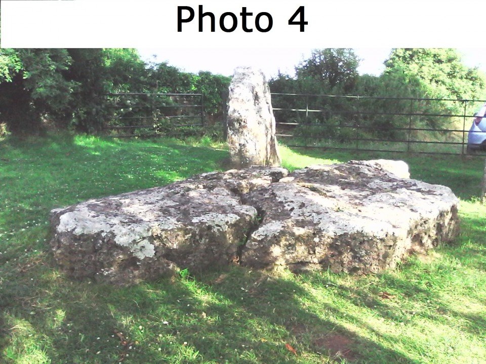
Some of the stones in the North East circle - numbers 3 and 4 (photos 1 to 3) and The Cove (photo 4) appear to have been pushed over to lie flat, rather than sunken over with time to lie at an angle. The break lines of the stones are regular with the pieces not being displaced, indicating deliberate breakage after the stone were flat, perhaps using iron wedges and heavy hammers. Two damaged stones (3 and 4) lie together, indicating their displacement on the circle. It is recorded that the Romans destroyed the Druids and their sacred groves, and as it is highly likely that the Druids knew of and used the stone circles, it could be thought that Stanton Drew was disrupted and damaged by the Romans, perhaps to be partially restored by the British once they had left.
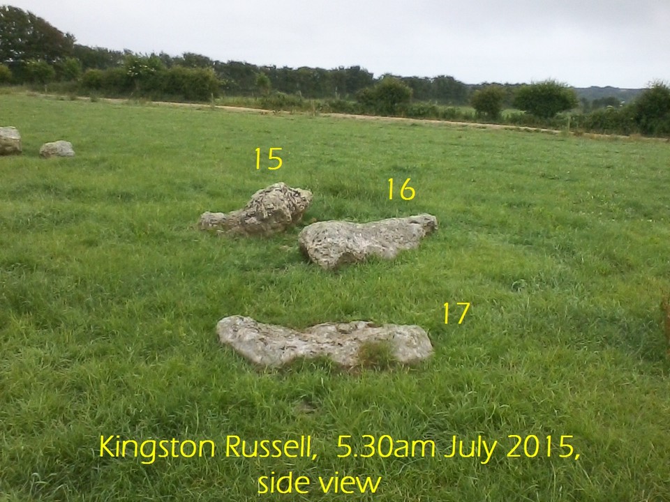
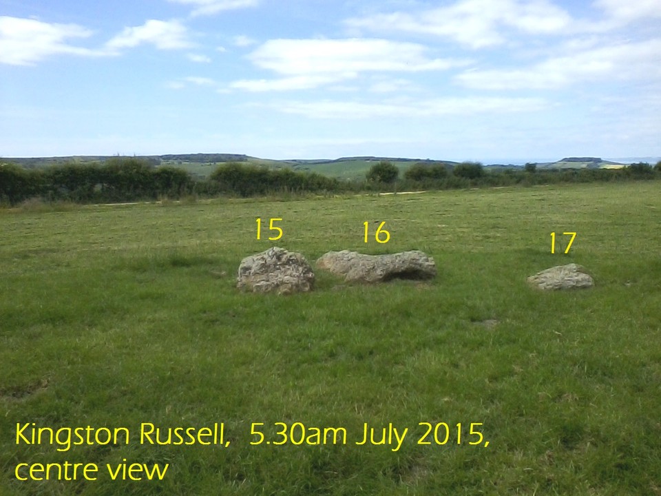
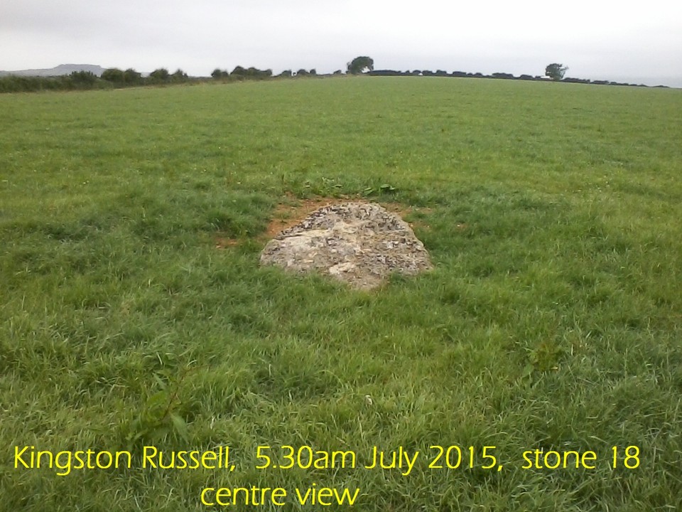
Please refer to the diagrams and photos.
For fuller information on sunrises weather/season forecasters please see:
https://sites.google.com/site/originsofstonehenge/
|
                           
|
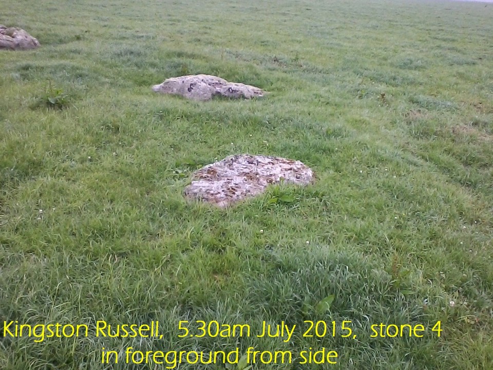
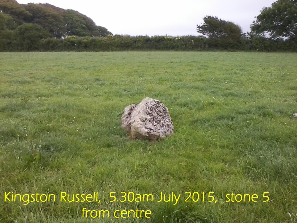
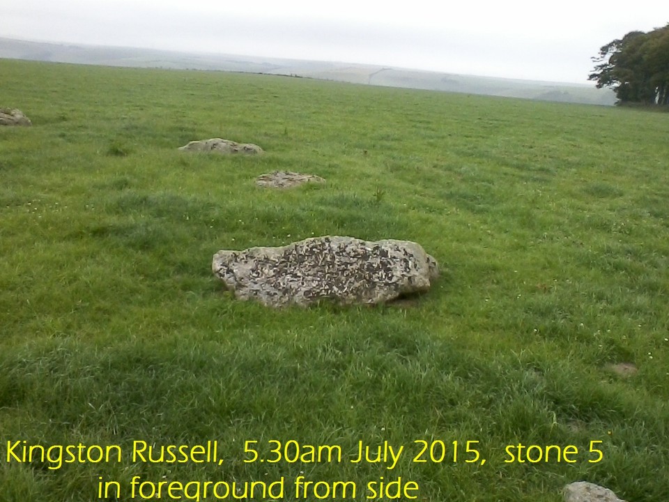
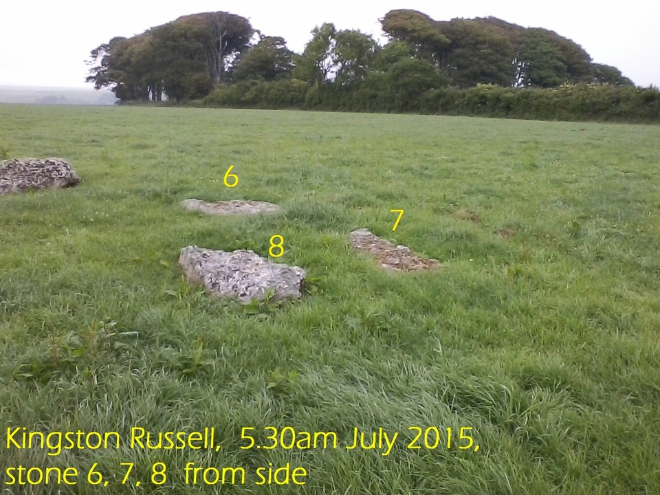
Latitude and longitude 50.688769 -2.598972
Dated - late Neolithic (English Heritage)
Horizon view - distant low hills
Horizon orientation - none noted
Structure orientation - midsummer, spring/autumn noted
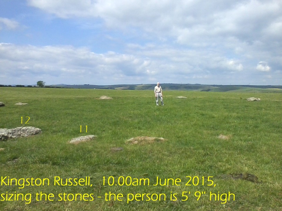
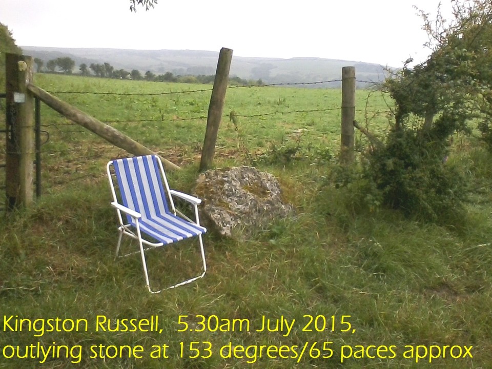
In order to access the site we parked at the turn-off from Bishop's Road towards Gorwell Farm (50.678776 -2.583842) The farmer paid a considerable sum of money to have his access track asphalted so do not cross the cattle grid ! : ) A bridle path, accessed via the track to the right, through a wooden gate immediately to the left, runs along side four fields and leads directly to the stone ring. It is quite a long rough walk so plastic calf boots are advised, winter and summer as the field containing the ring may be heavily sown with cow pats, some of which are hidden under clumps of grass! A couple of these were discovered by treading in them! Urrgh. We took along a couple of folding picnic chairs so we could stop, rest, and admire the country side.
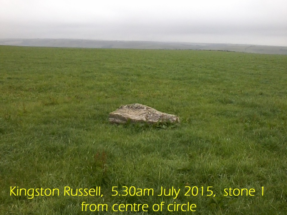
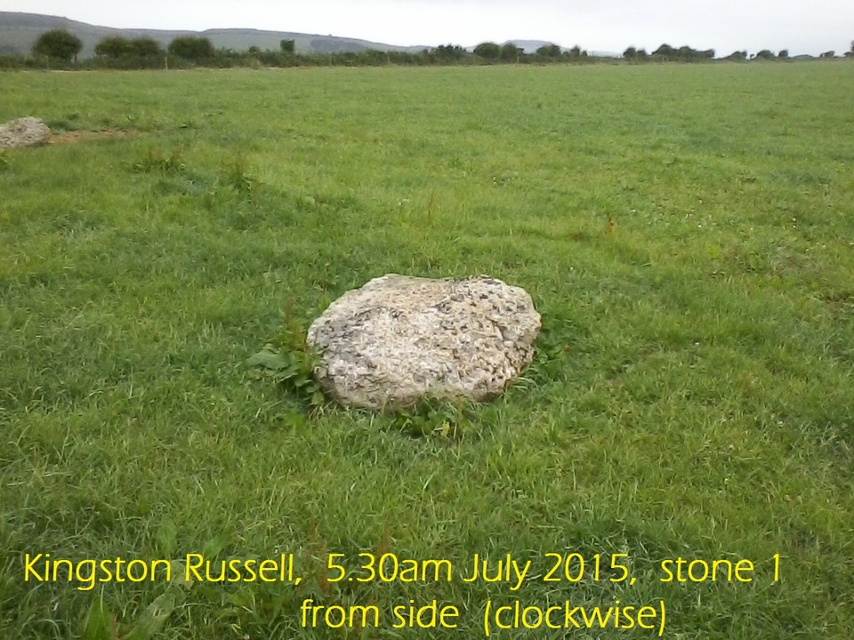
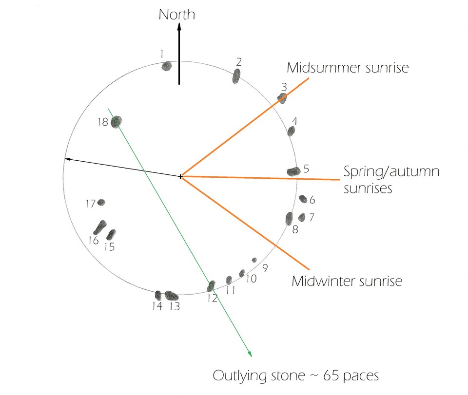
Once there the scenery alone makes the trek worth while, and what we found was an irregular circular shape with midsummer, spring/autumn sunrise orientation noted. Appears to have been ruined, with no reconstruction as some stones have sunk into the ground, although the ground here is rocky with considerable broken flints, and provides a firm base. There is a faint mark of a ditch on one side of the circle (South) but no bank, so this may be the result of regular ploughing with the furrow turned away from the stones. The size of the structure indicates a small Neolithic population of a few hundred.
Agricultural weather/season indicator -
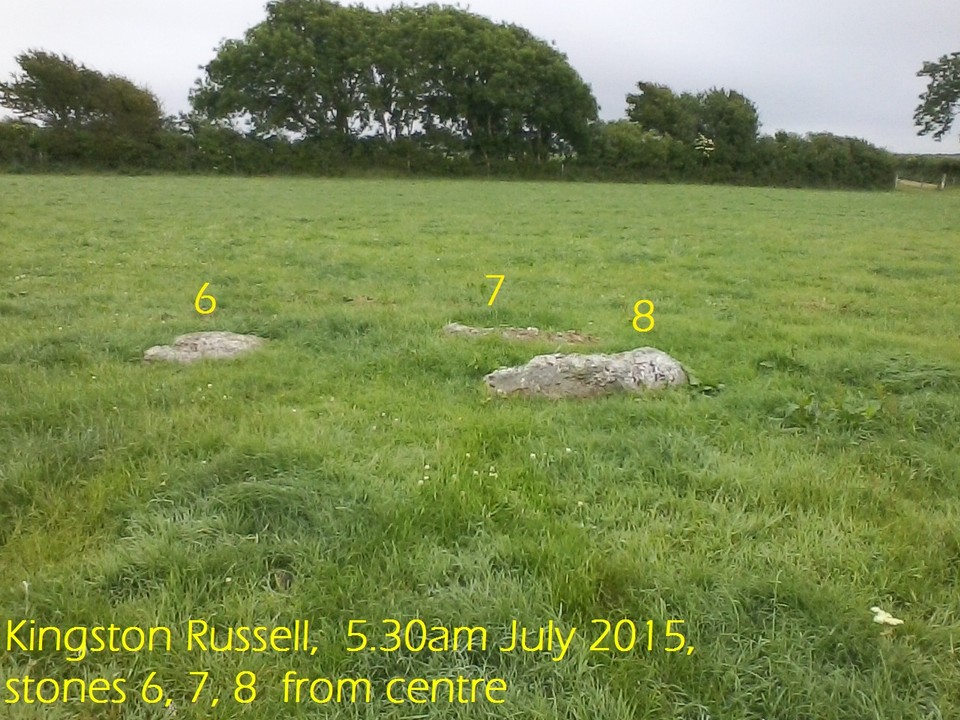
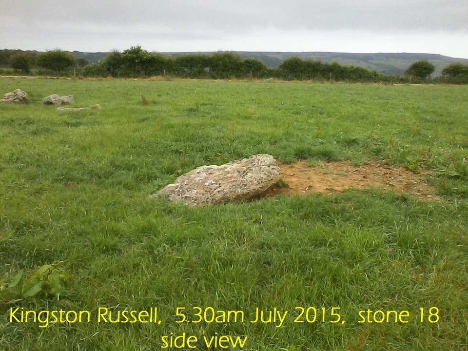
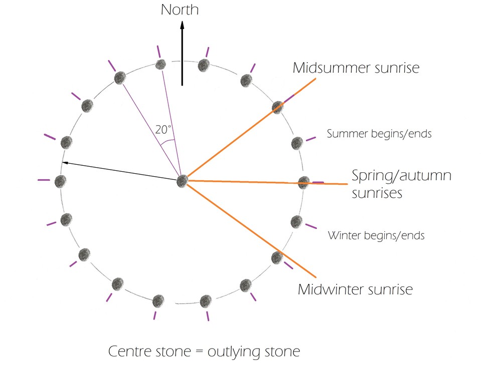
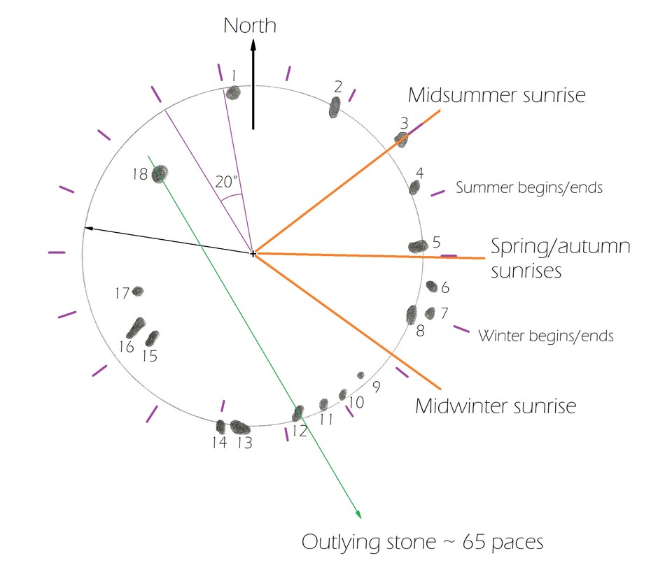
The stones are roughly comparable in size and do not appear to have been broken up, so the original number may have been as today - 18. If 18 stones are placed equidistance from one another in a circle then the angular distance between each is 20 degrees. This could align with the sunrises as shown in the diagrams.
Thus this site has the potential to be aligned to the sunrises if arranged in a symmetrical circle. However it's irregular placements of the stones makes it appear that it has been wrecked long long ago. If the stones were placed regularly and positioned from the midsummer sunrise then the alignment would be as in the diagram below of a hypothetical original structure. Please see diagrams in the diagram section.
Sacred site -
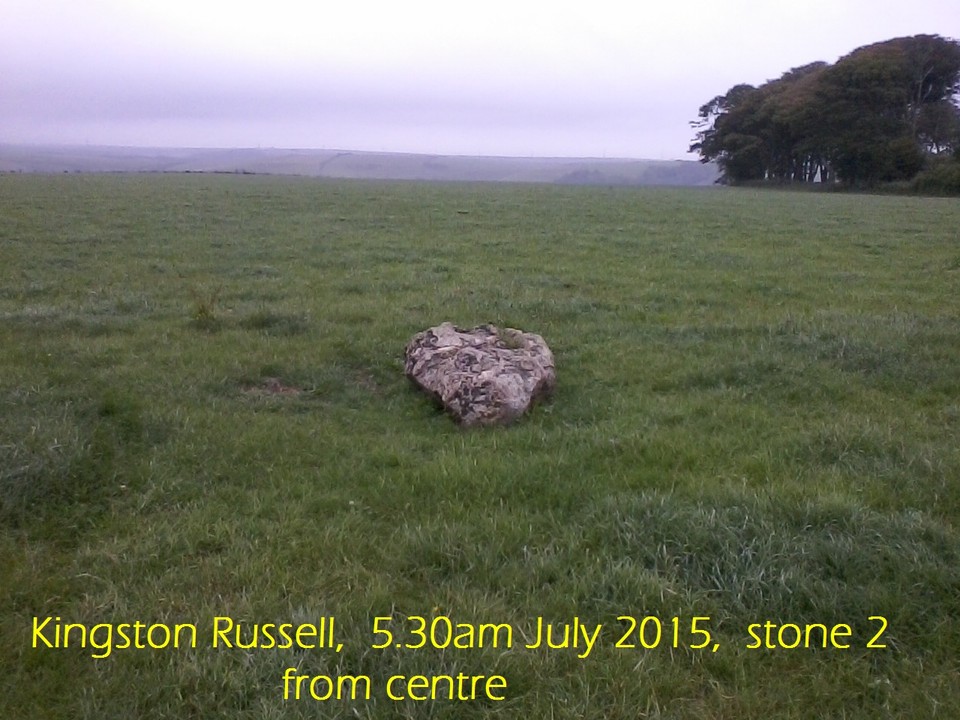
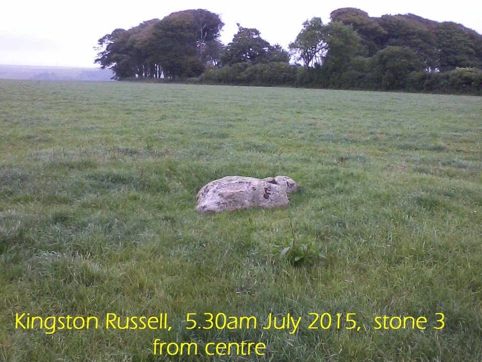
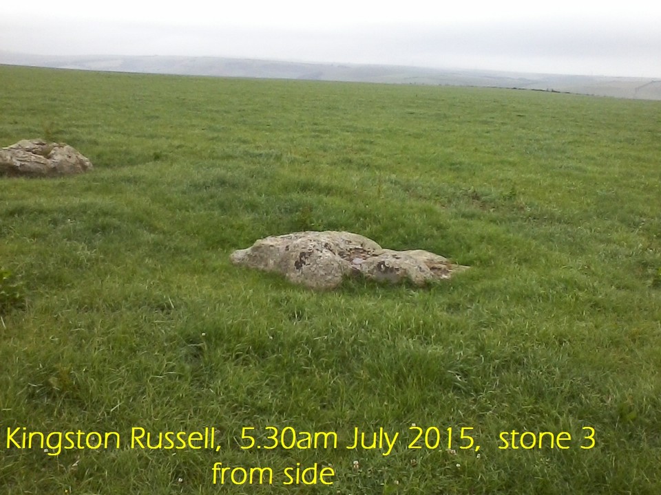
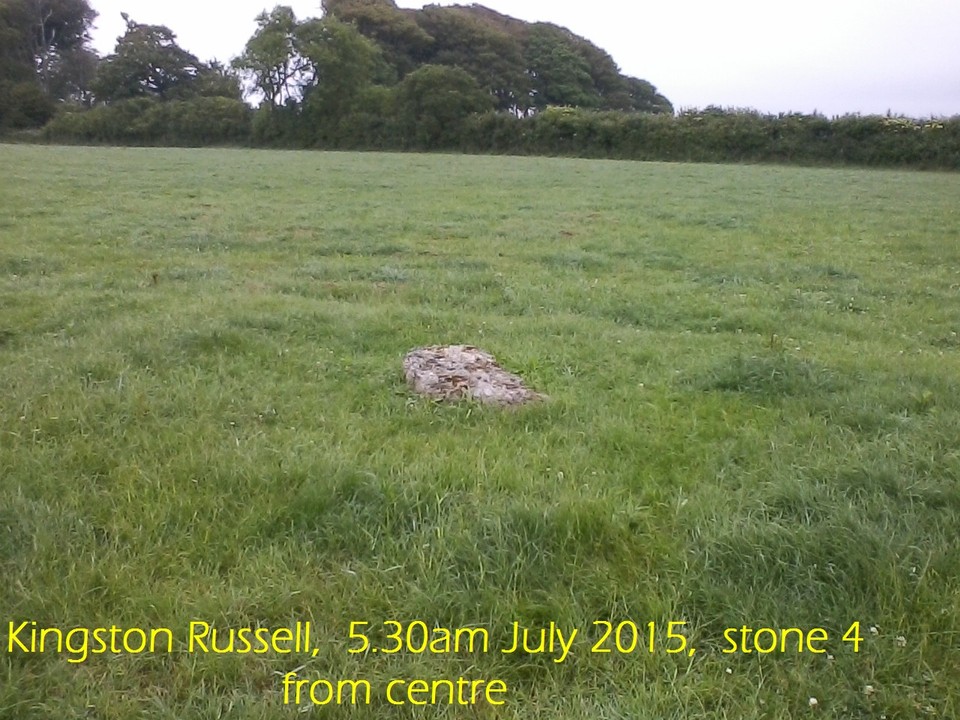
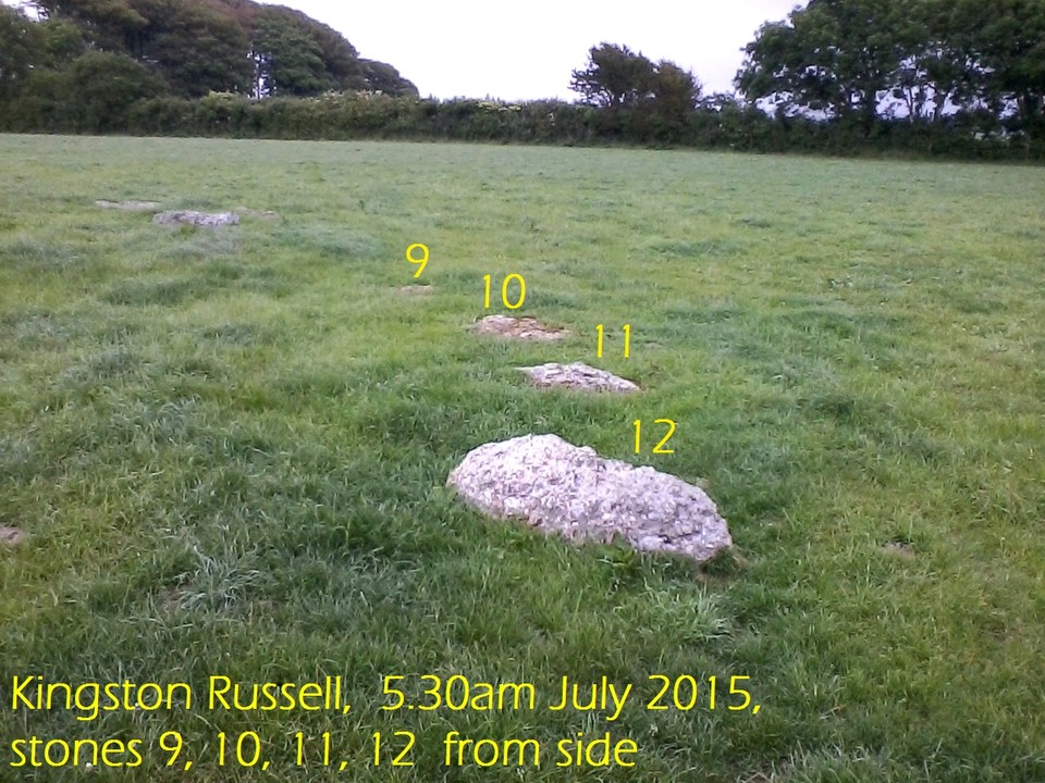
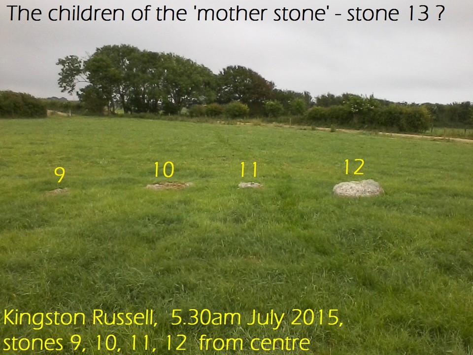
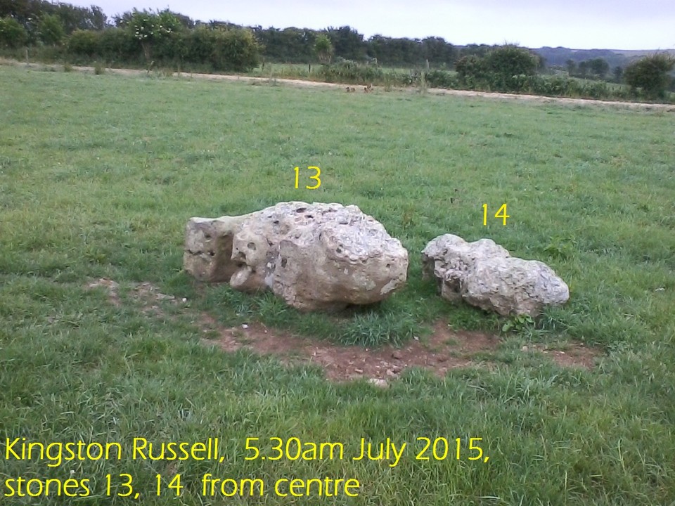
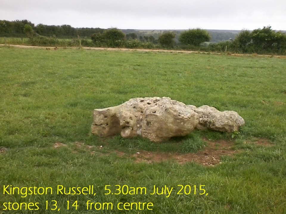
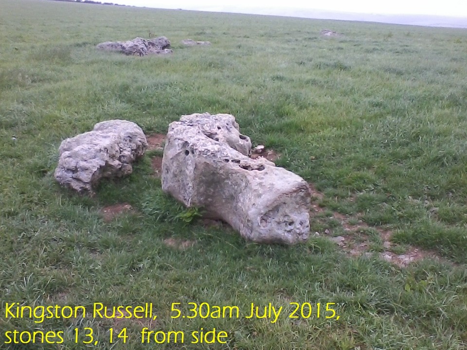
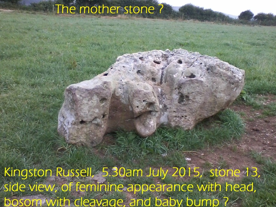
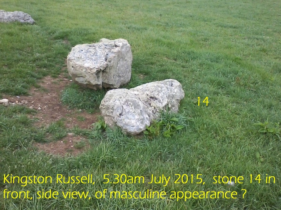
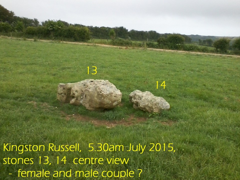
An interesting feature is an unusually shaped stone (stone 13 in the diagrams) that appears to have been roughly carved, although it is now considerably weathered. There appears to be a head and a bosom with a cleavage, and baby bump, with the back curved as per a human woman. Four stones in a line (9 to 12) of diminishing size give a distinct impression of a stone family. A further stone (14) next to the shaped stone 13 is blunt with 'masculine features'. We can be no more specific on this family site! : ) Thus this would seem to be a sacred structure, perhaps built as a development of an original one. Please see photos.
|
A Sage of the Stones.
Now retired and free - that's me !!!
|
|