|

|
 
|

|

|
 
|

|

|

|
 
|

|

|
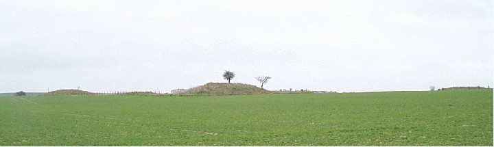
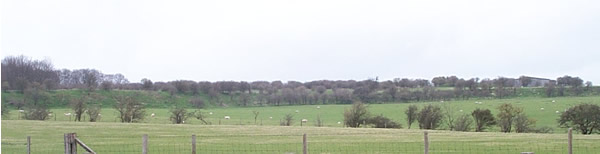
Far down the track from Stonehenge and past Normanton Down, as you approach the Lake Group, the path climbs up a hill. About half way up, leading up the edge of the Lake Group wood, an earthwork is marked on the map. No longer a ditch or bank, a strong cropmark jumps out at you. I've seen pictures of cropmarks in ariel photographs, but have been disappointed on the ground. Not here.
The cropmark is only visible on the eastern side, where grass is growing, becoming thick and lush on the site of the earthwork. A different crop is growing on the western side, and the site of the earthwork isn't visible at all, not when we visited.
Not the most imposing of sites, but certainly worth the walk if you're in the area (but the walk itself is certainly worth it), just to see what this cropmark business is all about, without the use of a plane ...
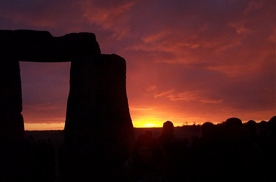
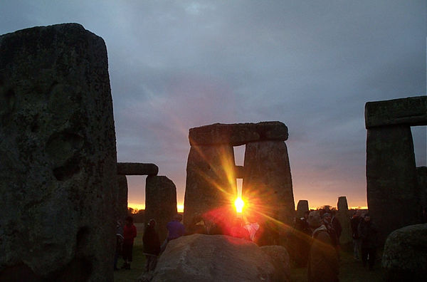
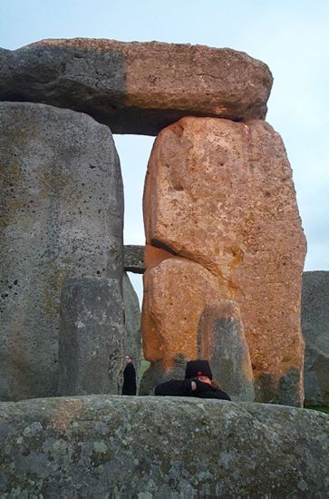
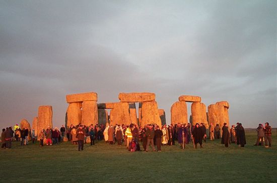
Spring Equinox, 2002
|
    
|
Devil’s Quoits, 9th March 2002
This site has occupied a curious place in my imagination for several years now – I’ve always known almost exactly where it was, but always felt as if it was untouchable, beyond reach, to be imagined but not experienced. I first read about it, as a passing reference, in Aubery Burl’s field guide many years ago. Not quite so many years ago I failed to get onto a rare organised visit organised by organised southern stone circle freaks. Only when the topic of the site was raised a few weeks ago did I finally decide to get down there and find out just what was going on, and why this site is so difficult to visit, or at least seems that way.
Located just south-west of Oxford, on the edge of the village of Stanton Harcourt, the Devil’s Quoits have suffered unjustly from their favourable location. Once the centre of considerable Bronze Age activity (records show this to rival Avebury, Flag Fen and Glynsaithmaen as a prehistoric cultural centre), first medieval agriculture, then wartime ‘necessity’, then construction (this is a rich gravel bed extraction area), and finally, the greatest insult of all, landfill. The henge and barrows ploughed out and destroyed, the stones flattened to build the runway, the earth scarred and ripped to provide the raw materials for road-building, and the wounds tended with the rotting garbage of our throw-away society. To study the progress of British civilisation, look no further.
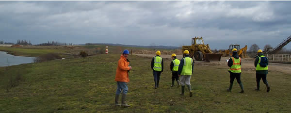
But you can’t. This site is still a working landfill site, home of a never-ending procession of bin-wagons, bulldozers and responsible landscape gardeners, as an unwelcome a prospect for Neolithic explorers as could be imagined. But prompted by a throwaway question, and still smarting from being too disorganised to make the previous visit 2 years ago, I took the bold step of ringing up the site, and asking, no, demanding, to be allowed on to the site, to inspect the damage for myself. In one of those strange twists that came to define the day, the lads on the site were really helpful, and could see no problem in me turning up, with up to 9 friends, pretty much any time I liked. That’s it, you can visit anytime you like, you only have to ask, and you’re in.
As the site is still a working landfill site, and is going to remain that way for a while, you have to follow Health and Safety regulations when on-site, which means high-visibility jacket/vest and hard-hat, but the site office can lend you these, and you really want to be wearing wellies as well.
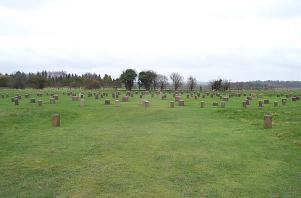
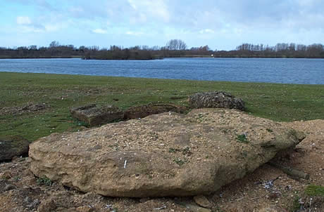
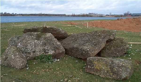
7 of us got together, and turned up on a fiendishly blustery day in March 2002. We parked up, signed in, kitted out and walked the 800 feet from the site office to the remains of the Devils Quoits henge, alongside an enormous gravel pit lake, which according to my map of the area, previously was home to dozens of barrows. By the waters edge are a variety of felled stones in a variety of conditions, piled up, half-buried and up on display. Most prominent is the stone clearly recognisable from the 19th century photograph (aka “Quoit A”), then towering above the self-photographer, now lying on the ground, still with a deep groove on it’s right-hand side. Slightly to the south are 2 half-buried stones, man height, which we took to be the other 2 stones standing in 1940. To the north is a genuine “pile of broken rocks”, which were apparently discovered in the 1988 excavations. These are not thought to have been part of the circle, but have been kept anyway, “just in case”. If all you’re interested in is seeing big stones tower above you, then you’re going to be disappointed, for the time being anyway. All the stones have been recovered from their graves, but await res-erection.
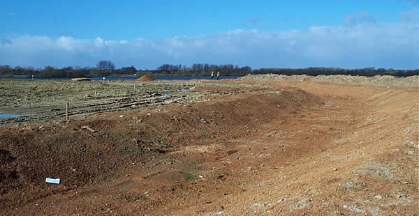
To the east of this megalithic graveyard is a far more impressive sight – the henge returns! And what a beauty it is, roughly equal in size to an Avebury inner-circle or Stanton Drew. This was a true giant among the henges, the focus of what seems to have been a site of huge importance, quite plainly the result of a lot of effort and hard-labour. The reconstructed ditch is deep and wide. It’s hard to imagine on a bleak pre-equinox spring morning, with rubbish blowing about, a disturbingly large number of dead birds crunching underfoot, and heavy plant roaring in every direction, but this was the centre of a barrow cemetery stretching for miles in every direction, the focus of a determined and extremely able society, of which we know just about nothing, and have literally thrown away the chance of discovering.
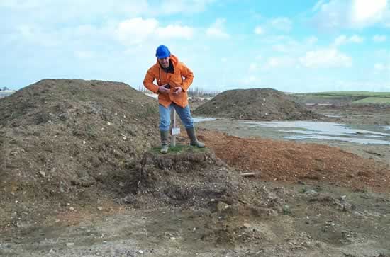
The Oxford Archaeological Unit (OAU) are working hard to make amends and cling onto what little we have, along with the heavy machinery of the Waste Recycling Group. 3 excavations have uncovered the surviving stones, the location of the stone holes, and the dimensions of the henge ditch. The ground has been brought down to the level of the site at the time of construction (various datum levels remain to show the level before work started, with little grass hairpieces) and the immense ditch dug out. The OAU have calculated the labour required to raise each stone by hand, and plan to reunite each surviving stone back to it’s place after their oh-so brief immersion in the soil. Missing stones are to be replaced with likely substitutes, from the local conglomerate. An awesome weekend awaits the strong, curious and adventurous.
The end-result should be a cut-above the average “landfill-turned-countrypark” that are becoming increasingly common. A great scar has been inflicted on what was once a site of intense activity. The countless barrows are gone, never to return, but a peaceful place for the future beckons. Visit it often, and marvel at the changes.
|

|

|
|
Be careful when exploring the Chilterns ... a cougar, puma or some other unidentified ABC (alien big cat) is said to prowl around these parts ... something to think about when staggering around the thick woodland Wain Hill in the fading twilight ...
|
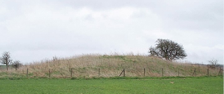
Finally, we reach The Cop. Deep in the cougar-infested woods on the Bledlow Ridge, on the eastern spur, opposite the Bledlow Cross, a small mound, deep in trees.
Now hugely overgrown, this must have been a magnificent place to be buried (along with the other barrows in this small group) - the Chilterns fall away (the Ridgeway marking the boundary) to reveal an enormous plain, a view for eternity, still takes my breath away every time I see it.
Trees, nettles and rabbits occupy this site now ...
|
from the w3px poem exchange website, via the Stones mailing list
Long Meg, by A.S.W
Two fathoms long, she points the way
to children 'ranged in a special play'.
Her time has come, when from the sun
her shadow marks the year as done
|
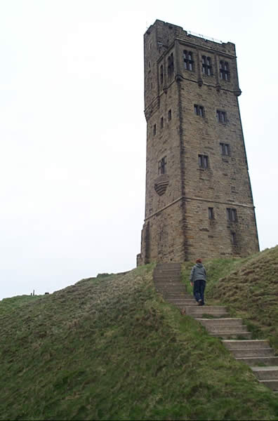
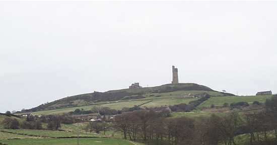
Anyone planning a visit to Roseberry Topping is advised to either undergo a circuit training program, or strap themselves to a passing mule train, due to the near vertical slope of the hill --- a true challenge for the dedicated Odinistic explorer. Highly recommended. I last climbed RT about 15 years ago, at the start of the White Rose walk, 30 miles down to the Kilburn White Horse (and now the site of a rediscovered hillfort) - the sheer scale of the hill struck terror into our adolescent hearts, a never to be forgotten experience ...
recommended
|
all about the cross and the hill
|
|
Another explanation for the "Heel stone" name is that it comes from "Helios", as in Sun ... as it marks the rising of the midsummer sun, it sort of makes sense, but you'll never know ...
|

|
    
|
A tidy little hill-fort, with spectacular views across the western chilterns and all the way to Oxford and beyond --- I didn't pick out Wittenham Clumps/Dorchester-on-Thames complex from here the day we visited, but they should be visible.
At the top of a massive hill, just south of Aylesbury, this forms part of the Icknield Way family of settlements, from Ivinghoe Beacon to the north, and joining up with the Ridgeway further south. Cholesbury is a 20 minute walk
The banks are pretty eroded, and obsucured by thick vegetation, but it's still a highly popular spot for picnickers. Go there.
|
A must-stop on any visit to the Uffington White Horse or Lambourn Seven Barrows. Head east from the White Horse towards Wantage. Look for the crossroads at Kingston Lisle, with the sign pointing North to the "Blowing-Stone" inn - turn South (towards Lambourn), and the Blowing Stone is on your left, at the start of the row of houses at the bottom of the hill. Parking is dodgy, but there's gate further up on the right where you might squeeze in.
The stone was moved here sometime in the 18thC, when it was the centrepiece of the old Blowing-Stone inn ... the story is that if positioned correctly, you can get a note out of this (like so much around here, there is a local-boy King Alfred story attached). However, you would need to be both insane (to put your lips anywhere near the thing) and have the lung-capacity of an elephant to get even a peep out of it.
If you do, then the whole valley will resound to it's magnificent timbre
Good luck
|
|
Alleged to be one of the resting places of King Arthur. They take the Mabiginon seriously around here ...
|
No-ones really sure about this site ... is it a "true" site, or is it a later addition? It stands by Carn Bica, on the path along the top of the Preseli ridge (by the famous "crossroads" that have caused so much speculation). The stones are about 2 ft high, and all tend to lean inwards.
The site isn't listed in Burl, but is definitely there, and in one of the most spectacular locations. You'll need to walk for at least 30mins/hour to get there from any road, but it's worth it.
|
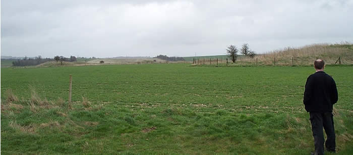
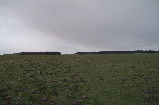
There's not a lot going on here now ... it's in the middle of a "pick-your-own" field. Arial photography has picked up fairly substantial crop marks here, suggesting a bronze age barrow cemetary. On it's own, not that interesting, but it's part of a chain of mounds and other sites dotted along the banks of the Thames
Access is possible at certain times of the year, but you need to be quick, and there's nothing to see anyway ... but, remember --- Context and Landscape!
RG
|
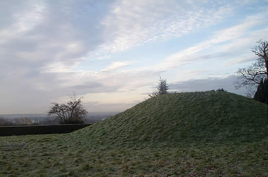
This is a cracker ... Heatherwood Hospital is just across the road from Ascot racecourse, on the big roundabout. Strictly speaking, you should really be a patient, or visiting one, to gain access, but they'll spank you for the parking fee regardless.
Inside the hospital, inside a tiny quadrangle, is a fair sized bowl barrow, probably late Bronze age. There's a little sign by it, but otherwise absolutely no acknowledgement of it's existence. Even the size of the space allocated to it demonstrates the begrudging nature of it's survival ...
|
Huge database of sites, indexed by location (grid-ref and postcode)
Excellent resource, including find information - USE IT!
|
Stroud Horestone rediscovered by amateur historian
http://news.bbc.co.uk/hi/english/uk/england/newsid_1670000/1670707.stm
An amateur historian has found a lost standing stone in his own "back garden" - 18 months after beginning a search for it.
Stephen Davis and historian friend Clare Forbes used ancient documents to help track down The Horestone near Stroud, Gloucestershire, some
350 years after it was lost.
Mr Davis learned of the stone when he began researching the history of his own house in 1987.
He then started to swap notes with local historian Ms Forbes and this led to the pair agreeing to look for the stone together.
The first known reference to the stone was in legal documents dated 1170.
But it is believed to mark a Bronze Age burial site dating back to around 2,500 BC.
The area was declared common land after a law suit was fought over it in the 14th Century.
Its last official recording was in 1636 in a tax record.
The land on which it stands, which is behind Mr Davis' house, was sold off 300 years ago and is now part of a housing estate.
'Astonishing moment'
The two stone-hunters feared the ancient rock on Rodborough Common might have been smashed up or buried to destroy its magical powers.
Mr Davis said: "We had no reason to believe that we'd actually find it. These things are buried, ploughed over or they just fall over."
They almost missed finding it because it was so overgrown with ivy it looked like a tree stump.
But both said they were glad to find it and "unpick the lock of ancient history around Rodborough".
On uncovering the stone, Mr Davis said: "It's curious to excavate a piece of history. It wasn't just stumbling across it, but just stumbling across
it while we were looking for it.
"It was the most astonishing of moments. It spoke immediately of lost time and still had all the atmosphere of a pagan shrine.
"I was certainly not expecting to have such a stunning moment in my own back garden."
English Heritage is now expected to declare the six-feet-high stone a scheduled ancient monument.
|
|