The official online archaeological resource for the Stockton and Hartlepool area. Contains a link to the areas HER, database of all the area's known archaeological sites, constantly being updated.
|
The interactive website of SHARP, Scotland's Coastal Heritage At Risk Register. News, events, interactive map of the 940+ sites at highest risk. Report via it any deterioration. A useful and worthy resource. Some of those sites may undoubtedly be yet to added to TMA too.
|
What it says...there is already a link for Orkneyjar, tucked right down at the bottom of the page, dated from 2001. That covers a different part of the website, the 'history' bit. Sixteen years on the archaeology section has grown into an invaluable resource, and deserves to be at the top of the links and the first port of call for those visiting TMA interested in Orcadian archaeology. I therefore hope that this 'sort of relink' will be allowed to stand.
|
A very interesting piece on Iron Age Orcadian burial practice, based on excavation of this structure.
|
The Canmore entry for a most intriguing complex of Bronze and Iron Age structures which are under threat of coastal erosion and where excavation has taken place for several years.
|
The archaeological section of the new website of the Ardnamurchan History and Heritage Association, listing all known sites, which will be added to as and when their members fieldwalking discovers them. Much to visit already that is officially notified but not as yet on TMA or elsewhere.
|

An article with fine photographs of and information about Greadal Fhinn which also contains a link within it to more of both..as well as a photographic description of what you will see if you visit this site and then keep walking and climbing westward in this most majestical and starkly beautiful hidden corner of Scotland.
|
A fine collection of Scottish archaeological websites, many with prehistoric-related contents
|
Team leader Julian Thomas's account of the Manchester University Dunragit excavations, published in 2015. Contains a chapter on the archaeology of Luce Bay. A hugely important area, much work still to be done.
|
A summary of the Manchester University excavations at Dunragit in 1999-2002. Top photograph shows the excavation of Droughduil's W side. Another photo shows the excavations of the wooden Dunragit circle and triple concentric cursus, with the interlinked Droughduil, believed a viewing platform, in the background.
|
Full title: Report on a survey of crannogs in the south west of Scotland (and excavations at Buiston) ..contains a complete list of known crannogs in D&G, submerged and above water. As of October 2016 many therein to be added to the TMA database...some shewn on OS Explorers not Pathfinders. An example is Whitefield Loch near Glenluce, where one is shown on OS Pathfinder 82 (NB correct name is Dorman's Island, Whitefield Loch) whilst Explorer 310 reveals more (two, albeit one submerged unless extreme drought)
|
The Historic England entry for Ewden Beck cairn cemetery and, also, Broomhead Dyke which divides it, both believed Bronze Age.
|
A blog by a walker who has stomped all over Dumfries and Galloway in all sesons solo and with other ramblers. Many sites visited despite these being in a by the by context. Many photos, highly 'visually informative' despite the frequent presence of lines of walkers therein. Good as a reference for routes and permitted access too. Site dormant since May 2015 following his involvement with an online admirer..hope all ok there. For practical purposes Google Glebe Blog and then destination or location you're interested in. MoG, Torhouskie, Cambret, you name it, he's probably been. I've found this site invaluable and therefore recommend it highly.
|
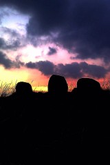
Apparently if you stand on top of the Wren's Egg on Midwinter's Day the Sun will set over Big Scaur - Scare on the OS - a large rock in the middle of Luce Bay. On every other day it sets further west. I remain interested whether this alignment is reflected in the two stones I found embedded in the stone dyke E of the site though accept that they are most probably of later date. I would also like to return to double check whether the Wren's Egg erratic is held in place by any visible chocking stones, indicating rolling into its present day position, perhaps in relation to this solar alignment.
|
Click on the red wording above to access an aerial view showing Slockmill enclosure, circular features therein, the stone circle or setting - near top right, and, to its left, the fort ramparts. Separate TMA site entries, fieldnotes and images for all. Crammag Head lighthouse and dun - and perhaps earlier cliff fort - is in the foreground.
|
Click on the red wording above to view a photograph taken from Dunman cliff fort showing Crammag Head and the southern and eastern sides of the dark, gorse covered outcrop inland which is unfenced. It would appear that the forts ramparts are deliniated by a level contour, with pasture below and gorse above, and may perhaps be distinguished by what appear to be indentations or notches in the gorse on the seaward side of this feature. The only unramparted side of this fort is therefore on the western side, where a high vertical rock scarp may have been thought sufficient defence.
|
Clicking on the red wording above will reveal an invaluable image showing the three Slochmill sites. Paper copy adviseable for those interested. To locate the stone circle - or setting - first look a the structure to the right (south) of the lighthouse. This is a WW2 Coastguard lookout. The dark line heading up the image from adjacent to the lookout is a wire fence. It intersects with an inverted crescent shaped feature which crosses from one side of the photograph to another. This is a Galloway dyke. Moving from the intersection with the fence leftward around the dyke's circumference a gap is visible with a straight, possibly stone topped path or causeway leading outward and upward from the dyke. It leads directly to the stone circle, some component stones of which are visible as grey-white dots. The path to the circle looks to have degraded ditches either side not seen when fieldwalking, denoted by darker vegetation, and there seems to be the faint trace of a ditch surrounding the circle, once again not noticed when fieldwalking. Inward, or seaward, of the dyke there are a number of circular crop marks, if the image is studied closely. Most are close to the dyke, predominantly towards the centre of its curvature. That they may be hut circles would only be confirmed by excavation. As before, they were not apparent when walking to Crammag Head dun. If proven though, they could be contemporary with the stone circle. The three ramparts of the fort commence due left ie. North, of the circle and encircle the base of the gorsey outcrop. Construction of this may have been incomplete as there are terraces between each rampart, not ditches, and I found ramps between each terrace. A three terrace fort from the Iron Age exists at nearby Kirkmaiden - the Canmore name of that site is Core Hill - for which there are separate fieldnotes on TMA. The similar construction of Slochmill's fort may indicate it is of contemporary date. My gut feeling is that at least some of the hut circles, if that is what they are, are of earlier date, perhaps mid Bronze Age.
|
Aerial views of Crammag Head lighthouse, and the remains of the dun which it has been built on top of. Near to and on the landward side of the light an encircling earthwork is just visible, of possible earlier date than the dun (or fort or broch - ID is inconclusive). The Slochmill sites are visible further inland, including the circular features within the enclosure, but are better served by a different, higher quality, aerial image, a link to which is attached to the TMA site entries for the stones and enclosure
|
A photograph of Dunman taken from the cliff below Crammag Head dun is, if seen in 'two photo in line' format, three rows down, right hand side, and a view to Crammag Head from Dunman Fort's N ramparts is two rows down, right hand side.
|
|
I have always been interested in history, fictional or historical, and loved reading as a child the works of Rosemary Sutcliff. Yes, I did read Stig Of The Dump too. When ten I found a mussel midden when digging holes in the back garden - it turned out my folks house was built adjacent to the town hanging place, and the mussels were part of the additional social attractions. I used to visit sites when I could with my similarily interested father, particularily on holiday. Glenelg Brochs, Caer Caradoc, Maiden Castle, Warham Camp... History was my strong point at school, but life took me elsewhere for a career. I continued to read the likes of Graves, Belloc and Childe, though, as well as watching any history programme on television.. Cunliffe, Wheeler, Chronicle.. this continues to the present. I watch the repeats of the repeats of the repeats of Time Team, you name it. While my interest latterly has been for the most part armchair based, I have always loved looking at maps, and by using the distance between the Roman milecastles of Hadrian's Wall as a datum I have done a lot of work identifying Roman settlements along pre-Roman routes, cross referencing with linguistic clues in placenames and archaeological records. I also believe I have found three settlements of some size where little or no habitation exists today. Oh, to dig. I have no favourites as to type of archaeological site, and feel that phenomena such as holloways and holy wells or sacred springs are unjustly neglected compared to the likes of stone circle glamourpussies. A site is a site is a site. I visited many in the White and Dark Peak in the '80's before raising a family and steam engine restoration and firing took precedence. After tentative explorations on holiday over the last five years I have recently started to visit sites intensively again, but my circumstances frustratingly rarely permit this. My prime interest currently is visiting Western Scottish coastal sites, and, as a horticulturist, studying the botany in their environs that may be present day survivors of cultivation contemporary with site's occupancy, such a sorrel and, yes, gorse, sacred to the Celts and much used by them, now cursed by those interested in archaeology today. Sorry! (Not : p) Favourite sites: Lagvag Cairn, Dunman, Slochmill, Barsalloch, Powerstock Common, Eggardon Hill, Arbor Low, Warham Camp and Stevington Holy Well. Avatar: Torhouskie Stone Row. I took this image after being charged by cattle there five minutes earlier. A reminder to myself to make the most of what life may yet have to offer, including enjoying this, my hobby, as it can end in a trice.
|