Leekfrith Torcs go on permanent display at museum.
Pieces of ancient jewellery discovered in a North Staffordshire field by two metal detector enthusiasts have gone on permanent display at Stoke-on-Trent's Potteries Museum and Art Gallery following a successful £325,000 fund-raising campaign to buy them.
Pals, Mark Hambleton and Joe Kania hit the headlines in December 2016 when they returned to a field near the Staffordshire Moorlands village of Rudyard some 20 years after failing to detect anything there and discovered the artefacts which are thought to be among the earliest examples of Iron Age gold ever found in Britain. The jewellery was declared treasure at an inquest in 2017, prompting the launch of a fundraising campaign by Stoke-on-Trent City Council in partnership with the museum's Friends group to buy the objects for the Potteries Museum and pay for expert restoration work.
More than 21,000 people viewed the Leekfrith Iron Age Torcs when they went on temporary display at the Potteries Museum & Art Gallery in February 2017 with members of the public donating thousands of pounds to the fundraising campaign. A grant of £80,000 from The Art Fund gave efforts a boost then, as the deadline to raise the funds to buy the precious ancient jewellery approached, a grant of up to £165,000 from the National Heritage Memorial Fund ensured that not only could the torcs be purchased but also ongoing research could be carried out.
Link to article in The Sentinel newspaper 28/05/18.
https://www.stokesentinel.co.uk/news/stoke-on-trent-news/ancient-treasure-bought-325k-finds-1609312
|

Archaeologists praise 'eagle-eyed' contractor
Peak District National Park archaeologists have praised a contractor working on a major footpath restoration scheme in North Staffordshire after he discovered a previously unknown Bronze Age burial site.
Kieran Fogarty was digging a trench to reinforce a popular public footpath at The Roaches near Leek when he unearthed part of a decorated Bronze Age cremation urn. Mr Fogarty quickly alerted staff at the Peak Park authority to his find and a team from the cultural heritage division visited the site and identified his discovery.
A team led by archaeologist John Barnatt carried out a rescue excavation of the site and as well as recovering three large fragments of the urn were also able to identify and record the extent of the cremation pit, fully recover a 'significant amount' of cremated bone and charcoal from the site and even record the impression left by the side of the urn in the edge of the pit.
Ken Smith, cultural heritage manager for the authority said: "Kieran did exactly the right thing - by contacting us quickly we were able to get out to the site and identify what he had uncovered." Mr Smith added, "Often finds like this are associated with burial mounds but in this case there was no clue on the ground surface that there was archaeology present."
Funding is to be sought for post-excavation work to be carried out that may identify where the clay used to make the urn came from, C14 dating of the charcoal and study of the cremated bone. Once the urn has been analysed it will be deposited with The Potteries Museum and Art Gallery in Hanley, Stoke-on-Trent.
Link to story on website of Leek Post and Times newspaper:-
http://www.leek-news.co.uk/Pot-containing-human-remains-3-500-years-old/story-27680909-detail/story.html
|
There seems to be some difference of opinion on this site.
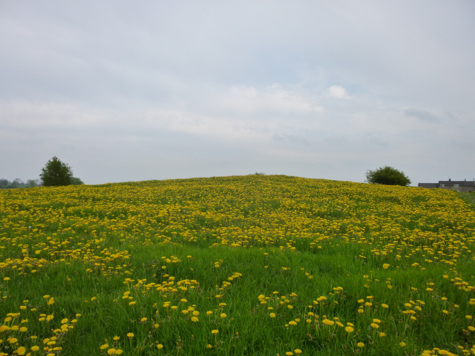
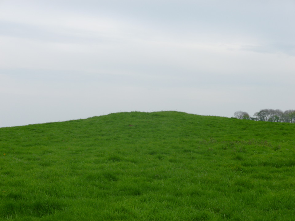
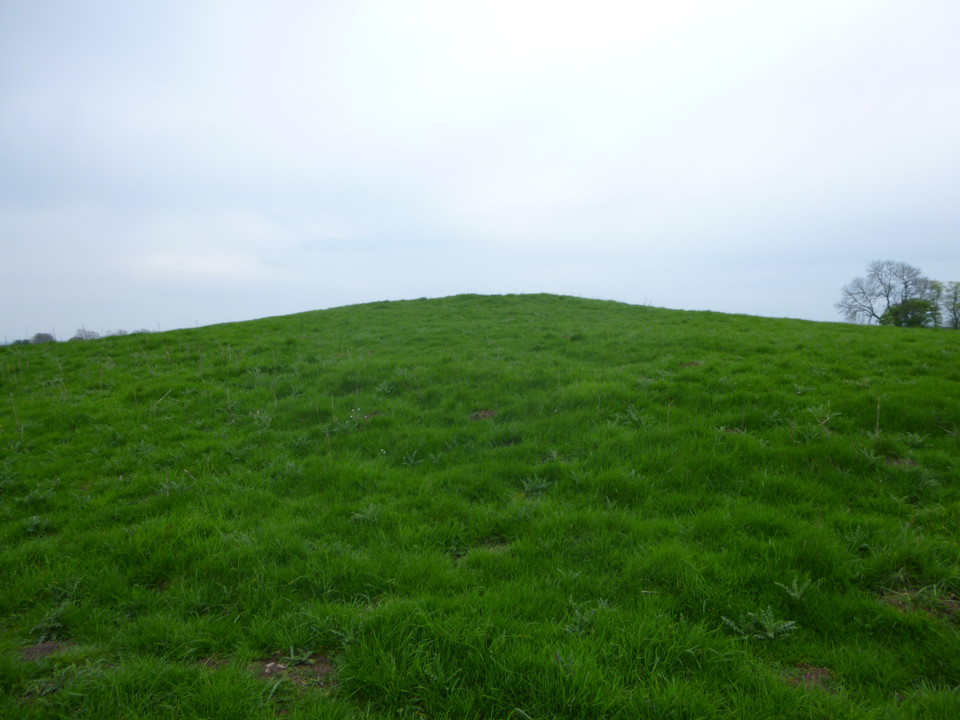
Pastscape sums it up with the description "conical mound with an outer ditch and bank, previously alleged to be a barrow, but probably a mound constructed to be topped by a mid 18th century obelisk - since removed. Scheduled as a Saucer Barrow."
Recorded as a Ring Barrow in the 1920's. In 1958 the OS's V.J. Burton interpreted the site as a possible Saucer Barrow. Notes that the summit has been dug into or levelled and reports that in 1954 a large erratic block was concreted on top of the mound, but that just four years later it had fallen off into the valley below!
However, in 1974 D.J. Clarke of the OS cited the excellent state of preservation, the unusual external bank and the level top as reasons to make it unlikely to be a barrow.
It may have been excavated by Molyneux in the late 1800's and the North Staffs Field Club proposed excavating the site but seem not to have done so.
Staffs. H.E.R. entry (PRN 00863) records it as The scheduled fragmentary remains of a probable Bronze Age Saucer Barrow. Pape notes it may have been robbed as the centre appears to have been dug into. Listed in Gunstone's gazetteer of barrows as Baswich 2.
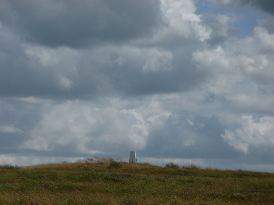
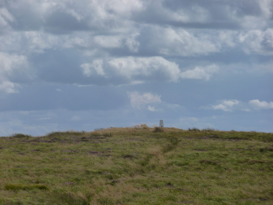
Finally, National Heritage List for England has the scheduling info. Grid Ref:- SJ 97656 20788. Scheduled Monument No.= 1009312. Scheduled as Saucer Barrow on Spring Hill. RSM=22423. First scheduled 21st January 1993.
Described as a Saucer Barrow consisting of an oval earthen mound upto 0.5m high, max dimensions 20.5m x 17m. bank and ditch surrounding it on all sides except the South-East. Ditch - 1.7m wide and upto 0.3m deep. Bank - 4.7m wide and 0.3m high. Monument not known to have been excavated. The concrete post is scheduled too!
Appears on OS Map as an earthwork symbol and Mound label in normal script.
|
Although these two barrows lie within the parish of Stanton, East Staffordshire they are a considerable distance to the North-West of the village. Stanton Dale barrows are in an accessible location to the South-West of Calton Moor crossroads where the A52 Cheadle road meets the A523 Leek to Ashbourne road. A rough track called Dale Lane runs to the North linking Common Lane to the A52 Cheadle road. A single footpath leads off Dale Lane across three fields before turning slightly to the right and enters the field containing the second barrow - with the other barrow just over the field wall to the South. Both barrows are shown on OS Landranger Map 119 and Explorer Map 259 by two earthwork symbols and a Tumuli label.
Stanton Dale 'A' - SK10775 48088. Scheduled Ancient Monument No. = 1009684. Scheduled as Bowl Barrow 190m North of Dale Abbey Farm. RSM = 13580. NMR = SK14 NW3.
A small, roughly oval stone and earth barrow with a flattened top 16.5m by 12m and up to 0.7m high sited to the South of the summit of the hill. The barrow lies to the South of the public footpath in the field adjoining Mount Pleasant Farm. The North-East and South-West sides of the mound are steep - possibly suggesting some robbing has occurred. There is an irregularly shaped shallow pit 0.1m deep at the centre of the mound that is thought to be the result of excavation. The previously unlocated excavation of Dale barrow recorded on page 125 of Bateman's Ten Years Diggings... is now thought to have probably been at this site.
On the 6th September 1848 Samuel Carrington opened a barrow at Dale (in the township of Stanton) about a mile from Calton Moor House. It is recorded in Bateman as irregular in form being 13 yards North to South and 16 East to West and about 3ft high. On the natural surface an unusual interment was found - two skeletons lain in a line head to toe which had been "exposed to the action of fire upon the spot, in such a manner as to preserve the bones in their natural state." They were surrounded by charcoal and earth and were of different sexes. Parts of an unburnt skull and some teeth were disturbed by the more Southern of these cremation-like deposits suggesting that an earlier inhumation had been moved to accommodate the burning of the skeletons. Some flint flakes and a fragment of pottery were found nearer to the surface of the mound.
John Barnatt included the barrow in his 1989 survey of Peakland barrows and speculates that the unusual shape of the barrow and nature of these partial cremations could indicate that Stanton Dale A is a Neolithic barrow.
Stanton Dale 'B' - SK10724 48123. Scheduled Ancient Monument No. = 1017688. Scheduled as Bowl Barrow 220m North of Dale Abbey Farm. RSM = 13579. NMR = SK14 NW3.
The second barrow to the North of the public footpath is less impressive. It is an oval earth and stone mound 24m by 18m up to 1m high which merges into the natural slope of the summit of the hill. Both the barrow and the natural slope have been ploughed down and spread leaving the barrow mound poorly defined. There are two shallow pits upon the mound but it is unclear if these are the result of excavation, stone robbing or plough damage. Pastscape states the barrow is not known to have been excavated but the NMR excavation records "Dale Abbey" excavated 1848 by Carrington - this may be a duplication of the Dale barrow excavation.
|
 
|
This is probably the barrow mentioned in the list of lows in Plot. ";and that other in a field near the left hand the way, as you pass between Mathfield and Ellaston near Colwich-Common, without a name; and another larger over against it, at the other end of the common, which they call Row-Low." Source: "The Natural History of Stafford-shire" Plot, R. 1686 p.404 paragraph 21.
So Calwich Low and Row Low both have names attached so the barrow near The Boxes is probably the one 'without a name'.
|
A Giant's Grave?
Robert Plot mentions that men's bones "of an extraordinary size" were found when a Low on Ecton Hill was opened. Apparently these bones were "preserved for some time by one Mr. Hamilton vicar of Alstonefield". Source: The Natural History of Stafford-shire", Plot, R. 1686. p.330 paragraph 109.
This is probably the low mentioned by Plot "on Ecton" in the list of lows on p.404 paragraph 21.
When Carrington opened Hanging Bank barrow on 18th May 1848 he noted that the site had been previously disturbed.
Bateman believed that this barrow must be the one Plot refers to as it is the only one of the five on Ecton that showed evidence of having previously been dug into.
There are plenty of examples from around the world of "Giant's bones" being discovered which are in fact the bones of large animals that have been misidentified - is that the case here? Maybe / maybe not - there are certainly examples of animals being interred in barrows in Staffordshire but these tend to be either smaller animals such as a dog, a pig or a polecat or they are part of an animal such as an Ox's head or antler tines. So could this just be the burial of a strapping, big warrior? Would that warrant the description "...bones...of an extraordinary size"?
It is a pity we do not know what Mr. Hamilton did with the bones he 'preserved'.
|
Top Low, Blore.
Top Low is located upon the summit of a hill standing between the Staffordshire Moorlands villages of Blore and Swinscoe. It is an oval mound of stone and earth 1m high with maximum dimensions of 22m by 20m. Two pits upon the summit of the mound are evidence of excavation. Samuel Carrington opened Top Low in May 1849 and Thomas Pape reopened it in 1929. The field surmounting the top of the hill is shown on a tithe map of the parish dated 1845 as bearing the name Top Low Field.
The report on Carrington's excavations of 5th and 12th May 1849 contained in Bateman's "Ten Years Diggings.." occupy six pages (including the plan of the distribution of the graves kindly added to this site by Chris Collyer). Carrington describes Top Low as being "an elliptical-shaped barrow, about 15 yards wide" the barrow was presumed to have started out as a round barrow whose shape has altered over time as numerous subsequent interments were added to it. Carrington found an interesting variety of funerary practices in evidence at Top Low with 14 interments in total. Two cremation deposits were found, one housed in a pottery vessel and one a loose pile of burnt bones accompanied by a flint implement. 11 interments were complete or partial crouched inhumations, mostly adults. These were interred in various grave forms - some lain in stone-lined cists, some surrounded by lines of stone slabs, some with upright stones erected at the head and feet whilst others were placed upon or leaned against stone slabs. However, the most unusual deposit was found at the very centre of the mound where a small, roughly built cist contained the ritual animal burial of a young hog accompanied by an antler tine. Also found were a bronze clasp, a lozenge decorated drinking cup, a complete 'A' type beaker, a broken leaf-shaped flint arrowhead and fragments of a second beaker.
Pape's 1929 excavation of Top Low was confused from the start as he was not aware that the barrow he was excavating was Top Low, even though he found the skeletal remains of several individuals all mixed up and piled together (probably reinterred by Carrington's workmen during backfilling). He did find a fragment of a polished greenstone axe. Pape's excavation report was published in the Transactions of the North Staffs Field Club simply as "Excavation of a round barrow at Swinscoe". Even after completing the dig Pape admitted that he was not sure if the site was Top Low but he had "an uneasy suspicion" that it was.
There is no public access to Top Low but both field walls between the barrow and the public footpath were down when I visited. There is a free public car park beside the Blore to Ilam road which is just a short walk via public footpaths from the hill which Top Low and Net Low sit upon.
Scheduled Ancient Monument No. =1009654. Scheduled as Top Low bowl barrow. NMR = SK14 NW1. RSM = 13576.
Net Low, Blore
Net Low is located upon the lower slopes of the same hill Top Low surmounts and some have labelled it Top Low II. However, this barrow does seem to correspond with one "in a field called Nettles" opened by Carrington in 1849 which he thought was called Net Lows. The name of the field in which this barrow sits is shown as 'Blore Netlow' on a tithe map of the parish dated 1845. Net Low sits upon a natural knoll on the side of the valley to the South-West of St. Bartholomew's church, Blore. It is an oval earthen mound 0.7m high with maximum dimensions of 13m by 10m.
Samuel Carrington opened Net Low on 2nd June 1849. On the South-West side of the barrow he found a paved cist containing calcined bones and a broken urn of red clay which contained a small vase or incense cup of the same fabric. This may have been the primary interment. Nearby his excavation trench uncovered the disturbed remains of an skeleton which has been interpreted as an Anglo-Saxon secondary inhumation. Near to the skeleton the base of a wheel turned pottery vessel and an iron ring one and quarter inches in diameter were found.
Thomas Pape re-excavated Net Low in 1927 finding disturbed charcoal, teeth (including a human tooth) and the Anglo-Saxon secondary inhumation.
Public footpaths run along the valley bottom below the site and along the hillside above it allowing the barrow to be viewed easily.
Scheduled Ancient Monument No. =1009652. Scheduled as bowl barrow 380m SW of Blore church. NMR = SK14 NW2 RSM = 13575.
|
 
|
 
|
 
|
 
|
 
|
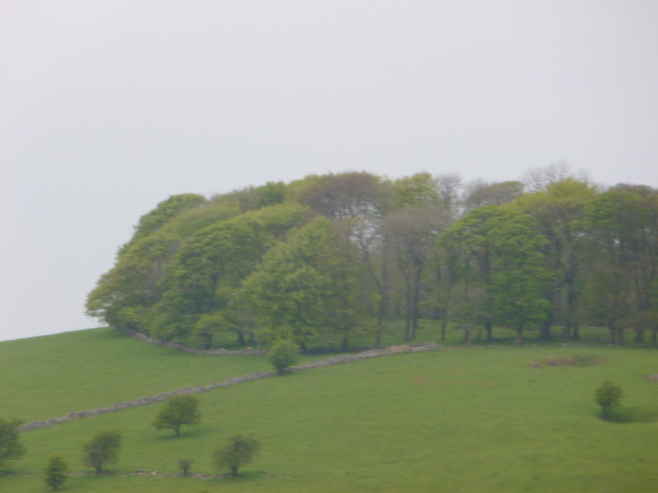
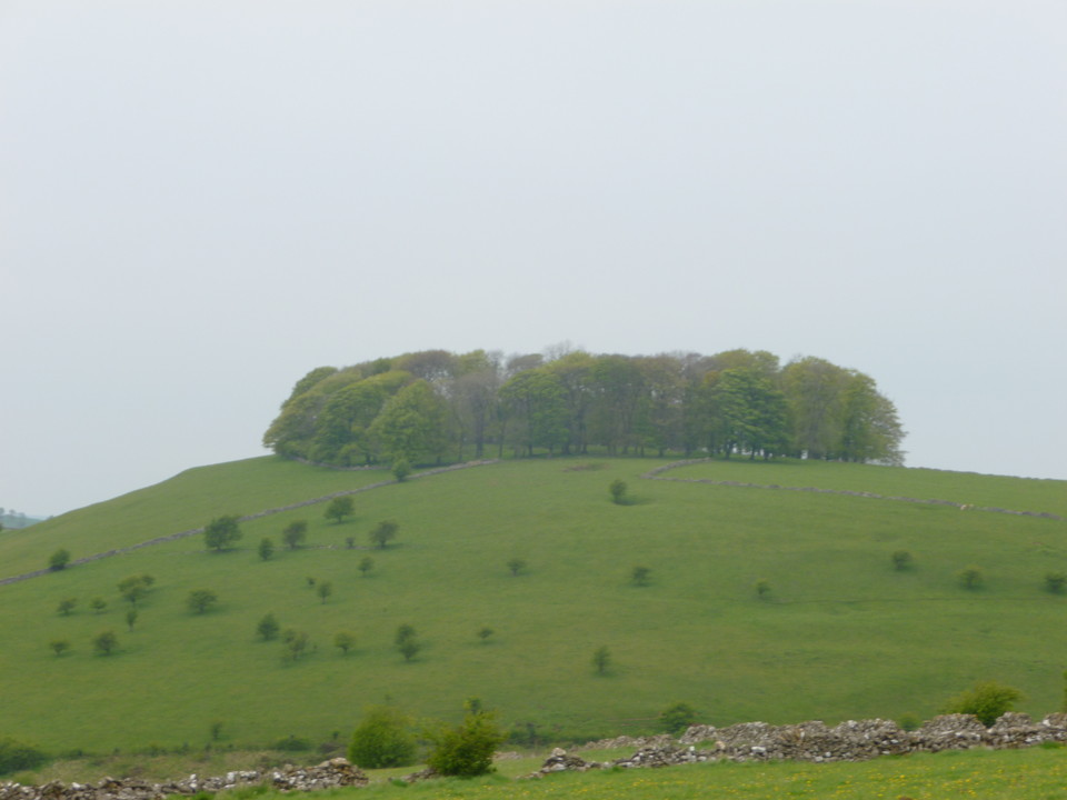
A highly visible hill located between the Staffordshire Moorlands villages of Calton and Blore to the South-East of Musden Low. Hazelton Hill is a distinctive dome-shaped hill with a clump of woodland upon it's summit. The hill is rather similar to Waterfall Low in appearance and good views of it can be had from the summit of Musden Low. Hazelton Clump can also clearly be seen from the A523 Leek to Ashbourne road which lies to the South.
A flat-topped barrow in the midst of a plantation on the top of Hazelton Hill was opened by Carrington in 1849. No primary burial was found but three secondaries, all cremations, were found.
One was accompanied by two arrow points of flint which were described as being of inferior quality as they were made from flint and broken pebble.
The second consisted of a few burnt bones placed under a small, inverted, plain cinerary urn.
The third was accompanied by a circular flint implement, some flint flakes and a peice of lead weighing more than 3 1/2 ozs.
Other finds included small pieces of a course urn, numerous pebbles, many large stones and a piece of iron ore. (Source: Bateman, T. "Ten Years Diggings..." 1861 p.140-1)
Although public footpaths run around the base of the hill to the North and South I am not aware of any public access to the site. There is a car park at the picnic site beside the Blore to Ilam road off to the East of Hazelton Hill near to Lady Low.
The site is marked on OS Maps by an earthwork symbol. The hill is marked by the label Hazelton Clump in plain text.
Scheduled Ancient Monument No.=1009441. Scheduled as bowl barrow on Hazelton Hill. N.M.R.=SK 14 NW15, R.S.M. No.=13554.
|
The smallest surviving hillfort in Staffordshire, Bishop's Wood is an Iron Age Univallate Promontory Hillfort located within that portion of the smaller, more northerly of the two coniferous plantations called Bishop's Wood that lies within the parish of Eccleshall, Stafford District. In fact the District and Parish boundary with Loggerheads Parish, Borough of Newcastle-under-Lyme runs along the western limits of the site.
The hillfort measures approximately 80m North to South, 50m East to West enclosing an area of roughly 0.2 hectares and sits at the South-Western end of a promontory. Close-set double ditches cut off the neck of the promontory and the inner ditch continues around the crest of the hill. A double bank and ditch facing North-East may mark the original entrance - though the modern roadway passes through the gap in the earthworks now. The defences continue for a short distance to the North as a scarped natural slope. A discontinuous outer line of defences has been added to strengthen where the natural topography is weakest. At the South-West a short stretch of ditch and bank defends the approach up the southern slopes of the promontory.
The site is not known to have been excavated but was surveyed by R.C.H.M.E. in 1988 as part of the Staffordshire Hillforts Project. A.H.A. Hogg lists this site as "Eccleshall Hillfort" in his Index of British Hillforts.
I have to say that despite there being public footpaths running through the wood this was not the easiest place to visit. The road leading to Bishop's Wood meets the B5026 Loggerheads to Eccleshall road near to Hookgate. (Look for a small sign on the opposite side of the B5026 pointing to the lane that reads "Fairoak Holiday Cottages - 1 mile"). There is a small cluster of houses and a farm at the head of the lane and this may be a public highway, however a short distance further on a sign states that the lane is a private road and no vehicular access is permitted without prior permission. The B5026 is a narrow but busy main road and not an ideal place to try and park and the lanes in the vicinity are very narrow. I can only suggest that you do what we did and park in Loggerheads and walk down to the site.
Follow the lane right the way down until you pass "Burntwood" Severn Trent Water station on the right. On the bend in the road just beyond that facilty there is a small metal gate with a spring-loaded catch that marks the start of the public footpath - ignore the direction the footpath fingerpost is pointing (it appears to have been knocked out of position and is now pointing straight at a tree trunk!) and instead follow the access track that winds through the woods. The track curves it's way around the base of the promontory that the hillfort sits upon. The whole site is aforested but ditches and banks are visible in parts.
Bishop's Wood Hillfort does not appear to be Scheduled.
|
The parish church for the parish of Loggerheads (The church of St. John the Baptist) is not located in Loggerheads itself but in the village of Ashley to the East.
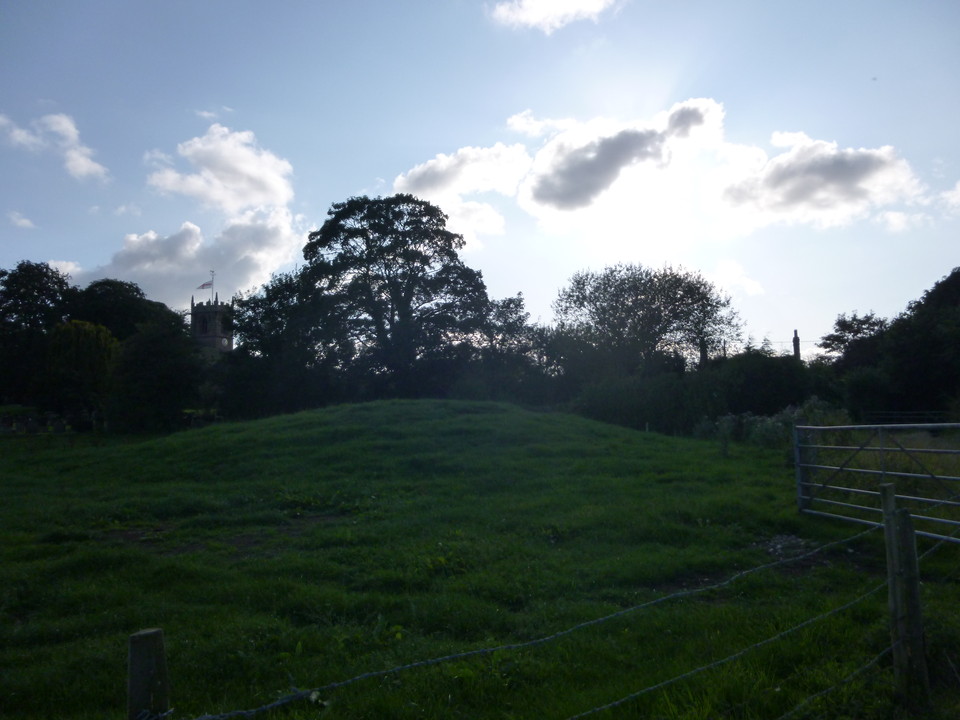
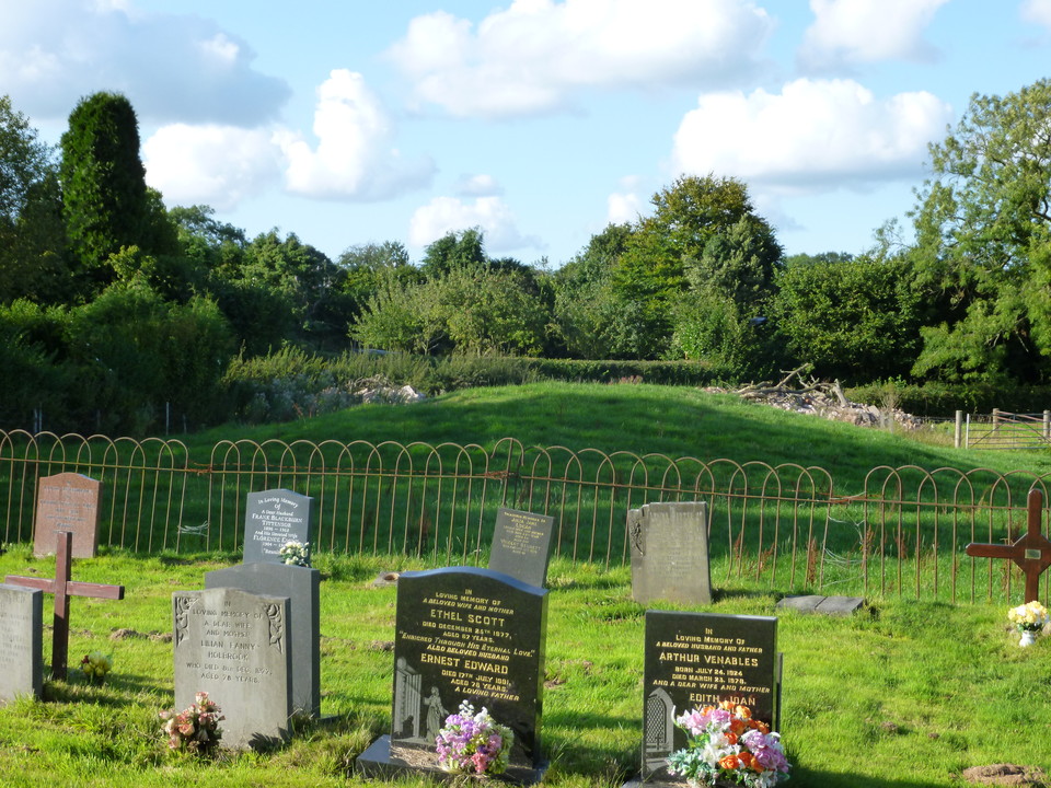
The Auctioneers Mound is an earthen mound scheduled as a round barrow situated in the field adjoining the church. The site is easy to find as it is located immediaetly to the rear of the house to the North of the church (directly opposite the village pub). On the far side of that house a track leads a very short distance down to a field gate, on the right-hand side of which is a stile labelled "Path to Podmore and Maer". Climb over the stile and the barrow is on your right in the next field on the other side of the barbed-wire fence.
The earthen mound is 1.8m high and 20m in diameter and has a flattened top 9m in diameter. An infilled ditch approx. 3m wide surrounds the barrow. In 1958 it was noted that an annual church service was held on the mound on Plough Sunday - but this tradition had apparently ceased by 1974. Presumably the name of the site comes from the idea of the Auctioneer standing atop the mound while conducting a sale of livestock giving them a panoramic view of both the stock and the bidders below.
The Auctioneers Mound is not shown on OS Landranger map 127. On OS Explorer map 243 the site is marked by an earthwork symbol and the label 'Mound' in plain text. The mound is not known to have been excavated and it has been suggested that it could be a Bronze Age Bowl Barrow, the motte of a timber castle or a burial mound covering medieval plague victims. It's location next to the church would not be unusual for any of these explanations.
Site Visited = 02/06/13
Scheduled Ancient Monument No.=1011065. Scheduled as Auctioneers Mound; a bowl barrow 70m NE of St. John the Baptist's Church. N.M.R.=SJ 73 NE11, R.S.M. No.=21530
|
The Tumulus marked on the OS at SK0944 5881 is called "The Cops". The barrow has a field boundary wall running over the top of it and it is completely destroyed on one side of the wall but fairly intact on the other side.
Pastscape entry for it is at http://www.pastscape.org.uk/hob.aspx?hob_id=305509
The portal has "Warslow Bowl Barrow" located at SK0907 5837.
Pastscape entry for Lid Low/Lett Low/Little Low at similar co-ordinates to that are at http://www.pastscape.org.uk/hob.aspx?hob_id=305504
|
Just a little more information on this site.
Carrington carried out an initial excavation of Brund Low on June 21st 1851 by excavating the centre of the mound. Halfway down he found a deposit of calcined bones accompanied by a triangular cup-marked sandstone. A disc-shaped flint was found in the filling of their trench. Carrington re-opened the barrow on July 16th 1851 and found charcoal and a second cup-marked sandstone.
Bateman records that one of the cup-marked stones was too large to be carried so the cup was cut from it. It would seem that both stones suffered the same fate as both of those at Sheffield City Museum are fist-sized.
Bateman also comments that they were told that the apex of the barrow had been much lowered when a bronze weapon half a yard in length was found. It has been suggested that this may have been a sword.
It was J.P. Sheldon's excavation of 1894 that uncovered the primary interment of calcined bones and charcoal in the small hole covered over by stones.
The V.C.H. calls this barrow Brund Lance. (Source: V.C.H. Staffs. Vol. I 1908 p376)
The barrow survives as a truncated earthen mound up to 1.7m high with max. dimensions of 40m by 38m and a slightly dished centre. Brund Low is marked by a Tumulus label and earthwork symbol on OS Maps 119 and OL24.
Site visited = 6th May 2013.
Scheduled Ancient Monument No.=1009080. Scheduled as Brund Low bowl barrow. NMR =SK16 SW2, R.S.M. No.=13525.
|
Brownlow is a bowl barrow sitting upon the crest of a spur in a field North of the B5053 road from Onecote to Warslow opposite Brownlow Farm to the South-West of the Staffordshire Moorlands village of Warslow. Just to the West of Brownlow Farm the road to Upper Elkstone village meets the B5053. A public footpath leads from this road North-Eastwards towards the site, the path runs parallel to the boundary wall of the field containing the barrow. Although the barrow is visible from this path its lower half is partially obscured by a small hillock between the barrow and the wall.
Brownlow is recorded in Bateman but was opened bya Mr. Manclarke on April 18th 1850, by the central pit method. This pit was dug down to a depth of 5ft where the undisturbed soil appeared to be strewn with charcoal, mixed with burnt bones from among which two pieces of flint were retrieved. (Source: Bateman, T. "Ten Years Diggings..." 1861. p245.)
Brownlow survives as an oval earthen mound with max. dimensions of 27m by 22.5m and up to 1.1m high. A shallow pit on top of the barrow is evidence of this antiquarian digging.
Brownlow is marked on OS Landranger 119 and OS Explorer OL24 by a Tumulus label and earthwork symbol.
Scheduled Ancient Monument No.=1008970. Scheduled as Brown Low bowl barrow. NMR = SK05 NE4, R.S.M. No. = 22412, S.M.R. No. = 00145.
Site visited= 17th April 2013.
|
An easily accessible site on the North-Eastern edge of the Staffordshire Moorlands village of Warslow, Blake Low is a somewhat truncated low oval mound scheduled as a Bronze Age Bowl Barrow.
The site is located to the North-East of the village pub "The Greyhound" and there is some on-street parking between the pub and the concessionary footpath that leads to the site (parking at the pub is limited). A short distance to the South of "The Greyhound" you will see a farm sign reading "The Warslow Herd - Gap Farm" at the end of a farm lane. The footpath follows the lane and across the farmyard of Gap Farm (the one nearest to the road), the path then continues along the lane towards a second farm before turning sharply right along a farm track. Immediately to the left you will see a field enclosed by a wooden fence. This field is almost entirely filled by the barrow. The footpath continues South to the B5053 Warslow to Longnor road. A large South Devon bull was in that field next to Blake Low when I visited and the farm dog was not very friendly!
Blake Low was opened by Carrington on February 23rd 1850. He describes the barrow as an earthen mound 20 yards across and 2ft deep in the trench cut through it. On the natural ground surface near the centre of the barrow a deposit of bones (a cremation?) and charcoal was found over which stones had been heaped. A neat, flint spearhead 2 1/4 inches long and an oval flint instrument 2 inches by 1 1/4 inches which was broken were found accompanying the deposit of bones. Carrington cut several trenches through Blake Low but made no further finds.
Blake Low survives as a slightly truncated (construction of a barn post-1957 levelled the western extremities of the barrow) oval earthen mound with Max. dimensions of 25m by 22m and upto 1.1m high. The central, sub-oval pit can be seen on top of the mound. The close proximity of the farm buildings and the wooden fence enclosing the site give Blake Low something of a 'hemmed in' appearance.
Blake Low is marked on OS Landranger 119 and OS Explorer OL24 by a Tumulus label and earthwork symbol.
Scheduled Ancient Monument No=1008969. Scheduled as Blake Low bowl barrow. NMR = SK05 NE7, R.S.M. No. = 22411, S.M.R. No. = 00146.
Site visited= 17th April 2013.
|
The hill Merryton Low forms the highest point of Morridge to the North-East of the Staffordshire Moorlands village of Thorncliffe. There are two barrows on Merryton Low, one on the summit and this second one to the South-West of the summit some 350m away.
Merryton Low II is obviously not as easy to locate as Merryton Low I simply because it has not got a concrete pillar on top of it! However, it is located just a short distance off to the West of the path that leads from the summit down the southern slopes of the hill. The top of the barrow is just about visible from the road that leads from The Mermaid Inn up to The Mermaid's Pool.
The barrow has a somewhat flattened top with maximum dimensions of 12m by 11m in diameter and up to 0.8m high. This barrow has an unusually narrow aspect to it and is sub-oval in shape (almost cigar shaped in fact). The western tip of the barrow looks as if it is aligned with Bosley Cloud over on the Staffordshire-Cheshire border.
Merryton Low II is not known to have been excavated and is not thought to be one of the three barrows on Morridge mentioned by Plot (Plot, R. "A Natural History of the County of Stafford-shire" 1686. Ch.X. Para.19, Ch.X. Para.21.)
Merryton Low II does not appear on the OS Landranger or Explorer maps covering the area.
Site visited:- 17th April 2013
Scheduled Ancient Monument No.=1008974. Scheduled as bowl barrow 350m SW of Merryton Low. NMR=SK06 SW13, R.S.M. No.=22415, S.M.R. No.=04186.
|
The hill Merryton Low forms the highest point of Morridge to the North-East of the Staffordshire Moorlands village of Thorncliffe. The summit of the hill is the meeting point of three parish boundaries: Onecote to the South, Fawfieldhead to the North-East and Heathylee to the North-West.
The name Merryton Low used to be 'Meriloneslowe' (13th-century spelling) denoting a barrow or hill (from the Old English Hlaw) by a boundary lane (from the Old English Gemaere lone). Source: VCH Staffs Vol.VII Leek and the Moorlands (1995) p.211.
Merryton Low I is a very easy site to locate as it sits at the southern end of the summit of the hill and has an OS Trig pillar at the South-West of the barrow's somewhat flattened summit. The western face of the OS Trig pillar has a memorial plaque upon it dedicated to four former members of the 5th Staffs Leek Battalion Home Guard 'C' Company who went on to serve in the regular army during WWII and died in combat. The parish boundary between Onecote C.P. and Fawfieldhead C.P. crosses directly over the barrow.
The barrow is oval in shape measuring 13m North to South, 12m East to West and up to 0.7m high. Merryton Low I is not thought to have been excavated - though there is evidence that the South side of the mound has been dug into.
Merryton Low I is visible from the road that leads from the Mermaid Inn up to Blake Mere (The Mermaid's Pool) and there is a track leading up to the site from the road. There is a similar track leading to the Mermaid's Pool just a short distance further along the road and this may be an easier place to park.
Merryton Low I is not thought to be one of the three barrows on Morridge mentioned in Plot.
(Plot, R. "A Natural History of the County of Stafford-shire', 1686. Ch.X Para.19, Ch.X Para.21).
Merryton Low I is clearly marked on OS Landranger 119 and OS Explorer OL24 by a Tumulus label and Earthwork symbol around the Trig Pillar symbol.
Site visited:- 17th April 2013
Scheduled Ancient Monument No.=1008973. Scheduled as Merryton Low bowl barrow. NMR=SK06 SW10, R.S.M. No.=22414, S.M.R. No.=04180.
|
Roylow or Rye Low is a large mound which is recorded as a barrow of uncertain date located right next to the public footpath that leads from the Staffordshire Moorlands village of Sheen to the hamlet of Brund. This barrow is in very good condition and very accessible.
Thomas Bateman examined Roylow on 21st August 1849. He described the barrow as being 35 yards in diameter and "rather more than 9ft" in height. The earth of the mound was intermixed with charcoal and layers of moss near the natural surface level.
On 2nd October 1894 Mr. J.P. Sheldon of Sheen reopened Roylow "Situated between Sheen and the Brund, three quarters of a mile to the West". He descibed the barrow as circular, about 100ft in diameter and 8ft high in the centre. A trench from West to East through the barrow revealed the upper part was of loamy clay with a few pieces of fist-sized sandstone within it. Below this and about a foot from the natural surface there was at the commencement of the trench "a thin stratum of ferruginous earth more or less hardened by the action of fire", apparently continuous throughout the barrow.
Beneath this were at least two layers of sods laid in irregular courses. In the centre of the mound were layers and vein like ramifications of some kind of sedimentary matter, bright blue in colour. Below this in the central region was a pasty sort of clay about 1ft in thickness containing many white nodules which Sheldon concluded were fragments of bone in a soft decomposed state but he could not say if the remains were human.
Roylow survives as a large bowl-shaped mound 33.5m in diameter and 1.9m high with no visible ditch. A single, now quite large tree sits on top of the mound and appears to sit in a slight depression on the summit of the mound.
Roylow is marked on OS Landranger 119 and OS Explorer OL24 by a Tumulus label and Earthwork symbol.
Site visited:- 6th May 2013.
Scheduled Ancient Monument No.=1008962. Scheduled as Rye Low bowl barrow. NMR No.=SK16 SW3, R.S.M. No.=22404
|
A Bowl Barrow situated on a prominent knoll to the East of the Staffordshire Moorlands village of Butterton.
The site is surrounded by a dry stone wall within which a ring of trees surmount the Barrow. The Barrow is approx. 23m in diameter and 0.7m high. No visible ditch.
The name Town Low appears on a tithe map of Butterton dated 1850. Town Low is referred to in a number of charitable bequests recorded on 18th and 19th Century plaques in the church at Butterton.
Shown on O.S. map by Tumulus label and earthwork symbol.
Scheduled Ancient Monument No. = 1010120. Scheduled as Town Low Bowl Barrow.
RSM No:- 13557 NMR= SK05 NE9
Pastscape entry at:-
http://www.pastscape.org.uk/hob.aspx?hob_id=305524
|
One of a number of locations across the Staffordshire Moorlands reputed by local lore to have been the site of a great battle in ancient times (Longnor and Illam are two others that spring to mind). In one version of the legend the battle was between Romans and a local tribe, in another between the (Christian) Mercian Saxons and the (Pagan) Danes.
Therefore it has been said that the burial mound on Callow Hill known as Cat Low is the final resting place of a great warrior/leader/King or even Centurian. who fell in combat at that battle. Perhaps that helps to explain why it has been excavated so often.
|
Oft excavated Bowl Barrow sited on a rocky spur of Callow Hill overlooking the Staffordshire Moorlands village of Dilhorne.
Cat Low was excavated in July 1955 by A.R. Mountford and a rock-cut grave found which was empty. The site had been excavated at an earlier date, thought to be circa 1920. However, a local told Mountford that the earlier excavations had taken place some 50 or 60 years previously.
The site was excavated again by the Potteries Museum Archaeological Society in the 1960s.
The Barrow has an average diameter of 35ft and rises to a height of 2ft. A ditch is apparent on the North side of the site 1m wide and 0.1m deep. There is a crater like depression in the centre of the summit of the mound that is probably evidence of one of the early excavations.
Shown on the O.S. map by a Tumulus label and earthwork symbol just to the South of the woods known as St. Thomas' Trees.
Scheduled Ancient Monument No.=1008721. Scheduled as bowl barrow at St. Thomas's Trees. R.S.M. = 22431. NMR=SJ94 SE9.
|
Scrip Low
A second round barrow, Scrip Low, lay to the East of Over Low due South of Slade Hollow much nearer to Stanton village. In fact the public footpath from Stanton towards Over Low crosses the site of Scrip Low at SK1225 4609.
Scrip Low was opened by Carrington in 1850. An interment of calcined bones, fragments of burnt bone, a broken flint implement and two small pieces of plain earthenware were found.
On older O.S. maps Over Low and Scrip Low both appear labelled by name.
However, by the 1950s Scrip Low had been ploughed down and spread. It was descheduled in 1992.
|
Despite the name, Over Low occupies quite a low lying position in a valley to the West of the East Staffordshire village of Stanton.
Wetton schoolmaster and Antiquarian Samuel Carrington opened Over Low in 1848. Two crouched burials were found, one of which was accompanied by a few flint implements and one sherd of coarse pottery. Source: "10 years diggings..." Bateman, T. 1861 p.127.
Over Low is 26m in diameter rising to a height of 1.3m. A public footpath leads from Stanton towards Over Low before splitting into two paths. The right-hand path goes along the valley bottom below the site. Blakelow Lane from Stanton snakes around the hill of Blake Low above the site and may provide a better view.
Scheduled Ancient Monument No.=1009411. Scheduled as Over Low Bowl Barrow.
RSM=13592. NMR=SK14 NW21
|
A large bowl-shaped barrow North of Latham Hall to the South-East of the Staffordshire Moorlands village of Calton. It has been identified with 'Thorncliff' a barrow opened by Samuel Carrington in 1848.
Carrington found a primary inhumation accompanied with a flint implement and a broken, rivetted bronze dagger. A secondary extended inhumation, probably of a much later date, was also found. ("Ten Years' Diggings.." Bateman, T. 1861. pp118-9.)
A central pit on the mound marks where Carrington opened the barrow and there is evidence of a second excavation of the site from 1959 that made no further finds.
The site was Scheduled (RSM No. 13578) on 4th June 1992. http://www.pastscape.org.uk/hob.aspx?hob_id=307557
|
|
|