The site is only a couple of hundred yards from the road - you can spot it from the coast road if you look up the hillside. There's room to park to the side of private lane leading up past the cairn, then a short walk uphill through the gate (there's a sign asking people to use the lane rather than climbing across the field).
Great place to take a picnic if the weather is good.
|
This standing stone is about 200 yards into a large farmers field. It sit's into a slight dell, and is very hard to spot from any road.
There are a few ways to get to the stone…
The first way is through the paths than run through Camore Wood (Forestry Commission). There's a public car park to the South of the wood on the Cuthill road, but you'll need a map to find your way through the forest paths - but it's a nice way to bulk out the walk.
Another way is via the main road out of Dornoch heading towards the A9. As you leave the main part of Dornoch keep your eyes to the left of the road, you'll pass along the edge of a estate of new houses, then shortly after a lone farm - after this, as the road climbs a little, look for a very small sign on the left marking a footpath and a gate in the wall. Beside the gate is a rough, unofficial pull in for one car. Park up, go through the gate and keep heading south for a few yards, through a pretty copse of trees. You exit on a wide footpath, head right towards the edge of Camore Wood. You'll shortly catch sight of the top of the stone in the field on your left. About two thirds along this path is a wide gate into the field, where you can enter the field without getting tangled in barbed wire. The stone is clearly visible. The field currently has a large flock of sheep in it, so best not to take dogs.
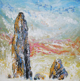
The stone itself is very odd - the south and north faces look like they are made of two entirely different types of rock (well to my untrained eye at least).I t's well over 8 feet tall, but has developed quite a lean to the North, which along with it's tapering shape make it feel like it could topple at any time.
In the past when I have visited the field has been smooth pasture, but this year it's been ploughed to within 2/3 feet of the stones base to plant turnips for the livestock.
|
We had a bit of trouble finding this for some reason, even though we'd read here and had a map and know the road... Looking in a false location my hubby and son managed to get coated in cow dung hee hee (I can laugh, it wasn't me!).
For others trying to find it the best advice I can give is... As previously mentioned it's about 3/4 - 1 mile along the A839 driving from the A9 at The Mound. Count gateways / laybys on the right-hand / North side of the road... You'll pass two almost-layby's which are clearly actually gateways - park in the *first proper no other use but as a layby* on that side.
You can then either walk back along the road verge on the same side of the road, and enter the field through the gate (just a few metres around the bend of the road) *or* climb the small wire field fence to the side of the layby, follow the fence and there's a spot to ford the burn. You'll come out into the next field just below the circle.
We visited in Winter, so there was very little bracken, which was great for actually seeing what's there. It also, I imagine, afforded us a much better view across the surrounding landscape, which has quite a lot of deciduous tree cover.
There are seven obvious stones in the circle, which is just a few meters across. Two upright a couple of meters high, another two smaller upright stones / boulders, one fallen which would have been as tall as the larger stones, and two more visible low in the scrubby ground cover, partly covered.
Another sizable stone lies a few meters down the slope where it appears to have tumbled. There's a gap in the circle directly above, so seems likely it belonged in the circle rather than being an outlying stone.
If this stone is from the circle that would make 8, and there would then be an obvious gap for a missing 9th.
There is a ridge a few meters above the circle, with a further, possibly 'placed' (rather than natural) stone on it - just visible from the circle with the low Winter ground cover. It *could* possibly be a tumbled boulder from the craggy hillside above, but it seems to be of a similar shape and alignment to one of the larger stones in the actual circle. From this point, even though very close to the circle, the view completely opens up, and through the tree coverage you are able to see out to Loch Fleet.
|
I've asked for this standing stone to be included on the database on the basis that the Edderton Stone (a near-ish neighbour, as the crow flies) has been included (listed at http://www.themodernantiquarian.com/site/5248/edderton.html). Both stones are generally thought to be Pictish or later carved stones, however both could conceivably be earlier standing stones which have been later inscribed and reused.
St Demhan's Cross stands not far south of the A949 Clashmore (Dornoch) to Bonar Bridge road in a field which slopes down toward the Dornoch Firth. The site is marked with a brown tourist sign, which you'll spot just to the side of the Creich burial ground. There is a layby outside the burial ground gate, which you can park in. A stile and some steps take you down to the stone, at the East end of the graveyard boundary wall.
The stone is listed on the HER database (linked) as being "Early Medieval - 561 AD to 1057 AD" and is generally considered to be a Pictish carved symbol stone.
It is included in the Highland Council's Pictish Trail tourist information leaflet, which states…
"A rough, unhewn standing stone, bearing an incised Celtic cross. Like the Clach Biorach at Edderton this could be a reused Bronze Age standing stone. The carving probably dates to the 9th or 10th century AD. This may have been used as a preaching cross rather than a grave-marker. The fair of St Devenic (or Demhan) was still held here in 1630. "
The carved (north facing) face of the stone is rather smoother and flatter than the other sides. Which would obviously have been convenient if the carving was made later.
To me, compared to some of the other Pictish carved stones in the area, the carving looks rather crude and shallow - which makes me feel it's more likely to be a reused stone, carved in situ (perhaps where the carver would find it more challenging to work and produce a finessed and elaborate piece of carving). I imagine if a more modern graveyard was sited next to an ancient standing stone then the best way to absorb it into the Christian site would be to make it into a cross. If the stone was already being used as a marker for a meeting place, this would also cause less confusion than taking it down altogether perhaps? But that's just personal conjecture!
|
Not to be confused with the seemingly far more famous Clach a Charra near Ballachulush - listed in this saite at http://www.themodernantiquarian.com/site/4792/clachacharra.html
The Clach a'Charra is situated right beside the A949, which links the A9 trunk road at Clashmore (near Dornoch) with Bonar Bridge. The stone is quite impressive at around 11ft tall, but surprisingly easy to miss as you travel past by car - it can easily be mistaken for a tree trunk in the verge.
The road / field boundary wall has been built around the stone in a u-shape, rather than the stone being absorbed into the wall as often happens. The stone has obviously at some point been knocked down / fallen - there is a clear repair line a few inches from the ground, and I have added a link to the Dornoch Historylinks museum archieve, which shows the stone being resited in 1968 in some detail (and the stone previous to this in two halves). The stone has roughly four faces, becoming slightly pointed near the top.
On the furthest face from the road (facing roughly south) is one 'hole' - too deep to be called a cup mark. It seems to have more of a functional purpose than be decorative. The hole is almost a couple of inches deep, and placed and about 5ft up from the ground.
The Highland Council Archaeological Unit comment…
"Local tradition says the stone marks the grave of a 'Danish' chief; and Joass calls the hole a staple-hole and notes an associated 'swinging chafe' as if a 'jougs' or iron collar had hung from it." It seems a bit odd however that the criminal would be chained on the side of the stone facing away from the road? Surely such punishment would involve the accused being as easily visible as possible? Unless the route of the road has changed, or we are missing some other part of the jigsaw?
There seems to be some interesting stuff going on in fields immediately either side of the road and stone - recorded on the HER are cremations and urns, evidence of stone working, crop marks, a shell midden…
If visiting there isn't really an obvious spot to stop in any where near by, and the nearest disused gateway is chained off. Best to plan to park further away where you can (safely) and incorporate the stone into a little walk.
I was asking a Gaelic speaking friend about the name - Clach a' Charra - and to the best of our figuring it means 'stone of stone'! She did suggest charra may have a similar root to Carnac - or even cairn, but she's promised to do some research for me with the senior Gaelic speakers in her family...
|
Invershin Farm stone is clearly visible from the A837, looking towards the river. I wonder how many people spot it as they drive North from Bonar Bridge to the locally famous tourist attraction, the Falls of Shin? If driving here, there are a few limited gateways to pull into to park, but perhaps to avoid blocking any farmers access it's best to use the rough lay-by outside the local burial ground, or the car park of the local village hall, both of which are only a minute or two's extra walk back along the road.
From the road the stone appears quite small, but up close it measures around 5'5". The stone features strong vertical striations, and a rather beautiful streak of quartz which is visible diagonally across both faces. It has a slight lean to the Eastern side. To the South is a low "hog backed stone" (as described by Canmore), and there are several other small rocks around the base. The ground was rather stubbly and 'lumpy' at the time of visiting, so it was hard to tell if there were further small rocks in the area. The general area is a low river valley, cupped by hills on three sides.
On walking back to the car a different route, across the fields, I noticed a small stone that just looked 'odd' for some reason, placed rather than natural - but could have been simply wishful thinking. It's not recorded anywhere so far as I can find. Have included photo's here for interest…
|
If you access this site from the castle cafe and shop then the walk is pretty gentle and it's very easy to find. You walk past the front of the castle (at a distance) which is a handsome building and decend to the stones, all through open ground with some wonderful sea views.
Parking at the cafe /shops is very limited, and the excellent cafe (WELL worth a visit!) is popular with vistors and locals alike, so if you intend to do this try not to go over the main lunch period.
|
Just a couple of words of warning / advice...
When we visited at Easter 2010 there was a large bull being kept in the Druids field so we obviously didn't dare enter - but there also wasn't any warning he was there so we could have got caught out!
Also a note on actually finding Druid Field / the circle - once you are parked up in the signposted spot next to the road, head across the field in front of you following the white painted boulders, but when they lead you to the field fence you follow it along on the *same side* which will lead you through a gate and along the side of the Druids Field to another gate leading into that area. We could see what appeared to us to be more painted boulders in the next field and ended up crossing field boundaries and getting very lost!
Also at that time of year the field was *extremely* wet and thick with very sticky, deep mud - enough to go over the tops of childrens wellies and take off even a heavy adults boot with suction. We ended up having to criss cross the field finding the driest path to make it passable at all (also beware the slippery boards over ditches) - so go prepared folks!
|
|
I live in the Northern Highlands of Scotland with my young family, although I grew up in Somerset visiting and loving Avebury, Glastonbury, Stonehenge, Stanton Drew, the sites of West Penwith... Always facinated, always learning, always on the hunt :-). These days I am an artist and have found myself studying stones as a main branch of my work...
Adding links, as I often post related material on my blog and Facebook art group...
http://nickipaints.blogspot.com/
https://www.facebook.com/pages/Nicki-MacRae/54822611086?ref=ts
|