|

|
   
|
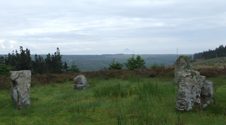
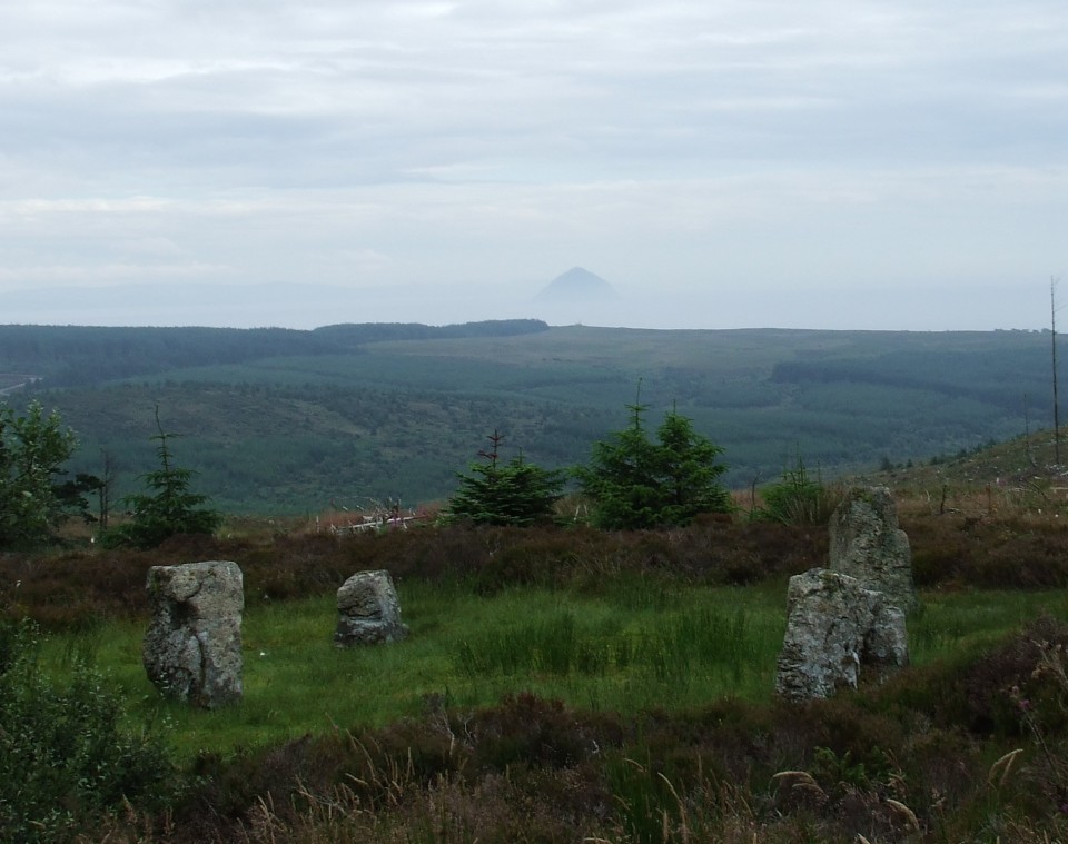
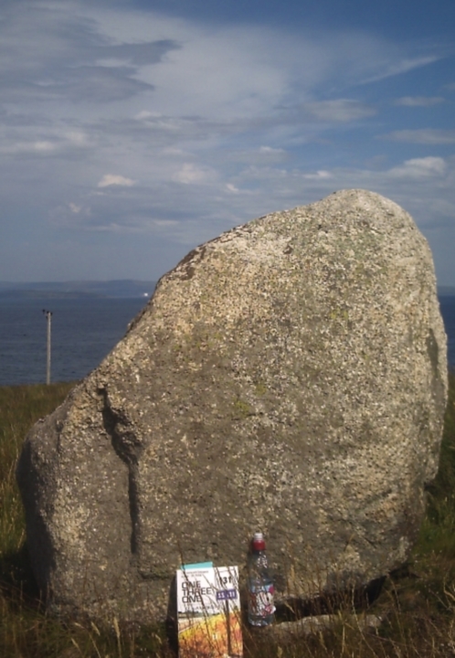
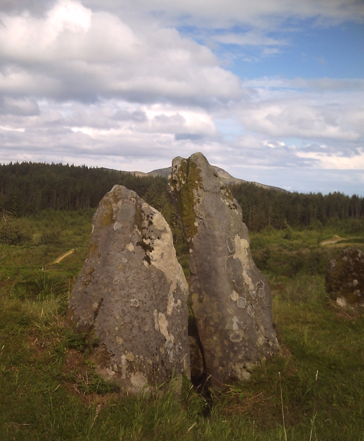
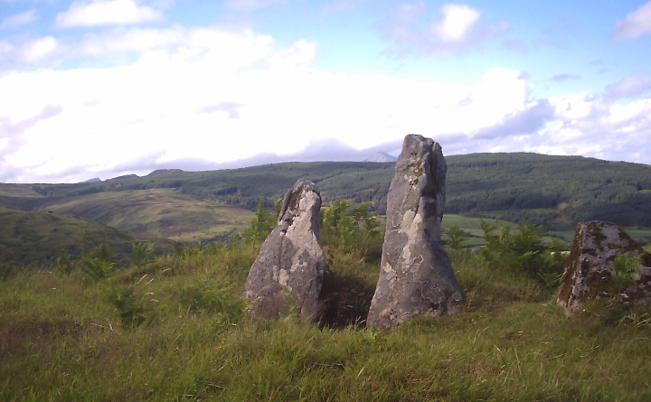
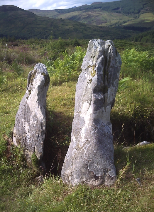
Allt Nan Tighean (AKA "Aucheleffan Stones")
Site visit 20 July 2016
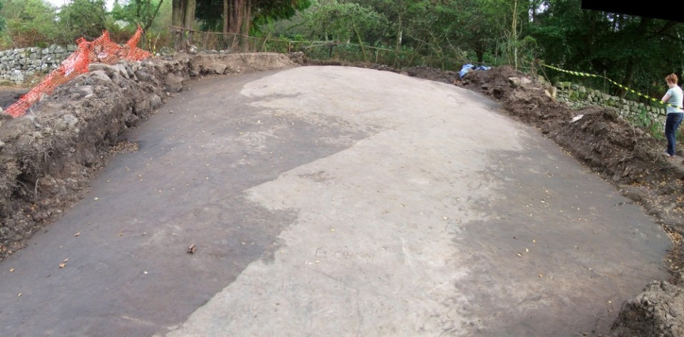
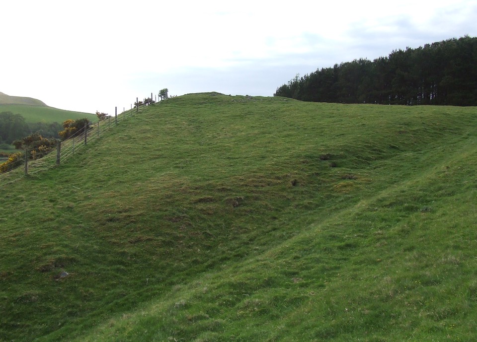
Parked the car at Kilmory Church and walked in via Cloined Farm (and Pottery). The route starts as the well surfaced farm road and deteriorates a little afterwards. It was twenty three years sinced I'd walked the route and yet the Beech Hedge on either side of the first 400 yards after the Pottery still seemed strangely familiar. On a particularly muddy stretch of pathway I was suddenly aware I was not wearing my walking boots... but had instead set off in the pair of comfy suede shoes I'd been driving in. I could see the well-metalled forestry road a little ahead, it was too late to walk back and change footwear now. The route up ahead was gonna be excellent so I carefully picked my way through the mud and puddles and made good headway after the Forestry Commission road started. Easy going for three or four kilometres, through Aucheleffan Farm and on up to the stones.
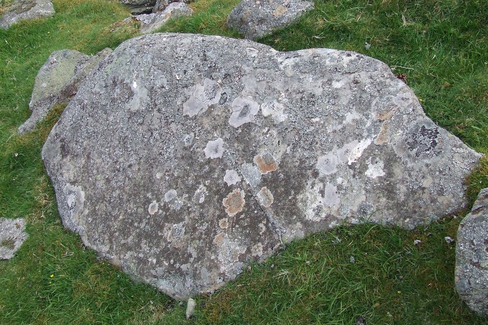
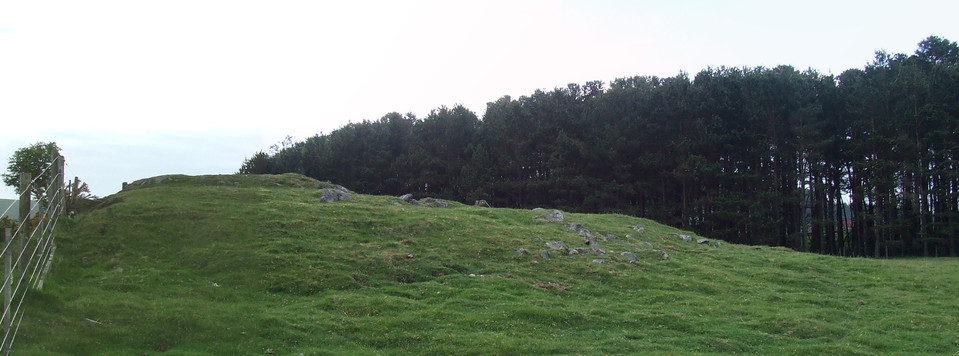
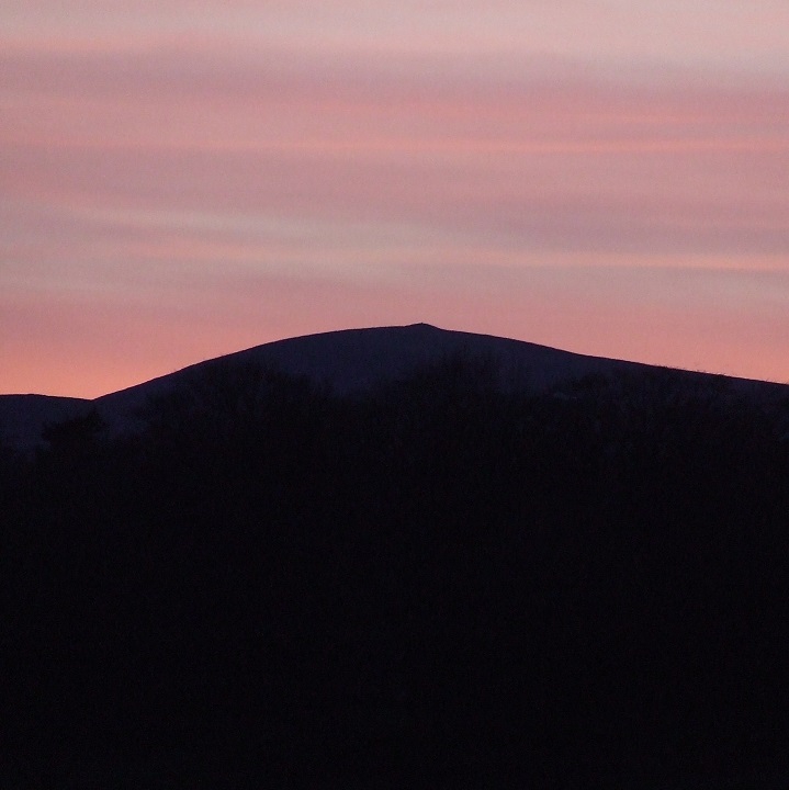
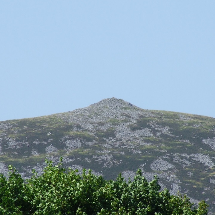
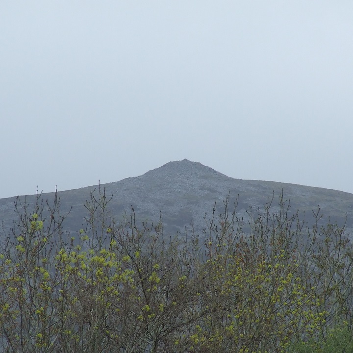
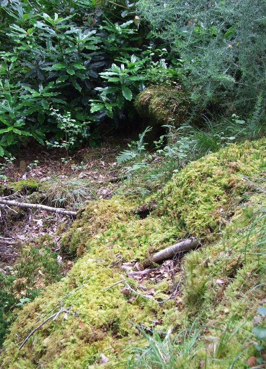
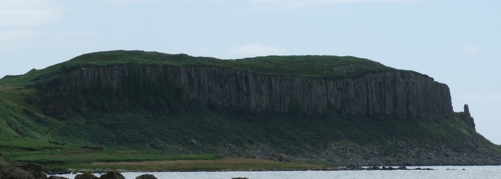
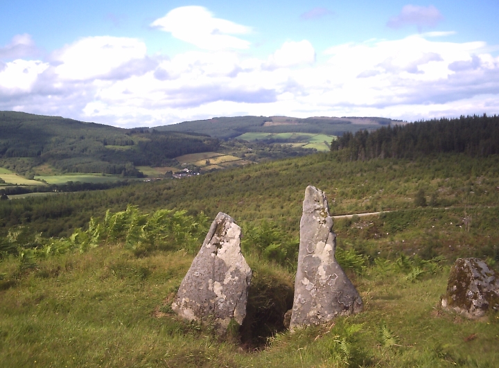
The continued clear-felling of forestry on the South of Arran has opened up the site beautifully, revealing a stunning view down across the South of Arran and across to Ailsa Craig. The view back up the hill doesn't have any such wow factor.
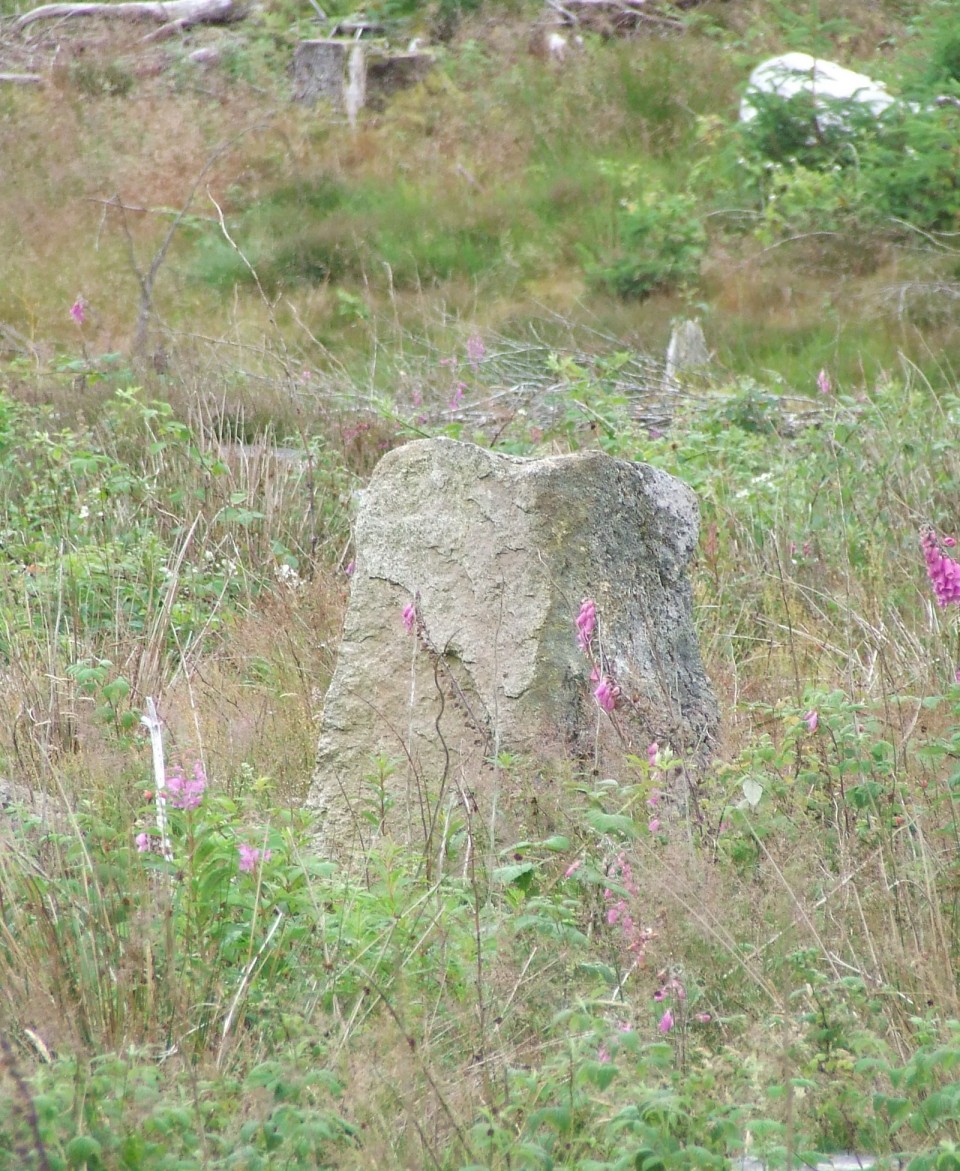
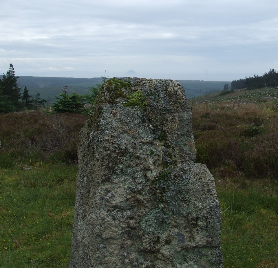
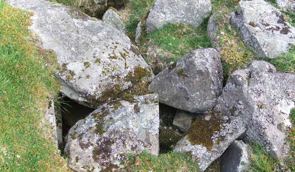
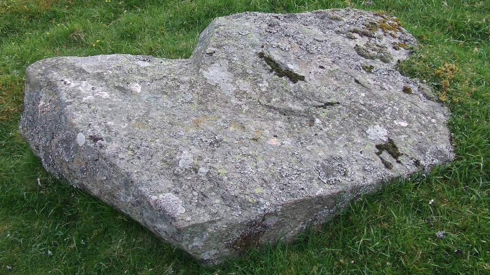
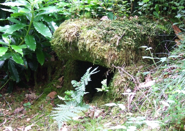
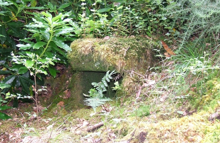
The clear felling has also revealed a few more stones a hundred yards due South of the Aucheleffan four poster. One in particular is an earthfast upright monolith about 1 and a half metres high and squared, tapering towards the top (in a typical Arran fashion).
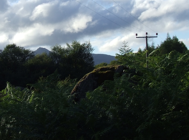
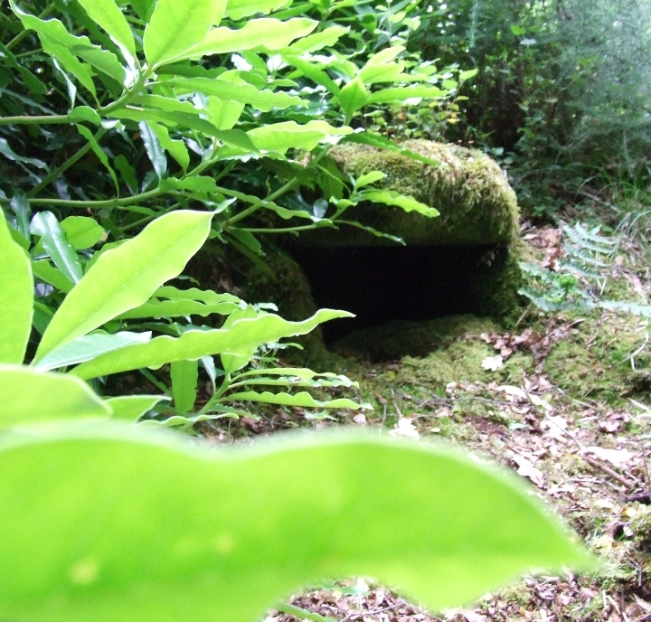
In 1995 another four poster was reported about 200 metres South East of Aucheleffan Stones and is named on Canmore as "Aucheleffan". Due to high bracken and the mess of clear-felled Sitka Spruce debris this other four poster was not to be seen on this visit.
Other Four Poster
|

|
     
|

|

|
 
|

|
 
|
Ancient grave found in Orkney
Archaeologists have been excavating the site of a child's grave on an Orkney island.
The grave - which it is believed could be up to 4,000 years old - was uncovered on Sanday's shoreline by winter storms and high tides.
It is thought the skeleton could be that of a child aged between 10 and 12.
The find was made by Carrie Brown, of See Orkney tours, who called in local archaeologists.
Historic Scotland was alerted, and experts were sent to Sanday on Saturday.
The skeleton will be analysed by an osteoarchaeology team in more suitable climatic conditions.
The remains were found on 3 February.
http://www.bbc.co.uk/news/uk-scotland-north-east-orkney-shetland-31313519
|
Additional information on this possible site from Canmore.
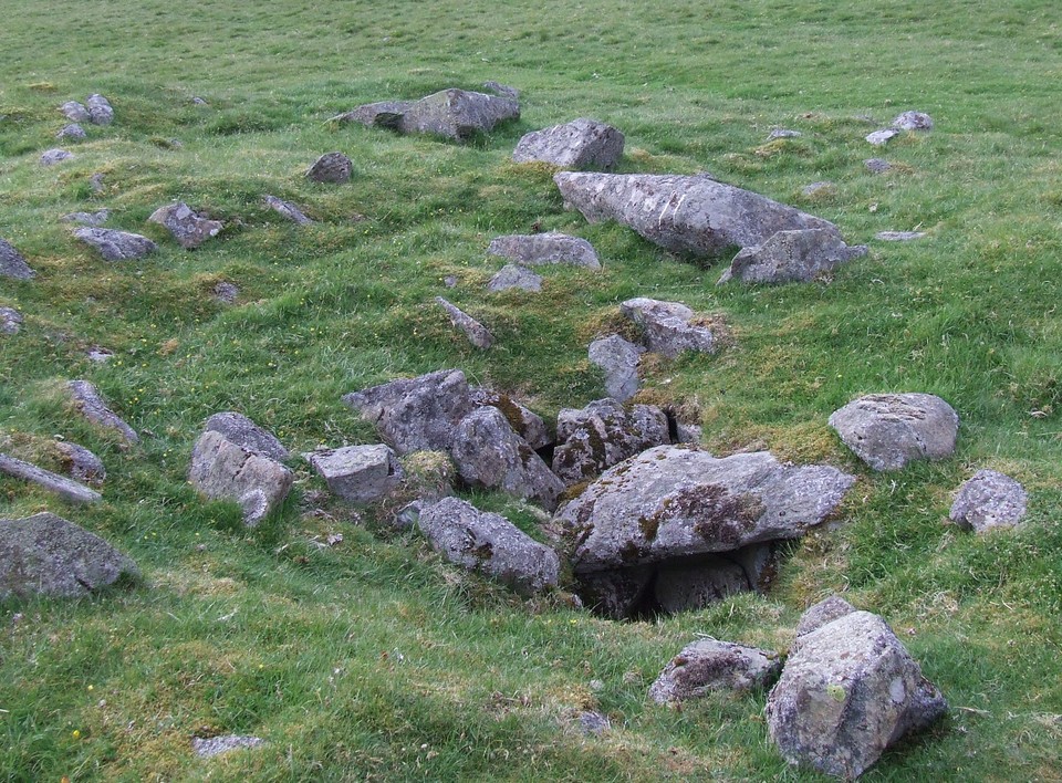
NS 4775 5323. "The Covenanter's Stone": fallen stone circle (A W Millar). Seven recumbent stone slabs, 4ft 11ins to 5ft 7ins in length by 2ft to 3ft in maximum breadth, are arranged in a circle about 25ft in diameter, (if the arrangement were symmetrical, an eighth slab is missing). The site is immediately S of a massive Medieval land dyke, broken by the 18th century coach road and a later track which pass round the circle on opposite sites.
F Newall 1963
NS 4773 5333. The dimensions of these seven recumbent slabs are as given above, the largest being 1.8m long, 0.9m wide and 0.4m thick. Their present position - they lie in two parallel rows of three and four stones respectively - make it difficult to visualise them forming a circle; however, depending on the way each stone fell (if, indeed, they ever stood), they might suggest a stone circle of possible 8.0m diameter. The name "Covenanter's Stone" is known locally but no
reliable information was obtained. The "Medieval land dyke" noted by Newall is a field bank of no great age. The 18th century coach road appears to be no more than a hill-track.
Visited by OS (WDJ) 26 November 1964
Listed by Burl as of "uncertain status, including complex and misidentified sites".
H A W Burl 1976
Seven large recumbent slabs lie in a rough 'avenue' running approximately E-W. The long sides of the stones are at right angles to this line. The stones vary in size from about 1m by 1m up to 2.2m by 1m with an average of 1.4m in length. An eighth stone reputedly from the site was until recently used as a bridge over a burn about 1/2 mile away. The stones are unlikely to be lying in their exact original positions - at least one is known to have been slightly moved in the 1950s. Prior to the legendary usage by the Covenanters, the seven (or eight) stones may well have formed a standing circle. About 7m to the N lie two stony mounds in line, with their long axis SW-NE. Both are about 7.5m in length. A relationship with the seven stones adjacent should not be ruled out.
Sponsor: Renfrewshire Local History Forum, Archaeology Group
B Henry et al. 1994.
There is no evidence that this group of stones ever formed a stone circle. They form no coherent pattern or arrangement and they lie in a damp, peaty hollow.
Visited by RCAHMS (JRS) 29 February 2008.
http://canmore.rcahms.gov.uk/en/site/43038/details/moyne+moor/
|

|

|

|

|

|

Jane Stanley Paints Castle An Dinas
Follow link to see the artwork.
http://www.strangehistory.net/2014/08/21/jane-stanley-paints-castle-dinas/
Jane Stanley is an extremely talented archaeological reconstruction artist, based out of Cornwall. Castle-an-Dinas is an Iron Age fort in the middle of that county, a six-acre site second only, in terms of its natural charisma, to South Cadbury in Somerset. Put Jane and Castle-an-Dinas together and you get some of the best historical fiction around, though historical fiction by brush stroke.
Cornwall Council commissioned Jane to do a series of paintings of Castle-an-Dinas. What makes this series (to the best of my knowledge) unique is that they are not just different aspects of the site (a deer kill, a burial, a hosting…) They are the site over perhaps twenty five centuries. We put them up here with a link to Jane’s facebook page, hoping that neither she nor Cornwall Council will send a cease and desist order: they are available in a pdf online; also given the quality of Jane’s work we take pleasure in pointing out a recent book, A Brush with the Past. Beach’s credit card has presently maxed out but as soon as everything is back up and functioning… The image at the head of the post shows the creation of the two bronze age tombs at the head of Dinas: the second picture immediately below shows, instead, the Iron Age fort that followed on. As is typical of these sites the Iron Age was all too happy to leave the Bronze Age in place. The stronghold was crowned by two tombs from centuries before.
So far this is the normal fare of archeaeological art (albeit it at the best end of the market). Now though we turn to more recent times. In the first days of March 1645 a mauled Royalist army camped out in old Iron Age vallum. Cornwall was an overwhelmingly Royalist area, but here the decision was made to surrender. The fight was impossible by this date and two days later the Royal Standard was given up to the Parliamentarians at Bodmin: a black day. Britain would labour under the ‘Protector’ for fifteen wasted years.
The next picture is a curiosity. Cornwall is mining country, but it was not until Britain’s straitened circumstances in the First World War that the decision was made to sink a shaft here in search of Wolfram of all things. Love the combination of Edwardian industrial might and Iron Age landscape.
Then my favourite picture of them all. In the 1960s a Pennsylvanian archaeologist, Bernard Wailes carried out a multi-year professional dig at the site. Bizarrely, though this sometimes happens in archaeology, he never got his act together to actually publish the findings. There were two brief notes in a Cornish journal. Castle-An-Dinas waits another archaeological hero, preferably one though that has time to dig and write.
Here are the pictures that Jane missed or that Cornwall Council did not commission. First, there are Arthurian rumours about the fort: a bit of desperate Romano-British sheltering might have been fun. Second, the fort was used by smugglers in the modern period: barrels being rolled out of the way of excise? Third, there are reports of great furze fires in the modern period at night. By all accounts the whole countryside could see Castle-an-Dinas in flames for miles around.
|

|
|