Showing 1-20 of 43 fieldnotes. Most recent first | Next 20 
A return visit to this huge, long structure bedded into its peaty hillside on a massive area of reedy marshy upland unimproved hill grazing.
I found some notes from my last visit which I am reproducing below.
Although three months earlier in the season than my last visit in December 2013, I was hardly five minutes from the car when a squall of freezing September rain came down in sheets utterly soaking me. The bitter rain had elements of hail and was driven by a chill wind. Be prepared. Eskdalemuir can be bleak even in September. By the time I summited the terminus cairn on the bank barrow it was sunny again. My lovely camera refused to work or even switch on despite the batteries being fully charged. I took some pitiful pictures with a steam-powered mobile which do not do the site justice. Another visit beckons... low Winter sun methinks.
The monument is long (currently estimated at 650 metres) and the terminus cairn is around 5 feet high. You cannot see the bottom from the top! Even walking down to where the North East rampart of the Roman Camp cuts across... the lower end of the bank barrow is nowhere to be seen. The scale starts to kinda sink in.
Rebecca Jones notes the deliberate siting of the North East "Stracathro Gate" atop the raised ground of the bank barrow and it is hard to interpret it in any other way. It was kinda cool to see this diagonal bank and ditch cutting out from the Roman ramparts... this site has the only known upstanding examples of this type of gate in the world. The general consensus is that the "Stracathro Gated" Roman Camps (they are only found in Scotland) date from the Agricolan Period and given this camp's location it is likely to date from the first couple of years of the campaign (79 - 80 AD).
There is another mighty Roman presence nearby with a big permanent Antonine fort's huge earthworks sited between Raeburnfoot Farm and the White Esk. Along the short stretch of farm road there are also the earthworks of two substantial settlements and aside from the bank barrow, the Lamb Knowe hill has a number of tantalising enclosures as well. With the Girdlestanes and Loupin' Stanes just a stone's throw away plus an enviable array of forts, settlements and earthworks across Castle O'er and Bessie's Hill this is a wee corner which could take years to explore properly.
Raeburnfoot 16.12.13
It was a straightforward scoot down the old A77 from Crawford zigzagging under the modern M77. Exit at Beattock heading for Moffat. The low winter sun was at its highest and I wanted to try and photograph some shadows on the lengthy earthwork to try and get some definition before the valley lost the light in the mid-afternoon.
I pulled into Eskdalemuir just in time for the rain to start. Take the little turn off marked B7060 to Jedburgh and as soon as you cross the bridge over the White Esk take a left and cross the Clerkhill Burn pull off the road into the farm track on the left signposted “Raeburnfoot”. Drive on and turn sharp left (steep uphill) at the first farmhouse. The road deteriorates after this and it might be advisable for those without 4 wheel drives to park at the side of the road. My wee VW Polo managed okay (just!) but be warned there are large potholes and the sharpness of the camber scraped my undercarriage/ sump a few times. This stretch of farm road is about three quarters of a mile long and brings you to Raeburnfoot Farm where the road forks in two.
There are plenty of places to leave a car here without getting in the way of farm vehicles. This is the point to park if you want to take in the Roman Fort en route to the Bank Barrow. The fort defences are in great shape and still present a challenge to get across. At the far side of the fort the ground starts to slope up and the start of the bank barrow can be seen in the centre of the slope in the short pasture.
If you want to avoid the Romans altogether there is a more direct route to the bank barrow. Instead of parking up... keep going and take the right hand road at the fork and continue through a gate which bars the road (be sure and close it after you). There are a few little areas on the left after the gate where it is quite safe to pull in and park out of the way. You will see a wee burn flowing under the road at the gate. Follow it upstream keeping in to its left bank. Five or ten minutes of proper striding and you will view the terminus cairn on the skyline and then crest the hill.
During my visit the driving rain turned to sleet when I got to the top of the hill. The site is on rough hill pasture with long grass and heather masking out a lot of the definition of this enormous structure. By following the Bank Barrow downhill for a few hundred yards you can get more of a perspective (though at no point can you see the whole monument) and the sheer scale kinda hits you! It is enormous!
|
This site has been clear-felled. Though I should stress the ground is NOT clear. It is an almost un-navigable wastleand of treestumps, holes, deep tyre-ruts and such-like. The cairns where I have been able to locate them, have ALL been respected by the plantation fellers. However the ground surrounding the cairn resembles The Somme in 1917. Here is the current state of North Sannox 2 which I was completely unable to locate last year despite the clear-felling. It was just too much of a wild jumble...
https://canmore.org.uk/collection/1665555
Canmore's photo perfectly shows the same orientation in my first "forested" photo of the chamber back in July 2012 when it was deep in Spruce Plantation.
http://www.themodernantiquarian.com/img_fullsize/109247.jpg
|
Site visit 13 July 2017
I always find myself at North Sannox for a few hours each year. My OH does a pony trek up Glen Sannox each year when we visit Arran... so I have a little free time on my hands. The reference on Canmore to a chambered cairn on the slope below the fort on Torr Reamhar was intriguing. No-one noticed what it was till the 1990's? Well, new old things are turning up all the time on Arran... I was leg-knackered from conquering Goatfell the day before so this was going to be a gentle strool and an appropriately sedate pace.
I struck uphill from the farm at North Sannox staying on the improved pasture side of the wire fence. The fields have a few sheep and are used for grazing ponies and horses too. Once at the level of the Communications Mast (just a couple of hundred feet up) strike out across the side of the hill staying on the contour line. You cross a stream and the wee path carries you directly across the hillside to a large pile of stones. This isn't the cairn you are looking for - but a mighty cairn it certainly is (even if Canmore and OS haven't noticed it yet).
Keep going acroos the side of the hill. A few hundred feet above on the skyline, the steep sided rocky stump which is topped by Torr An T' Sean Chaisteil looks over the North Sannox Valley (it is a marvellous hillfort site and a beautiful viewpoint but there was no time on this outing).
The Allt Carn Bhain cairn comes into view a little below and just on the other side of an old field boundary. It is an easy stroll down and across.
The cairn is quite substantial though it has been ripped-oot at some point. The bleached white bones of a sheep lie at the East End in a deep scoop. The West End of the cairn is marked by a massive triangular conglomerate boulder jutting out of the small hillside terrace like a tooth. Among the granite stones and boulders lie out-of-place and odd-looking river and beach rolled stones. Within the cairn material a few upright slabs can be made out and there is what appears to be a partial chamber in a hollow on the North side.
I ate a sandwich and had some juice while perched on the big triangular conglomerate boulder, peering down at the Lochranza Road. I watched two Golden Eagles fly in from the crooked corrie of The Devil's Punchbowl at the end of the Goatfell Ridge and then made my way down to the the old ruins of the clearance township at the bottom of the hill. I walked out along to North Sannox Farm to wait for my OH returning from her pony trek. While I sat I got chatting to a woman now living in Vancouver, who, it turned out, half a centuiry ago grew up three streets away from me in a town in Ayrshire and went to school with my late brother. I didn't dare tell her that by a pure fluke I had a Canadian Flag in the boot of my car. Small world.
|
Site visit 21.10.16
My cycling days are over so I sent OH and the Teenage HD on down the barely surfaced road from Kingshouse to Gualachulain. My loudly complaining exhaust disturbed a rock band who were shooting a video in front of Stob Dearg. Sorry guys.
About 15km of bad road later and I pulled up at the wee car park. I'd seen the cairn as I passed it a few hundred yards back. Bright white and shining in the autumn light.
The drop-dead rugged scenery and pristine surroundings would normally attract huge numbers of tourists to views like this, but the sump-rupturing pot-holes and uneven road surface seems to put all but the usual idiots like myself off. I'd passed the other two thirds of my family throwing sangwidges at the Red Deer a mile or two back so I figured I'd have a little mosey over to the cairn near the cottage at Gualachulain. It would give my hissing engine a little time to cool and rest that clattering exhaust in preparation for the return up the glen.
The clear-felling of the small patch of surrounding forestry has been instrumental in exposing the cairn but thankfully there has been no manicuring of the landscape around the cairn. The only concession to visitors has been the erection of a fine four-step stile (with a top resting platform) over the top of the Deer Fence. This allows easy access and a grand elevated view of the site. The bark, twigs and tree-stumps are gradually being consumed by Nature's decomposers and munchers.
The cairn is constructed from white river-rounded stones. It stands to a fine height. There is a lot of it left. A fine curiously veined boulder tops the cairn. The loamy peat has been washed off a lot of the cairn mound now and exposes most of the stones. They gleam a bright white with just a couple of rounded stones being of a rosey-pink.
The nearby cottage garden on the other side of the Deer Fence does not intrude at all on the site's atmosphere. From atop this lovely cairn I watched the sun sweep amber rays across the foot of the mountains on the far side of Loch Etive. I heard the sound of screeching brakes and a voice shouted "Hi Dad! I think Mum'll be about ten minutes." I headed back over to the stile. Time to go.
Ten minutes later we were heading back up the glen, exhaust spluttering, engine hissing, two bikes slung on the back of the otherwise uncomplaining Golf. Oban Fish Bar beckoned with its blonde, pony-tailed waitresses and the finest fish and chips available anywhere.
|
A walk to the City of the Giants. 25 September 2016
A spur of the moment decision to pop down to North Wales and see Auntie Betty and the family turned into a marvellous weekend of stormy seaside strolls, some good dining (with a few beers) and a Sunday Afternoon walk to the City of the Giants. A few years back when myself, my OH and son were en-route to a wedding at Nant Gwrtheyrn, I’d seen the signpost for the footpath and promised a walk up to Tre’r Ceiri next time we were down. Cousin Gavin had described the place to me and I’d checked it out on Google and Bing Maps. I had since seen the photos on TMA from postman, GLADMAN and thesweetcheat. On Saturday Night last, at dinner in Pwllheli, Gavin suggested a stroll to the City of the Giants on Sunday afternoon. We had spent Saturday watching kite-surfers riding a frothing cauldron and getting airborne at Hell’s Mouth, so I was a little uncertain as to what the weather would bring on Sunday, but a plan was made.
Sunday dawned bright and fair. Gavin and June brought the Gavmobile round to pick us up and we headed off. From Pwllheli you just head out on the A499 towards Caernafon and turn off to the left down a wee narrow street at Llanaelhaearn and head round the foot of the hills between Tre’r Ceiri and Mynydd Carnguwch. There is a great wee pull in spot here.
https://goo.gl/maps/WtLaa5RKoto
The footpath begins right across the road. A little steep at the start, then up over a stile at the top of the field, a little to the left around the big rocky crag of Caergribin and then it is a fairly level walk across the moorland to the foot of the crag which is the City of the Giant’s perch. I was genuinely floored with amazement as the bright sunlight picked out the faces of the massive stone walls. The flat tops of the mighty defences looked wide enough to drive a car around. My son ran ahead and I watched him dart up the steep entrance while I sweated it out on the heather flanks below. We were less than 30 minutes from the Gavmobile and hadn’t been forcing any kind of hard pace. This is a fairly easy walk and boy does it pay every easy stride back in spadefuls!
I’ll let everyone’s photos of this historical wonder do most of the talking here. There is an awful lot of stone meeting the eye. It is hard to take in the scale of the construction at Tre’r Ceiri. All around are the stoney, scree-strewn peaks of Yr Eifl, Moel-Pen-Llechog and the lower (yet strikingly beautiful) peaks which unfold down the length of the Llyn Peninsula towards Nefyn. But standing straight across from the City of the Giants is the mighty upright cairn of Mynydd Carnguwch, time and again I found my eye was dragged back to look at its profile. The Welsh sun shone all afternoon. We could have stayed all day.
The preservation is exceptional, the walls are a wonder, the simple areas of restoration are easy to spot (with their little drill holes). This is the most amazingly preserved, mightiest, most grandest, finest, panoramically stupefying-est, weirdly intoxicating hillfort I have ever been in. If you are in North Wales and can walk for half an hour or so on fairly easy terrain, get yourself up to Tre’r Ceiri, the City of the Giants. It’s a monster!
|
Allt Nan Tighean (AKA "Aucheleffan Stones")
Site visit 20 July 2016
Parked the car at Kilmory Church and walked in via Cloined Farm (and Pottery). The route starts as the well surfaced farm road and deteriorates a little afterwards. It was twenty three years sinced I'd walked the route and yet the Beech Hedge on either side of the first 400 yards after the Pottery still seemed strangely familiar. On a particularly muddy stretch of pathway I was suddenly aware I was not wearing my walking boots... but had instead set off in the pair of comfy suede shoes I'd been driving in. I could see the well-metalled forestry road a little ahead, it was too late to walk back and change footwear now. The route up ahead was gonna be excellent so I carefully picked my way through the mud and puddles and made good headway after the Forestry Commission road started. Easy going for three or four kilometres, through Aucheleffan Farm and on up to the stones.
The continued clear-felling of forestry on the South of Arran has opened up the site beautifully, revealing a stunning view down across the South of Arran and across to Ailsa Craig. The view back up the hill doesn't have any such wow factor.
The clear felling has also revealed a few more stones a hundred yards due South of the Aucheleffan four poster. One in particular is an earthfast upright monolith about 1 and a half metres high and squared, tapering towards the top (in a typical Arran fashion).
In 1995 another four poster was reported about 200 metres South East of Aucheleffan Stones and is named on Canmore as "Aucheleffan". Due to high bracken and the mess of clear-felled Sitka Spruce debris this other four poster was not to be seen on this visit.
Other Four Poster
|
Meallach's Grave... Notes in Great Weather... July 15 2014.
Decided to take a wee walk in the forestry at Dyemill before dining at Lamlash, just to put a keen edge on the appetite. We had no intention of climbing all the way up to visit on old Meallach but had a couple of sunny hours to kill and had decided to wander the forest paths by the burns on the lower slopes of The Urie.
I had visited Meallach's Grave twenty four years ago and had been massively underwhelmed by its midge-ridden forestry confinement. I kinda like a view when I climb a hill - call me old fashioned - and there hadn't been exactly a lot of stonework to see back then. It was more than my dinner was worth to even suggest taking a look in on Meallach and the stumps of his cairn...
As we walked along the pleasant forestry paths admiring the splashing burns, waterfalls and deep pools, we wound gently up through the trees and out into the the open sunshine. The entire side of The Urie had been given a right good scrogging - all the trees were gone!
The footpath then joined a well-metalled forest road which made very easy walking to the crest of the hill at Creagan Nan Coileach. We turned to head back down and a little footbridge beckoned us to walk down the opposite side of the burn we'd walked up on. A little signpost suggested a short walk to Meallach's Grave. I held up my hands - I hadn't planned on a site visit. My OH and wee HD let me know in a wordless kind of way that I would be visiting Meallach on my own and that they would see me back at the car.
The climb up from the main path took five minutes. Easy walking. Lovely open hillside, breezy, no midges. As I climbed up to the terrace with Meallach's Grave I noticed a number of North Arran Peaks come into view over the long back of A' Chruach - just as I reached the site.
What a site. What a sight! What a change! What a difference clearing off the Forestry has made to this site. The views are (of course) stunning, but the placing of the cairn in its particular position makes so much sense. With the forestry gone you can even see the curve of the portal on the South side of the cairn some distance from the stones. A green line of buried mossy stones curving off in a gentle arc. The chambers were a bit clearer too - they had been full of heather and bracken when I last visited. Clearing the forestry and removing the forest debris from the site has opened it right up. I headed back down to the car with a real spring in my step.
Meallach's Grave is right up there with Giants Graves in Arran's Chambered Cairns. Meallach is a big league hitter now. These places never made much sense when they were cloaked in forestry and made kinda devoid of context. The trimming of shrubbery on many of Arran's hillsides continues. Cannae come quick enough I say. Brazilians all round.
|
Back To The Old House
Back over on Arran and back in the old cottage at Merkland.
Left the OH and the Young Digger knocking balls around Bilsland's Crazy Golf on the front at Brodick. I coaxed Old Piney into fourth gear and trundled out past Cladach and the stinky old harbour below Brodick Castle. Two seals were basking out on the rocks at Merkland Point. Piney reversed into the the layby/ boat ramp almost by herself and even thoughtfully stalled as soon as she was tucked in position.
I'd had a fair old struggle locating this cist until a few years back and I've still never seen any sign of anyone else having visited the place. It is incredibly close to the road and I decided to time myself getting to the cist from closing the car door.
The old Merkland cart track which also serves as a part-time burn was even more overgrown than last year (and the year before). Long trailing Brambles and sprouting Hogweed conspired with ankle deep slimy mud and curtains of Willow to obstruct my progress. But only 2 minutes and 45 seconds after slamming the car door shut and setting out, I was gazing down at the mossy old cist of Merkland Wood. I heard two cyclists on the road chatting as they pedalled by (this site is THAT close to the road).
The moss looked deeper than before, with little seedlings of the Willow and Rhododendron sprouting on the thick, moist green carpet on the capstone. The erosion below the cist (just above the burn) has slightly worsened but the earth and bank immediately around the cist seem fairly well consolidated.
The deep undergrowth does mean a very high midge count even during the hottest and sunniest of days. After a few minutes taking in the quiet of this site I'd fired off enough photos and lost enough blood to the skeeters - I fled and staggered back down through the mud and thorns.
Old Piney grumbled into fourth gear and trundled the couple of miles back into Brodick. Young Digger and his mum were only on the 10th hole. I'd been away for a bit less than 30 minutes - but they weren't your regular minutes I don't think.
|
September 2013
This is a difficult walk in whatever point you start from and these particular Galloway Hills are an unforgiving bunch. Our route took us in from the car park at Kirriereoch, a good march into the hinterland on former forestry tracks, then out onto the great long whaleback of Kirriereoch Hill via a series of ever diminishing and deteriorating sheep paths. About 1800 feet up Kirriereoch a tremendous stone wall begins. The stones are enormous. We saw one which was the size of a small car. Story says the wall was meant to delineate the old Ayrshire - Galloway county border and the wall appears to be of some great age. After the superhuman effort put into its construction it is a pity so few people have ever seen it. After topping Kirriereoch Hill we took a steep descent following a much smaller wall which wound us down 1500 feet to the tiny lochan of Loch Twachtan (careful now!). Twachtan's population of trout have been completely isolated since the last Ice Age by a few steep waterfalls.
Time limits meant we only had twenty minutes to catch the allotted number of specimens for a Fishery Research Project we've been involved in for a number of years. We hit the fishy target at 19 minutes paused for breath, a five minute breather, a sandwich and some juice. Then with our work done we pressed on to the social part of the journey, we were going to visit on The Grey Man of Merrick.
Progress across the morass between Twachtan, Munshalloch and the Howe of The Cauldron was very slow. Legs plunged deep into peat bog and despite clinging to the winding stone wall for guidance, low cloud sometime erased all views, the weather closed in and at times we thought we were past the crag we wanted to see. But we needed to hit Loch Enoch first. Loch Enoch had its own distinctive and unique family of trout until the end of the 19th Century when Victorian-Era Acid Rain killed the loch (and many other Galloway Lochs). This loch was restocked over the latter half of the 20th Century and has recovered well.
After edging round the shining gravel shores of Enoch we hit another wall and struck off towards the Grey Man. After a few hundred yards we took the small path off to the right and our target drew into sight.
The Grey Man is a spectacular feature. It works from both sides and its scale is spectacular. Return took us down past Loch Neldricken and Loch Valley to Loch Trool and the second car. Oops did I mention you'd need to do a 2-car job to take this one in? You don't actually need to... but it is advisable. Good luck y'all!
|
Grey Weather at Calla
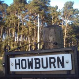
This site has long intrigued me. A broch... here in the dark badlands of South Lanarkshire? Well... why not? After all... on my short twenty minute journey to the site of Calla Broch I drove past a henge, a Norman Motte, the oldest roofed building in Scotland, the late Upper Paleolithic site at Howburn, an important roman crossroads, a roman fortlet and a field with two emus in it.
The broch site is just that... just a site, A stump.. but it is a beautifully elevated platform with stunning views to Tinto, Quothquan Law and within sight of the massive roman complex at Castledykes by Ravenstruther. It is thought that the legions had a hand in bringing this mighty structure crashing down at the end of the first century.
The broch was known locally as "the quarry" for centuries and has provided the drystane dykes for many of the fields here. The site itself has intact walling most of the way round, but it is just well concealed under turf, deep undergrowth and fallen trees.
A quiet site with little to catch your eye. There are some large blocks of worked and hewn masonry scattered at the edge of the platform and here and there where you can find the curtain wall's edge, it is robust and stands quite a few courses in height.
The site has never really been excavated. Chatting with a local archaeologist about it a few years back, he described the broch as having been toppled into itself. The resultant heap was then quarried over centuries and then the area around the broch heap was planted with conifers and Beech. Many of these old trees have blown down around the edges of the broch platform and remain uncleared. It would take an army to clear this place in order to let any excavation take place. A very limited dig some years ago uncovered a couple of pieces of cannel coal.
|
High Auchenlarie - October 2012 - Notes in Grey Weather.
Three days and nights of unrelenting rain have rendered what is normally a well-drained, steeply-sloping pleasant field of springy upland pasture into a flowing quagmire of muddy goo. My climbing boots skite left and right as I clamber up like a novice ice-skater. The possible "cairn" lies uphill, in the top right corner of the first field above High Auchenlarie Farm (best park at the wide point below the farm road-end where the Auchenlarie Burn flows under the Laggan Outdoor Centre B-road). Follow the track up from the minor road and turn left through a metal gate just before the farm.
The “cairn” is disappointing, being formed of a number of large slabs and boulders dumped on top of a low mound of smaller stones. It is not quite a metre high now. The whole thing looks exactly like a low pile of field clearance and the fields around here are full of such field clearance cairns – some much larger. The views down over the roofs of the static caravans at Mossyard and out over Fleet Bay to Wigtown Bay and beyond are spectacular. The view hung like an apocalyptic storm-scene as painted by a depressed Turner, nursing the mother of all hangovers. I have seen this site in beautiful summer and autumn weathers many times and the views out to the Isle of Man are spectacular. The walk over from Cambret over Cairnharrow and Barholm Hill via Cauldside takes in a few sites well off the track and worth of a few hours stiff walking. Half a mile or so above the disputed cairn in unimproved hill-sheep land is a spectacular cairn, quite undisturbed and standing over 10 feet high proud and confident of what it is. Not this place though. Without excavation I think it must remain a site of disputed antiquity – albeit one surrounded by authentic sites and with an outlook worthy of Galloway’s best.
The cup and ring marked outcrop 15 yards SW is well turfed up and once the deluge started again I quit and slithered back down the hill to my car. I'll take my trowel the next dry day I am up there!
|
It was my OH who picked this summer's Arran holiday cottage deep in the heart of the Merkland Wood. My preliminary researches confirmed my suspicions - the cist I had unsuccessfully sought in previous years lay somewhere within the cottage's grounds. Last July I had spent a frustrating couple of hours getting eaten alive by midges and cut and scratched by bracken and rhododendron as I tried to find the cist said by the antiquarians to be "situated on a small eminence" above a burn and described by the OS to be "poorly preserved".
I parked in the small tarmacked boat ramp and crossed the road to the trackway leading up to 2 cottages at Maol Don. Do not go up this track, instead enter the rhododendron jungle to the left of the cottage track but to the right of the roadside stone wall.
I found a vestigal path which sort of becomes a burn. To the left rises the "small eminence". This "small eminence" turns out to be a thirty foot cliff whose top is swathed in head-high bracken and rampant rhododendron. As I clambered up the steep crumbling bank I found myself gazing into a dark hole surrounded by mossy stones. I knew I was right on the money. Badger activity six feet below this cist has left it in a bit of a precarious position. This cist is not poorly preserved - indeed it is in great nick - and sits jutting out of the sloping bank above the burn just just below the flat top of the "eminence". In previous attempts to find this cist I'd been stumbling around on the eminence's "summit top" among the tick-laden, midge-ridden ferns and shrubs.The landowner's attempts to hack back the invasive rhododendron has left many ankle breakers and stumps which are real trip hazards in the deep undergrowth. But you don't need to go there & if you find yourself up there amongst the bracken you have passed the cist.
The cist is complete, the mossed-over capstone is in place, the four side slabs sit vertical and in position. This cist's dimensions are a bit larger than those described on Canmore, so a part of me wonders if this is the same cist. There are no photographs or sketches of the Merkland cist described on Canmore (or in Balfour's Book of Arran Vol 1)) to work from, but I am presuming it has to be the same one. This is a very quiet, deep woodland setting for a cist in a fine state of preservation. I stood brushing off midges with the slanting bars of evening sun transforming the wood into a tropical rainforest of rhododendron blooms, green ferns and deep moss with tall natural Scots Pines forming a scented canopy. I got the impression that no-one had visited in a very long time. A very cool resting place.
|
After a Sea-Trout commando expedition myself and Sam Spade dropped in on Gatehouse of Fleet en route home. We parked outside the house which posed as "The Green Man" pub in The Wicker Man and strolled out through the town to the Borland Hills. Some very perky stirks just out into pasture from the long delayed Spring meant an abrupt retreat from the area of Rutherford's Witnesses before we could locate the Rock Feature.
Time was pressing upon us to return home but we figured we had half an hour left so I suggested we have a wee search for some of the Lagganmullan panels. We drove quickly out towards Skyreburn and parked at a little pull in on the Glenquickan Road. The fields were full of Ewes and lambs and our presence soon had literally hundreds of the things scuttling away through the connecting field gates, baaahing and bleating as they rushed up towards the farthest field at Lagganmullan Wood.
The field I wanted to check out for rock art was mercifully free of livestock (I am continually beset by livestock issues on my stone forays) and after wandering hoplessly up to the top field wall, I could see no slabs or rocks protruding from the surface of the smooth turf. In desperation I grabbed a handful of turf and tried to peel it back - it came away and revealed a beautiful pair of cups and rings. Sam Spade nearly fell over in surprise and amazement. I was pretty gobsmacked to have fluked it in such a random way too! We found another part of the panel by peeling some more easy turf back. A good soaking with some water & some photos before replacing the turf then we headed up to the top field where I wanted to check out a group of stones on a small hillock which had caught my eye on visits to the area last Autumn and at Easter this year. See if you can spot them here (a few of the blobs are trees).
http://goo.gl/maps/19N5
The Ewes and lambs which had fled from us when we entered the first field were now crowded around the stones on the hillock. I didn't want to further disturb the livestock and incur the wrath of the farmer who was now approaching on his quad, so we just photographed them from a few hundred yards away. From the air, the stones form a rough triangle. Field clearance? Modern/ Victorian Folly? Messed up ancient site? Who knows... its not on Canmore and I'll have to wait for another few weeks till I'm back in the area to get a proper look at the arrangement. Failing that... I'm back down for another week at Borland in October.... The lambs will have gone off to market and the Ewes will be off the hills by then...
|
Visited Monday 26th September 2011
I've been spotting this circle since the mid 1980's when I used to travel down to England on Citylink coaches. Later, when I got my car and was heading down the M6, I always saw it at the last minute as I hurtled towards some much needed comfort stop at Shap Services. Gunnerkeld - often seen and never visited. So it was again on Friday 23 September 2011 as we headed down to North Wales, battering over Shap with our first stop already decided as "the first Gwasanaethau on the A55" - so Gunnerkeld would still have to wait. I caught a fleeting glimpse of the site in the morning sunshine as we passed heading South for Pwllheli and I made a note to stop off on our leisurely return on Monday.
The leisurely return trip on Monday was thwarted by a bad crash on the M6 at Junction 31-32 near Preston during the afternoon. It took us five hours to move ten miles during which our missed lunch turned into tea-time. My OH and junior were both starving by the time we got through the carnage of the accident (it looked awful) and with the promise of some fast food and a wee scenic rest, they held their fast until we hit the burger joint at Tebay. We all rammed burgers and fries into our faces while I manouvered us off at Junction 39, rolled up the minor road and parked up. We'd been on the road for nine hours.
I was truly bowled over by this site. Maybe after the carnage of the journey North I needed to relax, maybe it was the hunger, maybe it was the Cumbrian evening sunshine, maybe it was actually stopping at this old friend whom I've looked at for more than half my lifetime (but never stopped and passed the time with). Who knows, but the place is a delight. Someone here has pointed out the similarity to Croft Mhoraig - it does have a similar feel. I loved the toothy, stumpiness of the place, the odd angles. It reminded me of a busted molar tooth with various bits split off and jutting up. Oddly perhaps, I loved the fact that the Southbound carraigeway of the M6 was so close. It made the stones feel alive and at the heart of things, even though they all do look a bit worse for wear. I could have sat all evening, sipping my regular drink and picking at juniors left over fries, watching the traffic and the sun sinking to the West over the peaks. The field was empty of livestock but some sheep thoughtfully baa'd in the next field over, completing the whole Cumbrian Gunnerkeld experience thing.
However, the car wasn't gonna drive itself to South Lanarkshire and there was still around 150 miles till home. The clock was ticking with school and work to get up for on Tuesday. We headed back to the car, back to the M6 and headed North for home. A great site. Roof of Cumbria. Shap. Great. I'll be stopping here again.
|
Barharrow Seven and Eight - Saturday 17 September 2011
Barharrow 1-8 is a collection of rock art panels first discovered in 1995. The outcrops form a rough trapezoid shape, whose points extend into fields on either side of a minor road near Twynholm. Canmap helps a lot.
You'll want to get yourself here. All the panels are within this frame.
http://maps.google.co.uk/maps?hl=en&ll=54.852699,-4.144163&spn=0.005571,0.013711&t=h&vpsrc=6&z=16
A phone call late last Thursday brought myself and junior down to stay Friday night with holidaying friends a couple of miles from Barharrow.
I rose early today (Sat 17th September 2011) and was joined by General S as we squelched through foot deep mud in search of Barharrow 8. It was easy to find, visible from the road and at the end of a hundred yard long submarine shaped hillock at the road-side of the field.
(Here it is on Google Streetview the little outcrop just to the right of the yellow gorse is the one)
http://g.co/maps/4c6bv
The hillock has many rocky outcrops and exposed faces. The little crag at the end is where you want to head once you navigate the fence and quite a meaty bit of rock art it is too. The lichen (yellow and white) encrusted rock has very deep motifs. A central cup has seven maybe eight deep curving channels radiating out (a bit like a spider shape). There were another couple of likely looking cups on the rock which connected with the radiating lines. A real chunky motif!
The field was also home to twenty five black Galloway bullocks and once they'd spotted us they came trotting over - we nipped smartly to the fence and got over while the bullocks were still plopping through the mud!
Barharrow 7 was next, back across the road, up the little access to the field and through the gate. You pass a couple of little old quarries which have been used for dumping rubble and old bits of corrugated iron in. Keep going. We were looking for the gate in the drystane dyke on our right. When we peered over there was a massive Charolais bull standing right where I wanted to go. After about a quarter of an hour's waving and distracting we got the monster with the horns and nose-ring to wander off along the edge of the fielddyke till it was far enough down for me to venture in, while General S stood on the dyke keeping watch. I'd had a brief visit to the panel a few months back but had no time to tarry then.
The panel is a beauty. Exquisite. A real treasure. A spiral - at least a foot across - sitting at the base of a gorse bush, staring at your face. If you check out Canmore the directions are quite clear. Just do the paces and look for the prominent outcrop (on the left of an old causeway...). It was a beautiful still Autumn morning and just a perfect day to see this panel. There is something about a spiral... and this one really is a lovely piece of work.
The delay with the bull meant Barharrow 1-6 will have to wait for a week's holiday in Gatehouse of Fleet mid October. My camera also had a malfunction and my pictures came out a bit blurry, however I also used the camera of General S, but as he's still down by Twynholm it'll be a few days before I can post them here.
|
Somebody once wrote that "the past is another country". It's not of course! The past is the same country but it was just a while ago. Different times.
Been a few years now since me and Mrs HD climbed Auchterhouse Hill. She grew up at the bottom of the hill but the last of her family passed away a few years back and we no longer have anywhere to stop up here. However, delights like the Sidlaws keep boomeranging back into the mind and while on a wee holiday in Blairgowrie this week we decided to return via Auchterhouse and stretch our legs.
(Turn off the Newtyle Road for Kirkton of Auchterhouse, head past the phonebox and make your way up the long straight of Auchterhouse Brae. Keep going straight on till the houses run out and you come to a gate beside a forestry plantation on your right. Go through and follow the path. The hillfort summit is the one with trees on it.)
The walk up the actual hill is a leg-stretcher but only for about twenty minutes. The path is very good. Watch out for doggy-dirt on the first few hundred yards as locals walk their hounds here. Indeed, on a number of occasions in the early/ mid 1990's we met Dundee legend and Whippet-lover, the late great Mr MacKenzie walking his dugs here. The past eh? It's a different time zone...
The evolving views are massive. Far to the West the great pyramid of Schiehallion stands clear and proud. There is a panorama which takes in the Vale of Strathmore, the Highland Massif, Fife and the mighty Tay Estuary. We even picked out the spine of the Pentlands showing between the Lomond Hills in Fife (I'll bet Tinto might even be seen on a clearer day).
The hillfort's ramparts and ditches are still pretty intact, despite being in an area planted with a little forestry. At some places there were five ramparts and ditches. The deepest being about six feet from the bottom of the ditch to the top of the rampart. The defences around the North and West are fairly sheer natural rocky crags. Someone had placed some flowers on the remains of a cairn in the centre of the fort.
We were back down at the car in twenty minutes. A great wee climb and a welcome opportunity for us to visit the past, but in the present. Our nine and three-quarter year old had never been up before and he practically ran it up and down! Do this one if you are in the area, if its a nice day - take a picnic and take your time.
|
Site visit 25 July 2011.
I parked in the lay-by 100 yards South-East of Carlsuith Castle on the A75. It was 6.30 am and I'd decided to rise early and get this done before breakfast. I was in need of some fresh air and a walk to shake off the night before - I'd had a few jars at the Ellangowan Hotel in Creetown (that's the pub/ hotel in The Wicker Man for any fans out there).
I headed up through Birk's Wood roughshod until I hit a wee path which took me to the right. I had to cross a wee burn and climb a dyke and fence at the edge of the wood before making my way up the edge of a field to the track which takes you up to the fort.
There is a stone standing on a wee knoll at the edge of the wood in the corner of the field. Unrecorded - but it's there. Nice shape and 1m high. The track up to the fort is very good. Ten minutes easy walking to the fort. The view is pretty spectacular. The Isle of Man with Snaefell and its neighbours loomed up out of a hazy Solway. Across the bay Wigtown and Garlieston lay snoozing. Early morning ferry traffic headed along the A75 to Stranraer far below.
The final approach to the fort is through a very narrow defile with sheer rock faces on either side. Then through a little metal gate and you are there. The fort itself is really a steep hill with rocky cliffs protecting three sides and a steep basnk on the other. Little of any ramparts are left, just the odd bit of banking and the faint trace of a ditch on the North and North-East side. There is a large stone set at one side of the entrance like a doorstop.
Don't visit here for impressive ditches or intact drystane ramparts. They simply aren't here. The defences seem to have been mostly natural cliffs augmented by man on the vulnerable North side of the fort. Little of the hand of man remains here. But do visit this site for the panorama. The fort is only about 600 feet up but it's like the top of the world!
|
Site visit 25.7.11
The car thermometer showed 26 degrees as we swung out of our base at Castlecary. Car windows wound down on the twenty minute run up to the masts on Cambret Hill. We parked by the masts and started down the hill at a good pace. A neat quad track took us most of the way down. It had been eight years since I last visited the site but I felt sure I could walk directly to the stone.
The walk down with my OH, our nine and a half year old and his best pal was quick but the sun was pretty merciless. We made a quick stop by the "cist-slab" rock to reapply some sun block.
After a quick map check I re-aligned us all and sent the kids ahead to find the marked rock in an area I pointed out. They found it straight off! I'd brought down a 2 litre bottle of water to wet the rock and photograph it better - but we had to drink the water! The glaring sun made my photos a bit indistinct and glared out!
The cairn across the burn looked massive and inviting but it was so hot that we had to get everyone back to the car ASAP.
The return trek up the hill was not so pleasant or so quick. A few cleg bites between us (I also pulled a deer tick out of my ankle later that night) and a toiling climb under an unforgiving sun. Ice creams and cold fizzy drinks at Gatehouse of Fleet soon sorted us out!
|
This is an easy stone to visit if you are in the area. Once in Gatehouse go down Church Street (directly opposite the Granite clock tower in the High Street). Stay on this street as it passes through rows of very sweet little white Gallovidian cottages and Church Street becomes Memory Lane (honest). Follow Memory Lane till the houses run out and a cemetery comes into view. Drive past the cemetery and park at the little parking bay just beyond. About a hundred yards into the field immediately beyond the parking bay is the stone . There is a good wee swing gate for access.
Today there were no jumpy stirks, nervous bulls, Belted Galloways or even a Texel sheep in the field. This lone four foot stone stood baking in 26 degrees of blazing Galloway sunshine. It is highly weathered and has suffered a fair old bit of cattle rubbing which reveals some surprising profiles.
It appeared on the 1854 OS sheets but is thought by some to have been fairly recently erected. At a point in the recent past it might well have been in a horizontal position on the ground for there are plough scars visible on one side of the stone.
A few hundred yards to the South West lies a barrow cemetery. A hundred yards to the North West (in the next field) is a wee roman fortlet - as yet the most westernly known node on the Flavian road system in Galloway. There is a settlement in the woods beyond the parking bays. A lot of history here and hereabouts but whether this standing stone is an ancient one or not is uncertain. Far above, the masts on Cambret Hill gaze down and say nowt!
|
This four poster lies at approximately the same elevation as Allt Cul Corriehiam but at a few hundred metres further East across the hill. You will find it at roughly the point where the broad level tongue starts to drop away. Again one stone lies fallen in the long grass. This four poster is a little smaller than Allt Cul Corriehiam and sits in a slight hollow and a few yards to the South in deep bracken sit two more stones in some kind of setting.
Despite being way out in the open air, I found the site felt quite enclosed and that it had less of the ambience and open-skied vibe of Allt Cul Corriehiam. Perhaps it was because the site perches above a narrow river valley with the steep sides of Burican Hill on the other side of the water. But somehow it felt less like a stone circle and more like a grave, with its two larger stones marking the head and feet.
As I stood up from crouching down to take a picture, a Merlin flew past me at waist height less than five feet away. I was nearly blown off my feet in surprise, but steadied myself and stood grinning like a fool as I watched it fly at breakneck speed down the hillside. I never find my time is ever wasted heading out to sites like these, even if the stones aren't the greatest, Nature often steps in and gives you a wee treat. Particularly on Arran.
|
Showing 1-20 of 43 fieldnotes. Most recent first | Next 20 |
I live in Scotland with my other half and my twelve year old son.
I grew up looking across the Firth of Clyde to Arran. I first visited the island in 1980. I've gone back a few times every year since.
|
