Showing 1-5 of 52 posts. Most recent first | Next 5 
Pleasant Valleys Sunday - Between Sirhwyi and Rhymni 30 January 2022
Back in the 2010s I was slowly exploring the prehistoric archaeology of the steep-sided ridges above the towns and villages that make up the South Wales Valleys. After visiting most of the cairns and occasional standing stones above the Rhondda and Cynon rivers, I got distracted and my trips out to these largely ignored sites dwindled. 2020 marked a year of stagnation, with Wales mostly unreachable, but a beautiful hot day in spring 2021 found me hanging out above Blaenavon, at the easternmost end of the Valleys. It was enough to rekindle a feeling that there was a lot still to visit here.
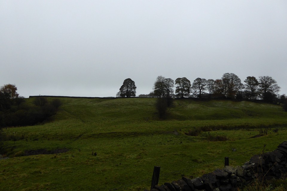
Last weekend finally saw me properly re-engage, in a strenuous but very rewarding horseshoe walk above Ebbw Vale, taking in solitary cairns on two of the high ridges that mark the northern frontier of the Valleys. Today I’m going for something shorter, lower, and with more archaeology, on a ridge that Carl trailblazed for TMA a decade earlier. A quick glance at the map reveals a potential embarrassment of riches in a relatively small stretch of ridge between the lower Rhymni and Sirhwyi valleys, ending with the prominent summit of Mynydd Machen, an obvious landmark from both the Gwent Levels to the south and from the magnificent Twmbarlwm hillfort across the valley northeast.
So it’s an early start for a Sunday; a saunter through a bitterly cold and largely deserted Newport city centre, then a bus towards Blackwood has dropped me below the small hamlet of Wyllie, nestled on the side of the ridge above Cwm Sirhywi and a good place to start the walk from the northwest.
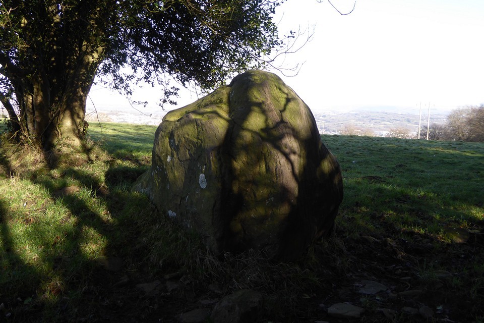
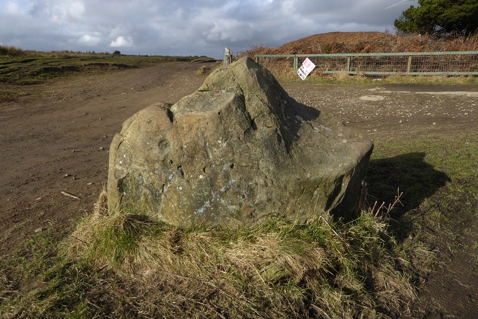
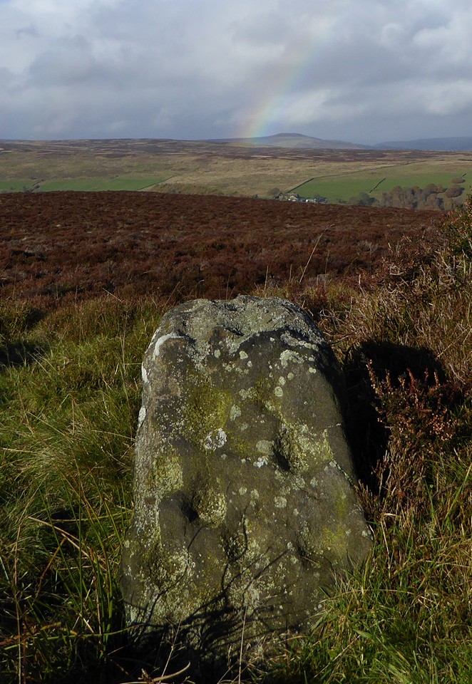
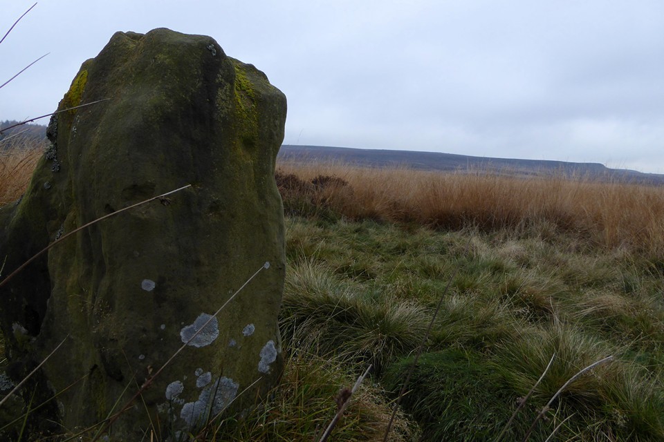
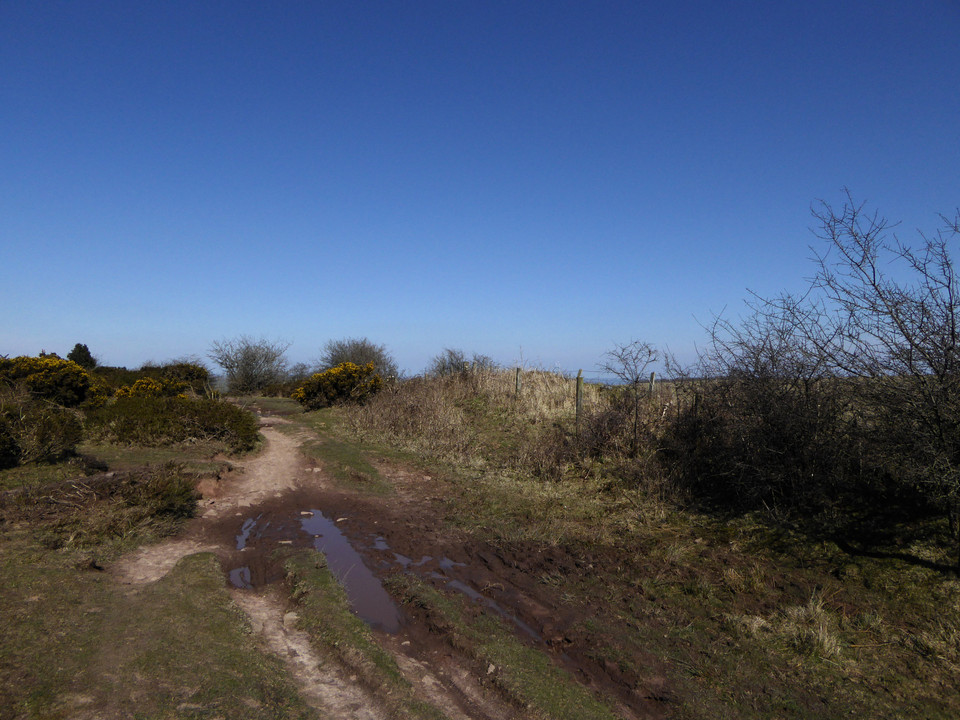
Despite the low temperature and the open windows that kept the bus ride cold, it’s a steepish climb up to Wyllie and I’m soon feeling warmer than I might have liked. The winter sky is clear blue, with the low sun raking through the trees framing the slightly sunken lane leading me onto the ridge. I’d done my homework for once, and Historic Wales has turned up a possible standing stone right next to my route.
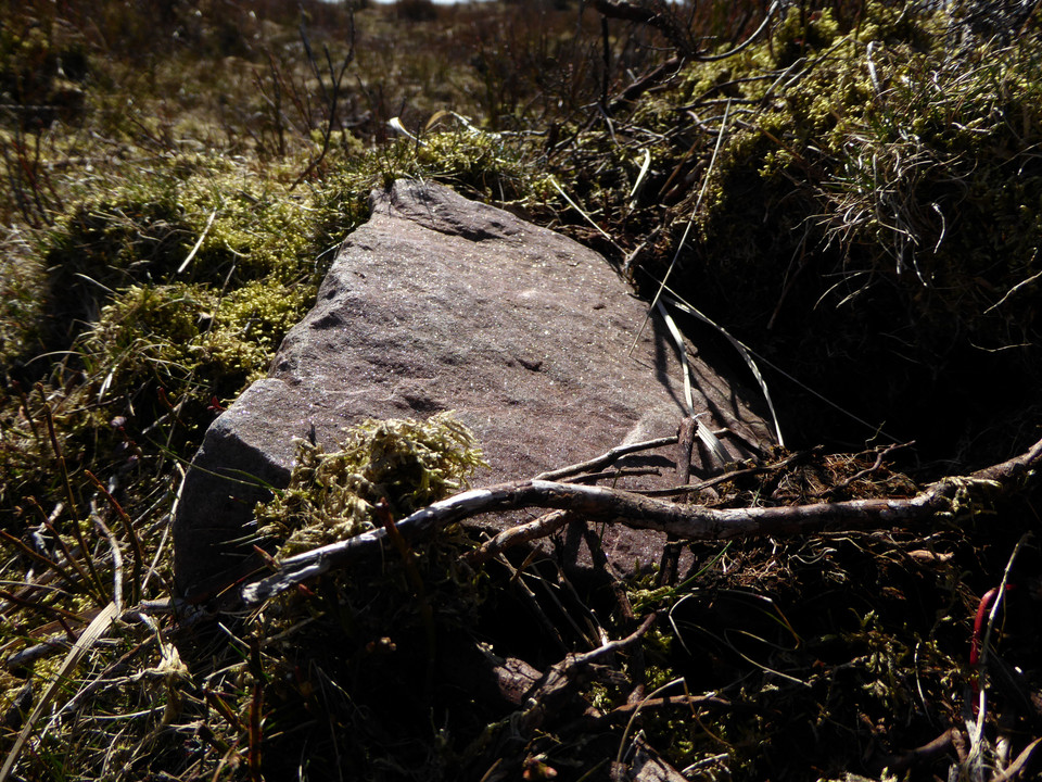
Tyle Gwyn (“White Bank”) stone turns out to be a big upright lump of sandstone. It’s one of those stones that looks too improbably erect to be natural, but too bouldery to be an obvious choice for a menhir. The stone is close to the lane, with a barbed wire fence between it and me. The field has cattle and some farm workers are repairing fences across the way, so I decide not to make the effort of trying to get any closer.
The contrast between the sharp shadows of the lane and the brightness of the field and hills beyond makes getting any decent photos difficult, but it’s a worthwhile stone to come and see. Given the prevalence of South Wales’ standing stones marking apparent routes to upland stone circles and cairns, I can’t help but feel nudged towards accepting this as the real thing and not merely a natural erratic. It certainly sets me on my way with hope for the monuments to come.
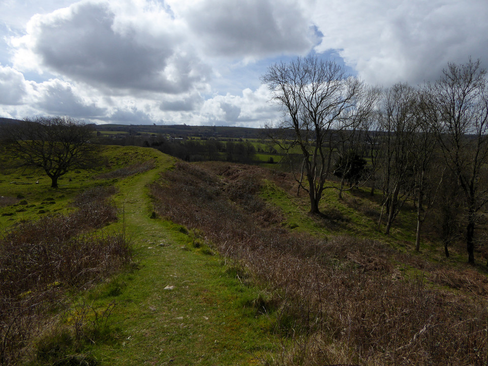
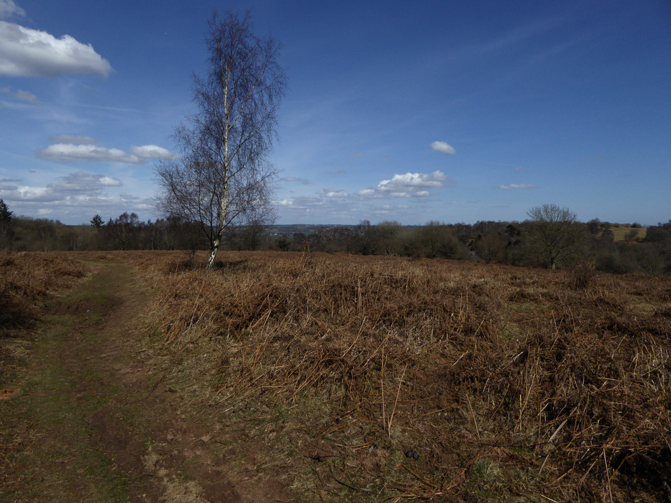
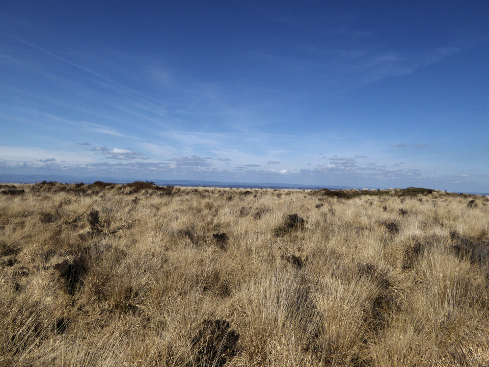
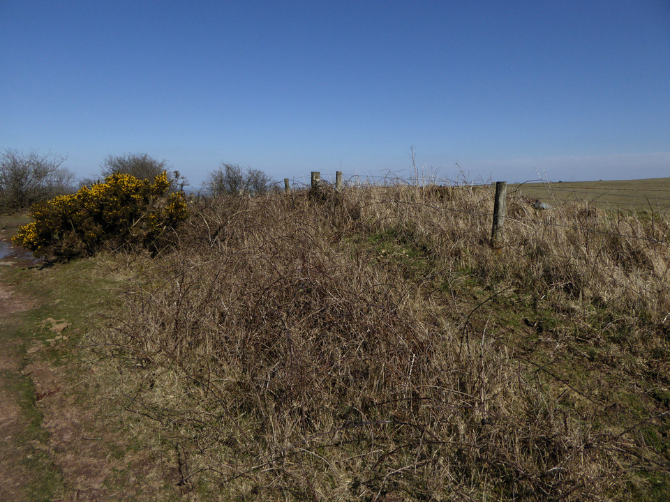
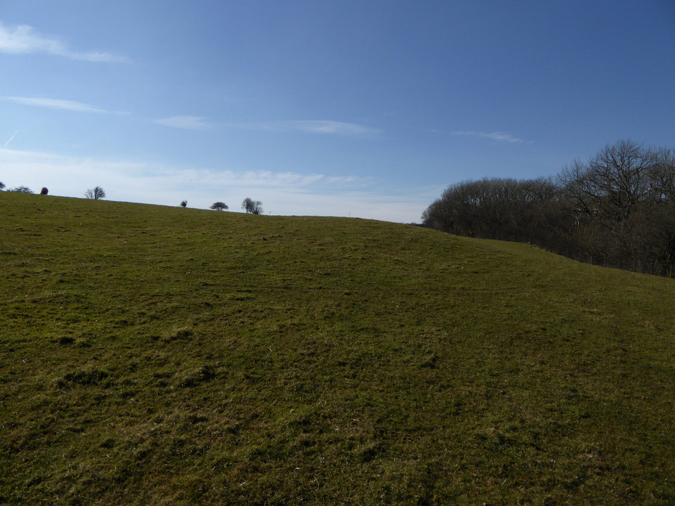
Not much further on, the end of the lane brings me out onto the ridge proper, and I head south on the minor road that will take me to the access land. The views eastwards have now opened up, particularly of Mynydd y Lan across Cwm Sirhwyi, which has its own unmarked cairn (one for a future trip). There is vehicular access along the ridge, the main restriction being whether a car’s suspension will handle the deep ruts and watery potholes. It also makes for a lot of motorbikes, some of which are being ridden responsibly, others less so. As I saw above Ebbw Vale last week, there is an ongoing threat of damage here from people who don’t know or don’t care about the ancient heritage on these ridges.
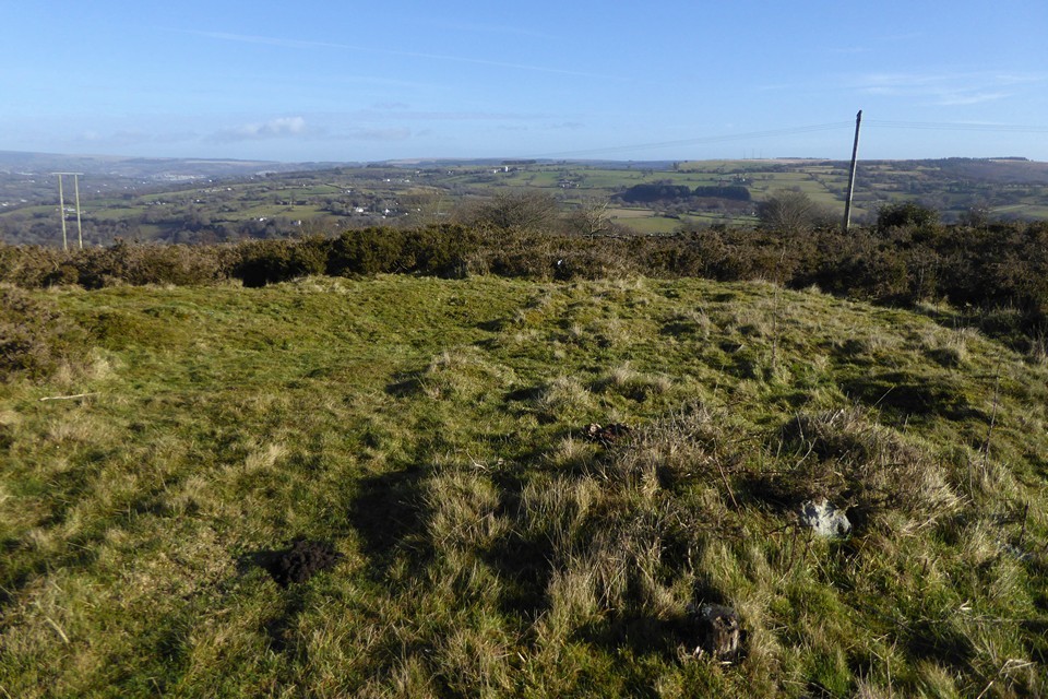
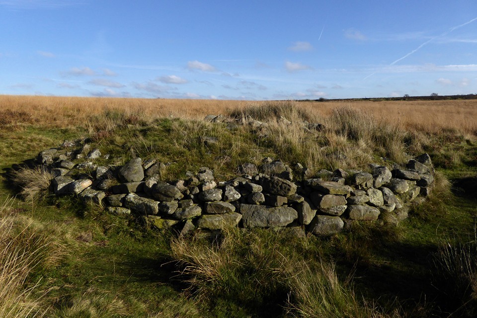
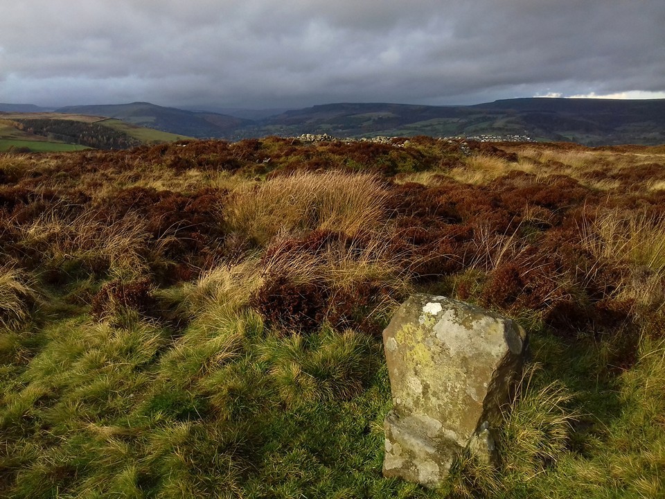
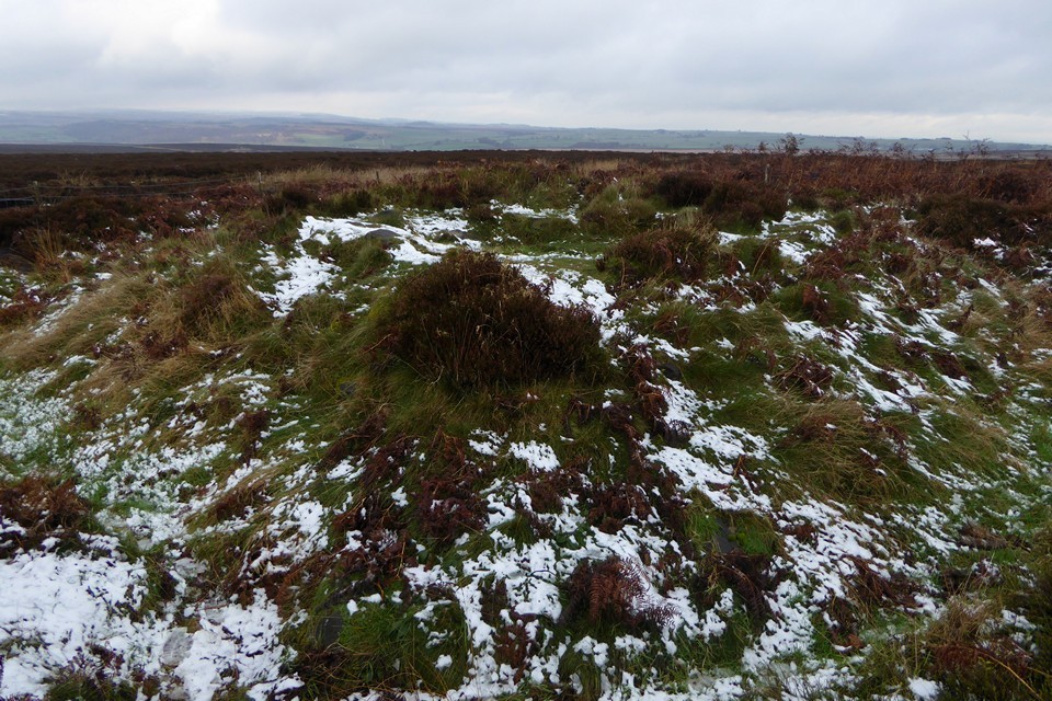
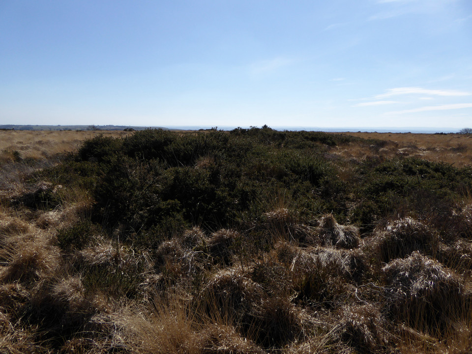
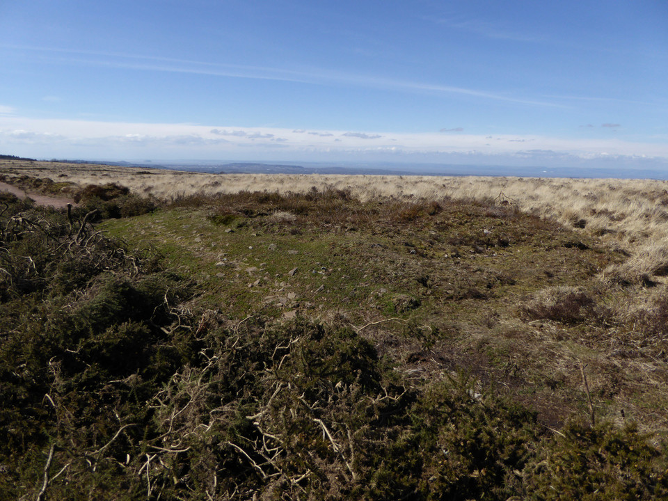
The first cairn of the day is Mynydd Bach 2, a low monument marked on the Ordnance Survey map. It sits in an area of gorse and scrub, criss-crossed by various tracks and I’m not particularly optimistic that it’s going to be easy to find. I follow one of the broad tracks running west from the main ridgeway, then another heading south. And amazingly, clear of the thick gorse smothering much of the area, here is the cairn. As described in the HER, it’s a low, circular monument. It rises highest above the surrounding ground surface on its eastern arc. I wouldn’t be surprised if it has always been a low monument, rather than the remains of a bigger robbed-out mound, as there are other ring cairns close by. From here I can see the obvious profile of Mynydd Machen, which is on the agenda for later.
Apart from a couple of stones protruding where gorse bushes have been cut back, the monument is covered in turf. Close by are signs of rubbish or motor debris having been burned, but at least it’s not happened on the monument itself. Although it’s not the most exciting cairn, I’m delighted to have found it so easily and drink in the extensive views.
Next I head into the scrubbier ground to the west, where there is supposed to be another ring cairn, unmarked on the OS map. After wandering for a bit and poking around in the gorse and tussocks I declare this one a failure. There’s plenty more to come, so I’m not too disheartened by this setback.
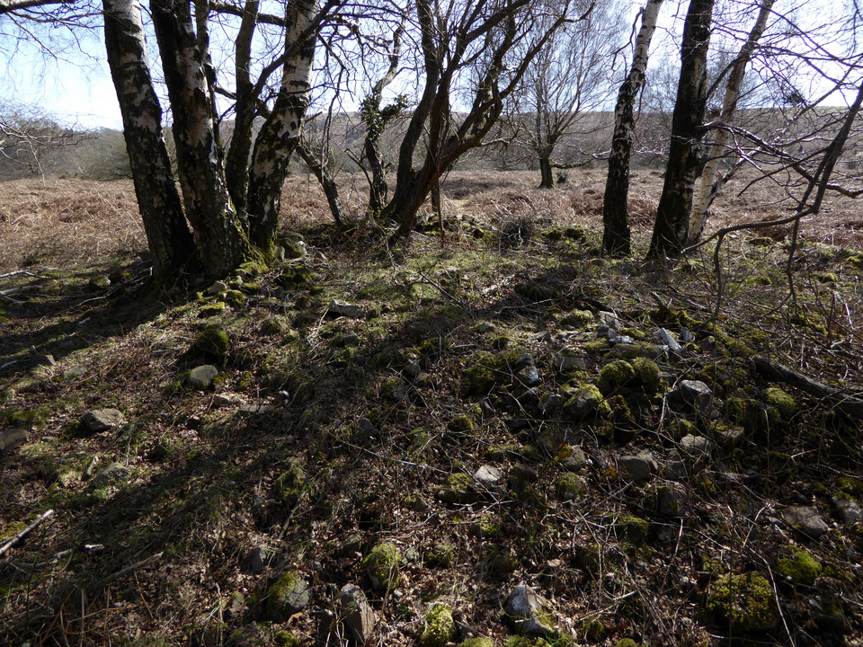
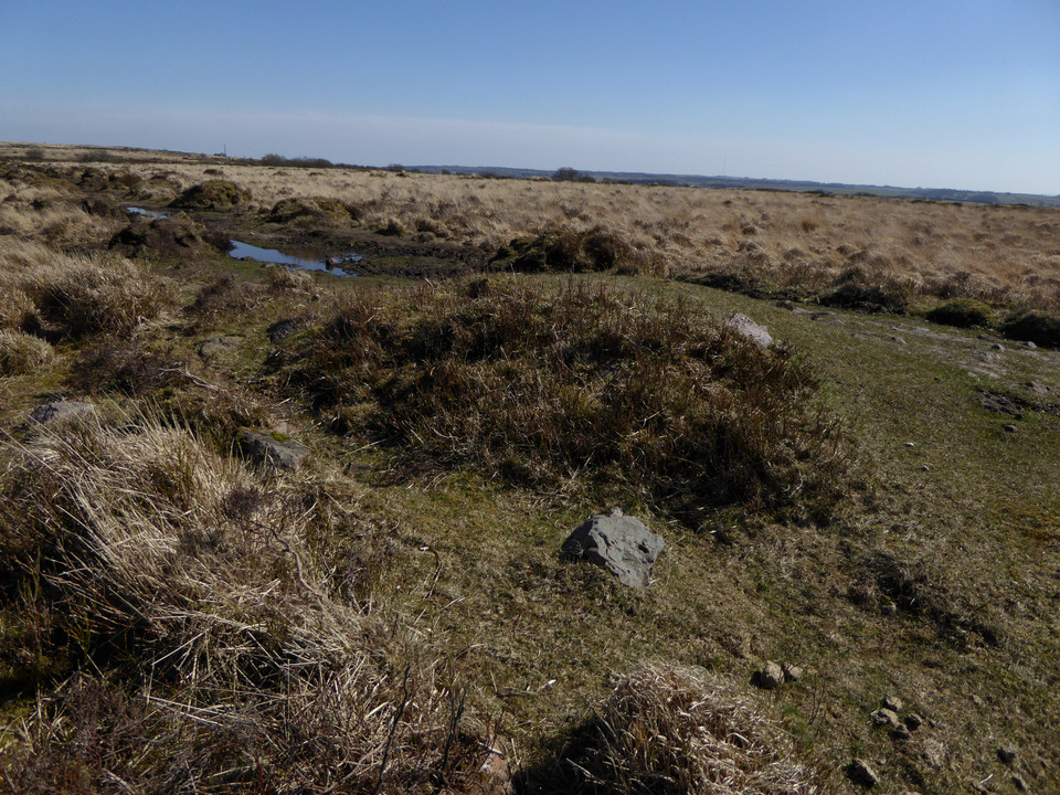
Returning to the main ridge path, the next cairn south (Mynydd Bach 1) is much more obvious. It lies in a grassy field to the west of the access land, and can be seen prominently from the path. The unexpected obstacle to this one turns out to be resident sheep, who take curiosity to heights bordering on belligerent, crowding around right behind me as I cross their field. To be fair I’m intruding on them, but it’s like something between panto season and Life of Brian; my attempts to convince them that I am not the messiah are unsuccessful.
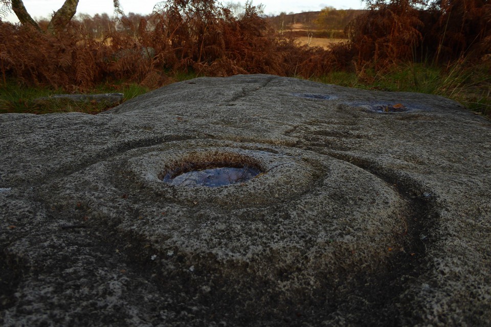
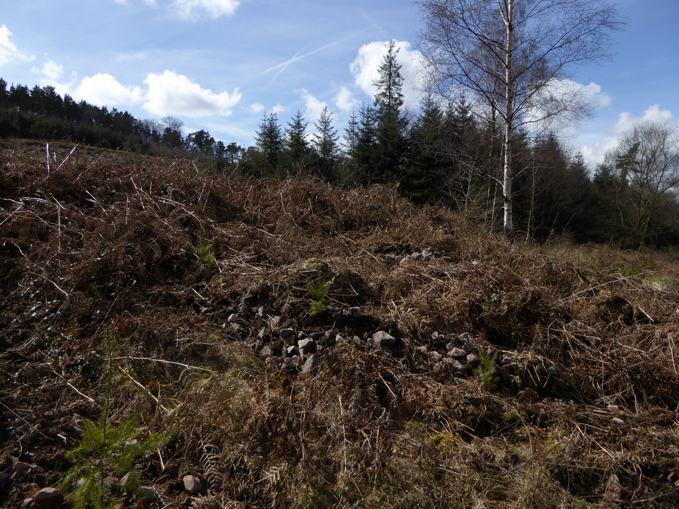
They follow me all the way onto the cairn itself, which makes taking photos somewhat difficult as I’m constantly on the brink of being pushed over from behind by whichever sheep is the bravest of the flock. Nevertheless, this invasion of my personal space doesn’t detract from what is a fine monument, with a cist exposed in its centre. Two side slabs remain, one still in place, the other lying out of position. There’s a bit of rubbish too, unfortunately, although by local standards it’s quite minor. A further small slab lies on the northern edge of the mound, but I’m not convinced it would have been large enough to be the capstone. There are fine views to the northwest, looking towards the higher ridges. To the west Cwm Rhymni drops away. If you can shake off the sheep, this is a very decent monument to visit.
With my retinue following me to the fence, I head south. Leaving them behind, the ground drops quite steeply and according to Coflein (but not GGAT) there is supposedly another very irregular cairn here. Apart from an area of stone exposed from quarrying, I can’t find anything at all in 10 minutes or so of walking backwards and forwards across the sloping field, so I give up and head back to the ridge path.
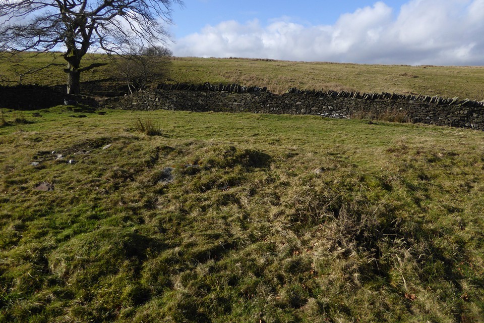
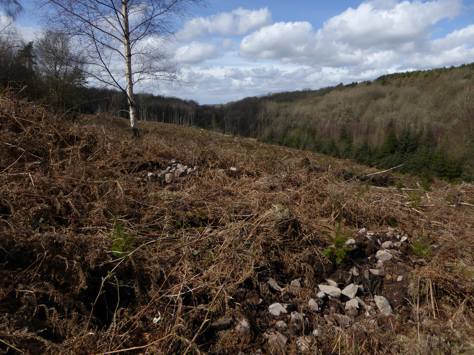
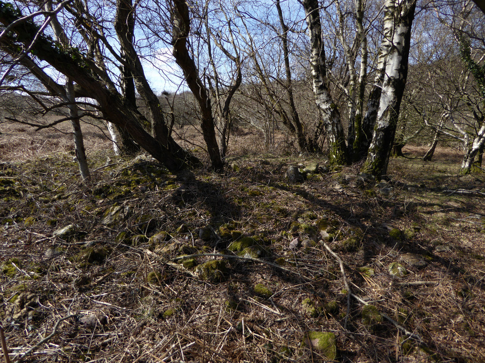
The next monument, Pont Bren Gwyn ring cairn, sounds like it will be elusive. However, the OS map is helpful in showing an obvious kink in the wall right where it’s supposed to be, and so it proves. Beneath a lone tree, with a broken wall on its west side, the arcing bank around the east side of the monument is quite easy to make out in the low sunlight and low vegetation of this time of year. Definitely one for the enthusiast, but like Mynydd Bach 2 it’s the sort of monument that gives a sense of satisfaction just from finding it at all. The name defies my attempts at translation; although it sounds like it may be related to “Brenin”, it seems that “Bren” may be a proper noun, which would make it “White Bren’s Bridge” I think. Like Mynydd Bach 2, the views are all eastwards, towards Mynydd y Lan.
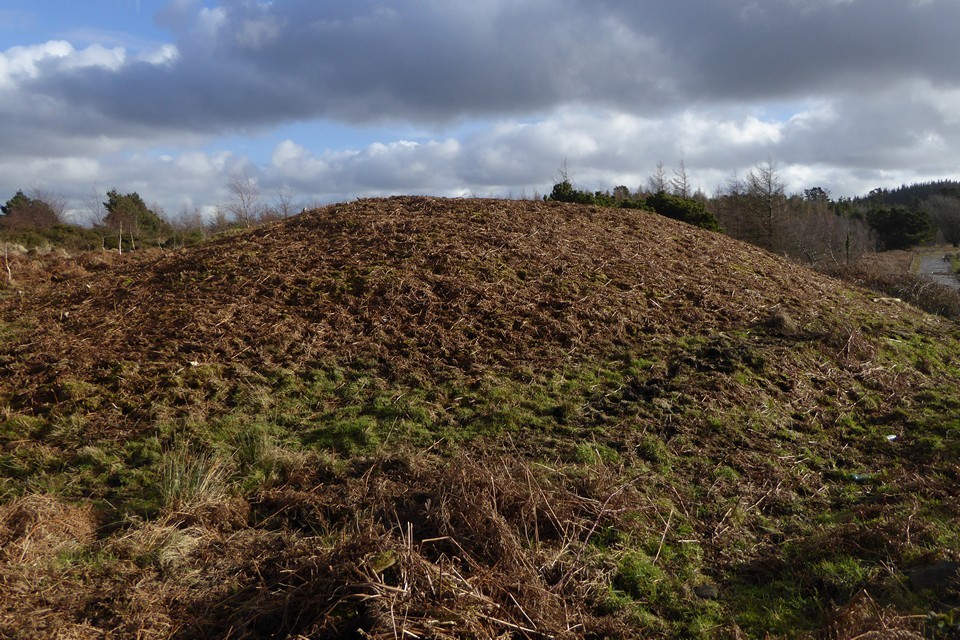
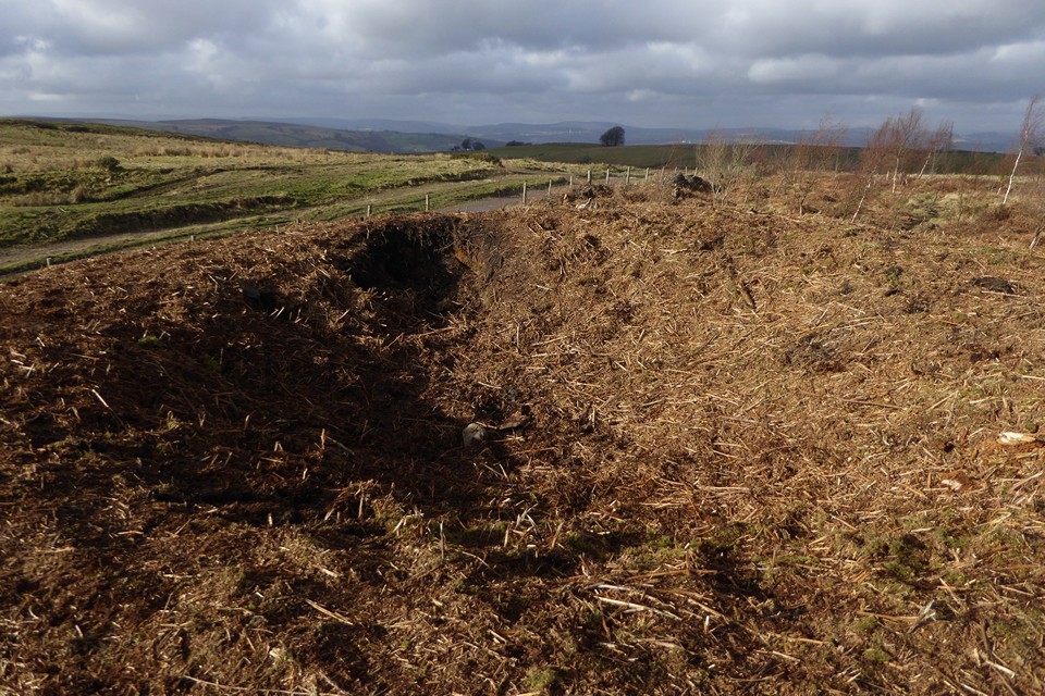
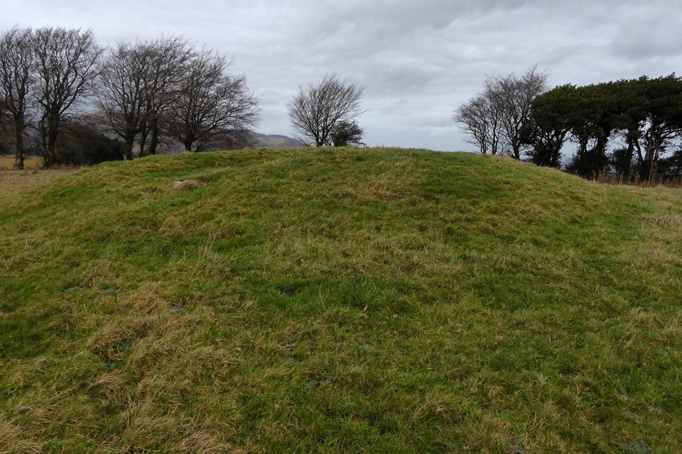
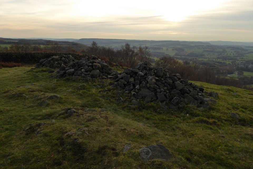
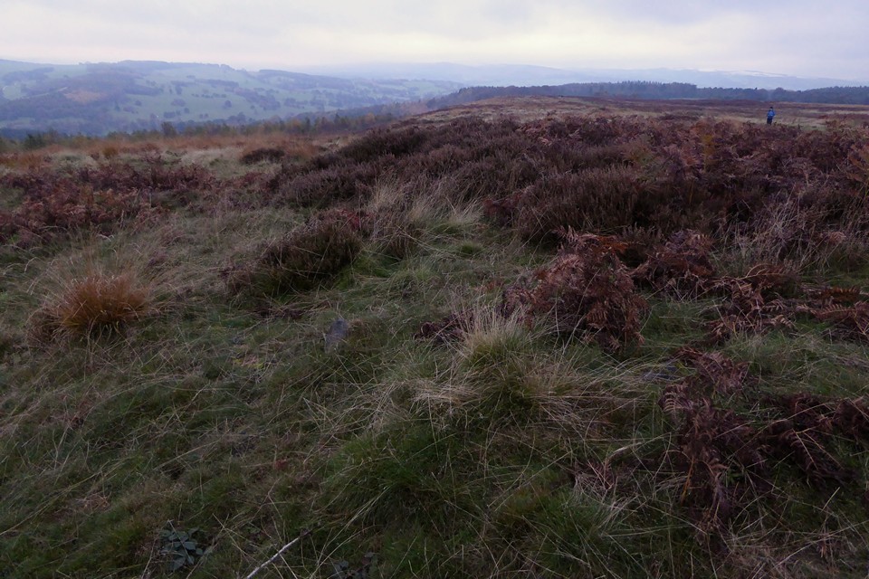
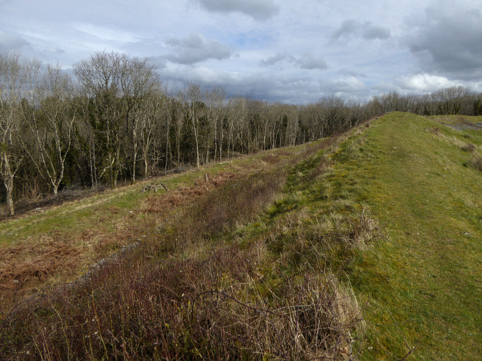
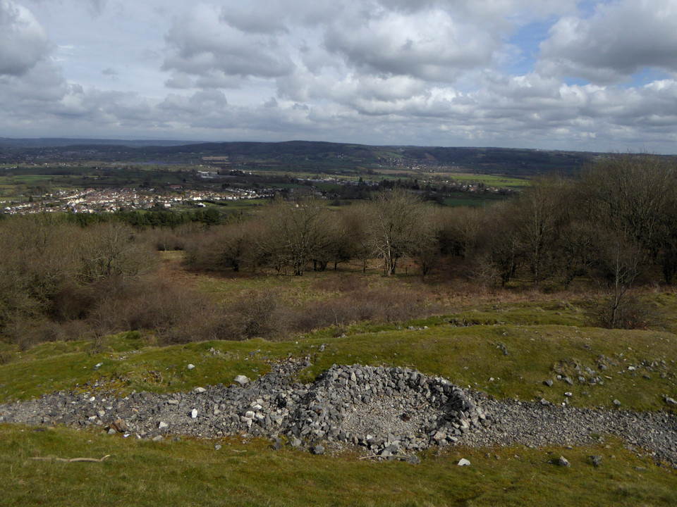
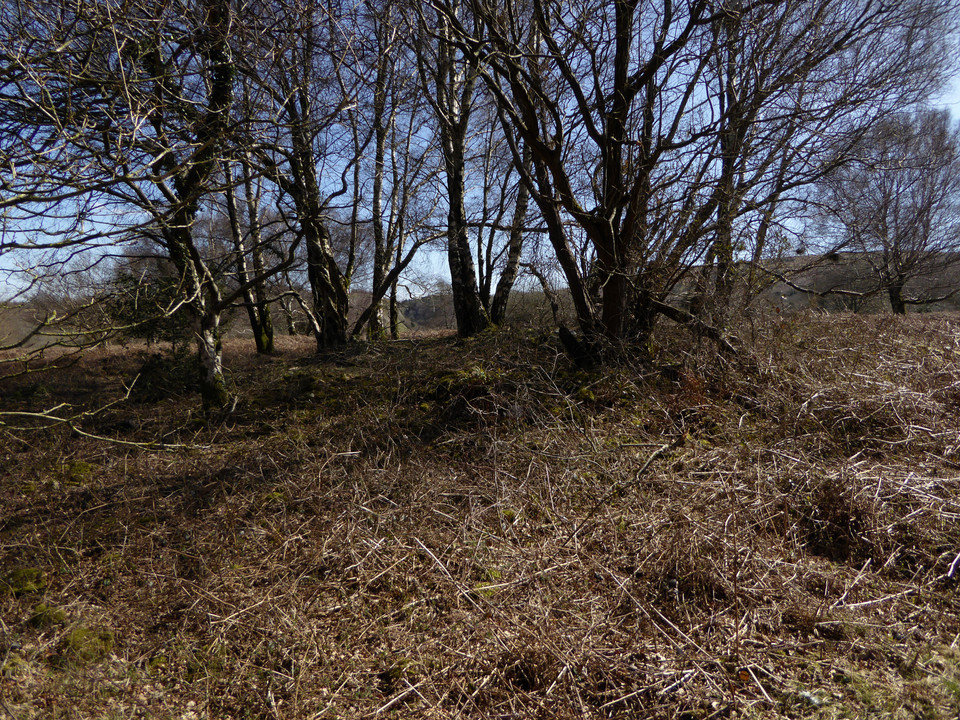
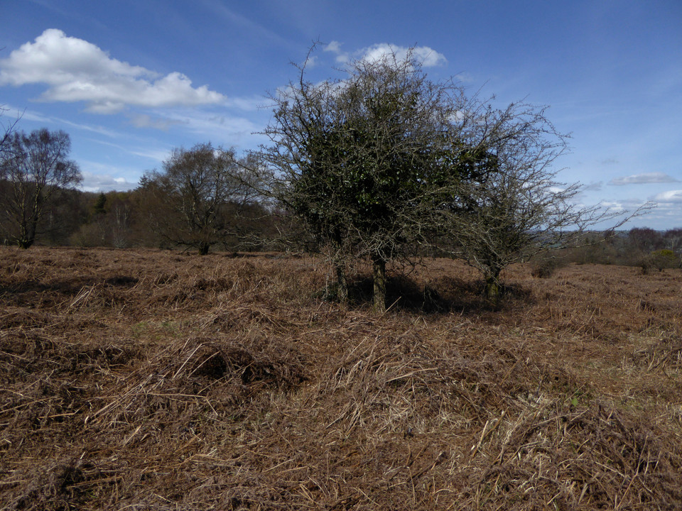
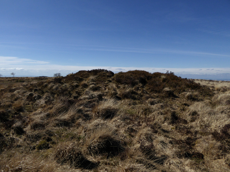
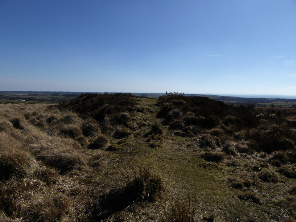
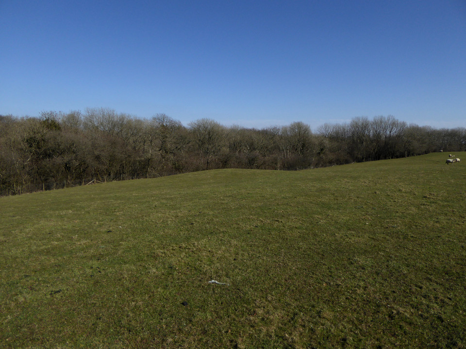
All in all this little group of sites has been a great start to the walk. There are plenty of other people out enjoying the winter Sunday sunshine, but no-one seems overly interested in these obscure lumps and bumps. No change there! Heading southeast, the main ridge path starts to climb gently up towards an area of forestry on my left. And rising rather majestically from the forest’s margins is the biggest barrow so far by some distance, Twyn Hugh-Cae (“Hillock of Hugh’s Enclosure/Close”). When Carl visited it was covered in summer vegetation, but today it has been close-cropped, probably by someone with a strimmer. The fence at its foot has been broken and there are worrying signs of bikes tracks cutting into its edges. Nevertheless, this is a big, impressive monument, regular sides sloping up to a flat top. On further investigation, the summit of the mound has been dug deeply into, a wide crater exposing earth and roots but no sign of any central chamber or cist this high up in the barrow. The construction appears to be more earth than stone. Views to the south are truncated, but the barrow has decent views north across Mynydd Bach (Maesycymmer) and beyond.
Across the main track to the west is an area of open ground, which hides the low banks of a square-cornered earthwork. The shape suggests it’s medieval or later, but it’s curious how close it is to the massive barrow and I wonder if it’s related to the site’s name. Immediately south of the barrow is a pointed standing stone. None of the HER records mention it, and it’s far too obvious to have been overlooked so I assume it has been taken to be modern. However, it’s a nice slab of sandstone and all its sharp edges have been worn smooth in a way that suggests it has been exposed for a long time. Hmm.
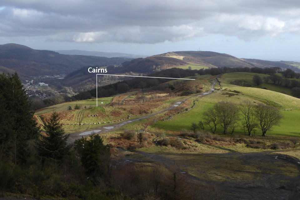
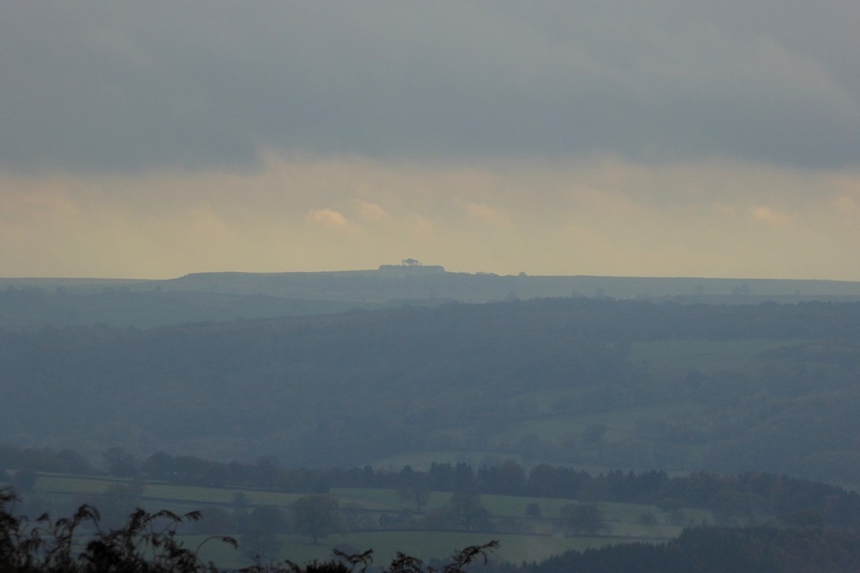
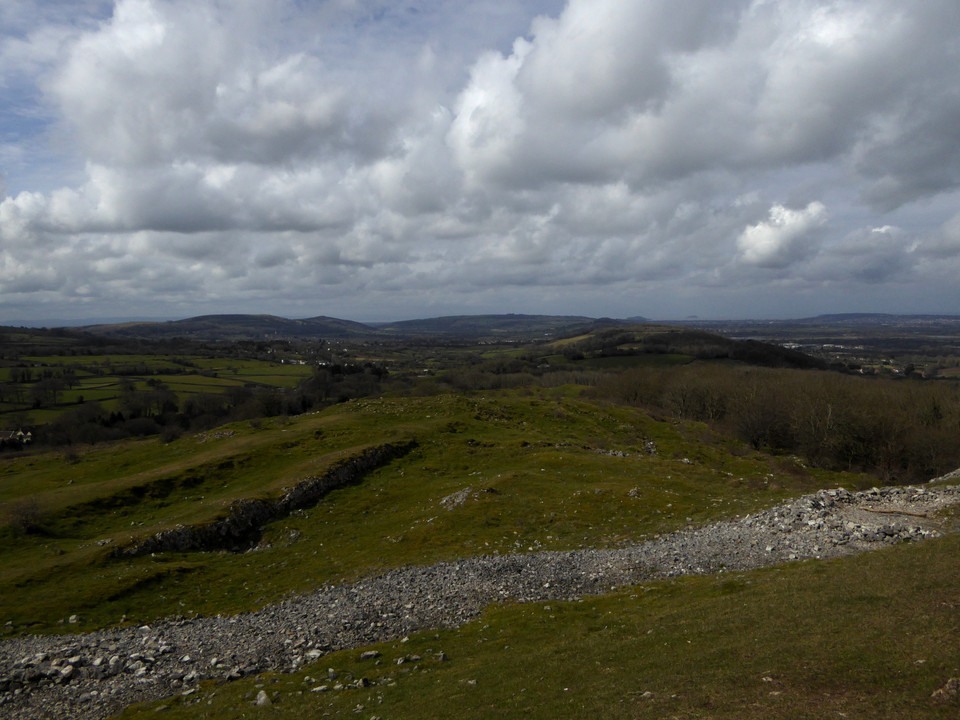
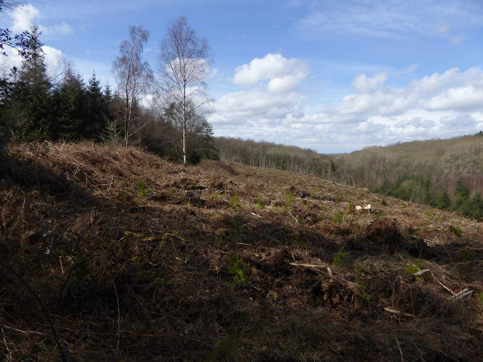
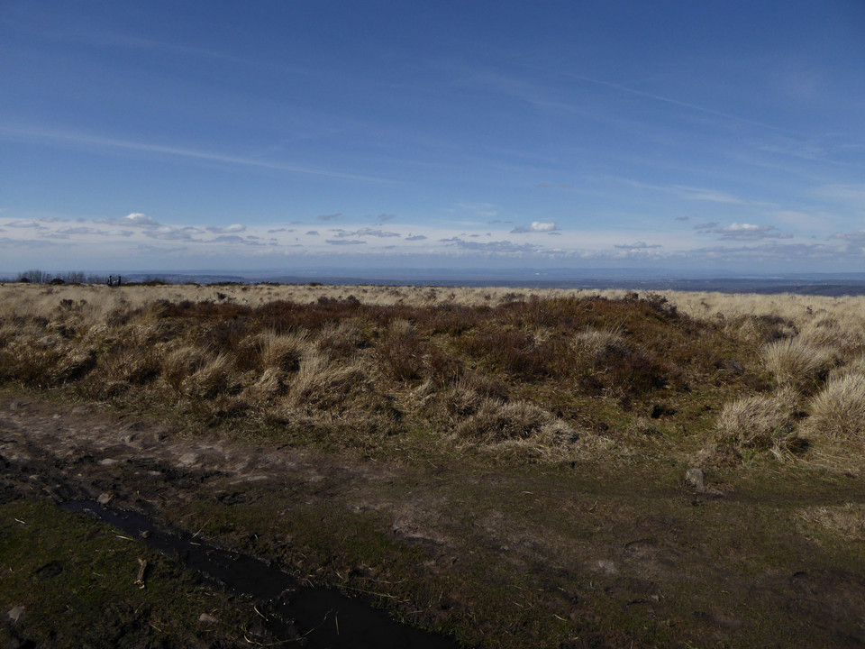
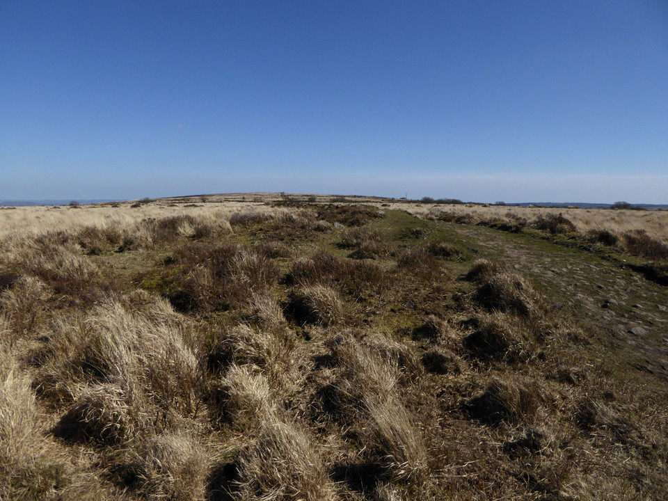
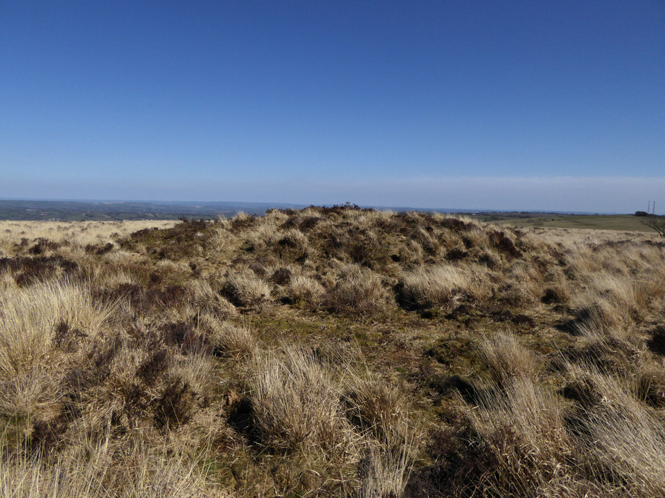
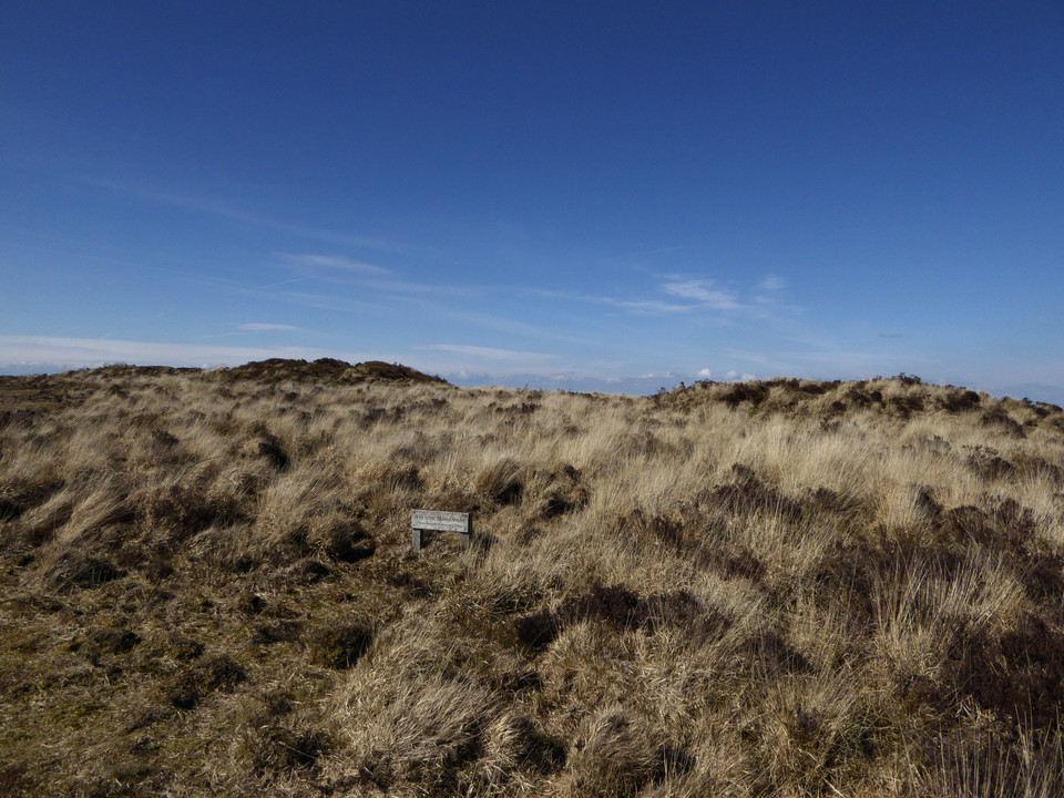
The main ridge path continues to head southeast, the ground rising ahead of me. The surface is becoming increasingly rutted and muddy, and the rising ground to my right has turned into a blighted landscape of churned, black earth. This is Mynydd y Grug, where the natural surface has been raised to a much greater height by the addition of mining or quarrying spoil. I slog my way up to the top to get a sense of the views. The top is gradually becoming vegetated, and I guess that in a few years this dark mass will blend more naturally into the wider landscape. It is worth coming up to the top for the elevated views the artificial height provides of my next objective, the pair of cairns or barrows at Twyn yr Oerfel and onwards to Mynydd Machen. Above the Sirhywi valley I can also see the round prominence of Twmbarlwm rising forbiddingly.
When Carl visited Twyn yr Oerfel (which appears to translate as “Hillock of Chill” or “Cold Hillock”) he expressed concerns about the barrows being damaged by motorbikes. From my elevated vantage on Mynydd y Grug I can see that the nearer western monument has now been encircled by a double ring of stone blocks, presumably to discourage vehicles from encroaching.
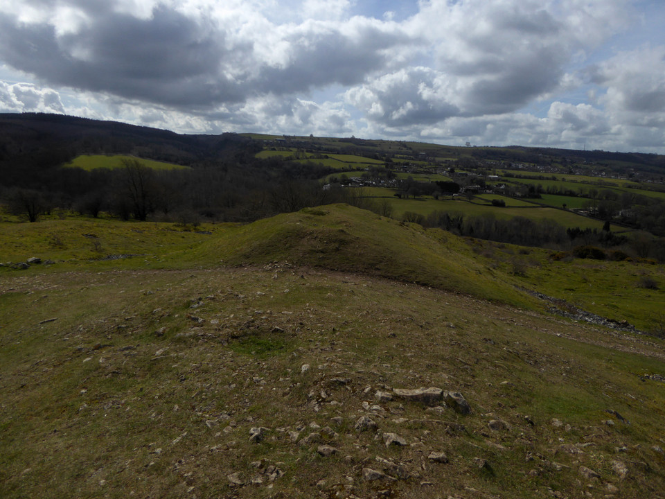
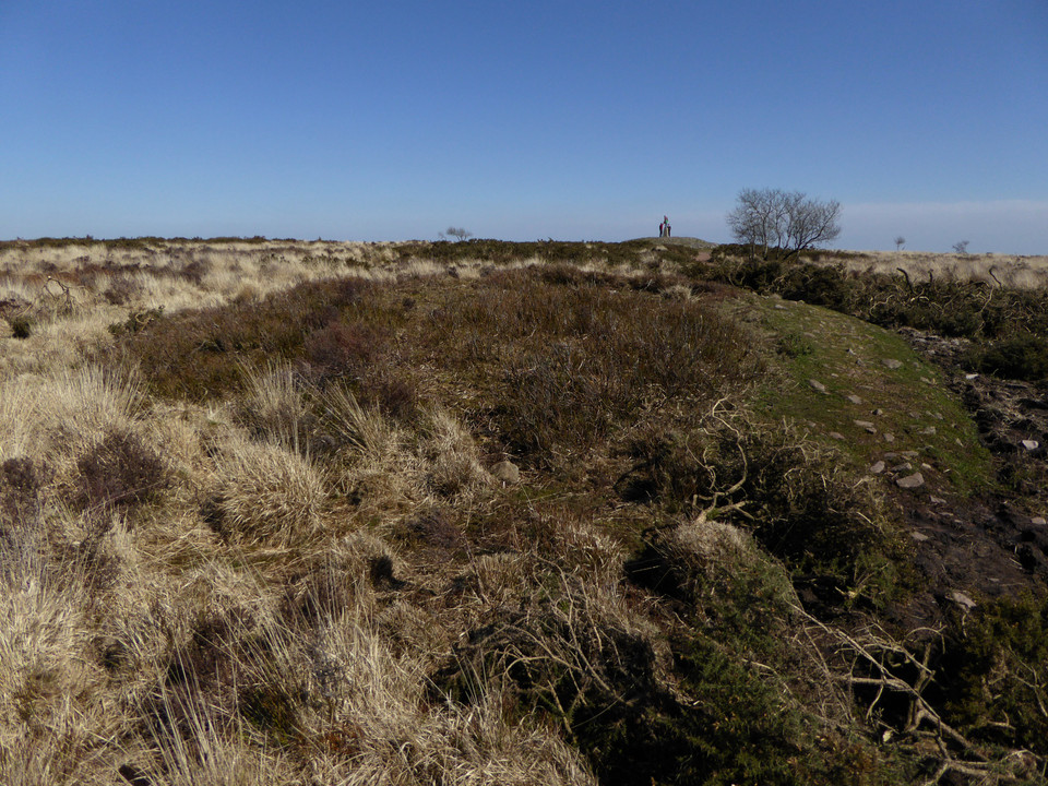
After making my somewhat slip-sliding descent from the spoil, reaching the western cairn reveals an excellent monument. Although there are ruts from wheels cutting its side, they appear to be mostly old and are being slowly grassed over. The mound stands to a good height and doesn’t have the usual signs of antiquarian digging in its top. Best of all though is the view. Perched right on the edge of steep slopes of Cwm Sirhwyi, the cairn enjoys a brilliant vista to the north and east. It’s a shame it’s been badly treated, but don’t let that put you off, it’s a cracking site.
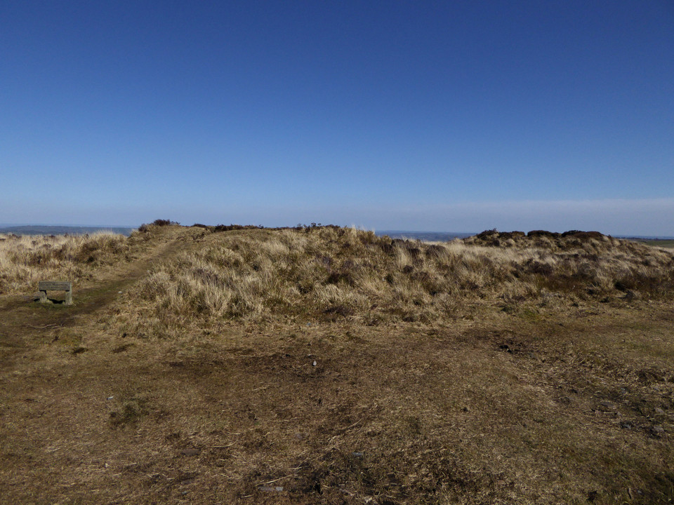
The eastern cairn is similarly poised above the drop. As I approach a number of motorbikes zip along the ridge path towards me, thankfully ignoring the mound which stands next to the track. Like the cairn I visited on Y Domen Fawr last weekend, this one has had the ignominy of a wooden bench being inserted into its top. Fair enough, the view is superb, but surely the Powers That Be didn’t need to actually stick the bench right on top of the cairn? The feeling persists that there is a lack of care or concern about the preservation of the heritage these monuments represent.
Whatever, this is a great pair of monuments; in terms of placement these are the best-situated cairns on this ridge. I stop here for a while and have a late lunch (yes, I am sitting on the bench).
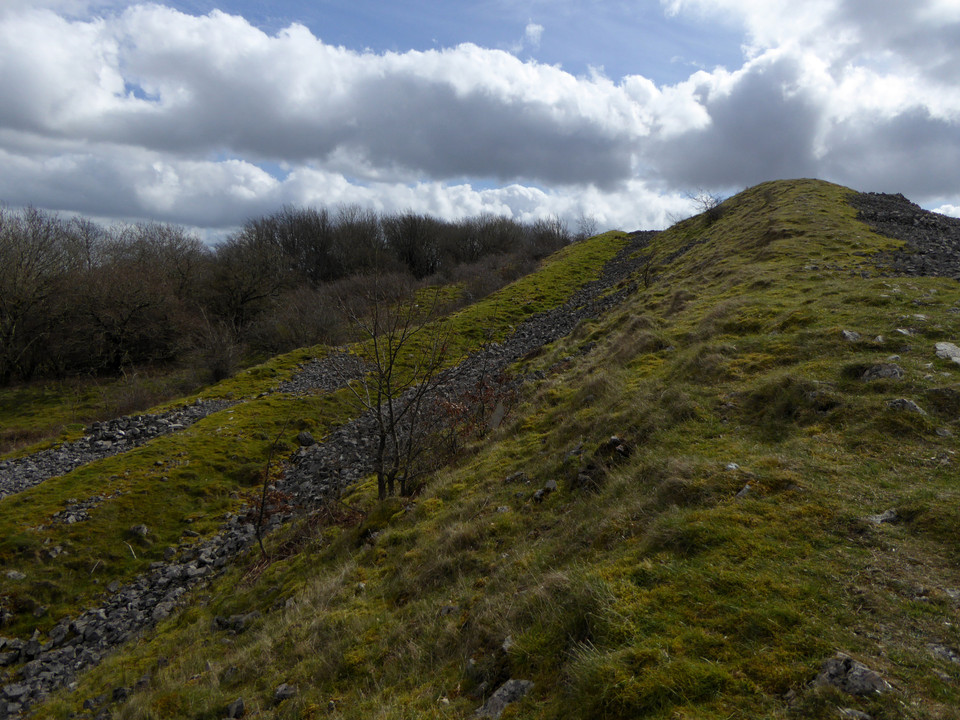
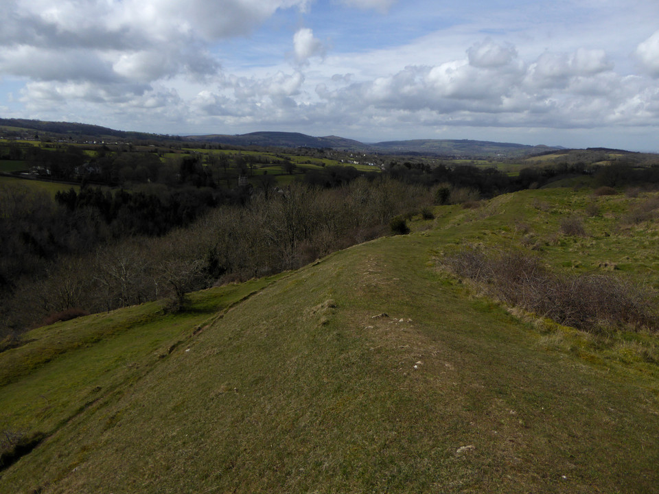
At length the need to get going again kicks in, I still have one biggish hill to climb before I’m done. I leave the main ridgeway before it turns back into a road and instead head northeast along a pleasant tree-lined track north of Penllan Farm. Eventually I reach a road and forestry parking area, busy with Sunday walkers. Eastwards the ground now rises steeply, and I’m huffing and puffing a bit as I reach the open land next to the extraordinary man-made ridge of Pen-Rhiw Tip. Although it’s a blighted landscape, it is slowly reverting to nature and the tip itself is worth a walk along for the excellent views it provides across the valley towards Mynydd y Lan and Twmbarlwm. The eastern end of the ridge is rather steep and loose, as I discover when I try to get back down from it!
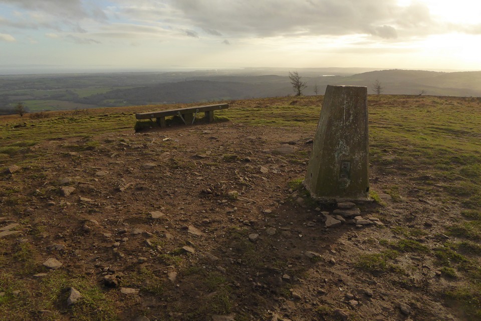
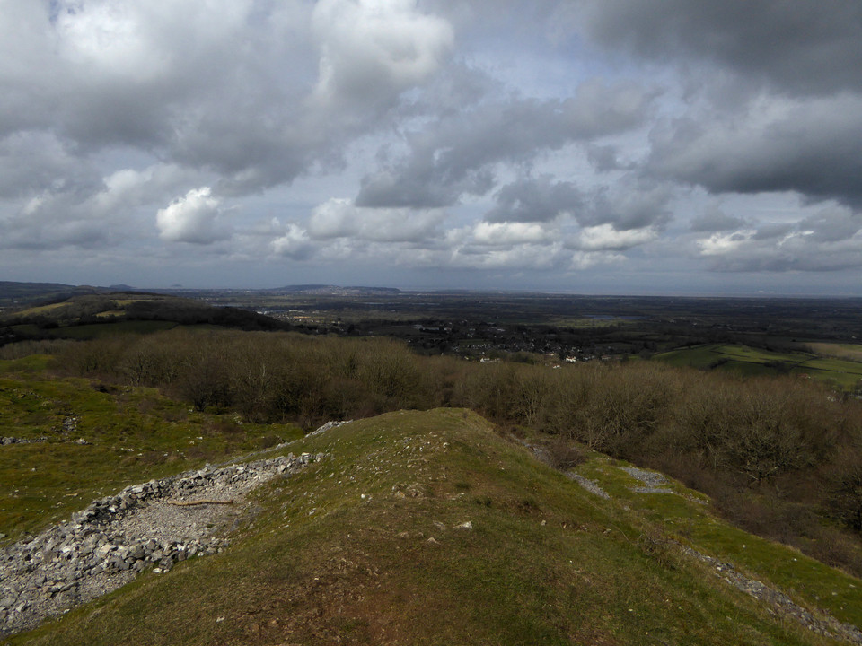
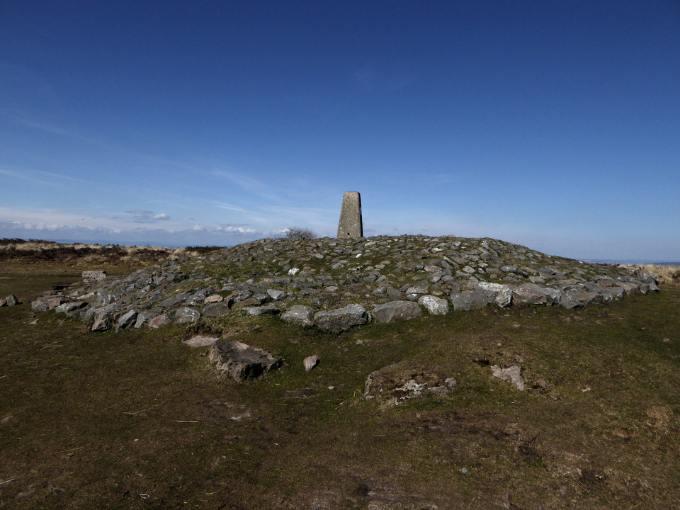
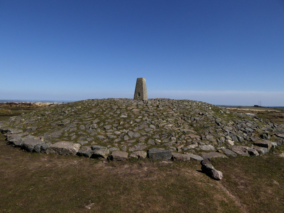
The final hill of the day is now directly ahead of me. It’s not that steep a climb from this direction though, and the going is easy. I reach the summit area next to the masts to find a few other people up here, enjoying the last of the sunshine, which is rapidly giving way to an overcast evening as the sun sinks behind low cloud. There’s also a 4x4 parked up, overlooking the much steeper drop eastwards.
The cairn is another fine one, but judging by ruts and loose stone on its top and sides it’s being actively damaged by vehicles. It’s a real shame, as the placement here is terrific. Although visibility has lessened with the cloud, there’s still an amazing panorama looking south and east across the Gwent Levels to the mighty Afon Hafren (Severn), with the instantly recognisable Flat Holm and Steep Holm islands.
While I’m taking photos, the 4x4 pulls away from the edge of the drop and comes and parks up right on top of the mound next to me. The driver and passenger grin idiot grins through the window at me, I’m sure they think they’re very clever. I carry on taking photos, now with the 4x4 as an additional feature. Belatedly realising that number plates can be traced, the driver decides he’s had his fun and drives away off the hill. It’s left a sour taste at the end of what has otherwise been a fine ridge walk. It’s so frustrating that people like this are wrecking the excellent archaeology around here.
With them gone, I enjoy the last sun rays on the barrow before making my way down the steep slopes to the east.   |
Off the hill, my route carries on southeast, and there’s one further site to fit in as the sky darkens and evening approaches.
I wasn’t necessarily expecting much from this, a barrow in a field with all the attendant risk of being ploughed down to nothing. It comes as a very pleasant surprise to find this is a very decent monument, a good upstanding mound with a few stones embedded in its top and sides. As Carl notes, there are good views down to the valley below; the Rhymni valley in this instance, as this barrow is at the top of a southwest-facing slope, unlike the other monuments I’ve visited today. The name (“Hillock of the Fair Hollow”) seems very apt. It’s a great site to finish the day despite the failing light, and lifts me after the irritation of my experience on Mynydd Machen.
The last part of the walk is down very steep roads into Risca. The rain, which has held off all day, arrives as I cross the Afon Ebbw and head for the bus shelter.
It’s been a very pleasant Sunday in the Valleys. The walks around here are often superb despite the human damage inflicted on the landscape. It’s just a shame that these visits often include brushes with an idiot mentality that can’t or won’t see that there is fine heritage worth preserving here. Never mind, there is beauty here for those that have eyes to see it, and that will be enough to bring me back to these ridges, time and again.
|
Raving on the Moors Part III – Big Moor 11 November 2016
The third and final day of our Peak District trip is the Big One, the day out we were going to fit in no matter how bad the weather turned out to be. And in the end it’s a beautiful day, blue skies and barely a nip of autumn wind. After a revisit to Bakewell church to see the green men and huge collection of early medieval stones, we’re heading off to Owler Bar, little more than a pub and bus stop at the northeastern corner of Big Moor.
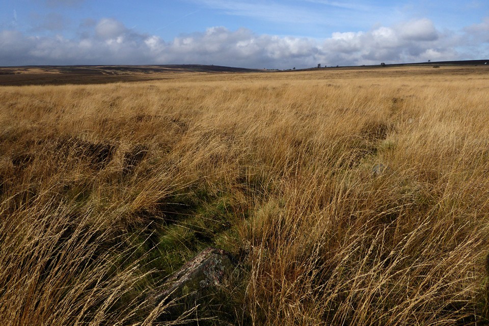
Big Moor is a sea of umber and orange at this time of year, and despite the busy A road running along its edge, it manages to feel like a remote place. Features are limited, just a gentle rise to the high points, the curve and dip of the course of Bar Brook, occasional lone trees, and the glint of sun on the half-empty Barbrook reservoir.
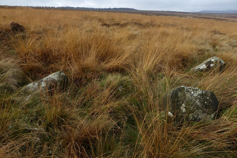
It’s towards this last feature that we head first, following a wet and muddy track running alongside Bar Brook itself. There are a few other walkers about, but they remain distant and unintrusive, leaving us to contemplate the gentle expanse of emptiness on either side as we head south.The first site of the day, Barbrook III will be the most difficult to find, rendered so by small stones and tall grasses. Leaving the embanked edge of the reservoir behind, we follow a faint path NNE, hoping that the stones will show themselves. Arriving at a darker ring of bracken, obvious amongst the pale oranges of reedy grass, I concede that we’ve gone too far this time, so we head slightly downhill and back on ourselves. Soon after the first stone appears, barely peaking its head above the vegetation. Then another, and another, and another. This is a laugh out loud circle, so easy to miss yet huge in size, if not stones, once discovered.
It’s a bit squelchy, the stones are half-hidden, their spacing makes it hard to photograph more than a couple at a time, but it’s truly wonderful. The relative flatness of the moor makes the surroundings somewhat undramatic, but instead there is a sense of secrecy that has a charm all of its own. The play of light on the rising ground to the west, the gnarly lichen on one of the stones, the patterns of erosion and wear on the upper surfaces of others, all combine into a near perfect experience. We can see cars on the road, walkers in the distance, but it seems almost unthinkable that any of them might ever come here. Hidden in plain sight, a gem all the more precious for its coyness.   |
We retrace our steps towards the reservoir, then rejoin the course of Bar Brook heading south once more. The valley deepens slightly, the sides blocking the views and channelling us into a place of even greater quiet and solitude. We see no-one now, except a single doe silhouetted on the skyline to the southwest, watching our strolling progress. Closer inspection reveals the antlered head of a stag, keeping below the crest, and soon we pick out many more of the herd, blending into the browns of the hillside across the valley.
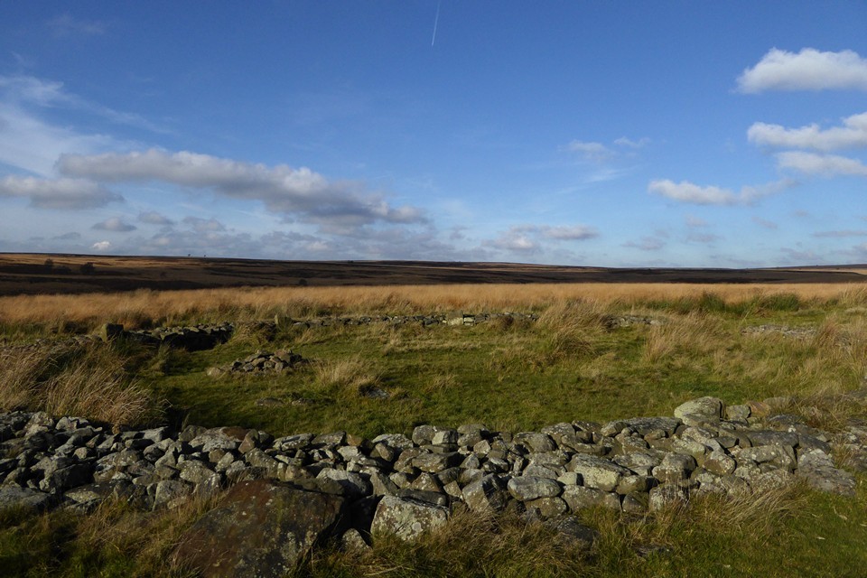
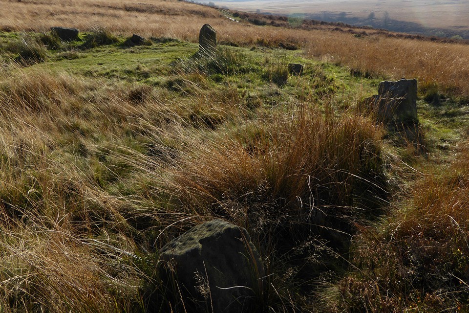
As the path curves southeast, we leave it and cross onto the open moor. The sites here are concealed from the level of the track, but a substantial round cairn, covered only in a thin layer of turf, is the first obvious sign that we’re in the right area. We’ll have a look at the cairn group a bit later, but the next objective is something a bit more unusual.Barbrook II is a bit of an enigma. A circle of free-standing stones, enclosed within a thick drystone wall that stands only slightly lower than the tops of the stones. I’m instantly in love with this place. We’ve never been before, another omission long awaiting correction. The circle feels utterly secluded, the wall and stones are low enough to escape attention from anyone but a deliberate visitor, especially as the Ordnance Survey map perplexingly shows no sign of the circle or nearby cairns at all, other than a misleading “field system” label.
This is somewhere to spend time, to watch the clouds and the changing light over the moor. We sit here for a while, no-one comes, nothing intrudes. There are lots of details, the burial cairn inside the circle, the large stone propped against the outside of the drystone wall, there’s also a cupmarked stone in the central cist but I don’t even notice it. The next time I come – and I really hope that isn’t too long away – I’ll pay more attention to these little elements, but today I’m so overwhelmed by the whole that I couldn’t really care less. Perfect.  |
The cairn cemetery lying between Barbrook II and Barbrook I proves well worth a stop off. A widely varied group, mostly dug into in the mid-19th century, many have excellent kerbs. The star of the show is the rebuilt cairn closest to Barbrook I, a bit of a classic of drystone edging about four courses high. One of the stones in the surround shows an interesting weathered pattern that is probably natural, but just possibly could be the very eroded trace of cupmarks.
From here we drop slightly to Barbrook I.  |
The third of today’s stone circles, and very different again from the other two. This is yer classic Peaks embanked circle, compact and neat. Unlike, say, Nine Ladies, the stones are quite varied in size, although with no particularly obvious grading towards a compass point. The top of one of the stones has cupmarks, something I was completely unaware of, but which recalls the stone at Stanage we visited yesterday.
When we first got into stone circles, I read that the Barbrook sites and Big Moor were closed for environmental reasons – this was in the days before the Countryside and Rights of Way Act opened up swathes of access land, and before the internet might have told me different – so we never came here on our earlier Peaks holidays. As I’ve felt throughout these last three days, the long wait has both sharpened and sweetened the experience of finally coming to these sites. They compare with the best.
The proximity of the track perhaps keeps this from quite reaching the heights of Barbrook II as a place to find solitude, but in truth no one passes our way in the time we’re here. We will definitely be back here.   |
So we bid goodbye to Big Moor, a brilliant introduction to some of the best sites I’ve been to. We head across the A road and skirt the edge of Ramsley Moor, our progress temporarily halted by a herd of cows that really would prefer not to get out of the way. Once these are safely persuaded to give us passage, Gardom’s Edge lies ahead of us. The sun is sinking low now, our eyes dazzle.
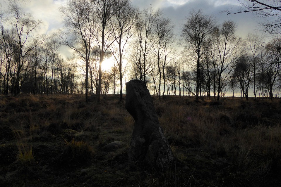
After crossing a slightly boggy patch of open moor, we head into the long shadows of a birch wood, stark black and white trunks surrounded by the darkening reds of dying bracken. There are a few people about, children’s voices carrying through the trees from somewhere ahead, unseen. The main reason for coming here is the rock art panel, so memorably filled with pink flowers by Postman a few years ago. But first, I’m hoping to find the standing stone, something of a rarity in this area. We walk through the woods, trying to stay away from the treeless edge, as I know the stone won’t be found there. It turns out to be further south than I’d realised, another site that the Ordnance Survey map doesn’t show. Eventually it makes itself known, as we get towards the higher part of the wood. The light has gone strange now, the low sun filtered around the edges of a bank of cloud giving an ethereal glow to the woods and the stone.
The stone is a good one, a little taller than I imagined and different from each angle and direction. Like many of the best standing stones, it gives off a feeling of sentience. Even though I know this is just projection on my part, it’s hard to shake once felt. There’s no malignance, or beneficence, just a presence. I often find woodland sites hard to leave, and the stone definitely exerts a pull. As we leave I’m compelled to look back, Orpheus to Eurydice.  |
Next up, we encounter the stonework of Meg’s Walls. Half-buried in the undergrowth, too large to take in easily, this is a fascinating survivor enhanced by a lovely woodland setting. But we’re really here for rock art. After a bit of rooting about in the undergrowth, we find it on the edge of the woods, looking towards the steep western face of Birchen Edge. The light is now too low to illuminate the panel, but casts a soft orange glow across the moor ahead of us.
Despite knowing that it’s a replica, the panel itself is still very impressive. I love the variety of patterns, whatever it represents – or doesn’t. Water has collected in the deepest cup, reflecting the slender trees and blue sky above, an ever open, all-seeing eye on the world.  |
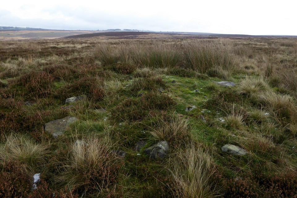
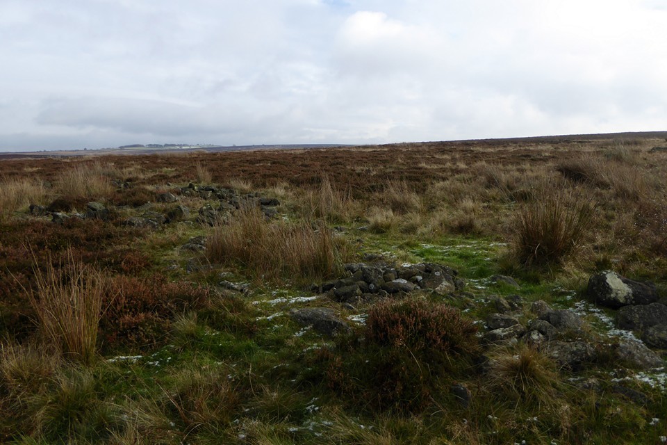
We follow the arc of Meg’s Walls south, before leaving the wood to emerge at the Three Men cairn. The three stone piles are clearly modern, but they sit on a much larger footprint. The views from here are great, looking down on Baslow as the sun sinks further. It’s starting to get colder and it won’t be long now until dark, so we press on without lingering. The path makes its descent, cutting through a cairnfield of pretty large, irregularly shaped cairns. The Gardom’s Edge ring cairn is completely hidden by bracken, but can be spotted by the forked silver birch that grows from its embanked edge. Once found, the course can be followed round easily enough, but really this is a place for a winter visit if you want to see it properly.
We drop down to Robin Hood, for the final bus journey back, near where we started the first walk of this break under snowy skies.
I’ve been re-energised by these last three days, a shot in the arm of prehistory. Revisiting the area where it all started, finding so much still to see for the first time, a reminder why these wonderful, enigmatic sites captured my heart in the first place.
|
Raving on the Moors Part II – Eyam Moor 10 November 2016
There is an annual tradition, or perhaps folklore, that says it always rains or hails on 10 November. I try to dispute this but more often than not it turns out to be accurate, so it’s no great surprise to open the curtains to see a heavy shower to start the day.
Today we’re going to Eyam Moor, to visit Wet Withens and a cup marked rock that have been on my imaginary visits list ever since we first started going to see prehistoric sites. There was an aborted attempt, round about 2000, when we went to Eyam but never made it beyond the outskirts as the weather closed in. I recall Eyam as a gloomy place, the omnipresent plague history coupled with the grey and damp conditions that day doing little to lift the spirits.
We’re off to Grindleford, a small village in the picturesque Derwent Valley, perched just below the eastern edge of Eyam Moor. There’s an initial steep pull up the road out of the village, enlivened by a steadily unfolding view of the moors and edges to the east, now under blue sky and banks of cloud that still carry the threat or promise of more rain. To the northeast is Owler Tor and the prominent outcrop of Mother Cap Stone, to the east Stoke Flat with Big Moor rising beyond. I’m hoping we’ll get across that way the next day.
The road levels off as it climbs on to relatively flat moorland, with the obvious landmark of the mast on Sir William Hill ahead of us. After a mile or so we arrive at a junction with a rough, stony track heading towards the summit, and finger posts for footpaths heading off northwest and northeast across the moor. We decide to follow the track west, to gain the last bit of height and hopefully take in an expansive view north and west from the summit ridge. Unfortunately, just as we cross the step stile onto the grassy slopes, the rain starts to spit and by the time we’ve reached the trig point it’s become a downpour. We take shelter in a little quarry scoop and don waterproofs. Once we’ve done so, the trailing edge of the shower is starting to pass, clearing the views but leaving a keen, chilly wind in its wake.
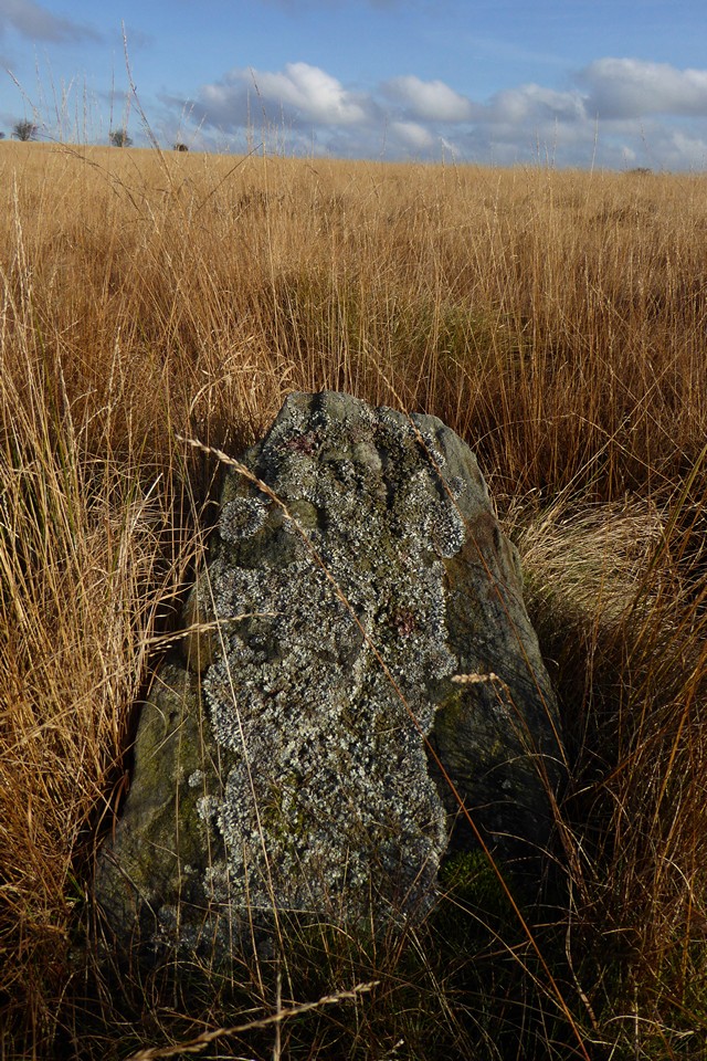
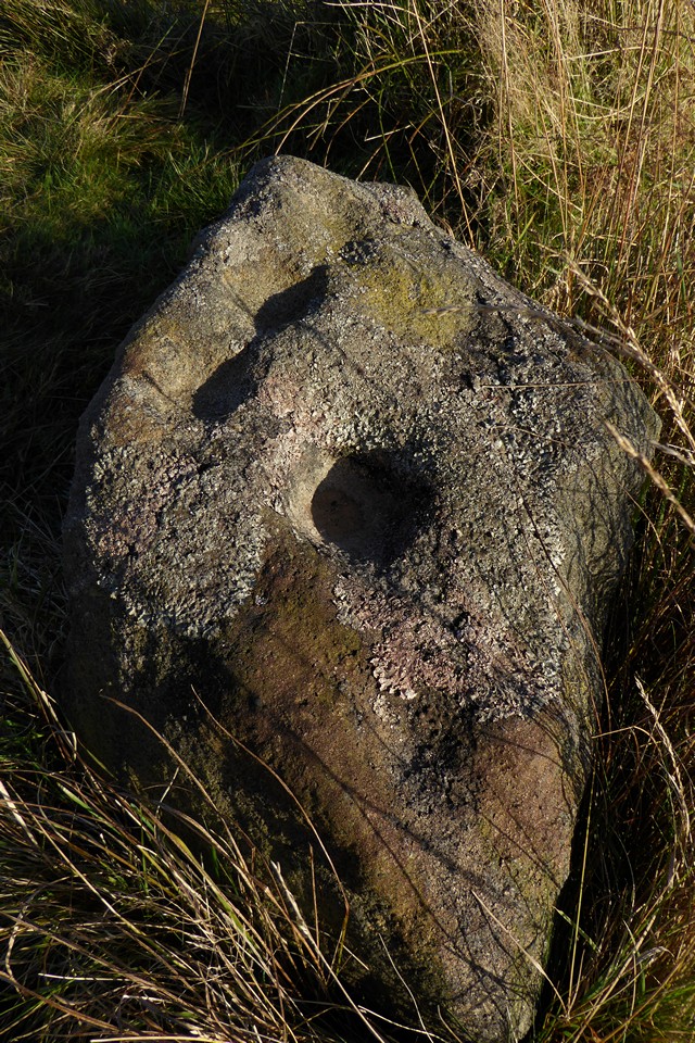
The views to the west and north are far reaching now that the storm front has passed. The bulk of the Kinder plateau fills part of the skyline, and in front of it I’m pleased to see the familiar face of Mam Tor. There are no prehistoric remains on top of Sir William Hill, even though it would be an obvious place for a cairn or barrow. The summit ridge drops gently to the NNE, and at a modern marker cairn we head more steeply downhill to the northwest, along a clear, grassy path that cuts into and through a dark sea of heather and provides a nice aerial view of our first site of the day.Where the ground once again levels off, Stanage cairn sits to the east of the path, surrounded by heather but prominent enough to stand clear of it. It’s a flat-topped mound at least 15 metres across, with a rubble bank poking through the vegetation on its circumference. It enjoys a great view to the north, with Mam Tor just peaking over Abney Moor. The most striking landscape feature from here is Win Hill, which reminds me of the Sugarloaf/Pen y Fal in South Wales. A good cairn in a lovely spot, but the real gem here is the cup marked stone in the edge of the monument.
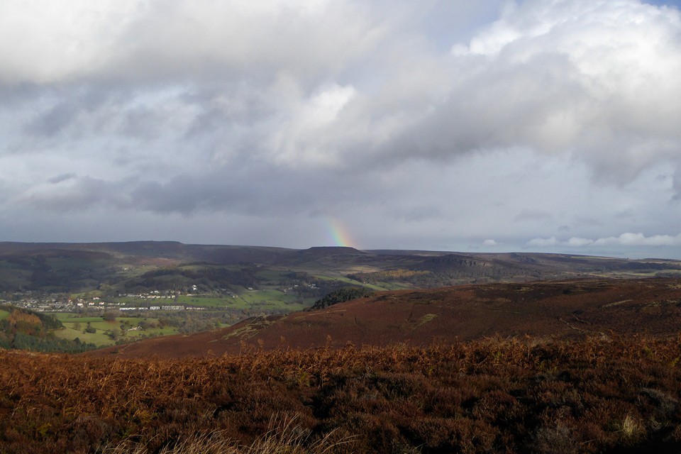
I’ve been aware of this stone for the best part of two decades, simply because I bought a postcard of it in Bakewell bookshop a long time ago. Somehow I’ve never quite found the time to get here until now, but it’s even better in the flesh. The cupmarks are large and cover two sides of the stone, as well as its top. We stop here for a while, watching the wind push the rain clouds of earlier further east, before revealing one last gift, an incomplete rainbow hanging beautifully over Win Hill. There are moments when time stops and lets you breathe, completely at peace. This is one of those, fleetingly brief but eagerly snatched.  |
At length we say our goodbyes, crossing the neck of the spur before heading southeastwards, up a pitted and muddy path alongside a drystone wall. Over the wall is the main part of Eyam Moor, clothed in dense heather interspersed with lighter, reedy patches that look suspiciously boggy. A direct route to Wet Withens would be to hack our way across here, but it looks horrible and instead we follow the path all the way back to the road, pausing to admire the hide-and-seek rainbow that has now chosen to reapparate over Higger Tor. |
When we get to the road the sky behind us is almost black, heavy with the promise of another cloudburst. The sun continues to shine on us for the moment, and the other end of our new rainbow friend is beckoning us to a pot of gold right at Wet Withens, so we turn northeast and head off. Half a mile in and the torrent arrives, before slackening off again as we reach the stone gateposts in the drystone wall that marks the eastern edge of the moor.
From here it’s a matter of picking a route through the knee deep heather as best we can. It’s slow progress, each open area of tussocky grass between the heather coming as a relief. Eventually we attain the high part of the moor, just as the rain is coming down again. There are a few prominent but misshapen cairns up here, one of which we crouch beside, seeking to bury ourselves and avoid the heavy tail-end of the shower. Once that clears and we can see our surroundings better, it’s clear that we’ve crossed the moor too far south and need to head slightly downhill towards the northern edge of the plateau.As the sun starts to come out, it picks out a light grey amongst the browns and reds, revealing the presence of the mutilated cairn next to Wet Withins. With that fixed, the eye then finds the darkly curving bank of the stone circle itself, with one larger stone standing out at its edge.
Wet Withens is another Peaks site that has lived in my mind and on my imaginary list for a long time. A feature in Burl’s guide, apart from the one swiftly abandoned attempt so long ago it’s eluded me up until now.
Rather like Gibbet Moor yesterday, some of the joy of coming here is undoubtedly borne from relief and satisfaction at actually getting here. But as well as that, it’s a terrific site. Bigger than I expected, the clearly defined bank and neatly placed stones make it a wonderful example of the ubiquitous Peak District embanked stone circle. Add to that the colours of the moor, freshly scrubbed from the recent soaking and illuminated by the sun against the dark backdrop of billowing clouds, and we’ve got a bit of a classic going on.  |
The barrow is a mess, the shape all but gone, straggling and ragged at the edges. But there’s still a lot of stone here, indicating that the upheaval wasn’t about robbing for walls. And the setting is perfect, better than the circle itself as it’s that bit closer to the northern lip of the moor. The countryside drops to a patchwork of green fields in the Derwent valley, with Hathersage the obvious settlement below. Beyond and above, the hills rise again towards the high uplands above Edale, the moors of South Yorkshire and the edges around Higger Tor.
Our rainbow makes its last appearance of the day, a welcome splash of colour against the grey. I should have come here years ago, but it’s still a sweet pleasure to come now. The day is drawing on, and the lack of late buses from Eyam or Grindleford means that we have to head down to Hathersage, so reluctantly we depart this place. Heading east we find a faint path through the heather, promising an easier route off the moor despite occasionally petering out. At length we’re down at Leem, after a final steep descent via a treacherously slippery mud-slide. Then it’s winding lanes and a main road along the valley to Hathersage and home.
The folklore rang true, the tradition was duly enacted and the day dispensed a deluge as foretold. But it also provided a long-overdue visit to a wild and windy moor, to sites that have waited long in the mind and now persist in the memory, in a light display refracted through the prism of pouring rain.
|
Raving on the Moors Part I – Gibbet Moor 9 November 2016
The morning brings snow, the first of this season. It falls heavily on Bakewell, but doesn’t stick. Advice in the coffee shop suggests that if we want to see proper snow we should head northwest to the higher moors and sharper edges, but that comes with the risk of bus cancellations and a difficult journey back. Instead Gibbet Moor wins the right to be the first trip out of this Peak District break, a relatively low moor with an easy climb from the road to the north, perfect for legs reacclimatising themselves to the hills after absence.
We start with a bit of a road slog under light drizzle that takes us past Stone Low, perched on the lip of valley to the north of the road. This cairn, once large and impressive, is now little more than a slight rim, a rise in the grass beside fieldwall and beneath trees. Nice position, but little else to see now. Better things await though, and we’re keen to get off the road and onto the moor.  |
Gibbet Moor is access land, and we make our way uphill, along a sturdy track running southwest from where the road crosses Umberley Brook. TMA shows all sorts of sites up here, but I only have eyes for the stone circle, three stones remaining of what might be a rare non-Scottish example of a “four poster”.
I know the circle is somewhere about 500m to the southeast of the point where the track meets a drystone wall. From here the tussocky, reedy grass and patches of heather look decidedly unappealing and lacking in paths, but this is where we need to go. Setting off into the slight unknown, the vegetation isn’t as bad as it looked, low enough to step through without snagging ankles and feet. But it is wet, and within 20 yards of leaving the track my feet are soaked in my old boots. Nice.
We wander around the gently sloping hillside looking for small stones in every reed clump and heather swell. There are plenty of stones, little stones, bigger stones, outcrops and individual rocks. But nothing resembling three stones of a circle. At one point I head towards an odd looking line of upright pallets, but nothing leaps out from the grasses.
We’ve been going around in circles for about 40 minutes before I finally decide to look properly at the photos on TMA. The first couple are by Stubob, one showing the recognisable dark swell of East Moor, the next looking north across the valley towards a distinctive clump of trees on the opposite hillside. The conditions are different to our dull grey skies and distant snow, but the landmarks are unchanged. Getting to a position where both photos match the view from where we are involves heading into a particularly soggy patch of reedy grass, close to one of the pallets I noticed earlier. And suddenly, there they are: three stones, unmistakeably slim and upright, their heads barely poking above grasses. Without Stu’s photos we’d probably still be there now, so much gratitude is due to the Peaks pioneer.
The lengthening grasses are threatening to drag the stones under, appearing quite a bit taller than in the previous photos. But despite the soggy setting and the even soggier feet, despite the small size of the stones and the absence of a fourth stone, I really like this site. Perhaps it’s partly the sense of relief and satisfaction at actually finding the circle, but it has a lot of charm. The views to the northwest and north are fine, across the valley and out to the distant edges. At this time of year the reedy grasses are a lovely shade of orange, which sadly the recalcitrant sun fails to properly light while we’re here. The stones are well chosen, shapely and lightly tapering. Whether this ever was a four stone circle, or just a three stone setting, I guess we’ll never know. But it’s well worth a visit, just wear something waterproof on your feet.  |
  |
Back on the track, the sun threatens to come out. We pass a linear stone built feature on our left, its end right up against the edges of the track and containing a couple of upright stones. At first I take it for a group of damaged hut circles, with the uprights marking an entrance, but it’s not obvious that it is the case.
Reaching the top of the moor, the views northwest open up to reveal a good coating of snow on the distant moors. The sky over us is closing in again, although there’s no sign of any rain or snow, just a dulling of the light giving the impression of dusk even at this early hour of the afternoon.
The track edges southeast alongside estate wall and dense treeline, gradually climbing to the crest of the moor. The snow cover is a little thicker here, although you would be hard put to find enough to build a snow fairy. The next stop-off comes into view, heralded by a boggy bit of path and an information board.We came to Hob Hurst’s House on our second Peak District holiday, pretty much exactly 18 years ago to the day. I remember a walk through the woods above Chatsworth, then crossing a boggy and wet moor under increasingly heavy rain. We were ill-dressed for open November moorland in the rain, and our first visit to a chambered tomb left both of us soggy and underwhelmed.
Since then we’ve been to a lot more prehistoric sites, and I’ve wanted to return here for ages. Funny how your memory is both accurate in details and completely faulty in the broader picture. As soon as we get here, I instantly remember the shape, size and layout of the mound with its squared-off bank and ditch. But I don’t recall the exposed stones of the chamber at all. I also have a recollection of a fairly flat landscape, perhaps the rain and cloud condensed the world around us that day. Today the views to the south are extensive and sweeping, taking in the deep valley of Beeley Brook, with the sharp line of Harland Edge above, then onwards to rising ridges and long hillsides fading into grey. The unmistakeable feature on the skyline is Minninglow, for all that I’ve never been there. For the second time today Stubob’s presence in these hills is palpable. Eyup Stu.
We stop here for a while and have a proper look at the chamber, noticing that the mound itself appears to be built at least partly of stone, another thing missed the first time. It’s too damp to sit and my wet feet are beginning to make me cold, and in any case there’s one more reacquaintance to be made today, so we head off downhill, following the line of the wood until we reach a field boundary.  |
 |
The direct route would be to carry on southwest directly across the open moor from here, but I decide to avoid another foot soaking and we follow the obvious path south instead until it drops into a holloway carved out by many feet, then joins a firmer track heading westwards towards Chatsworth.Park Gate stone circle is not visible from the track, so it’s a matter of following the route until it starts to turn northwest, where another fainter path heads off north onto the moor again. There are a couple of stones in the circle that are big enough to stand above the reedy grasses, so it’s a lot easier to see than Gibbet Moor was earlier.
This is the second revisit of the day, as we came here in 1998 on the same day as Hob Hurst’s House. At the time it was the fourth stone circle I’d been to, after Arbor Low, Nine Ladies and Nine Stones Close, three of the Peak District’s big hitters. So it’s probably not a great surprise that it felt a bit of a disappointment after those sites. Although there are at least ten stones in the circle, many of them are small and overwhelmed by the tufty, reedy grass that surrounds the site. The biggest stone, on the southwest of the circle, is leaning at an alarming angle over the top of a pit that threatens to swallow it whole if it ever goes the rest of the way. The most striking stone is the one on the east, a shapely upright with what appears to be at least one cupmark and some other dents that are apparently bullet holes and do have a ragged outline. This is the stone I remember from our first visit, and indeed the only one that I have a photo of.
For all that, it’s actually a really good circle. In the 18 years since I last came, I’ve been to a lot of wrecked, dishevelled, uncared for, ploughed out, vandalised and generally unloved sites. So although there’s also been a lot of awe-inspiring, stop-you–dead-at-50 paces classics over the same period, my expectations are very different to how they were back then. Now, I see a fine circle in a good setting, looking towards Harland Edge particularly. It could do with a de-vegging, as the long grass is detracting from the sense of the whole site. Circle stones needn’t be enormous to make an impression, as anyone who’s had the pleasure of Cerrig Duon or Nant Tarw could attest. But they do need to be kept visible, and a judicious tidy up here would do it wonders.
The only disappointment really is the terrible dullness of the day. It’s not even 2:30 but it feels like dusk, as though the sun has given up and set early, leaving a crepuscular greyness to the scene, even with the autumn colours of the moor. We head back to the track and head west.  |
The final site of the day is Beeley Moor ring cairn, an easy visit as it’s right next to the track. So near in fact that the track is slowly nibbling away at its northern arc. The monument itself is quite heavily overgrown with heather and scrubby grass on the circumference and bracken in the centre. Stones protrude from the bank here and there. It’s reasonably upstanding, but worth a stop off mainly for the excellent views down to the valley below.
From here the path starts to descend more steeply – I have no memory of this being an uphill slog on our first visit, where we came from the opposite direction. At length we reach a step stile over the estate wall, and head into the lovely woodland of the Chatsworth Estate, eventually emerging into the park for the last walk into Baslow as dusk falls, for real this time.
As well as the visit to Gibbet Moor, it’s been wonderful to return to Hob Hurst’s House and Park Gate after so long, the longest gap between visits of any sites we’ve been to. The intervening years have sharpened the interest, provided a lot more context and perhaps some better understanding. It feels rather like coming home.
|
Mendip First - 2 April 2016
It’s six o’clock in the morning, and I’m the only person in this house that’s awake. My bag is packed and ready for a trip over the mountaintops of South Wales, but the forecast is looking uninspiring. Rain until early afternoon, which suggests little enjoyment for most of my walking window. Widen the forecast out though, and it looks like sunshine galore to the southwest. Hmmm.
A quick burst of complete replanning, frantic printing of different bus timetables and I’m off to Bristol to catch the “Mendips Explorer” and head into an area I’ve never been to before. A look at the Cheddar Gorge and Mendips West map opens up a huge amount of possible destinations, barrows seem to ooze from every km square around here. There’s also a decent amount of open access land, which promises a day free of the irritations of blocked paths and muddy farmland.
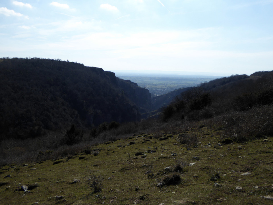
The bus climbs out of Bristol, offering a view of Maes Knoll before passing the Stanton Drew turning. I’m tempted, but not enough. The Priddy complex is only a couple of miles west as well, but I’m not in the mood for farms today. One connection later and I’m heading through Cheddar to a little strung-out hamlet called Sandford Batch, not quite on the hills but not right down in the low-lying vale either. A path heads eastwards into community woodland, scarred by quarrying and with an impressive limekiln left as a visible reminder of industry.
Further east the woods open out to fields and as the path starts to descend I’m rewarded with a view of my first objective of the day, Dolebury Warren. From here it looks like short climb, but my route drops right down into Dolebury Bottom gorge first, adding significantly to the amount of the steep ascent. The overcast morning is slowly starting to lift, so I shed my coat and fleece before starting on the uphill.
The approach is through woods, climbing fairly sharply although not quite taking the direct route up the scarp. I’m anticipating a slog but in fact the ramparts come into sight pretty quickly – after spending so much time in the Welsh uplands it’s easy to forget that the hills here are not very big, for all that they’re very steep-sided. The sun starts to break through as I reach the western entrance.
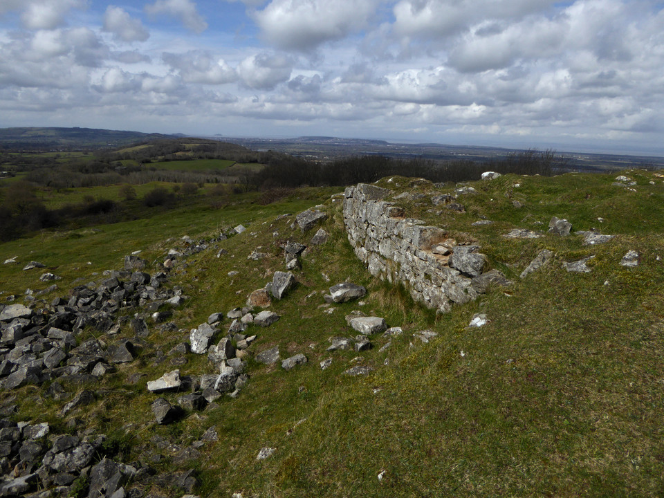
It’s immediately apparent that this is a first rate hillfort in great preservation. There are two lines of ramparts, the inner one much higher than the outer and built of stone blocks. The western entrance is at the lowest part of the fort, which continues to climb steeply towards the top of the hill a good 30 metres higher than where I’m standing. The banks are inturned and the entrance appears to be an original one.
I follow the rampart along its northern side, steadily climbing as it goes. The fetish for building shelters that has damaged so many Bronze Age summit cairns is in evidence here too, with the plentiful stone of the rampart obviously being too difficult to resist messing about. Actually, it’s a pretty windswept place. Although the sun is now out, when it occasionally dips behind ragged cloud there’s a serious chill and I’m quickly reminded that it’s still early in the year to be wandering around a hillfort in a t-shirt.
As the rampart climbs, the views open out wonderfully in every direction but east. The Severn is the main event, looking towards Steep Holm and Flat Holm islands that we got familiar with walking the coast path on the opposite side. I also recognise Brean Down and assume the urban sprawl to be Weston-super-Mare. Almost due west a wooded hill with open interior is the neighbouring Banwell Plain hillfort.
The ditch between the ramparts is overgrown in places, but there is obviously regular clearance of scrub going on. A couple of dog walkers and a couple of walkers are dotted around the fort, but it’s a big place and there’s no sense of intrusion. Reaching the very top of the fort there’s another entrance facing east, also looking like it’s probably original. The views are now magnificent, right across to South Wales – if the cloud and rain lifted there, I’ve no doubt the Brecon Beacons would be readily visible. To the south the high ridge of the Mendips blocks the view, open moorland that will be my next objective once I leave here.
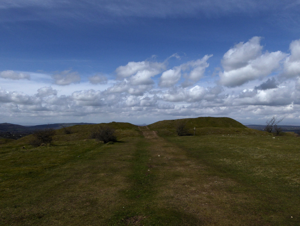
But first there’s the southern circuit and interior. On the south side the rampart is less built-up, but the reasoning is obvious as the ground falls very steeply away to a lovely wooded gorge below. Rowberrow church is visible across the ravine, and in a field beyond there is a sizeable round barrow that just manages to be obscured by trees no matter where I stand on the rampart. I head back up into the fort’s interior, which is heavily scarred and pitted. The fort’s name gives the reason away, as it was the site of a huge artificial rabbit warren in the 17th century. At the highest part of the interior, just inside the eastern entrance, there is a low curving linear feature with a square structure inside. This was apparently the garden wall and footings of the warren-keeper’s house. I wonder what it must have been like to live here, surrounded by rabbits and the ghosts of the original inhabitants. Whatever, it makes a great spot for an early lunch before heading east.
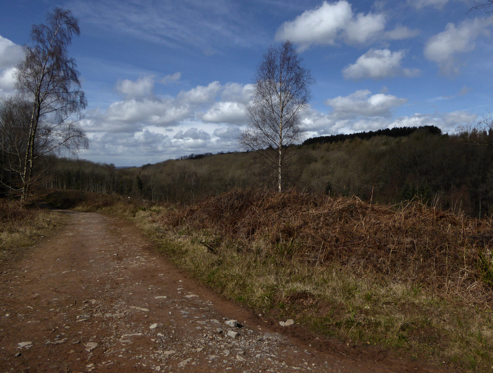
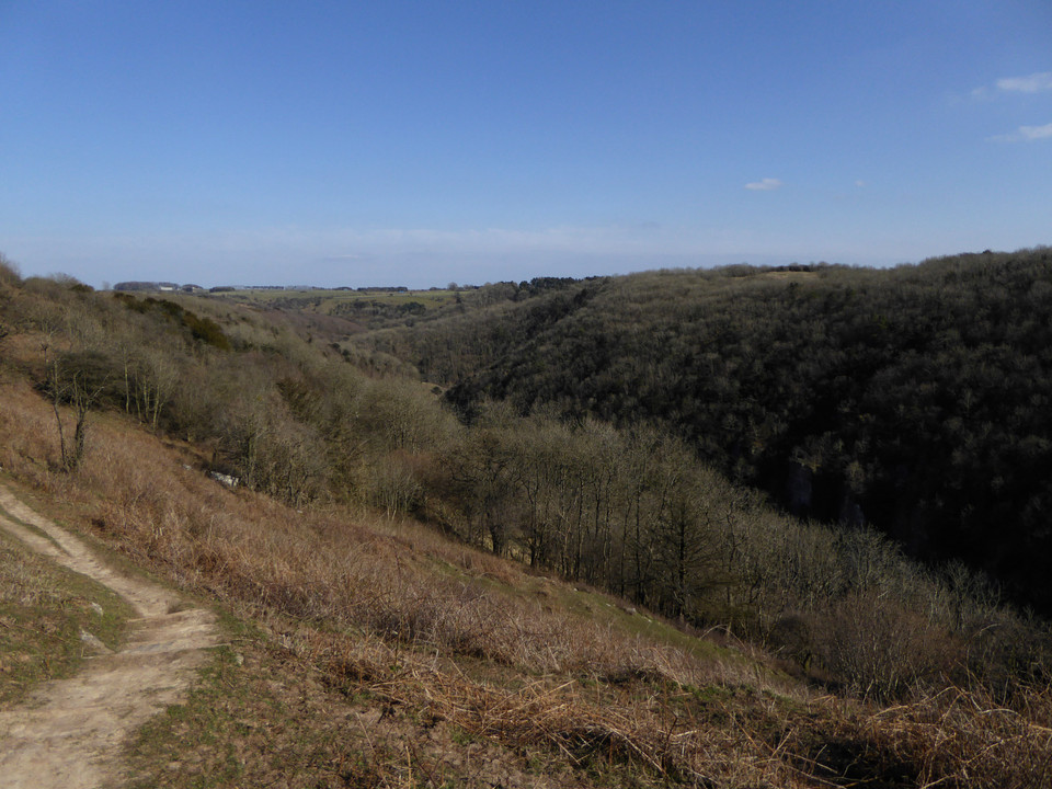
A final touch as I leave is the way Steep Holm in the Bristol Channel is framed by the eastern entrance. What a great place this is. I reluctantly turn away, hugely impressed by this great fort with its sweeping views. To the southeast, the route drops gently towards the upper end of a valley. On the other side is a dense conifer forest that wouldn’t be out of place above the South Wales valleys. Somewhere over there the OS map shows a pair of cairns, which I’m intending to call in on before climbing onto the main Mendips ridge. The first thing that stands out is a large area of felling – the cairns are somewhere in it, which will either make them easy to find or impossible.
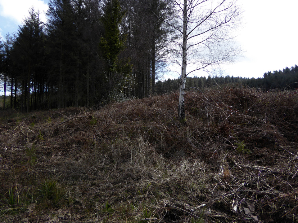
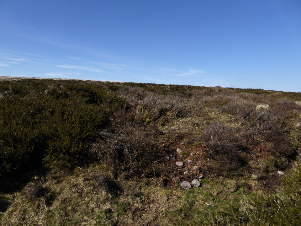
Luckily there’s not a huge amount of height loss to cross the valley at its head. Bridleways head off in several directions – to get to the first cairn I take the one heading west then a fork to the southwest, which slopes gently uphill into the felled area. The map shows the cairn at a bend in the track, right in the heart of the felling. I could be back in the Welsh forests here. Forestry clearance is a messy business, often leaving deeps ruts from the machinery and then a burst of vegetation as the tree covers disappears. This is no exception. I find the cairn right by the track, hidden at first glance by the high verges pushed up by logging vehicles. It’s in a sorry state, the edge has been damaged by the felling operation and it’s covered in a tangle of brambles and bracken. The only redeeming feature is a single silver birch, left to grow on the western side of the mound.
Once over the pitiful state of the immediate surroundings though, the location can be appreciated. The cairn looks down the steep-sided valley between Dolebury Warren to the north and the high Mendips ridge to the south. As with many of the upland cairns of South Wales, there seems to be a definite relationship between watercourses and the placing of these Bronze Age funerary monuments.
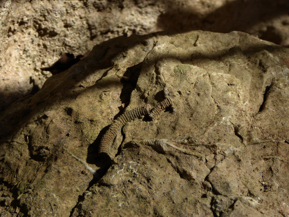
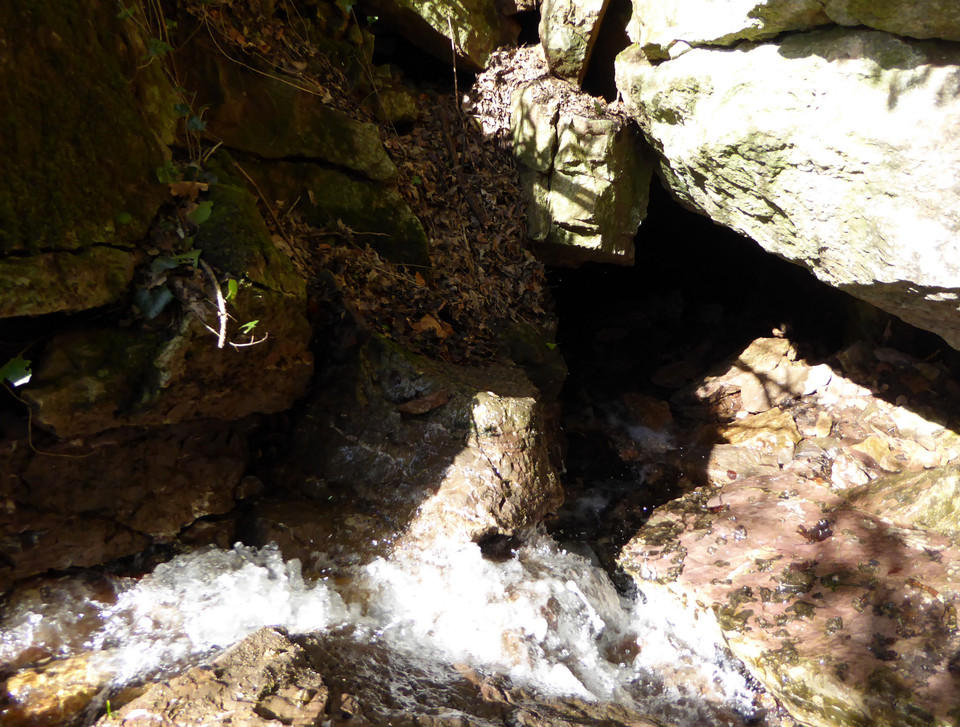
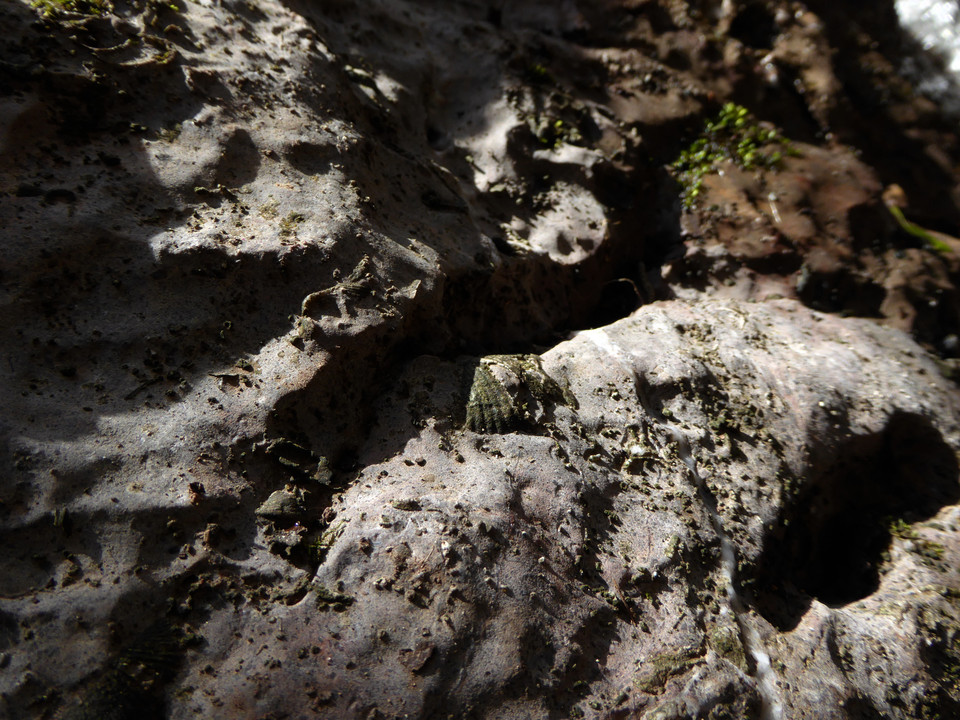
I head back the way I’ve come to the junction of paths. The second cairn is also in a felled area, this time a narrow triangle of land between tracks. The OS map shows it as right next to a bridleway heading onto Black Down. Unfortunately the felling here has left behind a deep tangle of bracken and water-filled ruts and ridges. I head uphill, but the track seems to follow a slightly different route to the map and after a while of fruitless prodding about in the bracken and tree stumps I reluctantly abandon the search. I’m sure it’s still here somewhere, but I won’t be the one to find it this time. Before heading on to the open moorland, the map offers one more site: Read’s Cavern. Heading ESE from the junction of paths, the track follows the course of the stream, soon opening onto a small clearing with a seat. The cavern lies immediately to the north, where the fast-running waters, cold and crystal clear, disappear into the side of the hill. The cave appears to be accessible, but only if you’re prepared for a proper caving expedition. The limestone rocks around the entrance are liberally decorated with fossils of sea-creatures from impossibly distant epochs of time.
The entrance is very small and the water pouring in suggests an instant soaking. A sign fixed to the rockface above gives an emergency call-out number in case of difficulties. I’m not equipped either mentally or physically to go pot-holing on this trip, so I sit near the entrance for a while and watch the splash and sparkle of the water. There are more barrows shown to the northeast, as well as another cave called Aveline’s Hole. I pass various deep sinkholes, glorying in the names Bos Swallet and Rod’s Pot. Some of these are huge scoops in the ground. As the path gives way to a metalled road, a proper look at the map shows Aveline’s Hole is actually on the other side of a steep gorge, so I reluctantly abandon any idea of a visit today. There are however three barrows (the OS shows one cairn and two tumuli) in an open area of common below the northern slopes of the moorland proper.
This area is deep with the brown stalks of last year’s bracken, which makes barrow hunting somewhat difficult, although not as much as it would be on a summer visit.
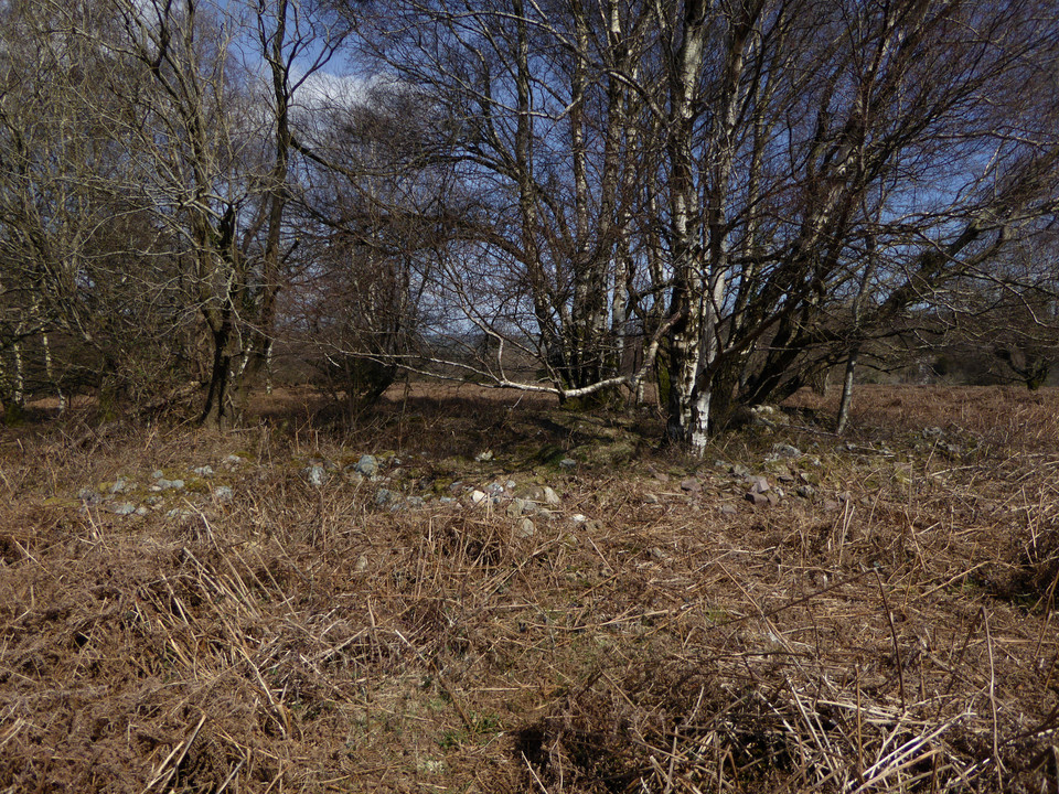
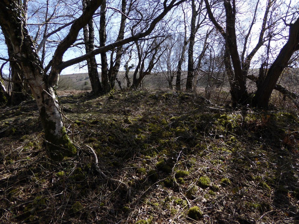
I start off looking for the cairn, the northern of the three monuments on the map. After foolishly hacking my way into and back out of a briar patch thinking it was the barrow, I realise that it’s actually a very prominent feature crowned with a stand of silver birch trees. On closer inspection it’s a beauty, lots of stonework and an crisp footprint (although no kerb as such). The trees are no doubt causing damage but enhance the atmosphere immensely, especially as the sun at its zenith is now beating down through a cloudless blue sky. Something of an unexpected highlight, and definitely worth the visit.
Heading south the other two marked barrows are less easy to find. The middle barrow is a low mound next to one of the many paths that criss-cross this open area. It’s misshapen and has hawthorn growing on it, assuming I’ve even found the right thing under all the bracken. I can’t find anything in the marked position of the southernmost barrow, although I think it’s likely to be somewhere near a single silver birch, as these trees seem to feature close to many of the barrows in this area. Either it’s deeply buried in bracken or the map has it in the wrong place. By now I’m feeling the need to press on, with the biggest hill of the day looming ahead, so I don’t stop very long to search. It is worth pausing to look at the unfolding view of the limestone cliffs across the gorge to the north. Somewhere in that hillside is Aveline’s Hole and there appears to be a hillfort or settlement on the hilltop above it. A good reason to come back to the area anyway.
The climb up onto Black Down is not too bad, a good clear path running above West Twin Brook. The excellent views north across the Severn/Bristol Channel give plenty to admire on each pause for breath. At the top of the ridge, the path is very eroded and muddy and I’m grateful that we haven’t had huge amounts of rain recently. The top of Black Down is a sponge that would make for a challenging visit in wet conditions.
There are plenty of people up here and it’s easy to see why the main path running east-west along the top of the hill is so churned up and eroded. Unfortunately, the same is also true of the pair of barrows immediately beside the path. The northeastern one has been worn down to its stonework and is in a sorry state, crossed directly by the path. The northwestern barrow has fared slightly better than its companion, not being quite so close to the main line of the path. A sparkly slab lies on the edge of the mound, crystals catching the beautiful spring sunshine.
The erosion is a shame as these are excellent barrows, substantial and upstanding, with terrific views. I look down on a now-distant Dolebury Warren and reflect that this walk is probably going to be a bit longer than I thought! Across the Bristol Channel, the hills and mountains of South Wales are still lying under dark clouds and I’m not in the least sorry I decided on the last minute change of plan this morning.
I head south across tussocky and damp ground to the possible third barrow in the group. This one is lower and difficult to discern under dense vegetation. So dense in fact that I startle and flush a deer from the side of the mound, watching it gracefully bound across the treacherously boggy ground. Back on the main path, the summit is obvious straight ahead. The map shows a big group of barrows and it’s coming back to me that Thelonious posted some photos a while ago. The going is not too bad as the weather has been dry, but would be horrible in wet conditions.
The first barrow (Burrington 11) is to the north of the path, another substantial mound despite erosion and probable excavation. From it the barrow that the trig pillar sits on obscures the linear group to the east.
The summit mound (Burrington 13) has obviously been resurfaced fairly recently with a new cap of stonework to protect it from erosion. This is the highest point of the Mendip hills and a fantastic viewpoint. As well as the views north and west that I’ve had for most of the day, there are now views south that take in Glastonbury Tor as well as Exmoor away to the southwest.
It’s a well visited place as you’d expect, and while I’m here there are walkers, cyclists and horseriders at various times.
The linear barrow group (Burrington 14-16) immediately east of the summit is also cracking, with wooden signs warning visitors that it is ancient monument and to keep off to prevent erosion. I imagine that the summit barrow itself was always going to be the target for most visitors, so this seems a good way to compromise and keep the other monuments from further damage. Two more barrows (Burrington 18 and 19) lie to the south, providing an excellent spot to head away from the other people and admire the linear group profiled along the skyline.
On such a lovely day, with the wind and sun on my face, this is as good a place as I could wish to be. But by now it’s getting on for 3 o’clock, so I bid a reluctant farewell to the barrows and head east. The path has been resurfaced here and initially provides nice easy going after the boggier ridge. There is a last barrow on the south side of the path (Burrington 20) which sets me on my way downhill.
Eventually the path comes to the edge of the open access land, with fields laid out to the east and another path running north-south. Right at the junction of these paths is another barrow (Burrington 22), but it’s low and buried in heather, offering little in comparison with the group on the summit. I head north briefly to look for a final barrow (Blagdon 1). It proves to be buried under the fence line and badly eroded.
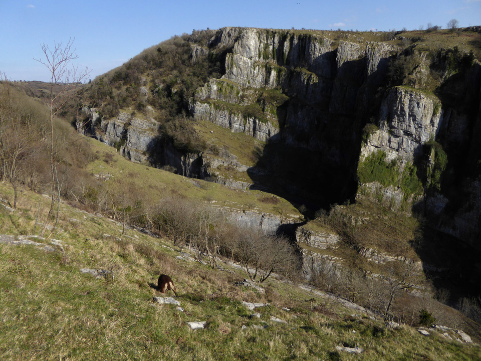
From here my path goes southwest, becoming increasingly wet and marshy. I’m soon hopping precariously from tussock to tussock, and it should come as no surprise to learn that one of the tussocks proves to be less solid than it looked. My tired legs refuse to keep me upright and I’m down on one knee, with an unpleasant feeling of cold, black water trickling into the top of my boot. Gah. My route heads east again, passing one barrow on the map that doesn’t appear to exist anymore, a load of the cutest spring lambs you ever saw, and then the obvious mound of Rhino Rift barrow. It’s perched above the edge of a steep sided wooded ravine, which presumably is the Rhino Rift itself. The barrow is not round, rather it’s an elongated shape, higher at one end than the other. I’m not surprised to read Chance’s post that it has been considered as a possible long barrow, although it’s not that long. Another descent, this time into Black Rock gorge, which reminds me strongly of the limestone country of both the Gower and Peak District. I’m nearing the head of Cheddar Gorge now, and I’m not really sure what the pedestrian access is going to be like. It’s also getting busier, as families have come here to enjoy the beautiful spring weather. With this in mind, when I see a finger post marked “Cheddar” I decide to take it. There’s an initial steep climb into some woods, but then the horrific sight of steep steps ahead. I push myself up them, creaking and groaning at the seams now.
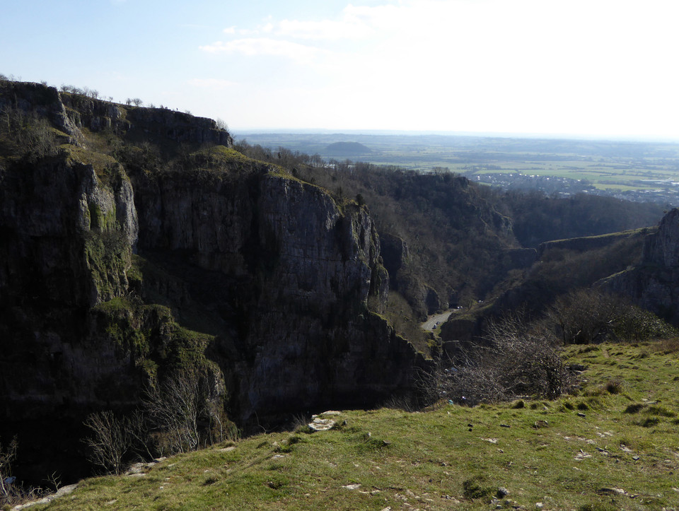
Finally at the top and a narrow path skirts along the north of the gorge itself, over exposed and uneven limestone. The scenery becomes spectacular, looking along the gorge through the cliffs at its end. A little stile with a sign warning of the drop gives access to a sloping grassy area right on the edge of the cliffs. The view drops straight down to the road, where miniature people and cars bustle far below. For the first time I can recall I’m vertiginous, not helped by the family of sheep of some ancient breed that scamper about the hillside around me. I beat a hasty retreat to the stile, pleased to put a wall between me and certain death. The path downhill becomes steeper and steeper and by now my feet are aching from the rough terrain. I had hoped to explore the gorge itself, but I’m exhausted now and just want to stop walking.
By the time I reach the village I’ve missed the bus and could do with having a lie down. This last section has proved to be very hard country, especially at the end of a 12 mile walk. But boy has it been rewarding. From the brilliance of Dolebury Warren, the long views of the southwest and Wales, the superb barrow cemetery on Beacon Batch and the spectacular scenery of the gorge at the end, this is definitely an area to come back to. Perhaps with a little more planning next time though. Adios Somerset.
|
Showing 1-5 of 52 posts. Most recent first | Next 5 |
"The fleeting hour of life of those who love the hills is quickly spent, but the hills are eternal. Always there will be the lonely ridge, the dancing beck, the silent forest; always there will be the exhilaration of the summits. These are for the seeking, and those who seek and find while there is still time will be blessed both in mind and body." Alfred Wainwright
"The movers move, the shakers shake, the winners write their history. But from high on the high hills, it all looks like nothing." Justin Sullivan
Elsewhere: Mastodon
|