George Tate's dig report - Vol 4, History of the Berwickshire Naturalists' Club, 1857.
|
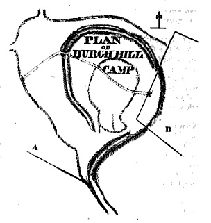
'Memoir written during a survey of the eastern branch of the Watling street,' describing the site in 1864.
|
Clearly visible on Google Earth, this looks like a defended enclosure.
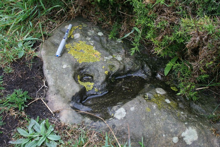
Listed as Iron Age but bronze axe was found here.
Looks worth a visit.
|
|
More of a cropmark than a clear hillfort but site and shape are clear to see on Google Earth.
|

|
|
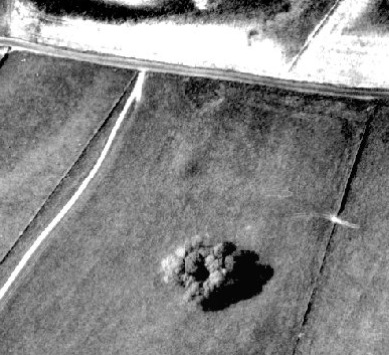
One I've yet to visit - researched off the web but a quick look at google earth shows this is clearly a large feature and well worth a visit given it's location (views should be great).
|

|
 
|
Write up of the original dig with the plates in Transactions of the Natural History Society of Northumberland - Vol 1
|
Not a site I've visited but one I've added from research on the web.
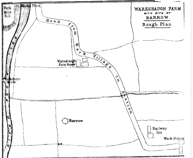
Looks like most if not all of the original barrow has been ploughed away but it was found in 1864 excavated in 1864-5 and this was written up at the time.
I've attached a couple of plates from the original dig and links to the write up of this in "Transactions of the Natural History Society of Northumberland - vol 1, p157"
Original dig was by Rev. Geo. Rome Hall.
He notes even then,
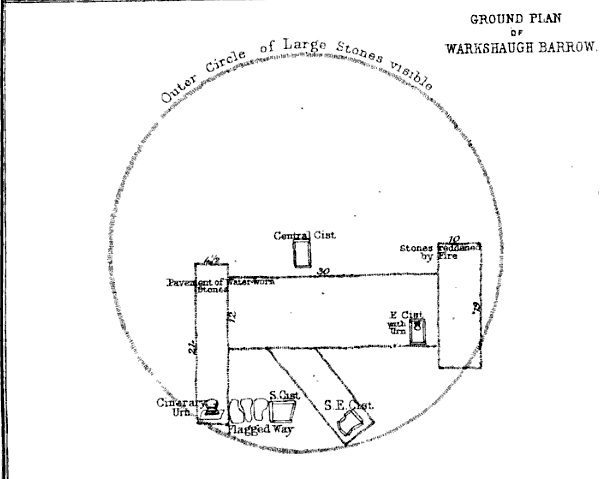
"The outline of the barrow has long been rendered indistinct by yearly tillage; but it can be remembered since it stood at least two feet higher than it does now. The ring of larger stones which usually encircles the base of such tumuli could be easily seen at the east and north, within which the level surface appears to have had a rough kind of pavement. Here, where many of the stones were reddened throughout by fire...."
and,
"The whole barrow must have been not less than sixty feet in diameter. Its internal arrangements are of peculiar interest. The southern cist, as we have seen, was connected with the largest urn by a rude kind of flagged path..."
See links for more details
|
New rock art finds in Norway
Looks a lot different from UK rock art of the same period but interesting to compare these finds with what we see when out and about.
Given the site of these finds (west coast of Norway) and the period (late Iron Age) I can't believe there wasn't some form of cultural exchange across the North Sea to Shetland/Orkney?
http://www.pasthorizons.com/index.php/archives/02/2011/norways-secret-petroglyphs
|
Another page mentions the Roman reuse of the barrow.
|
|
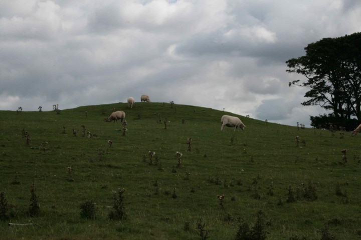
Bronze Age Round Barrow - scheduled monument. Has a dry stone wall going over it.
|
Bronze Age Round Barrow - scheduled monument.
Clearly visible at the top of Reed Hill. Shown on some maps as a cairn but was excavated in 1911/12
"It was surveyed and excavated in 1911. The mound itself was composed of closely packed pebbles and covered in a turf layer. The primary burial was a chamber built of gritstone in the form of a beehive. Sunk into the mud floor was a mass of cremated human bones. A secondary stone cist was found but there were no human remains inside."
|
 
|

|
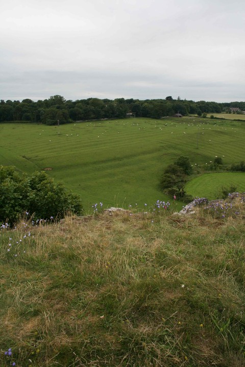
Visited the site in July 2010 and took some photos.
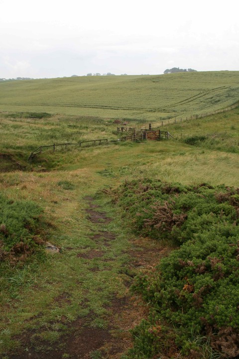
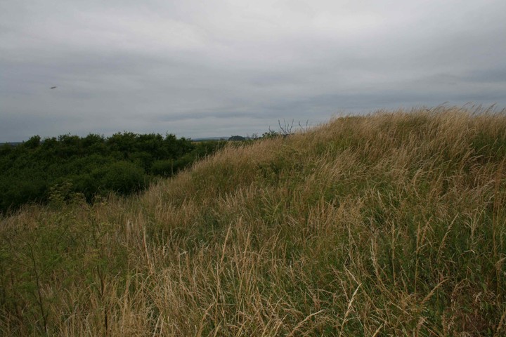
Access to the site is best from Craster village itself. Follow signs for the smoke house (home of Craster Kippers) and turn right up Whin Hill just after the smoke house itself. Go straight up Whin Hill, straight across the first road you meet (slight, left, right kink crossroad) and Whin Hill turns into a track bearing left. A little later the track starts to turn to the right, ignore the right hand fork here and proceed west up the main track. Ahead you'll start to see the banking of the enclosure on the skyline.
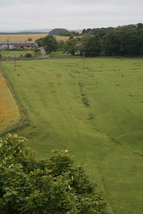
The site is listed as being an Iron Age enclosure. The "defended" area makes use of the natural cliffs for protection to the north and west, with raised banking (with at least a single ditch) to the east and south.
Roughly rectangular in shape around 50m North/South and 25m East/West at it's widest, tapering towards the north.
Bank and ditch are impressive from the east and look defensive in scale. The cliffs to the west offer great protection (careful here as there is no fencing around what is a 20+m drop) and great views.
|
   
|

|
Wildflower Walk at Harrop.
|
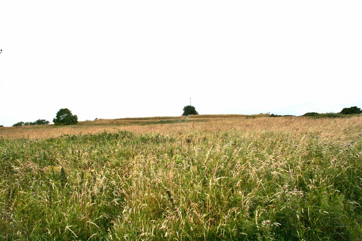
Bronze Age barrow - marked as "Tumulus" on OS maps. Easily seen from the road side in the corner of the field between the small corpse of trees and the road, around 15m in diameter and 1m high.
One reference (see below) states this is a "roman barrow" and that it was excavated by the University of Manchester in 1936 but I can find no no other references to back this up. Claims of grave goods - "there was a pot inside with all the jewels in the middle" in this reference but again references to back this up.
Checked with "Barrows of the Peak District: Recent research, Barnett & Collins, 1996" and there is no record there of any excavations at this site so nothing to back up the roman point above.
|

  
|
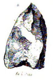
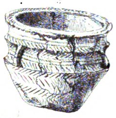
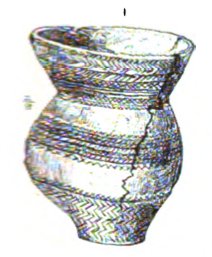
Discovered details on the cists and the grave goods found there in "The history of the borough, castle, and barony of Alnwick" by George Tate, 1866.
Google books link at http://www.archive.org/stream/historyboroughc01tategoog/historyboroughc01tategoog_djvu.txt
Text below based on a clean up of the Google scan.
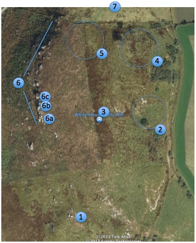
"On the White House grounds, now forming the north-west corner of Holn Park, three other sepulchres have been discovered.
One was opened in 1818 and contained a skeleton, by the side of which stood an elegant shaped drinking cup, covered with zigzag scorings ; it is said to have contained ashes — Plate II, fig, 1. This is the shape most usually met with in Ancient British interments in North Northumberland; elegant in form and in ornamentation, they exhibit no small degree of artistic taste. Another cist-vaen in this locality
was found in 1833 ; but of this we have no definite information; beyond the fact that the direction of the grave was from north to south. Of the third sepulchre, however, which was opened in 1863, we have more particular knowledge. The cist-vaen was as usual formed of sandstone slabs, the length being 2 feet 9 inches, the width 1 foot 10 inches, and the direction from N.E. to S.W. ; within was laid a skeleton with the head towards the south-west end, the body bent, the knees being drawn up towards the head ; and nearly in the centre stood an urn or vase, which is 5 inches in height, with four knobs at the side, and ornamented with characteristic zigzag scorings — Plate II, fig, 3. The skeleton was that of a young person, about 12 years of age ; for the temporary canine teeth had disappeared, and the permanent canine teeth were making their appearance; while also the sutures of the skull were very distinct. Unfortunately the cranium was broken and incomplete ; but so much remained as to admit of its general characters being determined ; it was a short, broad, and compact head; the longitudinal diameter being 6.3 inches and the parietal diameter 5 inches, giving a proportion of nearly 10 to 8, which marks the cranium of the Brachy-cephalic type. The form is well rounded, but there is a peculiar flattening from the occipital protuberance to the foramen magnum, probably due to artificial compression ; for Dr. Barnard Davis, the distinguished author of the "Crania Britannica,'' has shewn that some ancient tribes modified by artificial means the natural form of the skull. Even now some of the American Indians distort the heads of their children by the use of a cradle board. Singular is it, that in the sepulchre of so young a person, there was a rude flint arrow head about one inch in length, and of the same character as one found in a similar interment at Wandylaw — Plate II, fig, 9. Other vases of the same kind from the district, preserved in the Alnwick Castle Museum, shew a gradual advance in Ancient British fictile art ; one from Warkworth has, in place of mere knobs, small but well shaped perforated handles."
Added the three plate pictures referred to in the text to the site.
|
Based in Argyll but spend a lot of time in Northumberland I've always been interested in things Iron Age and earlier.
I now have the time to combine this interest with walking and taking photos so I hope to add content where I can.
|
|