|
|

|
D42 EmmeresHunebed
|
||||||||||||||||||
|
|
|
Images (click to view fullsize) |
|
Photographs: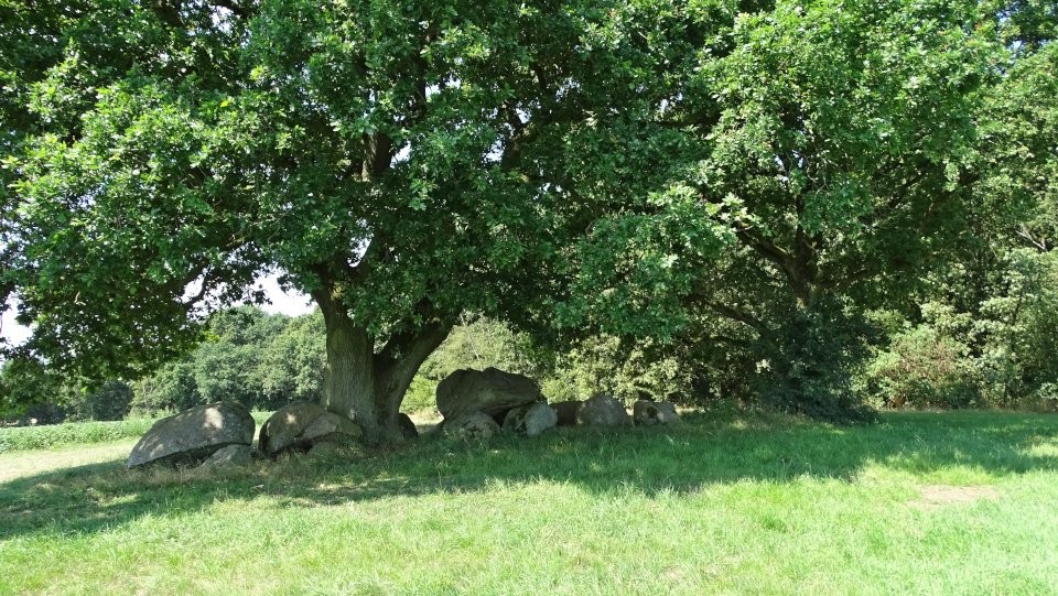

 Maps / Plans / Diagrams:
|
Fieldnotes |
|
|
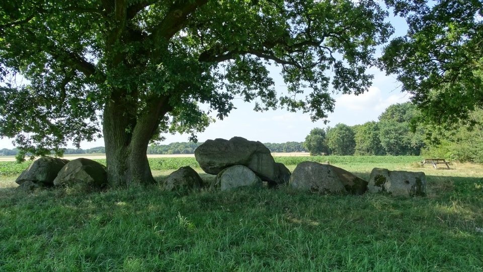
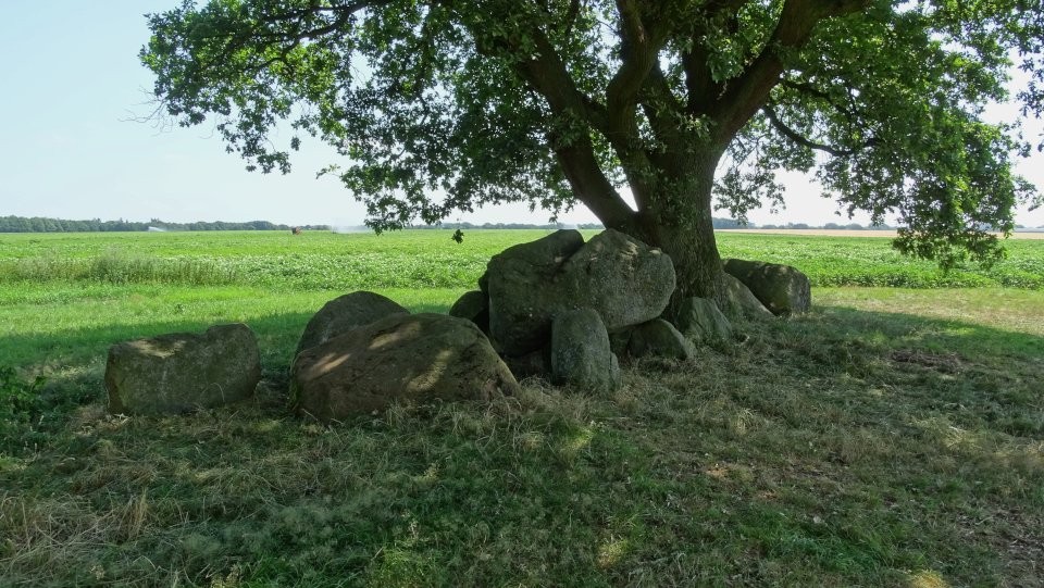
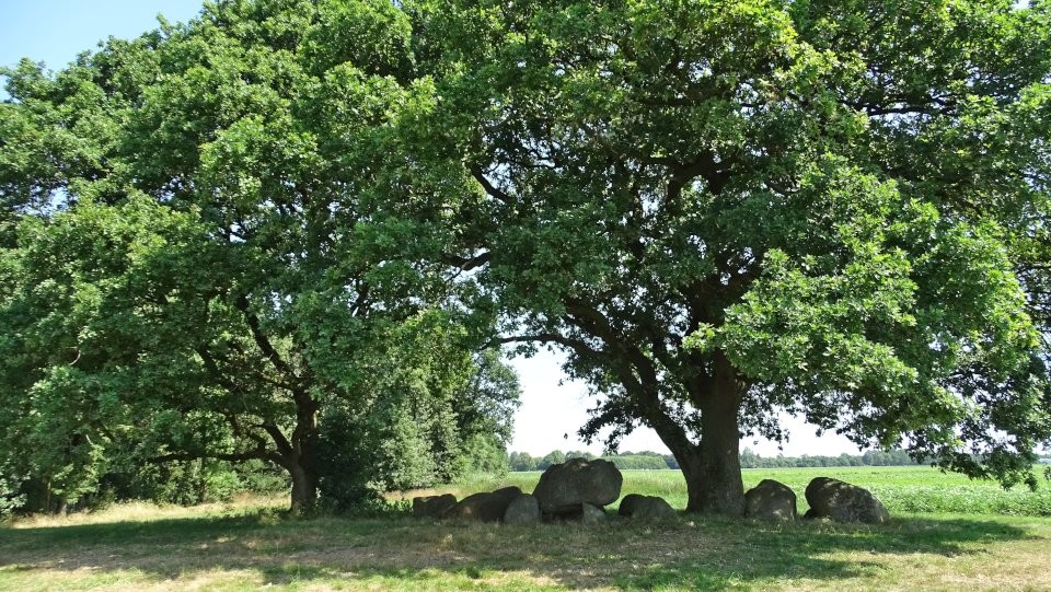
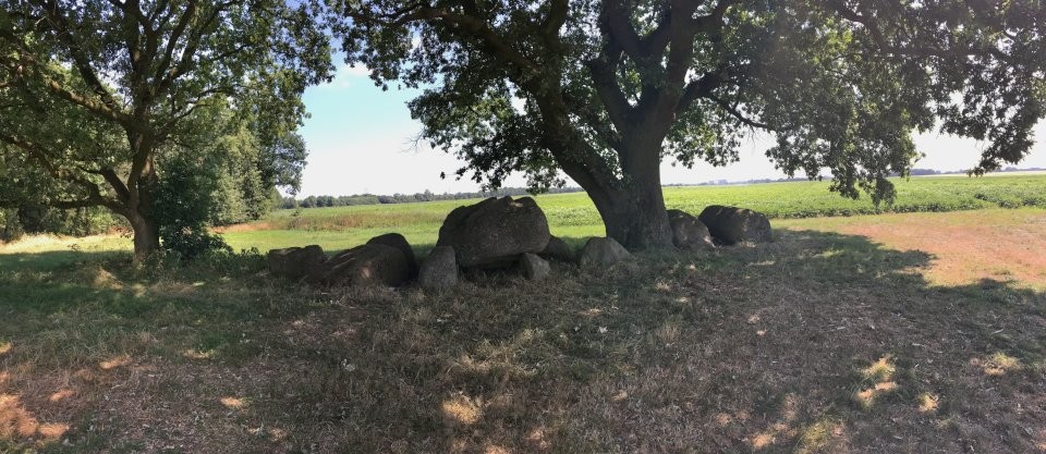
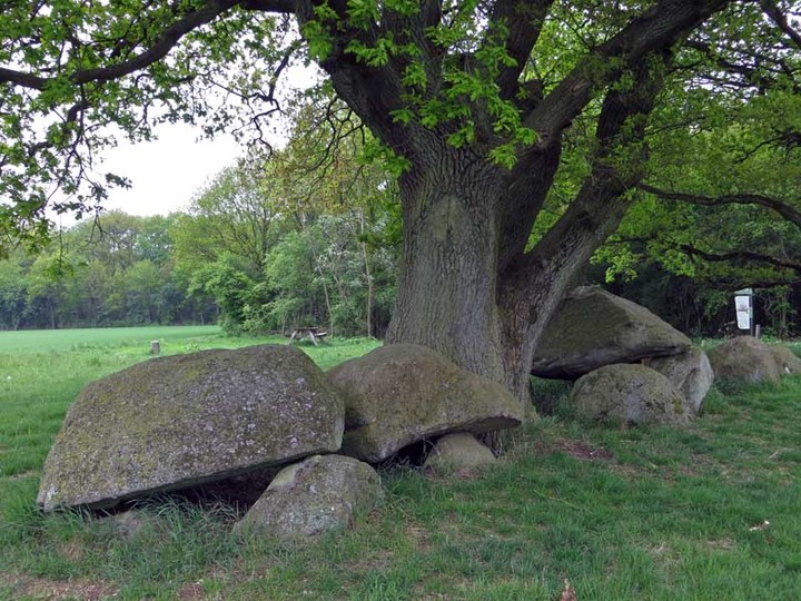
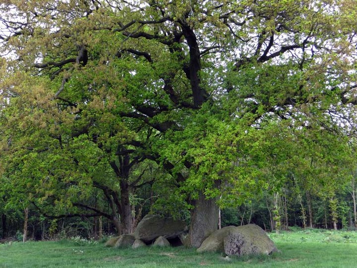
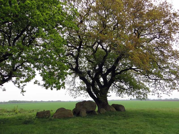
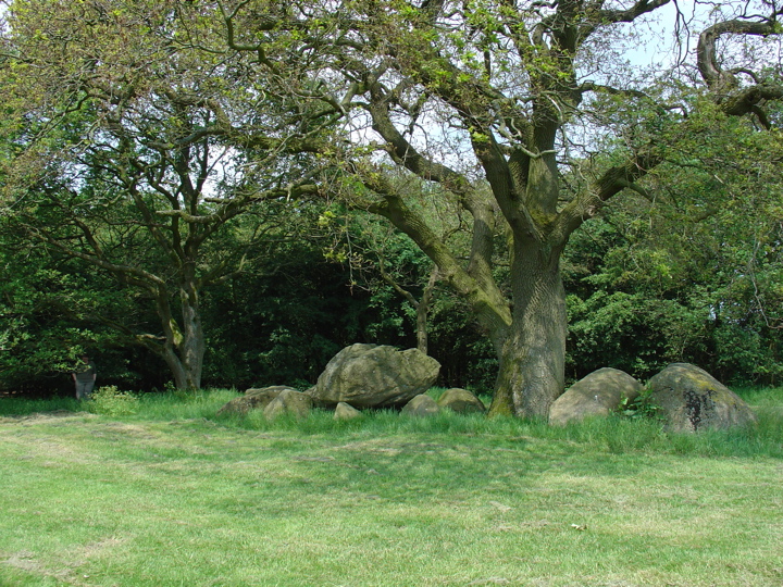
This is one of the larger (16.8 x 4.5 m), but also one of the lesser known dolmens of Drenthe. Originally it had 9 capstones, 4 of which are left over. Also 7 supporting stones and an endstone have disappeared. The terrain where it is, was called the 'Stien Camp' - the Stone field. The Hunebed is special because the entrance was once formed by a corridor of twice three stones facing each other. Such a long 'corridor' has no other Hunebed; nothing can be seen anymore. There is an impressive oak tree that rises from the middle of the Hunebed. Visited July 2018 |
5th August 2018ce Edited 5th August 2018ce |
|
Visited May 19, 2013 Hunebed D42 Emmeres lies west of the city of Emmen, about 2½ kilometres walk from the Central Bus and Railway station. If travelling on foot, head west from the station until you reach the main road, Noordeind/Odoorneweg. Follow Odoorneweg northwards for just under a kilometre (takes 12 minutes walking), then follow the first road left, Sluisvierweg. Follow this for a kilometre to Schietbaanweg, and turn left (south) down this road. By now you should encounter 'hunebed' signs as you walk the 400 metres to the end of the woodland. Here a path heads left, through the last of the trees, and takes you to the hunebed which lies in the clear, on the corner of the wooded area. This is not one of the most magnificent hunebeds, having clearly been greatly robbed over the centuries. It is believed that this passage grave originally boasted nine capstones: only four remain today, and two of these are fallen. It was restored in 1960 and, if you look closely, you will see the concrete imprints that were set into the ground to mark the positions of the missing sidestones. The most notable feature of D42 Emmeres is the mighty oak tree that rises from the middle of the hunebed. Reference: Dolmens in the Netherlands by Hans Meijer. |
 Posted by LesHamilton
22nd May 2013ce Edited 29th August 2013ce |
Links |
|
D42 Westenesch - De hunebedden in Drenthe en Groningenwith 3d model, short video (in Dutch), pictures and further information |
5th August 2018ce |
Hans Meijer's Dolmens in the Netherlands |
 Posted by Jane
30th July 2007ce |