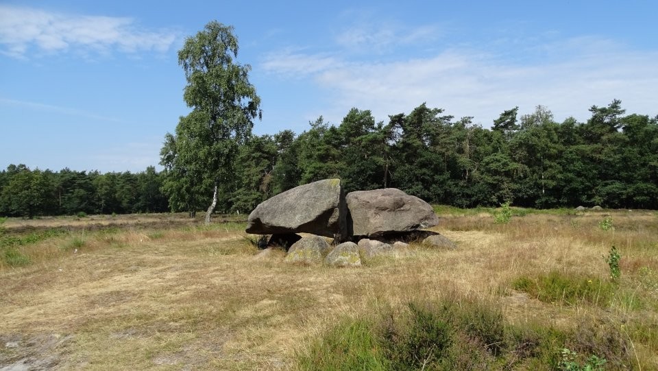
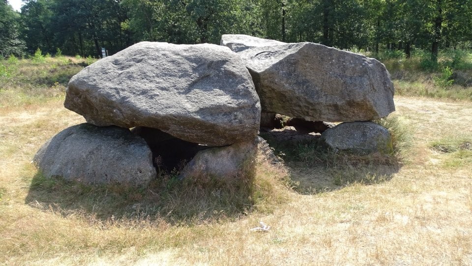
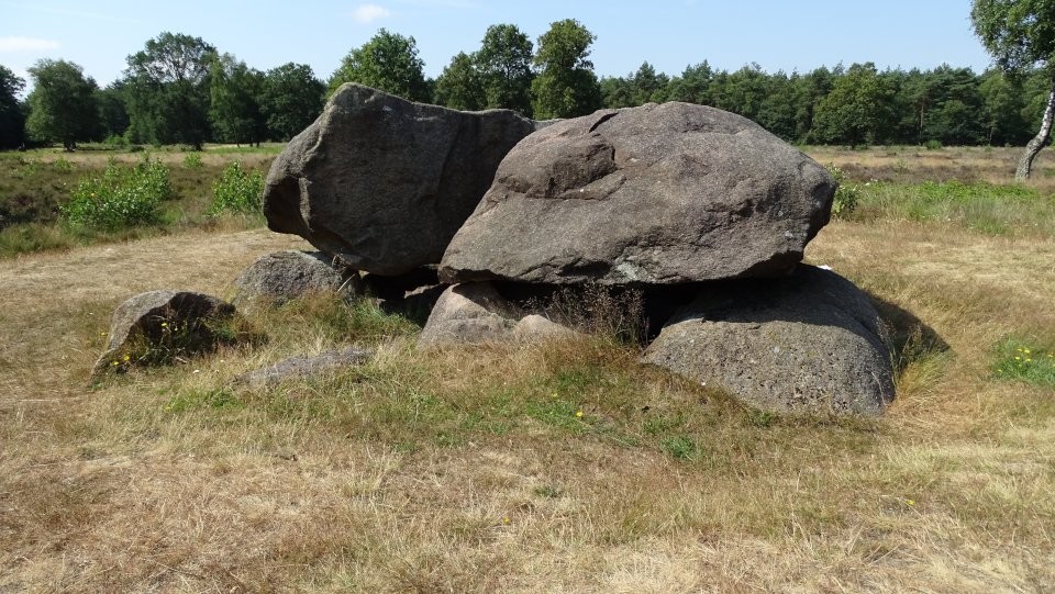
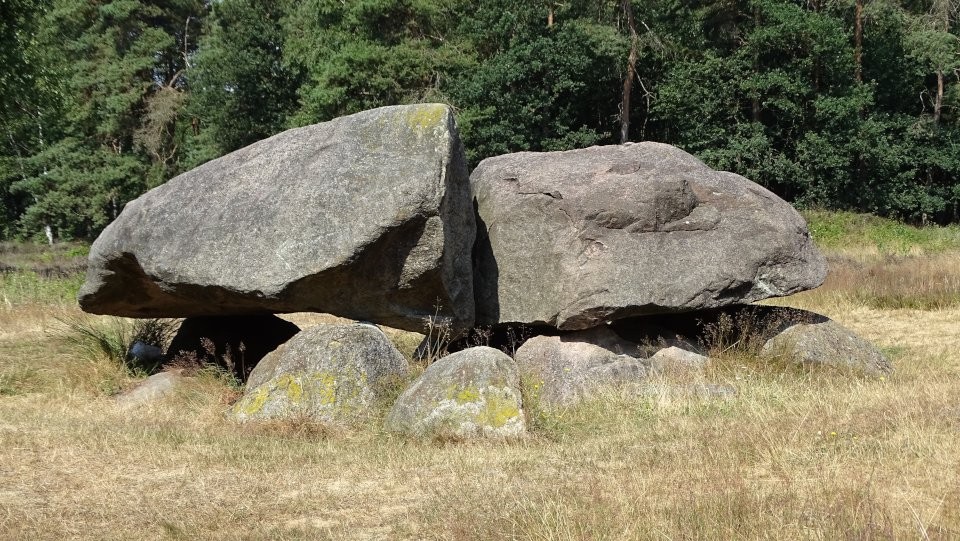
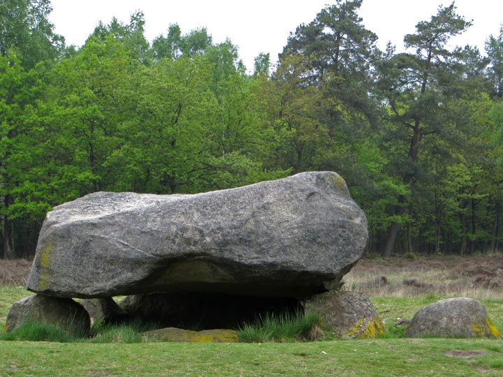
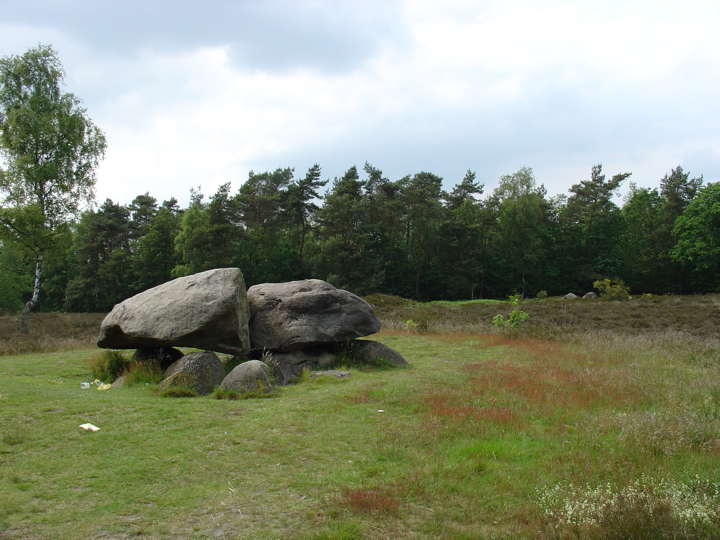
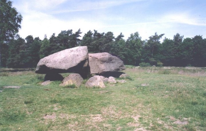
Although hunebed D40 Emmerveld Southeast today presents a splendid profile with two enormous capstones resting on four sidestones—of probably similar size—and a stone entranceway, it was not always so.
When the hunebed was originally built, these stones were simply the superstructure of the passage grave: all the spaces between the sidestones were packed with smaller stones and the entire structure was buried under an artificial mound of sand and turf.
As recently as 1918, when this hunebed was investigated by noted Dutch archaeologist Albert van Giffen, it was still partly covered over. Disappointingly, this hunebed revealed very few artefacts: just a few loose potsherds and three stone tools. In the decades since, the covering mound has been stripped away.
This splendid megalith can easily be reached on foot from Emmen Station. Head north along Weerdingerstraat for about 250 metres then follow the 3rd road on the left, Walstraat, to its intersection with Noordeinde at the western boundary of Emmen. Turn to the right and follow Nordeinde (which changes its name to Odoorneweg on the way) to a roundabout, where it is joined on the right by Valtherzandweg. Continue along Odoorneweg past the roundabout for 200 metres till you come upon a tree-lined farm track on your right (heading roughly north). There are prominent 'Hunebed' signs at the start of this track, so you can't miss it. What follows is a pleasant woodland walk of about 700 metres to the clearing which contains hunebed D40 Emmerveld. The surroundings are delightful, consisting of open woodland and heather.
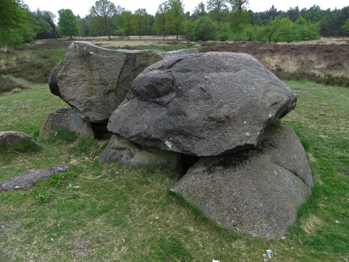
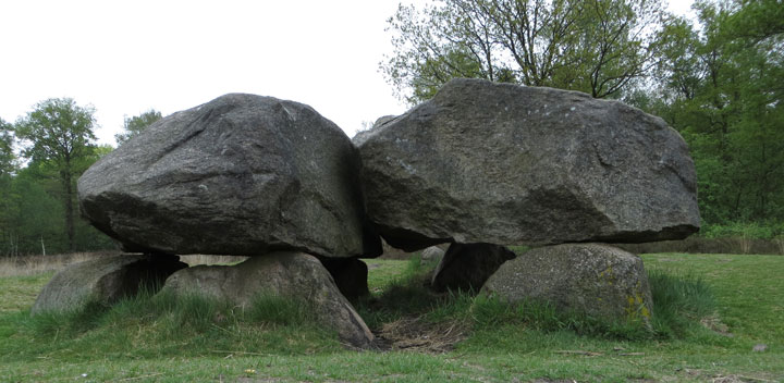
One of a trio of hunebedden, D38 and D39 lie just a few metres away in the same clearing.
D40 is the most impressive of this trio of 'grafheuvels' in the Valther Forest just north of Emmen. It would be a fairly long walk to them from the road, so risking the wrath of the forest ranger and being completely unable to read the signs, I drove up the sandy forest track until we found them in a bright forest clearing.
You approach D40 first, which is the most complete of the trio. Two great capstones are supported by six sidestones which seemed to us to have more beneath the ground level than above.
Strike off to the west for 20 metres through the low growing heathers and you find D38 and D39.
All three have distinct round raised ringed walls of sand hinting at the size and scale of what once must've been quite a necropolis of round barrows.

 Posted by LesHamilton
 Posted by Jane