|
|

|
|
Meon HillHillfort
|
||||||||||||||||||||||||
|
|
|
Images (click to view fullsize) |
|
Photographs: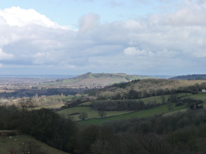
 Maps / Plans / Diagrams:
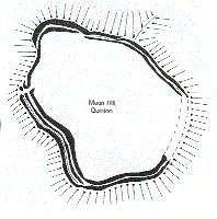
|
Fieldnotes |
|
|
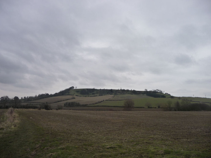
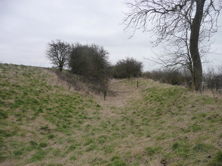
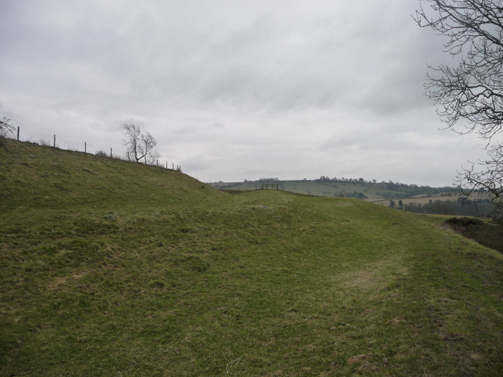
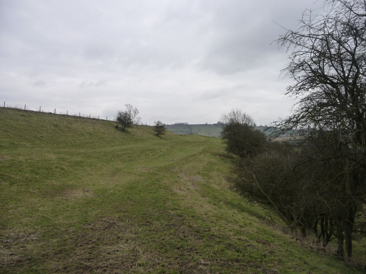
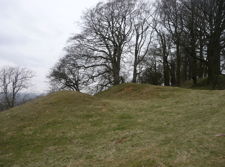
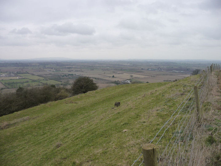
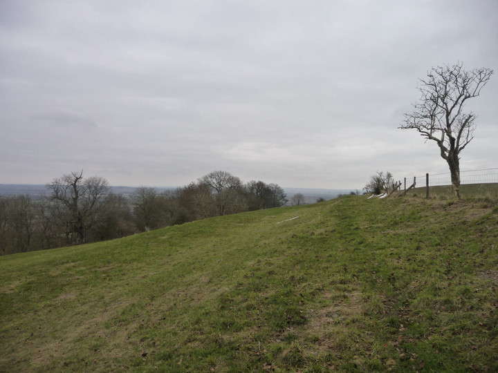
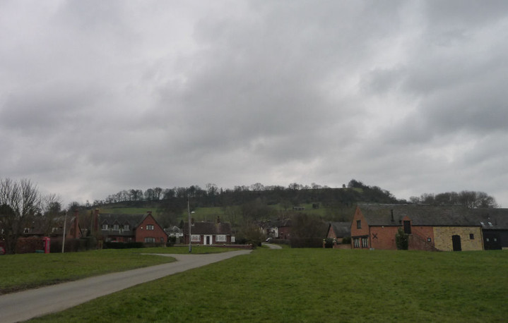
A grey and very cold late Winter's day (23.2.2013), coupled with the usual end-of-month lack of money, deters me from venturing too far afield, so instead I decide to make a foray into Warwickshire, a county I have pretty much ignored until now. The meagre pickings on TMA don't suggest this to have been much of an omission, but it would be wrong to pass judgement without a visit. A recent internet trawl has also revealed that permissive access has been granted to part of Meon Hill, which otherwise lacks any public rights of way. A meandering double bus journey takes me through plentiful pretty Cotswold towns and villages, before crossing from Gloucestershire into Warwickshire just after the village of Mickleton. From here the flat-topped hill is obvious, dominating the landscape and providing a commanding vantage over the rural patchwork below. The bus finally drops me at Upper Quinton, from where I will make my way up the northern slopes to the fort. The climb, like many up onto the Cotswold escarpment, starts gentle and gets steeper as the top is neared. By the time I'm through the trees and into the field below the northern rampart, I'm uncomfortably hot under the warm layers that had seemed so welcome scant minutes earlier. On its northern side, the rampart is set back from the scarp edge slightly, leaving a sloping field between trees and defences. The earthworks are in poor order, obviously the plough has taken its toll over the centuries. For all that, the views, even on such a grey day, are extensive. To the north, a flat expanse is laid out for as far as the eye can see, while to the west the nearest eminence is Bredon Hill in Worcestershire (although it takes me a while to realise that's what I'm looking at). Southwest, the Malverns are dimly seen. Only to the south is the view curtailed, by Ebrington Hill - the highest point in Warwickshire, which also marks the border with Gloucestershire. Following the top of the hill round to the west, the rampart effectively ceases above a steeper, wooded slope shown on the map as Jarrett's Brow. Crashing through tangled undergrowth here I startle a pheasant, which rises squawking from the hillside - the crump of not-so-distant shotguns indicates that this is not the time for it to be breaking cover. At the southwest, the rampart is at its finest, a double row of banks and ditches following the contour in a manner reminiscent of Uley Bury, much further south along the Cotswolds' western edge. The view really is very far-reaching. Apparently, the hill was the inspiration behind Tolkein's Weathertop, but there are neither ruins nor wraiths to disturb my visit today. I walk along the southern part of the rampart, where the ditch is at its deepest. In the southeast, the defences disappear, lost to the centuries of farming up here. It's a short, steep descent to the access area on the western slopes, then a very muddy walk along the "Heart of England" Way to Mickleton. I recall Gladman commenting on the ability of South Walian farmers to grow mud: suffice to say, they would be given a run for their money by their counterparts in Warwickshire, who specialise in a clinging clay that adds pounds to the boots in the space of a few short yards. I'm glad to reach tarmac in the village, where a once-huge nursery and market garden has been demolished to leave only crumbling brick and tangled weeds. Shame. From the village, I continue a while along the Heart of England Way, where further views of Meon Hill from the south confirm its excellent choice as a hillfort site. Past Hidcote gardens and up to the top of Ebrington Hill, before a gentle stroll back into Gloucestershire to Chipping Campden. I don't imagine I'll be spending much time in Warwickshire in the future, for prehistory is not well-represented here, sadly. But Meon Hill is a fine hillfort for those who like their views long, and a reminder that every part of the country has something worth the TMAer's effort. |
 Posted by thesweetcheat
24th February 2013ce Edited 24th February 2013ce |
Folklore |
|
|
The devil threw a stone from here to Cleeve Hill Tumulus, as you may read about on that page. But due to my impressionable childhood mind voraciously devouring the Reader's Digest 'Strange Stories, Amazing Facts', Meon Hill always reminds me of the story of the witchcraft-related? murder of Charles Walton. You can read all about it in Adrian Pengelly's White Dragon article here: http://www.whitedragon.org.uk/articles/charles.htm (amongst countless other internet sites). The article also teasingly mentions in passing that "there had long been stories of a ghostly black dog on Meon hill that heralded death to those it appeared to". The detective investigating the case is said to also have seen a black dog on the hill.. |
 Posted by Rhiannon
28th April 2007ce Edited 28th April 2007ce |
Miscellaneous |
|
|
Meon Hill is topped by a large multivallate hill fort, one of only two in Warwickshire - it must have been a pretty important place in the Iron Age. Traces of many huts have been found, and long ago there was discovered a hoard of currency bars: "In the month of June last (1824) as some workmen were searching for lime-stone in a turnip field belonging to a Mr. Smith, situated in the centre of a Roman camp on Meon Hill.. they discovered about three feet below the surface 394 javelin-heads of iron, the blades of which were 28 inches long, and 3/4 of an inch wide, with the exception of one whose width was two inches. ..they were not above the thickness of a shilling..." (p262 of the Gentleman's Magazine v94 pt2 (1824). |
Posted by Rhiannon 28th April 2007ce Edited 28th April 2007ce |
Links |
|
DefraAn area of permissive access has been opened on the western slopes of Meon Hill. Access end date is 31 July 2018. |
Posted by thesweetcheat 8th February 2013ce |