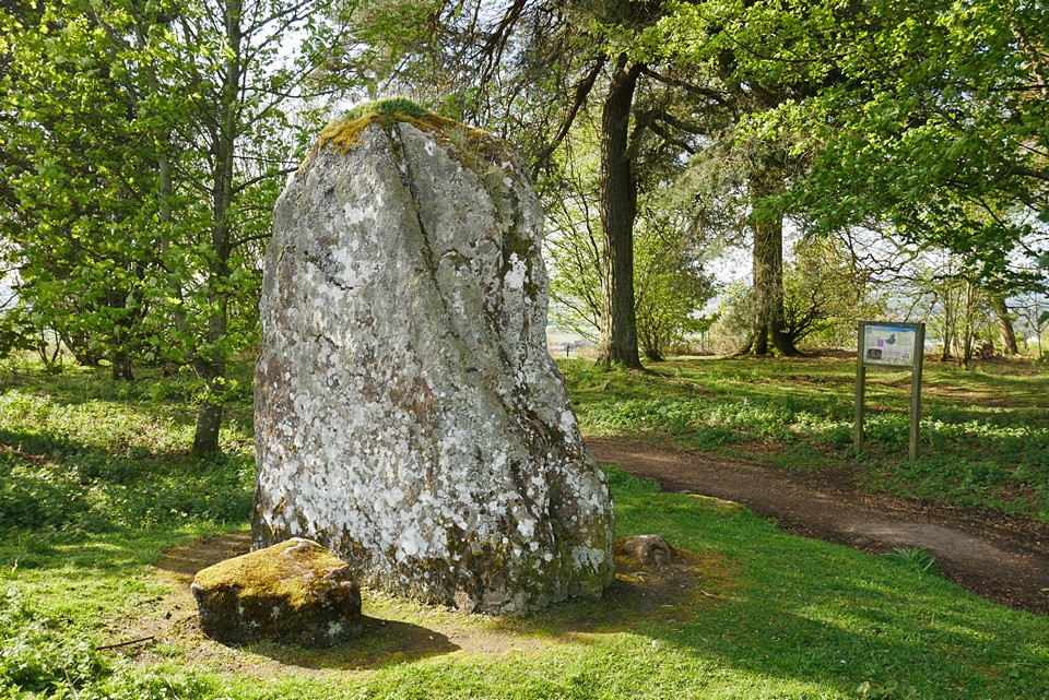
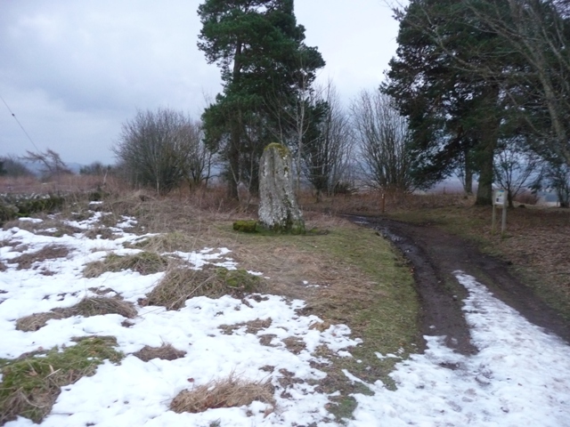
This was the final site stop of the day, well the last stop was Parkhead, and what a wonderful stone. Situated on the south east outskirts of Kirriemuir. Leave the B957 taking the last minor road north before Kirriemuir, West Hill Road.
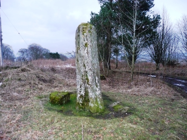
There is a handy car park and path which leads straight to the stone which stands at 2.7 meters tall with fantastic all round views.
With that it was time for Glasgow and the best place on earth.
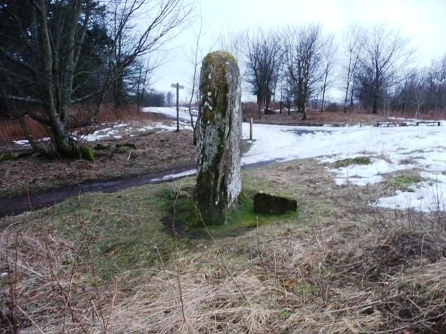
The "Stannin Stane" on the Hill of Kirriemuir is, undoubtedly, the most familiar object among our local antiquities. Many who have never seen i t know it through Barrie's writings; but every Kirriemuir boy has bestrode it, and visitors to the Hill rarely fail to give it some attention.
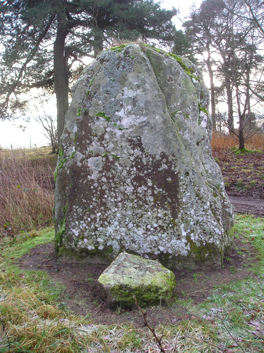
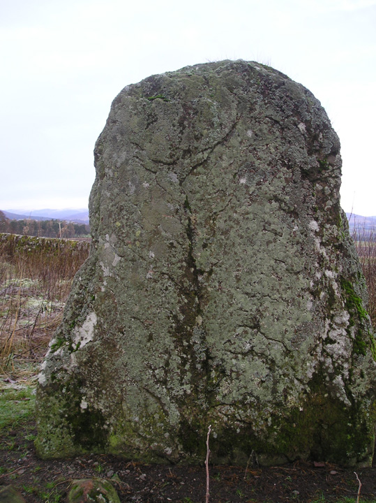
Formed of the old red sandstone of its site, the great, solitary monolith measures 9 feet in height, is 7 feet in width at its broadest part, and averages a couple of feet in thickness. There is no exact record regarding its hold on mother earth, which, probably, is not great, for the native rock crops out all round.
But there are tales, difficult to credit, of its being originally "as high again" as it is now; of its standing on another stone even larger than itself; and of its having split in two, overwhelming a band of robbers who were dividing their ill gotten plunder at its base.
No record appears on its surface; no tradition exists to explain its origin or purpose; surmise alone can offer any feasible explanation of its meaning. Says one, it marks the bounds of some ancient tribal possession; says another, some great warrior of old lies buried here. But, whatever its precise age or origin, it may safely be affirmed that the "Stannin Stane" saw all the conflicts waged between the early Picts and Caledonians, and marked the advance of Rome eastwards to the sea, from the great camps of Ardoch and Cardean to Stonehaven, Aberdeen, or the Moray Firth, or from Battledykes by Forfar to the Tay.
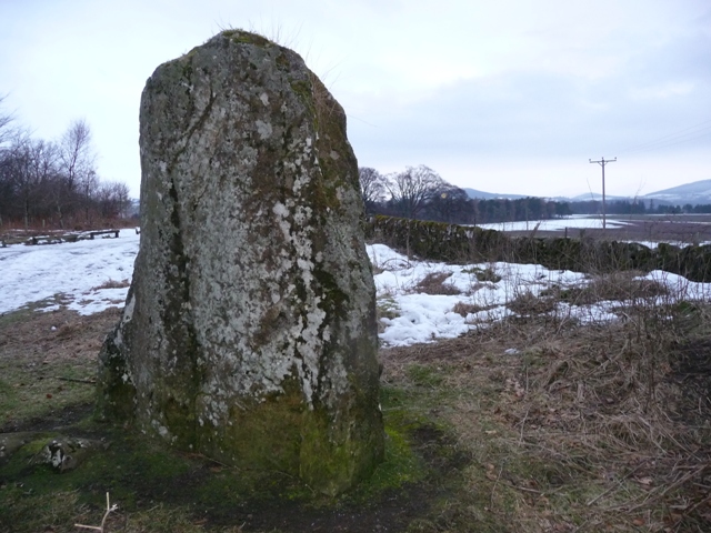
I'm surprised such a large stone has long gone unadded to TMA; this is how the RCAHMS record describes it:
"This standing stone is 9' high and 6'6" across the base. The New Statistical Account (NSA - 1845) notes a fragment 12'9" long lying on the ground, but this had disappeared by 1909. Reid (1909) suggests that the two stones may have formed part of a circle, the recumbent one not having broken off as suggested in the NSA.
There is a small upright stone in the field-wall 6m to the east."
The NSA suggests that the massive 12' section was a part of the standing stone, that had split off (though in what sense they don't expain), and that "in the memory of man [the standing stone] tapered towards the top, but the projecting part has been knocked off". Also, that "it cannot be less than three or four feet in the ground."
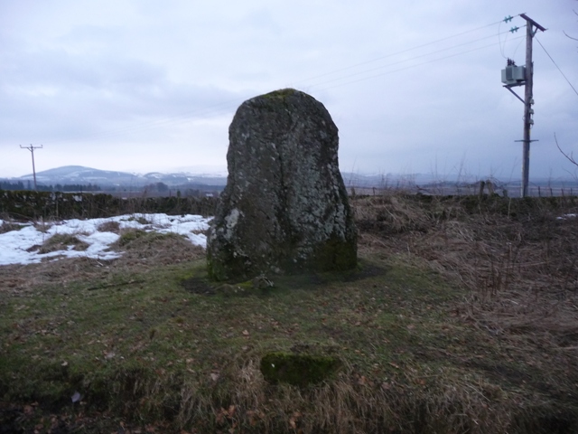
"Tradition is silent as to the purpose for which it was erected." says the New Statistical Account of the 1840s.

 Posted by Rhiannon