The Modern Antiquarian
Log in
|
Register
Home
Latest Posts
Forums
Maps
Help
Browse Sites
News
Blog
Contributors
The Books
Select
-
Belgium
Denmark
Eire
France
Germany
Greece
Italy
The Netherlands
Norway
Portugal
Republic of Malta
Spain
Sweden
Switzerland
United Kingdom
County Tipperary
Ballinahinch
Ballinahinch
Barrow / Cairn Cemetery
Ballinahinch (Barrow / Cairn Cemetery) on The Modern Antiquarian, the UK & Ireland's most popular megalithic community website. 1 image, plus information on many more ancient sites nearby and across the UK & Ireland.
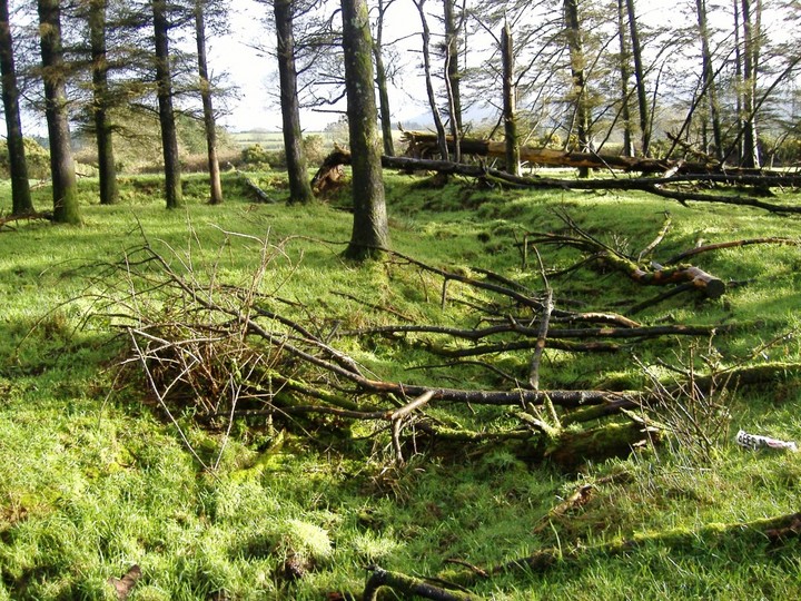
Image © Bawn79
Nearest Town:
Ballina (7km NW)
OS Ref (IE):
R753684 /
Sheet: 59
Latitude:
52° 45' 58.17" N
Longitude:
8° 21' 57.48" W
Added by
bawn79
Images (1)
0 discussions
Start a topic
Show |
Hide
Web searches for Ballinahinch
Flickr
Google
Google Images
The Megalithic Portal
Bing
Stone Pages
Wikipedia
Show map
(inline Google Map)
- Sites within 20 km -
-
Ballinahinch (0.1km WSW) (1 post)
Ballinahinch (0.2km SSE) (2 posts)
Garraun (1.2km NE) (3 posts)
Garruan (1.2km NE) (1 post)
Clonalough (1.7km ENE) (2 posts)
Ballynahinch (1.84km W) (1 post)
Ballynahinch (2.09km WSW) (3 posts)
Ballynahinch (2.09km WSW) (2 posts)
Cappadine (2.2km NNW) (5 posts)
Ballyard (4.44km SW) (3 posts)
Ballina (4.57km WNW) (1 post)
Roolagh (5.78km WNW) (5 posts)
Birdhill (6.01km WSW) (6 posts)
Ballymalone More (6.28km NW) (2 posts)
Killaloe (6.49km WNW) (4 posts)
Burgesbeg (6.85km NNE) (1 post)
Burgesbeg (7.46km N) (6 posts)
Coumroe (8.11km N) (4 posts)
Carrigeen (8.15km NNE) (7 posts)
Bauraglanna (8.47km E) (9 posts)
Scraggeen (9.11km S) (2 posts)
Graves of the Leinstermen (9.62km NNW) (10 posts)
Laghtea (10.07km NNW) (2 posts)
Knockaunreelyon (10.1km NNW) (2 posts)
Craglea (10.11km WNW) (3 posts)
Lackamore (10.54km N) (3 posts)
Garranbane (11.09km S) (5 posts)
Reardnogy More (11.71km ESE) (3 posts)
Sonnenstein - Beckstedt (11.82km WNW) (5 posts)
Ardataggle (11.94km WSW) (0 posts)
Kilcolman (12.08km NNE) (2 posts)
Doonglara (Glenbrohane) (12.28km S) (1 post)
Baurnadomeeny (12.3km ESE) (6 posts)
Baurnadomeeny (12.32km ESE) (4 posts)
Tullahedy (12.36km NE) (2 posts)
Lisheentyrone (12.4km N) (4 posts)
Lisheentyrone (12.4km N) (10 posts)
Baurnadomeeny (12.57km ESE) (38 posts)
Cureeny Commons (12.87km E) (17 posts)
Creggane (12.95km NNE) (2 posts)
Shanballyedmond (13.13km ESE) (17 posts)
Pestruper Gräberfeld (13.3km NW) (9 posts)
Cloneygowny (13.35km N) (2 posts)
Goulmore (13.58km ESE) (4 posts)
Mauherslieve (13.69km E) (6 posts)
Mauherslieve (13.69km E) (1 post)
Foilnamuck (14.16km E) (10 posts)
Foilnamuck (14.54km E) (5 posts)
Youghalvillage (14.56km NNE) (4 posts)
Garranmore (14.63km N) (3 posts)
Cooneen (14.94km E) (8 posts)
Cooneen (14.95km E) (3 posts)
Bealkelly (15.16km WNW) (0 posts)
Killokennedy (15.4km W) (5 posts)
Formoyle More West (16.31km W) (7 posts)
Knockshanbrittas (A) (16.53km ESE) (6 posts)
Aughsullish SW (16.53km ESE) (6 posts)
Aughsullish NW (16.54km ESE) (1 post)
Foilycleara (17.09km ESE) (3 posts)
Cloongaheen West (17.15km W) (4 posts)
Ballinacurra (17.19km ENE) (1 post)
The Bargaining Stone - Inishcealtra (17.27km NW) (2 posts)
Lackanagoneeny (17.29km SE) (4 posts)
Barbane (17.4km W) (6 posts)
Knockalton Lower (17.43km NE) (1 post)
Iniscaltra (17.46km NW) (6 posts)
Iniscaltra (17.65km NW) (3 posts)
Reisk (17.79km E) (1 post)
Ardskeagh (17.87km W) (0 posts)
Loughbrack (17.88km E) (11 posts)
Knocknabansha (17.97km E) (5 posts)
Drummin (18.18km W) (0 posts)
Tuogh (18.51km SSE) (0 posts)
Violethill (18.56km W) (0 posts)
Knockshanvo (18.65km W) (5 posts)
Rathurles (18.94km NE) (2 posts)
Knockeen (18.98km SSW) (1 post)
Knockmaroe (19.26km E) (3 posts)
Gortnageragh (19.26km ESE) (2 posts)
Rathfalla (19.41km NE) (5 posts)
Garracummer (19.48km ESE) (8 posts)
Rathurles (19.53km NE) (9 posts)
Rathurles (19.67km NE) (6 posts)
Knigh Hill (19.94km NE) (3 posts)
- Add -
-
Add news
Add an image
Add fieldnotes
Add folklore
Add miscellaneous
Add a link
-
Add a site
Add a nearby facility
Add an alternative name/spelling
Images
(click to view fullsize)
Add an image
 Image © Bawn79