|
|

|
|
Dun NosebridgeHillfort
|
||||||||||||||||||||||||
|
|
|
Images (click to view fullsize) |
|


|
Fieldnotes |
|
|
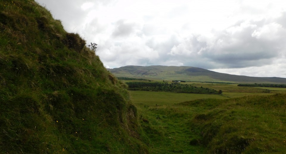
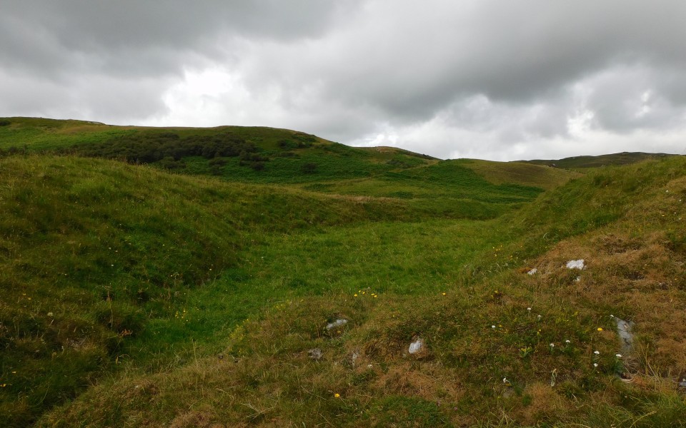
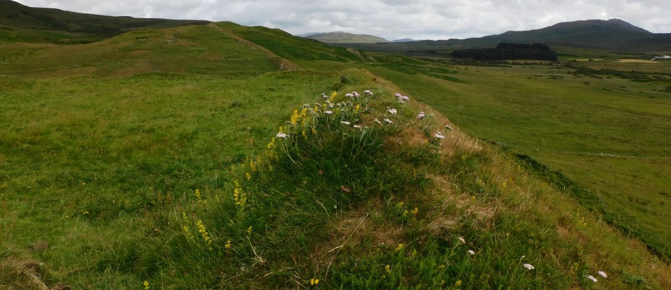
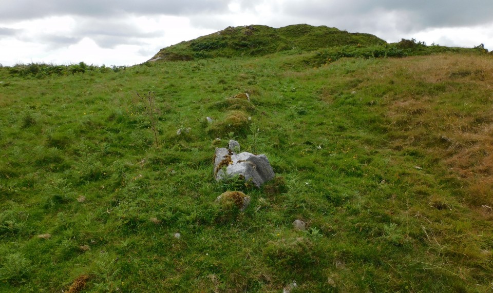
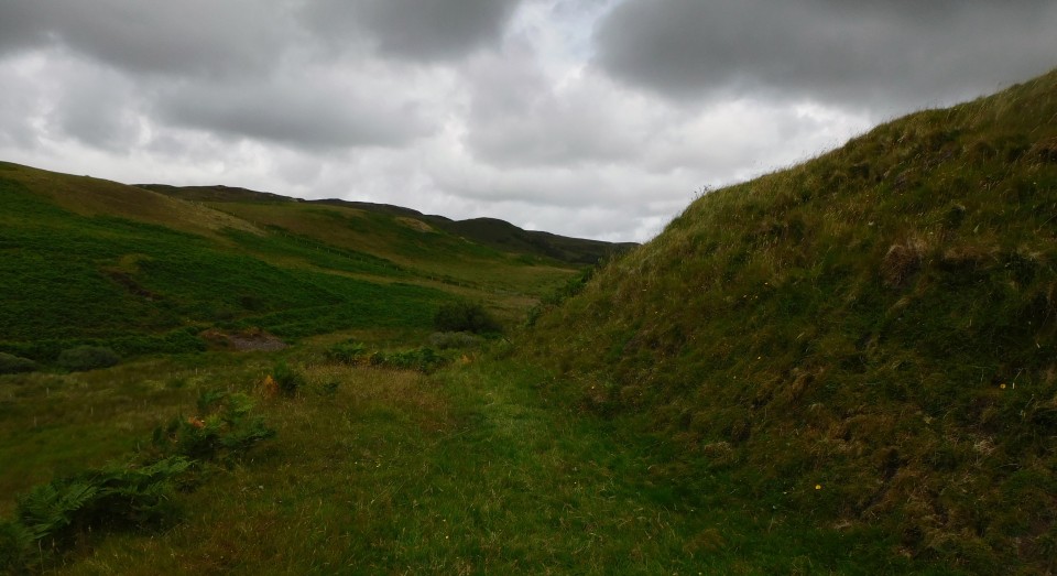
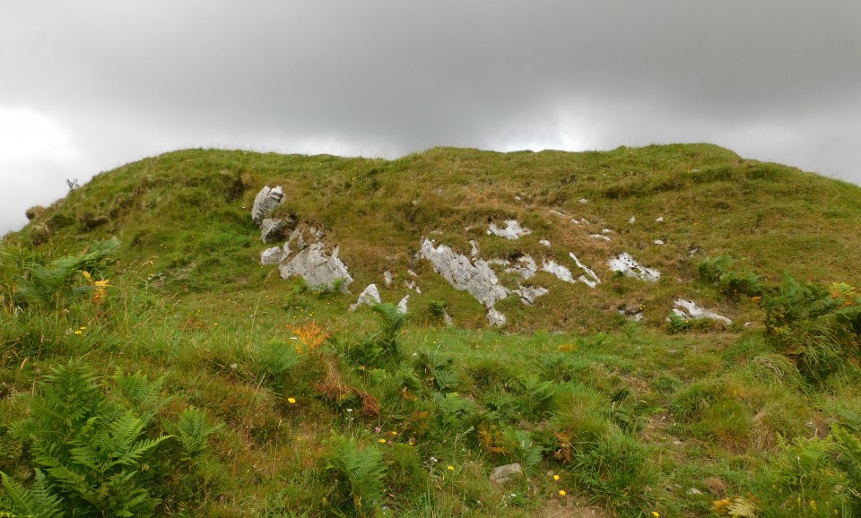
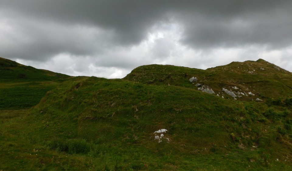
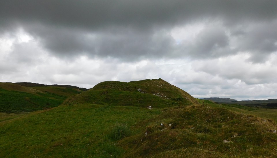
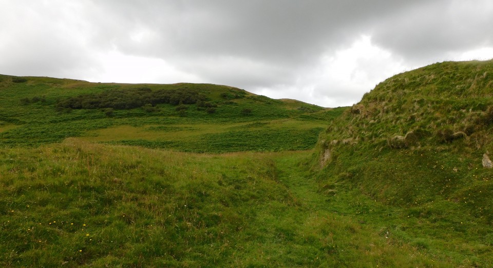
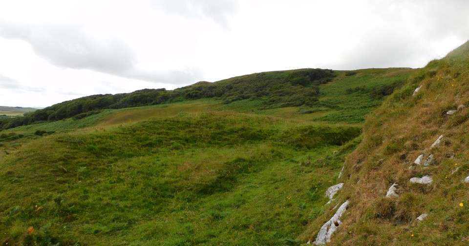
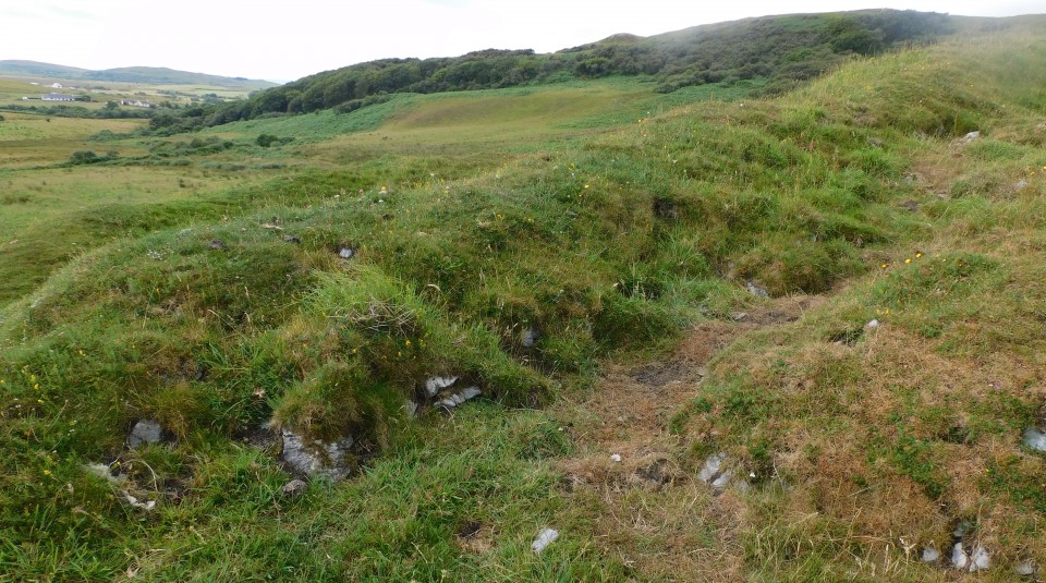
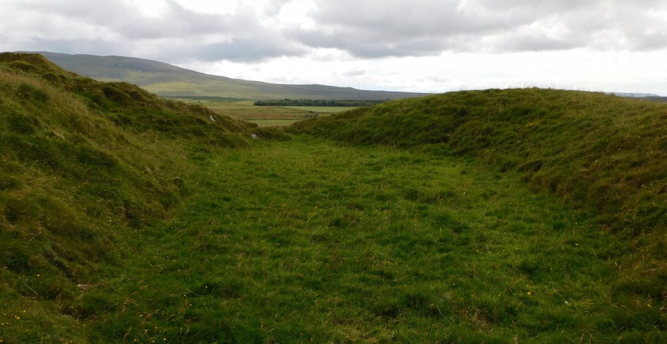
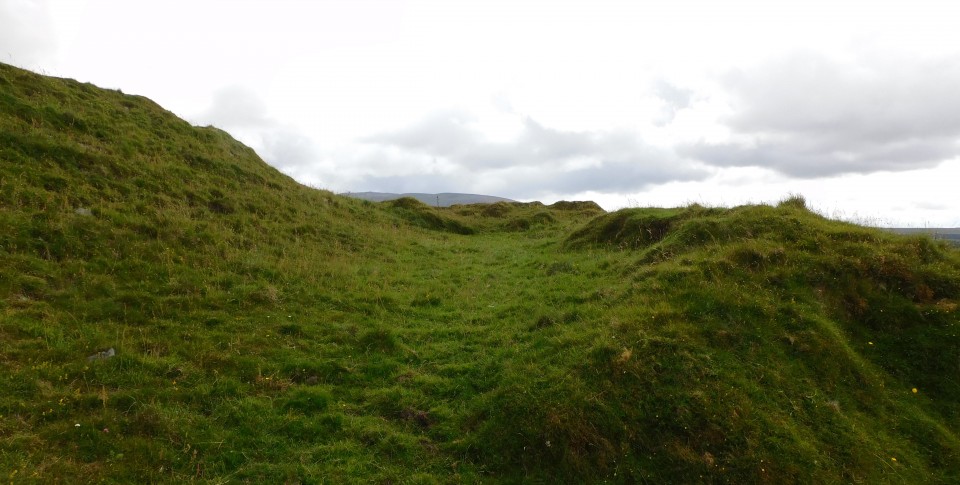
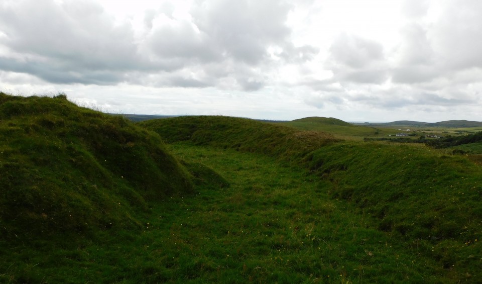
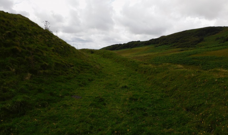
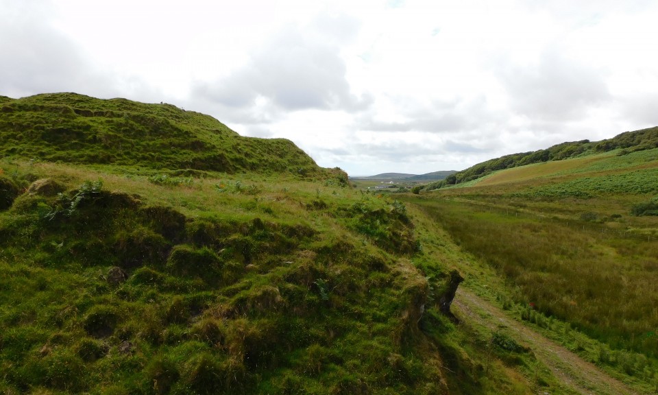
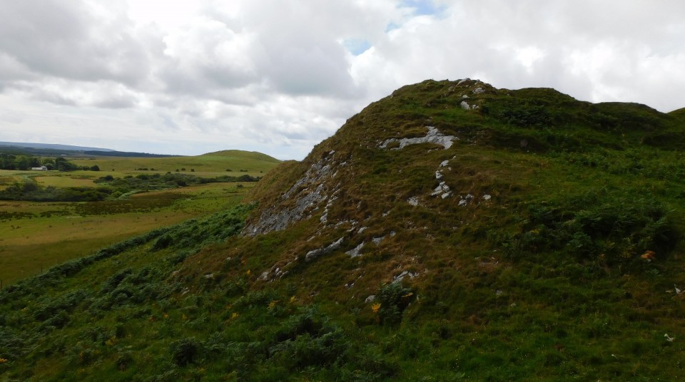
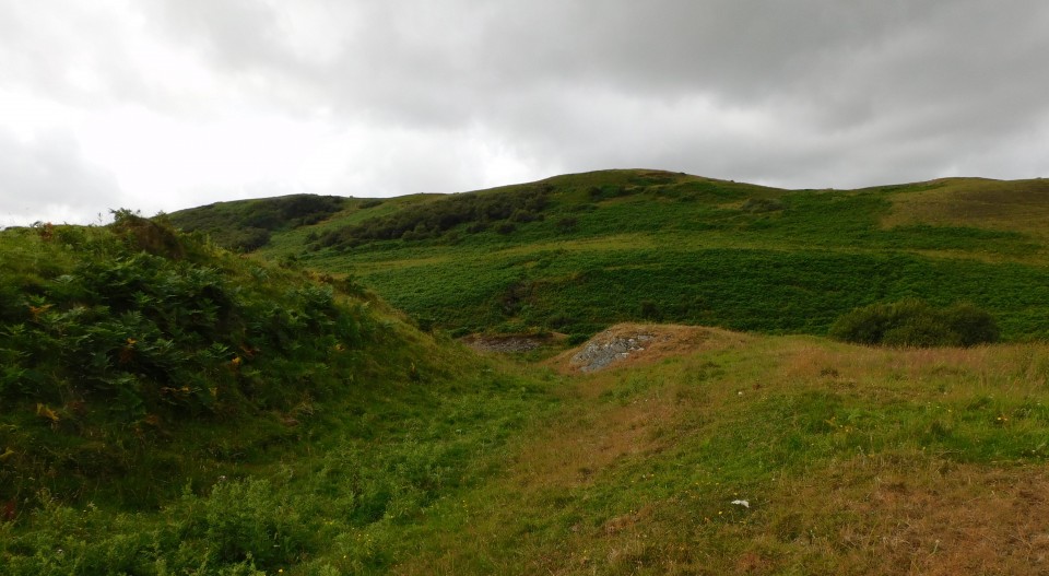
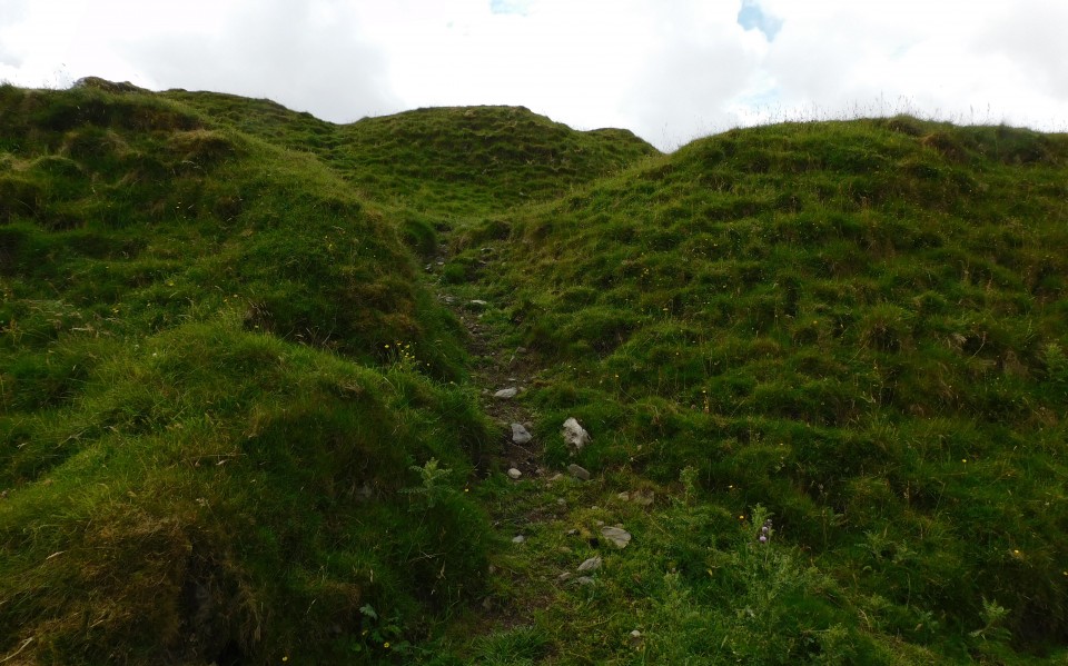
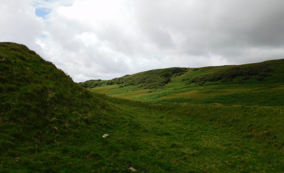
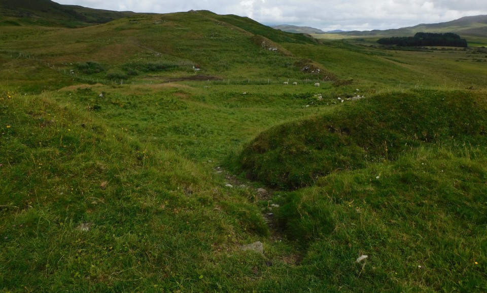
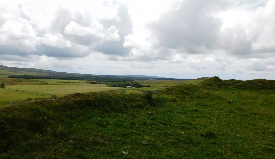
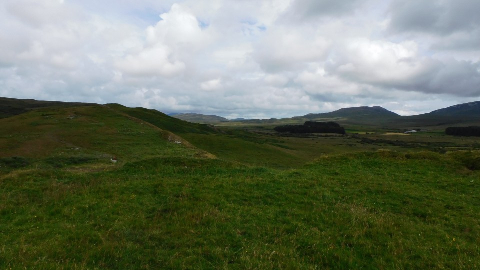
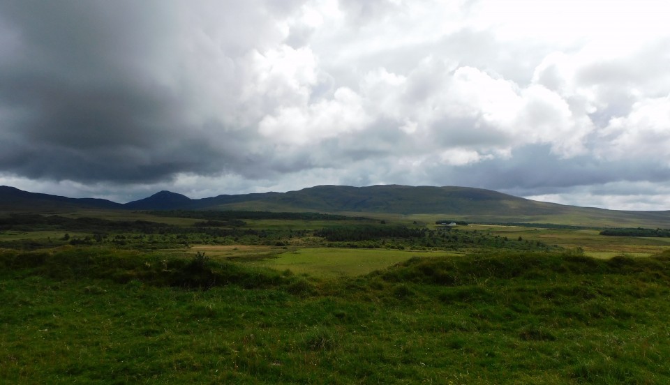
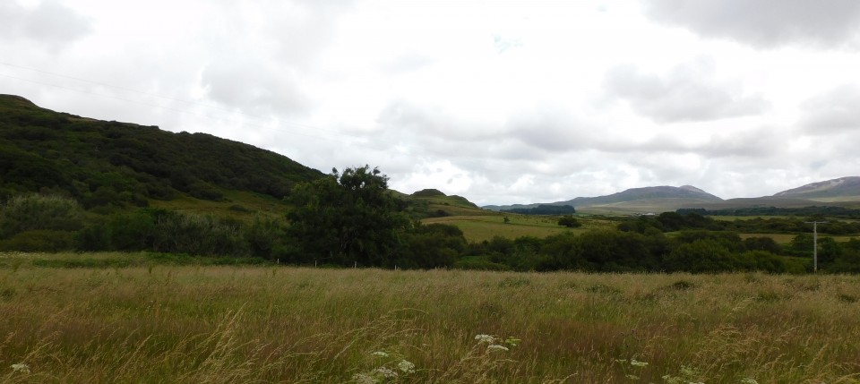
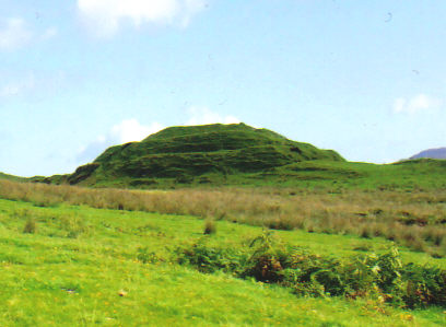
Dun Nosebridge truly is a stunning place and it can be seen from Mulindry, where we parked. The gentleman at Mulindry Old Schoolhouse, also proved very helpful, with place name pronunciations, and also allowed to park immediately behind his car, i.e. The Oa / Kilchoman. Nosebridge is as it reads :-) Cross over the River Laggan, and take the track heading east, a nice easy walk which leads straight to fort. The cairn at Caisteal Mhic Dhomhnuill is also nearby, is at the top of the hill immediately north. However the main attraction soon comes into view. The fort can be easily climbed from the west but the main stone lined entrance is on the east. Three huge ramparts cover north, three, perhaps more cover east and west and to the south natural defences, a cliff face. There must have been a huge amount of work carried out here, no doubt in later centuries the fort was used for more agricultural purposes. At the moment, thankfully, it seems to be left alone. Truly stunning site. Visited 28/07/2021. |
17th September 2021ce Edited 17th September 2021ce |
|
Believed to be an iron age hillfort, this is an impressive structure overlooking the River Laggan valley. It features a 'flat rectangular summit, about 15m by 25m, enclosed within concentric ramparts - three main ones separated by large ditches' (Caldwell). Easily approached by footpath on road from Bridgend, where it crosses river at Mulindry Bridge. Name derives from Norse for 'fort on the crag', but the site predates the Vikings' arrival on Islay. Source for quote: Islay, Jura and Colonsay: a historical guide - David H. Caldwell (Birlinn, Edingburgh, 2001). |
Posted by Neil-NewX 26th November 2006ce |
Folklore |
|
[In the photograph] are two "celts." The lower one is nearly black (basalt?) the upper one is of a very light grey and in perfect condition. Both are of hard close-grained stone. The interest attaching to them is that they are "fairy arrows." They were found at Mulindry Glen, near what appears in the maps as Dun Nosebridge, locally called Nosbreac, Islay. The original owner of them, when handing them to the lady from whom they were received, said "they were in the possession of her father and her grandfather and were always called saigheadan shith and were saigheadan shith." In Eigg these seem to be called Ceapa-Sithein, as if they had been used for blocking something on, as a shoemaker's last is used.Charms, etc., Figured on Plate IX R. C. MacLagan Folklore, Vol. 14, No. 3. (Sep. 29, 1903), pp. 298-300. |
 Posted by Rhiannon
9th December 2006ce |
Miscellaneous |
|
|
Robert C. Graham, author of the book Carves Stones of Islay written in 1885, described the fort as follows: The name is an elaborate corruption of the Icelandic words Hnaus and Borg, meaning Turf fort, and apt description, as the whole structure is covered with a most beautiful and velvety sward. The top of the hill has been cut away so as to form a level quadrilateral platform, 90 feet long by 50 feet wide. The longer sides run east and west and the platform is protected by earthworks. The slope towards the river on the south side is so steep as to render artificial defences unnecessary, but on the other sides the fort is strongly protected. On the west there are four trenches one above the other, with high earthworks between. One of these trenches if continued round the northern and eastern sides, to which from the nature of the ground it would form a sufficient protection. At the east end, however, a projecting lump of hill, below the main trench, is again protected by a smaller ditch. This is a most interesting place and well worth seeing. |
18th August 2021ce |
|
Alternatively, we might want to refine the criteria for inclusion of given borg names in the list. Take Dùn Nosebridge in Kilarrow (NGR: NR 371 601), for example, from Norse *Hnausaborg (Turf Fortress). The fort in question is of the impressive, yet highly unusual ‘multivalate’ type. Its location also dominates the fertile Laggan Valley, one of Islay’s two main watersheds. If we were to exclude it from the total we would be left with one independent borg name per medieval parish, suggesting perhaps that these reflect a sixpart administrative division – six séttungir. As in Man and Orkney, this would not preclude division into administrative ‘halves’; and this could be where the true significance of Dùn Nosebridge lies. ‘ B o r g s ’ , B o a t s a n d t h e B e g i n n i n g s o f Islay’s Medieval Parish Network? Alan Macniven |
11th August 2021ce |
Links |
|
Atlas of HillfortsDetails of the impressive fort. |
11th August 2021ce |