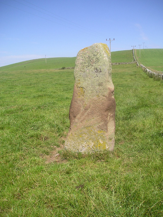
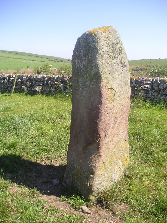
Log in
|
Register
Home
Latest Posts
Forums
Maps
Help
Browse Sites
News
Blog
Contributors
The Books
Select
-
Belgium
Denmark
Eire
France
Greece
Italy
The Netherlands
Norway
Portugal
Republic of Malta
Spain
Sweden
Switzerland
United Kingdom
Scotland
Dumfries and Galloway
South Cairnwell
Standing Stone / Menhir
South Cairnwell (Standing Stone / Menhir) on The Modern Antiquarian, the UK & Ireland's most popular megalithic community website. 2 images, plus information on many more ancient sites nearby and across the UK & Ireland.
Image © tiompan
Nearest Town:
Stranraer (12km NNW)
OS Ref (GB):
NX085485 /
Sheet: 82
Latitude:
54° 47' 40.38" N
Longitude:
4° 58' 45.12" W
Added by
tiompan
Images (2)
0 discussions
Start a topic
Show |
Hide
Web searches for South Cairnwell
Flash Earth
Flickr
Google
Google Images
MAGIC
The Megalithic Portal
Bing
Stone Pages
Streetmap.co.uk
Wikipedia
Show map
(inline Google Map)
- Sites within 20 km -
-
Doon Castle (4.29km SSW) (3 posts)
Dunragit (11.07km NE) (0 posts)
Stair Haven (13.25km ENE) (4 posts)
Killantringan Bay (13.31km WNW) (5 posts)
Mull of Sinniness (14.88km ENE) (2 posts)
Glentirrow (15.24km NNE) (16 posts)
Teroy (15.63km N) (5 posts)
Kemp's Wark (15.72km WNW) (0 posts)
Mid Gleniron I and II (16.03km NE) (23 posts)
Mid Gleniron III (16.08km NE) (3 posts)
Mid Gleniron Round Cairn (16.22km NE) (5 posts)
Whitefield Loch (16.47km ENE) (1 post)
Machermore (17.18km ENE) (1 post)
The Dunnan (17.2km SE) (1 post)
Auld Wife's Grave (17.21km NNE) (0 posts)
Knock Fell (18.3km ENE) (2 posts)
Bennen of Garvilland (19.2km NE) (4 posts)
Mull O' Galloway (19.33km SE) (1 post)
Caves of Kilhern (19.46km NE) (25 posts)
Fauldinchie (19.67km NE) (3 posts)
- Add -
-
Add news
Add an image
Add fieldnotes
Add folklore
Add miscellaneous
Add a link
-
Add a site
Add a nearby facility
Add an alternative name/spelling
Images
(click to view fullsize)
Add an image