|
|

|
|
Bury Hill CampHillfort
|
||||||||||||||||||||||||
|
|
|
Images (click to view fullsize) |
|
|
Fieldnotes |
|
|
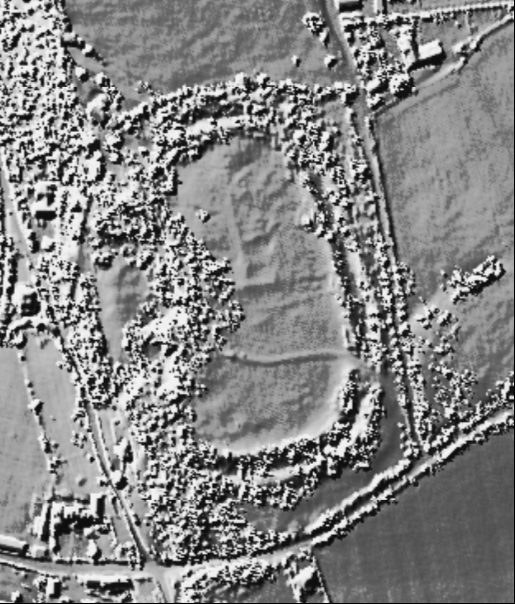
Visited 6.3.13 Directions: Taking the A432 north out of Bristol, take the turning left along Cuckoo Lane shortly after crossing over the M4. Turn left into Bury Hill Road and then right into Mill Road. On your right you will see an access lane to a house signposted ‘private’ and shortly after that a public footpath sign also on the right. There is room to pull in next to the footpath sign. All you then need to do is walk up the handily provided stone steps leading to the site. Although the directions given sound fairly straightforward it took quite a while to locate the Hillfort despite being armed with an O/S map. However, the effort was well worth while. Oddly enough I see that Xseawitch has recently posted a fieldnote about this site but my findings were much more successful. The walk up the steps through the trees is a very pretty climb. It would have been a difficult walk without the steps as it is very steep. At the top you arrive at the garden wall (of said ‘private’ lane fame) and then you can enjoy walking pretty much through their ‘private’ garden as there is a public right of way! Access to the field/Hillfort is via a gate. There were two horses grazing in the field who chose to ignore me. The western side of the Hillfort showed few remaining signs of defences except for one stretch of banking which still stood to about 1m in height. It seems the builders were quite happy for the steep hillside to act as the main deterrent. The eastern defences, where the ground is flat, provided the greater defences. There is a single ditch / bank which still stands to an impressive height of about 2 metres (from the bottom of ditch). Much of this is now overgrown by trees and bushes. The centre of the Hillfort seems to have lots of ‘lumps and bumps’ – I wonder what they are? All in all this is a decent site to visit when in the area, requiring little walking other that the steep climb up the steps. |
Posted by CARL 7th March 2013ce |
|
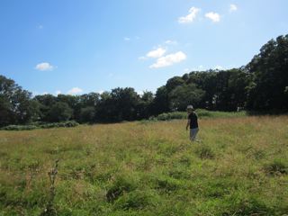
Spent ages last August studying the O/S map, trying to find this hill fort. We went up and down Bury Hill before discovering that the anonymous clearing we'd passed at the top was, in fact, the hill fort. Nothing to see there except some butterflies, trees and nettles obscure any real view of the earthworks. May be better to go in Autumn or Winter when there is less foliage. |
 Posted by xseawitch
5th March 2013ce Edited 6th March 2013ce |
Miscellaneous |
|
|
The Proceedings of the Spelaeological Society of the University of Bristol for 1923 relate that various Roman artefacts were found here, as though the Romans had taken it over for their own purposes. According to the EH Excavation Index for England (via Heirport), most of the excavation records and artefacts relating to this site were destroyed during WW2. The fort isn't tucked into the curves of the adjacent stream as you'd perhaps expect. But then I'm not an Iron-Age fort builder. A path (the long distance Community Forest Path / Frome Valley Walkway) crosses the fort. |
 Posted by Rhiannon
29th October 2006ce |