The Modern Antiquarian
Log in
|
Register
Home
Latest Posts
Forums
Maps
Help
Browse Sites
News
Blog
Contributors
The Books
Select
-
Belgium
Denmark
Eire
France
Germany
Greece
Italy
The Netherlands
Norway
Portugal
Republic of Malta
Spain
Sweden
Switzerland
United Kingdom
County Leitrim
Errew
Standing Stones
Errew (Standing Stones) on The Modern Antiquarian, the UK & Ireland's most popular megalithic community website. 2 images, plus information on many more ancient sites nearby and across the UK & Ireland.
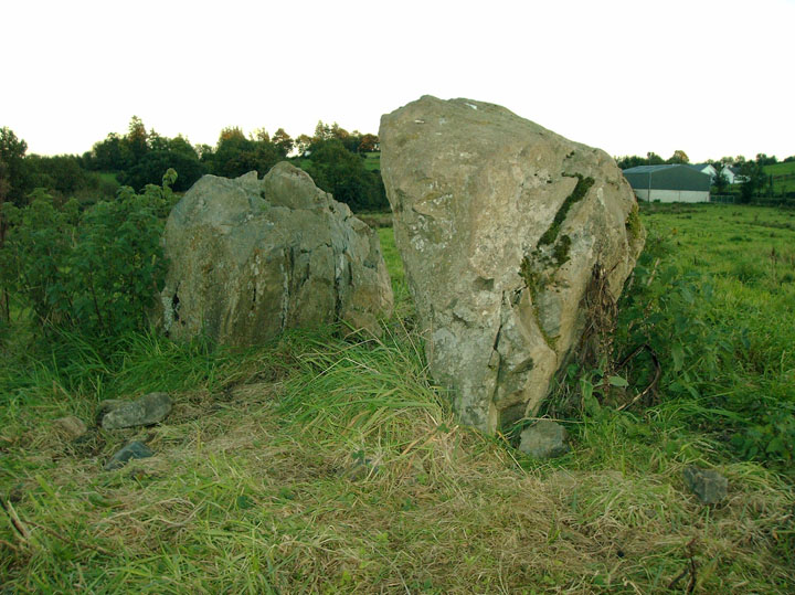
Image © Alan Lee
Nearest Town:
Carrigallen (2km NW)
OS Ref (IE):
H245014 /
Sheets: 27, 34
Latitude:
53° 57' 40.56" N
Longitude:
7° 37' 36.1" W
Added by
Alan Lee
Images (2)
0 discussions
Start a topic
Show |
Hide
Web searches for Errew
Flickr
Google
Google Images
The Megalithic Portal
Bing
Stone Pages
Wikipedia
Show map
(inline Google Map)
- Sites within 20 km -
-
Drumhart (3.44km ENE) (0 posts)
Killameen (7.2km WNW) (1 post)
Clogh (8.61km WSW) (1 post)
Mullaghboy (8.88km E) (0 posts)
Moylehid (9.43km WSW) (6 posts)
Corduff South (9.57km WSW) (2 posts)
Sunnagh More (9.9km WSW) (0 posts)
Gartnanoul (10.34km ENE) (7 posts)
Carrickclevan (11.45km E) (8 posts)
Drumroosk (11.5km E) (0 posts)
Cleenrath or Cleenrah (11.87km SSE) (21 posts)
Aghnacliff (12.81km SSE) (22 posts)
Middletown (13.2km ESE) (8 posts)
Killycatron (13.27km ESE) (0 posts)
Annaghmore (13.51km SW) (14 posts)
Drumhawnagh (13.72km ESE) (7 posts)
Kilnavert (14.04km NNW) (1 post)
Kilnavert (14.14km NNW) (5 posts)
Killycluggin (14.59km NNW) (0 posts)
Creenagh (Mohill By.) (14.73km WSW) (6 posts)
Knockmullin 2 (14.8km W) (0 posts)
Lissanover (14.82km NNW) (2 posts)
Fenagh Beg 2 (14.84km W) (4 posts)
Fenagh Beg 4 (14.84km W) (1 post)
Fenagh Beg 3 (14.84km W) (2 posts)
Fenagh Beg (14.84km W) (12 posts)
Knockmullin 1 (14.84km W) (0 posts)
Knockmullin 3 (14.89km W) (0 posts)
Lissanover (14.91km NNW) (5 posts)
Creenagh (Mohill By.) South (14.98km WSW) (0 posts)
Commons (15.13km W) (11 posts)
Fenagh (Glebe) (15.13km W) (1 post)
Dromore (15.51km WNW) (1 post)
Gartaquill (15.71km NNE) (2 posts)
Cranaghan (Slieve Russel Hotel, present location) (15.8km NNE) (9 posts)
Lettergonnell (15.86km S) (3 posts)
Melkagh (15.86km SW) (1 post)
Creevy (16.48km W) (3 posts)
Clooncoe (16.54km WSW) (0 posts)
Kiltyhugh (16.85km WNW) (1 post)
Creevy (17.05km WNW) (2 posts)
Creevy (17.25km WNW) (3 posts)
Doon (18.03km N) (6 posts)
Corn Hill (18.12km SSW) (5 posts)
Drumanny (18.48km ENE) (3 posts)
Churchfield (19.08km W) (0 posts)
Drumany (19.17km W) (4 posts)
Pollamore Near (19.23km ENE) (0 posts)
Dalystown (19.24km SE) (2 posts)
Drumany (19.48km W) (7 posts)
Cloonfinnan (19.92km WSW) (5 posts)
Rausker (19.98km N) (4 posts)
- Add -
-
Add news
Add an image
Add fieldnotes
Add folklore
Add miscellaneous
Add a link
-
Add a site
Add a nearby facility
Add an alternative name/spelling
Images
(click to view fullsize)
Add an image
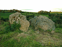 Image © Alan Lee