The Modern Antiquarian
Log in
|
Register
Home
Latest Posts
Forums
Maps
Help
Browse Sites
News
Blog
Contributors
The Books
Select
-
Belgium
Denmark
Eire
France
Germany
Greece
Italy
The Netherlands
Norway
Portugal
Republic of Malta
Spain
Sweden
Switzerland
United Kingdom
Scotland
Dumfries and Galloway
Mull of Sinniness
Standing Stone / Menhir
Mull of Sinniness (Standing Stone / Menhir) on The Modern Antiquarian, the UK & Ireland's most popular megalithic community website. 4 images, plus information on many more ancient sites nearby and across the UK & Ireland.
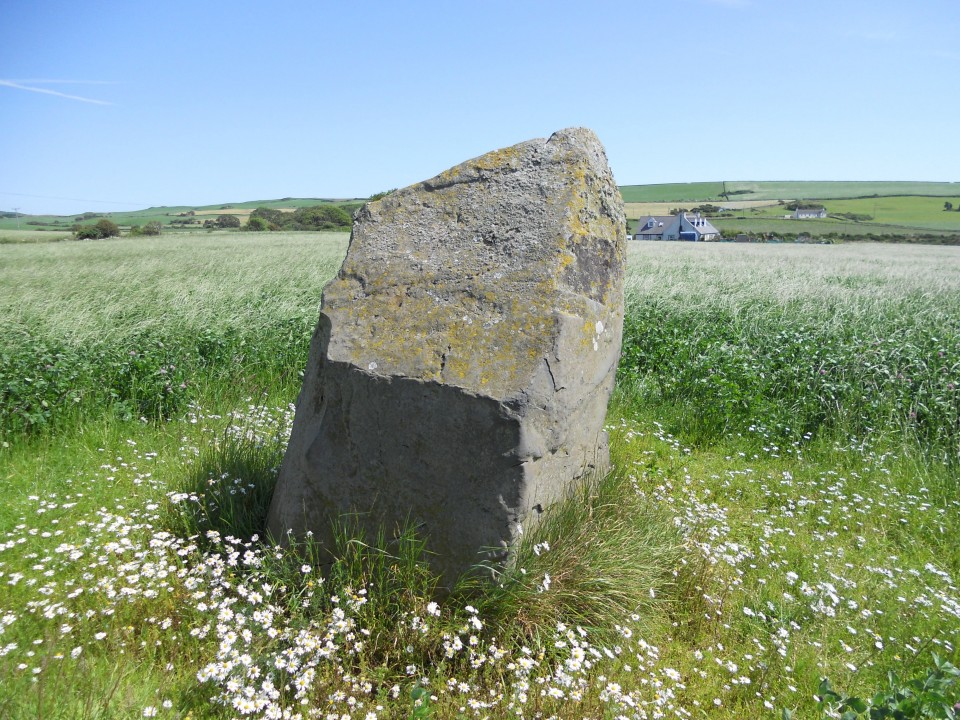
Image © Mike Purslow
Nearest Town:
Stranraer (19km WNW)
OS Ref (GB):
NX230521 /
Sheet: 82
Latitude:
54° 49' 55.89" N
Longitude:
4° 45' 22.04" W
Added by
Kozmik_Ken
Images (4)
0 discussions
Start a topic
Show |
Hide
Web searches for Mull of Sinniness
Flickr
Google
Google Images
MAGIC
The Megalithic Portal
Bing
Stone Pages
Streetmap.co.uk
Wikipedia
Show map
(inline Google Map)
- Sites within 20 km -
-
Laigh Sinniness (1.43km W) (5 posts)
Culquhasen (1.55km NNE) (10 posts)
Culquhasen (1.55km NNE) (0 posts)
Stair Haven (2.41km W) (18 posts)
High Gillespie (2.54km ENE) (11 posts)
Culroy Farm Cairn (2.76km NE) (4 posts)
Machermore (2.86km NE) (14 posts)
Whitefield Loch (2.98km N) (6 posts)
Tree Island, Whitefield Loch (3km N) (1 post)
White Cairn, Culroy (3.16km NE) (5 posts)
Barnsallie Fell (3.27km N) (8 posts)
Craignarget Hill (3.37km E) (11 posts)
Green House Bridge (3.62km E) (6 posts)
Cairn Buy (3.98km E) (7 posts)
Knock Fell (4.32km NE) (3 posts)
Chapel Finian (5.76km E) (8 posts)
Castle Loch (6.2km ENE) (16 posts)
Coffin Stone (Glenluce) (6.23km NNW) (5 posts)
Corwall S (6.5km E) (10 posts)
Corwall E (6.68km E) (9 posts)
High Moor Hut Circle (6.71km E) (9 posts)
Brae Moor (6.78km E) (7 posts)
Lang Riggs (The May) (7.02km E) (7 posts)
The May (7.1km E) (6 posts)
Brae Farm SW (7.12km E) (9 posts)
Brae Farm Central (7.14km E) (7 posts)
Court Cairn, The May (7.26km E) (6 posts)
Brae Farm NE (7.28km E) (7 posts)
Mochrum Fell (Elrig) (7.68km E) (18 posts)
St Katherine's Well (Glenluce Abbey) (7.94km WNW) (5 posts)
House of Elrig (8.45km E) (0 posts)
Ballach-a-Heathry (8.65km NNW) (5 posts)
Benlaight South (8.85km NW) (13 posts)
Camrie Fell (9.09km NW) (11 posts)
Airyolland W (9.13km E) (10 posts)
Airyolland E (9.15km E) (10 posts)
Benlaight North (9.19km NW) (8 posts)
Airyhemming E (9.29km WNW) (14 posts)
Airyhemming W (9.38km WNW) (13 posts)
Droughduil (9.44km W) (10 posts)
Dunragit (9.62km W) (1 post)
Mid Gleniron III (9.74km NW) (5 posts)
Mid Gleniron Round Cairn (9.78km NW) (7 posts)
Carlin Stone (9.81km E) (8 posts)
Mid Gleniron I and II (9.91km NW) (27 posts)
Round Dounan (10.02km W) (7 posts)
Craig Fell N (10.05km WNW) (8 posts)
Loch Head (10.06km E) (5 posts)
Elrig (10.21km E) (8 posts)
Bennen of Garvilland (10.69km NNW) (4 posts)
Cruise Back Fell (11.27km NW) (14 posts)
Littlepark (11.59km NW) (16 posts)
Cairn MacNeilie, Cruise (12.01km WNW) (12 posts)
Kilhern SE (12.16km NW) (11 posts)
Cruise W (12.31km NW) (12 posts)
Cruise E (12.32km NW) (13 posts)
Caves of Kilhern (12.69km NW) (30 posts)
Hardcroft (12.85km NW) (15 posts)
Knockcraven Wood (13.03km NW) (7 posts)
Dranigower Hut Circle E (13.09km NW) (5 posts)
Dranigower (13.11km NW) (1 post)
Dranigower Hut Circle W (13.11km NW) (7 posts)
White Cairn, Glenterrow (Destroyed) (13.15km WNW) (6 posts)
Glentirrow (13.33km WNW) (26 posts)
Fauldinchie E (13.34km NW) (6 posts)
Milton of Larg (13.35km WNW) (7 posts)
Loch Heron (13.37km NNE) (6 posts)
Fauldinchie W (13.38km NW) (10 posts)
Fauldinchie (13.39km NW) (3 posts)
Glenterrow Cairn (13.45km WNW) (6 posts)
Boreland (13.55km ENE) (4 posts)
White Cairn, Boreland (13.69km ENE) (7 posts)
Cults Loch (13.74km W) (6 posts)
Boreland (13.9km ENE) (4 posts)
Barnshangan E (14km NW) (15 posts)
Hole Stone (14.02km ENE) (13 posts)
White Cairn, Crouse (14.02km ENE) (6 posts)
Barnshangan W (14.05km NW) (6 posts)
Mains of Larg NW (14.42km NW) (19 posts)
Mains of Larg NE (14.44km NW) (17 posts)
Gowk Nest Wood (14.71km NW) (9 posts)
South Cairnwell (14.88km WSW) (6 posts)
Barhoise (14.9km NE) (9 posts)
Drumtroddan Carved Rocks (15.17km E) (48 posts)
Shennanton SE (15.17km NE) (8 posts)
Terally (15.2km SW) (10 posts)
Shennanton NW (15.2km NE) (9 posts)
Logan House Standing Stone (15.33km SW) (4 posts)
Cairn Na Gath (15.38km NNW) (11 posts)
Kirkmadrine (15.42km WSW) (3 posts)
Drumtroddan Standing Stones (15.49km E) (37 posts)
White Loch of Myrton (15.53km E) (8 posts)
Torhousekie (15.55km ENE) (8 posts)
Torhousekie Farm (15.55km ENE) (10 posts)
Galla Hill (15.56km W) (7 posts)
Culgarie (15.66km E) (12 posts)
White Cairn, High Aires (15.83km N) (5 posts)
Torhousekie Stone Row (15.83km ENE) (22 posts)
Torhousekie (15.83km ENE) (81 posts)
Cunningham (15.88km ENE) (5 posts)
Barsalloch Point (15.95km ESE) (9 posts)
Barlure (15.96km NW) (14 posts)
Auld Wife's Grave (15.98km WNW) (8 posts)
Cairn Macneilie, Inch Parks (16.37km W) (5 posts)
Lingdowey Burn S (16.5km WNW) (9 posts)
Mid Float E (16.53km WSW) (7 posts)
Fell of Barhullion (16.55km ESE) (6 posts)
The Wren's Egg & Nest (16.55km ESE) (45 posts)
Redbrae (16.56km ENE) (3 posts)
Big Balcraig (16.58km E) (7 posts)
Whirlpool (16.61km WSW) (7 posts)
Craigencroy (16.64km WSW) (8 posts)
Cairnerzean Fell S (16.7km WNW) (7 posts)
Lingdowey Burn N (16.72km WNW) (8 posts)
Blairbuy 6 (16.73km E) (9 posts)
Mid Float W (16.76km WSW) (7 posts)
Cairnerzean Fell Central (16.77km WNW) (7 posts)
Blairbuy Farm (16.77km E) (1 post)
Blairbuy Standing Stones (16.81km ESE) (10 posts)
Lingdowey Burn E (16.96km WNW) (16 posts)
Cairnerzean Fell N (16.97km WNW) (12 posts)
Blairbuy 4 (17.05km E) (5 posts)
Kenmuir Graves, Island Buoy (17.13km WSW) (2 posts)
Cairnerzean Farm SW (17.3km NW) (9 posts)
Cairnerzean Farm NE (17.31km NW) (12 posts)
Cairnerzean Fell (17.31km WNW) (2 posts)
Cairnerzean Fell Summit (17.31km WNW) (11 posts)
Altigoukie Burn Burnt Mound (17.31km NW) (5 posts)
Balker Moor S (17.33km WNW) (9 posts)
Altigoukie Burn Cairn (17.4km NW) (12 posts)
Low Curghie (17.42km SW) (8 posts)
Blairbuy 3 (17.44km E) (6 posts)
Craigbirnoch S (17.5km NW) (7 posts)
Craigbirnoch (17.5km NW) (0 posts)
Dove Cave Head (17.62km WSW) (1 post)
Cairn Wood (Barskeoch) (17.71km NE) (17 posts)
Teroy (17.71km WNW) (15 posts)
Blairbuy 1 (17.72km E) (8 posts)
Blairbuy - 10 (17.74km E) (3 posts)
Blairbuy 5 (17.81km E) (4 posts)
Cairn Hill (Barraer) (17.83km ENE) (9 posts)
Craigbirnoch Central SE (17.87km NW) (8 posts)
Doon Castle (17.88km WSW) (17 posts)
Blairbuy 2 (17.92km E) (5 posts)
Craigbirnoch Central NW (17.94km NW) (14 posts)
Kilfeddar Farm (17.97km NW) (14 posts)
Craigbirnoch NE (17.97km NW) (9 posts)
St Medana's Well (18km ESE) (5 posts)
Knock (18.01km ESE) (41 posts)
Craigbirnoch NW (18.03km NW) (9 posts)
Duniehinnie (18.09km WSW) (0 posts)
Core Hill (18.5km SW) (11 posts)
Cairn Pat (18.98km W) (28 posts)
Cairnhouse W (19.06km ENE) (7 posts)
Culnoag (19.34km E) (7 posts)
Bladnoch (19.35km ENE) (10 posts)
Laggangarn (19.48km NNW) (15 posts)
Drumacissock South (19.63km WNW) (4 posts)
Cairnhouse E (19.64km ENE) (5 posts)
Drumacissock North (19.68km WNW) (6 posts)
Beoch Hill (19.83km WNW) (5 posts)
Diddles Hill (19.85km WNW) (11 posts)
White Cairn, Beoch Hill (19.93km WNW) (6 posts)
- Add -
-
Add news
Add an image
Add fieldnotes
Add folklore
Add miscellaneous
Add a link
-
Add a site
Add a nearby facility
Add an alternative name/spelling
Images
(click to view fullsize)
Add an image
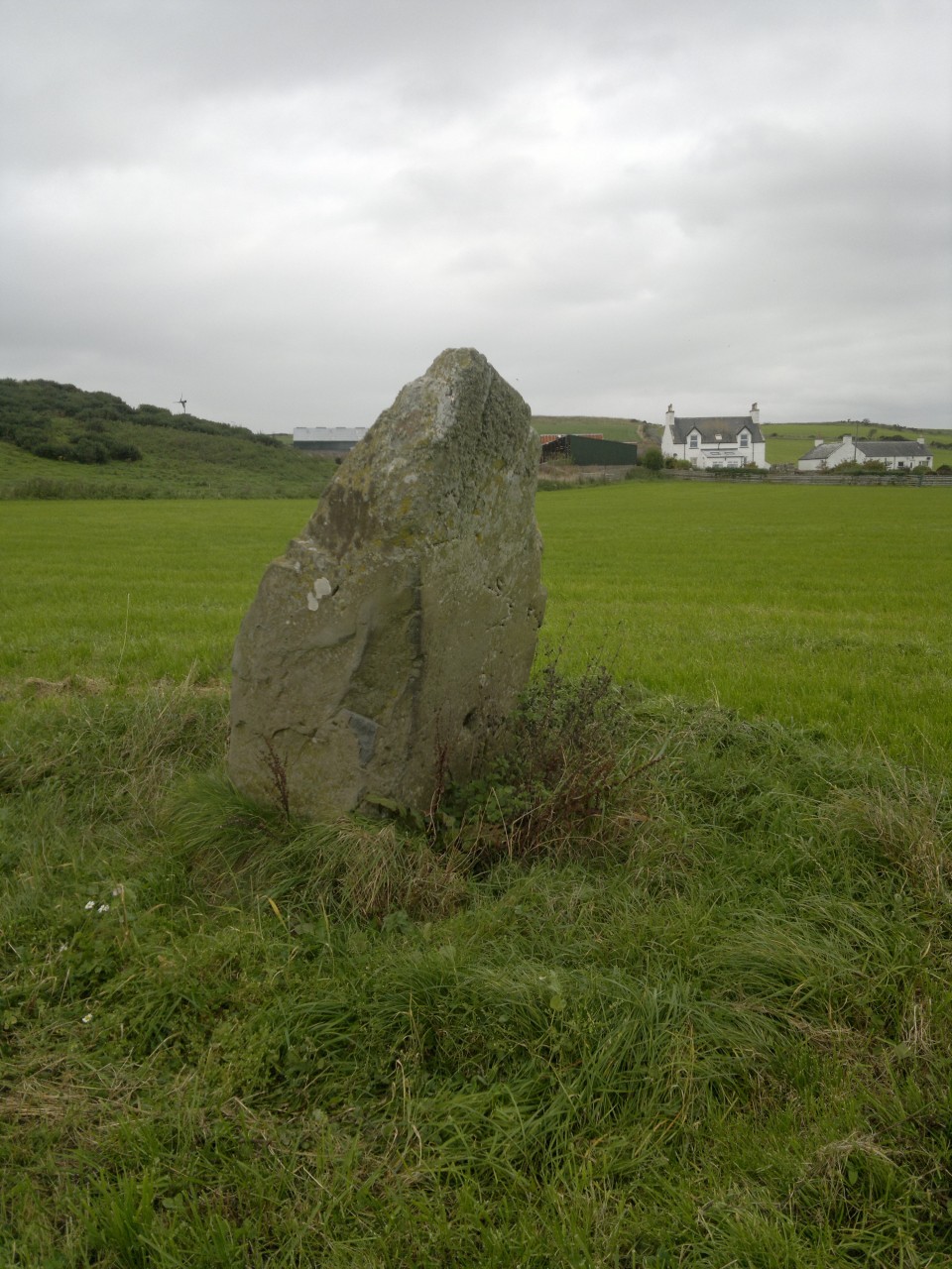
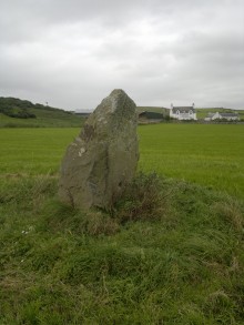 Image © Mike Purslow
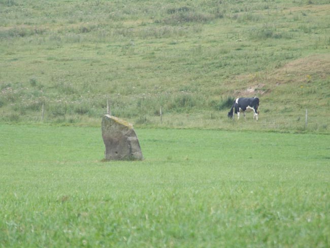