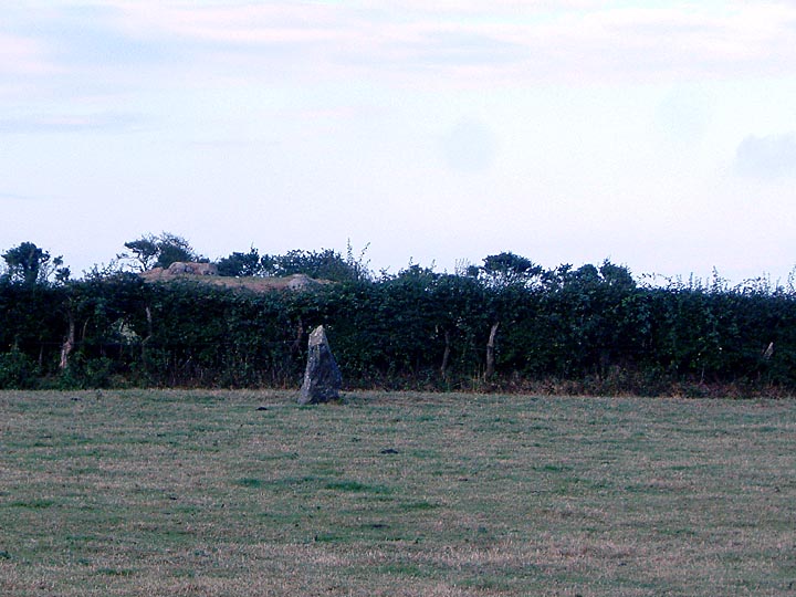
Log in
|
Register
Home
Latest Posts
Forums
Maps
Help
Browse Sites
News
Blog
Contributors
The Books
Select
-
Belgium
Denmark
Eire
France
Greece
Italy
The Netherlands
Norway
Portugal
Republic of Malta
Spain
Sweden
Switzerland
United Kingdom
Wales
Anglesey
Graiglas
Standing Stone / Menhir
Graiglas (Druid Farm) (Standing Stone / Menhir) on The Modern Antiquarian, the UK & Ireland's most popular megalithic community website. 5 images, 2 fieldnotes, plus information on many more ancient sites nearby and across the UK & Ireland.
Image © bloss
Also known as:
Druid Farm
Nearest Town:
Llangefni (4km ENE)
OS Ref (GB):
SH416751 /
Sheets: 114, 115
Latitude:
53° 14' 55.96" N
Longitude:
4° 22' 27.79" W
Added by
stubob
Images (5)
Fieldnotes (2)
0 discussions
Start a topic
Show |
Hide
Web searches for Graiglas
Flash Earth
Flickr
Google
Google Images
The Megalithic Portal
Multimap 1:25000
Stone Pages
Streetmap.co.uk
Wikipedia
Show map
(inline Google Map)
- Sites within 20 km -
-
Henblas (2.5km SE) (19 posts)
Din Dryfol (3.35km SW) (24 posts)
Llangristiolus (4.16km E) (6 posts)
Craig yr Allor (5.04km W) (1 post)
Malltraeth (5.75km S) (7 posts)
Lain Wen Farm Inscribed Stone (6.1km WSW) (6 posts)
Trefor (6.7km WNW) (0 posts)
Hirdrefaig (6.89km E) (8 posts)
Ty Newydd (7.19km WSW) (36 posts)
Bodowyr (8.25km ESE) (50 posts)
Llech Golman (8.76km NNE) (14 posts)
Presaddfed (8.99km WNW) (32 posts)
Llanddyfnan (9.12km ENE) (7 posts)
Maenaddwyn (9.29km NNE) (9 posts)
Trefwri Standing Stone (West) (9.3km ESE) (6 posts)
Bryn Gwyn (9.38km ESE) (31 posts)
Castell Bryn-Gwyn (9.41km ESE) (9 posts)
Trefwri Standing Stone (East) (9.43km ESE) (3 posts)
Traeth Fawr (9.54km SW) (12 posts)
Caer Leb (9.56km ESE) (8 posts)
Carreg Leidr (9.69km NNE) (13 posts)
Barclodiad-y-Gawres (9.72km WSW) (76 posts)
Mynydd Bach (9.72km WSW) (5 posts)
Standing Stone, near Bryn Celli Ddu (9.9km E) (12 posts)
Bryn Celli Ddu Gorsedd (10.08km E) (10 posts)
Bryn Celli Ddu (10.3km E) (118 posts)
Perthi Duon (10.46km ESE) (11 posts)
Maen Chwyf (10.51km N) (8 posts)
Llys Einion (10.78km N) (5 posts)
Maen Hir, Tregwhelydd (11.01km WNW) (4 posts)
Bedd Branwen (11.22km WNW) (11 posts)
Shop Farm (11.51km W) (5 posts)
Bod Deiniol (11.61km NW) (2 posts)
Plas Newydd Burial Chamber (11.68km E) (29 posts)
The Three Leaps (11.73km ENE) (10 posts)
Glyn (11.84km NE) (14 posts)
Pant-y-Saer (11.87km NE) (19 posts)
Plas Bodafon (11.98km NNE) (4 posts)
Bryn-yr-Hen-Bobl (11.98km E) (20 posts)
Maen Morddwyd (12.28km E) (2 posts)
Ty Mawr (12.61km E) (10 posts)
Benllech (12.76km NE) (1 post)
Pen-y-Gelli (13.51km ESE) (2 posts)
Hendrefor (13.64km ENE) (13 posts)
Plas Cadnant (13.7km E) (12 posts)
Lligwy (13.87km NE) (53 posts)
Garth Standing Stone (14.36km E) (8 posts)
Maen y Goges (14.53km NNW) (4 posts)
Llanfaethlu (14.78km WNW) (18 posts)
Maen Pres (15.11km NNW) (7 posts)
Stanley Mill (15.39km W) (7 posts)
Parys Mountain (15.4km N) (8 posts)
Cremlyn (North and South) (15.61km ENE) (12 posts)
Bwlch Farm (15.76km ENE) (6 posts)
Bangor Stone Circle (16.24km E) (4 posts)
Cilgwythwch (16.47km ESE) (11 posts)
Dinas Dinorwig (16.51km E) (6 posts)
Ty'n-llywyn Pentir (16.62km E) (10 posts)
Trefignath (16.67km W) (51 posts)
Llanfechell (17.2km NW) (7 posts)
Ty Mawr (17.24km W) (13 posts)
Pen-yr-Orsedd (South) (17.28km NW) (7 posts)
Mein Hirion (17.37km NW) (32 posts)
Pen-yr-Orsedd (North) (17.59km NW) (6 posts)
Foel Fawr (17.77km NW) (8 posts)
Werthyr (17.78km NNW) (7 posts)
Bwrdd Arthur (17.98km ENE) (8 posts)
Llandegai Cursus (18.2km E) (5 posts)
Hafodlas Cairn Circle (18.28km ESE) (5 posts)
Parciau Gleison (18.62km ESE) (6 posts)
Carnedd Howell (18.66km E) (1 post)
Porth Dafarch (18.81km W) (7 posts)
Dinas Dinlle (18.89km SSE) (17 posts)
Pen-y-Bwlch (19.18km ESE) (3 posts)
Caer Pencraig (Ty'n y Caeau) (19.28km E) (7 posts)
Coed y Brain (19.47km SE) (4 posts)
Penrhosfeilw (19.7km W) (34 posts)
Bodfan Menhir (19.86km SSE) (12 posts)
- Facilities within 20 km -
-
Oriel Ynys Môn (Museum: 4.5 km ENE)
Cwningar (Holiday Cottage: 9.4 km SW)
Gwynedd Sites and Monu... (Library: 16.9 km E)
Pizzeria La Gondola (Restaurant: 18.5 km WNW)
- Add -
-
Add news
Add an image
Add fieldnotes
Add folklore
Add miscellaneous
Add a link
-
Add a site
Add a nearby facility
Add an alternative name/spelling
Images
(click to view fullsize)
Add an image
Fieldnotes
Add fieldnotes
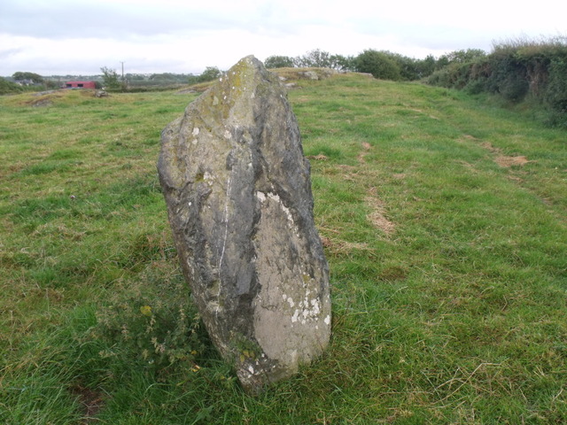
On the A5 between Llangefni and Mona.
Just opposite the entrance to the industrial estate the stone can be seen from the road but it is easy to get into the field.
I couldn't help but notice the rocky outccrop close by in the field.
Comments (3)
|
Add a comment
|
Permalink
Posted by
blossom
7th August 2011ce
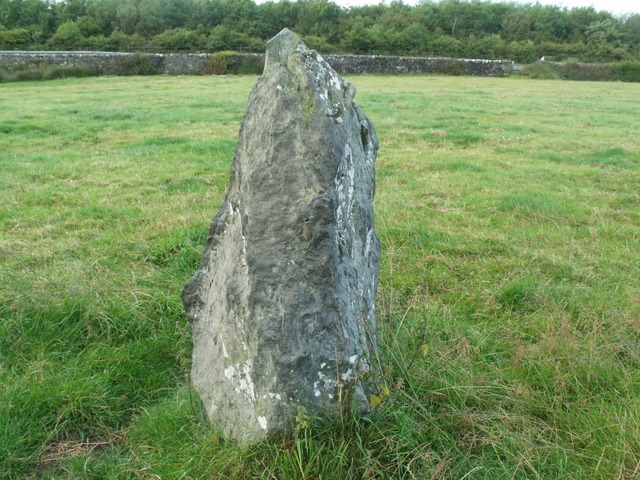
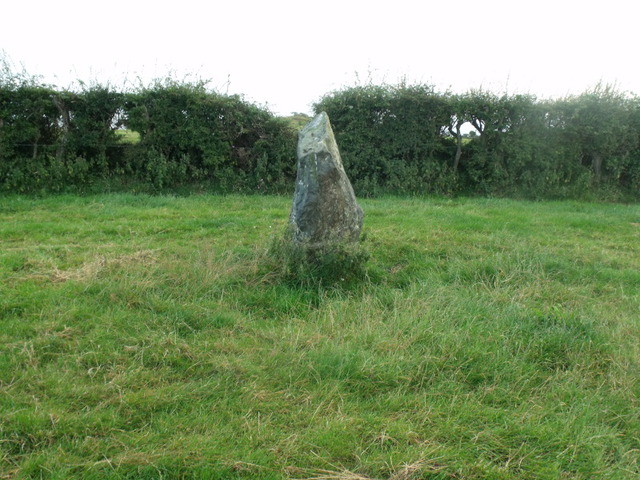
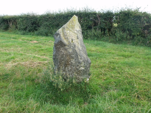
Standing a little over 1m in height this stone isn't as impressive as the majority of others found on Anglesey, but is easy to find standing by the A5 near the showground.
Comments (0)
|
Add a comment
|
Permalink
Posted by
stubob
11th August 2006ce