The Modern Antiquarian
Log in
|
Register
Home
Latest Posts
Forums
Maps
Help
Browse Sites
News
Blog
Contributors
The Books
Select
-
Belgium
Denmark
Eire
France
Germany
Greece
Italy
The Netherlands
Norway
Portugal
Republic of Malta
Spain
Sweden
Switzerland
United Kingdom
County Carlow
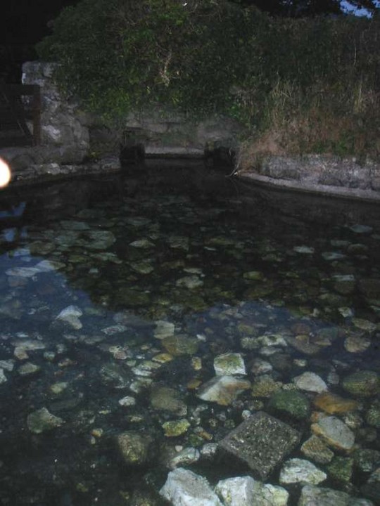
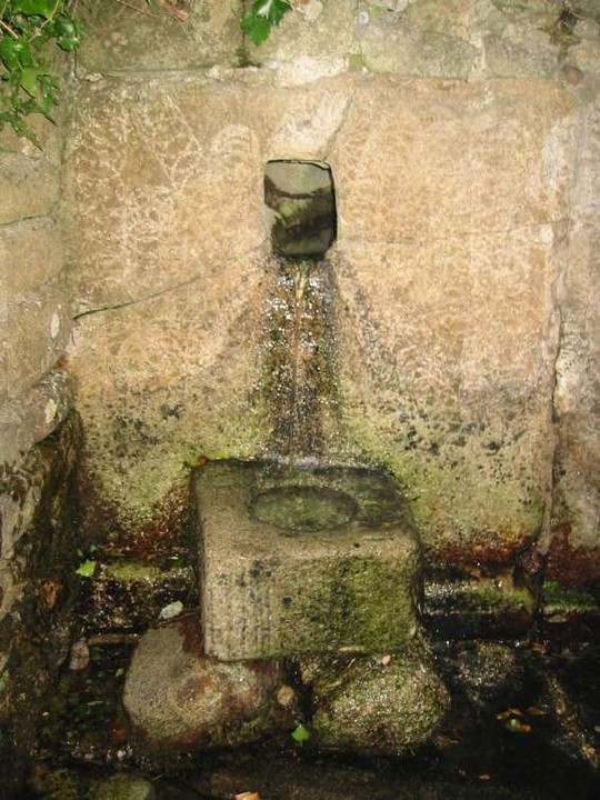
St Mullin's Well
Sacred Well
St Mullin's Well (Sacred Well) on The Modern Antiquarian, the UK & Ireland's most popular megalithic community website. 2 images, plus information on many more ancient sites nearby and across the UK & Ireland.
Image © ryaner
This site is of disputed antiquity. If you have any information that could help clarify this site's authenticity, please post below or
leave a post in the forum
.
Nearest Town:
Graiguenananagh (6km NNW)
OS Ref (IE):
S728382 /
Sheet: 68
Latitude:
52° 29' 25.65" N
Longitude:
6° 55' 41.19" W
Added by
ryaner
Images (2)
0 discussions
Start a topic
Show |
Hide
Web searches for St Mullin's Well
Flickr
Google
Google Images
The Megalithic Portal
Bing
Stone Pages
Wikipedia
Show map
(inline Google Map)
- Sites within 20 km -
-
Dranagh (now in St. Mullins) (0.25km SE) (6 posts)
Ballinvarry Irish (2.03km WSW) (1 post)
Dranagh Standing Stone 2 (2.51km ENE) (4 posts)
Dranagh (2.79km ENE) (2 posts)
Dranagh (3.69km ENE) (2 posts)
Cullaun (3.76km WSW) (0 posts)
Brandon Hill (3.82km W) (0 posts)
Curraun (4.18km ESE) (2 posts)
Carriglead (4.3km N) (0 posts)
Dranagh Cairn(s) (4.3km ENE) (2 posts)
Brandon Hill (5.88km NW) (2 posts)
Aghnaglear (6.37km ENE) (3 posts)
Newtown (6.69km NNE) (2 posts)
Gowlin (6.85km NE) (0 posts)
Tinncarrig (9.28km NNE) (5 posts)
Commons or Newtown (10.01km SE) (4 posts)
Ullard (10.09km NNW) (5 posts)
Lacken (10.1km SE) (0 posts)
Irishtown (10.29km S) (3 posts)
Kyle (10.66km NNE) (0 posts)
Kilmissan (10.82km NE) (0 posts)
Rathgeran Upper (11.08km NE) (3 posts)
Glencloghlea (11.18km SSW) (6 posts)
Rathgeran Hill (11.3km NE) (8 posts)
Kilmissan (11.41km NE) (0 posts)
Rathgeran (11.47km NE) (7 posts)
Rathgeran (11.72km NE) (4 posts)
Ryleen (11.89km SSE) (0 posts)
Knockmore (12.05km NNE) (2 posts)
Robinstown Great (12.21km ESE) (11 posts)
Shanbogh (12.26km SSW) (1 post)
Knockroe (13.85km NE) (6 posts)
Spahill (13.98km N) (2 posts)
Ballinasilloge (14.18km N) (11 posts)
Knockroe (14.8km NE) (9 posts)
Ballyellin and Tomdarragh (14.92km NNW) (3 posts)
Smithstown (15.52km SW) (1 post)
Tomdarrach (15.61km NNW) (2 posts)
Crannagh (15.66km NE) (3 posts)
Crannagh (15.68km NNE) (0 posts)
Knockscur (15.94km NNE) (0 posts)
Killoughternane/Knockscur (15.98km NNE) (4 posts)
Killoughternane (15.98km NNE) (0 posts)
The Three Friars (16.19km SW) (3 posts)
Carrickbyrne Hill (16.72km ESE) (0 posts)
Kilgraney (17.17km NNW) (11 posts)
Ballylowra (17.24km WSW) (4 posts)
Raheevarren (17.63km ESE) (0 posts)
Ballinkillin (17.87km N) (3 posts)
Ballinkillin (17.98km NNW) (0 posts)
Whitechurch (18.26km S) (0 posts)
Slievebawn (18.31km NNE) (5 posts)
Mount Leinster (18.35km NNE) (5 posts)
Ballyvaheen (18.47km WSW) (2 posts)
The Nine Stones (18.62km NNE) (4 posts)
Kilcruit (18.87km NNW) (2 posts)
Ballyvaheen Tomb (18.89km SW) (0 posts)
Rochestown (19.31km SSW) (0 posts)
Ballyfarnoge (19.43km S) (0 posts)
Newbaun (19.48km SE) (0 posts)
- Add -
-
Add news
Add an image
Add fieldnotes
Add folklore
Add miscellaneous
Add a link
-
Add a site
Add a nearby facility
Add an alternative name/spelling
Images
(click to view fullsize)
Add an image