The Modern Antiquarian. Ancient Sites, Stone Circles, Neolithic Monuments, Ancient Monuments, Prehistoric Sites, Megalithic Mysteries

England   Northern England   Durham and Northumbria   Northumberland  

Haughton Common

Stone Circle

<b>Haughton Common</b>Posted by HobImage © IH
Also known as:
  • King's Crags stone circle
  • Simonburn Common

Nearest Town:Hexham (15km ESE)
OS Ref (GB):   NY803712 / Sheets: 86, 87
Latitude:55° 2' 5.07" N
Longitude:   2° 18' 29.74" W

Added by NorthumbrianDawn


Discussion Topics0 discussions
Start a topic


Show map   (inline Google Map)

Sites in this group:

5 posts
Davy's Lee Cup Marked Stone
8 posts
Kingscrag Gate Cairn(s)
2 posts
King Wanless Green Cist

Images (click to view fullsize)

Add an image Add an image
<b>Haughton Common</b>Posted by bladup <b>Haughton Common</b>Posted by bladup <b>Haughton Common</b>Posted by Hob <b>Haughton Common</b>Posted by Hob <b>Haughton Common</b>Posted by Hob <b>Haughton Common</b>Posted by Hob <b>Haughton Common</b>Posted by Hob <b>Haughton Common</b>Posted by Hob <b>Haughton Common</b>Posted by Hob <b>Haughton Common</b>Posted by Hob

Fieldnotes

Add fieldnotes Add fieldnotes
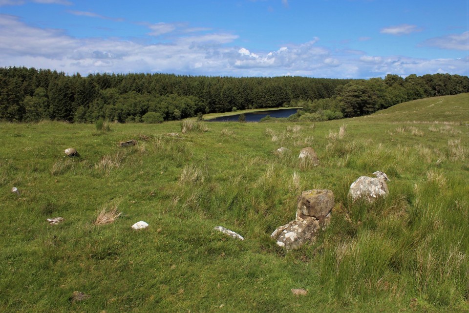
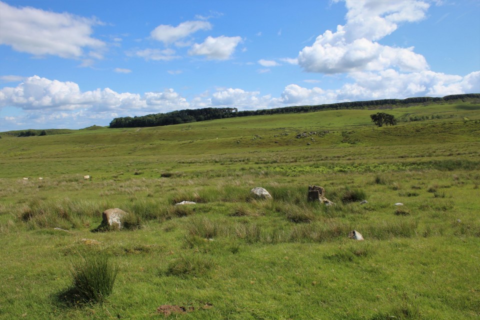
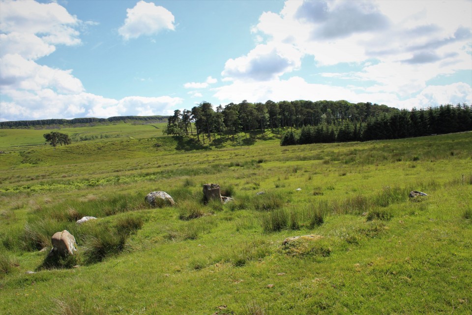
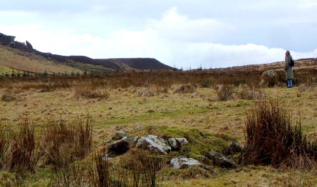
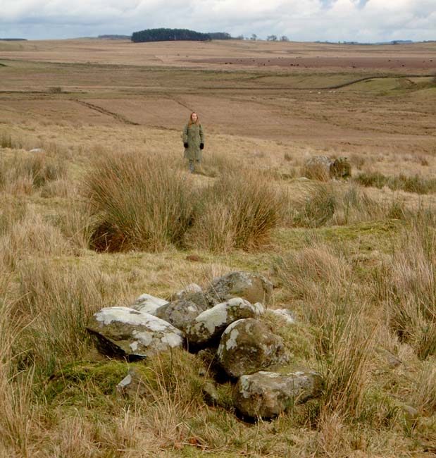
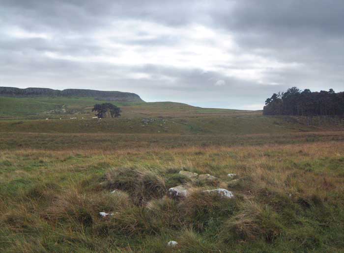
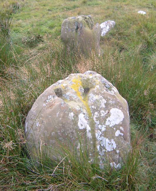
A visit when the grass was lower turned up a couple of little rectangular cairns, one either side of the circle, each about 20m on a vague SW-NE alignment.

Closer inspection of the notches Bluegloves refers to in the notes accompanying one of his pics, shows that rather than being artificially scooped, they seem artificially filled in. Romans probably, as that wall runs over them. But it made me think that before they were filled in, they would have been a lot more conspicuous, and may well have had something to do with the strange placement of this little circle. Gwenhyfar's chair probably had something to do with it too.
Hob Posted by Hob
11th February 2005ce
Edited 15th March 2005ce

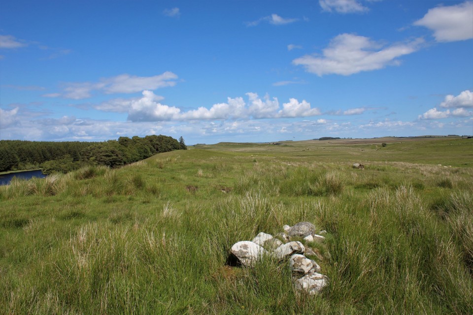
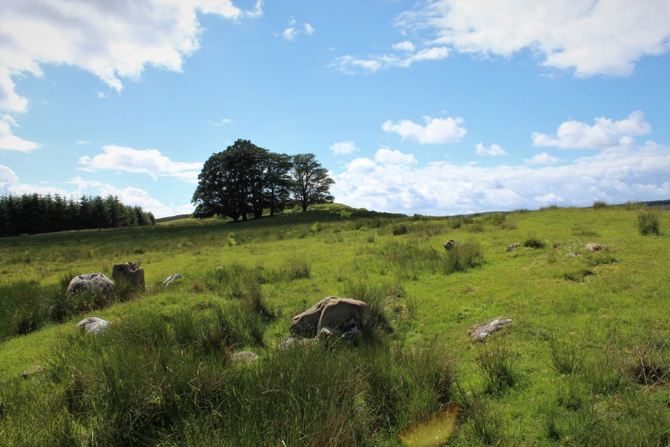
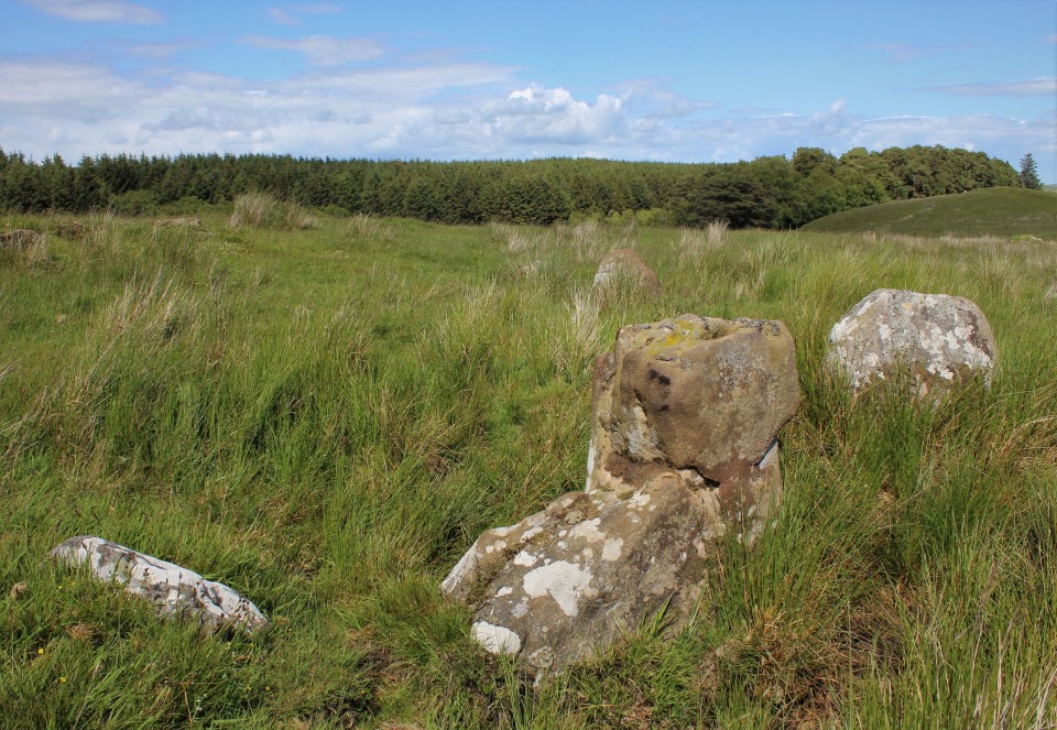
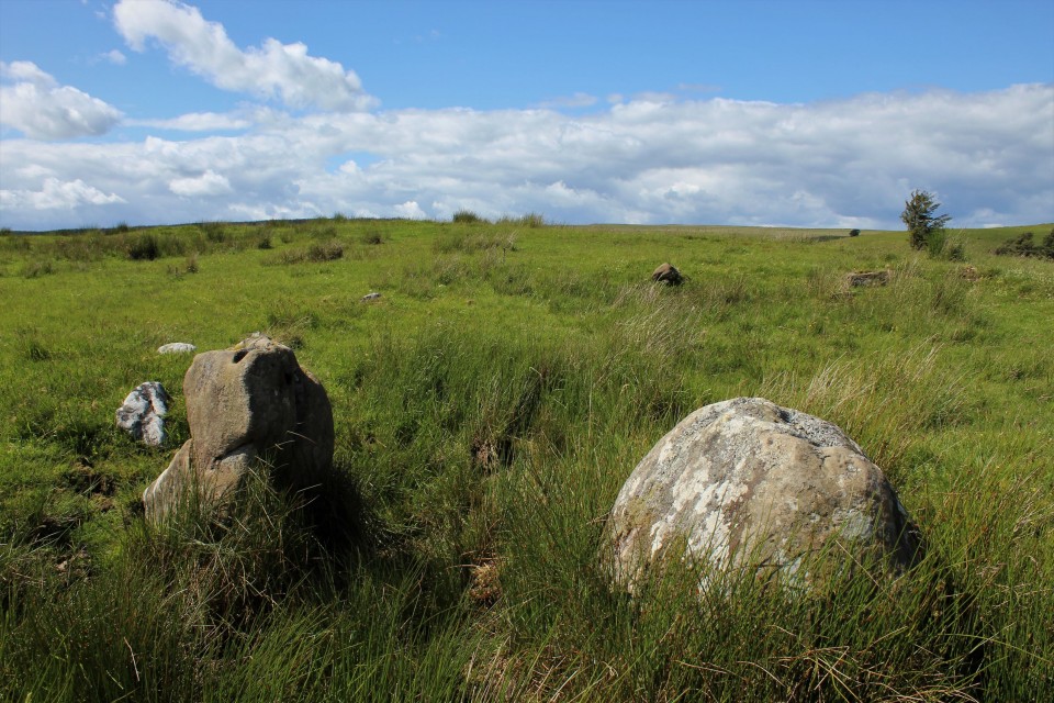
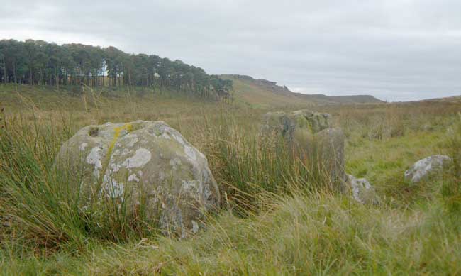
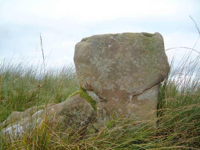
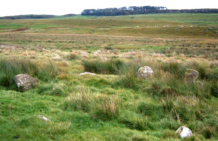
I could waffle on about this place for hours, but a large part of that waffle would involve the setting of the circle rather than the stones themselves. It's such a fantastic landscape with the cuestas of the Whin Sill doing their thing.

It's very like it's companion at Greenlee Lough in terms of the size of the circle and he stones which comprise it. None are large, but one in particular is an odd 'L' shape. The thing that struck me the most was the fact that it's on a fairly pronounced slope, with the stones at the top being smaller, so that the overall effect is to make the tops of each stone roughly level.

I also entertain a suspicion that both this and Greenlee are some how connected with the highly conspicuous outcrop of Queens Crags, which at Greenlee I'd mistaken as Sewingshiels.

Parking on the military rd can be easily missed, though Sewingshiels is closest, it's worth the walk from dreary old housesteads so-called fort. This takes you over some great crags and affords very good views of the snazzy landscape.

Either way, access is not easy, though easier from the track heading for Old Stell Green from Sewingshiels. Decent shoes essential, quads being the only wheeled things that are going to get here easily.
Hob Posted by Hob
2nd November 2004ce
Edited 2nd November 2004ce

This is the sweetest little stone circle i have ever met. Look on a good map at the two fish shaped lakes, or loughs as we call them, northeast of Housesteads. Near the western lough is the circle. It's on Haughton Common, which sounds like Hutton , my name, and the name of many small settlements in Cumbria and the borders. As you approach from crossing the wall west of Housesteads, and heading north, you will know the path when you cross it. The path takes you East through a cut in the Crags, Kings Crag and Queens Crag, linked by local legend to Arthur. You can see Sewingshields Crag (the site of Sewingshields Castle) where Camelot is said have been. There is a hidden cave here where a local farmer once found Arthur’s Knights frozen in sleep waiting for a horn to sound, summoning them to save britain (small B).

The circle seems to rise from the ground as you stumble on it. The last time I went I found a sheep horn in the centre. Its a lovely spot and you can see the Wall from most of the walk. I don't think there is a right of way, but who's counting?
Posted by NorthumbrianDawn
3rd January 2002ce

Links

Add a link Add a link

Archive.org


Lots of folklore (including the Arthurian) connected with Sewingshields, as collected by Michael Denham in his 'Tracts'.
Rhiannon Posted by Rhiannon
31st January 2010ce
Edited 31st January 2010ce

Sewingshields Crags


Short account of the Arthurian connection, with reference to Cummings Cross.

I can't help think the tale of the warrior in the hollow hill may be an echo of the person in centuries past, who discovered the burial cist on Haughton Common.
Hob Posted by Hob
12th July 2004ce

Latest posts for Haughton Common

Showing 1-10 of 15 posts. Most recent first | Next 10

Kingscrag Gate (Cairn(s)) — Folklore

[A] local tradition of King Arthur is told by Dr. Bruce: "To the north of Sewingshields, two strata of sandstone crop out to the day; the highest points of each ledge are called the King and Queen's Crag, from the following legend. King Arthur, seated on the furthest rock, was talking with his queen, who, meanwhile, was engaged in arranging her 'back hair.' Some expression of the queen's having offended his majesty, he seized a rock which lay near him, and with an exertion of strength for which the Picts were proverbial, threw it at her, a distance of about a quarter of a mile! The queen with great dexterity caught it upon her comb, and thus warded off the blow; the stone fell between them, where it lies to this very day, with the marks of the comb upon it, to attest the truth of the story. It probably weighs about twenty tons."
One would imagine the comb marks are those clearly seen at the top of the massive stone in Hob's photo.

From the Denham Tract called 'Border Sketches of Folklore' - you may read the rest at
http://www.lib.rochester.edu/camelot/denhamtracts.htm
Rhiannon Posted by Rhiannon
9th June 2009ce

Davy's Lee (Cup Marked Stone) — Images (click to view fullsize)

<b>Davy's Lee</b>Posted by Hob<b>Davy's Lee</b>Posted by Hob<b>Davy's Lee</b>Posted by Hob<b>Davy's Lee</b>Posted by Hob Hob Posted by Hob
21st March 2007ce

Davy's Lee (Cup Marked Stone) — Fieldnotes

Notes originally posted in 2004, then reposted after site was taken from TMA by he who did originally post it's presence, then edited after a 3rd revisit on Nov 02 2007, this time with a bunch of veteran D&NRAPers. What a faff.

Despite what I've written below, closer inspection showed that this does look like outcrop.

There are also signs of quarrying, though by whom, who knows. it may have even been those pesky romans, who went around snaffling other people's sandstone for their gaudy Mithraic temples etc.

Irregardless of who did the quarrying, it is interesting to wonder why they stopped before they'd broken up the whole bit of outcrop.

Imagination, given a bit of free-rein, suggests that this may have been because the 'significant' nature of the cupmarks was recognised, as is seen on many other marked outcrops in the county.

or, it may have been a deliberate act of desecration, with the remaining few cups being left as a reminder of what had been done. In which case, perhaps the original outcrop was much larger, maybe with more, wonderfully complex motifs (as opposed to a handful of fairly ropey cups...).

This speculation in turn leads to the idea that it may have been a case of prehistoric reverence, that a part of the marked stone was taken to serve as part of one of the many cairns in the area, or maybe even one of the cists, as is also seen with marked rocks elsewhere in Northumberland.

But, when it comes down to it, it's more than likely that the stone was quarried to provide material for the nearby limekilns. Why did the quarrying stop before the whole stone was removed? Well, if I were some 18th/19thC dude repairing what was possibly an old roman limekiln, I'd only quarry as much as I needed, no more. What's the point of going through the effort of breaking and transporting stones you don't need?


Possibly the same cup-marked stone originally added to the county SMR by a keen cup-spotter, but then largely overlooked (like most of the prehistoric remains close to Hadrian's Wall), this erratic boulder is fairly conspicuous, it's the only one in the enclosed field, more or less in the middle of what is marked on the OS map as 'Davy's Lee'. I'm not sure if it's the thing recorded on the Beckensall Archive, as that had a grid ref which placed it in a nearby stream, and was listed as being on outcrop. There's no outcrop in the stream and there's more than the 6 cups related on both the Archive and on the Northumberland county SMR, so ambiguity prevails.

It has natural grooves, which seem to have deermined the placement of the cups to some degree, as they are in groups, each group in an a part of the surface defined by the grooves.

The enclosed field in which the stone sits is interesting in it's own right, as the boundary is a low earthen bank, containing what looks like cord rig. The banks are more pronounced at the NW corner, where a ditch is also in evidence, possibly part of a settlement?

Like most of the pre-roman remains in the vicinity, I'd argue this stone may have some connection with the stupendous stone at Queen's crags.

Access:
Ask permission at the gatehouse, or at Sewingshields Farm. Rough, boggy terrain unsuitable for wheelchairs.
Hob Posted by Hob
21st March 2007ce

Kingscrag Gate (Cairn(s)) — Images

<b>Kingscrag Gate</b>Posted by Hob<b>Kingscrag Gate</b>Posted by Hob<b>Kingscrag Gate</b>Posted by Hob<b>Kingscrag Gate</b>Posted by Hob Hob Posted by Hob
15th March 2005ce
Showing 1-10 of 15 posts. Most recent first | Next 10