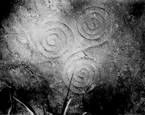
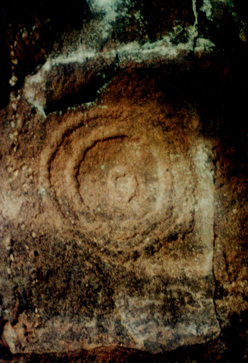
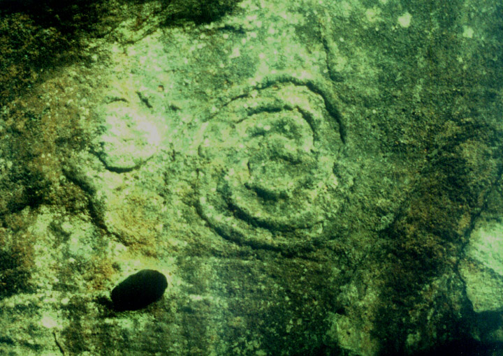
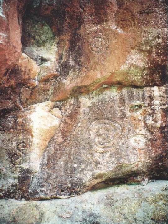
Well-preserved series of carvings on the vertical faces of a shallow recess on a rock ledge above the River Esk. Circles, spirals, triangles, an S-motif, a shield and other geometric marks and grooves are incised on the rock. The site is difficult to access and potentially dangerous to visit.
Hawthornden Cliff Carvings (AKA Gorton House)
Monday 24/12/01
'Inaccessible rock ledge…situated in a precipitous cliff.'
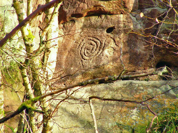
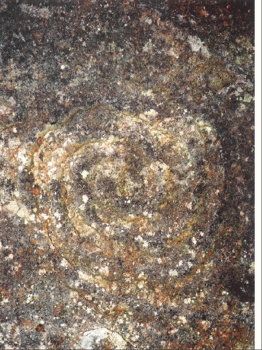
I managed to scramble down the banking to the rivers edge opposite these cliffs as an OS report from 1954 said these carvings could clearly be seen from the opposite banking- however, this report is contradicted by a more recent one from 1975 saying that the site could no longer be located. I stood and stared for an age at the massive cliffs over the river from me scanning their couple-of-hundred-foot towering mass up and down and from left to right. I peered intently at the large vertical slabs where I would have expected something to have been, but nothing. There was, however, many areas covered by vegetation and I was about to admit defeat and say that this site has now been covered by plants when, just through the trees I saw it- a single spiral. It was on a rock face in a small recess about 30 or 40 foot up the cliffs above the river. That was it- I simply had to see them and touch them. Unfortunately the carvings were across the other side of the river and straight up a very steep and muddy banking and cliff face. There was only one thing to do and I did not think twice- I was entranced by the sight of that single spiral. I grabbed a huge stick from the banking and waded into the river, the cold water filling my boots immediately and freezing my feet. Actually, it wasn't that cold considering it was the end of December- I've been in colder water (like surfing in the North Sea in April- brrr!). As it turned out (luckily) the River North Esk was only about knee deep. That was the least of my problems. I still had to get up about 30 or 40 foot of mud, cliff and trees. I tried working out a route, but had to return to my original crossing point as I came across a vertical rock wall with no holds. I started off up the mud and used the trees to swing horizontally above the river on my way up n up n up! I slid, I climbed and I scrambled and I bloody well made it- hahahahahahaha! And I was completely blown away. I expected a couple of carvings, including my enchanting spiral, but not the sight that greeted me. The overhanging vegetation, the red rock cliffs and these carvings- for all intents it looked like a forgotten Australian aboriginal sacred rock. Except here I was at this sacred and once lost Scottish aboriginal site. There were spirals, triangles, double S shaped spirals, notches and these circles all over- just plain circles. Not only these but an amazing fish type symbol- it looked like a horizontal Einsturzende Neubauten symbol. I've seen a fair amount of rock carvings on my travels, but this place, no- something very different about this place- it felt more primitive. The only similar spiral I've ever seen was at the Templewood circle. I was shaking- partly from exhilaration as I had just waded a river and climbed up here (and I'm not that keen on heights) but mostly I was extremely energised- I had made it here and it felt as though I was the first person to see these symbols for many, many years. I fired off about ten pics, but I was shaking so much I doubt if any of them will actually turn out okay. I eventually scrambled and slid back down to the river almost coming a cropper on a couple of occasions. I waded back across the river and back up to the main path. I was totally soaked, freezing and covered in mud. But most of all I was completely bedazzled. This precipice, high above the River North Esk is an extremely powerful, sacred and magickal site, made even more so due to its inaccessible and hidden nature. This site crackles and buzzes with energy.
Directions
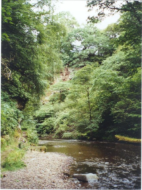
Firstly- this site is *extremely* difficult to find and reach. Sometimes I turn into a complete idiot with no sense of fear, especially when it comes to exploring places like these (although I always retain my sense of respect). I could easily have been swept away in the river, fallen from the cliff (almost did) etc. Just cos I write about this site doesn't mean I'm recommending an actual visit. Follow the A701 south out of Edinburgh. Pass Ikea on the right and head through Bilston. At the roundabout in Bilston take a left through Roslin. Go down the main street which turns sharp right and look out for the Roslin Glen signs before the main road turns right again. Down this steep road and park in the designated car park at approximately NT272628. Take the path across the river, under the castle drawbridge (see Roslin Glen Folklore) and follow it northeast along by the river. Paths lead off uphill, but stick by the river- pass Lovers Leap on the way along the path (see Roslin Glen Fish Carving). Continue along the path next to the cliffs above the river. The path descends down to the level of the river and in places is carved from the cliffs and takes the traveller along the river bed- it's obviously only passable during periods of low rain/snow fall. Keep an eye out for Wallace's Cave high above the river on the opposite side- the carvings are approximately 30 metres further round from the cave (north) and about 8 metres below it. Best to view from the other banking in the Winter with a pair of binoculars!
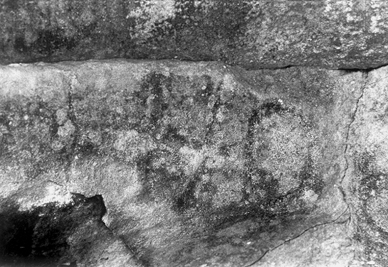
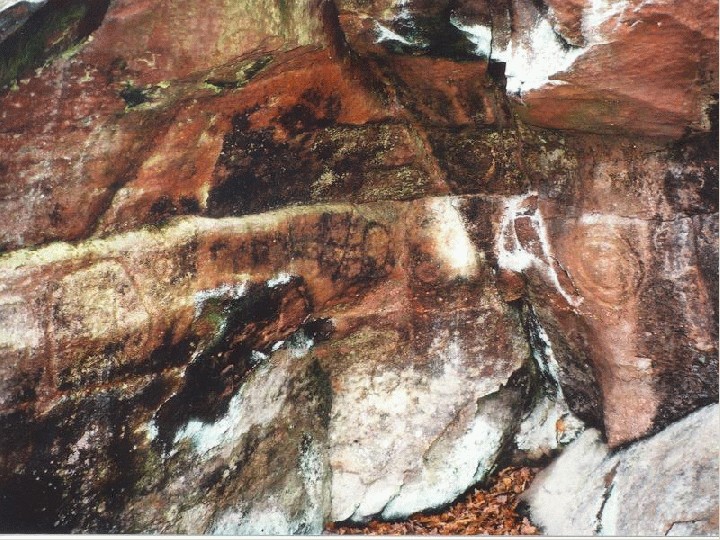
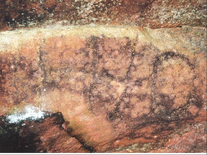
The image above by Luke Oldale/countryboy is the alleged Fish Face of Lover's Leap - see the Roslin Glen carvings site nearby for discussion.
However, I have posted an image of one of the Hawthornden cliff carvings which I believe to be the actual Fish carving.
It's just a shame that it wasn't a vesica piscis - that would have been cool because we could have said it was by the Chapel masons or the Templars. ;¬}
I had no idea these carvings even existed until now and I've been "haunting" Roslin Glen on-and-off for over 30 years! There is at least one other carving on the opposite bank of the river.
Follow the path upstream from the part opposite Wallace's Cave and eventually, right by the path and just 18 -24 inches above the ground, there's a distict FACE carved in the rock. You can see the head shape and two very round eyes, but the bottom of the face is missing. Does anbyone know anything about this?
Also, continuing upstream to the waterfalls below Roslin Castle, there are holes carved downwards into some of the rocks as though to accommodate the uprights of a wooden bridge. On the rocks closest to the castle, however, there are sloping (near horizontal) sections carved out as though to support roof beams (?) for some kind of shelter. Anyone got any ideas about them?
UPDATE! I was speaking to someone the other day who visited this site. Turns out it isn't as obscure and difficult to reach as I thought. They have spent Midsummers night at Wallaces Cave and there's apparently a very steep path from the cave heading right to the carvings. I'll try this the next time- no more wading through rivers and scrambling up through mud ;)
The RCAHMS entry states that this site is 'a most unusual and well-preserved series of carvings occur on the vertical faces of a shallow recess on an almost inaccessible rock ledge above the River Esk. Circles, spirals, triangles, an S-motif, a shield and other geometric marks and grooves are incised on the rock. These figures are quite unlike the more normal Bronze Age markings, and may be of a different date.' The entry then goes on to state that an OS visit of 1954 discovered that it was not possible to examine the symbols closely due to being sited in a precipitous cliff. Then in 1975, the OS were unable to even locate the site.