What a rare pleasure it was to visit some stones and not find cattle in the field. Yes, there's a little bit of erosion round their bases, but they look set for another thousand years, easy. I spent some time circling round them, photographing, using them to frame the Wrens Egg and Nest, basking in the autumn sunshine in the field downhill and over the road. I walked from Monreith over the fields to get to these and the latter, on the way encountering an elderly lady and helping her with a troublesome gate. We had a good chat as we walked slowly, and I asked her if she thought the farmer would mind me visiting the sites on thier land. Oh no, it would be fine. She carried on when I stopped to photograph...and then went into the farmhouse. No problems here. Enjoy. What I do regret is not visiting the nearby Fell of Barhullion, which lowered over the far side of loch. The Wren had blue sky, the Fell a backcloth of dark cloud. A leg injury while broching meant I had to ration my walking somewhat. The Fell, capped with dark vegetation, I assume gorse, looks a place with presence. Next time. Ditto all the cup and ring marked rocks. There's scope for a daysworth of exploring within a small radius of Monreith. Not as big a hotspot of sites as, say, Kilmartin, but, nonetheless, lots to see. All that I went to I want to revisit.. lots to absorb too. Why Galloway and the Machars seem to be so little visited, both by contributors to TMA and generally, is a mystery. I'm hooked.
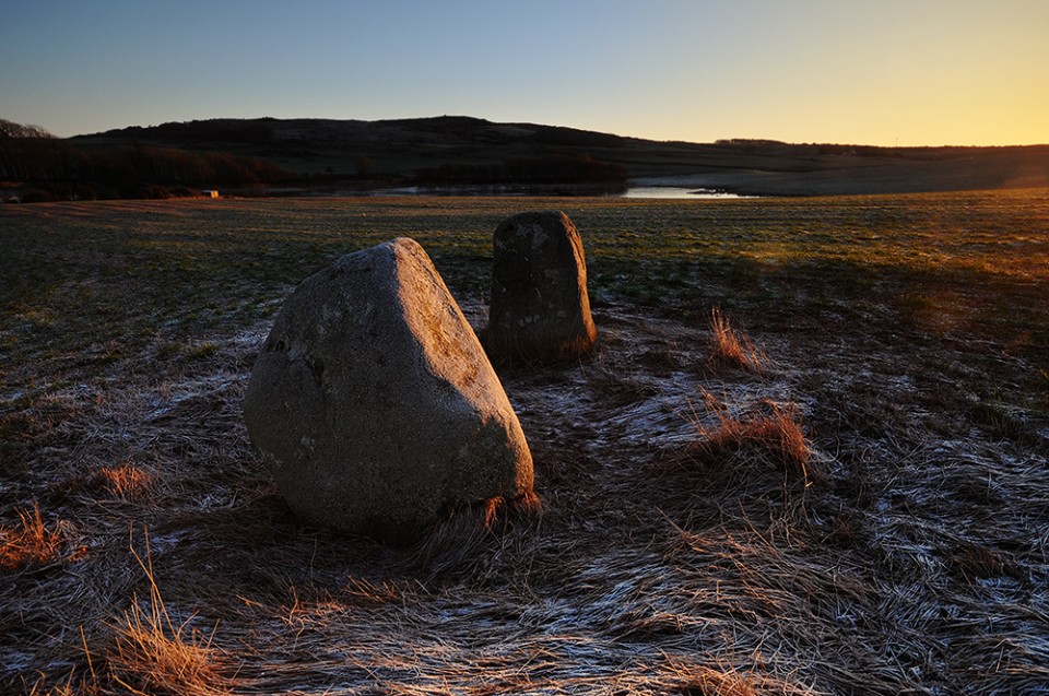
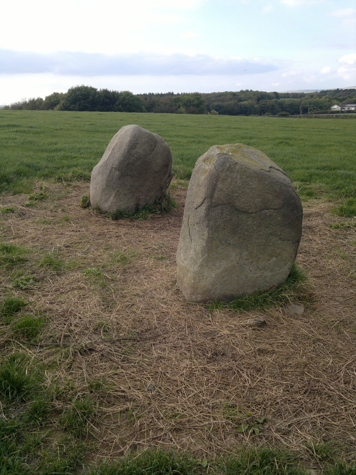
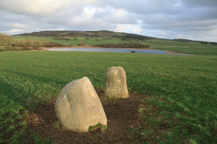
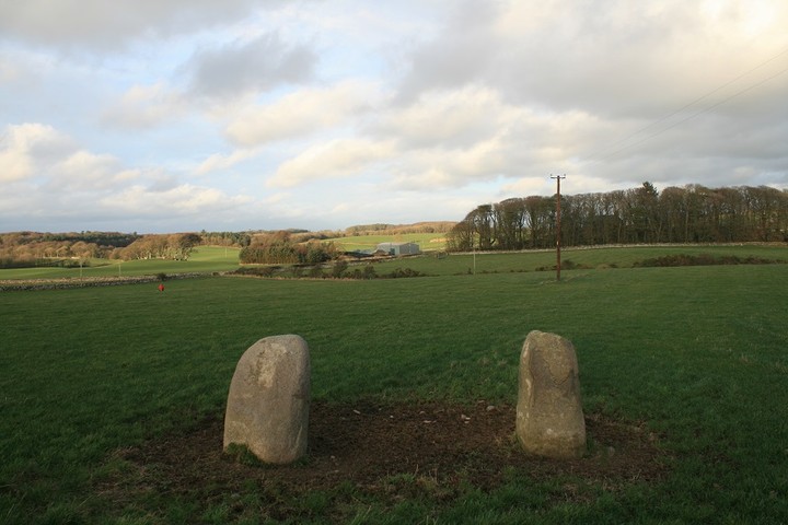
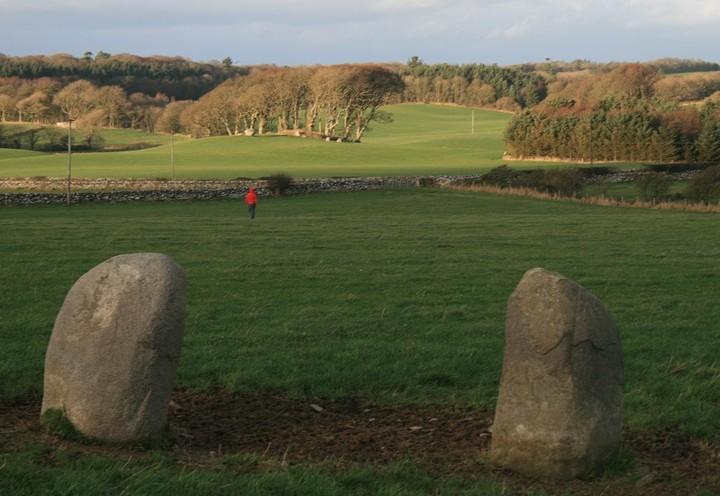
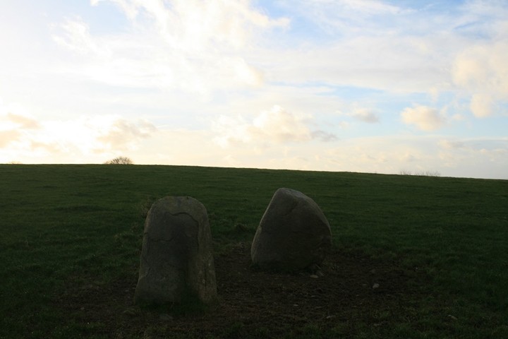
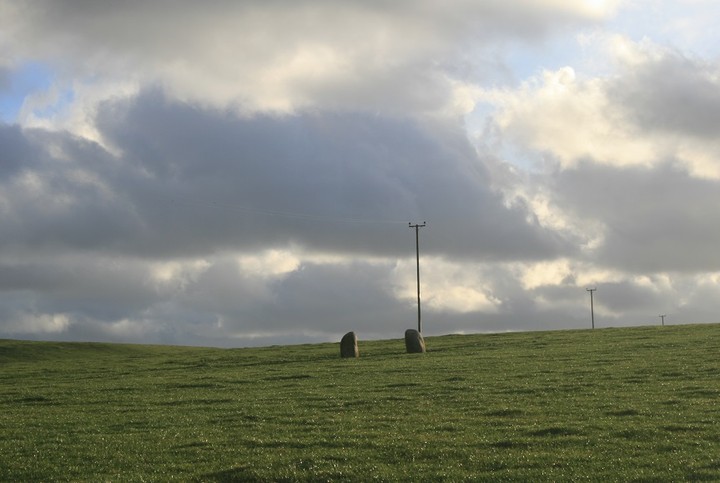
Across the road and a couple of fields from the wonderful Wren's egg and nest is this neat pair of standing stones.
They are not tall, not much more than three feet, but they are good looking stones and are aligned just south of east/west, pointing at not much, but vaguely at some cup and ring marked rocks. The hill fort of Fell of Barhuliion is just north of east from the stones and highly visible across Blairbury loch.
The stones would make good goal posts, if a little short, a game could be played between them and the wrens eggs, which are closer together, but at this distance the opposition would claim it as optical illusion, "it's just because your further away"
The Wren would be a static referee...."play on"

 Posted by postman