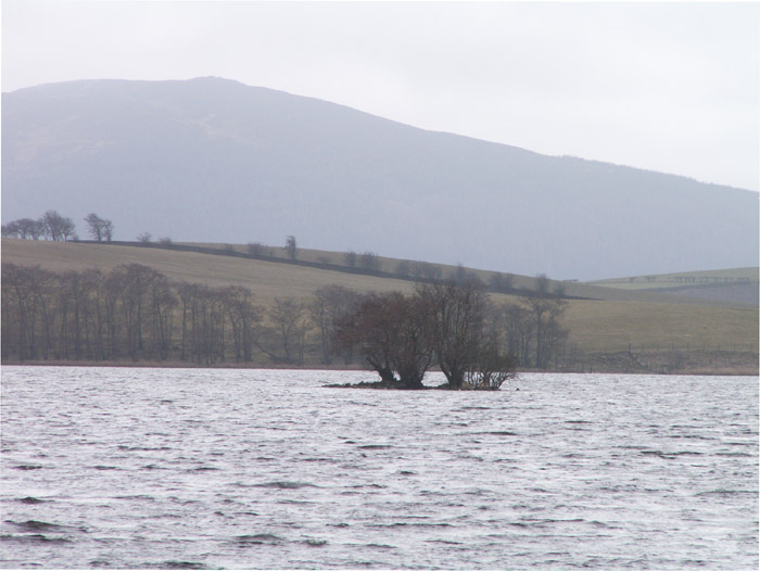
Lochrutton Loch Crannog is not spectacular, however, it is an easy walk on a path to view the crannog from the E bank of the loch.
Directions: Take the Lochfoot turn off the A75 at the Drummore Roundabout c. 3 miles W of Dumfries. After c. 0.7 mile you will reach a crossroads. Continue straight onto an unsigned narrow road for c. 0.3 miles to reach a lay-by on the left. A path for Lochrutton Loch starts here, heading W along a fence. As the path heads through a dry stane dyke turn left, heading S through the field towards a wooded promontory on the loch edge. The path continues W along the promontory for c. 100 yards to the water's edge. The crannog is a small isle in the middle of the loch, populated by several small trees, SW of the promontory. My walk can be viewed on Lochrutton Loch.