The Modern Antiquarian
Log in
|
Register
Home
Latest Posts
Forums
Maps
Help
Browse Sites
News
Blog
Contributors
The Books
Select
-
Belgium
Denmark
Eire
France
Germany
Greece
Italy
The Netherlands
Norway
Portugal
Republic of Malta
Spain
Sweden
Switzerland
United Kingdom
Scotland
Dumfries and Galloway
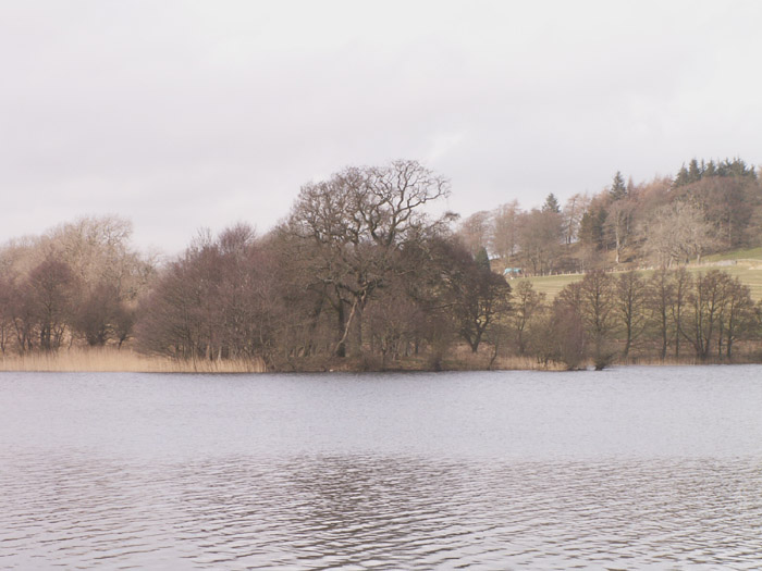
Loch Arthur
Crannog
Loch Arthur (Crannog) on The Modern Antiquarian, the UK & Ireland's most popular megalithic community website. 1 image, plus information on many more ancient sites nearby and across the UK & Ireland.
Image © pebblewolf
Nearest Town:
Dumfries (9km NNE)
OS Ref (GB):
NX903690 /
Sheet: 84
Latitude:
55° 0' 11.78" N
Longitude:
3° 42' 55.08" W
Added by
rockartwolf
Images (1)
0 discussions
Start a topic
Show |
Hide
Web searches for Loch Arthur
Flickr
Google
Google Images
MAGIC
The Megalithic Portal
Bing
Stone Pages
Streetmap.co.uk
Wikipedia
Show map
(inline Google Map)
- Sites within 20 km -
-
Lochrutton Loch (4.02km NNW) (2 posts)
Easthill (5.15km NNE) (40 posts)
Pict's Knowe henge (5.95km ENE) (19 posts)
Milton Loch SE (6.39km W) (6 posts)
Milton Loch Central (6.81km W) (6 posts)
Milton Loch (6.85km W) (2 posts)
Green Island, Milton Loch (6.95km W) (12 posts)
Milton Loch NW (7.02km W) (5 posts)
Beacon Hill (7.47km N) (3 posts)
Lochhill (7.64km E) (2 posts)
Slewcairn (7.87km SE) (10 posts)
Slewcairn NE (7.96km SE) (4 posts)
Slewcairn SW (8.03km SE) (6 posts)
Loch Kindar (8.14km E) (1 post)
Curriestanes (8.38km NE) (2 posts)
The Doons (8.58km NW) (2 posts)
Redcastle (8.7km WSW) (6 posts)
Hall Hill (10.49km N) (2 posts)
Maryholm Stone (10.54km NE) (5 posts)
The Twelve Apostles of Hollywood (11.27km NNE) (62 posts)
Ward Law (12.33km E) (7 posts)
Kells Standing Stone (12.46km SE) (4 posts)
Home Farm (12.74km SE) (5 posts)
Court Hill (13.47km SW) (0 posts)
Ernespie Standing Stones (14.01km WSW) (10 posts)
Newbarns North (14.23km S) (15 posts)
Newbarns South (14.23km S) (13 posts)
Colvend (14.23km S) (1 post)
Torrs Hill (14.62km WSW) (1 post)
Springfield Hill (15.31km NNW) (1 post)
Gars Hill (15.48km NE) (0 posts)
Carlingwark Loch (15.52km WSW) (7 posts)
Kerricks Farm Barrow (15.74km NNE) (0 posts)
Temple Wood (16.27km N) (3 posts)
Glenesslin Schoolhouse (16.75km NW) (5 posts)
Camp Law, Tinhill (16.82km NE) (0 posts)
Lodge Of Kelton Farm (17.74km WSW) (9 posts)
White Cairn, Gelston (18.05km SW) (4 posts)
Mullach Hill (18.14km N) (1 post)
White Cairn, West Skelston (18.29km NW) (5 posts)
Slagnaw (18.55km WSW) (3 posts)
Fleuchlarg (18.91km NW) (15 posts)
White Hill (19.67km NE) (5 posts)
- Add -
-
Add news
Add an image
Add fieldnotes
Add folklore
Add miscellaneous
Add a link
-
Add a site
Add a nearby facility
Add an alternative name/spelling
Images
(click to view fullsize)
Add an image
 Image © pebblewolf