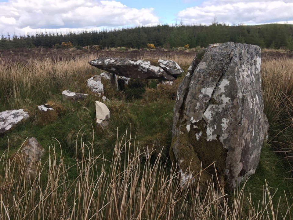
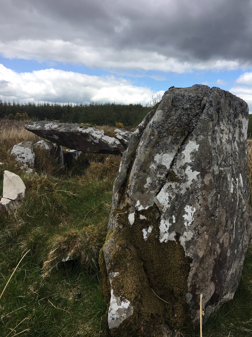
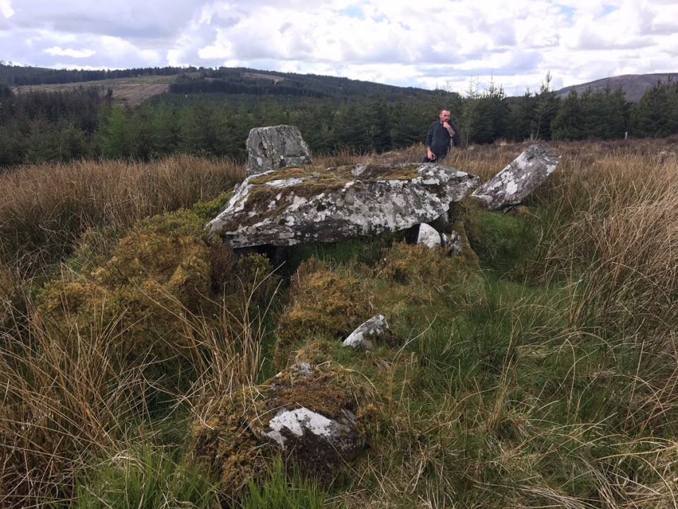
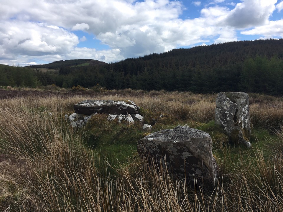
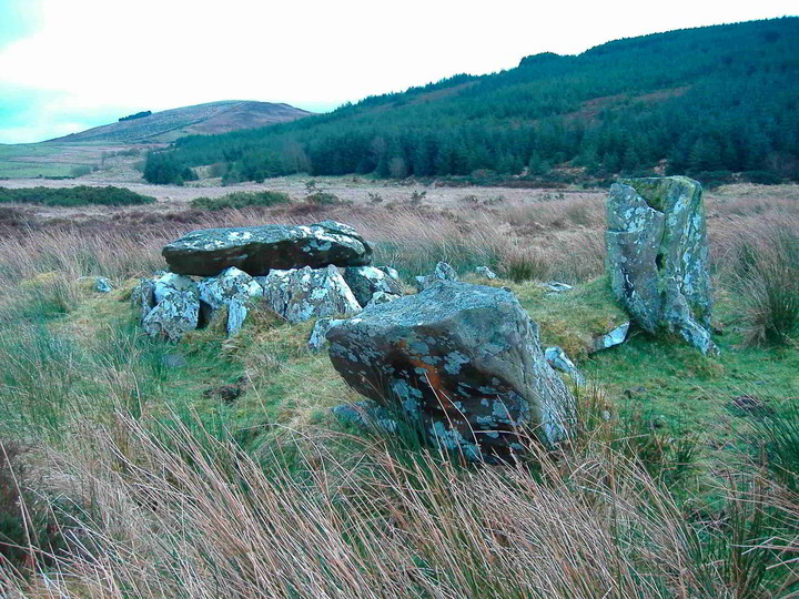
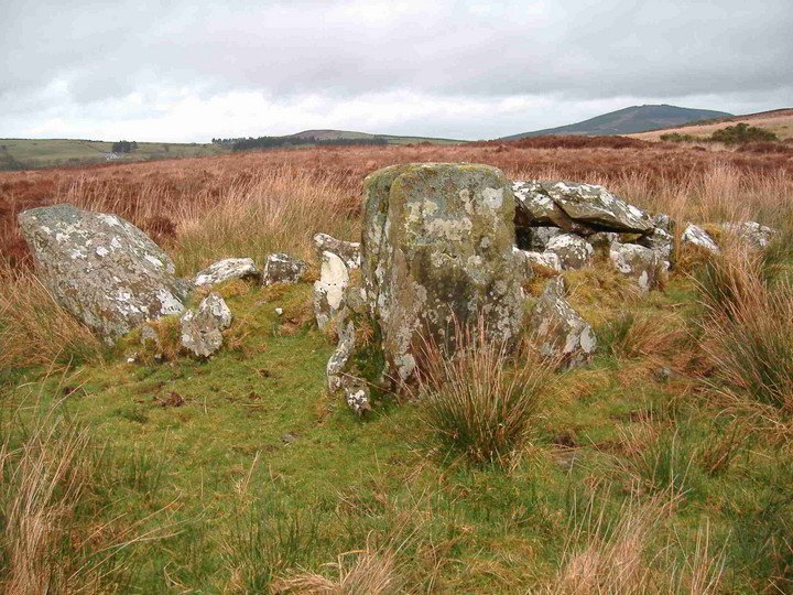
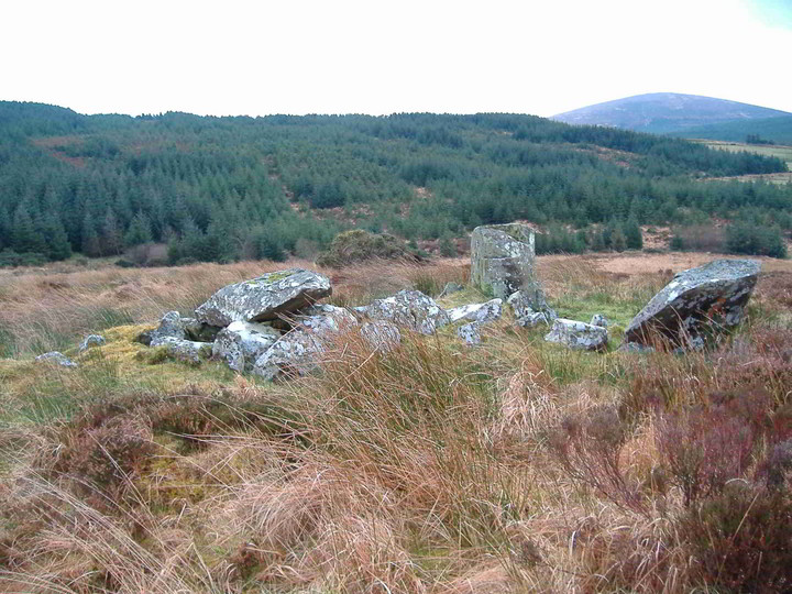
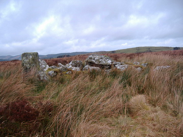
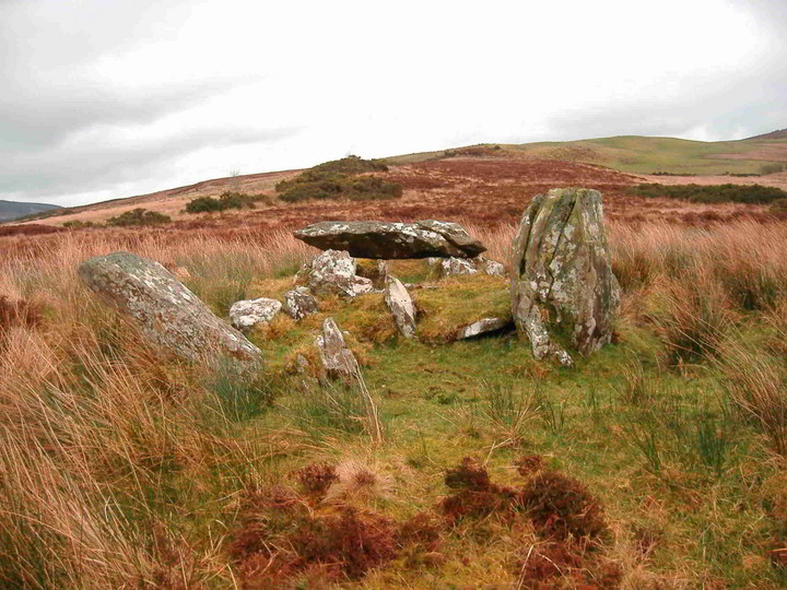
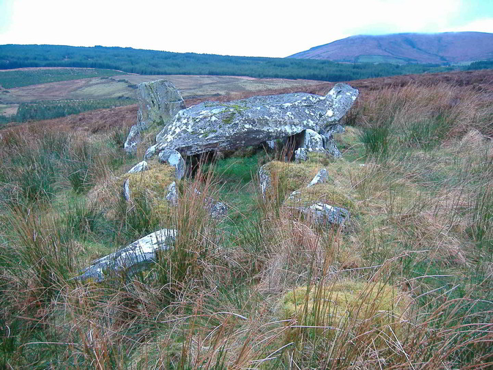
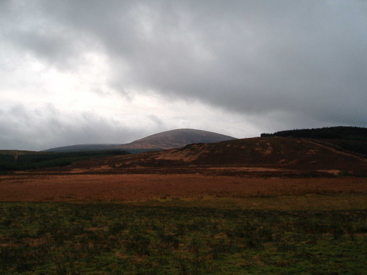
This is a very nicely preserved tomb and its big as the below description suggests at least 7m long. It runs east-west and has views to the Mahurslieve to the south and Keeper Hill to the north-west.
I met the guy that owns the house on the way in the track (on the OS map) and he warned me about the disappearing lake Lough Beg. Seems that it is grown over but still marshy below so best keep to the highland as you walk to the tomb. This lake is the source of the Mulkear river which is a great salmon fishing river so its worrying if it is drying up.
Keeping to the highland also allows you to view the tomb from way off and its actually a very easy one to find. Its about a 2km walk from the house at the beginning of the lane. There were tracks leading the tomb so it looks like it has been visited recently.
Also the North Tipp Inventory mentions a standing stone and a barrow to the south-west, I only gave a quick look but couldnt see anything so if anyone heads this way keep an eye out. The standing stone is over a 1m high.
Taken from the North Tipp Archaeological Inventory
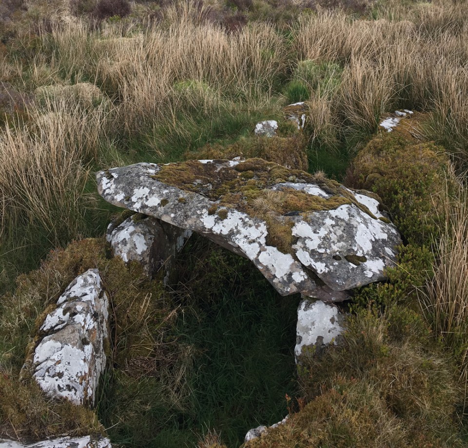
Wedge Tomb
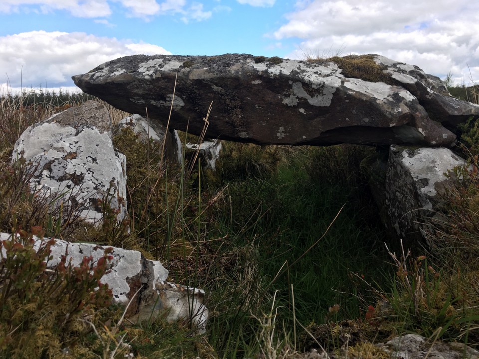
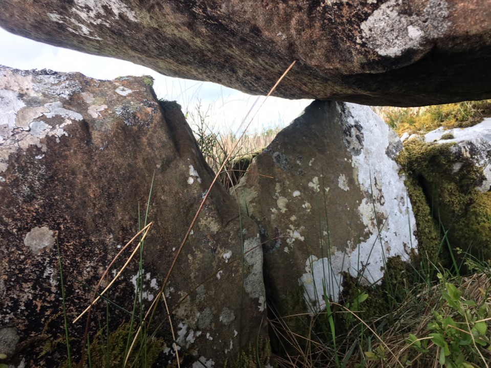
Situated at the western side of Knockteige Hill and in the basin of the Mulkear River. The tomb consists of a double-walled gallery, at least 7m long and 1.2m in maximum width, divided by a septal-stone, into a portico at the WSW and a main chamber some 5m long. The gallery sides decrease in height towards the E. Forward of the septal stone there are a number of stones. Among them are two outer-wall stones to the S and one to the N. Outside the last are two stones which seem to represent a doubling of the outer-wall. Two stones in the N and one to the S link the outer-walling to the septal-stone. These three stones could represent the sides of the portico or may be a doubling of its sides. There are three set stones of main chamber is represented by five orthostats and a prostate stone adjoining the easternmost of these may be a fallen example. The doubling along this side of the gallery is represented by six stones. The N side of the main chamber consists of six orthostats forming an irregular line. Almost 1m beyond the eastern end of the line there is another orthostat This could be a buttress-stone for a missing backstone or a continuation of the gallery wall. The doubling of the N wall of the gallery is represented by five stones. (De Valera and Ó Nualláin 1982, 82-3, No. 4)