The Modern Antiquarian
Log in
|
Register
Home
Latest Posts
Forums
Maps
Help
Browse Sites
News
Blog
Contributors
The Books
Select
-
Belgium
Denmark
Eire
France
Germany
Greece
Italy
The Netherlands
Norway
Portugal
Republic of Malta
Spain
Sweden
Switzerland
United Kingdom
Wales
Ceredigion
Bwlch-y-Crwys
Round Barrow(s)
Bwlch-y-Crwys (Round Barrow(s)) on The Modern Antiquarian, the UK & Ireland's most popular megalithic community website. 1 image, plus information on many more ancient sites nearby and across the UK & Ireland.
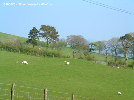
Image © Simon Marshall
Nearest Town:
Aberystwyth (14km W)
OS Ref (GB):
SN710776 /
Sheets: 135, 147
Latitude:
52° 22' 50.78" N
Longitude:
3° 53' 43.71" W
Added by
Kammer
Images (1)
0 discussions
Start a topic
Show |
Hide
Web searches for Bwlch-y-Crwys
Flickr
Google
Google Images
The Megalithic Portal
Bing
Stone Pages
Streetmap.co.uk
Wikipedia
Show map
(inline Google Map)
- Sites within 20 km -
-
Fron Ddu (0.98km SW) (3 posts)
Castell Bwa-Drain (1.92km N) (12 posts)
Gelli Round Barrow (2.45km NNW) (7 posts)
Tan-y-Ffordd (2.81km WNW) (12 posts)
Pen-y-Felin Wynt (2.97km W) (4 posts)
Devil's Punch Bowl (3.21km E) (6 posts)
Bryn Rhosau (3.25km NE) (11 posts)
Esgair Nant-yr-Arian (4km NNW) (11 posts)
Dolgamfa Circle (4.02km ENE) (20 posts)
Cnwc y Bugail (4.24km SSW) (9 posts)
Castell Disgwylfa (4.53km SSW) (9 posts)
Ysbyty Cynfyn (4.57km ENE) (21 posts)
Blaen Llywernog (4.64km NNE) (6 posts)
Carn Dolgau (5.06km NNW) (9 posts)
Castle Grogwynion (5.22km SSE) (12 posts)
Esgair Gorlan (5.33km NNE) (9 posts)
Esgair Nant-y-Moch (5.58km NNE) (6 posts)
Buwch a'r Llo and Mynydd March (5.82km N) (41 posts)
Garrig Hir (5.92km NNW) (13 posts)
Carreg Slic (6.06km N) (1 post)
Capel Bangor Camp (6.07km W) (3 posts)
Nant Geifaes (6.1km NNE) (10 posts)
Banc y Darren (6.22km NW) (6 posts)
Dinas Hut Circle (6.23km NNE) (0 posts)
Darren Camp (6.23km NW) (12 posts)
Glandwr Stone(s) (6.25km NNE) (3 posts)
Disgwylfa Fach Stone (6.38km NNE) (5 posts)
Cerrig yr Wyn (6.45km NW) (21 posts)
Dinas (Blaenrheidol) (6.53km NNE) (23 posts)
Garn Wen (Trefeurig) (7.06km NW) (10 posts)
Garn Lwyd Stone and Barrow Cemetery (7.07km NE) (5 posts)
Tanybryn-Isaf (Trefeurig) (7.14km NW) (5 posts)
Banc-y-Geufron (7.29km SSE) (8 posts)
Pen-y-Castell Hillfort (7.49km NW) (24 posts)
Pen-y-Castell Stone (7.53km NW) (5 posts)
Disgwylfa Fawr (7.59km NNE) (29 posts)
Hirnant Circle (7.61km NE) (22 posts)
Y Garnedd (7.7km NE) (3 posts)
Carreg Samson (Llethr) (7.86km SE) (3 posts)
Penrhyncoch Camp (8.23km WNW) (5 posts)
Lle'r Neuaddau Circle (8.31km NNE) (22 posts)
Gaer Fawr, Trawsgoed (8.35km SW) (11 posts)
Pen-y-Ffrwyd Llwyd Camp (8.81km SSE) (14 posts)
Carn Nant-y-Llys (8.84km E) (11 posts)
Pen Craig y Pistyll (Ceulanamaesmawr) (8.91km N) (13 posts)
Craig Ysradmeurig (8.94km S) (8 posts)
Nant-y-Fedwen (9.11km NNE) (3 posts)
Bwlch yr Adwy (Ceulanamaesmawr) (9.35km N) (10 posts)
Penrhyn-Coch War Memorial (9.38km WNW) (4 posts)
Old Warren Hillfort (9.53km W) (13 posts)
Trawsallt (9.91km ESE) (12 posts)
Y Garn (Pumlumon) (9.98km NE) (22 posts)
Aber Camddwr Ring Cairn (10km NNE) (1 post)
Bryn Dafydd (10.15km ESE) (13 posts)
Aber Camddwr Reconstruction (10.2km NNE) (6 posts)
Cwmere Farm Stone (10.21km NNW) (7 posts)
Carreg Llwyd (East) (10.24km W) (5 posts)
Hen Gaer (10.25km WNW) (2 posts)
Carreg Llwyd (West) (10.32km W) (4 posts)
Nant Maesnant Fach (10.51km NNE) (10 posts)
Llethr Brith (10.55km ESE) (10 posts)
Pen Dinas (Banc Mynydd Gorddu) (10.58km NW) (16 posts)
Copa Hill (10.75km E) (7 posts)
Carn-y-Rhyrddod (10.76km ESE) (11 posts)
Carn Owen (10.81km N) (15 posts)
Llan Ddu Fawr (10.84km ESE) (12 posts)
Pen-y-Bannau (11.16km SE) (25 posts)
Domen Milwyn (11.3km E) (9 posts)
Drosgol (Pumlumon) (11.36km NNE) (20 posts)
Y Garreg Fawr (11.44km W) (10 posts)
Bwlch Graig-Fawr, Teifi Pools (11.67km ESE) (11 posts)
Caer Lletty-Llwyd (12.11km NW) (4 posts)
Pen Pumlumon-Fawr (12.18km NE) (84 posts)
Craig-y-Dullfan (Pumlumon) (12.71km NNE) (12 posts)
Caer Allt-Goch (12.71km WNW) (2 posts)
Pond Nant y Cagal Stones (12.8km N) (7 posts)
Pendinas (Aberystwyth) (12.82km W) (49 posts)
Pen Cor-Maen, Pumlumon (13.1km NE) (2 posts)
Penmaen-Gwyn (13.17km SE) (5 posts)
Cylch Derwyddol (13.43km NNW) (10 posts)
Garn Wen, Mynydd Bach (North) (13.62km SW) (13 posts)
Ffynnon Drewi (Mynydd Bach) (13.63km SW) (2 posts)
Banc Blaenegnant (13.63km ESE) (3 posts)
Banc Llechwedd-mawr (Pumlumon) (13.8km NNE) (25 posts)
Bwlch east of Moel y Llyn, Ceulanamaesmawr (13.97km N) (9 posts)
Tan-yr-Esgair, Mynydd Bach (South) (14km SW) (7 posts)
Craig y Lluest, Cwmdeuddwr (14.05km E) (18 posts)
Cerrig Cyfamod Glyndwr (14.06km NNE) (13 posts)
Moel y Llyn, Ceulanamaesmawr (14.07km NNW) (20 posts)
Bedd Taliesin (14.13km NW) (32 posts)
Talcen Yr Esgair (Esgair Elan) (14.29km E) (8 posts)
Cae'r Arglwyddes II (& the White Stone) (14.32km NNW) (12 posts)
Cae'r Arglwyddes I (14.35km NNW) (4 posts)
Carn Bwlch y Cloddiau (14.36km ENE) (0 posts)
Bryn-y-Crofftau (14.5km SE) (12 posts)
Pen Pumlumon-Arwystli Cairns (14.6km NE) (66 posts)
Maen Hir (14.66km E) (6 posts)
Carnedd Fach (14.75km ENE) (1 post)
Maen Hir, Glan Fedwen (14.81km E) (18 posts)
Bryngwyn Bach (14.88km SSE) (20 posts)
Banc Lluest Newydd (Pumlumon) (14.88km NE) (15 posts)
Cerrig Blaencletwr-Fawr (Esgair Foel-ddu) (14.95km NNW) (8 posts)
Pen-y-Bwlch (West) (15.27km SE) (13 posts)
Pen y Foel Goch (15.3km NNW) (21 posts)
Cistfaen (15.32km E) (15 posts)
Castell Flemish (15.44km SSW) (13 posts)
Carn Hyddgen (Pumlumon) (15.52km NNE) (30 posts)
Pen-y-Bwlch (Ystrad Fflur) (15.52km SE) (8 posts)
Carn Blaen Glasffrwd (15.6km SE) (16 posts)
Carn Fflur (15.66km SE) (24 posts)
Carreg Wen (16.1km NE) (19 posts)
Pen Glog (16.19km WSW) (7 posts)
Garn Gron (16.78km SSE) (17 posts)
Carn Fawr (16.82km NE) (15 posts)
Gilfach-Hafel Camp (16.85km WSW) (1 post)
Blaen Clawdd Du, Cwmdeuddwr (16.88km E) (6 posts)
Y Garn (Garn Gron) (17.05km SSE) (11 posts)
Carn Biga (17.15km NE) (19 posts)
Carn Bwlch Corog (17.15km N) (6 posts)
Carnfachbugeilyn (17.17km NE) (9 posts)
Pen Carreg Gopa (17.2km N) (6 posts)
Lan Fraith (17.23km E) (9 posts)
Carn Ricet (17.42km E) (5 posts)
Castell Tregaron. Sunnyhill wood camp (17.54km S) (13 posts)
Carneddau Hafod Wnog (17.54km NNE) (12 posts)
Esgair Beddau, Cwmdeuddwr (17.7km E) (11 posts)
Caer Penrhos (17.7km WSW) (4 posts)
Groes Fawr (17.8km SSE) (6 posts)
Castell Rhyfel (17.85km SSE) (13 posts)
Moelau (18.28km SSE) (8 posts)
Cantre'r Gwaelod (18.28km WNW) (17 posts)
Lluest Aber Caethon, Cwmdeuddwr (18.35km E) (9 posts)
Bryn Cosyn (18.38km SSE) (4 posts)
Banc Cynnydd, Cwmdeuddwr (18.55km E) (10 posts)
Esgair Perfedd (18.62km SSE) (7 posts)
Carreg Wen Fawr (Llanwrthwl) (18.73km ESE) (1 post)
Esgair Crawnllwyn, Cwmdeuddwr (18.77km E) (8 posts)
Graig Gethin (19km ENE) (6 posts)
Esgair y Llwyn, Cwmdeuddwr (19.02km E) (7 posts)
Cwmbiga (19.07km NE) (21 posts)
Blaen Camddwr (19.13km SSE) (5 posts)
Penycerrig (19.26km ENE) (1 post)
Carn Nant-y-Ffald (19.32km E) (12 posts)
Castell Bach and Castell Mawr (19.4km WSW) (15 posts)
Carn Wen, Cwmdeuddwr (19.57km E) (8 posts)
Twmpath y Crynwyr (19.91km NNW) (3 posts)
Nant-y-Maen (19.96km SE) (7 posts)
Rhiw Afon, Cwmdeuddwr (19.98km E) (10 posts)
- Facilities within 20 km -
-
Hafod Arms Hotel (Hotel: 3.1 km E)
Red Kite Cafe (Cafe: 3.9 km NNE)
Druid Inn (Pub: 4.1 km NW)
George Borrow Hotel (Hotel: 4.4 km NE)
Farmers Arms (Pub: 4.8 km WSW)
Halfway Inn (Pub: 4.8 km WSW)
Maesbangor Arms (Pub: 5.7 km WNW)
Maesnant Centre (Youth Hostel: 6.2 km NNE)
Dyffryn Castell Hotel (Hotel: 6.5 km NE)
Gogerddan Arms Hotel (Pub: 11.6 km W)
Black Lion (Pub: 11.6 km W)
The National Library o... (Library: 12.3 km W)
The National Monuments... (Library: 13 km W)
Yr Hen Orsaf (Weathers... (Pub: 13.1 km W)
Scholars (Pub: 13.2 km W)
Harry's Hotel & Restau... (Restaurant: 13.2 km W)
Treehouse Organic Food... (Restaurant: 13.3 km W)
Aberystwyth Tourist In... (Tourist Information: 13.4 km W)
Penguin Cafe (Cafe: 13.4 km W)
Glansevern Arms Hotel (Hotel: 14.1 km ENE)
Borth Tourist Informat... (Tourist Information: 16 km NW)
Black Lion Hotel (Hotel: 19.9 km ENE)
- Add -
-
Add news
Add an image
Add fieldnotes
Add folklore
Add miscellaneous
Add a link
-
Add a site
Add a nearby facility
Add an alternative name/spelling
Images
(click to view fullsize)
Add an image
 Image © Simon Marshall