The Modern Antiquarian
Log in
|
Register
Home
Latest Posts
Forums
Maps
Help
Browse Sites
News
Blog
Contributors
The Books
Select
-
Belgium
Denmark
Eire
France
Germany
Greece
Italy
The Netherlands
Norway
Portugal
Republic of Malta
Spain
Sweden
Switzerland
United Kingdom
County Tipperary
Corravalley
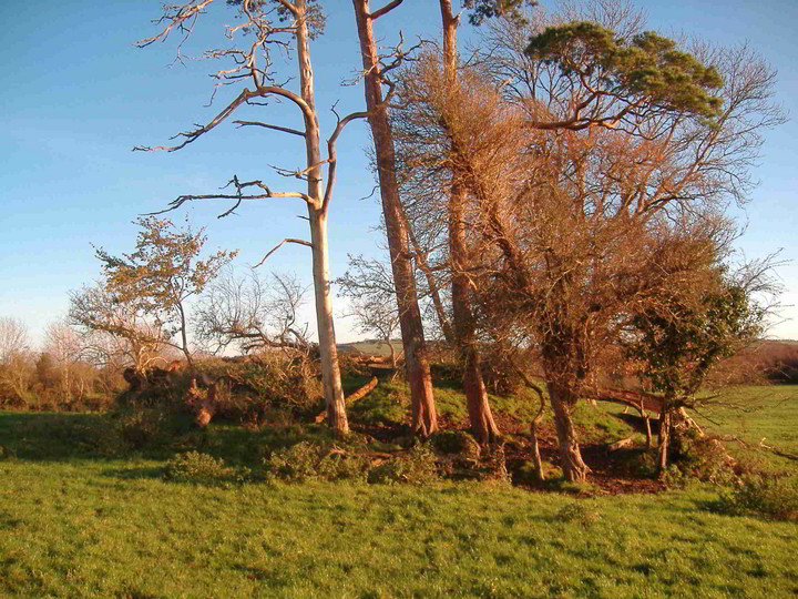
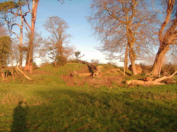
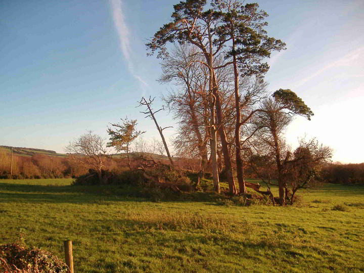
Round Barrow(s)
Corravalley (Round Barrow(s)) on The Modern Antiquarian, the UK & Ireland's most popular megalithic community website. 3 images, plus information on many more ancient sites nearby and across the UK & Ireland.
Image © Bawn79
Nearest Town:
Cloghjordan (6km ENE)
OS Ref (IE):
R919874 /
Sheet: 59
Latitude:
52° 56' 14.67" N
Longitude:
8° 7' 13.75" W
Added by
bawn79
Images (3)
0 discussions
Start a topic
Show |
Hide
Web searches for Corravalley
Flickr
Google
Google Images
The Megalithic Portal
Bing
Stone Pages
Wikipedia
Show map
(inline Google Map)
- Sites within 20 km -
-
Ardcroney (1.3km W) (12 posts)
Coolagorane Upper (2.1km W) (5 posts)
Whitstone (3.87km W) (4 posts)
Middlewalk (3.88km ESE) (3 posts)
Ardcroney (3.89km WSW) (7 posts)
Ashley Park (4.14km WSW) (3 posts)
Townfields (4.21km ENE) (3 posts)
Ashley Park (4.5km WSW) (21 posts)
Kilruane (4.6km SSW) (3 posts)
The Commons of Carney (6.28km WNW) (3 posts)
Knigh Hill (6.4km WSW) (3 posts)
Rathurles (6.87km S) (6 posts)
Rathurles (6.99km S) (9 posts)
Gorraun (7.47km E) (7 posts)
Rathfalla (7.71km S) (5 posts)
Rathurles (7.72km S) (2 posts)
Ballyquinlevan Upper (8.94km WNW) (3 posts)
Knockalton Lower (9.11km SSW) (1 post)
Tullahedy (12.81km SW) (2 posts)
Creggane (12.95km SW) (2 posts)
Youghalvillage (13.42km WSW) (4 posts)
Kilcolman (13.46km SW) (2 posts)
Garranmore (14.59km WSW) (3 posts)
Ballinlough (14.67km SE) (2 posts)
Ballinlough (14.67km SE) (1 post)
Dermot and Gráinne's bed (15.13km NW) (0 posts)
Cloneygowny (15.56km WSW) (2 posts)
Bendubh (15.71km E) (3 posts)
Lisheentyrone (16.97km WSW) (10 posts)
Lisheentyrone (16.99km WSW) (4 posts)
Lackamore (17.06km WSW) (3 posts)
Lorrha (17.18km N) (4 posts)
Ballinacurra (17.59km SSE) (1 post)
Carrigeen (18.03km SW) (7 posts)
Borrisnoe (18.12km E) (2 posts)
Borrisnoe (18.12km E) (2 posts)
Borrisnoe (18.12km E) (5 posts)
Coumroe (18.37km SW) (4 posts)
Hexenstein - Neerstedt (18.37km W) (8 posts)
Knockanora (18.54km SE) (4 posts)
Devilsbit Mountain (18.84km ESE) (6 posts)
Burgesbeg (18.97km SW) (6 posts)
Burgesbeg (19.02km SW) (1 post)
Cooneen (19.14km S) (8 posts)
Garrangrena Lower (19.6km SE) (2 posts)
Lissballyard (19.62km NNE) (2 posts)
Foilnamuck (19.82km S) (10 posts)
- Add -
-
Add news
Add an image
Add fieldnotes
Add folklore
Add miscellaneous
Add a link
-
Add a site
Add a nearby facility
Add an alternative name/spelling
Images
(click to view fullsize)
Add an image
 Image © Bawn79