|
|

|
|
Jug's GraveCairn(s)
|
|
|
|
News |
|
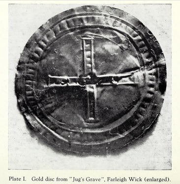
Sun-disc from the dawn of history goes on display in Wiltshire for summer solsticeStonehenge sun-disc from the dawn of history goes on display in Wiltshire for summer solstice Wiltshire Museum will exhibit a gold 'Stonehenge sun-disc', which may have been worn on clothing or a head-dress Marking this year’s summer solstice an early Bronze Age sun-disc, one of the earliest metal objects found in Britain, has ... continues... |
 Posted by moss
19th June 2015ce Edited 21st June 2015ce |
Images (click to view fullsize) |
|
|
Fieldnotes |
|
|
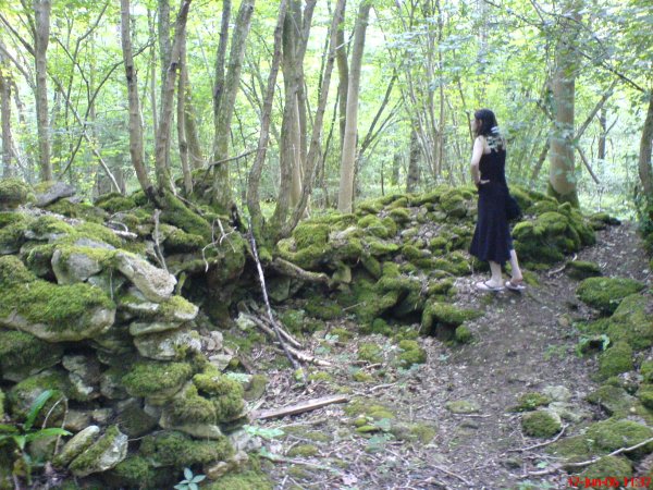
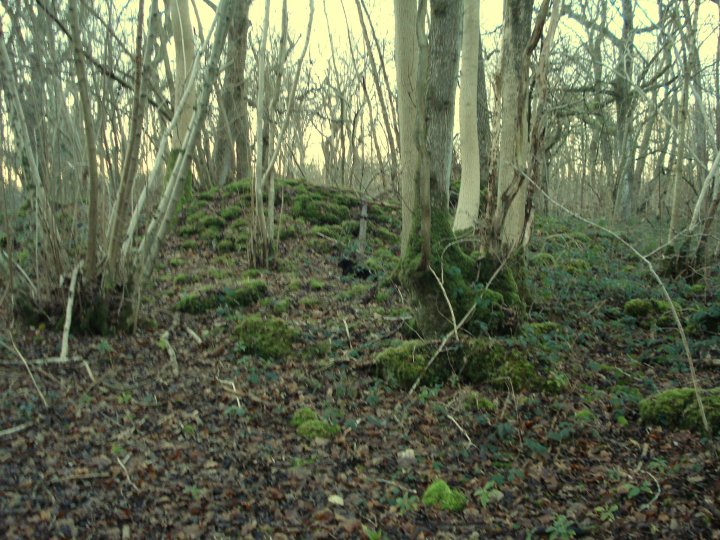
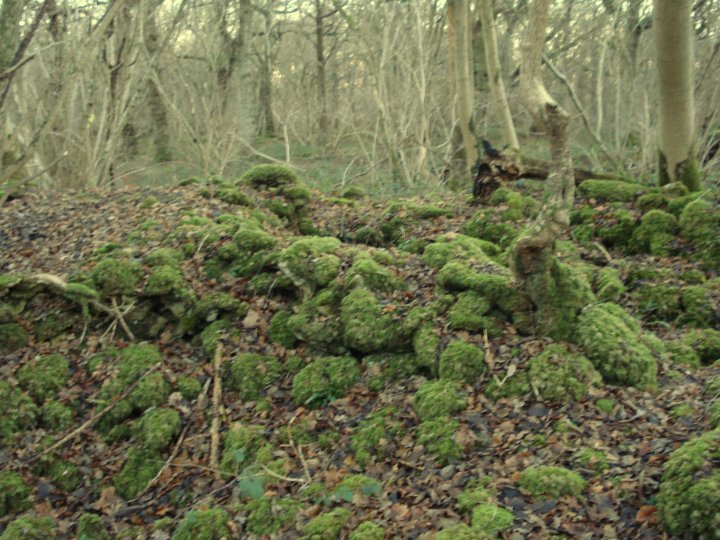
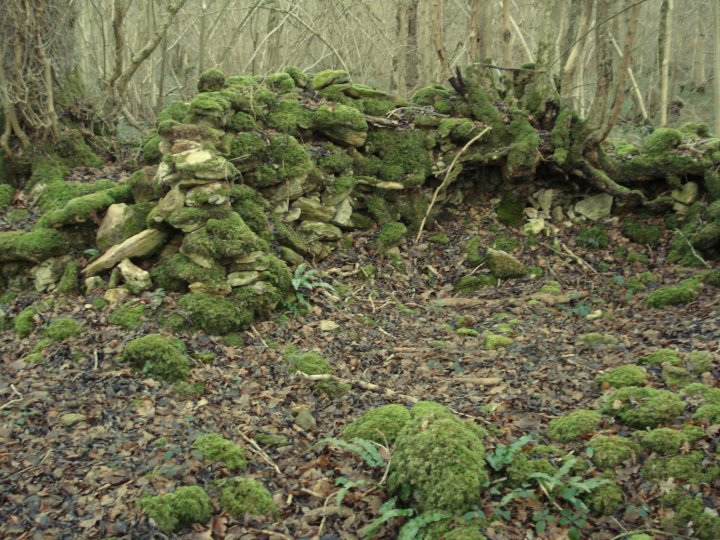
Visited 27.8.12 Directions: We came off the A363 and followed the signs for Ashley. We then went through a maze of lanes until we found the road which winds through Warleigh Wood. An O/S map is required. Once we arrived at approximately the right place we just about managed to find a passing place to squeeze into. Parking is difficult along this minor road. I looked over the barbed wire fence into deep woodland and doubted I would be able to find the Cairn despite the O/S map showing it to be close to the road. I found a suitable place to hop over the fence (always a bit dodgy in shorts!) and roamed amongst trees. I was about to give up and when I spotted it! It is not easy to find. This much mangled Cairn is low and covered in ferns, brambles, several small trees and huge amounts of moss. Despite this I liked the atmosphere of the place but would say this is one for the dedicated only given the difficulty in access / finding the Cairn. |
Posted by CARL 31st August 2012ce |
Miscellaneous |
|
|
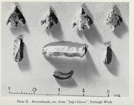
Details of Barrow on Pastscape ST 79696305 - An oval-shaped bowl barrow, known as Jug's Grave. It is 27 by 21 paces and 4 feet high. There are slight indications of a ditch on the south and west. Excavations by G. Underwood, 1946/7, revealed a primary interment of two skeletons in a stone cist accompanied by four EBA flint arrowheads, probable Beaker sherds, a gold 'sun disc' ornament and a fragment of bone ring. Four secondary inhumation-burials were found in the north part of the mound and other finds included a few flint flakes and scrapers and part of an hour-glass perforated stone mace. Three banks of the field system (ST 86 SW 1) impinge on the mound. Jug's Grave at ST 79686305, is a cairn 1.4 metres high, extensively mutilated in the centre and N.W. where large quantities of stone have been removed. No indications of the ditch could be seen. S.E. of Jug's Grave at approximately ST.79796298, are two smaller cairns each 0.5 metres high. They may be field clearance heaps, but this seems unlikely as in the surrounding field system (ST 86 SW 1) the boundary banks are composed of stone and this would seem the obvious place to dispose of any surplus stone, nor are any other heaps of stone visible in the area. They may therefore be burial cairns. Both contain depressions in their centres where stone has been removed. Sherds of a Bell Beaker from Jug's Grave are in Bristol Museum, Acc. No. F. 3594, and the 'sun-disc' is in the posession of Capt. Whitehead, Inwoods, Farleigh Wick. Surveyed at 1/2500 |
 Posted by Chance
12th October 2012ce Edited 12th October 2012ce |
| According volume 52 of the Wiltshire Archaeological Magazine (1947/8) a golden 'sun disc' was found at Jug's Grave. It was about 2 1/2cm in diameter and made from two pieces of gold foil beaten together. It was decorated with an equal-armed cross in the centre, each arm being made of six dots. The cross was enclosed by two circles, the space between the circles having 60 short marks. The marks were impressed from the front, while the crosses and circles were pressed in from the back of the foil. The magazine mentions that a similar disc was found at the fabulous Whitesheet Hill, Mere, by Colt Hoare (conveniently down the road from his house), and this had 80 rim dots. And then of course there was the more elaborate gold 'sun disc' found in a Lansdown barrow. |
 Posted by Rhiannon
28th September 2005ce Edited 5th June 2008ce |
Links |
|
Wiltshire Heritage MuseumLots of details of the finds - and a (sadly black and white) photo of the gold disc. (The pictures seem to have disappeared, but there's a photo of a replica here on the Bradford on Avon museum website. |
Posted by Rhiannon 11th October 2010ce Edited 6th February 2014ce |