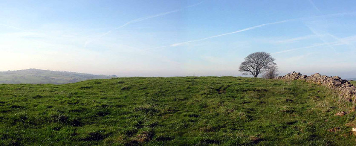
There's plenty to see on Masson Hill. Crowning almost the very top is this barrow. the barrow is surrounded by caves, victorian show caverns (if you know the still open secreted entrances to them), mine shafts, mine levels, q-pits, gardens, cable cars and meres.....
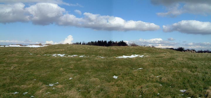
In diameter the barrow's maybe 20m and approx. 1.75m in height. It survives in tact; never excavated. On the western side of the mound a shallow ditch remains, highlighted today by the remains of the recent snow.
Rising up outta Matlock Dale opposite the limestone cliffs of High Tor, Masson is one of the Peak's great hills sitting on the south-eastern edge of the White Peak, it's also one of the last before reaching the plains that stretch northwards from Chesterfield.
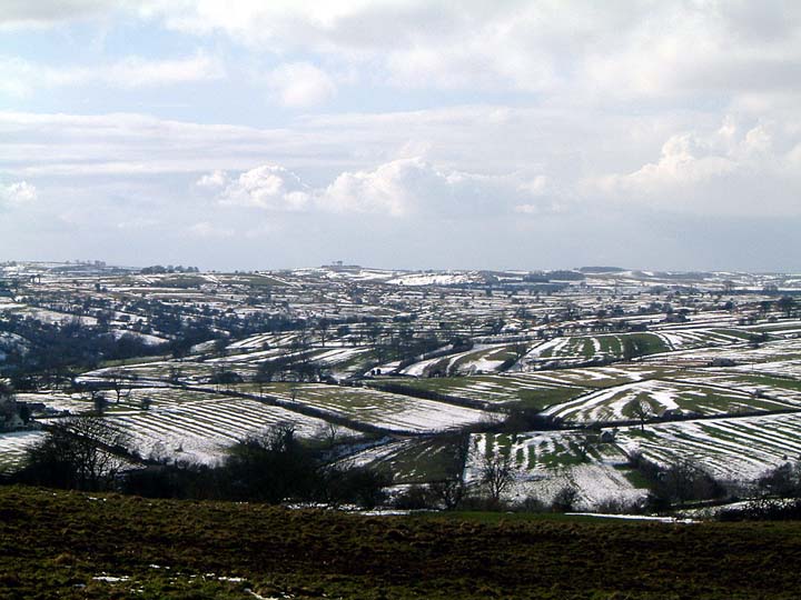
The views from up here are excellent. The flood plains of the Trent are to the south with Shardlow's power stations marking the location of the henge complexes and cursus that once stood there. Stanton Moor, Longstone Edge, Froggat Edge and the hills of the Dark Peak beyond, are to the north.
Minninglow hill, and its beech trees are visible from most of the Peak's high ground….and from many of the White Peak's barrows. From here it's three quarters of a mile away to the west.
Masson's barrow however is one of only a small handful of burial mounds to have a proper two way thing going on with Minning Low.
The concrete slab on top the barrow is for the base of a trig point, Masson;s summit only being 100yds to the east.