|
|

|
|
SilbabyArtificial Mound
|
|
|
|
Images (click to view fullsize) |
|
Photographs: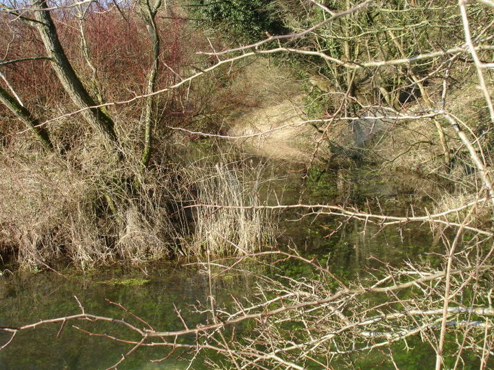
 Maps / Plans / Diagrams:
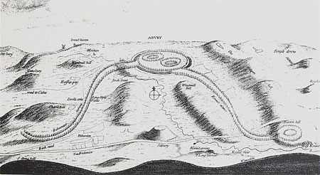
 Artistic / Interpretive:
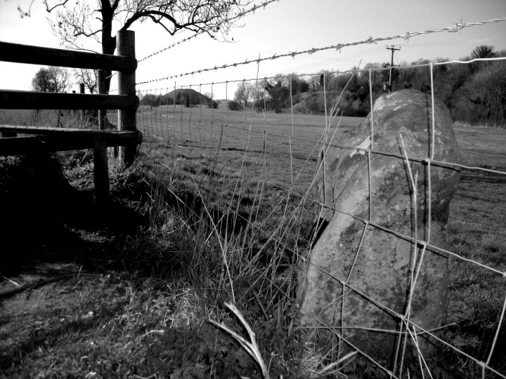
|
Fieldnotes |
|
|
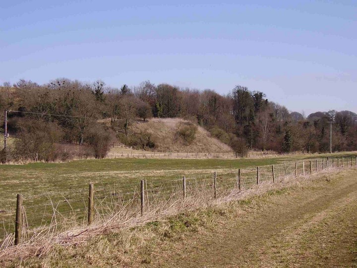
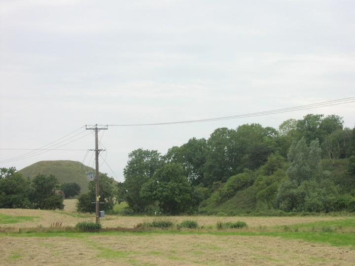
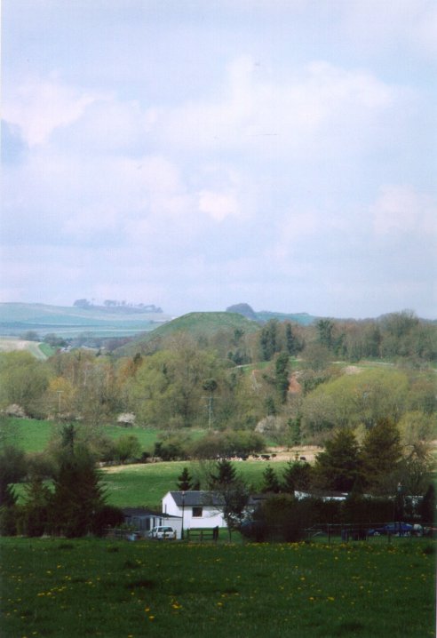
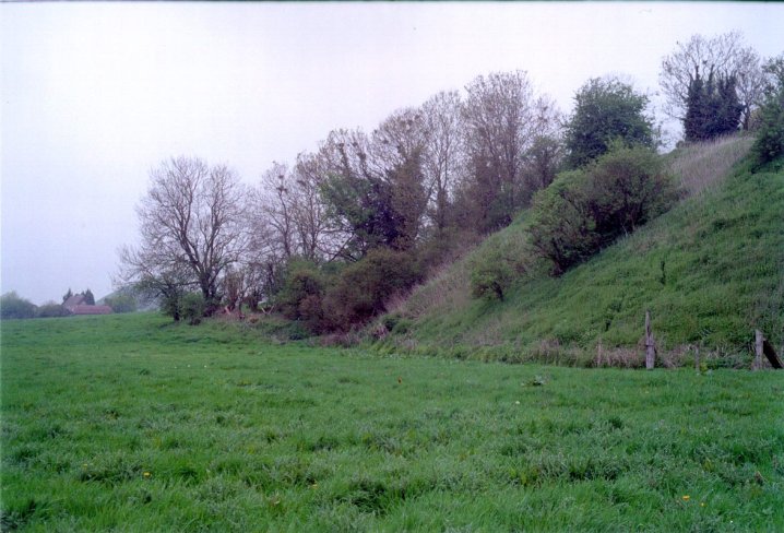
'Visited' 1.10.11 I parked in the WKLB parking bay and walked along the busy A4 towards Silbaby. When I got to the trees I was confronted by waist high nettles and a barbed wire fence. As I was in shorts I was going no further! I peered through the trees but to be honest I couldn't make a lot out so I trudged back to the car. On the way back I spotted 2 people who had climbed to the top of Silbury Hill. Although I have never done so myself I must admit it is tempting to do so. Walking up the hill towards WKLB I discovered that this was the best place to view Silbaby from all along! |
Posted by CARL 4th October 2011ce |
Miscellaneous |
|
|
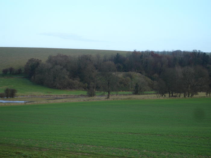
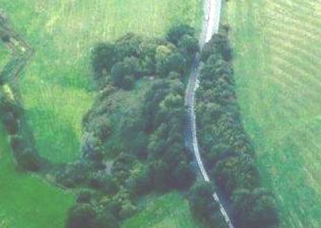
Details of associated earthwork on Pastscape Earthworks of an uncertain date seen along the edge of a low terrace overlooking the Kennett valley seen on a 2006 lidar survey. (1) (SU 1070 6824) This terrace would be unremarkable appart from the fact that its curve follows the projected course of the palisade enclosure 2, the larger of the main palisade enclosures of the West Kennett Palisade Enclosure complex. The terrace overlooks the mound 'Silbaby' and the Waden spring. The earthworks create an edge to the terrace which appears to have faint traces of ridge and furrow within the enclosure that the earthworks create. It is cut through at its west end by two drainage ditches. around its base at its east end is another drainage ditch that could be a part of the water meadow to the east (NMR 1500135). |
 Posted by Chance
29th October 2012ce Edited 9th April 2013ce |
|
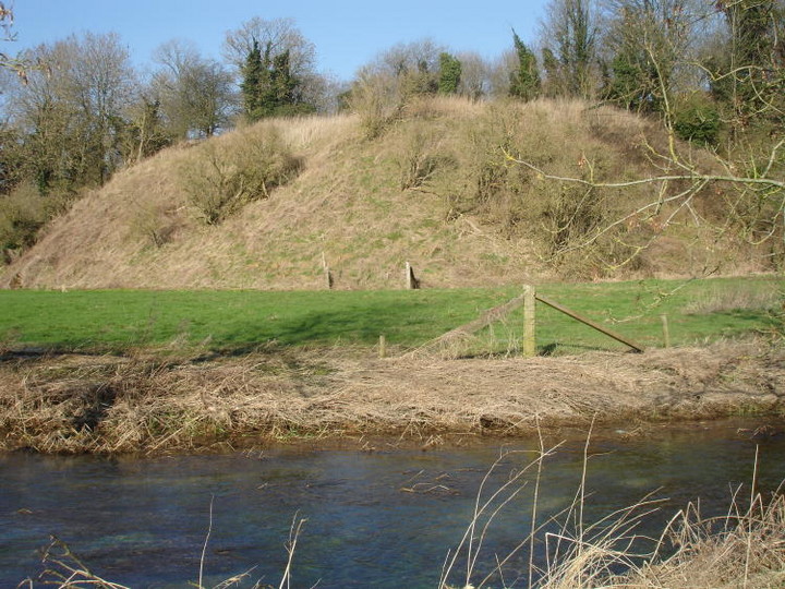
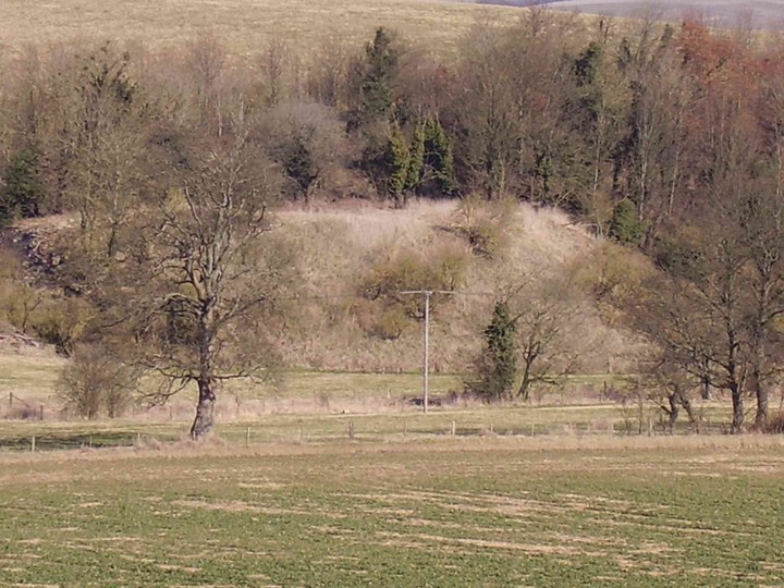
Details of site on Pastscape The earthwork mound of uncertain date known as 'Silbaby' seen in a 2006 lidar survey. (1) (SU 1069 6831) |
Posted by Chance 29th October 2012ce |
|
The main problem I have regarding this site as ancient is that when I look at the old maps of the area, it doesn't show up at all. Furthermore this place hasn't always been a greenfield site at all. The earliest map I could find was the 1886-7 OS Survey, which shows a small enclosure on the western end of the site containing a range of buildings, and also an extension of the river Kennet forming a pond along the southern side of the enclosure. A well is shown about 10 yards south of the buildings. The map-makers here showed a shallow road cutting north of the buildings with the traditional hatched markings, but showed absolutely no trace of a mound anywhere on the site. This state of affairs continues right the way on to 1961, when the buildings are still there, and never once is a mound shown. The 1978 map is markedly different. The buildings have gone, the well isn't marked, the road cutting is noticeably larger and a large mound has appeared on the "Silbaby" site, partly overlying where the houses once were and partly infilling the pond formed by a branch of the Kennet. At a rough guess, at some point between 1961 and 1978 which I cannot accurately determine, the A4 road was improved and the cutting immediately north of the site was either deepened, or was widened to remove the risk of landslides. The houses south of the road were purchased and the area used as a dump zone for the excess chalk and soil. From the look of the mound, I do not think that any particular care or attention to detail was made at all; the debris was just dumped as it was excavated and the pile left to settle naturally. Any layering will just be the result of this laisse-faire approach, and not unfortunately careful Neolithic building. What I don't think is that centuries of antiquarians and years of ordnance surveyors have missed a large Neolithic mound. Between the 1886 map and the 1900 map, the spot-heights all change (by 20' upwards) as I suppose someone re-surveyed the area and realised the discrepancy; this means that the site has been carefully examined twice by surveyors; it is most unlikely that they would miss the same feature twice, yet carefully mark every tumulus, mound and similar feature on the maps. |
Posted by Dan1701 20th June 2012ce |
|
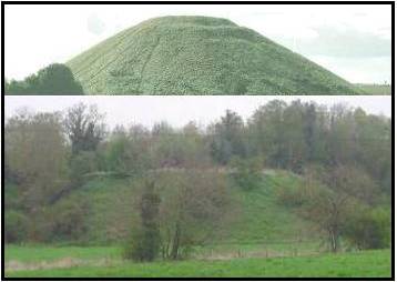
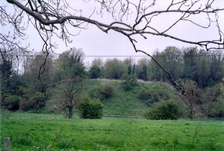
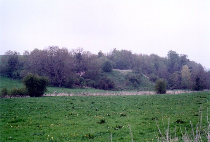
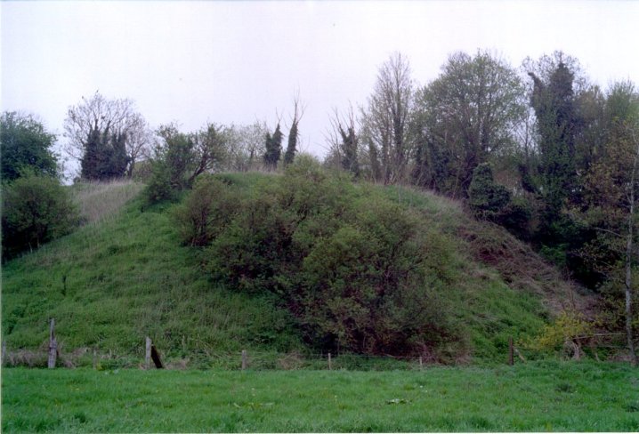
I'd like to add my amateur opinion to the debate. Like everyone else, I was quite excited by the idea of a newly discovered monument in the Avebury area. Having visited it though, I am convinced that it is purely a natural feature, formed by the Roman road cutting off a spur at the end of Waden Hill. The roundness of the hill is unusual, as is the fact that the angle of its slope matches that of Silbury. However, both can be explained by its location. The hill is on the edge of the flood plain of the River Kennet, as can be seen by the very flat ground at its base. This means that it has been eroded by the river over many, many years. This has had the effect of shortening the gradual slope of Waden Hill - the long tail of the hill has been washed away. Any large scale erosion brought about by floodwater would cause a cliff of chalk to form, but this would fairly soon settle down into a slope. All soils have a natural angle at which they settle. This is called their 'angle of repose'. You can see this in action by pouring sugar onto a table - internal friction means that the pile will always settle into a slope of the same angle. It so happens that the angle of slope of Silbury Hill is pretty close to the natural angle of repose of chalk soil. This is discussed in the English Heritage report on Silbury ('Silbury Hill', February 2005) which says that "Professor Chandler... considered the slope stability of the Hill and [noted that] it was close to the angle of repose". In other words, whether due to design or because of erosion over the years, the slope of Silbury Hill is similar to that of a naturally eroded chalk cliff. That the slope of Silbaby is almost the same is no accident – it too follows the natural angle of repose for chalk – but due to the natural processes of erosion and slope formation rather than by the hand of man. A similar angle of slope can be seen on the tree-lined banks of the Kennet by the Swallowhead spring, where the hill coming down from the West Kennet long barrow has been cut away by the stream. Stukeley's print showing a 'barrow cut through by the Romans' is a bit of a red herring. Stukeley was clearly referring to a disc barrow – a small, banked Bronze Age mound – and not to a large hill. His engraving of the 'Avebury Serpent' shows this disc barrow clearly, together with the relationship between the Roman road and the tail of Waden Hill. Overall, I'm sorry, but I'd say that Silbaby was a natural feature. Unusual, intriguing, and definitely worth protecting, but natural nonetheless. On the other hand, I can't explain the alignment between Silbury, Silbaby and the Sanctuary… |
 Posted by Dunstan
17th March 2008ce Edited 17th March 2008ce |
|
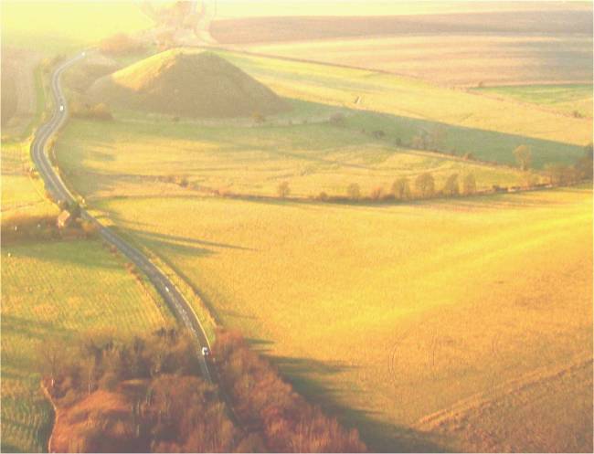
What are the chances? How precise does an alignment of three points need to be before it is considered "likely to be deliberate" rather than "mere chance"? It's an impossible question since "mere chance" can never be discounted. But what can perhaps be said is that the more accurate, the more the possibility it is deliberate. On that basis, if these rather inaccurate alignments are given some sort of credence by some as being perhaps deliberate - http://www.themodernantiquarian.com/post/25391 then what is to be made of THIS level of accuracy between The Sanctuary, Silbury and Silbaby? http://www.themodernantiquarian.com/post/64185/images/silbaby.html (Just asking, not saying) |
 Posted by nigelswift
4th December 2006ce Edited 1st November 2007ce |
|
"Silbaby" was noted (or "re-discovered"?) and named by Pete Glastonbury. It's not thought to be modern, and is apparently artificial (but that's as far as it seems safe to go). The site is posted here, not because it's known to qualify, but because no-one seems to have established that such a thing is impossible. Silbaby is currently subject to fly tipping, which is ruining its (possibly important) shape. Marked on old maps as "the Girt Bank" and possibly sketched by Stukeley (we think) it must have been seen by many archaeologists and thousands of tourists, yet no-one seems to have considered it noteworthy. Yet, as can be seen from the pictures, it's worth a second look, and a third. Interesting factoids, to aid any "unwarranted speculation" as an expert might term it's presence here: it's slopes equate precisely with Silbury's, it's exactly on a line between Silbury and The Sanctuary and is co-visible with both, it has a sarsen lying on it, a spring at it's base, a "moat" round it and a flat flood plain adjoining it. So far, we can find no expert attribution or even mention of it, and it's currently being liberally fly tipped. Apart from the fact that dumping stuff in a WHS should be stopped, expert reassurance that this place is of no archaeological significance would seem to be urgently required and would be gratefully received. |
Posted by nigelswift 23rd November 2004ce Edited 30th November 2004ce |