|
|

|
|
Tormain HillCup and Ring Marks / Rock Art
|
|
|
|
Images (click to view fullsize) |
|
Photographs: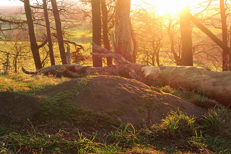
 Maps / Plans / Diagrams:
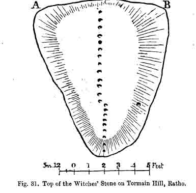
 Artistic / Interpretive:
|
Fieldnotes |
|
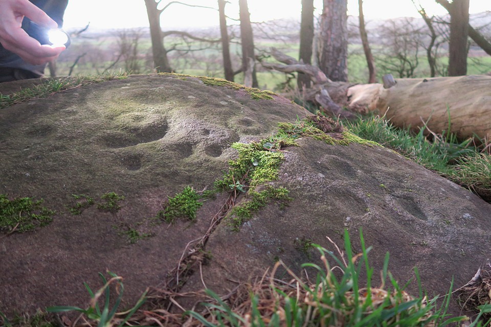
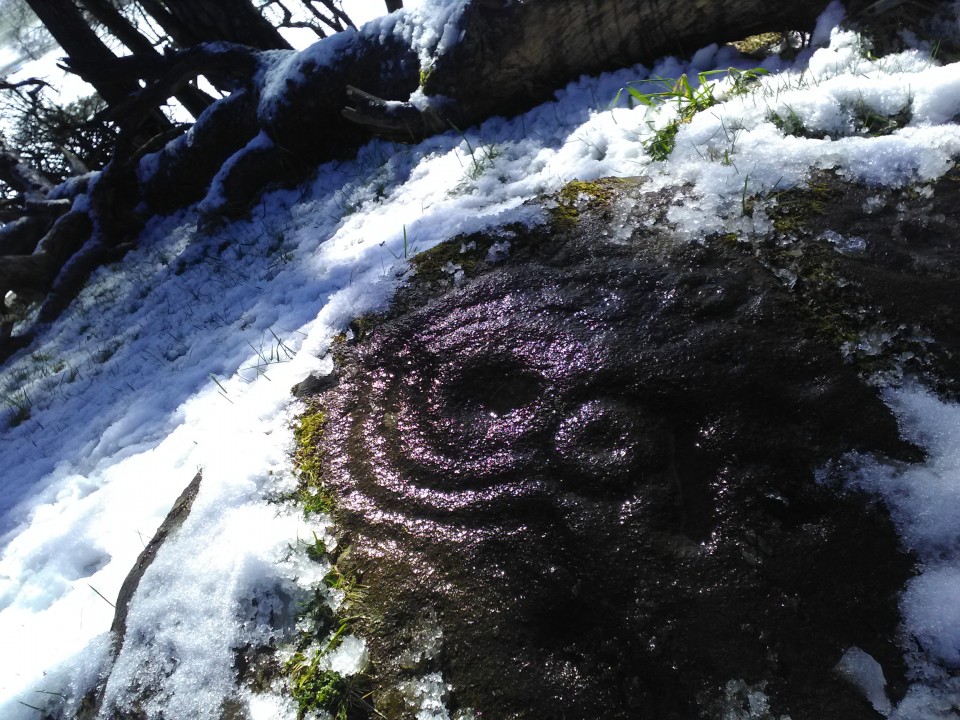
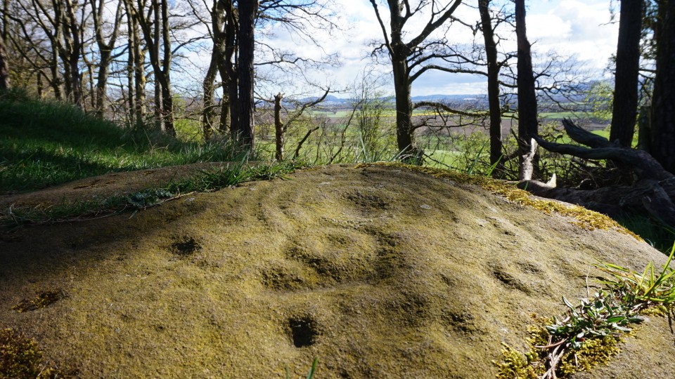
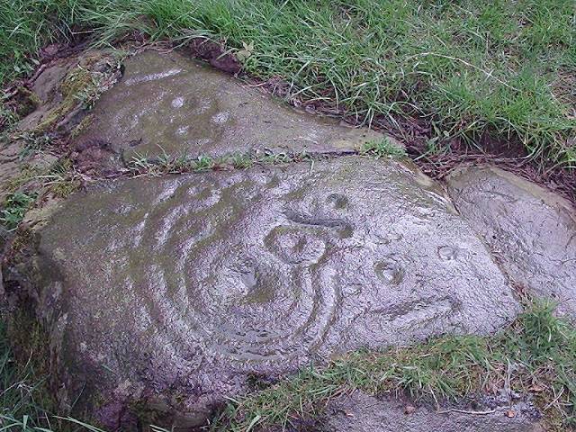
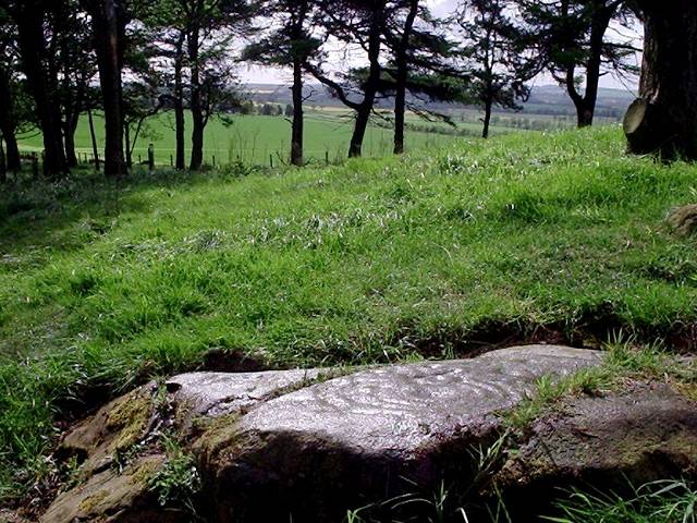
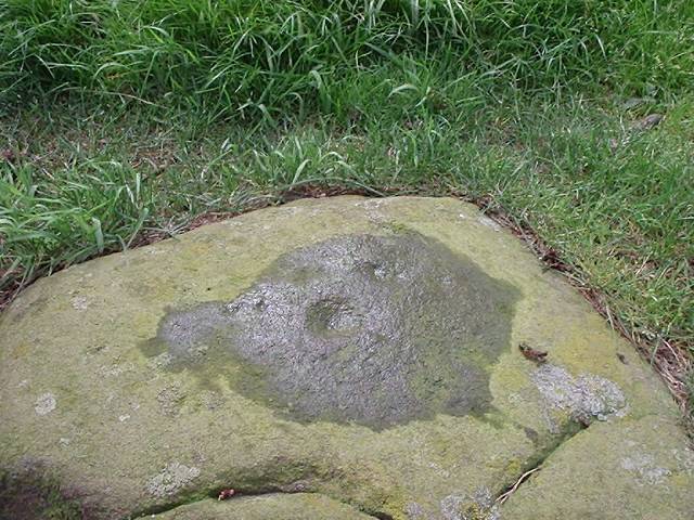
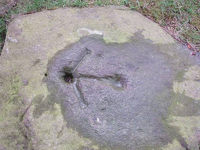
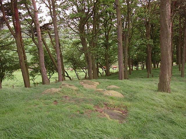
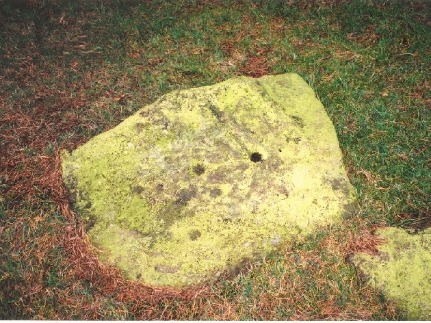
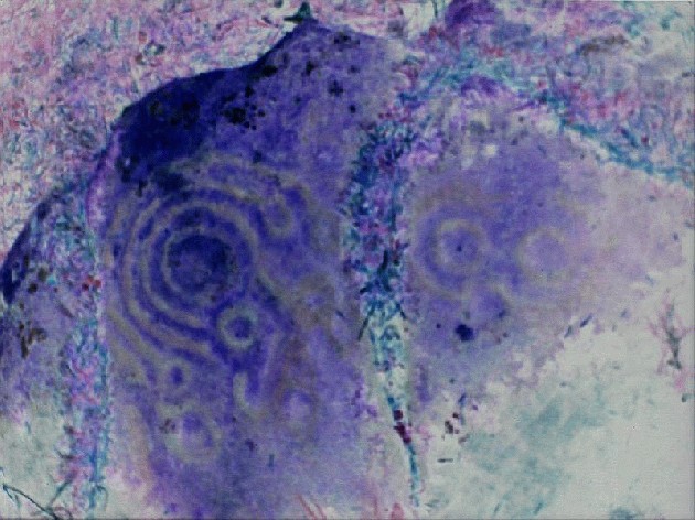
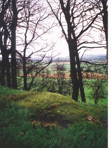
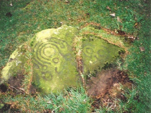
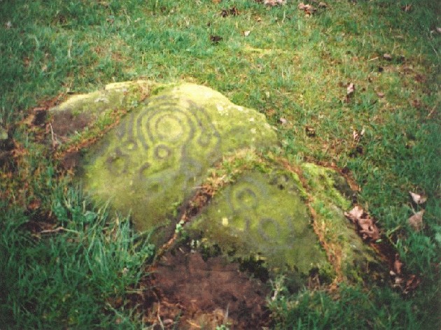
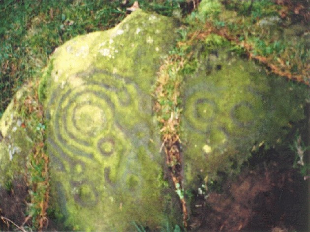
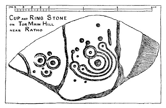
| 28/01/2019 – Early morning bus out to Wilkieston from Edinburgh (big thumbs up to the Edinburgh bus network, cheap and you can get a bus nearly anywhere). Good access, sign posted path to the top of Tormain Hill from the north. We reached the stones just before sunrise. Lovely open woodland setting. I think we counted seven stones with cup marks on them. The pick of the bunch is the one with the cup and ring markings, it’s very good indeed. Really enjoyed our visit here. It was pretty special watching the sun rise from behind the Pentland Hills to slowly light up the stones and surrounding area, magic. |
 Posted by thelonious
30th January 2019ce |
|
Easier to get to than before (no barbed wire to negotiate) approached by a well used path with handy new stile and sign posts at the top. Following the path that accompanies a narrow line of trees on the Wilkiston road out of Ratho head to the top of the hill past a rope swing, very popular with dog walkers (not the rope swing...or at least i think not) If you like you can get the number 20 lothian bus from Slateford (Chesser) to Ratho then after your neolithic detour go along the canal for cake and coffee at the brilliantly odd international climbing centre. If you are visiting Jupiter Art Land then you can walk stealthily out through the farm at the back of the estate through Bonnington mains, cross the road and head towards Ratho. Then take sign posted path on the right to tree topped Tomain hill opposite the horribly vast water filled quarry on the other side of the road. |
 Posted by olly
11th April 2017ce Edited 11th April 2017ce |
|
Wednesday 28/8/02 Today I need to leave the city, just for lunchtime, but I need to escape. This place draws me like a magnet. Every time I lift my head from my PC or paperwork in my office, this ridge is there. It’s funny, I’ve always stayed in Edinburgh and I’ve always been interested in the surroundings hills, woods and country. I’ve often wondered ‘where is that line of trees on the horizon?’ It’s here. Where these rocks are. This is the place that holds the key. This is the site of the *interpreter*. I sit by the main cup and ring marked stone, place my hands lightly on it and close my eyes. I let the sounds rush in. My head is too full of fuzz though. I still leave this place calmed. ‘See for yourself the summer fields, before the tractor comes…walk along on your own’. |
Posted by Martin 4th September 2002ce |
|
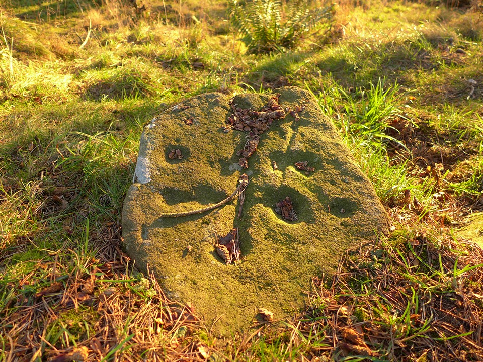
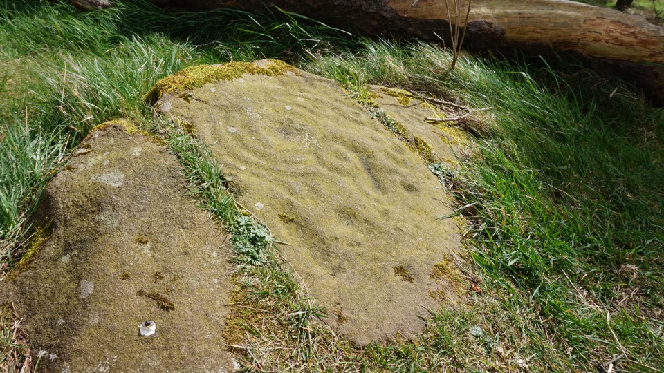
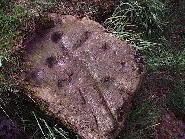
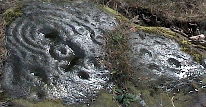
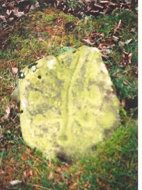
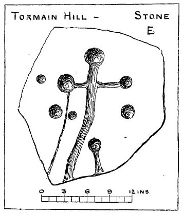
Tormain Hill Cup and Ring Marked Rocks Wednesday 21/11/01 In a howling gale. On the way up here I stopped to check out some of the massive boulders and stones and slowly turned round to have a look at the most amazing view of Edinburgh- I laughed! In a perfect row stood Corstorphine Hill, Berwick Law, Arthurs Seat, Traprain Law and the Braids Hills. What an amazing ancient skyline! What a place- 360 degree views all around the Lothians, Fife and beyond. Away from the industrialisation, the motorways and the airport to this site. The rock markings are dotted on the outcrops of this wooded hill- I've never seen rock markings like these- the main cup and ring rock is a complete mind-fuck. Y'know, the first thing that came into my mind when I looked down upon it, then looked up at the skyline was 'viewfinder'. Is this a landscape interpreter? A magickal symbol encompassing all the surrounding sacred sites? I've had to move down off the hill into the slightly more sheltered tress as it's pissing down now and the flask of coffee is out as I'm so bloody cold! I think about the symbols above me with the wind roaring through the trees towering above me- I'll have to check out my dates etc. The other main cup marked rock (and I could find 6 in total) has cups joined by channels and grooves- a cross with the grooves running off down the hill. one of the other smaller rocks has been brutalized by the OS many years ago- nice one. I leave this place with shivers running down my back and, no, it's not because I'm cold. Directions From Sighthill in the west of Edinburgh, take the A71 west heading out past Heriot Watt University. At Linburn take a right (Bonnington Road) on the B7030. At Bonnington Mains farm take the road right. Just before Ratho look out for a line of trees on the right with a footpath sign. The rocks are just past a sign that says 'footpath ends' near the top of the hill. |
Posted by Martin 26th November 2001ce Edited 30th December 2003ce |
Folklore |
|
|
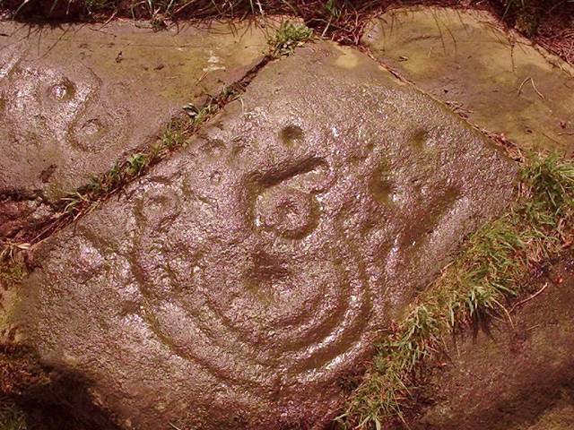
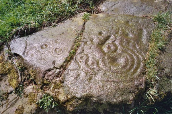
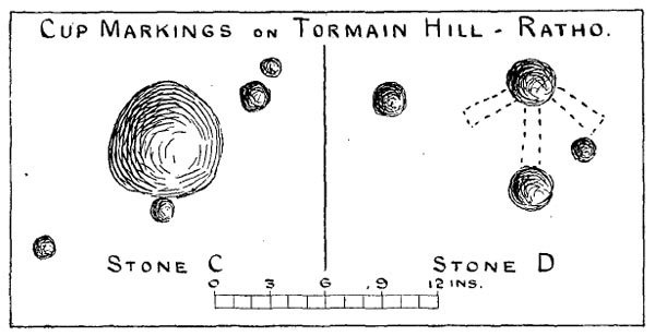
'Hitherto Undescribed Cup- and Ring- Marked Stones.' Fred R Coles. Proc Soc Antiq Scot 37 (1902-03) On page 228 and 229 is a description of the "Witches' Stone" at Tormain Hill. I have added a copy of the diagram. The stone has 22 cupmarks in a dog-legged line across 9ft of stone, and a 23rd at a distance just where the kink in the line is. More about it on p143+ of volume 10 (1872-4). Tiompan tells me this stone is sadly no longer with us, having been willfully destroyed by some philistine (see forums). It's said to have been used in 'fertility rituals' with young ladies* sliding down it. *i.e. the Witches! and their shocking behaviour. Having used the word 'dog-legged' I synchronicitously found Charles Fort reporting that the holes are said to be 'the tracks of dogs' feet' (maybe that's why - they don't really look like tracks of a four-footed animal). His 'Book of the Damned' cites the Proc Soc Antiq Scot "2-4-79" but I have not read the original. |
 Posted by Rhiannon
30th May 2007ce Edited 30th May 2007ce |
Links |
|
Tormain Hill on BRAC UpdatedTormain Hill on BRAC Updated |
Posted by markj99 30th March 2021ce |